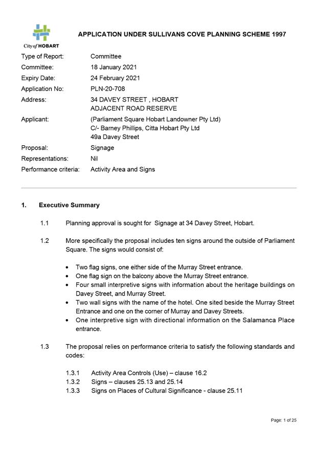
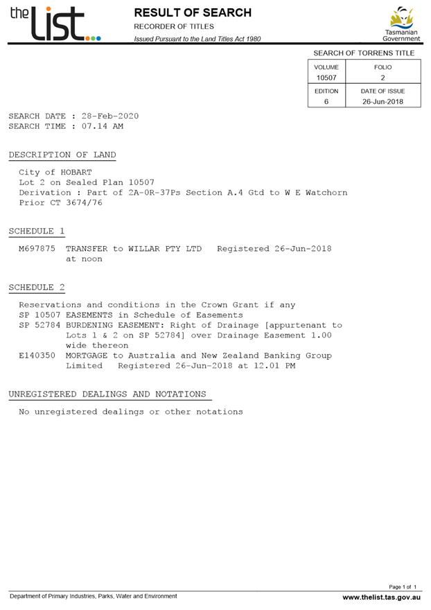
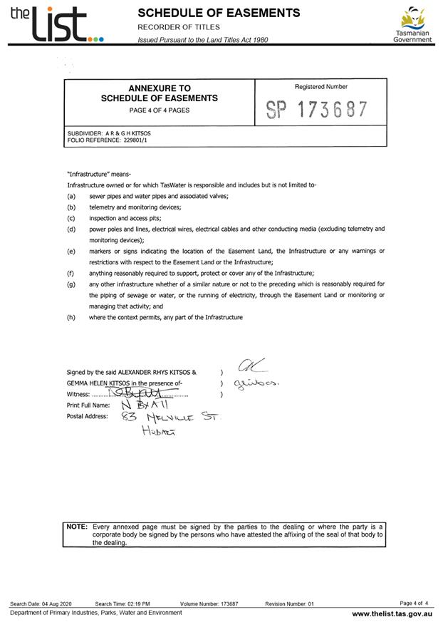
City
of hobart
AGENDA
City Planning Committee Meeting
Open Portion
Monday, 18 January 2021
at 5:00 pm
Council Chamber, Town Hall
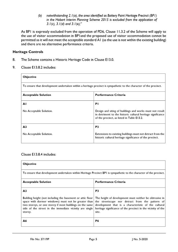
City
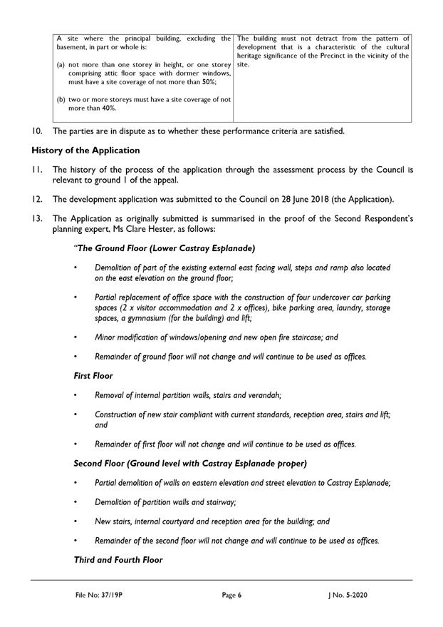
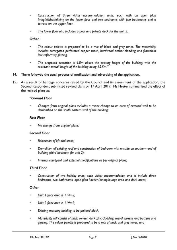
of hobart
AGENDA
City Planning Committee Meeting
Open Portion
Monday, 18 January 2021
at 5:00 pm
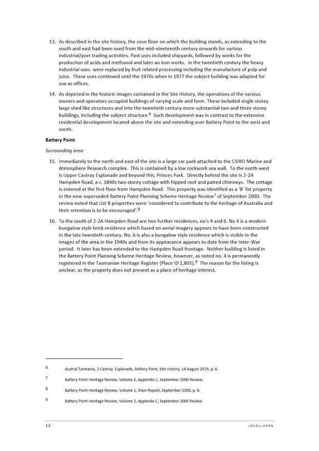
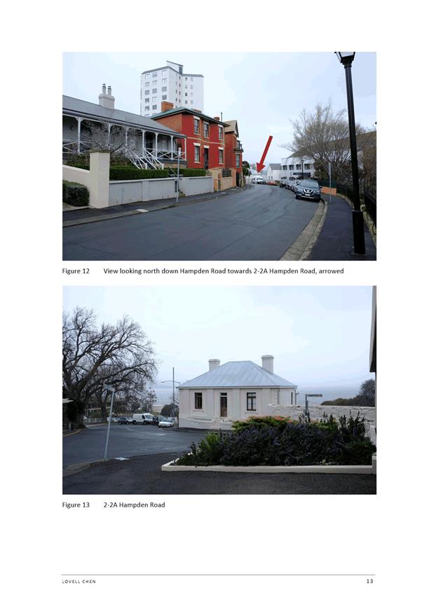
Council Chamber, Town Hall
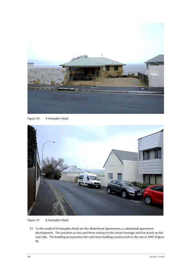
Working together to make Hobart a better place for the community.
THE VALUES
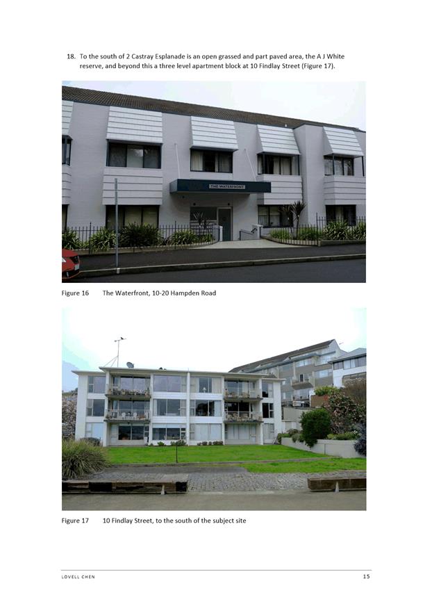
The Council is:
|
People |
We care about people – our community, our customers and colleagues. |
|
Teamwork |
We collaborate both within the organisation and with external stakeholders drawing on skills and expertise for the benefit of our community. |
|
Focus and Direction |
We have clear goals and plans to achieve sustainable social, environmental and economic outcomes for the Hobart community. |
|
Creativity and Innovation |
We embrace new approaches and continuously improve to achieve better outcomes for our community. |
|
Accountability |
We are transparent, work to high ethical and professional standards and are accountable for delivering outcomes for our community. |
|
|
Agenda (Open Portion) City Planning Committee Meeting |
Page 3 |
|
|
18/1/2021 |
|
Business listed on the agenda is to be conducted in the order in which it is set out, unless the committee by simple majority determines otherwise.
APOLOGIES AND LEAVE OF ABSENCE
1. Co-Option of a Committee Member in the event of a vacancy
3. Consideration of Supplementary Items
4. Indications of Pecuniary and Conflicts of Interest
6. Planning Authority Items - Consideration of Items With Deputations
7. Committee Acting as Planning Authority
7.1 Applications under the Sullivans Cove Planning Scheme 1997
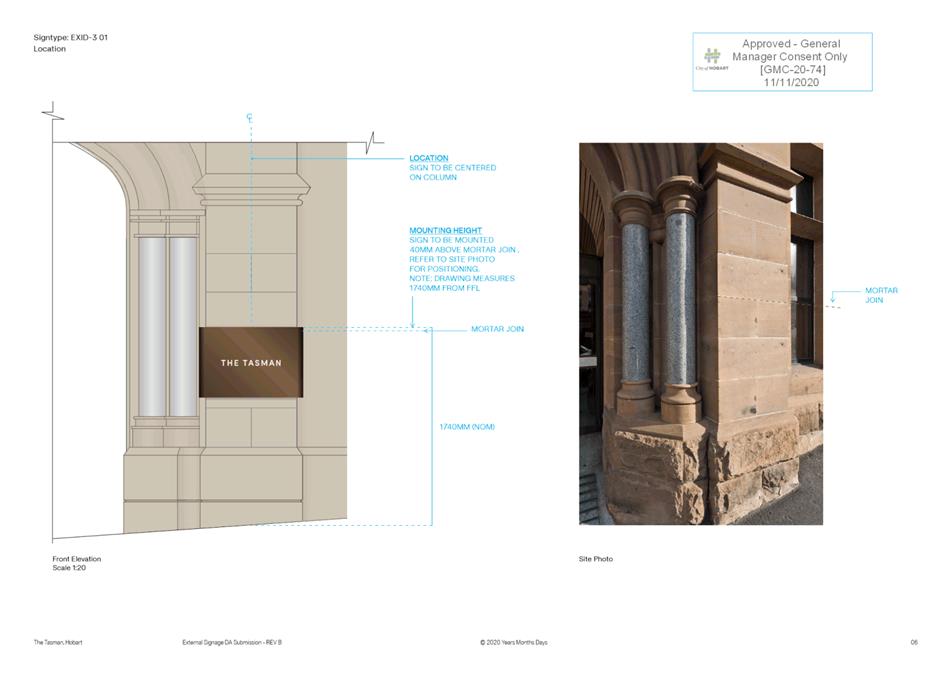
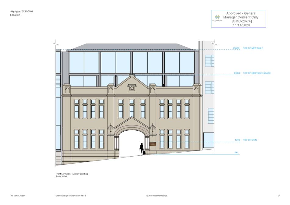
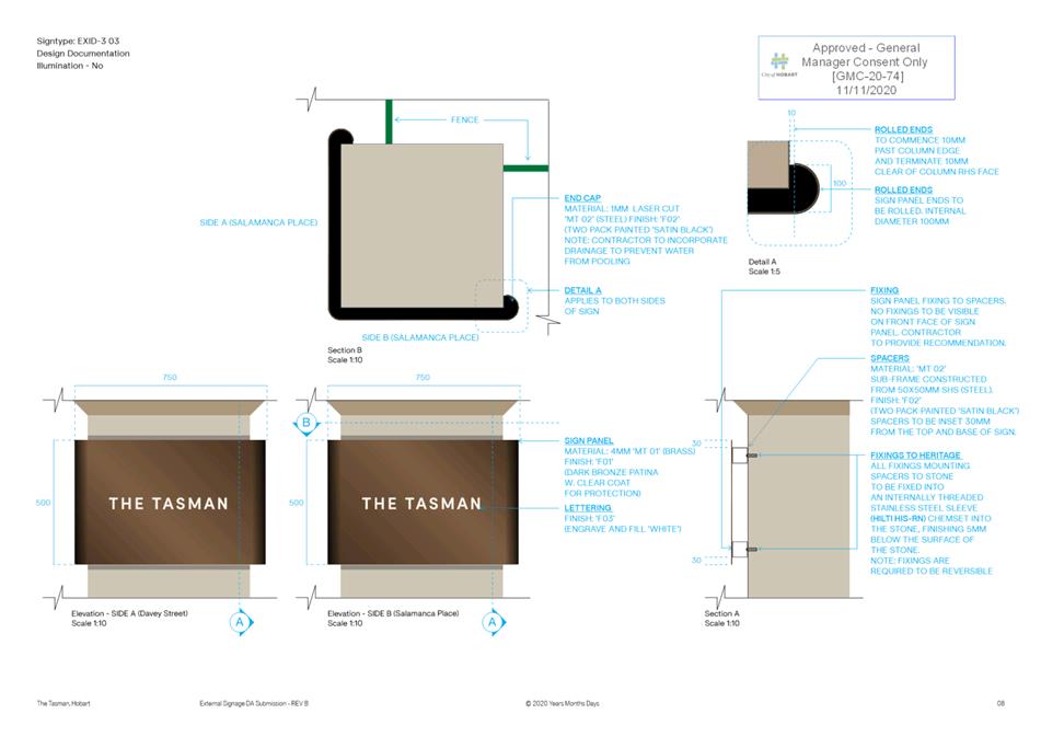
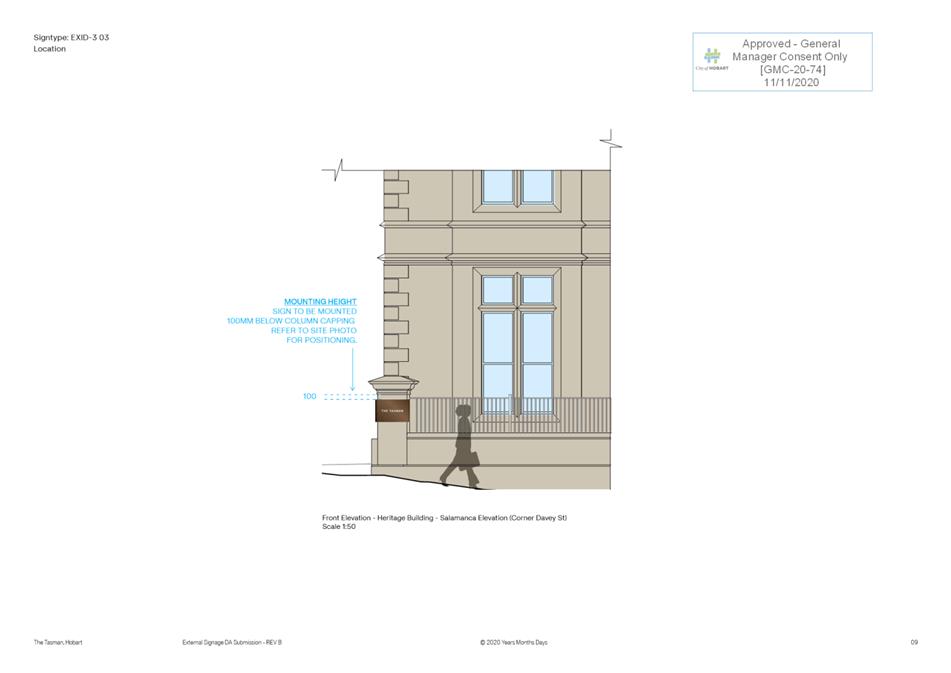
7.1.1 34 Davey Street, Hobart and Adjacent Road Reserve - Signage.
7.2 Applications under the Hobart Interim Planning Scheme 2015
7.2.3 109-113 Liverpool Street, Hobart - Signage
7.2.4 326 Strickland Avenue, South Hobart and Adjacent Road Reserve - Dwelling
7.3 Committee Acting as Planning Authority
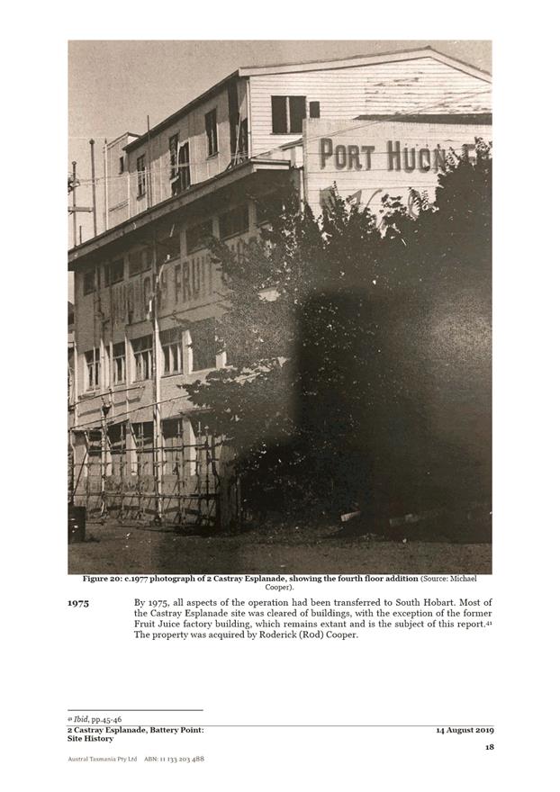
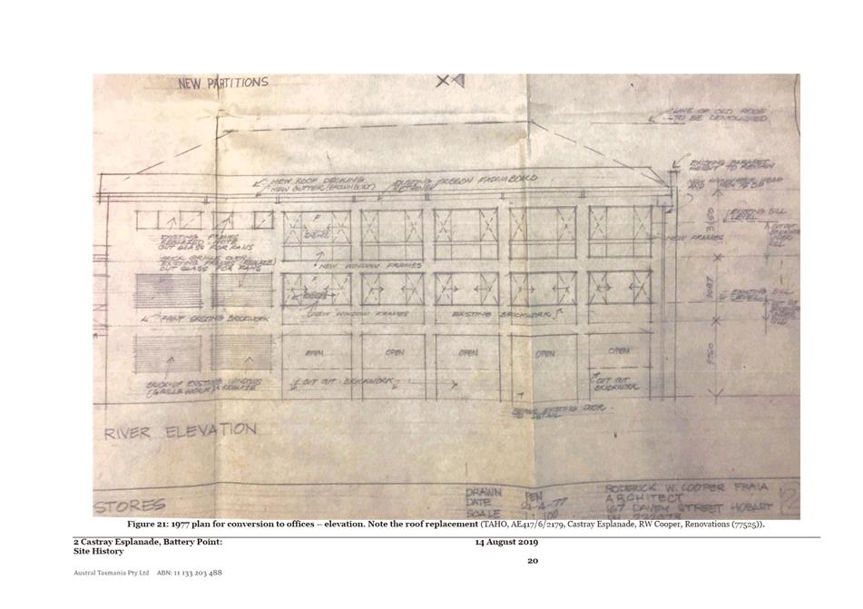
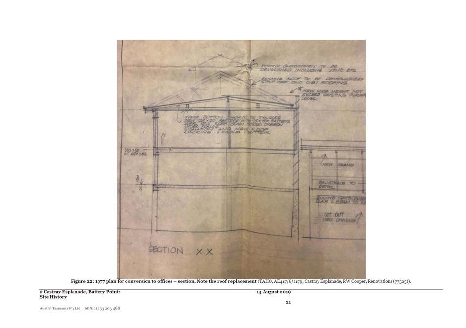
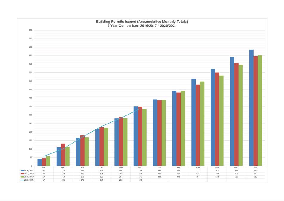
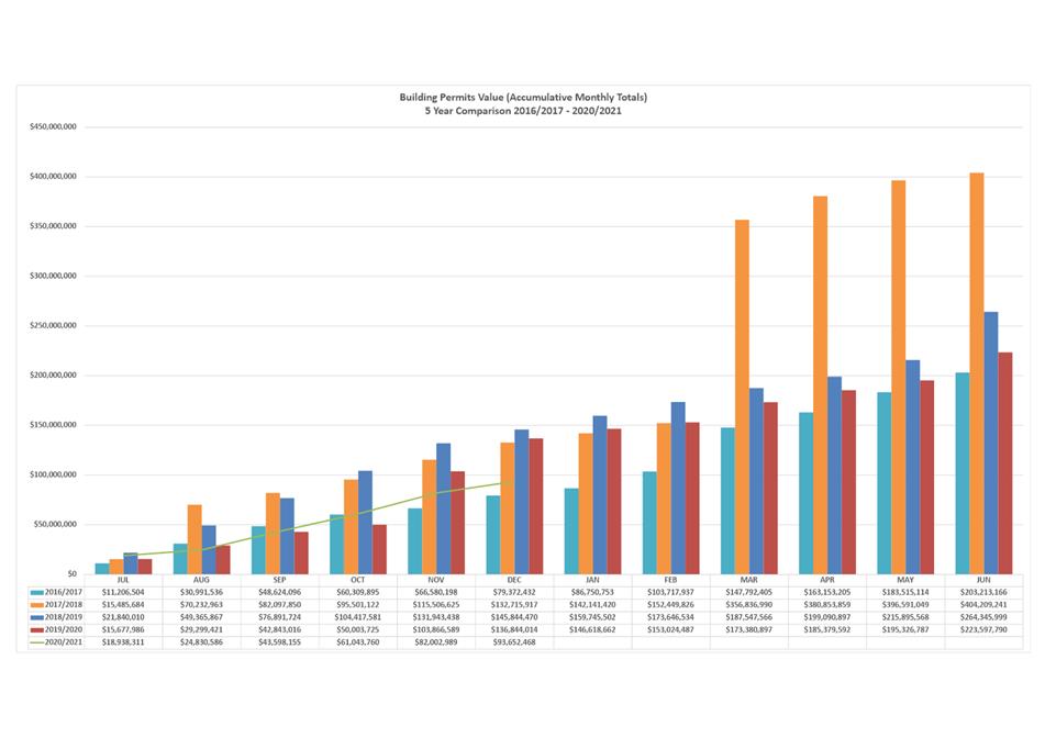
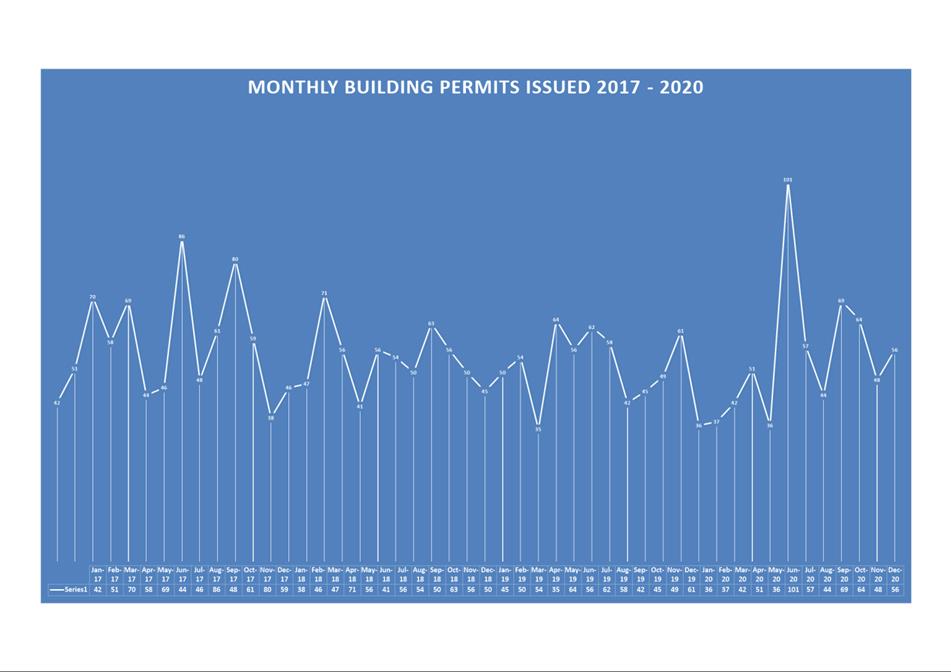
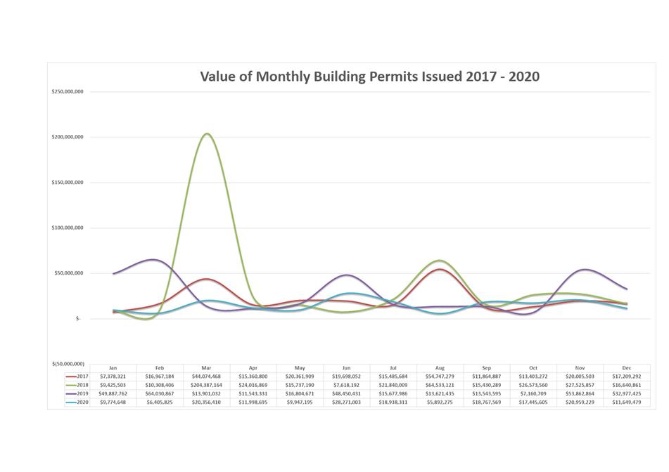
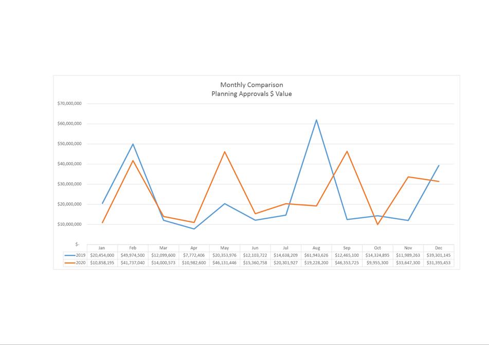
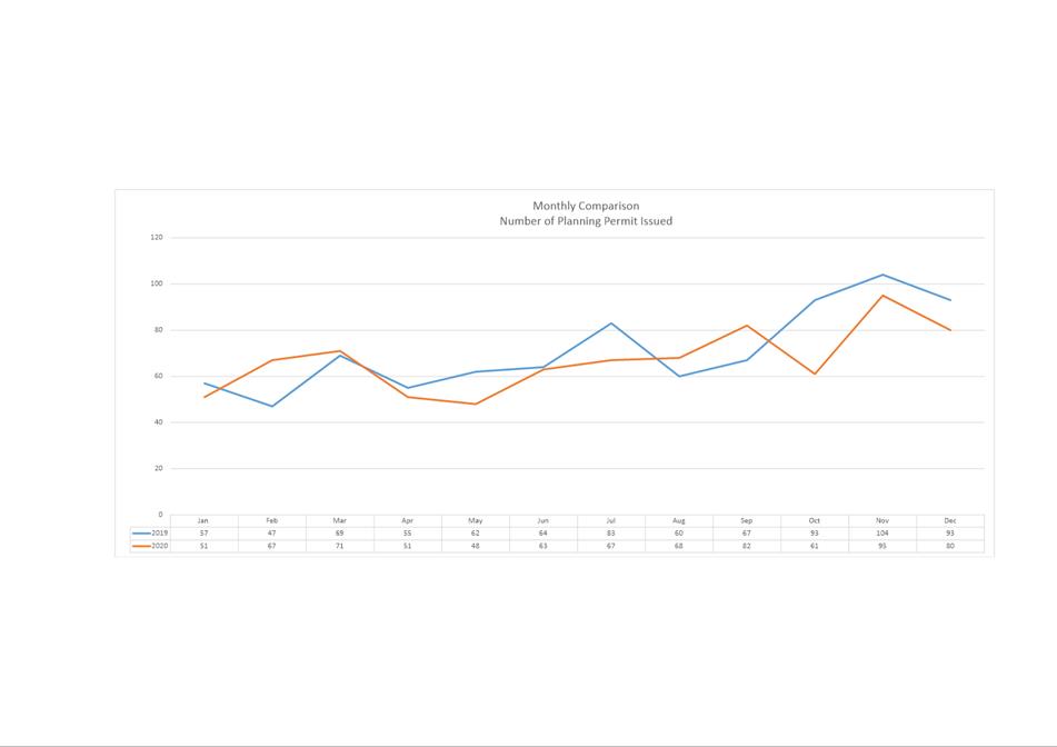
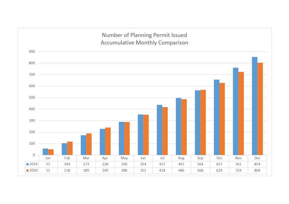
8.2 Monthly Building Statistics - 1 December - 31 December 2020
8.3 Delegated Decision Report (Planning)
8.4 City Planning - Advertising Report
9. Responses To Questions Without Notice
9.1 Bicycle Parking Provisions
9.4 55 Mount Stuart Road - Overlooking
9.5 Building Permits - Timeframe
11. Closed Portion Of The Meeting
|
|
Agenda (Open Portion) City Planning Committee Meeting |
Page 6 |
|
|
18/1/2021 |
|
City Planning Committee Meeting (Open Portion) held Monday, 18 January 2021 at 5:00 pm in the Council Chamber, Town Hall.
This meeting of the City Planning Committee is held in accordance with a Notice issued by the Premier on 3 April 2020 under section 18 of the COVID-19 Disease Emergency (Miscellaneous Provisions) Act 2020.
|
COMMITTEE MEMBERS Deputy Lord Mayor Burnet (Chairman) Briscoe Harvey Behrakis Dutta Coats
NON-MEMBERS Lord Mayor Reynolds Zucco Sexton Thomas Ewin Sherlock |
Apologies:
Leave of Absence: Nil.
|
|
The minutes of the Open Portion of the City Planning Committee meeting held on Monday, 14 December 2020, are submitted for confirming as an accurate record.
|
Ref: Part 2, Regulation 8(6) of the Local Government (Meeting Procedures) Regulations 2015.
|
That the Committee resolve to deal with any supplementary items not appearing on the agenda, as reported by the General Manager.
|
Ref: Part 2, Regulation 8(7) of the Local Government (Meeting Procedures) Regulations 2015.
Members of the committee are requested to indicate where they may have any pecuniary or conflict of interest in respect to any matter appearing on the agenda, or any supplementary item to the agenda, which the committee has resolved to deal with.
Regulation 15 of the Local Government (Meeting Procedures) Regulations 2015.
A committee may close a part of a meeting to the public where a matter to be discussed falls within 15(2) of the above regulations.
In the event that the committee transfer an item to the closed portion, the reasons for doing so should be stated.
Are there any items which should be transferred from this agenda to the closed portion of the agenda, or from the closed to the open portion of the agenda?
In accordance with the requirements of Part 2 Regulation 8(3) of the Local Government (Meeting Procedures) Regulations 2015, the General Manager is to arrange the agenda so that the planning authority items are sequential.
In accordance with Part 2 Regulation 8(4) of the Local Government (Meeting Procedures) Regulations 2015, the Committee by simple majority may change the order of any of the items listed on the agenda, but in the case of planning items they must still be considered sequentially – in other words they still have to be dealt with as a single group on the agenda.
Where deputations are to be received in respect to planning items, past practice has been to move consideration of these items to the beginning of the meeting.
RECOMMENDATION
That in accordance with Regulation 8(4) of the Local Government (Meeting Procedures) Regulations 2015, the Committee resolve to deal with any items which have deputations by members of the public regarding any planning matter listed on the agenda, to be taken out of sequence in order to deal with deputations at the beginning of the meeting.
|
|
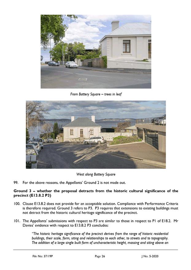
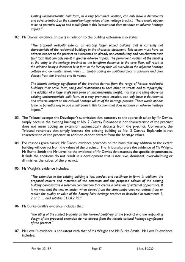
Agenda (Open Portion) City Planning Committee Meeting |
Page 7 |
|
|
18/1/2021 |
|
In accordance with the provisions of Part 2 Regulation 25 of the Local Government (Meeting Procedures) Regulations 2015, the intention of the Committee to act as a planning authority pursuant to the Land Use Planning and Approvals Act 1993 is to be noted.
In accordance with Regulation 25, the Committee will act as a planning authority in respect to those matters appearing under this heading on the agenda, inclusive of any supplementary items.
The Committee is reminded that in order to comply with Regulation 25(2), the General Manager is to ensure that the reasons for a decision by a Council or Council Committee acting as a planning authority are recorded in the minutes.
|
Agenda (Open Portion) City Planning Committee Meeting |
Page 11 |
|
|
|
18/1/2021 |
|
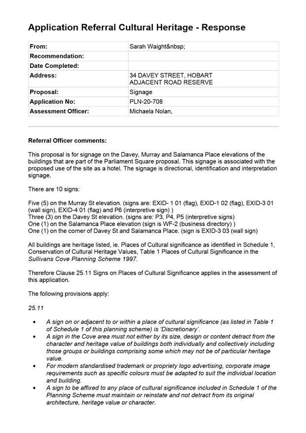
7.1 Applications under the Sullivans Cove Planning Scheme 1997
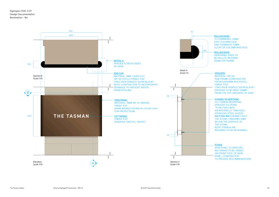
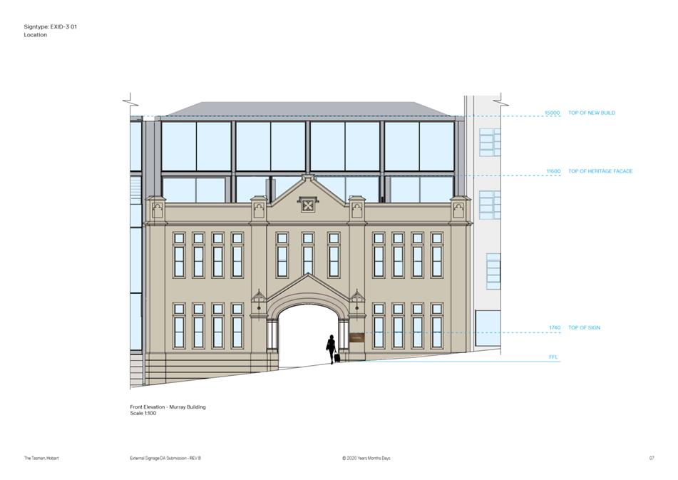
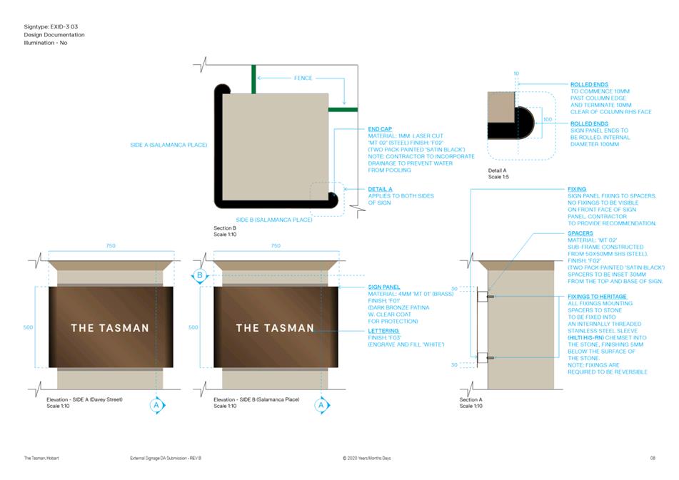
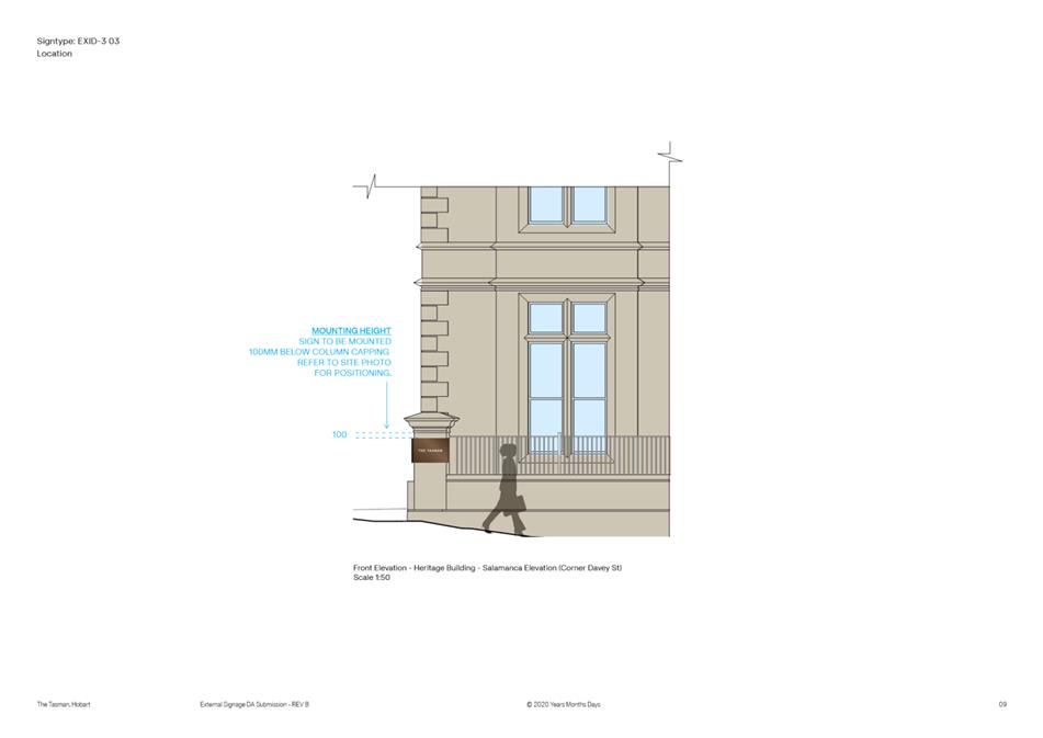
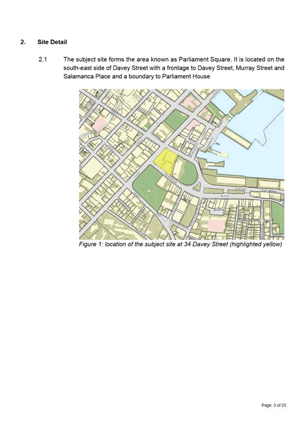
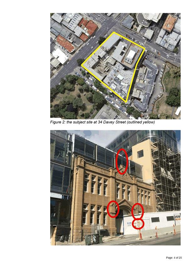
7.1.1 34 Davey Street, Hobart and Adjacent Road Reserve - Signage
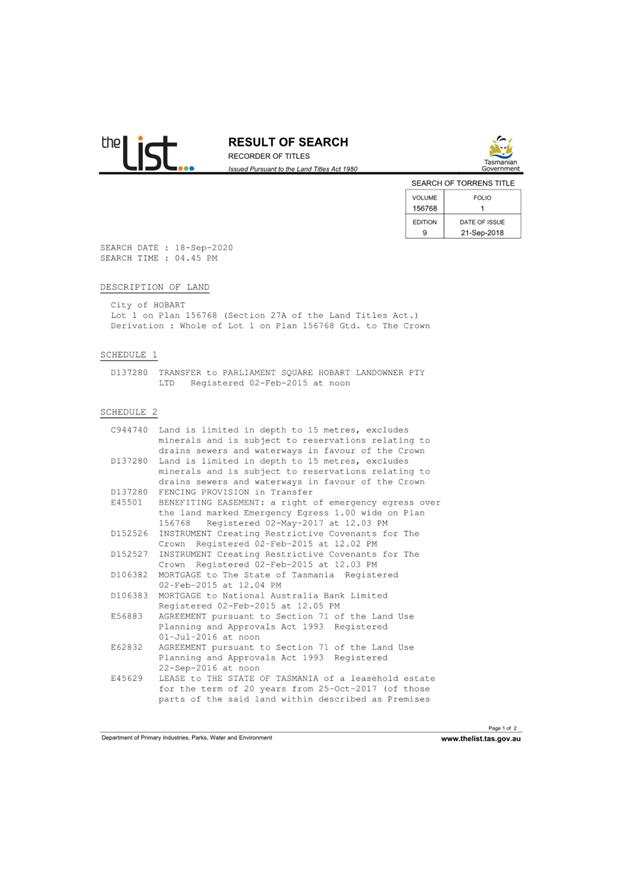
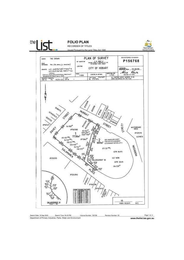
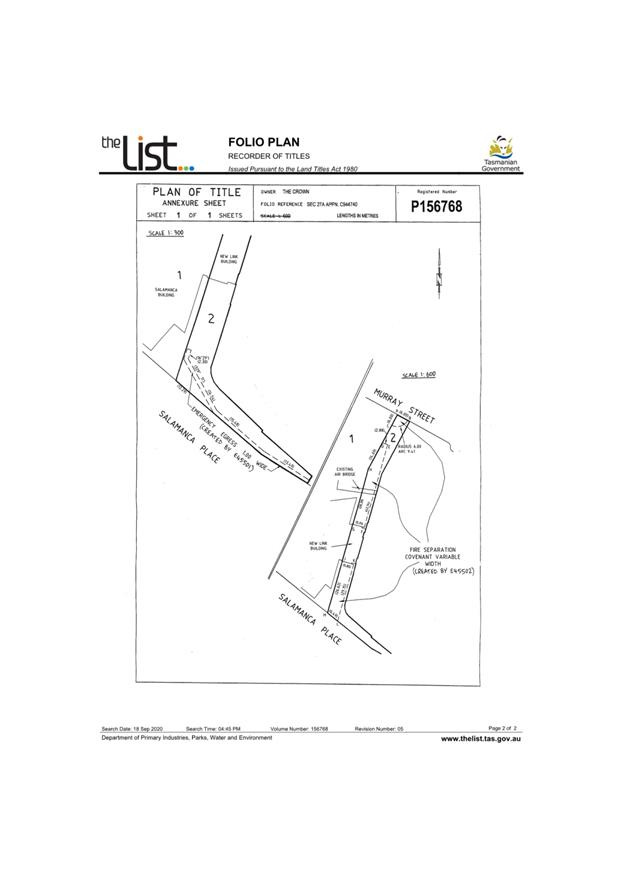
Address: 34 Davey Street, Hobart TAS 7000 and Adjacent Road Reserve
Proposal: Signage
Expiry Date: 24 February 2021
Extension of Time: Not applicable
Author: Michaela Nolan
|
REcommendation That pursuant to the Sullivans Cove Planning Scheme 1997, the City Planning Committee, in accordance with the delegations contained in its terms of reference, approve the application for signage at 34 Davey Street, Hobart for the reasons outlined in the officer’s report and a permit containing the following conditions be issued:
GEN
The use and/or development must be substantially in accordance with the documents and drawings that comprise PLN20708 34 DAVEY STREET HOBART TAS 7000 Final Planning Documents except where modified below.
Reason for condition
To clarify the scope of the permit.
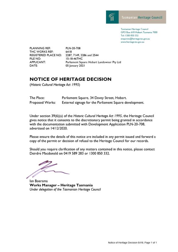
THC
The use and/or development must comply with the requirements of the Tasmanian Heritage Council as detailed in the Notice of Heritage Decision, THC Works Ref: 6418 dated 5 January 2021, as attached to the permit.
Reason for condition
To clarify the scope of the permit.
ENG s3
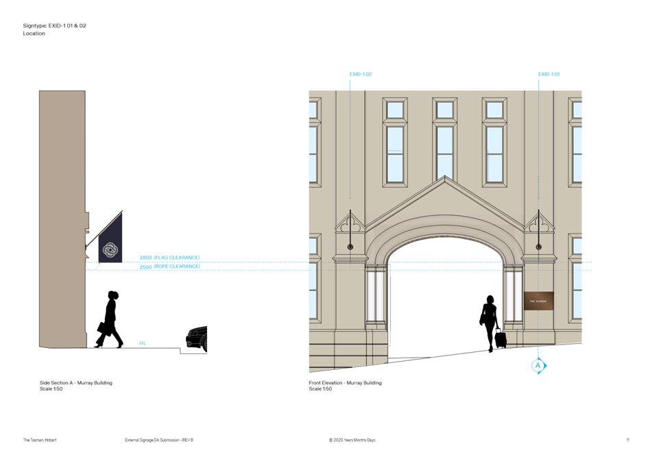
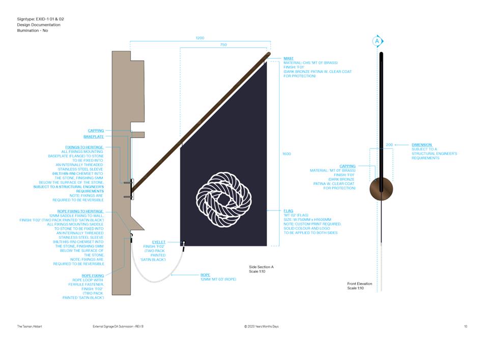
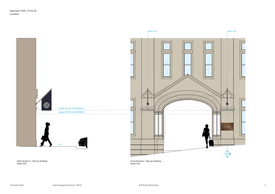
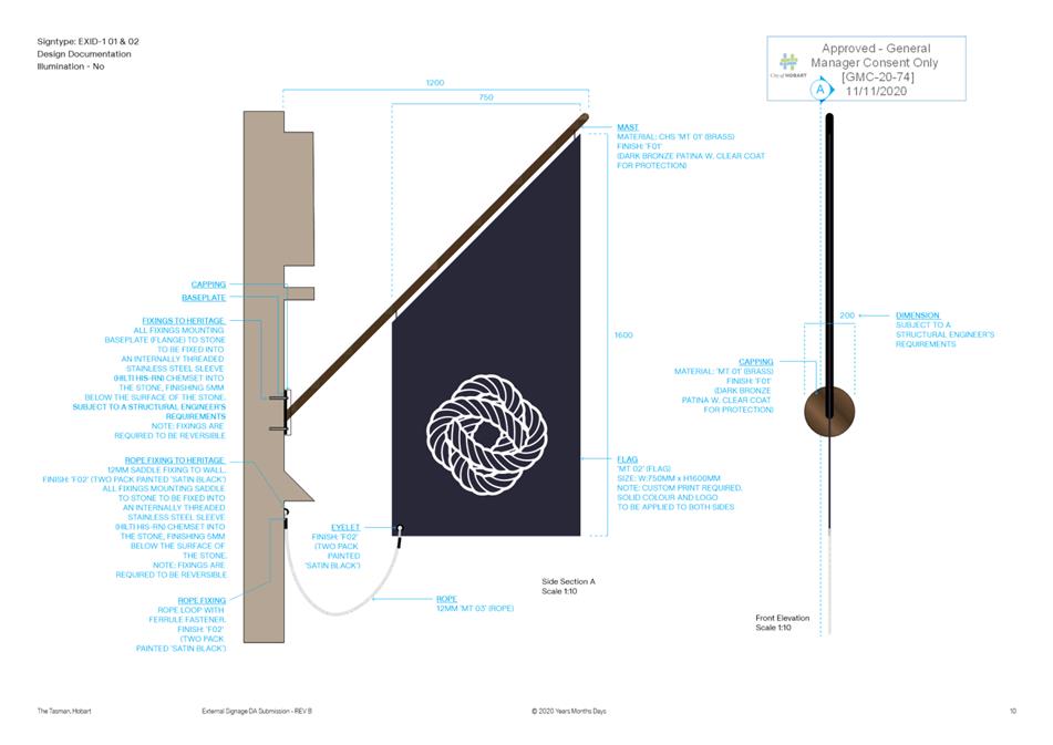
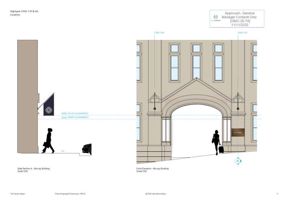
The flags and any associated projection onto the highway must have a minimum vertical clearance of 2.5 metres.
Once the signage and flags are installed, contact the City Infrastructure Inspector to inspect and confirm compliance with the above requirement.
Reason for condition:
To ensure that the works carried out to the satisfaction of the Council.
HER 11
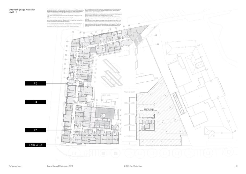
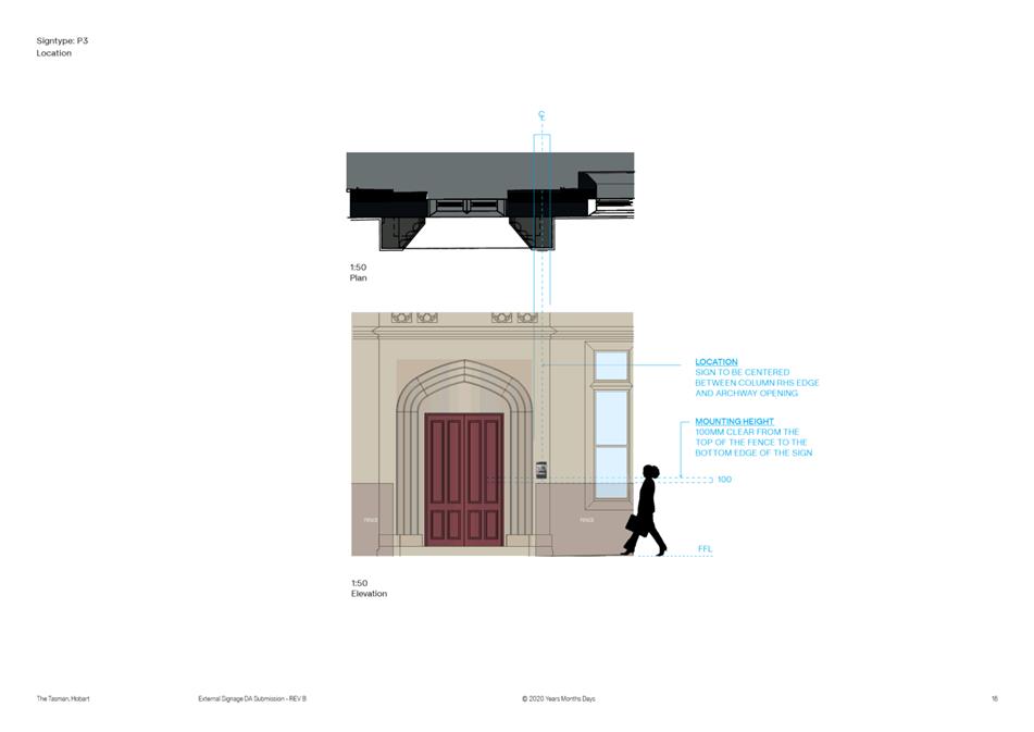
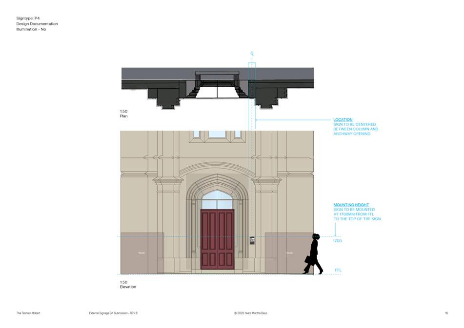
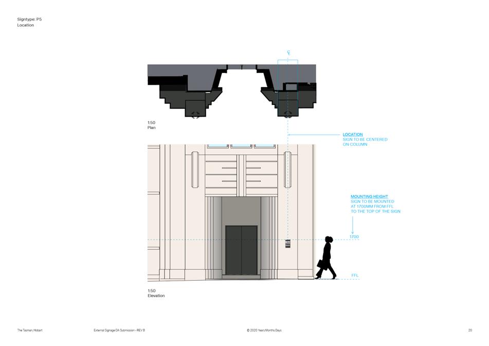
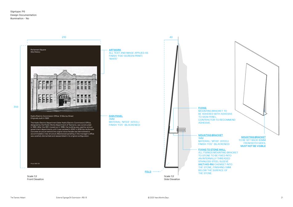
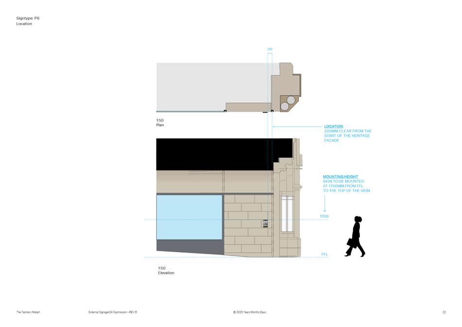
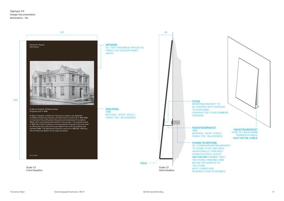
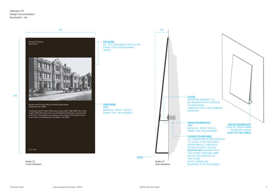
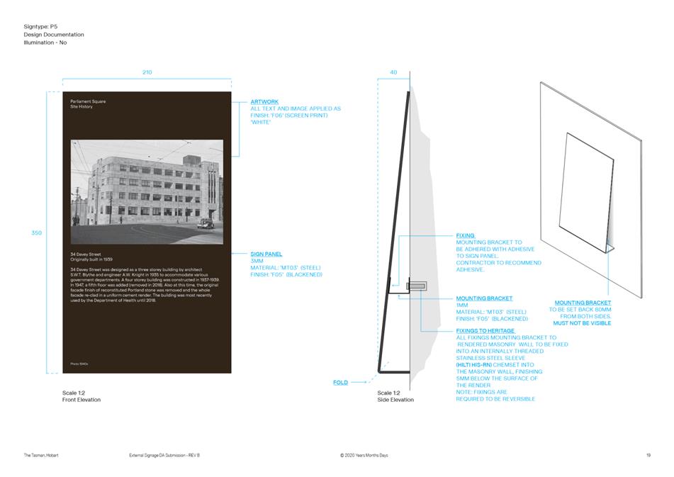
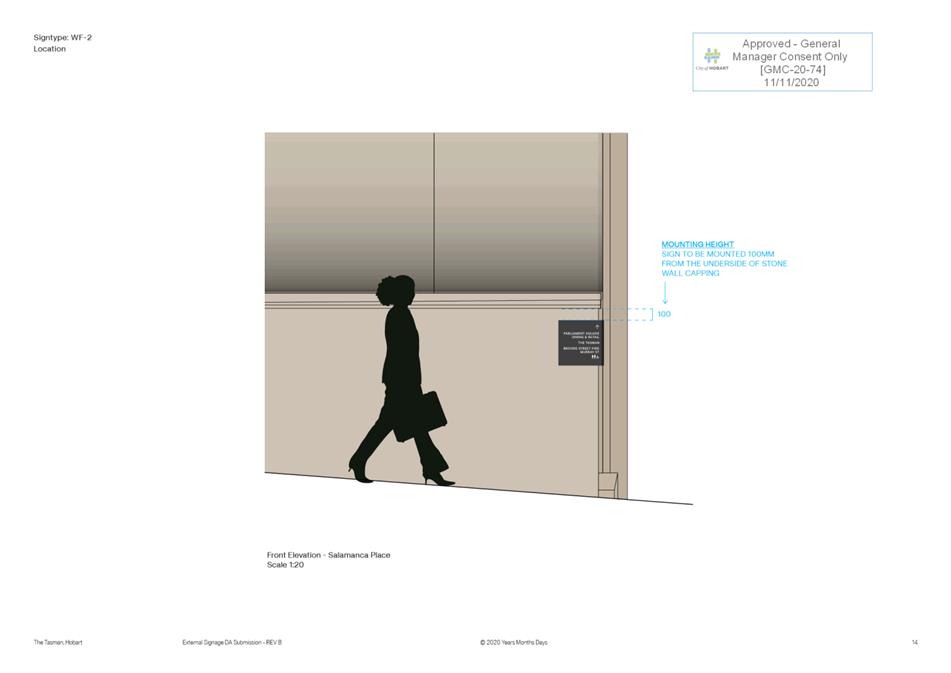
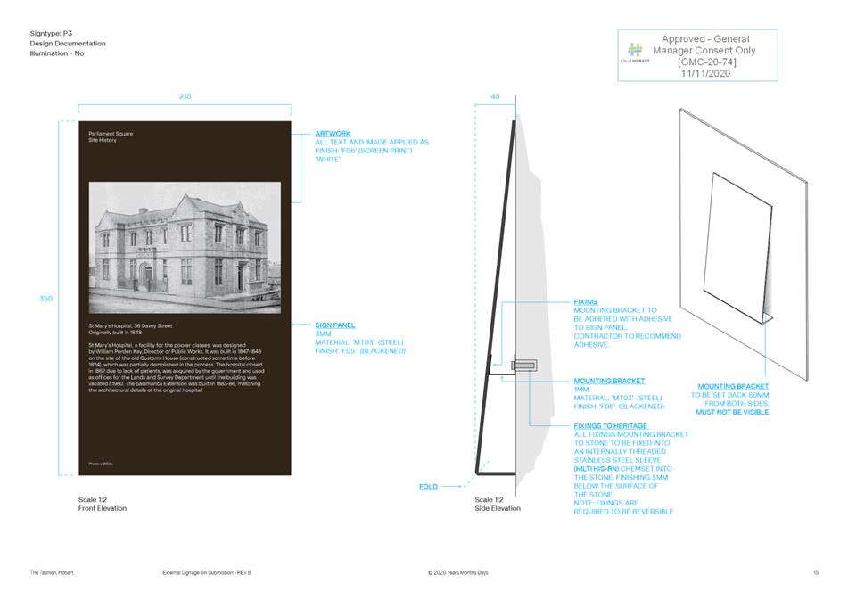
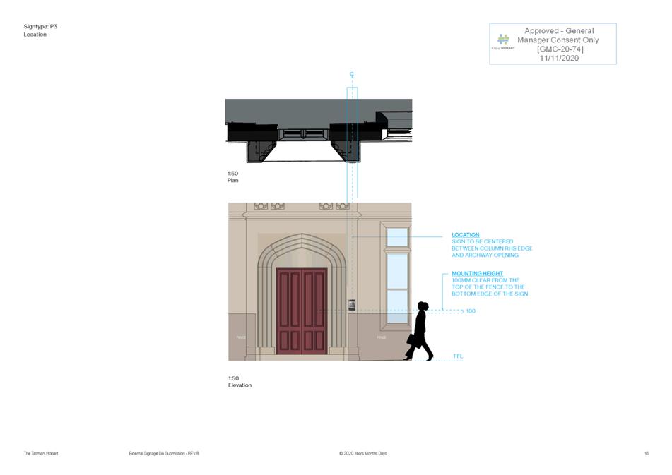
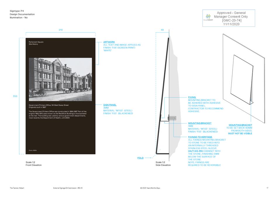
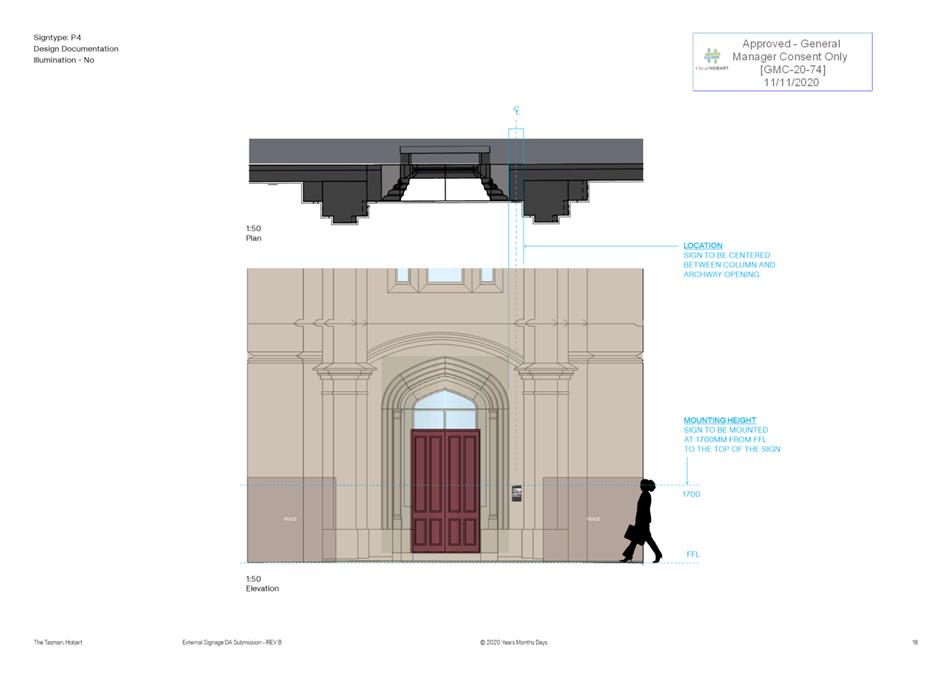
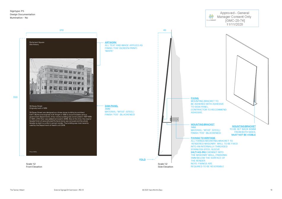
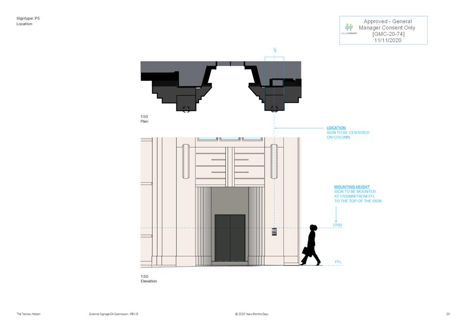
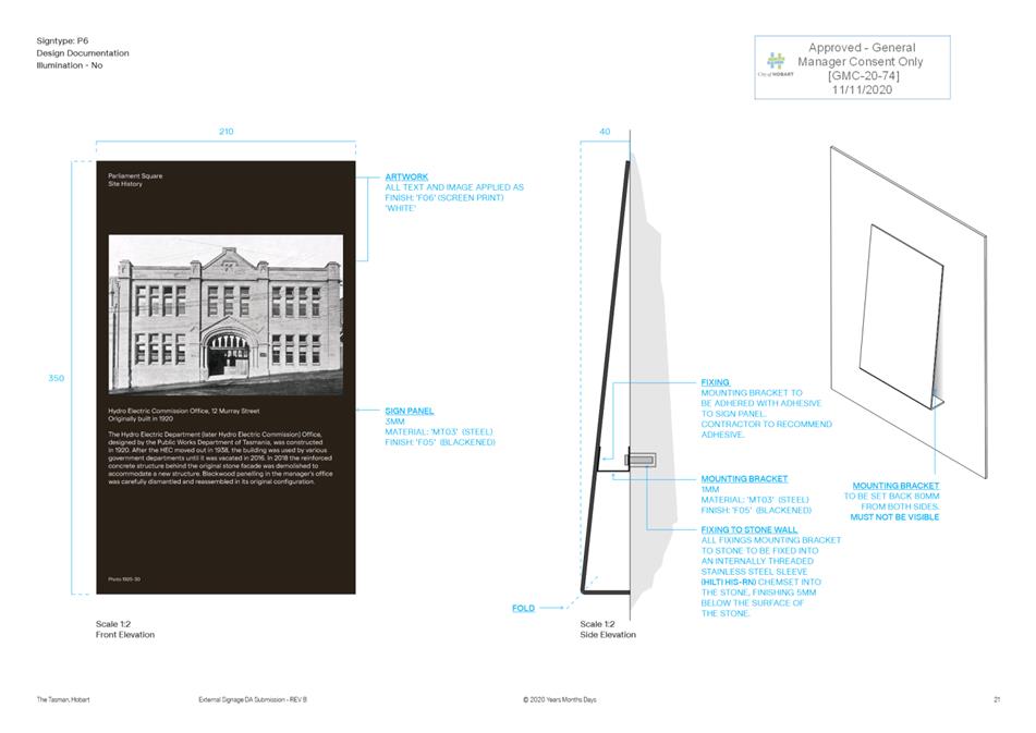
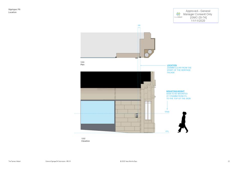
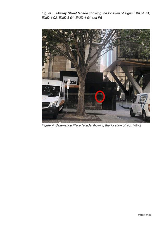
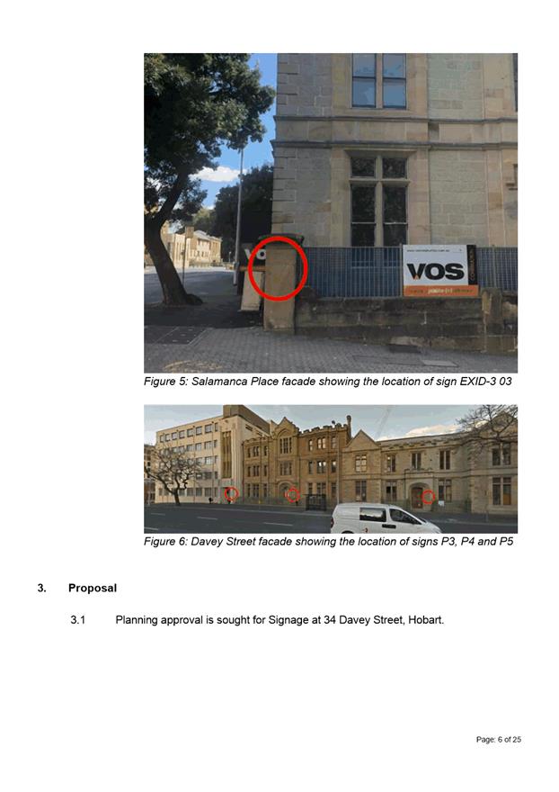
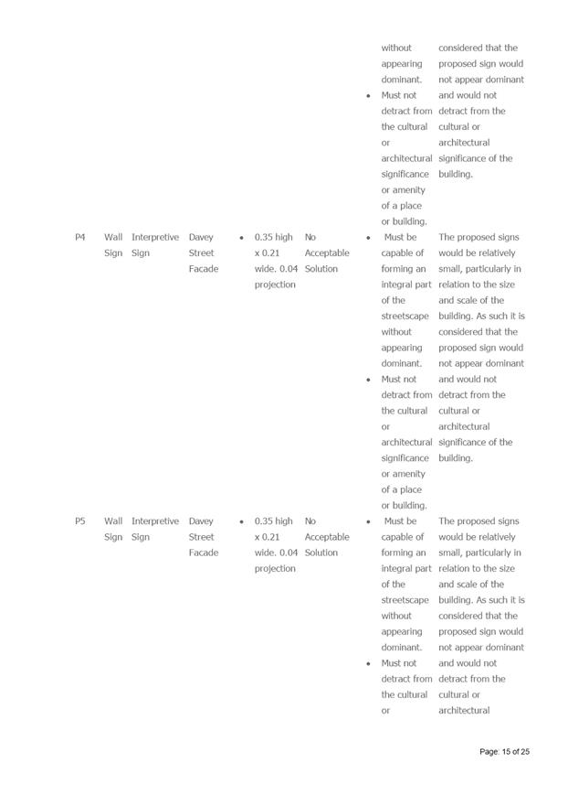
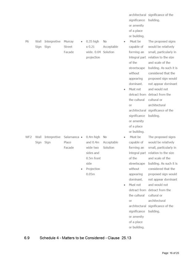
The interpretive signs P3, P4, P5 and P6 must reference the source or collection of the historic image being used and appropriate permissions must be obtained for the reproduction of the image on the interpretation signs.
Reason for condition
To ensure that the historic cultural heritage significance of the place and all sources of information are acknowledged and are historically accurate.
HER 3
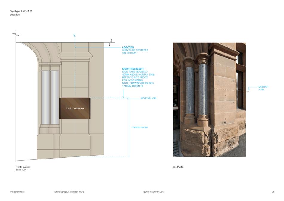
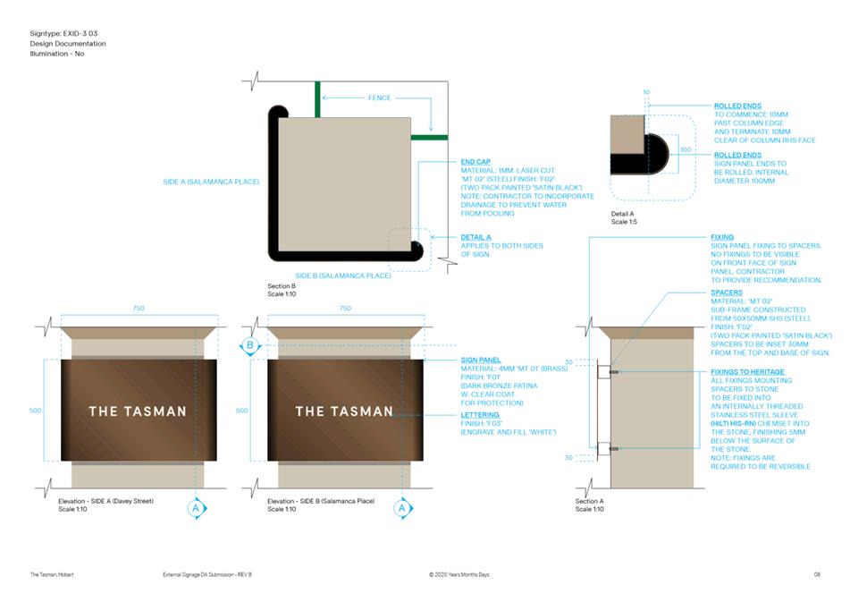
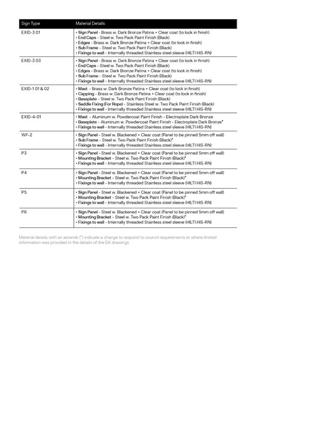
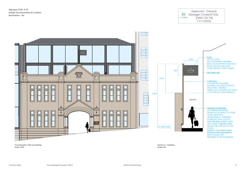
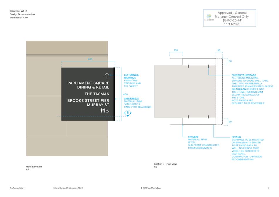
No new holes are to be drilled into the face of sandstone blocks for the installation of signs listed below under (1.). No new holes are to be drilled into the face of sandstone blocks for the rope fixings for the signs listed below under (2.). The signs listed in 1. and 2. below must be installed in existing mortar joints and holes. All fixings for all signs must use noncorrosive fixings.
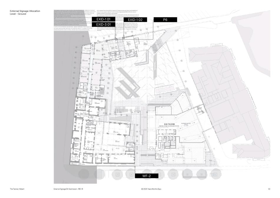
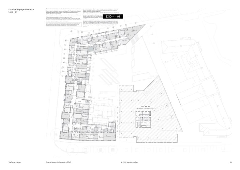
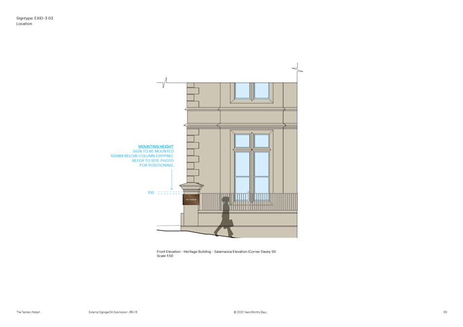
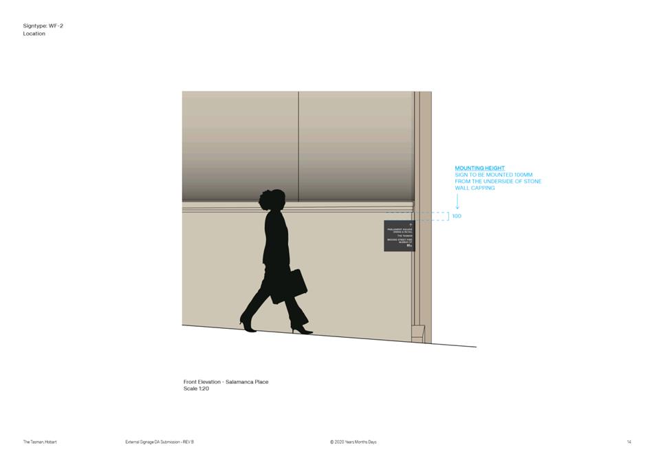
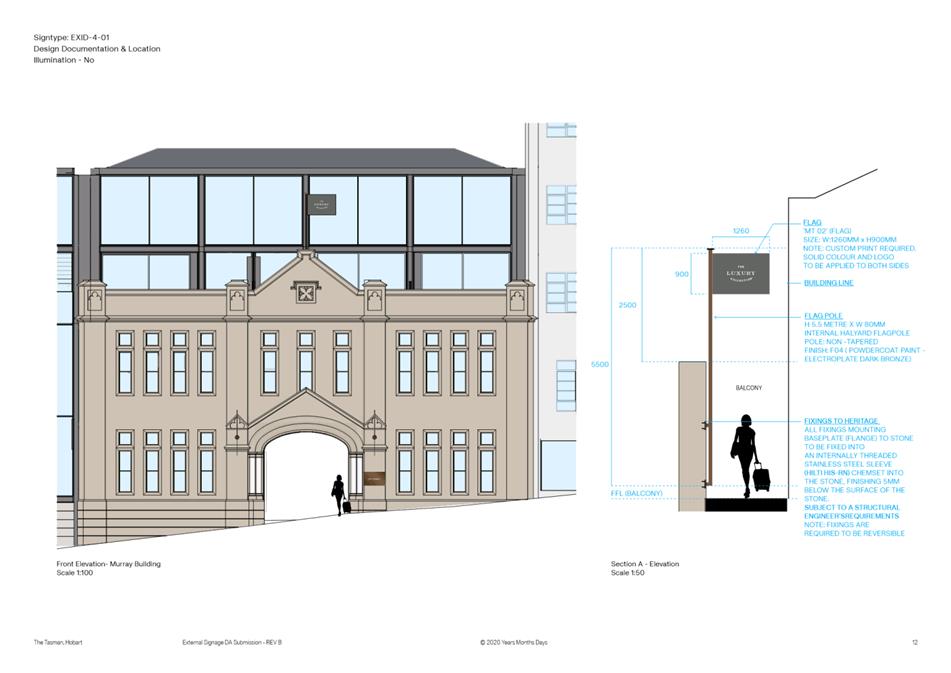
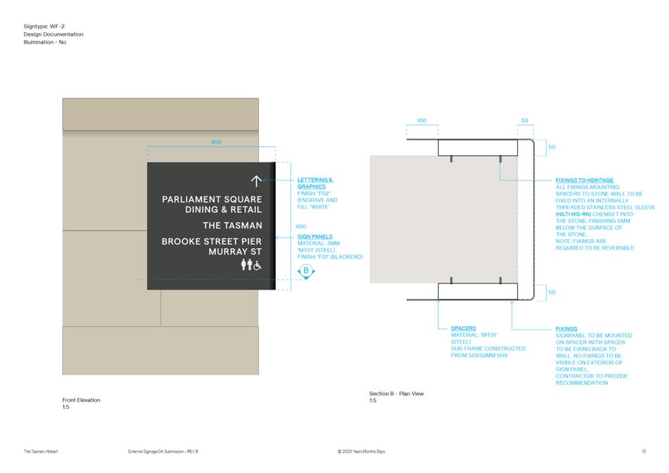
1. EXID303, EXID301, EXID401, P3, P4, P5, P6 and WF2 2. EXID1 01 and EXID102
If the size and position of any of the signs listed above in (1.) and (2.) have to be modified to enable the metal subframe to be fixed to existing sandstone mortar joints, revised plans must be submitted and approved by the Council.
Prior to the issue of any approval under the Building Act 2016, documentation must be submitted and approved which shows how the signs are to be fixed into the existing mortar joints in accordance with the above requirements.
All work required by this condition must be undertaken in accordance with the approved plans.
Reason for condition
To ensure the fixing of signs does not impact on the cultural heritage significance of heritage places as described under clause 25.11 of the Sullivans Cove Planning Scheme 1997.
ADVICE
The following advice is provided to you to assist in the implementation of the planning permit that has been issued subject to the conditions above. The advice is not exhaustive and you must inform yourself of any other legislation, bylaws, regulations, codes or standards that will apply to your development under which you may need to obtain an approval. Visit the Council's website for further information.
Prior to any commencement of work on the site or commencement of use the following additional permits/approval may be required from the Hobart City Council.
BUILDING PERMIT
You may need building approval in accordance with the Building Act 2016. Click here for more information.
This is a Discretionary Planning Permit issued in accordance with section 57 of the Land Use Planning and Approvals Act 1993.
OCCUPATION OF THE PUBLIC HIGHWAY
You may require a permit for the occupation of the public highway for construction or special event (e.g. placement of skip bin, crane, scissor lift etc). Click here for more information.
You may require an occupational license for structures in the Hobart City Council highway reservation, in accordance with conditions to be established by the Council. Click here for more information.
You may require a road closure permit for construction or special event. Click here for more information.
You may require a Permit to Open Up and Temporarily Occupy a Highway (for work in the road reserve). Click here for more information.
|
Attachment a: PLN-20-708
- 34 DAVEY STREET HOBART TAS 7000 - Planning Committee or Delegated Report ⇩ ![]()
Attachment
b: PLN-20-708
- 34 DAVEY STREET HOBART TAS 7000 - CPC Agenda Documents ⇩ ![]()
Attachment
c: PLN-20-708
- 34 DAVEY STREET HOBART TAS 7000 -Planning Referral Officer Cultural Heritage
Report ⇩ ![]()
|
Item No. 7.1.1 |
Agenda (Open Portion) City Planning Committee Meeting - 18/1/2021 |
Page 21 ATTACHMENT a |

|
Agenda (Open Portion) City Planning Committee Meeting - 18/1/2021 |
Page 37 ATTACHMENT b |
|
Agenda (Open Portion) City Planning Committee Meeting - 18/1/2021 |
Page 121 ATTACHMENT c |

|
Agenda (Open Portion) City Planning Committee Meeting |
Page 127 |
|
|
|
18/1/2021 |
|
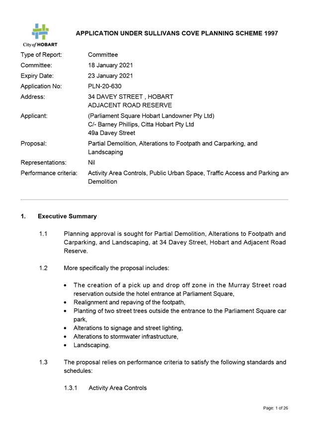
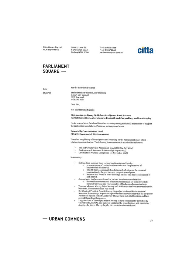
7.1.2 34 Davey Street, Hobart and Adjacent Road Reserve - Partial Demolition, Alterations to Footpath and Carparking and Landscaping
Address: 34 Davey Street, Hobart and Adjacent Road Reserve
Proposal: Partial Demolition, Alterations to Footpath and Carparking and Landscaping
Expiry Date: 23 January 2021
Extension of Time: Not applicable
Author: Michaela Nolan
|
REcommendation That pursuant to the Hobart Interim Planning Scheme 2015, the City Planning Committee, in accordance with the delegations contained in its terms of reference, approve the application for partial demolition, alterations to footpath and carparking, and landscaping, at 34 Davey Street, Hobart and adjacent road reserve for the reasons outlined in the officer’s report and a permit containing the following conditions be issued:
GEN
The use and/or development must be substantially in accordance with the documents and drawings that comprise PLN20630 34 DAVEY STREET HOBART TAS 7000 Final Planning Documents except where modified below.
Reason for condition
To clarify the scope of the permit.
SW 1
Prior to the commencement of work on the site, a preconstruction structural condition assessment and visual record (eg video and photos) of the Hobart City Council’s stormwater infrastructure within/adjacent to the proposed development which will not be renewed must be submitted to the City of Hobart.
The condition assessment must include at least:
1. a site plan clearly showing the location of the investigation, with access points and all segments and nodes shown and labelled, with assets found to have a different alignment from that shown on the City of Hobart’s plans to be marked on the ground and on the plan; 2. a digital recording of a CCTV inspection and written condition assessment report in accordance with WSA 052013 Conduit Inspection Reporting Code of Australia, in a 'Wincan’ compatible format; and 3. photos of any existing drainage structures connected to or modified as part of the development.
The preconstruction condition assessment will be relied upon to establish the extent of any damage caused to Hobart City Council’s stormwater infrastructure during construction. If the owner/developer fails to provide the City of Hobart with an adequate preconstruction condition assessment then any damage to the City of Hobart’s infrastructure identified in the post construction condition assessment will be the responsibility of the owner/developer.
Advice:
Council notes postwork CCTVs required by the applicant's contractor under previous Road Opening Permits have not yet been submitted, however preworks CCTVs show both that the main must be replaced, and does not have the straight alignment shown on Council's maps and the concept plans submitted.
SW 2
Prior to commencement of the approved use, a postconstruction structural condition assessment and visual record (eg video and photos) of the Hobart City Council’s stormwater infrastructure (new and existing) within/adjacent to the proposed development, along with photos of any existing drainage structures connected to or modified as part of the development, must be submitted to the City of Hobart.
The condition assessment must include at least:
1. a site plan clearly showing the location of the investigation, with access points and all segments and nodes shown and labelled, with assets found to have a different alignment from that shown on the City of Hobart’s plans shall be marked on the ground and on the plan; 2. a digital recording of a CCTV inspection and written condition assessment report in accordance with WSA 052013 Conduit Inspection Reporting Code of Australia, in a 'Wincan’ compatible format; and 3. photos of any existing drainage structures connected to or modified as part of the development.
The postconstruction condition assessment will be relied upon to establish the extent of any damage caused to the Hobart City Council’s stormwater infrastructure during construction. If the owner/developer fails to provide the City of Hobart with an adequate postconstruction condition assessment then any damage to the Hobart City Council’s infrastructure identified in the post construction CCTV will be deemed to be the responsibility of the owner/developer.
SW 3
The proposed works, including tree pits, must be designed to ensure the protection and access to the Hobart City Council’s stormwater infrastructure.
Prior to commencement of works, a detailed design must be submitted and approved. The final detailed design must be prepared by a suitably qualified expert and must:
1. Demonstrate how the design will ensure the protection of and provide longterm access to the Hobart City Council’s stormwater main. 2. Include a crosssection clearly showing the relationship both vertically and horizontally between Council’s stormwater infrastructure and the proposed works, including drip zone and root barriers, and stating the minimum setbacks from the works to the nearest external surface of the main.
All work required by this condition must be undertaken in accordance with the approved detailed design.
Advice:
Council notes the location of the gas main shown on JMG drawing P04 Rev DA2 appears to clash with the tree pits.
SW 6
Council's stormwater infrastructure within the area of works must be renewed as directed by Council. The new stormwater infrastructure must be designed and constructed prior to commencement of the approved use.
Prior to commencement of works, detailed engineering drawings must be submitted and approved. The detailed engineering drawings must be certified by a suitably qualified and experienced civil engineer and must:
1. be substantially in accordance with the Local Government Association of Tasmania: Tasmanian Municipal Standard Drawings (May 2020), as varied by the City of Hobart’s published departures from those Drawings, and the Local Government Association of Tasmania, Tasmanian Subdivision Guidelines (October 2013); 2. clearly distinguish between public and private infrastructure; 3. show in both plan and longsection the proposed stormwater infrastructure, including but not limited to, surface drainage, connections, flows, velocities, hydraulic grade lines, clearances (including from existing and proposed services, works, structures and surface applications), cover, gradients, sizing, material, pipe class, and inspection openings; 4. include a construction program demonstrating how services to external land will be maintained. 5. show surface drainage designed to flow to Council infrastructure. The proposed trench grates in the footpath at the Davey/ Murray Street intersection are not accepted. 6. show the new main as DN450 RCP Class 4.
Council will contribute to the cost of the stormwater infrastructure replacement. The cost must be agreed upon in writing prior to commencement of work.
All work required by this condition must be undertaken in accordance with the approved detailed engineering drawings.
ENG 1
Any damage to council infrastructure resulting from the implementation of this permit, must, at the discretion of the Council:
1. Be met by the owner by way of reimbursement (cost of repair and reinstatement to be paid by the owner to the Council); or 2. Be repaired and reinstated by the owner to the satisfaction of the Council.
Any damage must be immediately reported to Council.
A photographic record of the Council's infrastructure adjacent to the subject site must be provided to the Council prior to any commencement of works.
A photographic record of the Council’s infrastructure (e.g. existing property service connection points, roads, buildings, stormwater, footpaths, driveway crossovers and nature strips, including if any, preexisting damage) will be relied upon to establish the extent of damage caused to the Council’s infrastructure during construction. In the event that the owner/developer fails to provide to the Council a photographic record of the Council’s infrastructure, then any damage to the Council's infrastructure found on completion of works will be deemed to be the responsibility of the owner.
Reason for condition
To ensure that any of the Council's infrastructure and/or siterelated service connections affected by the proposal will be altered and/or reinstated at the owner’s full cost.
ENG r1
The works within or supporting the highway reservation must not undermine the stability and integrity of the highway reservation and its infrastructure.
Reason for condition
To ensure that the stability and integrity of the Council’s highway reservation is not compromised by the development.
ENG r3
Prior to the commencement of use, the proposed work within the highway reservation must be designed and constructed in general accordance with the City's requirements, including but not limited to:
· TSDR09v3 – Urban Roads Driveways and TSD R14v1 Type KC vehicular crossing · TSDR06v3 Urban Roads · Footpath Urban Roads Footpaths TSDR11v3
Design drawings must be submitted and approved prior to any approval to commence works. The design drawing must:
1. Be in accordance with the approved plans, with sufficient detail for construction 2. Show existing infrastructure and linemarking 3. Show the cross and long section of the driveway crossover within the highway reservation and onto the property 4. Show the long and cross section the road and footpath 5. Detail all new and existing services or infrastructure (ie light poles, pits, awnings) 6. Detail proposed surface finishes and landscaping 7. Be designed for the expected vehicle loadings. A structural certificate to note that driveway is suitable for heavy vehicle loadings. 8. Show swept path templates, including for a 19m and 24m BDouble at Davey Street intersection 9. If the design deviates from the requirements of the TSD then the drawings must demonstrate that a B85 vehicle or B99 depending on use (AS/NZS 2890.1 2004, section 2.6.2) can access the driveway from the road pavement into the property without scraping the cars underside 10. Show that vehicular and pedestrian sight lines are met as per AS/NZS 2890.1 2004. 11. Be prepared and certified by a suitable qualified person, to satisfy the above requirement, and accompanied by the City's detailed design checklist
All work required by this condition must be undertaken in accordance with the approved drawings.
Advice:
The applicant is required submit detailed design documentation to satisfy this condition via Council's planning condition endorsement process (noting there is a fee associated with condition endorsement approval of engineering drawings [see general advice on how to obtain condition endorsement and for fees and charges]). This is a separate process to any building approval under the Building Act 2016.
Failure to address condition endorsement requirements prior to submitting for construction approval may result in unexpected delays.
A Permit to Construct Public Infrastructure will be required.
Reason for condition
To ensure that works will comply with the Council’s standard requirements.
ENV 2
Sediment and erosion control measures, sufficient to prevent sediment leaving the site and in accordance with an approved soil and water management plan (SWMP), must be installed prior to the commencement of work and maintained until such time as all disturbed areas have been stabilised and/or restored or sealed to the Council’s satisfaction.
A SWMP must be submitted prior to the issue of any approval under the Building Act 2016 or the commencement of work, whichever occurs first. The SWMP must be prepared in accordance with the Soil and Water Management on Building and Construction Sites fact sheets (Derwent Estuary Program, 2008), available here, and any recommendations in a contaminated site
All work required by this condition must be undertaken in accordance with the approved SWMP.
Advice:
Once the SWMP has been approved, the Council will issue a condition endorsement (see general advice on how to obtain condition endorsement).
Where building approval is also required, it is recommended that documentation for condition endorsement be submitted well before submitting documentation for building approval. Failure to address condition endorsement requirements prior to submitting for building approval may result in unexpected delays.
Reason for condition
To avoid the pollution and sedimentation of roads, drains and natural watercourses that could be caused by erosion and runoff from the development.
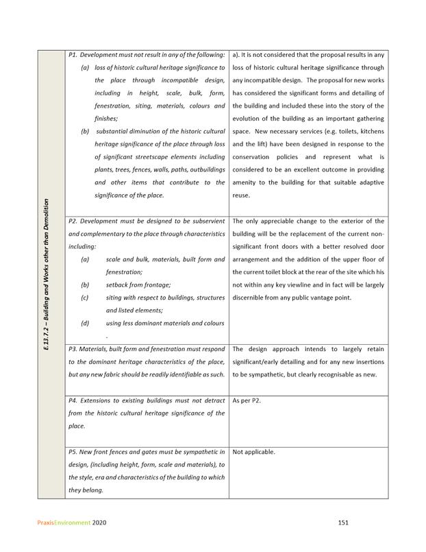
HER 11
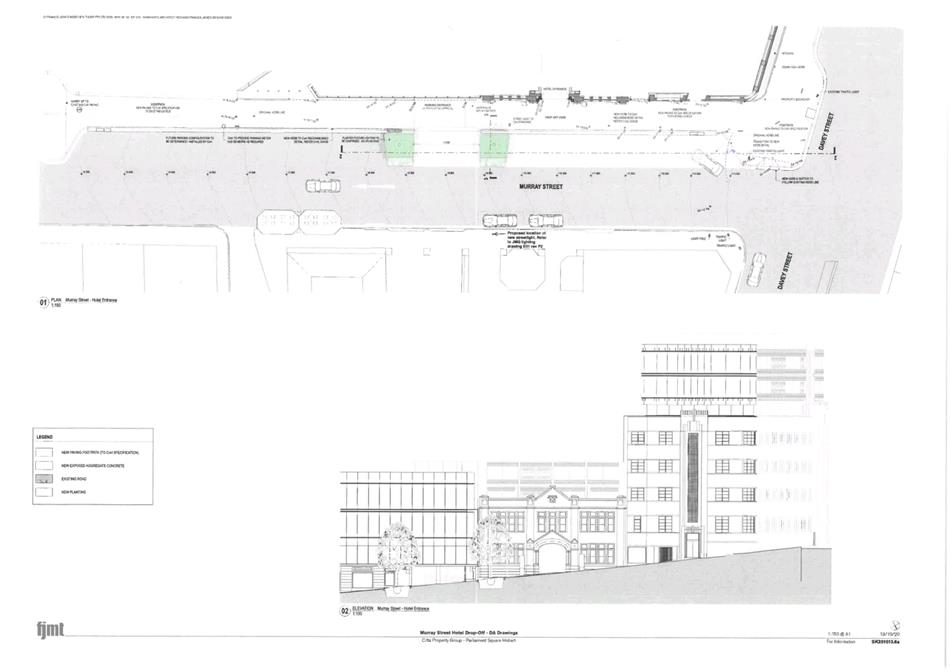
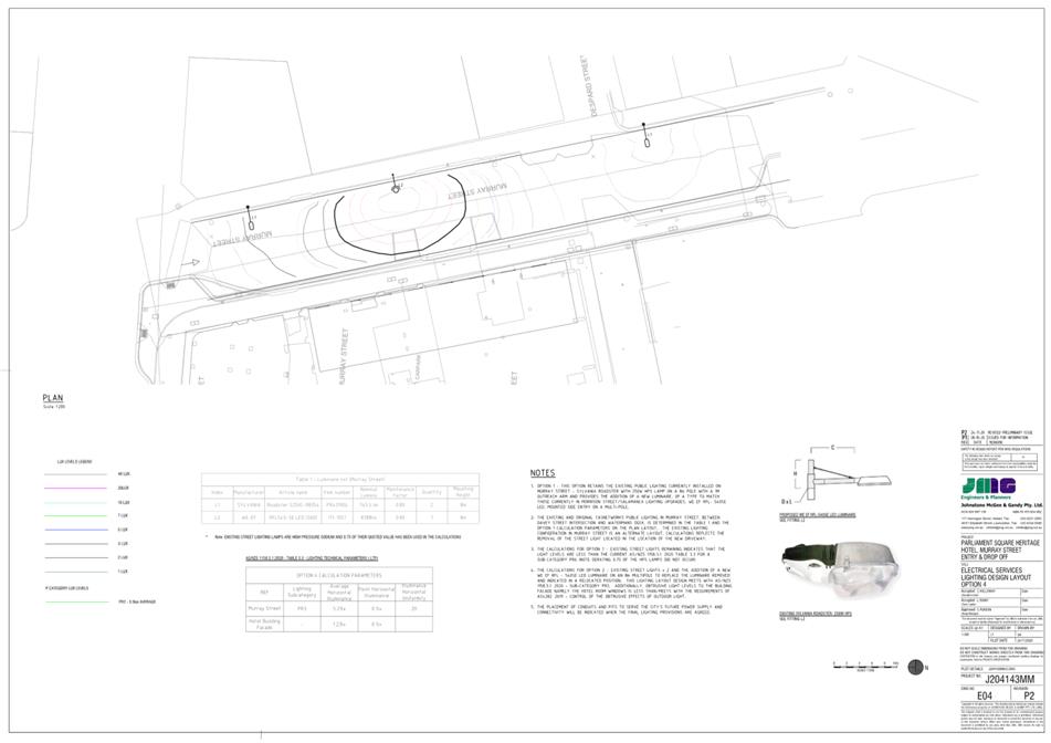
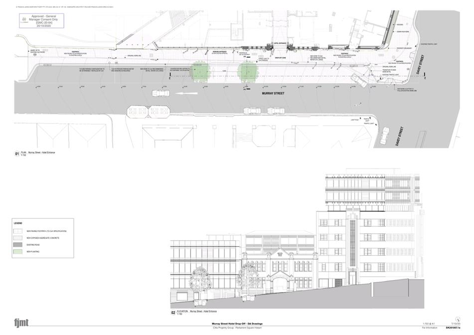
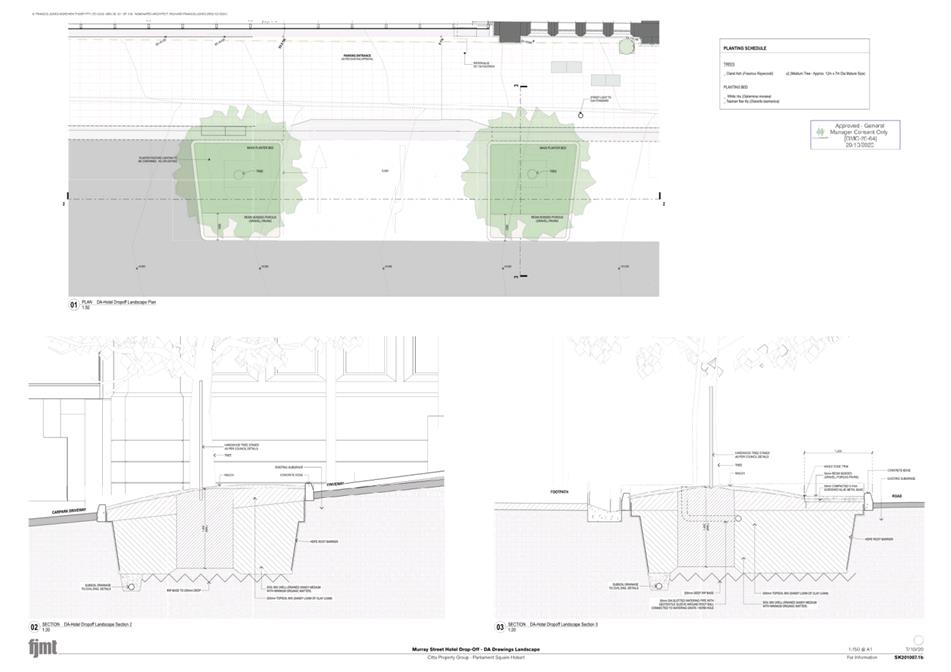
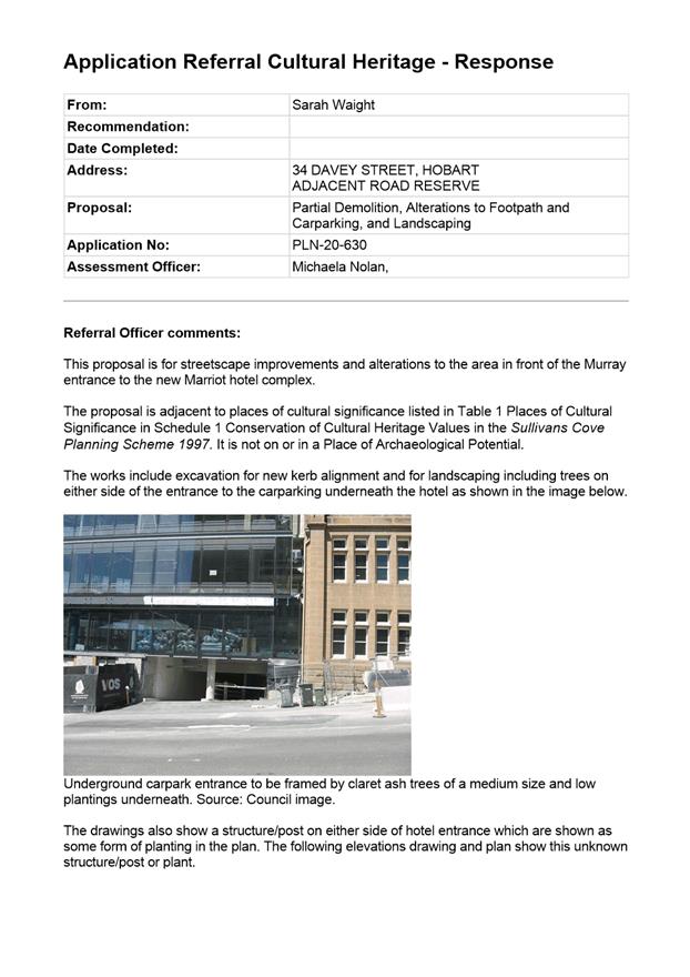
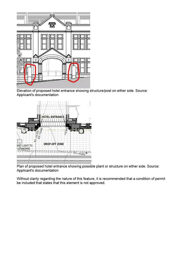
The proposed structures/post/planters on either side of the Murray Street hotel entrance shown on drawing SK201013.6a dated 13/10/20 are not approved.
Prior to the issue of any approval under the Building Act 2016 or the commencement of works, whichever occurs first, revised plans must be submitted and approved without these structures or planters.
All work required by this condition must be undertaken in accordance with the approved revised plans.
Reason for condition
To ensure that development at a heritage place is undertaken in a sympathetic manner which does not cause loss of historic cultural heritage significance.
ADVICE
The following advice is provided to you to assist in the implementation of the planning permit that has been issued subject to the conditions above. The advice is not exhaustive and you must inform yourself of any other legislation, bylaws, regulations, codes or standards that will apply to your development under which you may need to obtain an approval. Visit the Council's website for further information.
Prior to any commencement of work on the site or commencement of use the following additional permits/approval may be required from the Hobart City Council.
BUILDING PERMIT
You may need building approval in accordance with the Building Act 2016. Click here for more information.
PLUMBING PERMIT
You may need plumbing approval in accordance with the Building Act 2016, Building Regulations 2016 and the National Construction Code. Click here for more information.
OCCUPATION OF THE PUBLIC HIGHWAY
You may require a permit for the occupation of the public highway for construction or special event (e.g. placement of skip bin, crane, scissor lift etc). Click here for more information.
You may require an occupational license for structures in the Hobart City Council highway reservation, in accordance with conditions to be established by the Council. Click here for more information.
You may require a road closure permit for construction or special event. Click here for more information.
You may require a Permit to Open Up and Temporarily Occupy a Highway (for work in the road reserve). Click here for more information.
BUILDING OVER AN EASEMENT
In order to build over the service easement, you will require the written consent of the person on whose behalf the easement was created, in accordance with section 74 of the Building Act 2016.
PERMIT TO CONSTRUCT PUBLIC INFRASTRUCTURE
You may require a permit to construct public infrastructure, with a 12 month maintenance period and bond (please contact the Hobart City Council's City Amenity Division to initiate the permit process).
STORMWATER
Please note that in addition to a building and/or plumbing permit, development must be in accordance with the Hobart City Council’s Infrastructure By law. Click here for more information.
STRUCTURES CLOSE TO COUNCILS' STORMWATER MAIN
The design of structures (including footings) must provide protection for the Council’s infrastructure. For information regarding appropriate designs please contact the Council's City Amenity Division. You may need the General Manager's consent under section 13 of the Urban Drainage Ace 2013 and consent under section 73 or 74 of the Building Act 2016.
WORK WITHIN THE HIGHWAY RESERVATION
Please note development must be in accordance with the Hobart City Council’s Infrastructure By law. Click here for more information.
DRIVEWAY SURFACING OVER HIGHWAY RESERVATION
If a coloured or textured surface is used for the driveway access within the Highway Reservation, the Council or other service provider will not match this on any reinstatement of the driveway access within the Highway Reservation required in the future.
FEES AND CHARGES
Click here for information on the Council's fees and charges.
DIAL BEFORE YOU DIG
Click here for dial before you dig information.
|
Attachment a: PLN-20-630
- 34 DAVEY STREET HOBART TAS 7000 - Planning Committee or Delegated Report ⇩ ![]()
Attachment
b: PLN-20-630
- 34 DAVEY STREET HOBART TAS 7000 - CPC Agenda Documents ⇩ ![]()
Attachment
c: PLN-20-630
- 34 DAVEY STREET HOBART TAS 7000 - Planning Referral Officer Cultural Heritage
Report ⇩ ![]()
Attachment
d: PLN-20-630
- 34 DAVEY STREET HOBART TAS 7000 -Applicant Traffic Impact Statement ⇩ ![]()
Attachment
e: PLN-20-630
- 34 DAVEY STREET HOBART TAS 7000 -Applicant Environmental Site Assessments ⇩ ![]()
|
Item No. 7.1.2 |
Agenda (Open Portion) City Planning Committee Meeting - 18/1/2021 |
Page 147 ATTACHMENT a |
|
Agenda (Open Portion) City Planning Committee Meeting - 18/1/2021 |
Page 160 ATTACHMENT b |
|
Agenda (Open Portion) City Planning Committee Meeting - 18/1/2021 |
Page 193 ATTACHMENT c |

|
Agenda (Open Portion) City Planning Committee Meeting - 18/1/2021 |
Page 194 ATTACHMENT d |


|
Agenda (Open Portion) City Planning Committee Meeting - 18/1/2021 |
Page 246 ATTACHMENT e |


|
Agenda (Open Portion) City Planning Committee Meeting |
Page 280 |
|
|
|
18/1/2021 |
|
7.2 Applications under the Hobart Interim Planning Scheme 2015
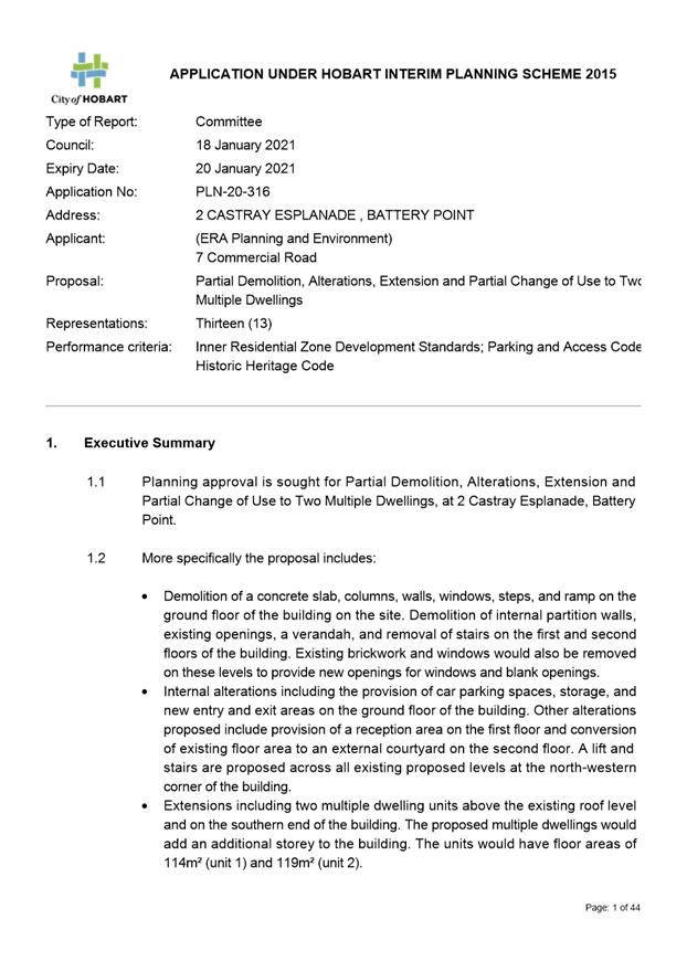
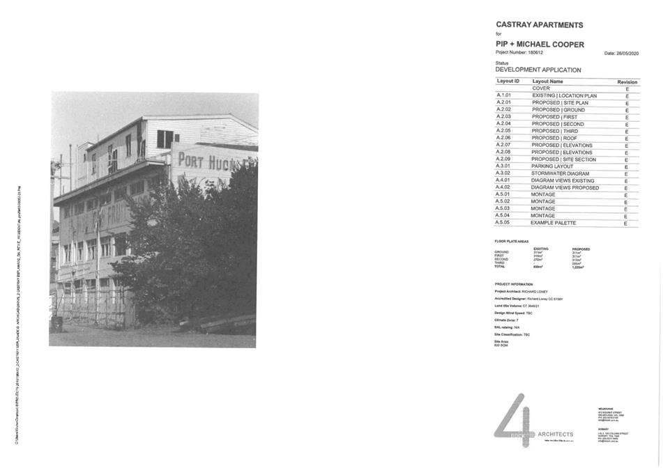
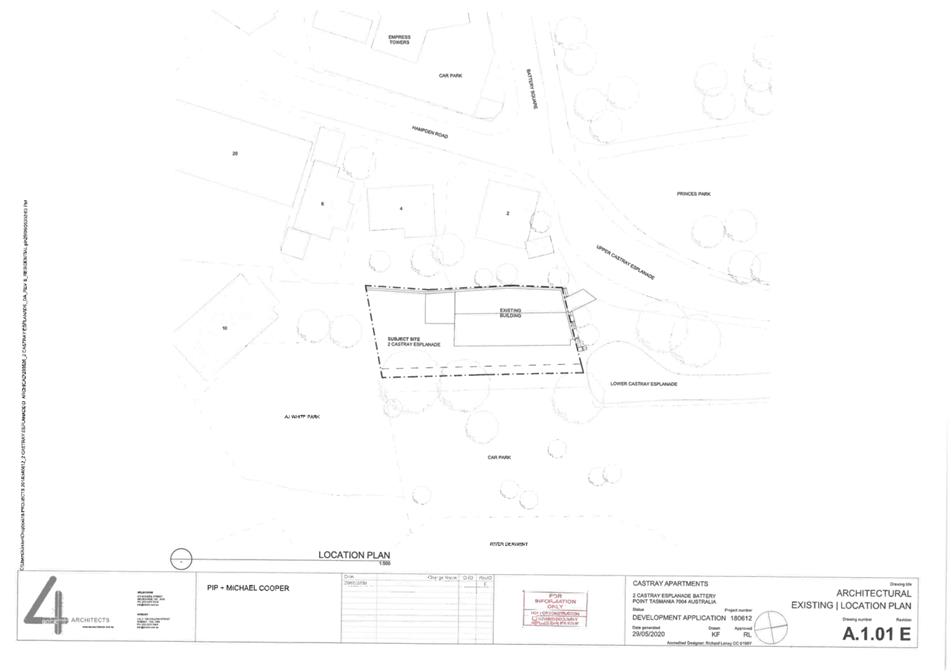
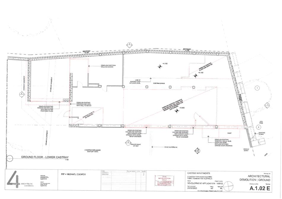
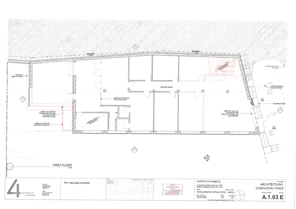
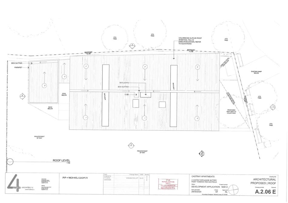
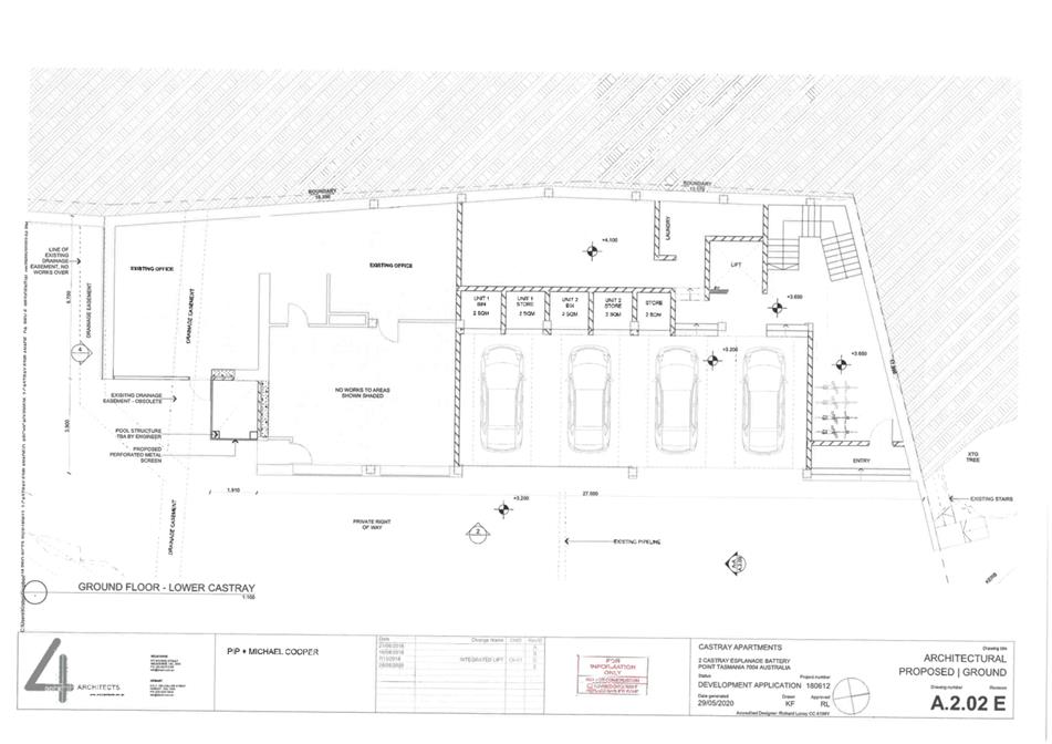
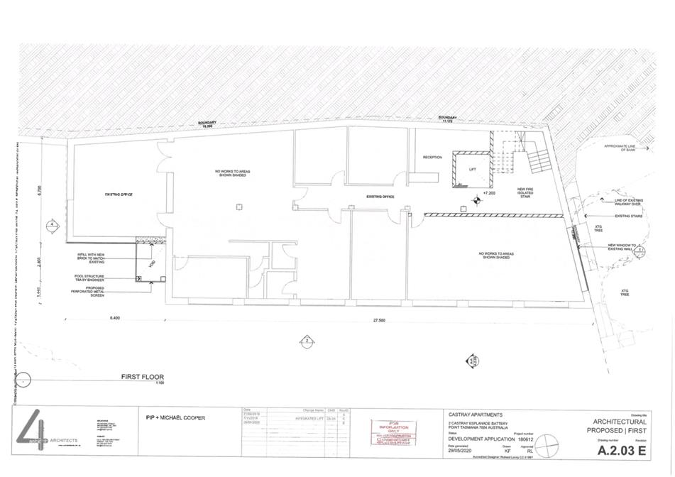
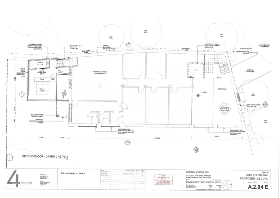
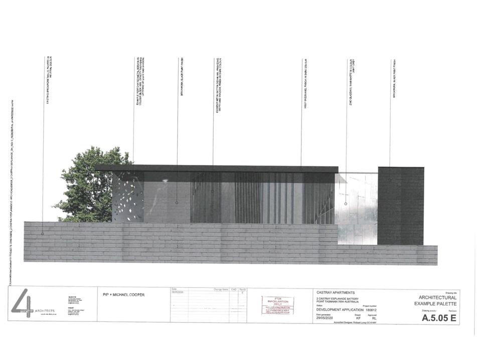
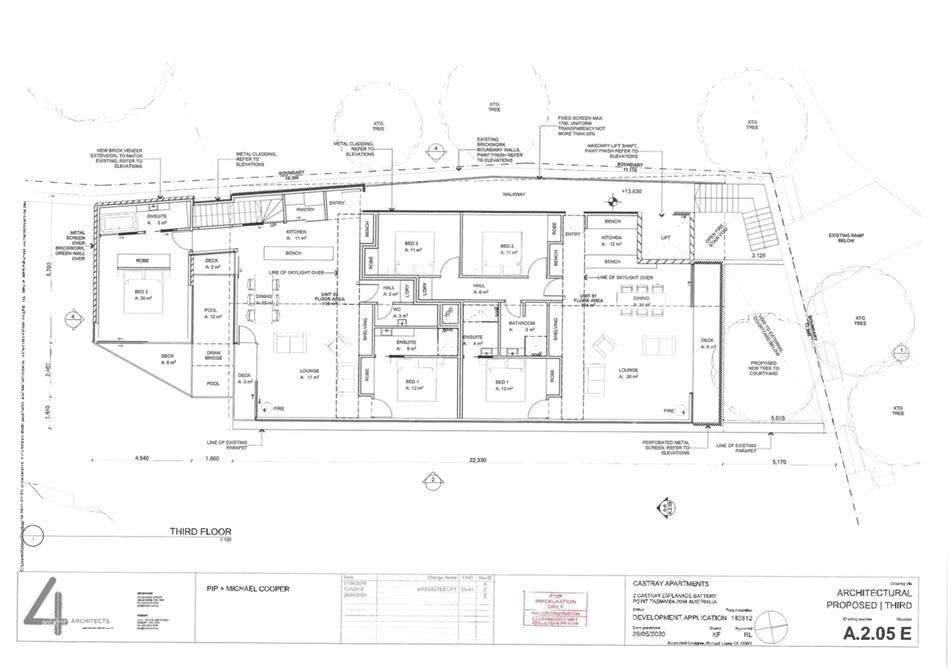
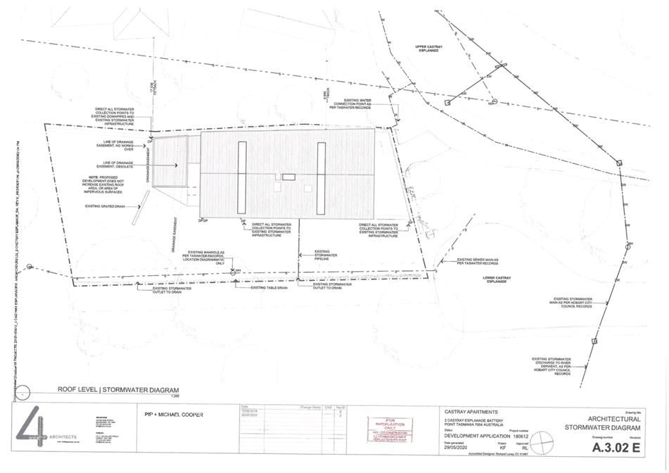
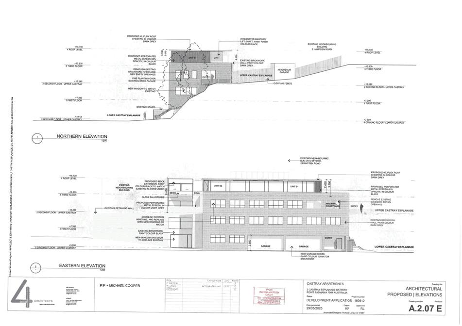
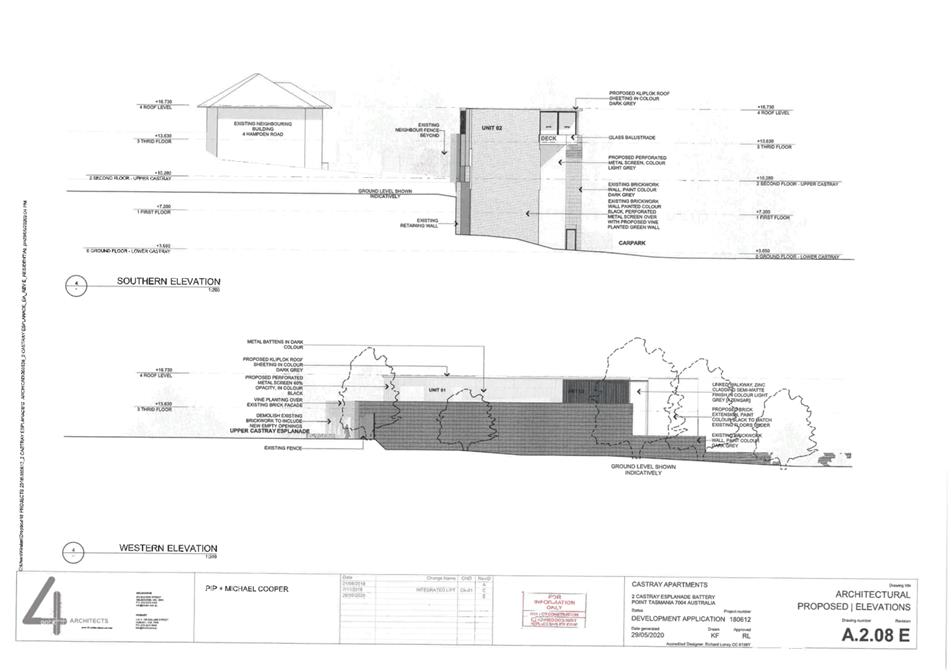
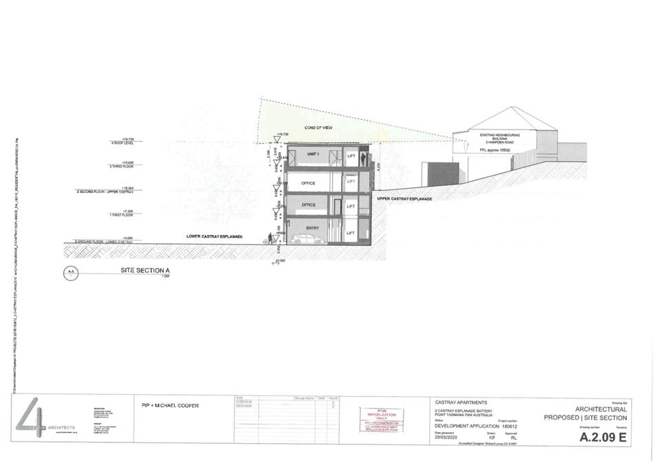
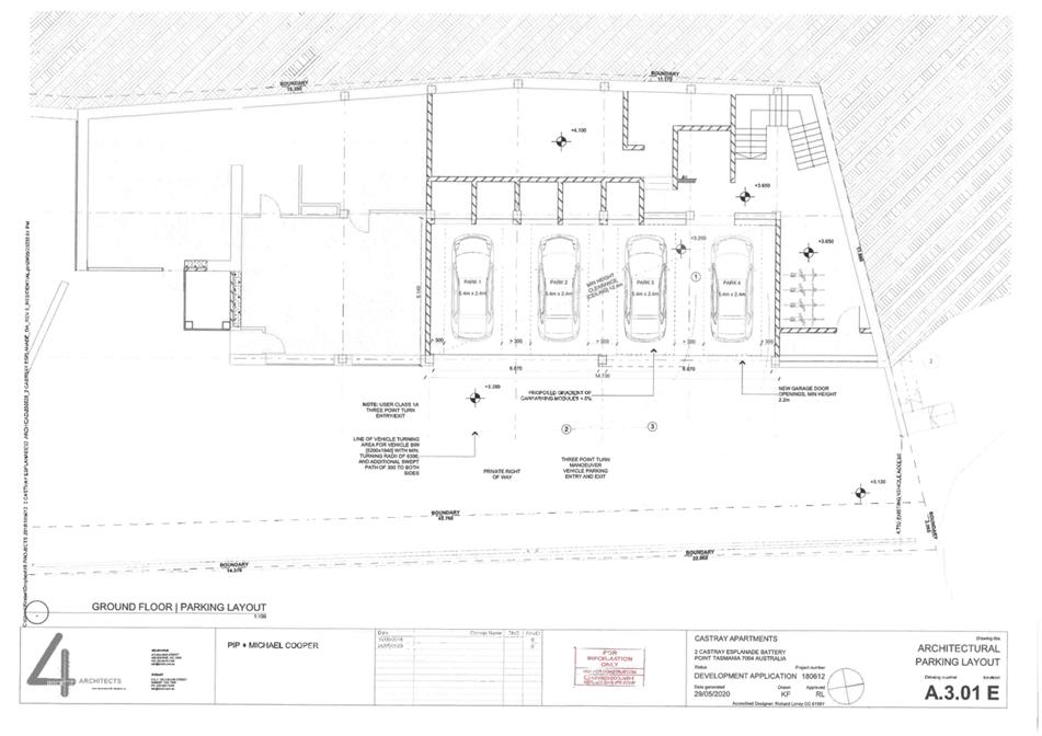
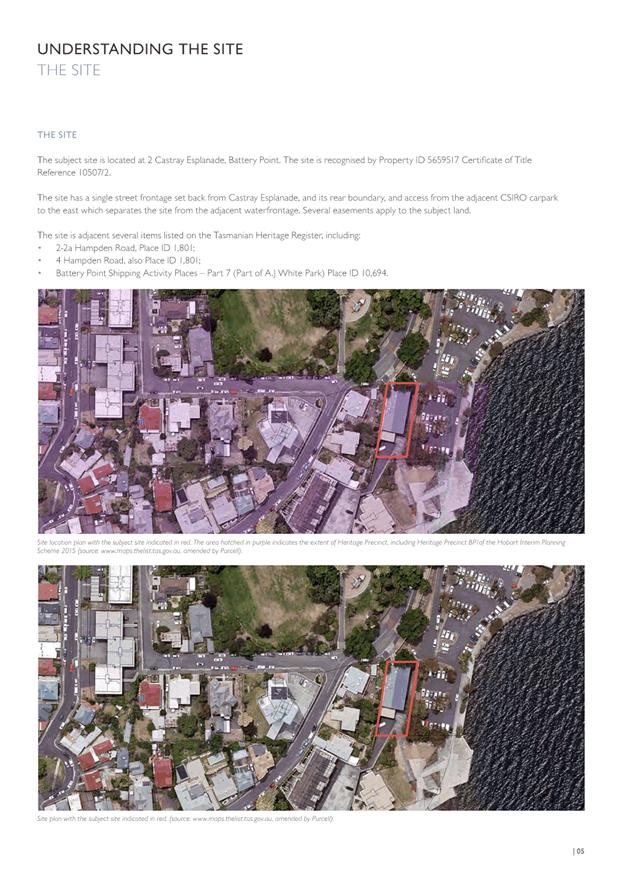
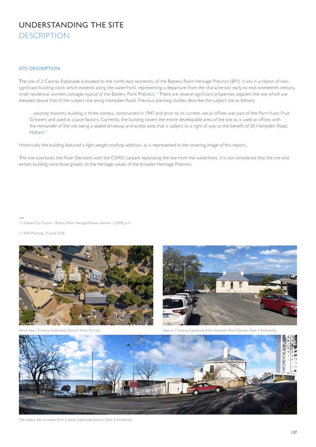
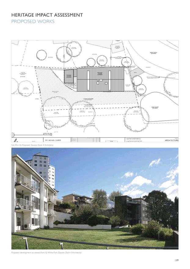
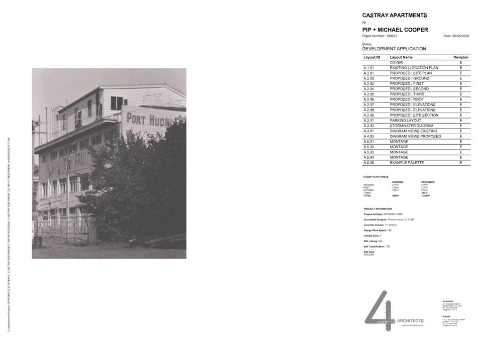
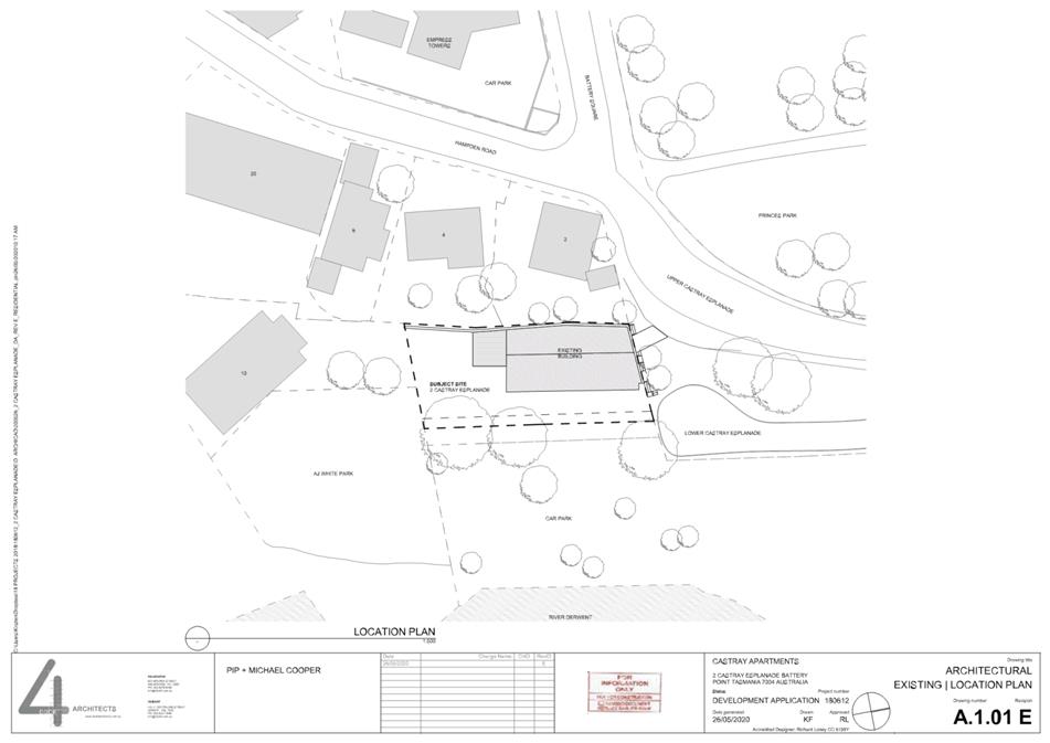
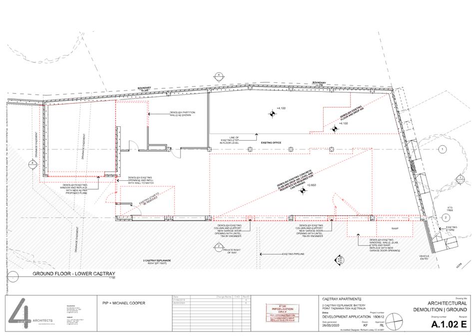
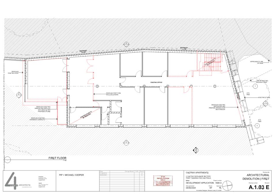
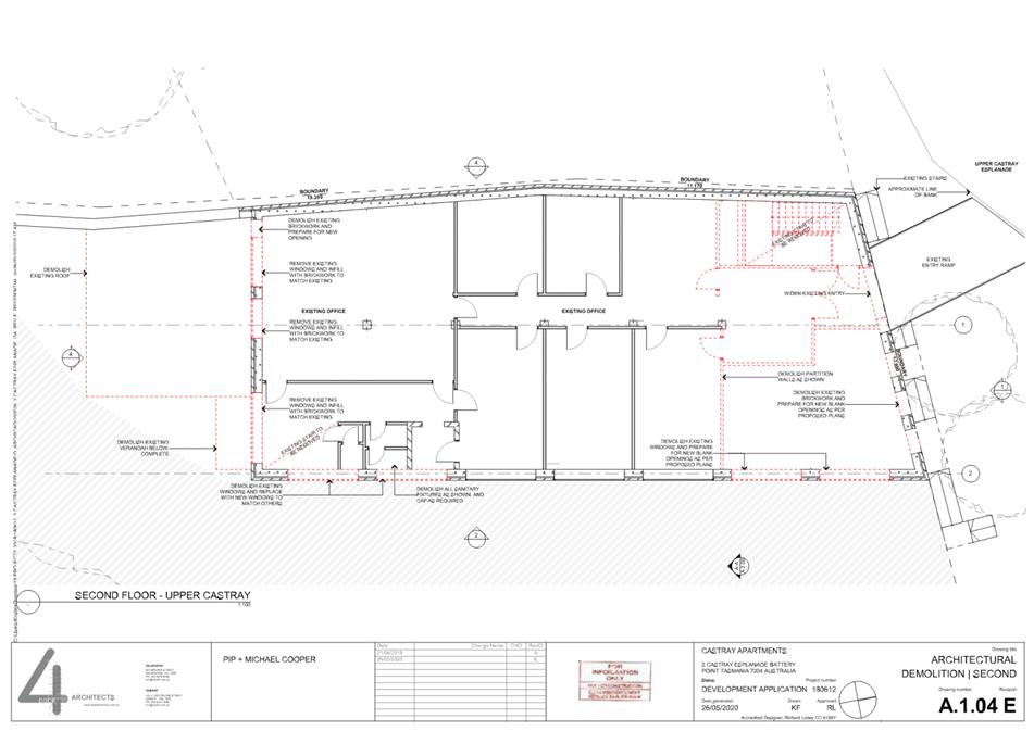
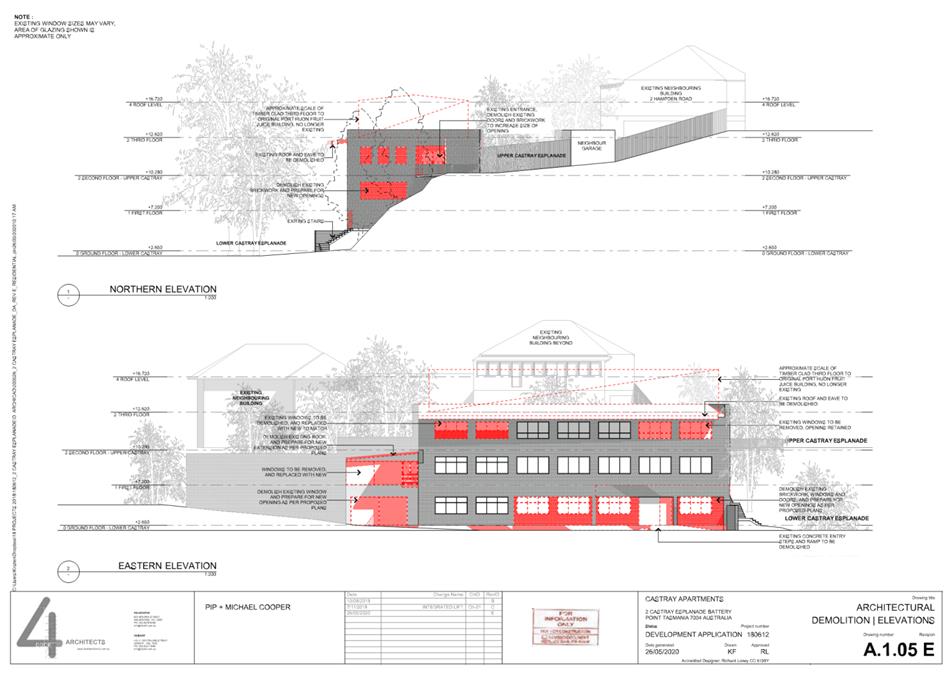
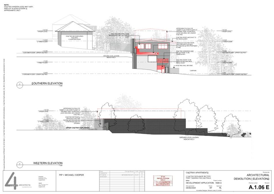
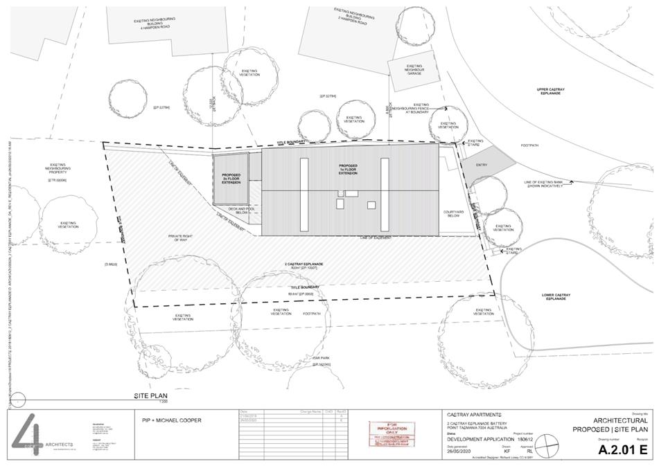
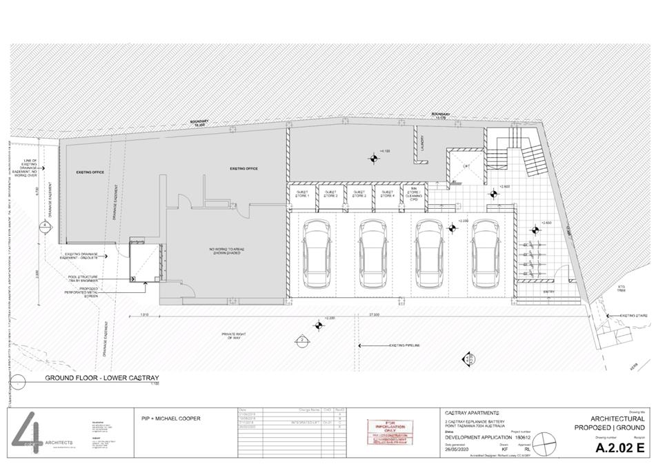
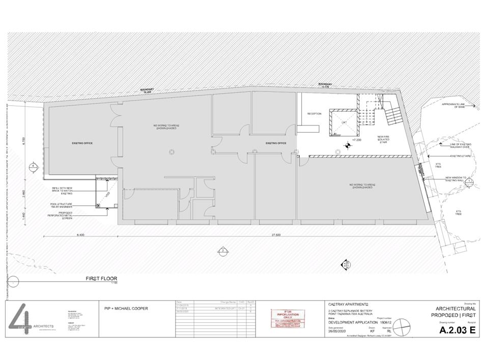
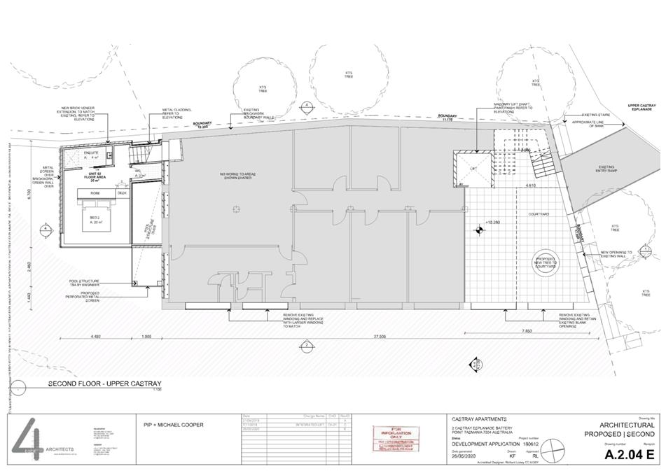
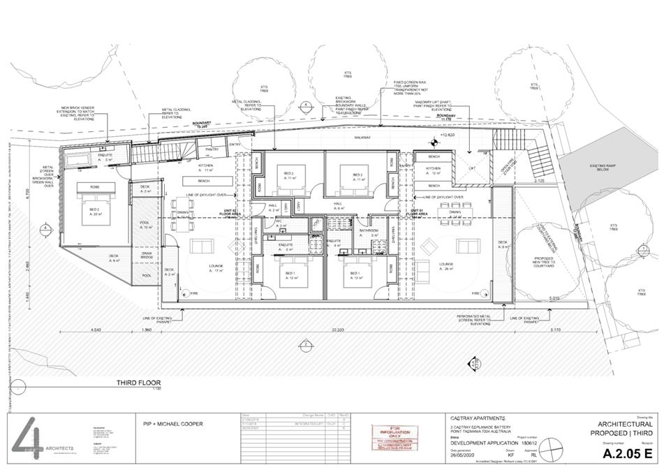
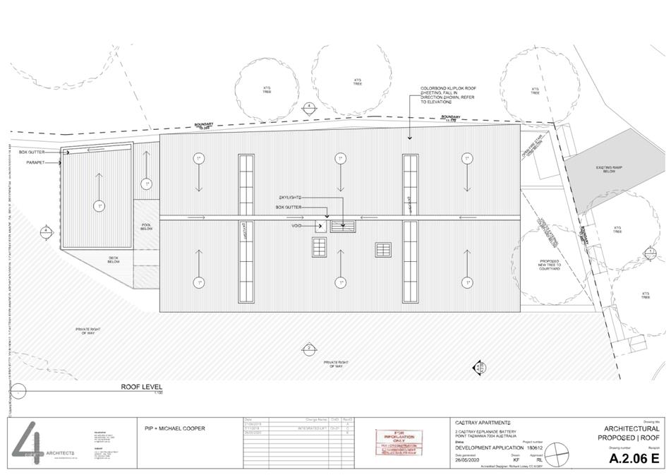
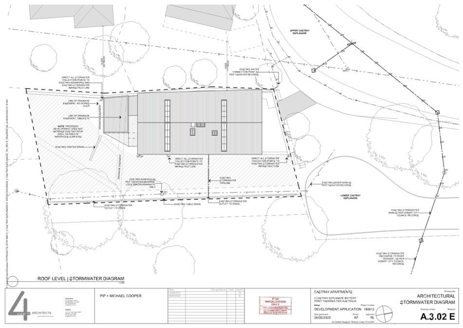
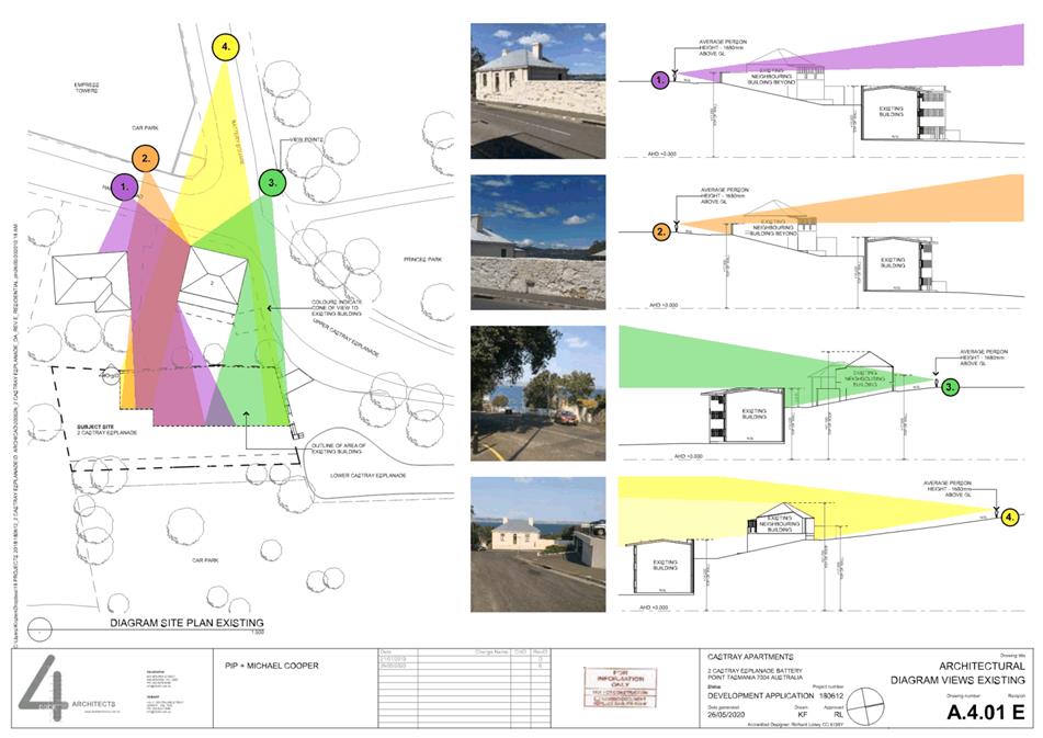
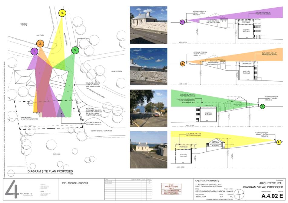
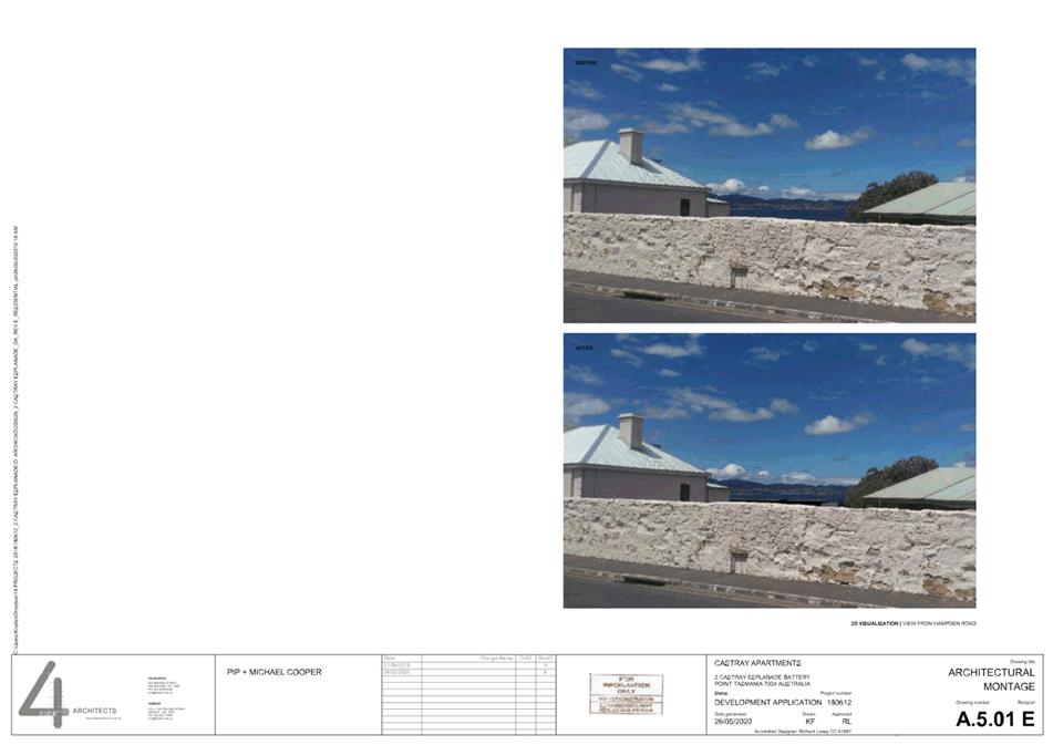
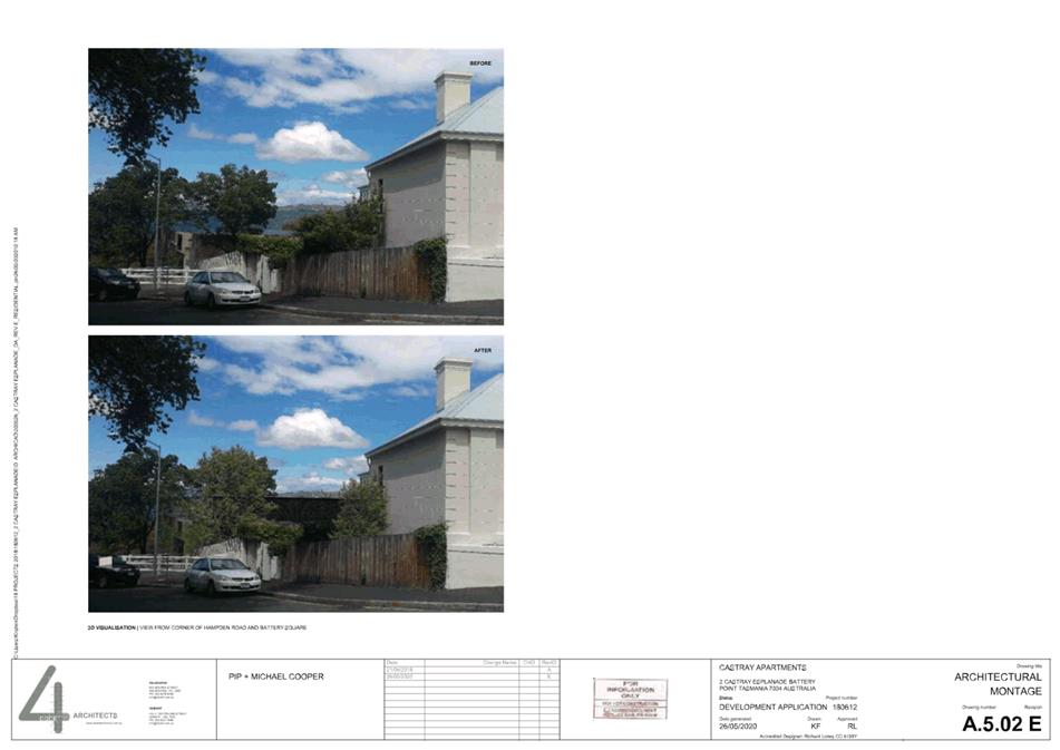
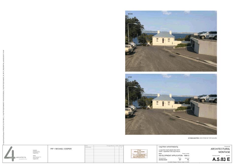
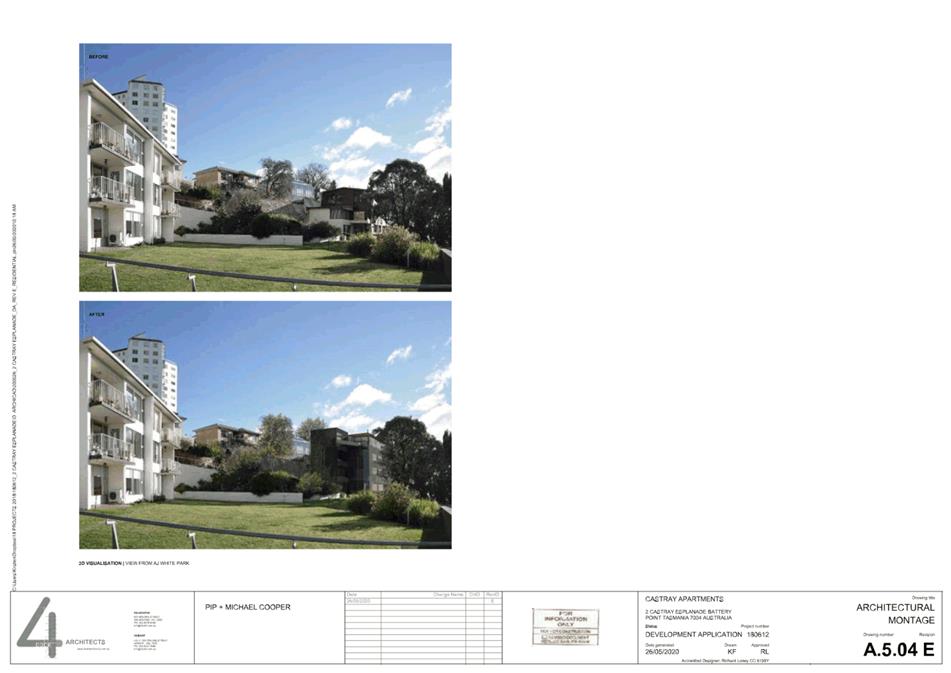
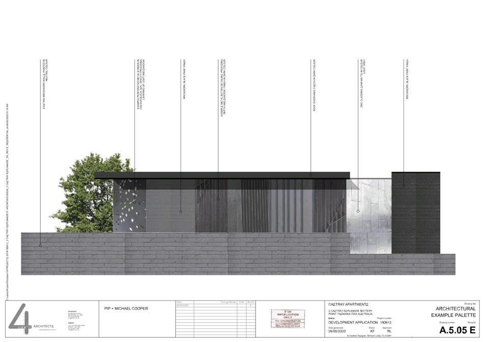
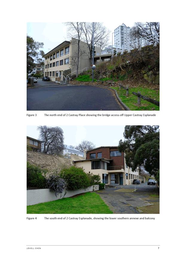
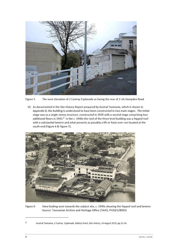
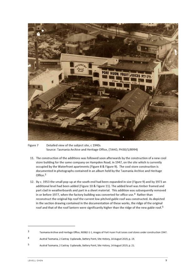
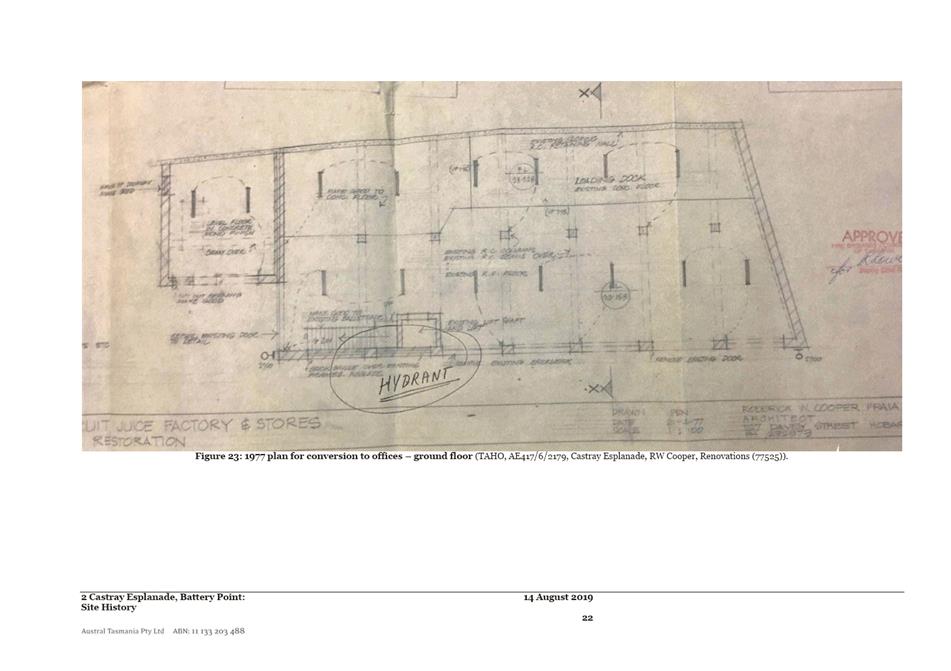
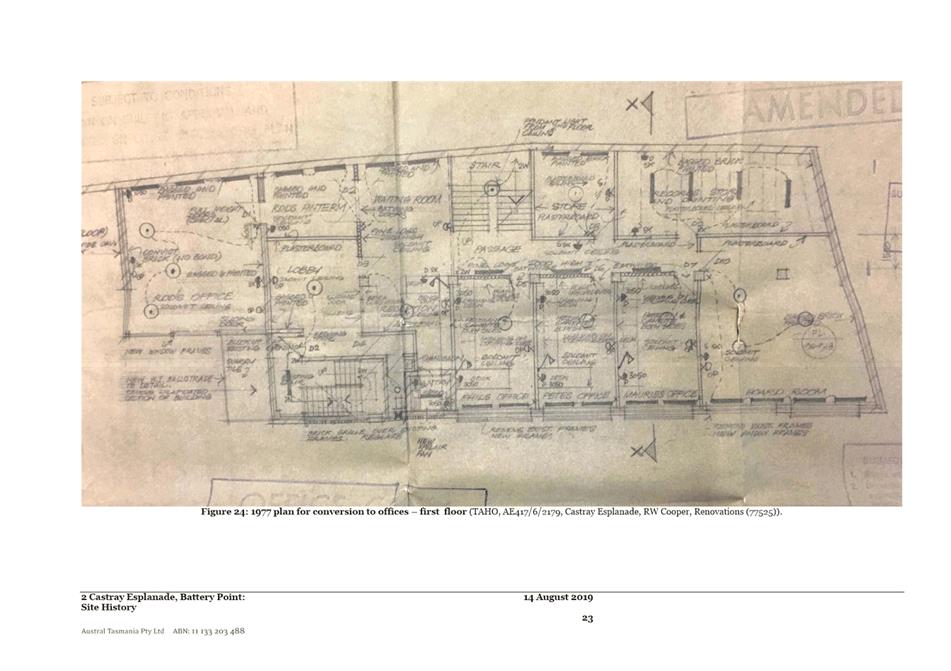
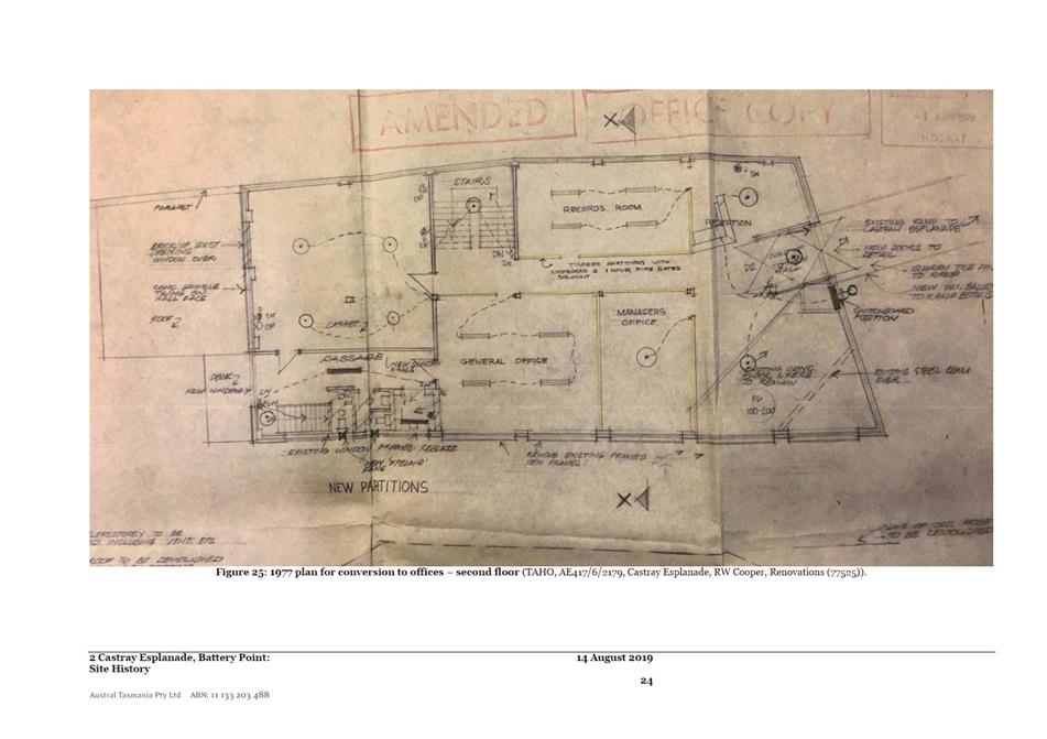
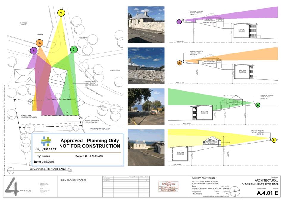
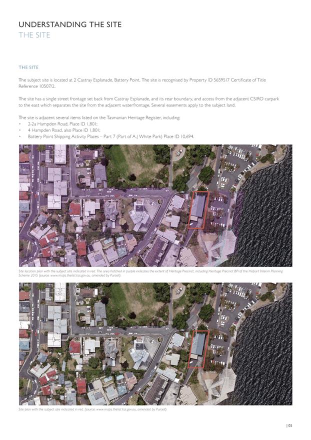
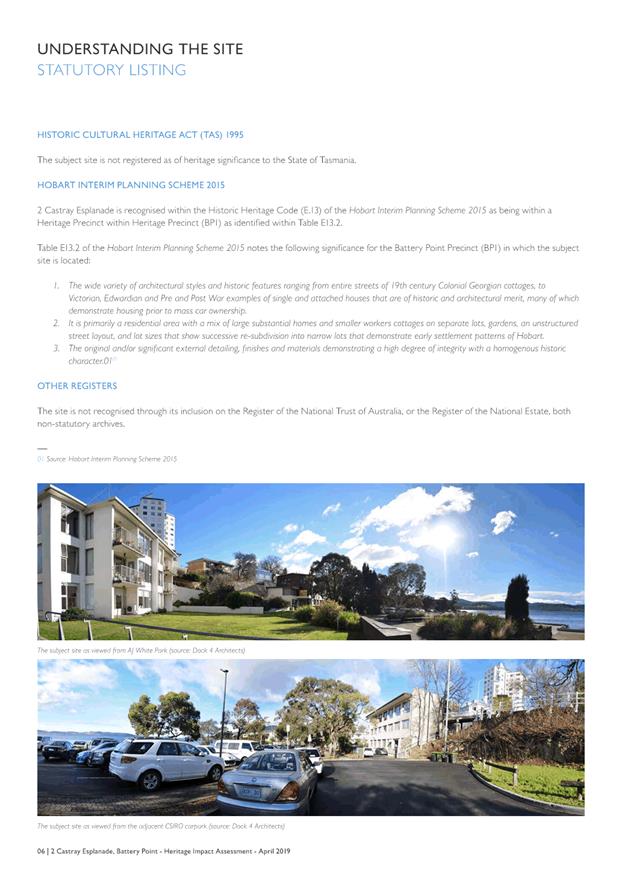
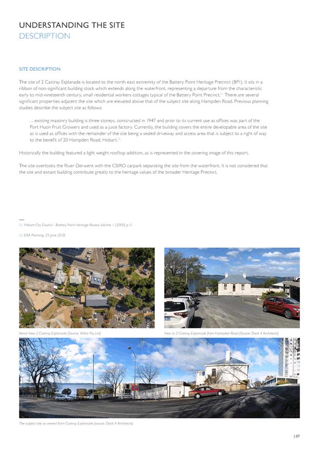
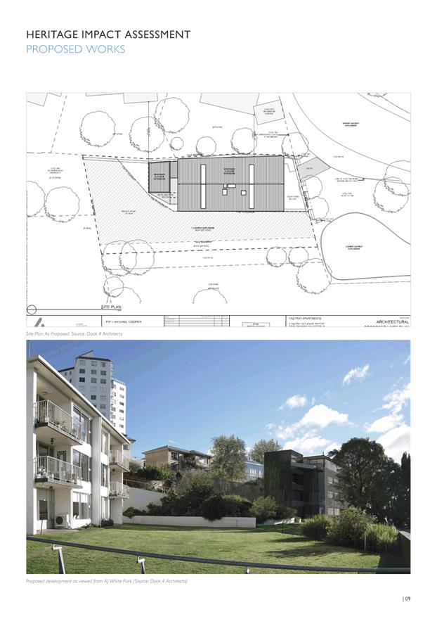
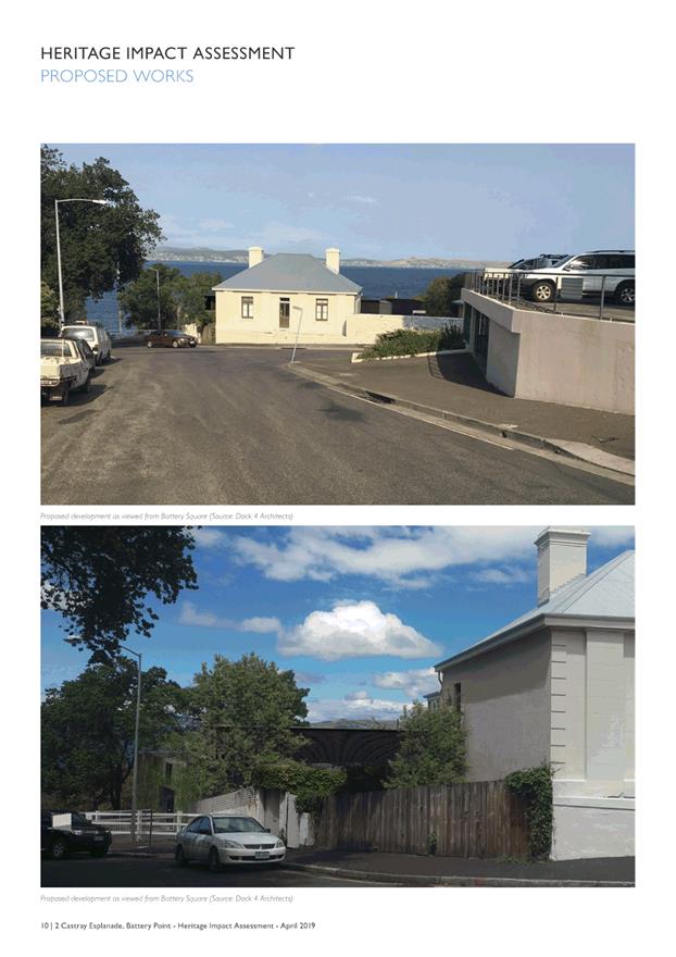
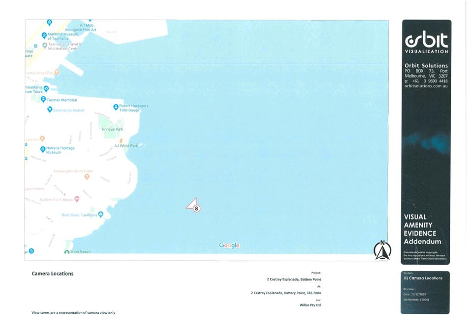
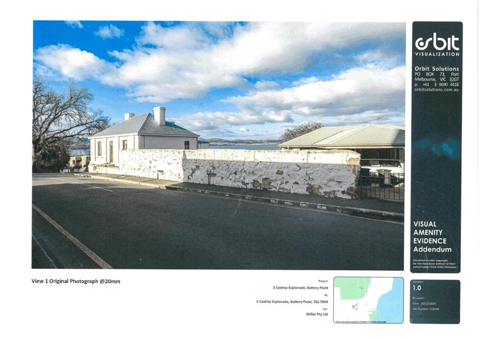
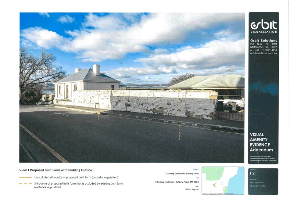
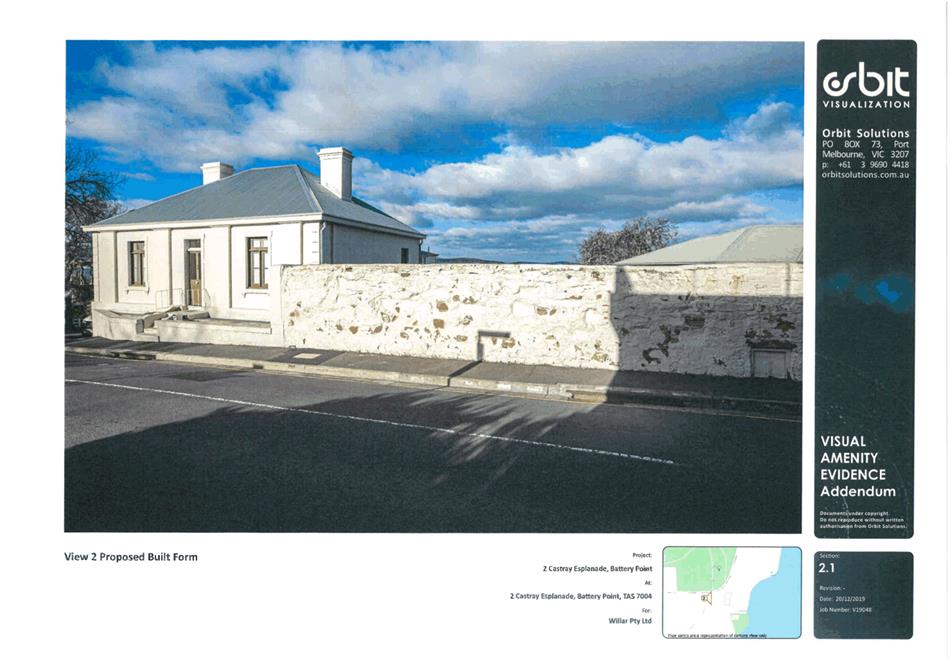
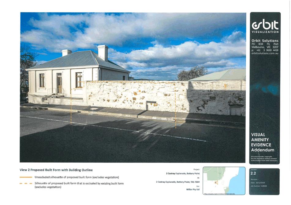
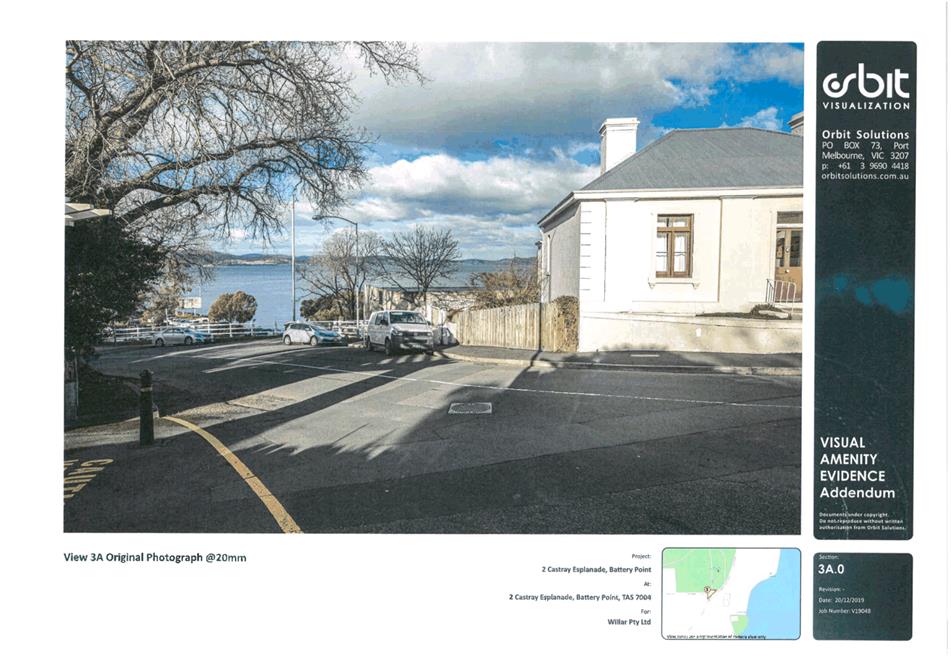
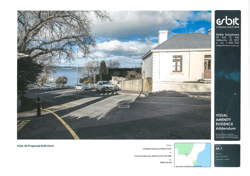
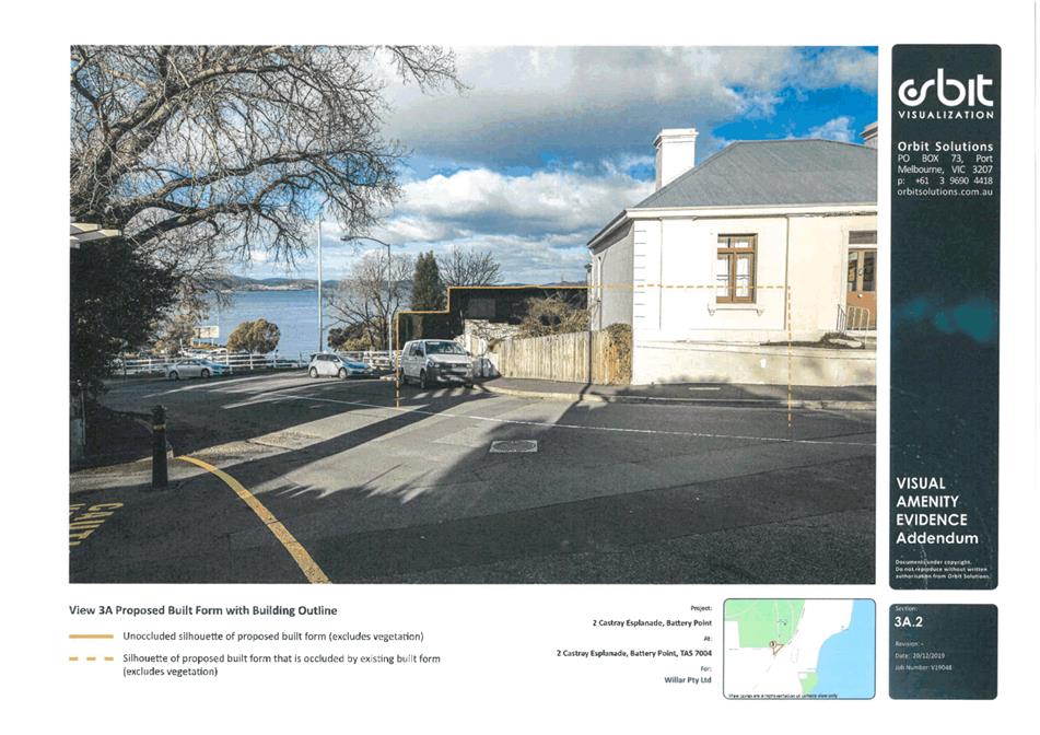
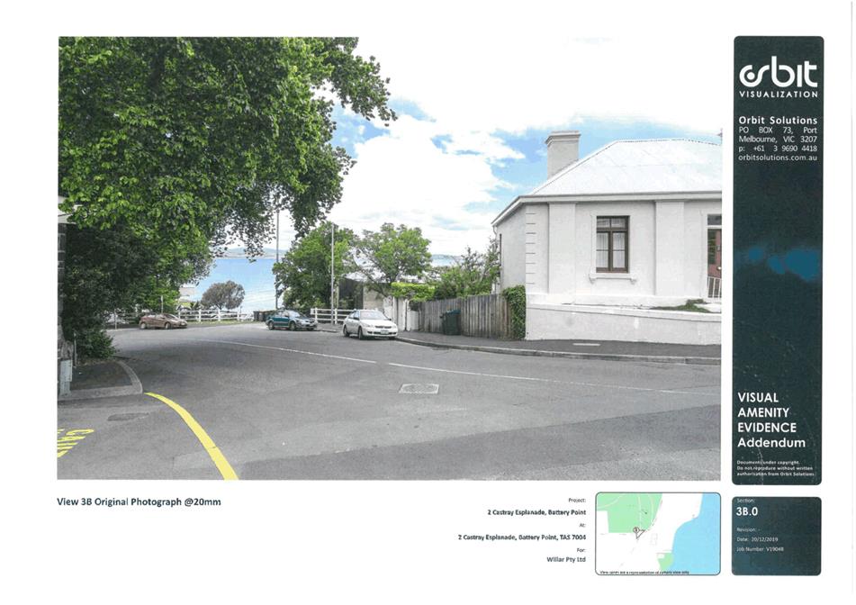
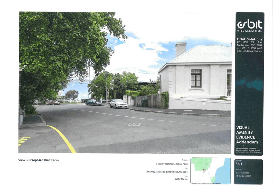
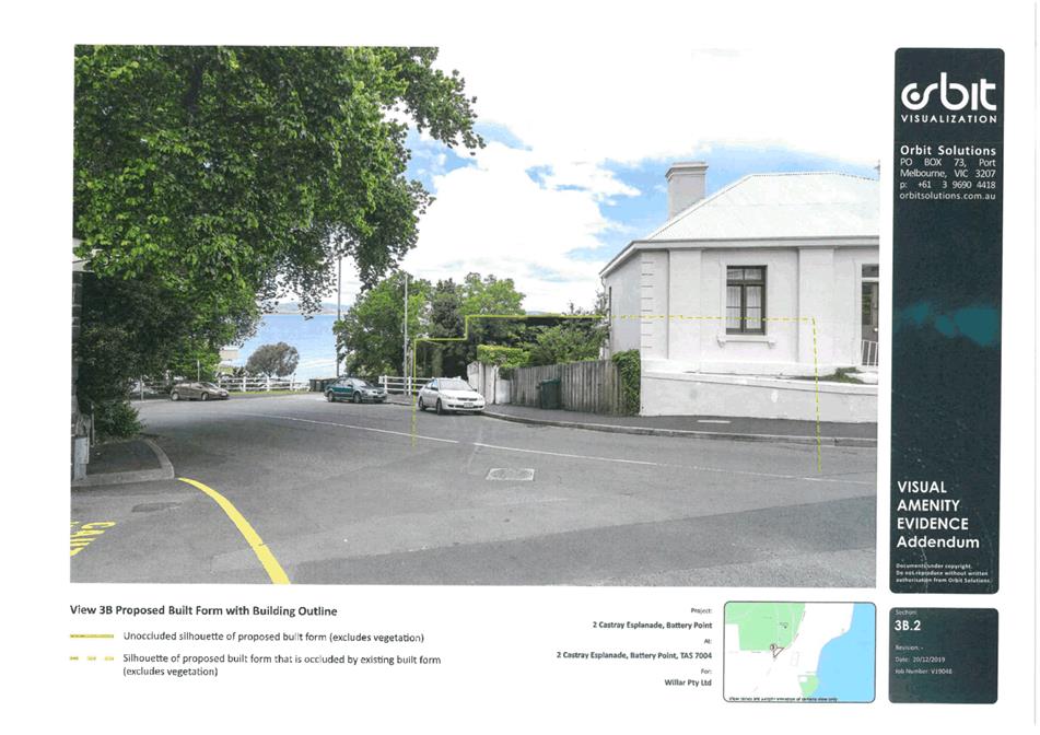
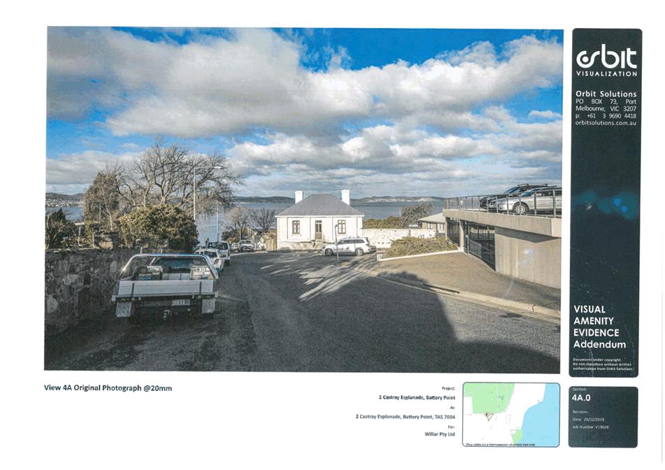
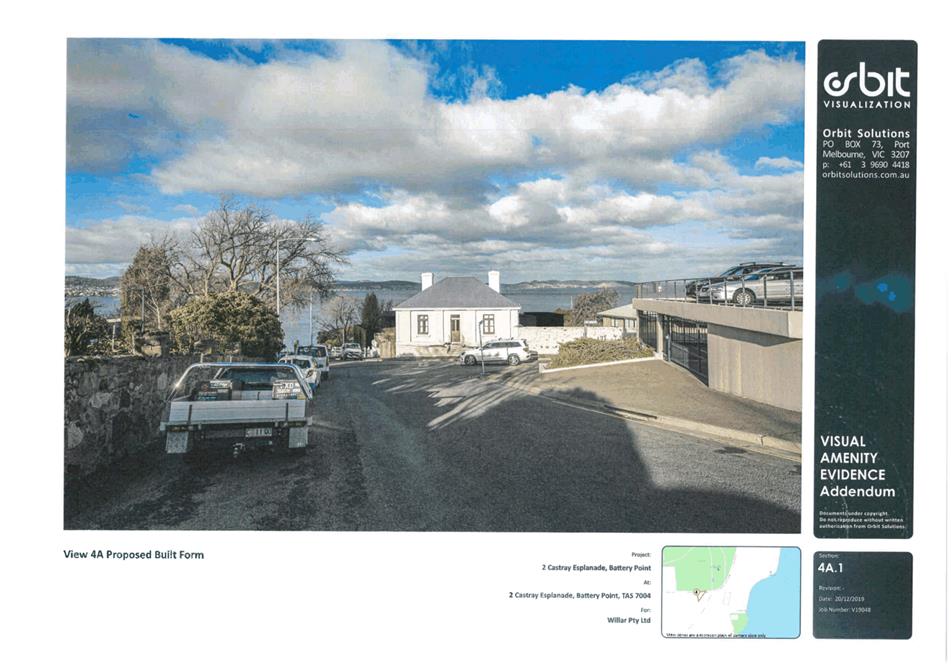
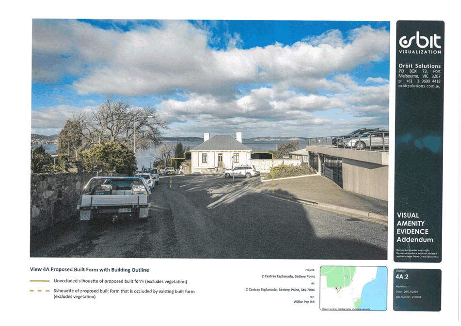
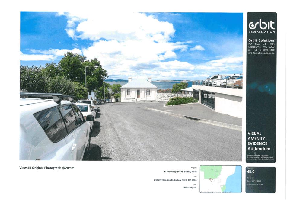
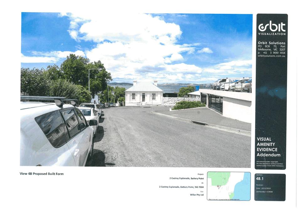
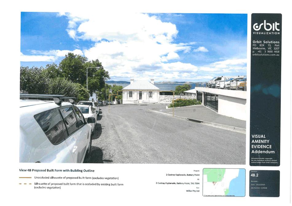
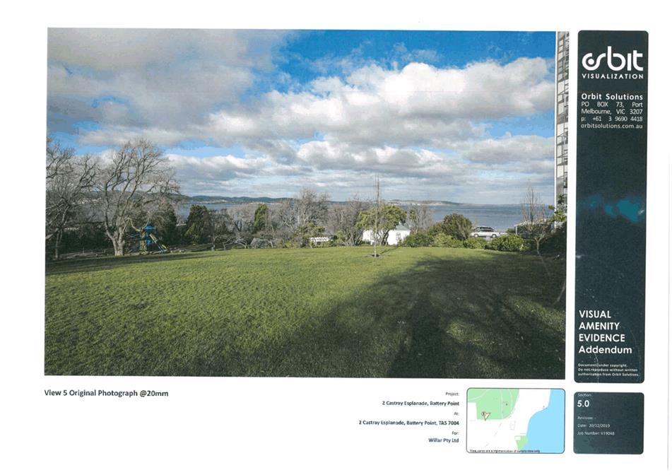
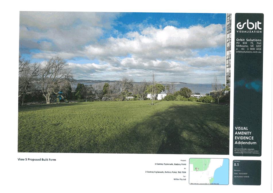
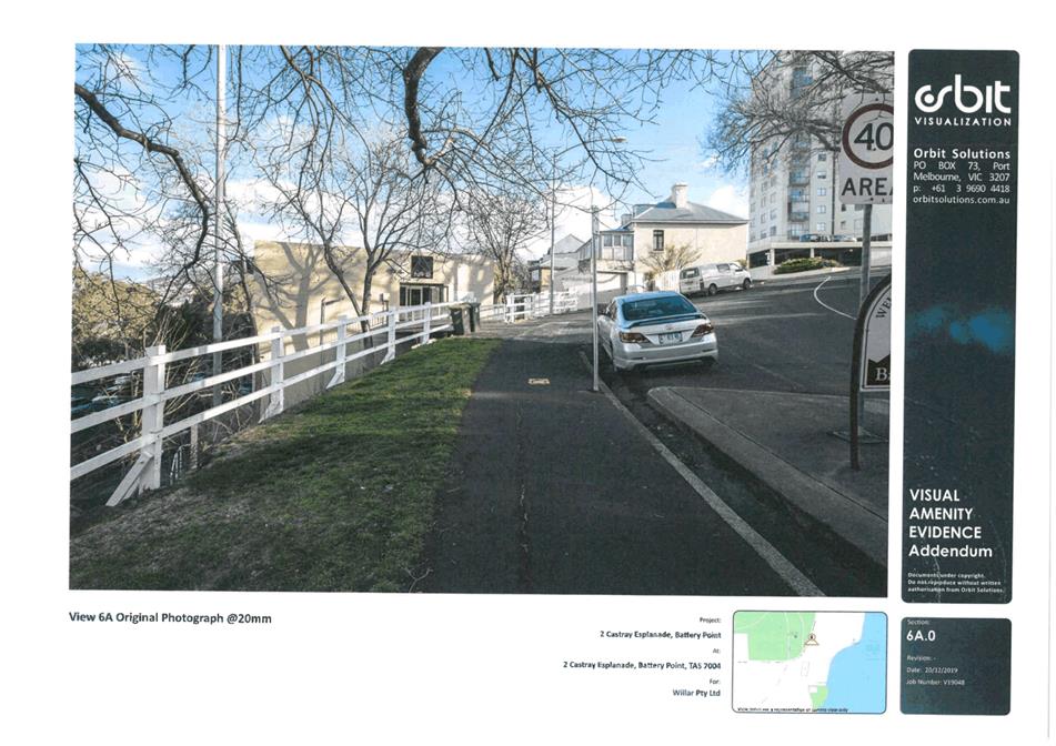
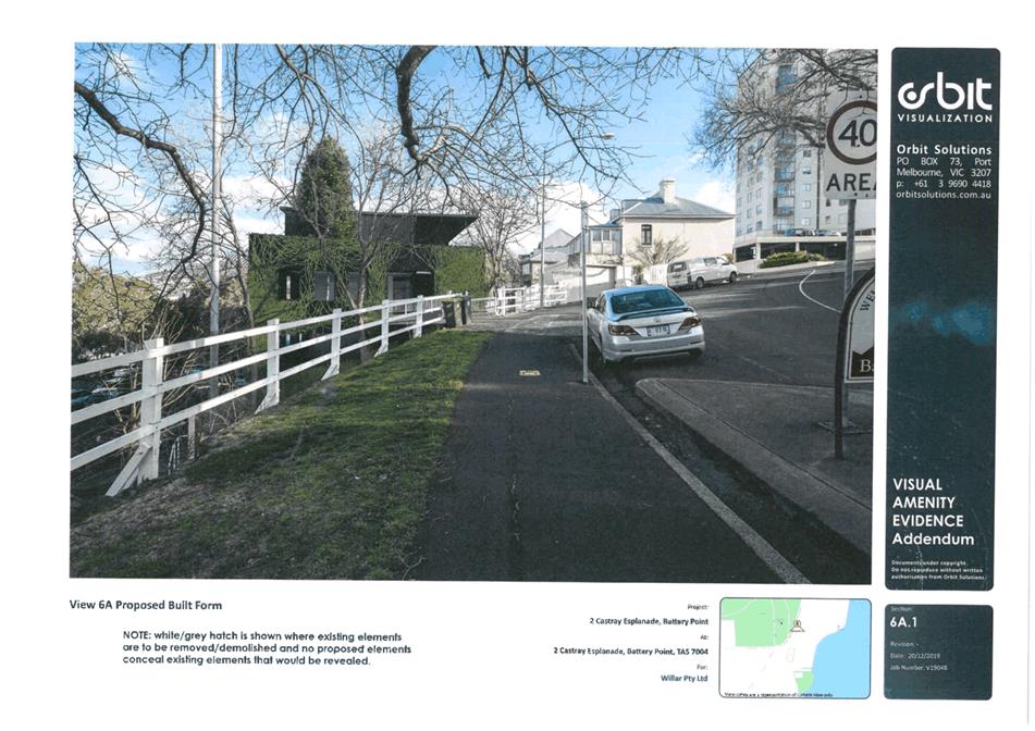
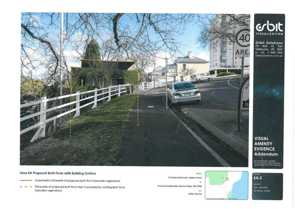
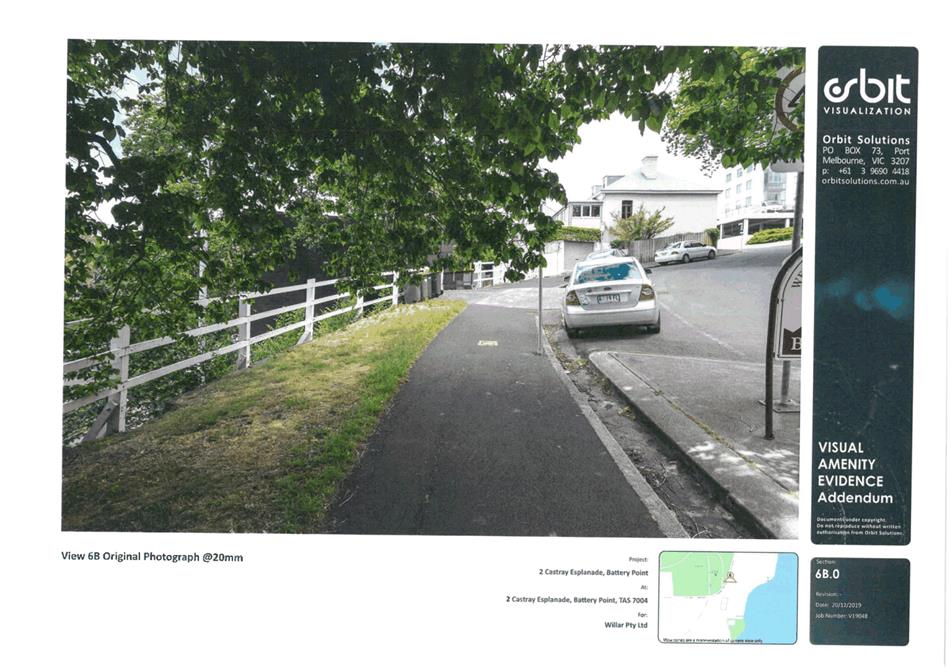
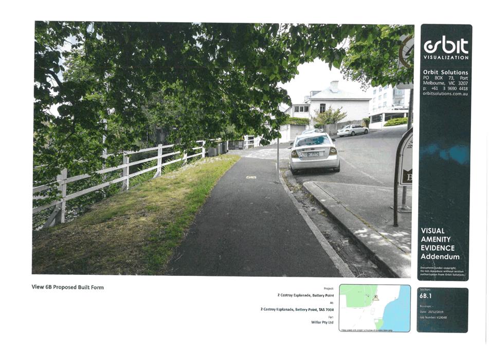
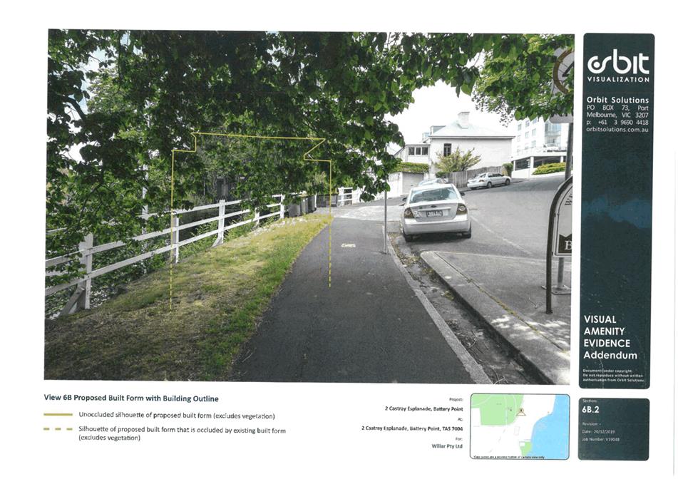
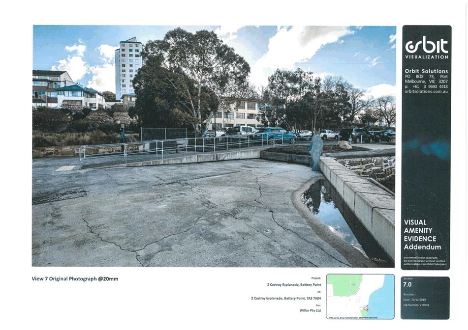
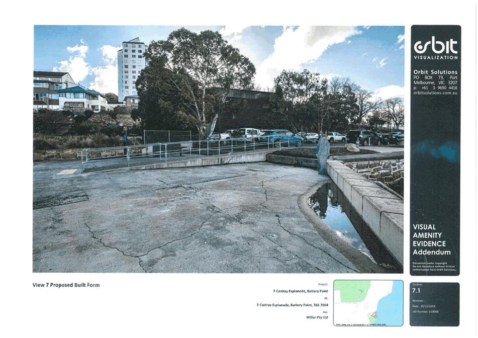
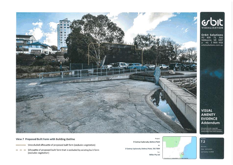
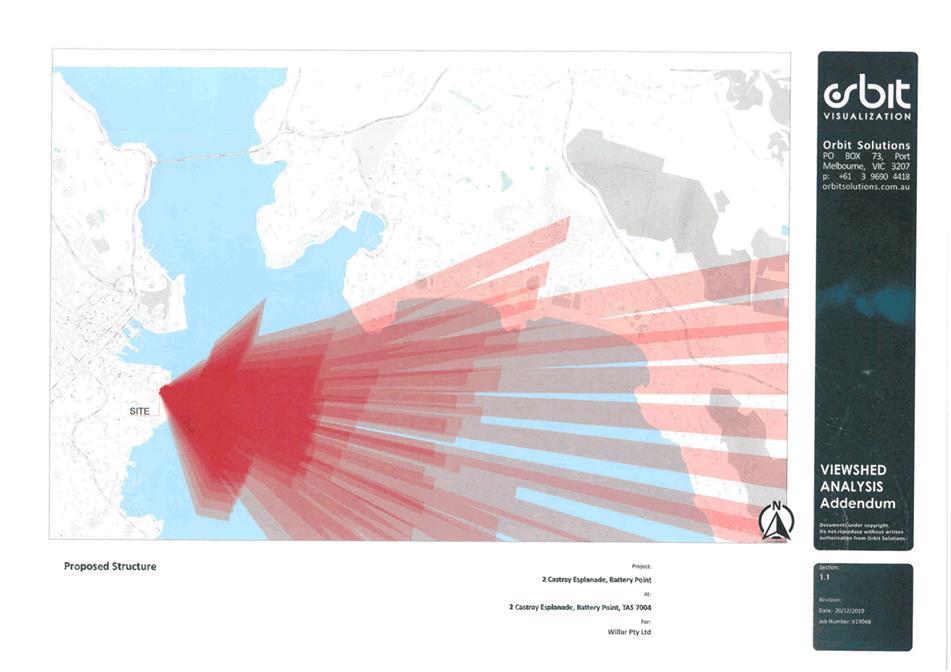
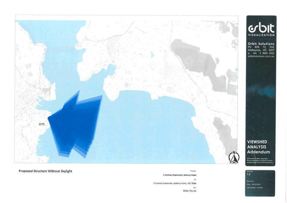
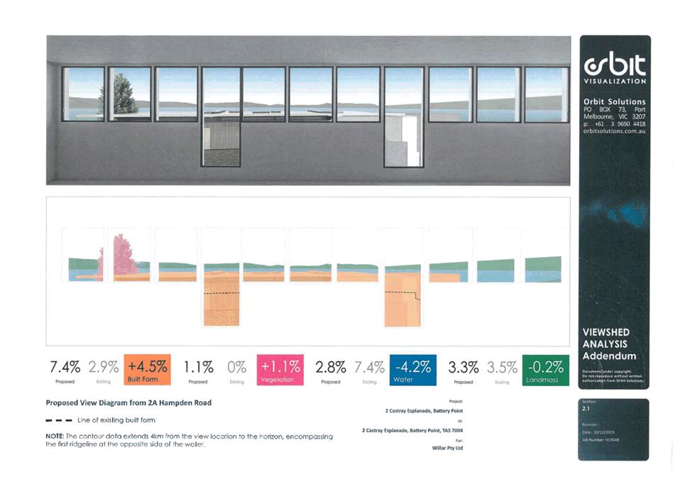
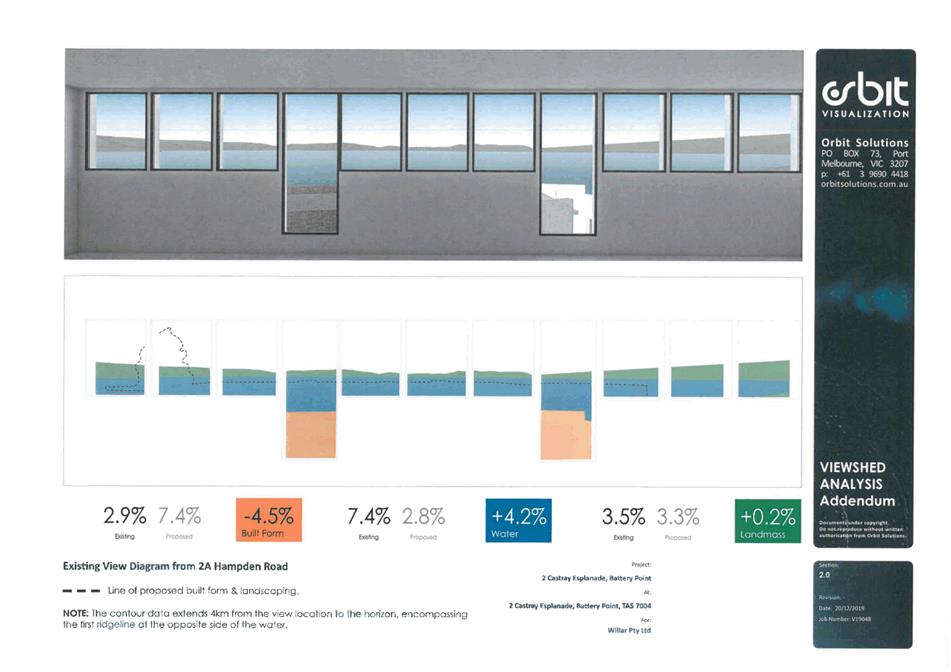
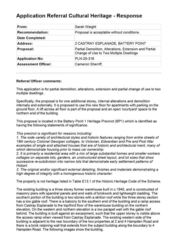
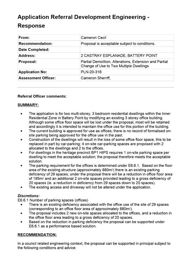
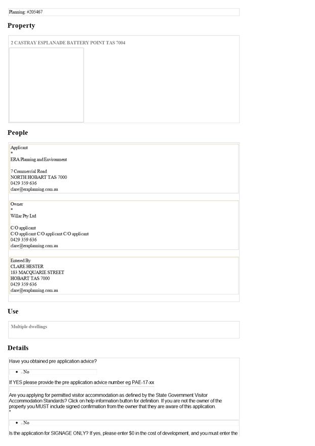
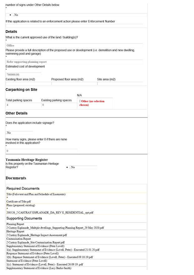
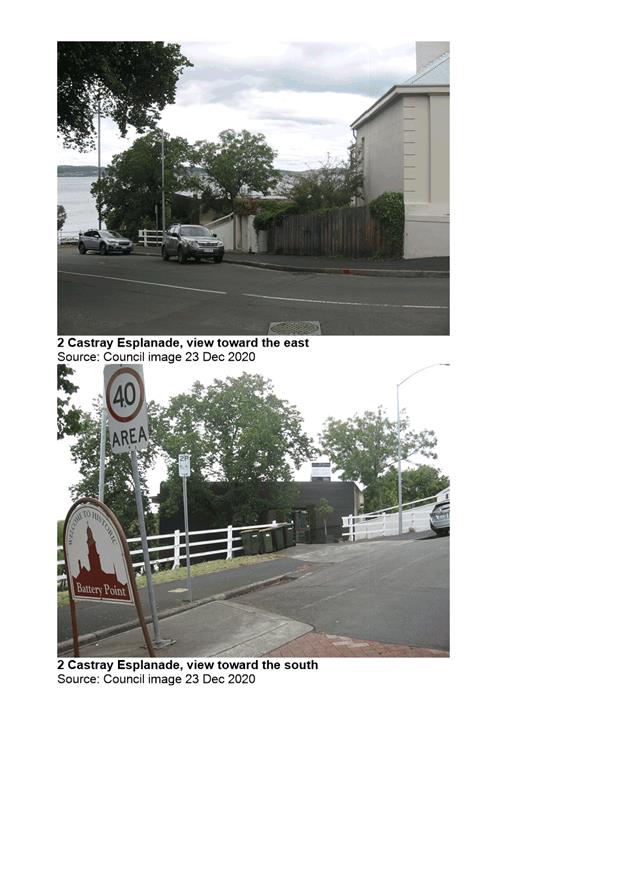
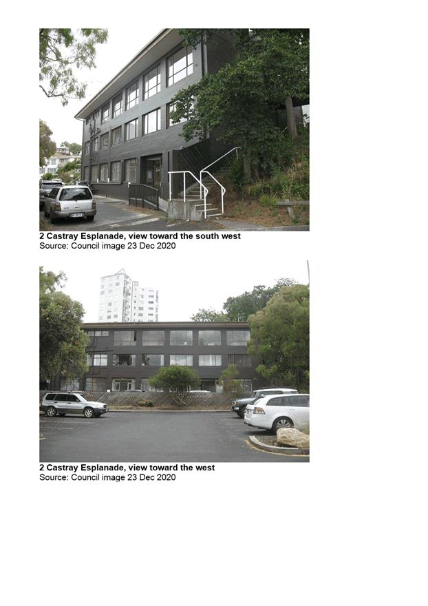
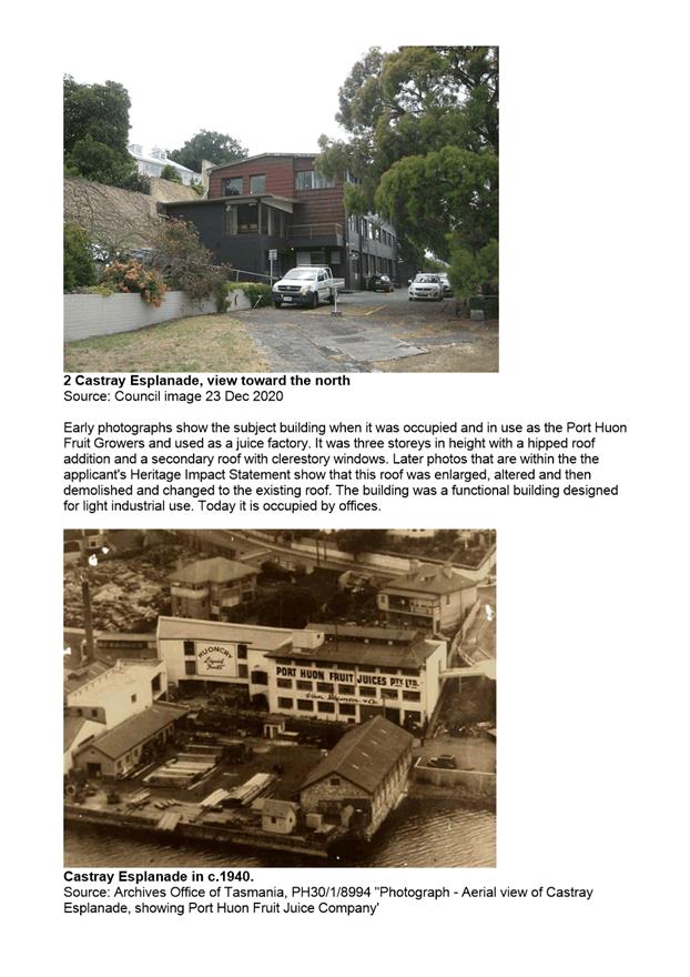
7.2.1 2 Castray Esplanade, Battery Point - Partial Demolition, Alterations, Extension and Partial Change of Use to Two Multiple Dwellings
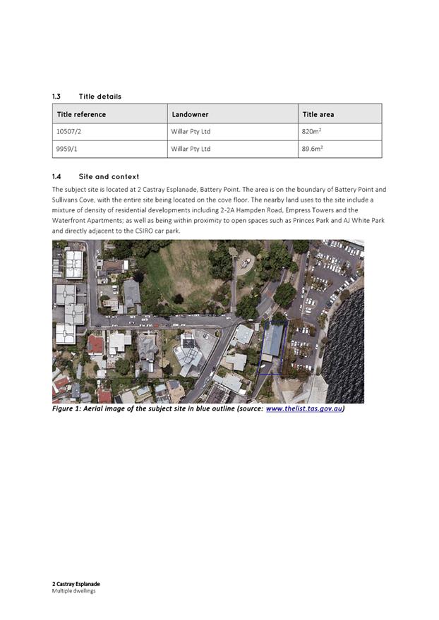
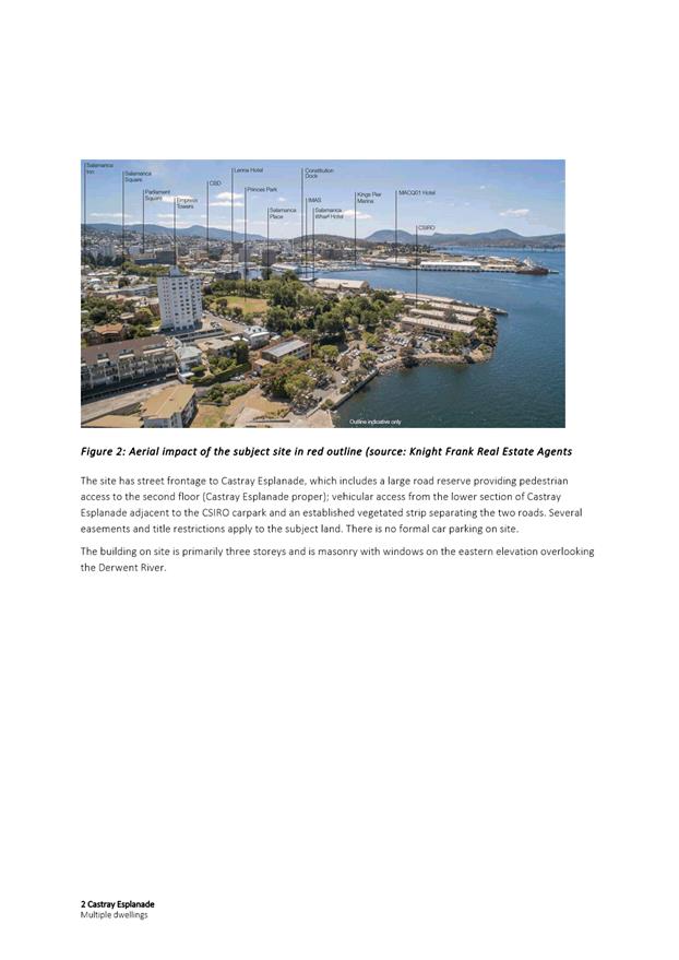
Address: 2 Castray Esplanade, Battery Point
Proposal: Partial Demolition, Alterations, Extension and Partial Change of Use to Two Multiple Dwellings
Expiry Date: 20 January 2021
Extension of Time: Not applicable
Author: Cameron Sherriff
|
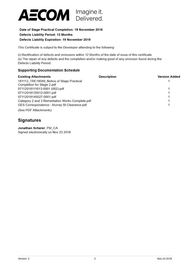
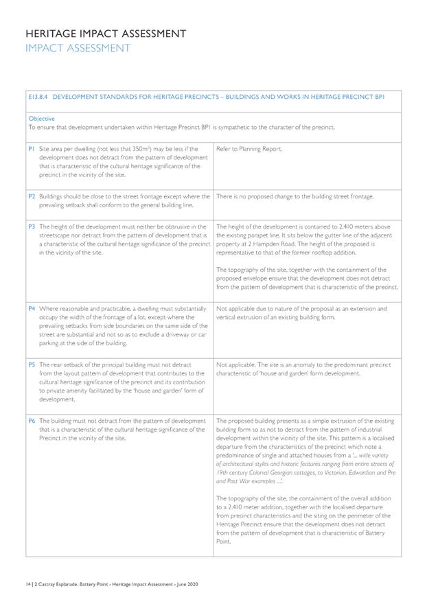
REcommendation That pursuant to the Hobart Interim Planning Scheme 2015, the City Planning Committee, in accordance with the delegations contained in its terms of reference, approve the application for partial demolition, alterations, extension and partial change of use to two multiple dwellings, at 2 Castray Esplanade, Battery Point for the reasons outlined in the officer’s report and a permit containing the following conditions be issued:
GEN
The use and/or development must be substantially in accordance with the documents and drawings that comprise PLN20316 2 CASTRAY ESPLANADE BATTERY POINT TAS 7004 Final Planning Documents except where modified below.
Reason for condition
To clarify the scope of the permit.
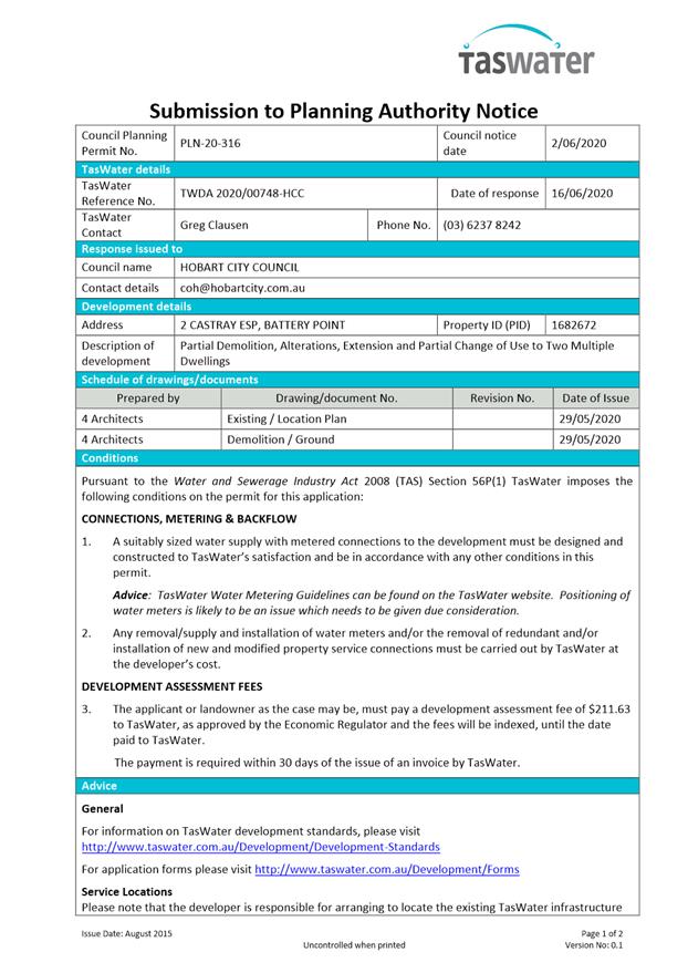
TW
The use and/or development must comply with the requirements of TasWater as detailed in the form Submission to Planning Authority Notice, Reference No. TWDA 2020/00748HCC dated 16/06/2020 as attached to the permit.
Reason for condition
To clarify the scope of the permit.
PLN 1
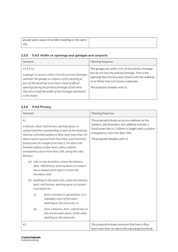
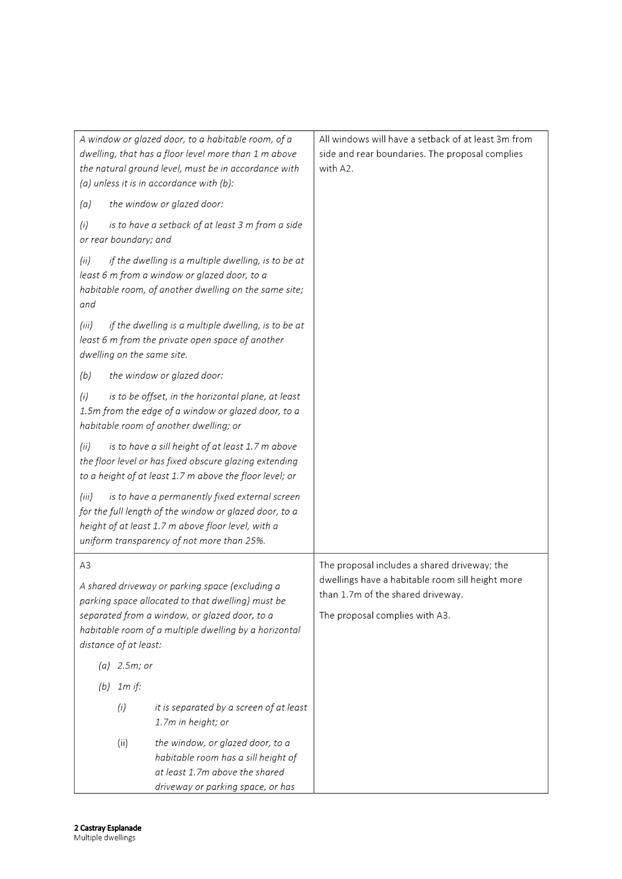
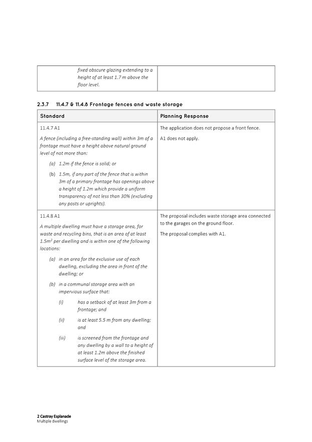
The fixed screening to a height of 1.7m above the walkway floor level, with no more than 25% uniform transparency as shown on the approved plans must be installed and maintained along the western side of the third floor level prior to first occupation.
Reason for condition
To provide reasonable opportunity for privacy for dwellings.
ENG 12
A construction waste management plan must be implemented throughout construction.
A construction waste management plan must be submitted and approved, prior to commencement of work on the site. The construction waste management plan must include:
· Provisions for commercial waste services for the handling, storage, transport and disposal of postconstruction solid waste and recycle bins from the development; and · Provisions for the handling, transport and disposal of demolition material, including any contaminated waste and recycling opportunities, to satisfy the above requirement.
All work required by this condition must be undertaken in accordance with the approved construction waste management plan.
Advice:
Once the construction waste management plan has been approved, the Council will issue a condition endorsement (see general advice on how to obtain condition endorsement).
Where building approval is also required, it is recommended that documentation for condition endorsement be submitted well before submitting documentation for building approval. Failure to address condition endorsement requirements prior to submitting for building approval may result in unexpected delays.
It is recommended that the developer liaise with the Council’s Cleansing and Solid Waste Unit regarding reducing, reusing and recycling materials associated with demolition on the site to minimise solid waste being directed to landfill. Further information can also be found on the Council’s website.
Reason for condition
To ensure that solid waste management from the site meets the Council’s requirements and standards.
ENG sw6
All stormwater from the proposed development (including hardstand runoff) must be discharged to a legal point of discharge with sufficient receiving capacity prior to first occupation or commencement of use (whichever occurs first). All costs associated with works required by this condition are to be met by the owner.
Design drawings and calculations of the proposed stormwater drainage from the site must be submitted and approved prior to the commencement of work. The design drawings and calculations must:
1. be prepared by a suitably qualified person; 2. extend to the point of discharge to the River Derwent; 3. demonstrate any private or private shared stormwater system passing through thirdparty land has sufficient receiving capacity; 4. clearly show ownership of stormwater infrastructure.
All work required by this condition must be undertaken in accordance with the approved design drawings and calculations.
Advice:
Under section 23 of the Urban Drainage Act 2013 it is an offence for a property owner to direct stormwater onto a neighbouring property.
Council has no record of how the site drains lawfully and efficiently to the River Derwent.
Council also notes the requirements of s81 of the Building Regulations 2016. Plans for any plumbing approval must clearly state the pool type (ie standard chlorine), show filter backwash to sewer, and state the proposed maximum discharge rate (<240L/min) and total chlorine concentration (<1.2mg/L) for emptying the pool as a maintenance action.
Reason for condition
To ensure that stormwater from the site will be discharged to a suitable Council approved outlet.
ENG 13
An ongoing waste management plan for all commercial and domestic waste and recycling must be implemented post construction.
A waste management plan must be submitted and approved, prior to commencement of work on the site. A waste management plan must:
1. include provisions for commercial waste services for the handling, storage, transport and disposal of commercial and domestic waste and recycle bins from the development.
All work required by this condition must be undertaken in accordance with the approved waste management plan.
Advice:
Once the waste management plan has been approved Council will issue a condition endorsement (see general advice on how to obtain condition endorsement).
Where building approval is also required, it is recommended that documentation for condition endorsement be submitted well before submitting documentation for building approval. Failure to address condition endorsement requirements prior to submitting for building approval may result in unexpected delays.
Reason for condition
To ensure that solid waste management from the site meets the Council’s requirements and standards.
ENG tr2
A construction traffic and parking management plan must be implemented prior to the commencement of work on the site (including demolition).
The construction traffic (including cars, public transport vehicles, service vehicles, pedestrians and cyclists) and parking management plan must be submitted and approved, prior to commencement work (including demolition). The construction traffic and parking management plan must:
1. Be prepared by a suitably qualified person. 2. Develop a communications plan to advise the wider community of the traffic and parking impacts during construction. 3. Include a start date and finish dates of various stages of works. 4. Include times that trucks and other traffic associated with the works will be allowed to operate. 5. Nominate a superintendant, or the like, to advise the Council of the progress of works in relation to the traffic and parking management with regular meetings during the works.
All work required by this condition must be undertaken in accordance with the approved construction traffic and parking management plan.
Advice:
Once the construction traffic and parking management plan has been approved, the Council will issue a condition endorsement (see general advice on how to obtain condition endorsement).
Where building approval is also required, it is recommended that documentation for condition endorsement be submitted well before submitting documentation for building approval. Failure to address condition endorsement requirements prior to submitting for building approval may result in unexpected delays.
Reason for condition
To ensure the safety of vehicles entering and leaving the development and the safety and access around the development site for the general public and adjacent businesses.
ENG 3a
The access driveway, circulation roadways, ramps and parking module (parking spaces, aisles and manoeuvring area) must be designed and constructed in accordance with Australian Standard AS/NZS2890.1:2004 (including the requirement for vehicle safety barriers where required), or a Council approved alternate design certified by a suitably qualified engineer to provide a safe and efficient access, and enable safe, easy and efficient use.
Advice:
It is advised that designers consider the detailed design of the access and parking module prior to finalising the Finished Floor Level (FFL) of the parking spaces (especially if located within a garage incorporated into the dwelling), as failure to do so may result in difficulty complying with this condition.
Reason for condition
To ensure the safety of users of the access and parking module, and compliance with the relevant Australian Standard.
ENG 4
The access driveway and parking module (car parking spaces, aisles and manoeuvring area) approved by this permit must be constructed to a sealed standard (spray seal, asphalt, concrete, pavers or equivalent Council approved) and surface drained to the Council's stormwater infrastructure prior to the first occupation.
Reason for condition
To ensure the safety of users of the access driveway and parking module, and that it does not detract from the amenity of users, adjoining occupiers or the environment by preventing dust, mud and sediment transport.
ENG 8
The number of parking spaces approved on the site, for use is:
· Two (2) user class 1A car parking spaces allocated to the residential dwellings (one space per dwelling); and · Two (2) user class 1A car parking spaces allocated to the offices.
Prior to the first occupation or commencement of use (whichever occurs first):
1. All parking spaces must be delineated by means of white or yellow lines 80mm to 100mm wide, or white or yellow pavement markers in accordance with Australian Standards AS/NZS 2890.1 2004; 2. The two (2) parking spaces allocated to the residential dwellings must each have a sign on the adjacent wall clearly stating the apartment number that the parking space is allocated to; and 3. The two (2) parking spaces allocated to the offices must each have a sign on the adjacent wall clearly stating 'Reserved Employee Parking Only'.
Reason for condition
To ensure the provision of parking for the use is safe and efficient.
ENG 1
Any damage to council infrastructure resulting from the implementation of this permit, must, at the discretion of the Council:
1. Be met by the owner by way of reimbursement (cost of repair and reinstatement to be paid by the owner to the Council); or 2. Be repaired and reinstated by the owner to the satisfaction of the Council.
A photographic record of the Council's infrastructure adjacent to the subject site must be provided to the Council prior to any commencement of works.
A photographic record of the Council’s infrastructure (e.g. existing property service connection points, roads, buildings, stormwater, footpaths, driveway crossovers and nature strips, including if any, preexisting damage) will be relied upon to establish the extent of damage caused to the Council’s infrastructure during construction. In the event that the owner/developer fails to provide to the Council a photographic record of the Council’s infrastructure, then any damage to the Council's infrastructure found on completion of works will be deemed to be the responsibility of the owner.
Reason for condition
To ensure that any of the Council's infrastructure and/or siterelated service connections affected by the proposal will be altered and/or reinstated at the owner’s full cost.
ENV 1
Sediment and erosion control measures sufficient to prevent sediment from leaving the site must be installed prior to any disturbance of the site, and maintained until all areas of disturbance have been stabilized or revegetated.
Advice:
For further guidance in preparing a Soil and Water Management Plan – in accordance with Fact sheet 3 Derwent Estuary Program click here.
Reason for condition
To avoid the sedimentation of roads, drains, natural watercourses, Council land that could be caused by erosion and runoff from the development, and to comply with relevant State legislation.
OPS s2
All the trees adjacent to the property that are owned by the City of Hobart must be protected from damage using temporary fencing. The fencing must be erected and inspected to the satisfaction of the Director City Amenity, prior to any machinery or materials being brought onto the site and prior to the commencement of work.
The fencing must:
1. define and protect the Tree Protection Zones, as defined in the Australian Standard AS 4970 – 2009 Protection of trees on developments site. 2. be constructed of star pickets and brightly coloured plastic meshing. 3. Include signs identifying the tree protection areas must be visible from the parts of the site where there will be construction or construction traffic.
No vehicular or pedestrian access, excavation, placement of fill, storage of materials, parking or soil disturbance is to occur within the Tree Protection Zones.
Advice:
Once the temporary fencing has been inspected and approved by the Council's Program Leader Arboriculture & Nursery (6238 2807), the Council will issue a condition endorsement (see general advice on how to obtain condition endorsement).
As building approval is also required, it is recommended that the fencing inspection for condition endorsement be undertaken well before submitting documentation for building approval. Failure to address condition endorsement requirements prior to submitting for building approval may result in unexpected delays.
Reason for condition
To ensure that a safe and attractive landscaping treatment enhances the appearance of the site and if relevant provides a visual break from land in a residential zone.
ADVICE
The following advice is provided to you to assist in the implementation of the planning permit that has been issued subject to the conditions above. The advice is not exhaustive and you must inform yourself of any other legislation, bylaws, regulations, codes or standards that will apply to your development under which you may need to obtain an approval. Visit the Council's website for further information.
Prior to any commencement of work on the site or commencement of use the following additional permits/approval may be required from the Hobart City Council.
BUILDING PERMIT
You may need building approval in accordance with the Building Act 2016. Click here for more information.
This is a Discretionary Planning Permit issued in accordance with section 57 of the Land Use Planning and Approvals Act 1993.
PLUMBING PERMIT
You may need plumbing approval in accordance with the Building Act 2016, Building Regulations 2016 and the National Construction Code. Click here for more information.
OCCUPATION OF THE PUBLIC HIGHWAY
You may require a permit for the occupation of the public highway for construction or special event (e.g. placement of skip bin, crane, scissor lift etc). Click here for more information.
You may require an occupational license for structures in the Hobart City Council highway reservation, in accordance with conditions to be established by the Council. Click here for more information.
You may require a road closure permit for construction or special event. Click here for more information.
You may require a Permit to Open Up and Temporarily Occupy a Highway (for work in the road reserve). Click here for more information.
GENERAL EXEMPTION (TEMPORARY) PARKING PERMITS
You may qualify for a General Exemption permit for construction vehicles i.e. residential or meter parking/loading zones. Click here for more information.
BUILDING OVER AN EASEMENT
In order to build over the service easement, you will require the written consent of the person on whose behalf the easement was created, in accordance with section 74 of the Building Act 2016.
STORMWATER
Please note that in addition to a building and/or plumbing permit, development must be in accordance with the Hobart City Council’s Infrastructure By law. Click here for more information.
STRUCTURES CLOSE TO COUNCILS' STORMWATER MAIN
The design of structures (including footings) must provide protection for the Council’s infrastructure. For information regarding appropriate designs please contact the Council's City Amenity Division. You may need the General Manager's consent under section 13 of the Urban Drainage Act 2013 and consent under section 73 or 74 of the Building Act 2016.
CBD AND HIGH VOLUME FOOTPATH CLOSURES
Please note that the City of Hobart does not support the extended closure of public footpaths or roads to facilitate construction on adjacent land.
It is the developer's responsibility to ensure that the proposal as designed can be constructed without reliance on such extended closures.
In special cases, where it can be demonstrated that closure of footpaths in the CBD and/or other high volume footpaths can occur for extended periods without unreasonable impact on other businesses or the general public, such closures may only be approved by the full Council.
For more information about this requirement please contact the Council's Traffic Engineering Unit on 6238 2804.
RIGHT OF WAY
The private right of way must not be reduced, restricted or impeded in any way, and all beneficiaries must have complete and unrestricted access at all times.
You should inform yourself as to your rights and responsibilities in respect to the private right of way particularly reducing, restricting or impeding the right during and after construction.
NOISE REGULATIONS
Click here for information with respect to noise nuisances in residential areas.
WASTE DISPOSAL
It is recommended that the developer liaise with the Council’s Cleansing and Solid Waste Unit regarding reducing, reusing and recycling materials associated with demolition on the site to minimise solid waste being directed to landfill.
Further information regarding waste disposal can also be found on the Council’s website.
FEES AND CHARGES
Click here for information on the Council's fees and charges.
DIAL BEFORE YOU DIG
Click here for dial before you dig information.
|
Attachment a: PLN-20-316
- 2 CASTRAY ESPLANADE BATTERY POINT TAS 7004 - Planning Committee or Delegated
Report ⇩ ![]()
Attachment
b: PLN-20-316
- 2 CASTRAY ESPLANADE BATTERY POINT TAS 7004 - CPC Agenda Documents ⇩ ![]()
Attachment
c: PLN-20-316
- 2 CASTRAY ESPLANADE BATTERY POINT TAS 7004 - Planning Referral Officer
Cultural Heritage Report ⇩ ![]()
Attachment
d: PLN-20-316
- 2 CASTRAY ESPLANADE BATTERY POINT TAS 7004 - Planning Referral Officer
Development Engineering Report ⇩ ![]()
|
Item No. 7.2.1 |
Agenda (Open Portion) City Planning Committee Meeting - 18/1/2021 |
Page 324 ATTACHMENT a |

|
Agenda (Open Portion) City Planning Committee Meeting - 18/1/2021 |
Page 325 ATTACHMENT b |

|
Agenda (Open Portion) City Planning Committee Meeting - 18/1/2021 |
Page 665 ATTACHMENT c |
|
Agenda (Open Portion) City Planning Committee Meeting - 18/1/2021 |
Page 674 ATTACHMENT d |

|
Agenda (Open Portion) City Planning Committee Meeting |
Page 680 |
|
|
|
18/1/2021 |
|
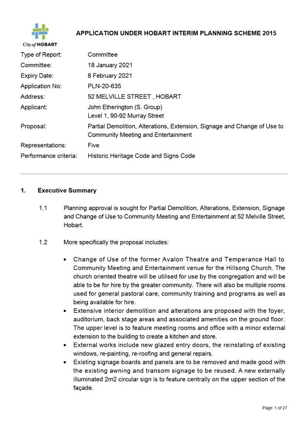
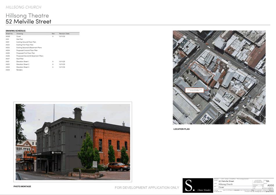
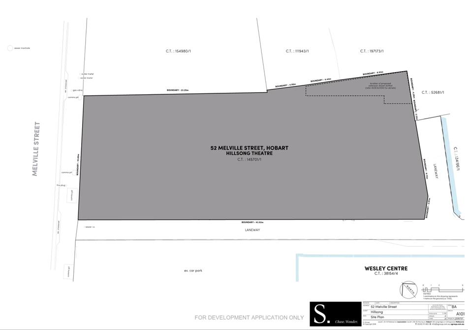
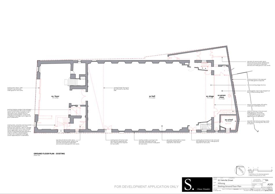
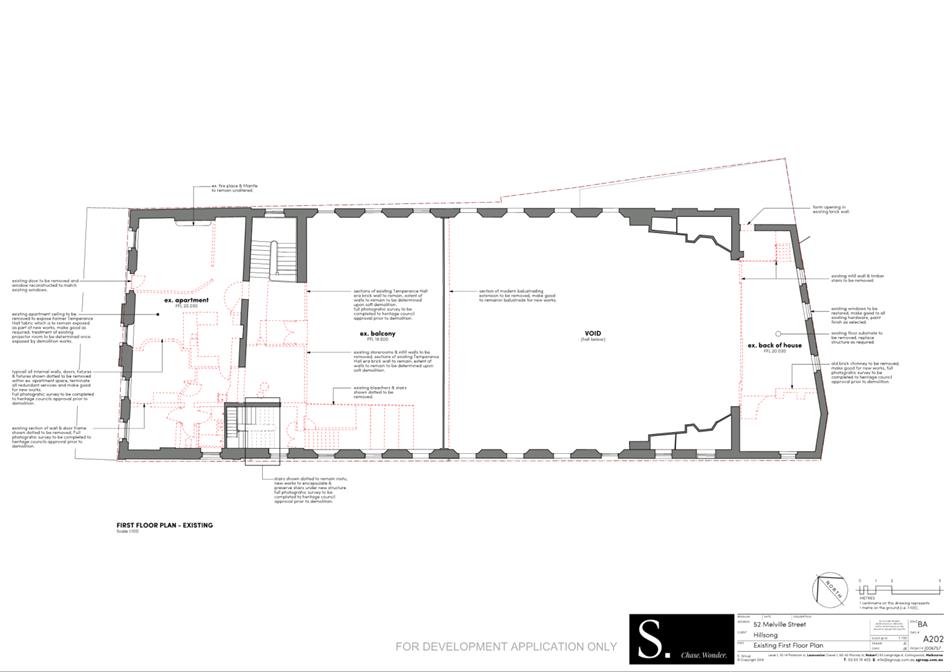
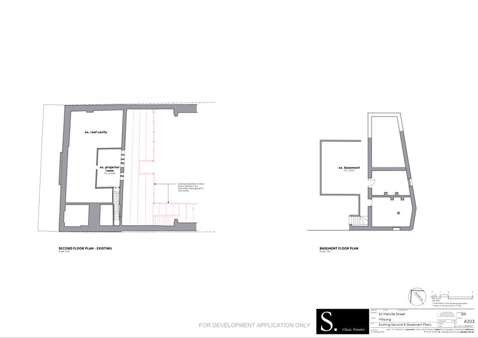
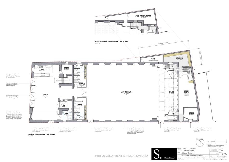
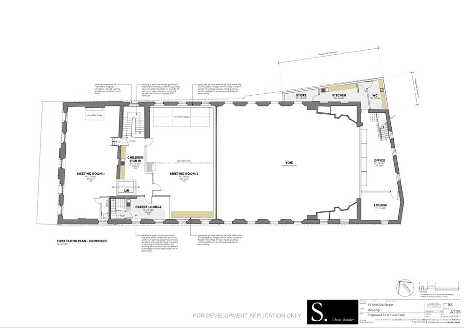
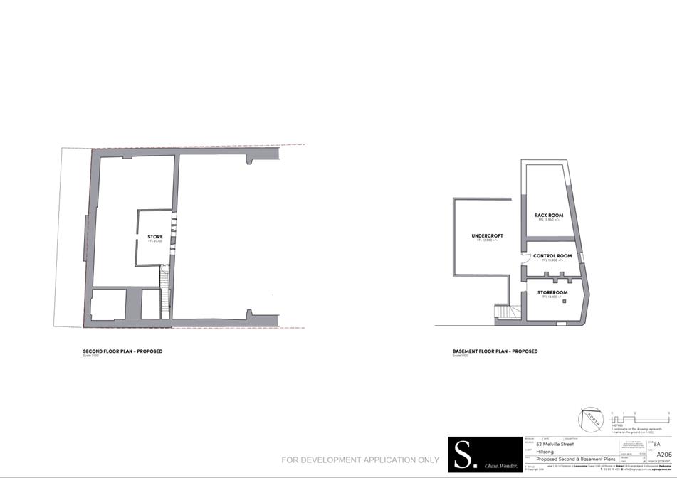
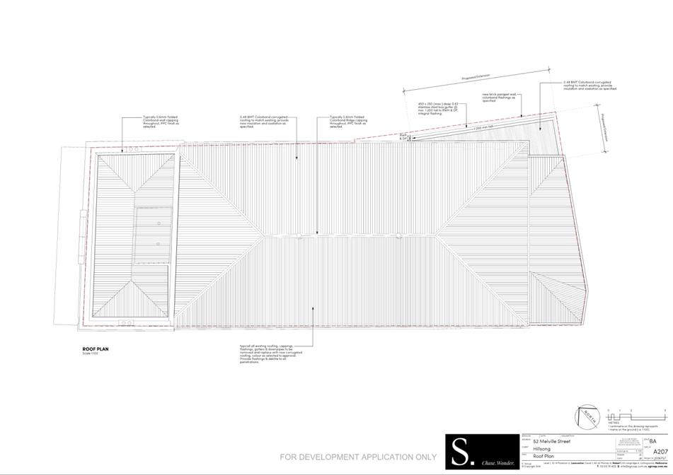
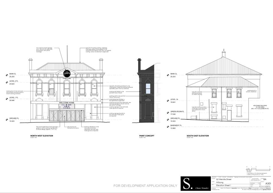
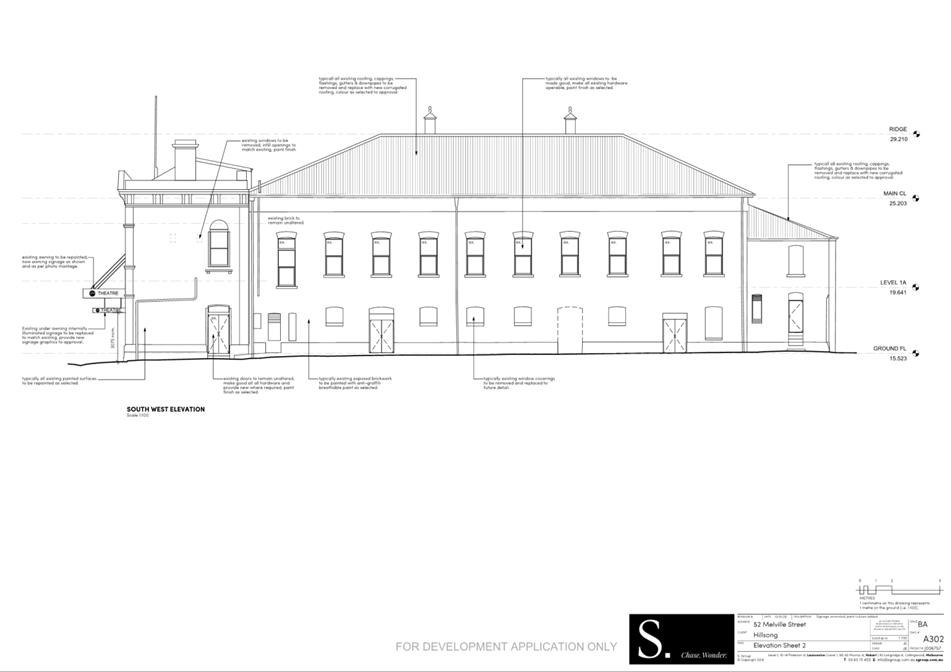
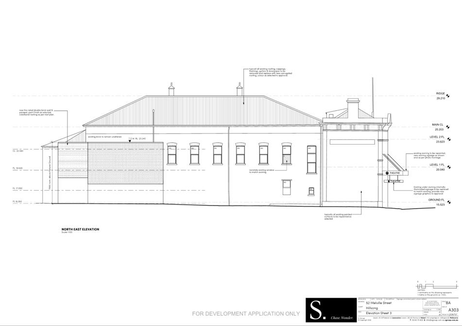
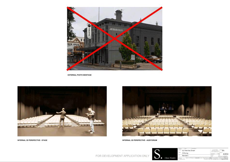
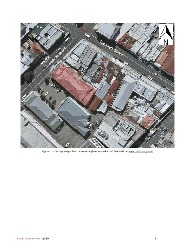
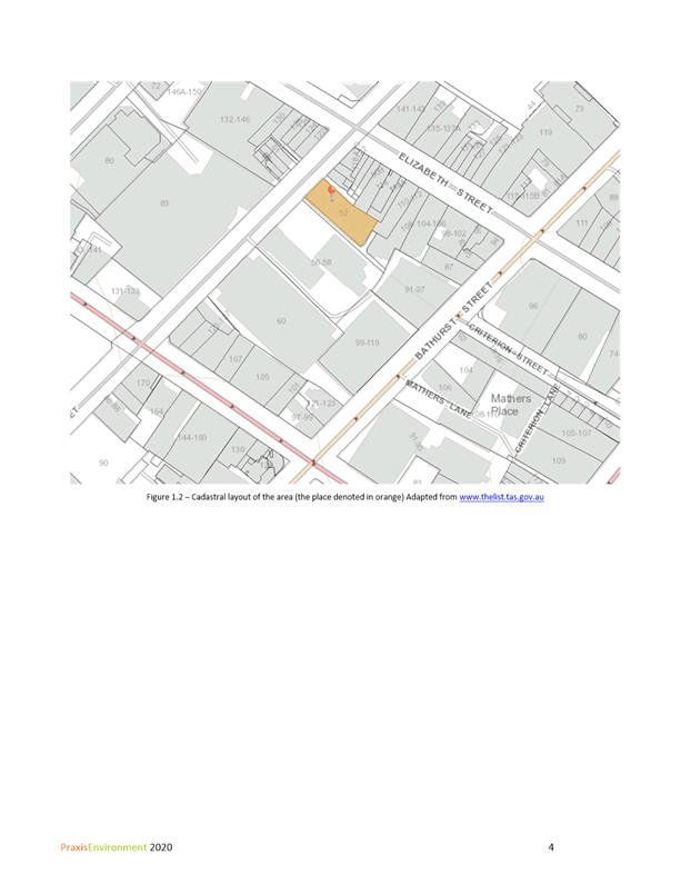
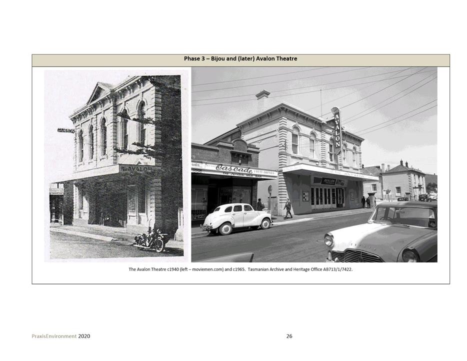
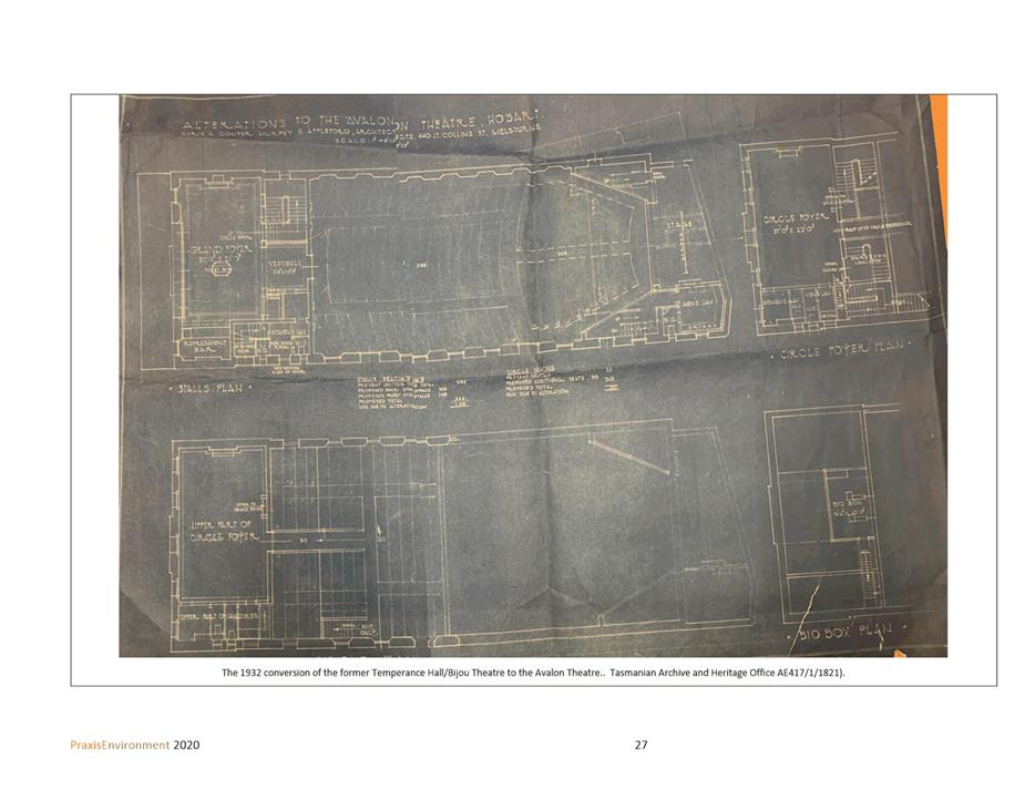
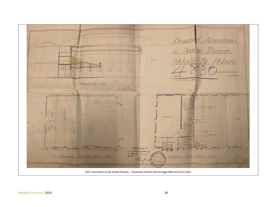
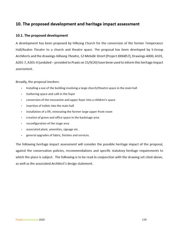
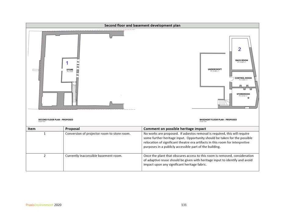
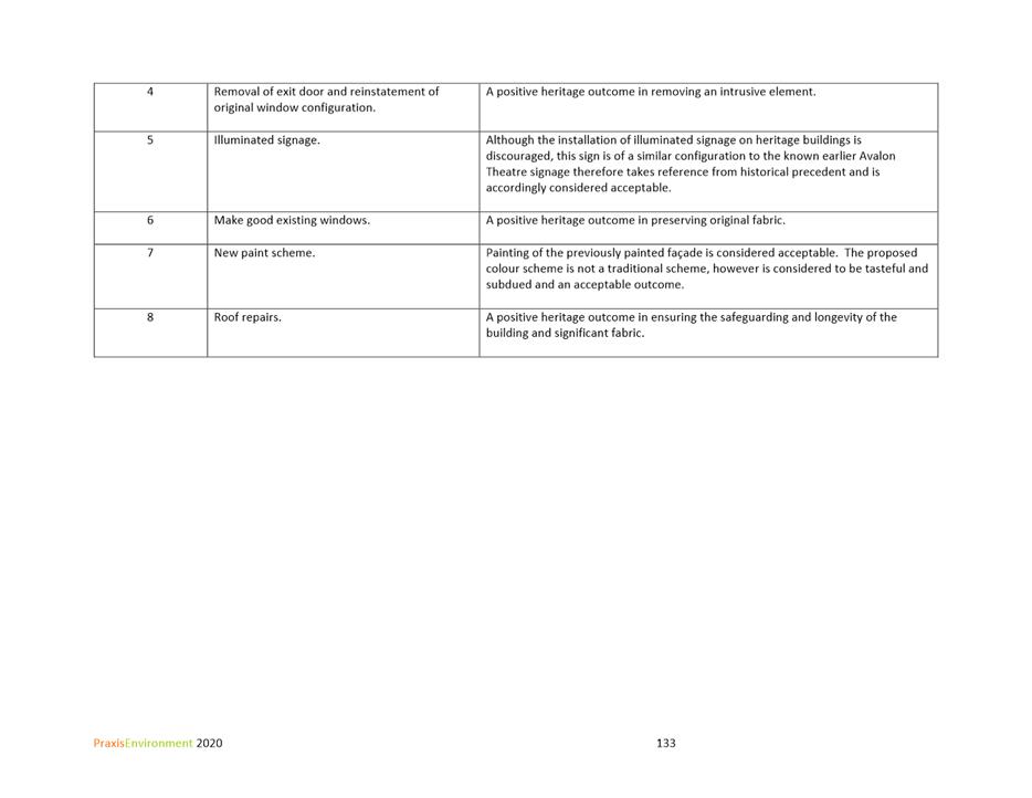
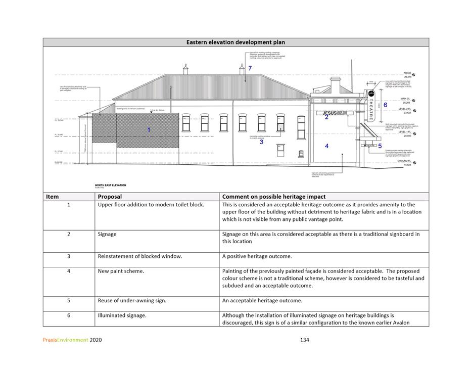
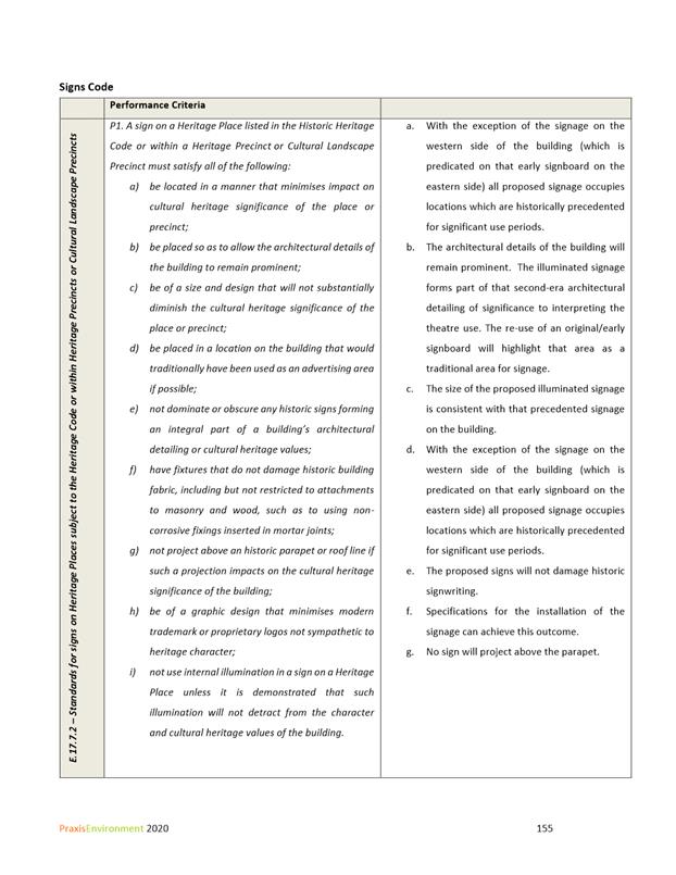
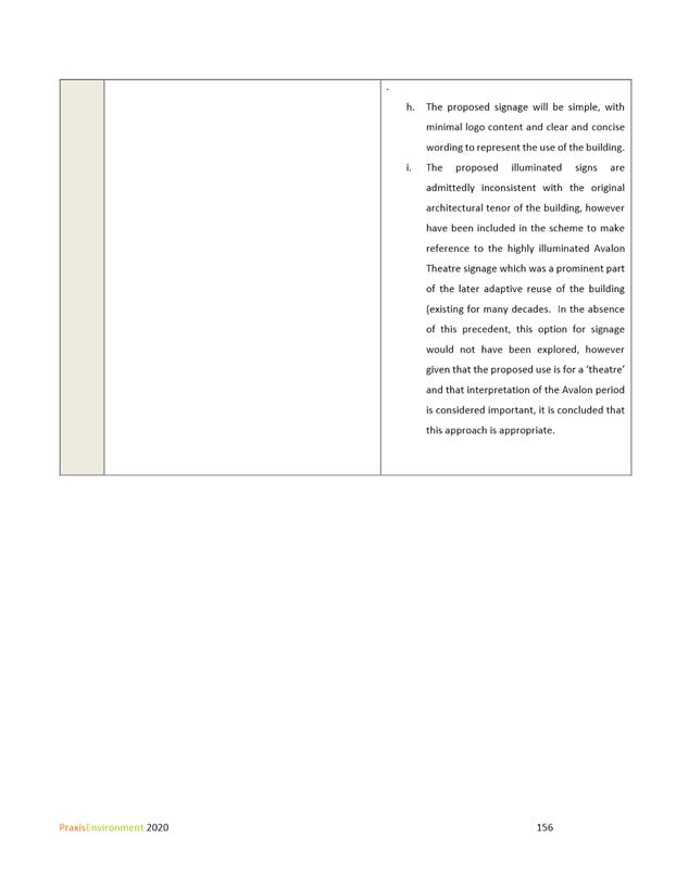
7.2.2 52 Melville Street, Hobart - Partial Demolition, Alterations, Extension, Signage and Change of Use to Community Meeting and Entertainment
Address: 52 Melville Street, Hobart
Proposal: Partial Demolition, Alterations, Extension, Signage and Change of Use to Community Meeting and Entertainment
Expiry Date: 8 February 2021
Extension of Time: Not applicable
Author: Tristan Widdowson
|
REcommendation That pursuant to the Hobart Interim Planning Scheme 2015, the City Planning Committee, in accordance with the delegations contained in its terms of reference, approve the application for partial demolition, alterations, extension, signage and change of use to community meeting and entertainment at 52 Melville Street, Hobart for the reasons outlined in the officer’s report and a permit containing the following conditions be issued:
GEN
The use and/or development must be substantially in accordance with the documents and drawings that comprise PLN20635 52 MELVILLE STREET HOBART TAS 7000 Final Planning Documents except where modified below.
Reason for condition
To clarify the scope of the permit.
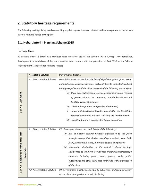
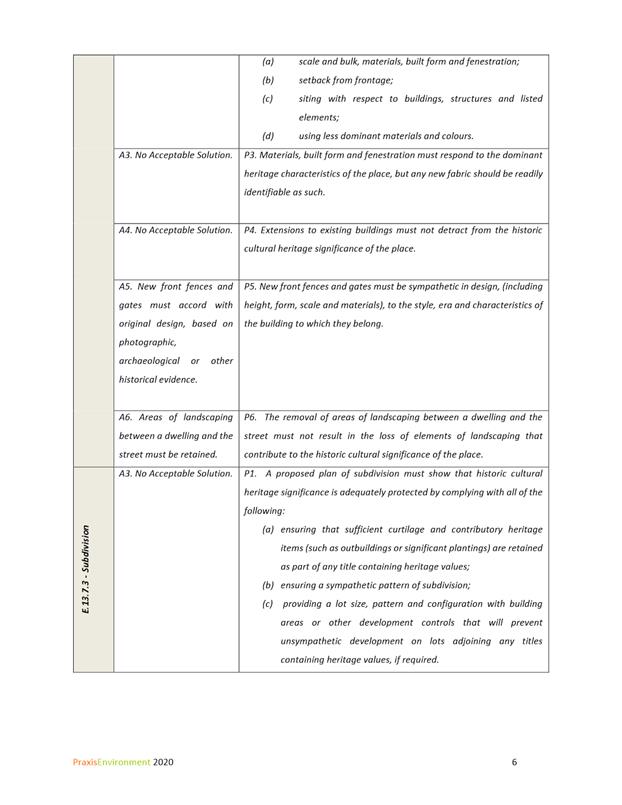
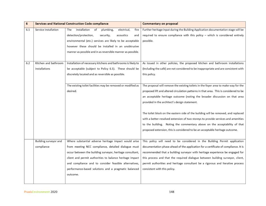
THC
The use and/or development must comply with the requirements of the Tasmanian Heritage Council as detailed in the Notice of Heritage Decision, THC Works Ref: 6366 dated 15 December 2020, as attached to the permit.
Reason for condition
To clarify the scope of the permit.
PLN s1
The proposed circular wall sign is to have a maximum area of 2m2 and must not be illuminated between the hours of 11pm6am.
Reason for condition
In the interest of residential amenity
HER 9
The painting of the unpainted brick exterior return elevation is not approved. The brickwork must remain unpainted.
Reason for condition
To ensure that there is no loss of historic cultural heritage values of this heritage listed site.
HER 13
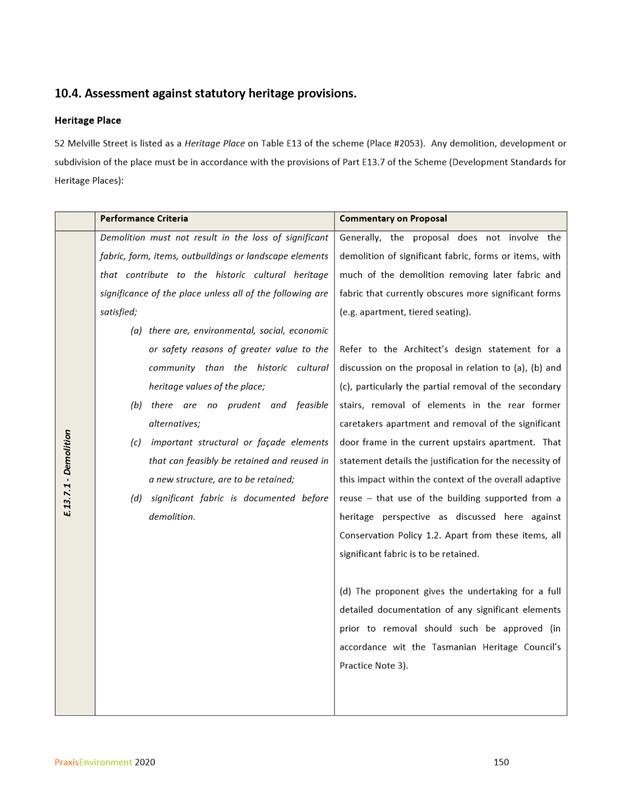
No internal fittings, fixtures and fabric of historic and architectural value other than those shown on the approved plans are to be removed.
Reason for condition
To ensure that demolition in whole or part of a heritage place does not result in the loss of historic cultural heritage.
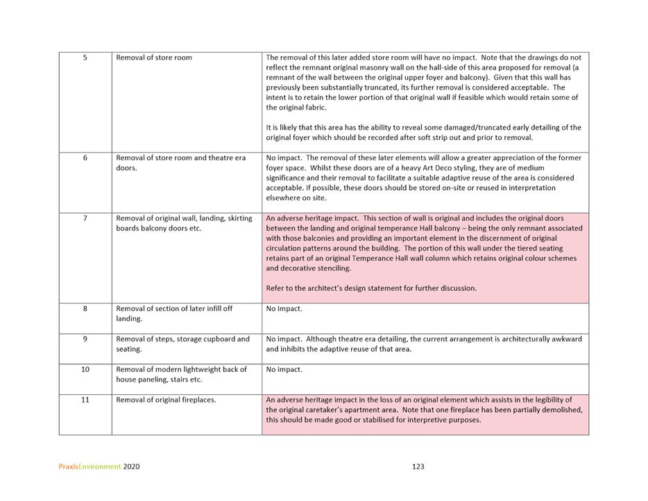
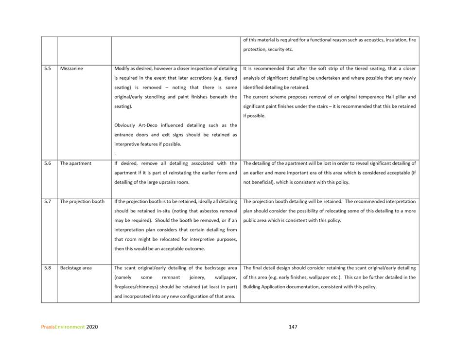
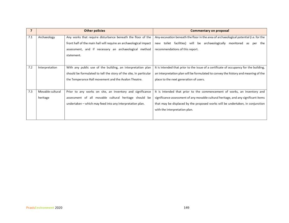
HER 6
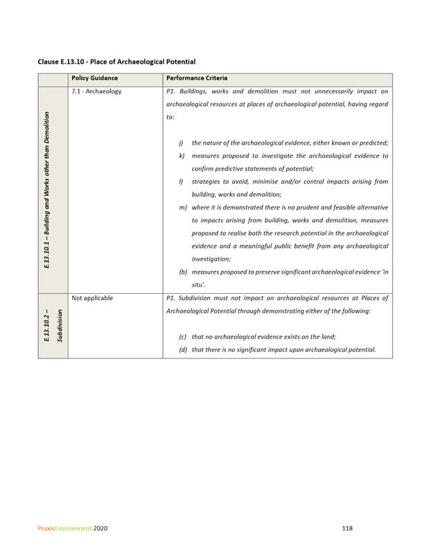
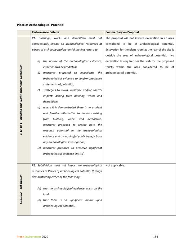
All onsite excavation and disturbance within the area of High Archaeological Potential identified within the Praxis Conservation Management Policy, Heritage Impact Assessment and Statement of Compliance Report dated August 2020 must be monitored by a suitably qualified archaeologist practitioner. Should any features or deposits of an archaeological nature be discovered on the site during excavation or disturbance:
1. All excavation and/or disturbance must stop immediately; and 2. The qualified archaeologist must provide advice and assessment of the features and/or deposits discovered and make recommendations on further excavation and/or disturbance; and 3. All and any recommendations made by the archaeologist engaged in accordance with (2) above must be complied with in full; and 4. All features and/or deposits discovered must be reported to the Council with 2 days of the discovery; and 5. A copy of the archaeologists advice, assessment and recommendations obtained in accordance with paragraph (2) above must be provided to Council within 5 days of receipt of the advice, assessment and recommendations.
Excavation and/or disturbance must not recommence unless and until approval is granted from the Council.
Reason for condition
To ensure that work is planned and implemented in a manner that seeks to understand, retain, protect, preserve and manage significant archaeological evidence.
HER s4
A photographic record must be made of the building, and a highresolution digital copy of this record must be provided to the Council prior to the commencement of any works. For areas that will be affected by the works, the record must comprise
1. at least one photograph of each interior space and external elevation; and 2. photographs of any detail or finish that may be of historical, archaeological or architectural interest; and 3. cross referencing of all photographs to “as existing” floor plans, showing the location and orientation of the camera.
Reason for condition
To record items of historical, archaeological and/or architectural interest, and document the evolution of this important heritage place in accordance with the heritage provisions of the Hobart Interim Planning Scheme 2015.
ADVICE
The following advice is provided to you to assist in the implementation of the planning permit that has been issued subject to the conditions above. The advice is not exhaustive and you must inform yourself of any other legislation, bylaws, regulations, codes or standards that will apply to your development under which you may need to obtain an approval. Visit the Council's website for further information.
Prior to any commencement of work on the site or commencement of use the following additional permits/approval may be required from the Hobart City Council.
BUILDING PERMIT
You may need building approval in accordance with the Building Act 2016. Click here for more information.
This is a Discretionary Planning Permit issued in accordance with section 57 of the Land Use Planning and Approvals Act 1993.
PLUMBING PERMIT
You may need plumbing approval in accordance with the Building Act 2016, Building Regulations 2016 and the National Construction Code. Click here for more information.
OCCUPATION OF THE PUBLIC HIGHWAY
You may require a permit for the occupation of the public highway for construction or special event (e.g. placement of skip bin, crane, scissor lift etc). Click here for more information.
You may require a Permit to Open Up and Temporarily Occupy a Highway (for work in the road reserve). Click here for more information.
CBD AND HIGH VOLUME FOOTPATH CLOSURES
Please note that the City of Hobart does not support the extended closure of public footpaths or roads to facilitate construction on adjacent land.
It is the developer's responsibility to ensure that the proposal as designed can be constructed without reliance on such extended closures.
In special cases, where it can be demonstrated that closure of footpaths in the CBD and/or other high volume footpaths can occur for extended periods without unreasonable impact on other businesses or the general public, such closures may only be approved by the full Council.
For more information about this requirement please contact the Council's Traffic Engineering Unit on 6238 2804.
RIGHT OF WAY
The private right of way must not be reduced, restricted or impeded in any way, and all beneficiaries must have complete and unrestricted access at all times.
You should inform yourself as to your rights and responsibilities in respect to the private right of way particularly reducing, restricting or impeding the right during and after construction.
WASTE DISPOSAL
It is recommended that the developer liaise with the Council’s Cleansing and Solid Waste Unit regarding reducing, reusing and recycling materials associated with demolition on the site to minimise solid waste being directed to landfill.
Further information regarding waste disposal can also be found on the Council’s website.
FEES AND CHARGES
Click here for information on the Council's fees and charges.
|
Attachment a: PLN-20-635
- 52 MELVILLE STREET HOBART TAS 7000 - Planning Committee or Delegated Report ⇩ ![]()
Attachment
b: PLN-20-635
- 52 MELVILLE STREET HOBART TAS 7000 - CPC Agenda Documents ⇩ ![]()
Attachment
c: PLN-20-635
- 52 MELVILLE STREET HOBART TAS 7000 - Planning Referral Officer Cultural
Heritage Report ⇩ ![]()
|
Item No. 7.2.2 |
Agenda (Open Portion) City Planning Committee Meeting - 18/1/2021 |
Page 707 ATTACHMENT a |

|
Agenda (Open Portion) City Planning Committee Meeting - 18/1/2021 |
Page 708 ATTACHMENT b |
|
Agenda (Open Portion) City Planning Committee Meeting - 18/1/2021 |
Page 901 ATTACHMENT c |
|
Agenda (Open Portion) City Planning Committee Meeting |
Page 902 |
|
|
|
18/1/2021 |
|
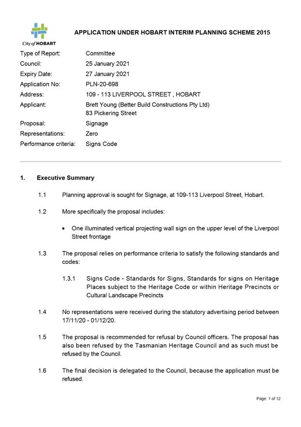
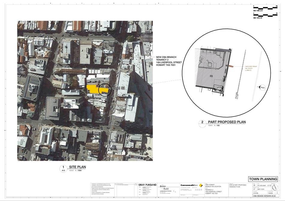
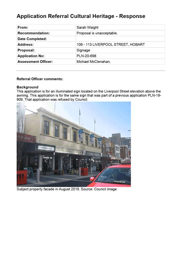
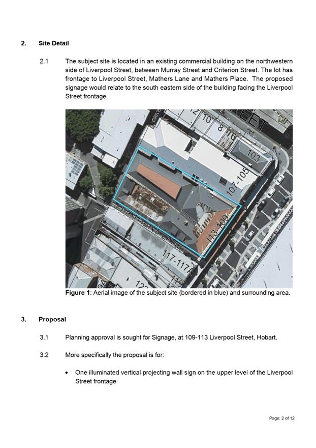
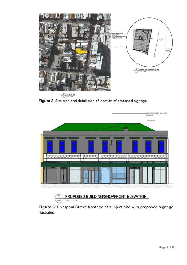
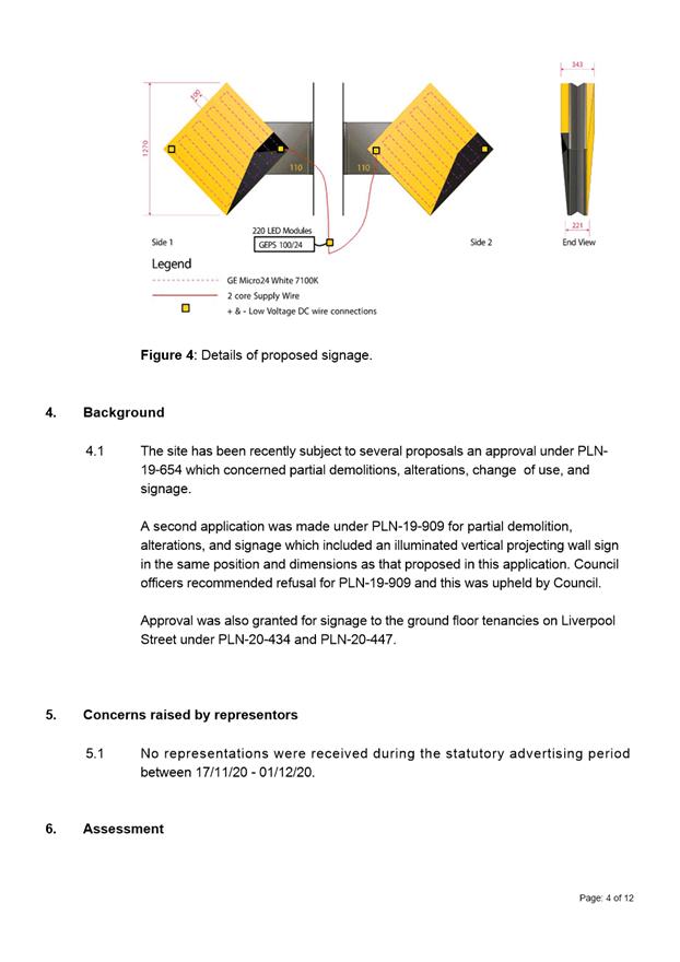
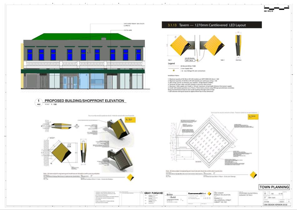
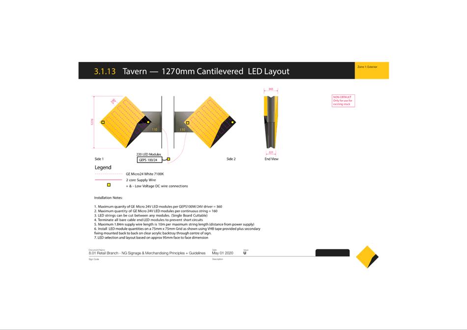
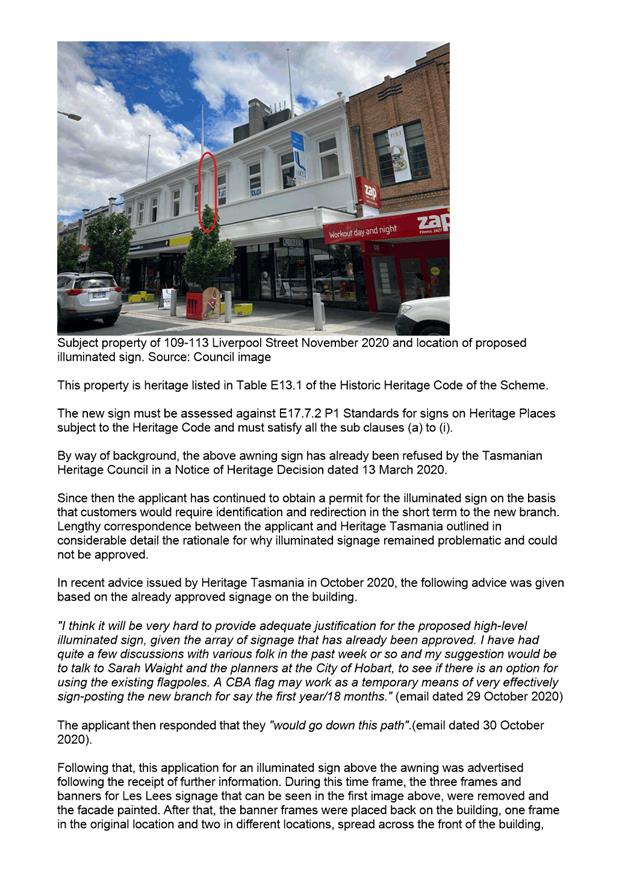
7.2.3 109-113 Liverpool Street, Hobart - Signage
Address: 109-113 Liverpool Street, Hobart
Proposal: Signage
Expiry Date: 27 January 2021
Extension of Time: Not applicable
Author: Michael McClenahan
|
REcommendation That pursuant to the Hobart Interim Planning Scheme 2015, and section 39(10) of the Historic Cultural Heritage Act 1995, the Council refuse the application for signage, at 109113 Liverpool Street, Hobart for the following reasons:
1. The proposal does not meet the acceptable solution or the performance criterion with respect to clause E17.7.2 P1 of the Hobart Interim Planning Scheme 2015 because the above awning sign is of a size, design, location, has modern trademarks, has fixings and is illuminated in a manner that does not complement the heritage character of the place.
2. Because the application has been refused by the Tasmanian Heritage Council pursuant to section 39(6)(c) of the Historic Cultural Heritage Act 1995. Refer Notice of Heritage Decision reference 6378 dated 10 December 2020 as attached to this refusal.
|
Attachment a: PLN-20-698
- 109-113 LIVERPOOL STREET HOBART TAS 7000 - Planning Committee or Delegated
Report ⇩ ![]()
Attachment
b: PLN-20-698
- 109-113 LIVERPOOL STREET HOBART TAS 7000 - CPC Agenda Documents ⇩ ![]()
Attachment
c: PLN-20-698
- 109-113 LIVERPOOL STREET HOBART TAS 7000 - Referral Officer Report ⇩ ![]()
|
Item No. 7.2.3 |
Agenda (Open Portion) City Planning Committee Meeting - 18/1/2021 |
Page 914 ATTACHMENT a |
|
Agenda (Open Portion) City Planning Committee Meeting - 18/1/2021 |
Page 917 ATTACHMENT b |
|
Agenda (Open Portion) City Planning Committee Meeting - 18/1/2021 |
Page 921 ATTACHMENT c |

|
Agenda (Open Portion) City Planning Committee Meeting |
Page 930 |
|
|
|
18/1/2021 |
|
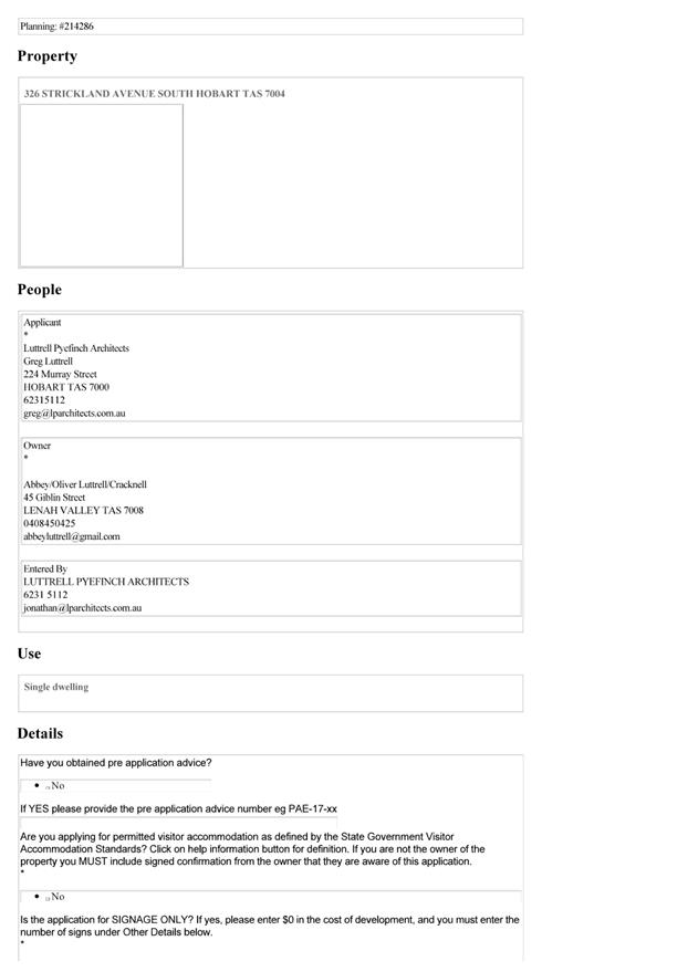
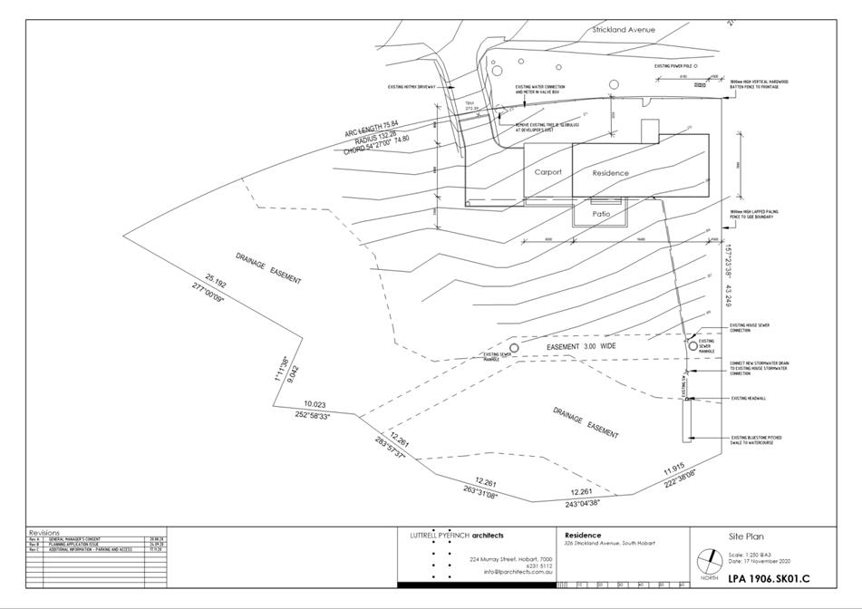
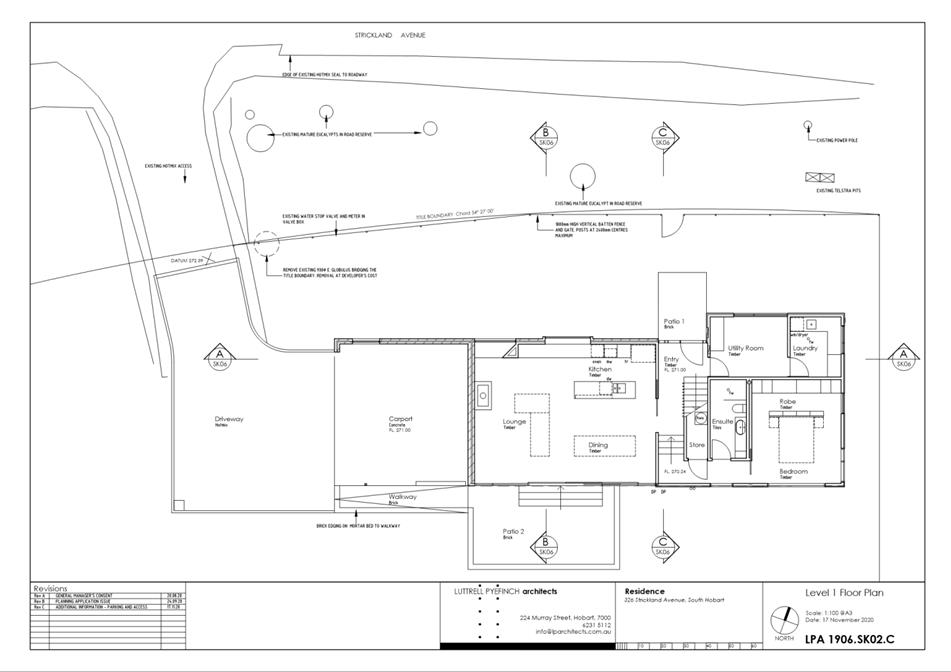
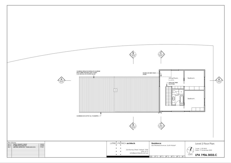
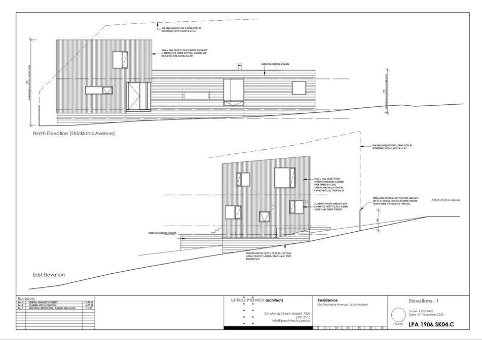
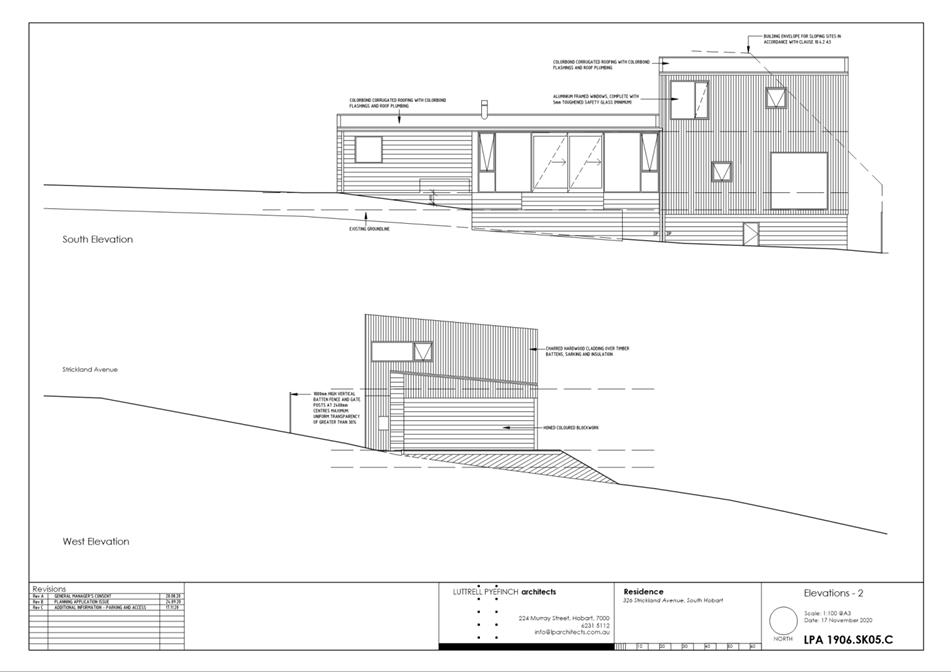
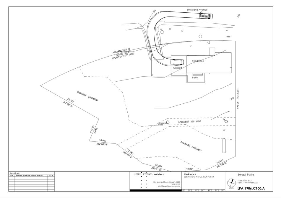
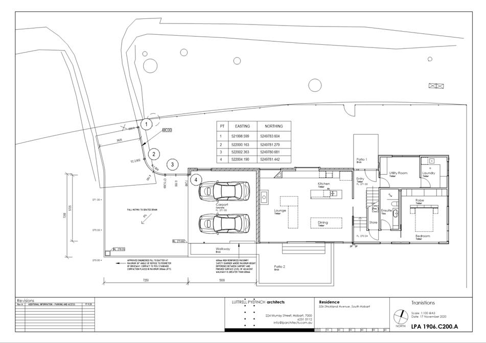
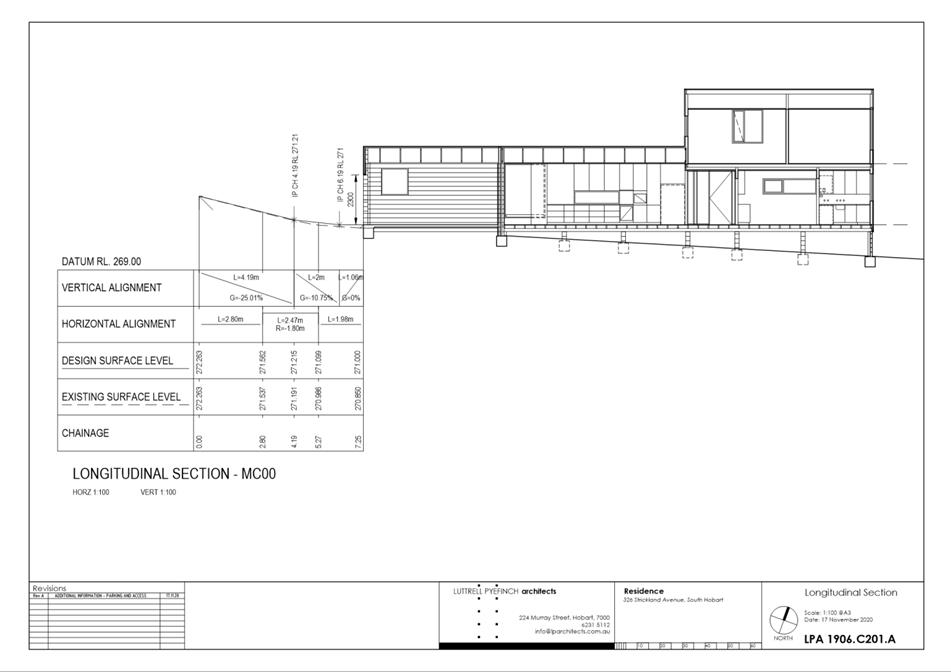
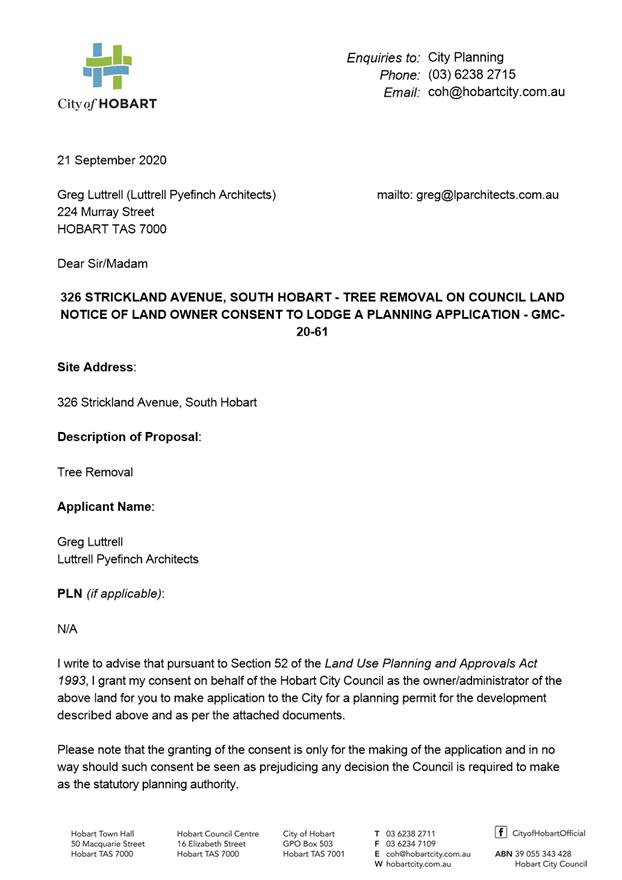
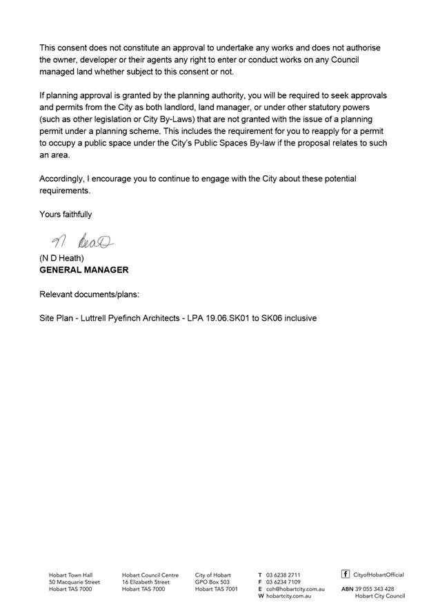
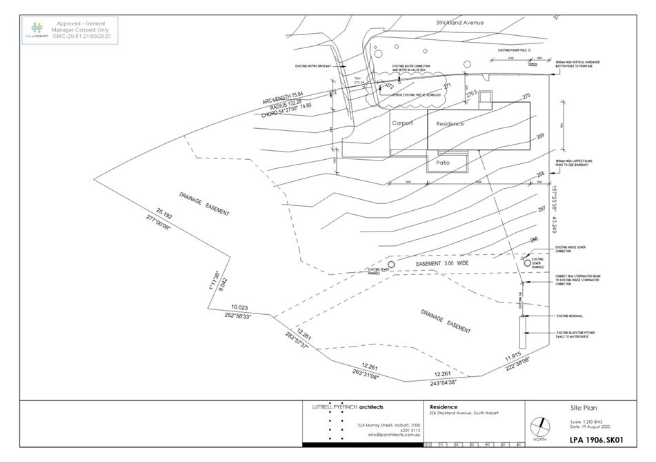
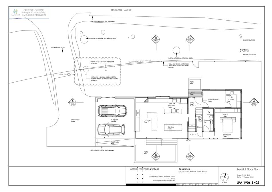
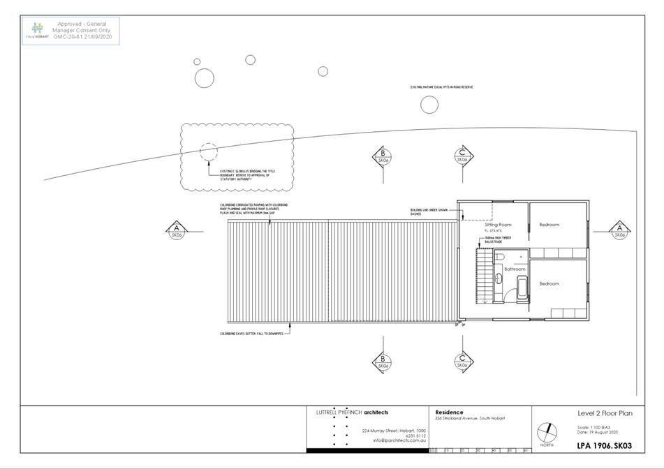
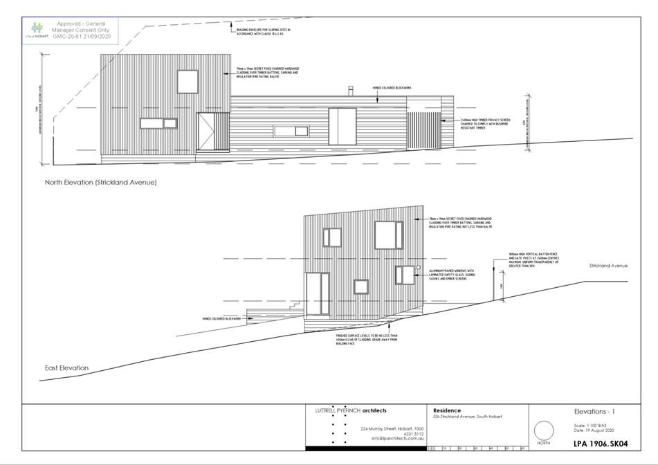
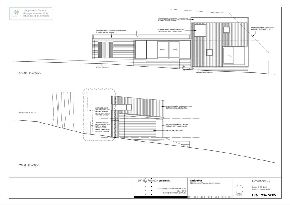
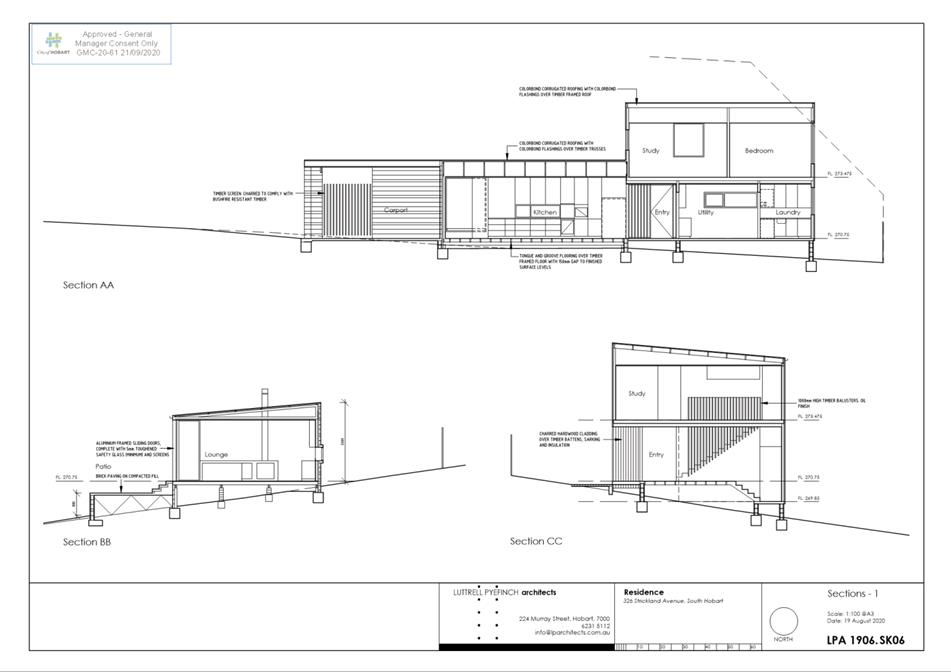
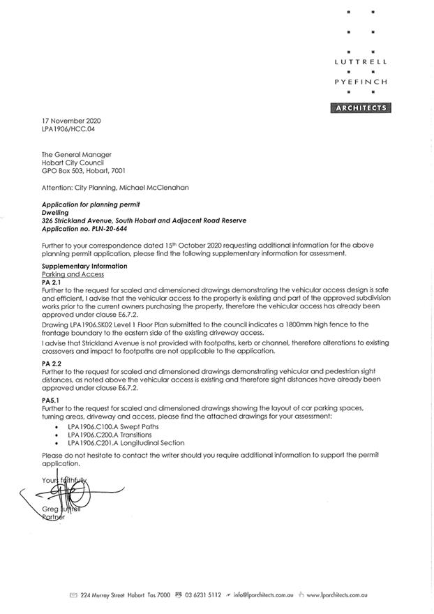
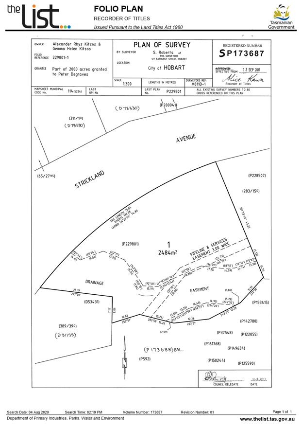
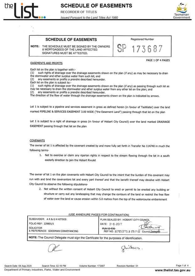
7.2.4 326 Strickland Avenue, South Hobart and Adjacent Road Reserve - Dwelling
Address: 326 Strickland Avenue, South Hobart and Adjacent Road Reserve
Proposal: Dwelling
Expiry Date: 28 January 2021
Extension of Time: Not applicable
Author: Michael McClenahan
|
REcommendation That pursuant to the Hobart Interim Planning Scheme 2015, the City Planning Committee, in accordance with the delegations contained in its terms of reference, approve the application for a dwelling at 326 Strickland Avenue, South Hobart and adjacent road reserve for the reasons outlined in the officer’s report and a permit containing the following conditions be issued:
GEN
The use and/or development must be substantially in accordance with the documents and drawings that comprise PLN20644 326 STRICKLAND AVENUE SOUTH HOBART TAS 7004 Final Planning Documents except where modified below.
Reason for condition
To clarify the scope of the permit.
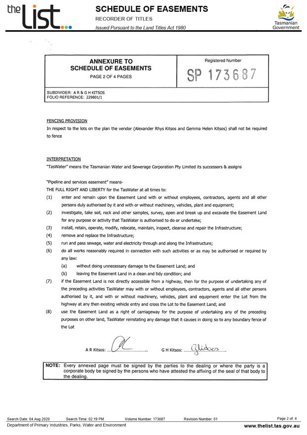
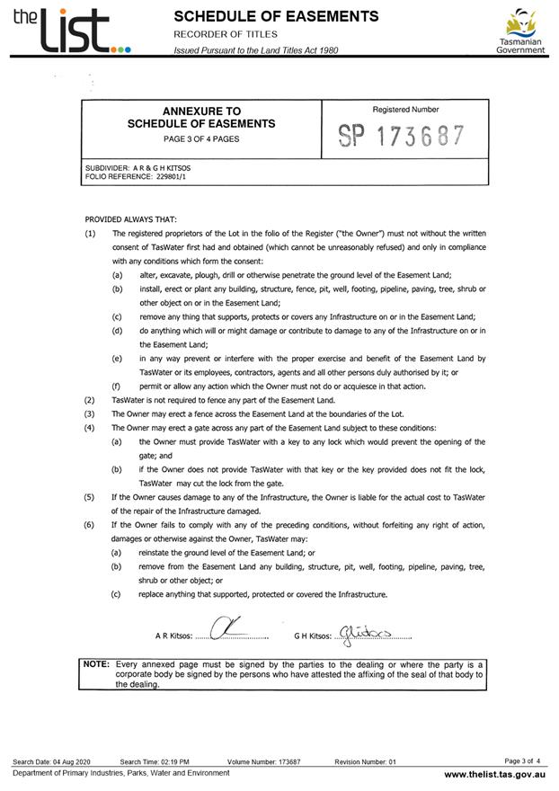
ENG sw1
All stormwater from the proposed development (including but not limited to: roofed areas, ag drains and impervious surfaces such as driveways and paved areas) must be drained to the Council’s stormwater infrastructure prior to first occupation or commencement of use (whichever occurs first).
Reason for condition
To ensure that stormwater from the site will be discharged to a suitable Council approved outlet.
ENG 2a
Prior to first occupation or commencement of use (whichever occurs first), vehicular barriers compliant with the Australian Standard AS/NZS1170.1:2002 must be installed to prevent vehicles running off the edge of an access driveway or parking module (parking spaces, aisles and manoeuvring area) where the drop from the edge of the trafficable area to a lower level is 600mm or greater, and wheel stops (kerb) must be installed for drops between 150mm and 600mm. Barriers must not limit the width of the driveway access or parking and turning areas approved under the permit.
Advice:
The Council does not consider a slope greater than 1 in 4 to constitute a lower level as described in AS/NZS 2890.1:2004 Section 2.4.5.3. Slopes greater than 1 in 4 will require a vehicular barrier or wheel stop.
Designers are advised to consult the National Construction Code 2016 to determine if pedestrian handrails or safety barriers compliant with the NCC2016 are also required in the parking module this area may be considered as a path of access to a building.
Reason for condition
To ensure the safety of users of the access driveway and parking module and compliance with the standard.
ENG 3a
The access driveway, circulation roadways, ramps and parking module (parking spaces, aisles and manoeuvring area) must be designed and constructed in accordance with Australian Standard AS/NZS2890.1:2004 (including the requirement for vehicle safety barriers where required), or a Council approved alternate design certified by a suitably qualified engineer to provide a safe and efficient access, and enable safe, easy and efficient use.
Advice:
It is advised that designers consider the detailed design of the access and parking module prior to finalising the Finished Floor Level (FFL) of the parking spaces (especially if located within a garage incorporated into the dwelling), as failure to do so may result in difficulty complying with this condition.
Reason for condition
To ensure the safety of users of the access and parking module, and compliance with the relevant Australian Standard.
ENG 3b
The access driveway, circulation roadways, ramps and parking module (parking spaces, aisles and manoeuvring area) design must be submitted and approved, prior to the issuing of any approval under the Building Act 2016.
The access driveway, circulation roadways, ramps and parking module (parking spaces, aisles and manoeuvring area) design must:
1. Be prepared and certified by a suitably qualified engineer. 2. Be generally in accordance with the Australian Standard AS/NZS2890.1:2004. 3. Where the design deviates from AS/NZS2890.1:2004 the designer must demonstrate that the design will provide a safe and efficient access, and enable safe, easy and efficient use. 4. Show dimensions, levels, gradients and transitions, and other details as Council deem necessary to satisfy the above requirement.
Advice:
It is advised that designers consider the detailed design of the access and parking module prior to finalising the Finished Floor Level (FFL) of the parking spaces (especially if located within a garage incorporated into the dwelling), as failure to do so may result in difficulty complying with this condition.
Once the design has been approved, the Council will issue a condition endorsement (see general advice on how to obtain condition endorsement).
Where building approval is also required, it is recommended that documentation for condition endorsement be submitted well before submitting documentation for building approval. Failure to address condition endorsement requirements prior to submitting for building approval may result in unexpected delays.
Reason for condition
To ensure the safety of users of the access and parking module, and compliance with the relevant Australian Standard.
ENG 4
The access driveway and parking module (car parking spaces, aisles and manoeuvring area) approved by this permit must be constructed to a sealed standard (spray seal, asphalt, concrete, pavers or equivalent Council approved) and surface drained to the Council's stormwater infrastructure prior to the first occupation.
Reason for condition
To ensure the safety of users of the access driveway and parking module, and that it does not detract from the amenity of users, adjoining occupiers or the environment by preventing dust, mud and sediment transport.
ENG 1
Any damage to council infrastructure resulting from the implementation of this permit, must, at the discretion of the Council:
1. Be met by the owner by way of reimbursement (cost of repair and reinstatement to be paid by the owner to the Council); or 2. Be repaired and reinstated by the owner to the satisfaction of the Council.
A photographic record of the Council's infrastructure adjacent to the subject site must be provided to the Council prior to any commencement of works.
A photographic record of the Council’s infrastructure (e.g. existing property service connection points, roads, buildings, stormwater, footpaths, driveway crossovers and nature strips, including if any, preexisting damage) will be relied upon to establish the extent of damage caused to the Council’s infrastructure during construction. In the event that the owner/developer fails to provide to the Council a photographic record of the Council’s infrastructure, then any damage to the Council's infrastructure found on completion of works will be deemed to be the responsibility of the owner.
Reason for condition
To ensure that any of the Council's infrastructure and/or siterelated service connections affected by the proposal will be altered and/or reinstated at the owner’s full cost.
ENV 9
No vegetation removal has been approved under this permit other than removal of the Eucalyptus globulous tree on the northwestern boundary for the purpose of erecting a boundary fence as shown on Site Plan LPA 1906.SK01.B.
Advice:
The clearing and modification of vegetation on the land must be no greater than that approved under planning permit PLN16936 (other than the abovementioned tree) and must be in accordance with the Bushfire Management Plan and Natural Values Management Plan referred to in Part 5 Agreement E99872.
Reason for condition
To clarify the scope of the permit
ENV 2
Sediment and erosion control measures, sufficient to prevent sediment leaving the site and in accordance with an approved soil and water management plan (SWMP), must be installed prior to the commencement of work and maintained until such time as all disturbed areas have been stabilised and/or restored or sealed to the Council’s satisfaction.
A SWMP must be submitted prior to the issue of any approval under the Building Act 2016 or the commencement of work, whichever occurs first. The SWMP must be prepared in accordance with the Soil and Water Management on Building and Construction Sites fact sheets (Derwent Estuary Program, 2008), available here.
The SWMP must include management of vegetation clearing to establish bushfire hazard management areas, particularly within the waterway protection area.
All work required by this condition must be undertaken in accordance with the approved SWMP.
Advice:
Once the SWMP has been approved, the Council will issue a condition endorsement (see general advice on how to obtain condition endorsement).
Where building approval is also required, it is recommended that documentation for condition endorsement be submitted well before submitting documentation for building approval. Failure to address condition endorsement requirements prior to submitting for building approval may result in unexpected delays.
Reason for condition
To avoid the pollution and sedimentation of roads, drains and natural watercourses that could be caused by erosion and runoff from the development.
ADVICE
The following advice is provided to you to assist in the implementation of the planning permit that has been issued subject to the conditions above. The advice is not exhaustive and you must inform yourself of any other legislation, bylaws, regulations, codes or standards that will apply to your development under which you may need to obtain an approval. Visit the Council's website for further information.
Prior to any commencement of work on the site or commencement of use the following additional permits/approval may be required from the Hobart City Council.
BUILDING PERMIT
You may need building approval in accordance with the Building Act 2016. Click here for more information.
This is a Discretionary Planning Permit issued in accordance with section 57 of the Land Use Planning and Approvals Act 1993.
PLUMBING PERMIT
You may need plumbing approval in accordance with the Building Act 2016, Building Regulations 2016 and the National Construction Code. Click here for more information.
WEED CONTROL
Effective measures are detailed in the Tasmanian Washdown Guidelines for Weed and Disease Control: Machinery, Vehicles and Equipment (Edition 1, 2004). The guidelines can be obtained from the Department of Primary Industries, Parks, Water and Environment website.
WORK PLACE HEALTH AND SAFETY
Appropriate occupational health and safety measures must be employed during the works to minimise direct human exposure to potentiallycontaminated soil, water, dust and vapours. Click here for more information.
NOISE REGULATIONS
Click here for information with respect to noise nuisances in residential areas.
WASTE DISPOSAL
It is recommended that the developer liaise with the Council’s Cleansing and Solid Waste Unit regarding reducing, reusing and recycling materials associated with demolition on the site to minimise solid waste being directed to landfill.
Further information regarding waste disposal can also be found on the Council’s website.
FEES AND CHARGES
Click here for information on the Council's fees and charges.
DIAL BEFORE YOU DIG
Click here for dial before you dig information.
PART 5 AGREEMENT
Please note that the owner(s)
of this property are subject to Part 5 Agreement E99872 that requires the
owner(s) to: · implement and maintain the relevant requirements of the Bushfire Management Plan in relation to the property, prior to the occupation of any dwelling; and · implement and comply with the recommendations and requirements of the Natural Values Management Plan in relation to the property.
In particular, establishment and maintenance
of the bushfire hazard management area must: · prioritise removal of woody weed species rather than native species; · include retention of trees and clusters of native understorey vegetation; · retain low riparian species such as ferns within the waterway protection area; · target the removal of wattle or stringybark trees in priority to blue gum trees; · be undertaken by hand tools rather than machinery within the waterway protection area.
Please ensure you are familiar with the requirements of the Site Development Plan and that the Site development Plan is complied with.
Copies of the Part 5 Agreement are available from The LIST website (www.thelist.tas.gov.au) via the ‘Scanned Dealings’ section.
|
Attachment
a: PLN-20-644
- 326 STRICKLAND AVENUE SOUTH HOBART TAS 7004 - Planning Committee or Delegated
Report ⇩ ![]()
Attachment
b: PLN-20-644
- 326 STRICKLAND AVENUE SOUTH HOBART TAS 7004 - CPC Agenda Documents ⇩ ![]()
|
Item No. 7.2.4 |
Agenda (Open Portion) City Planning Committee Meeting - 18/1/2021 |
Page 950 ATTACHMENT a |

|
Agenda (Open Portion) City Planning Committee Meeting - 18/1/2021 |
Page 958 ATTACHMENT b |
|
Agenda (Open Portion) City Planning Committee Meeting |
Page 980 |
|
|
|
18/1/2021 |
|
7.3 Committee Acting as Planning Authority
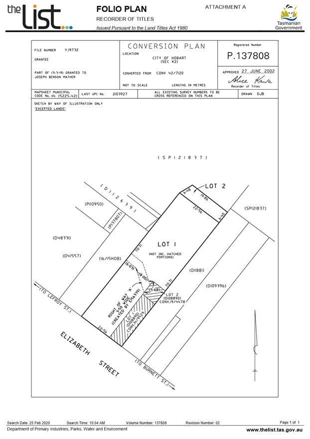
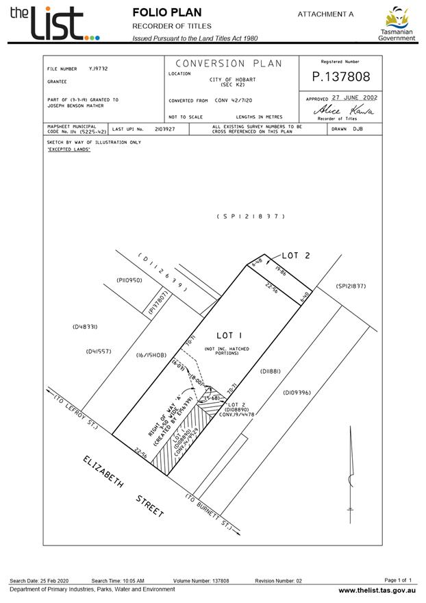
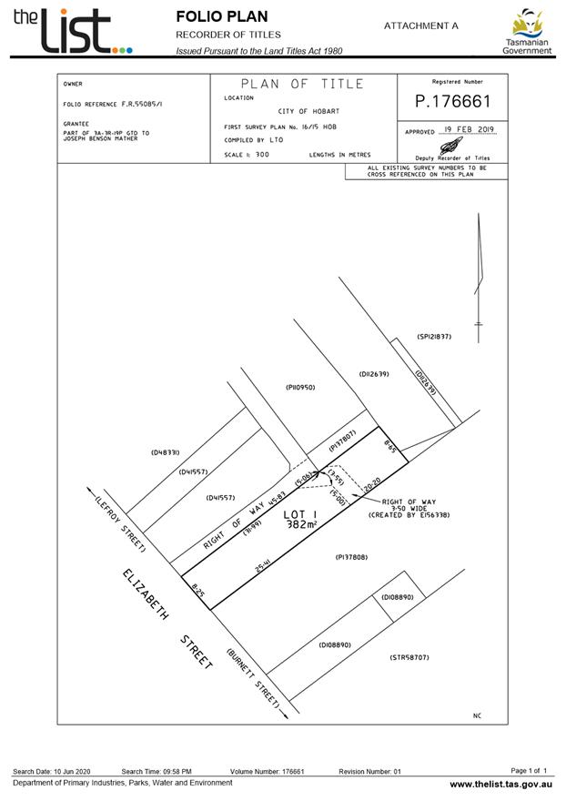
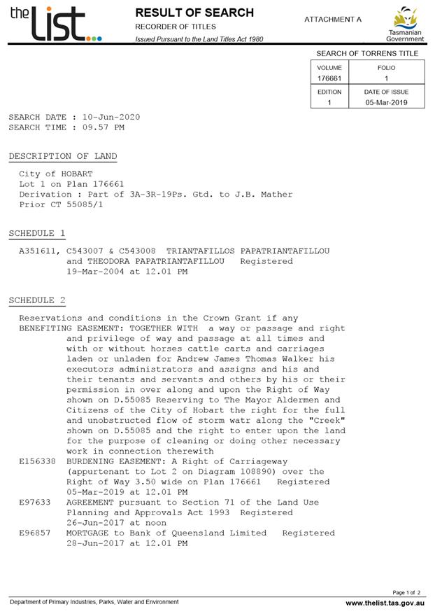
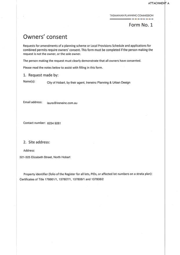
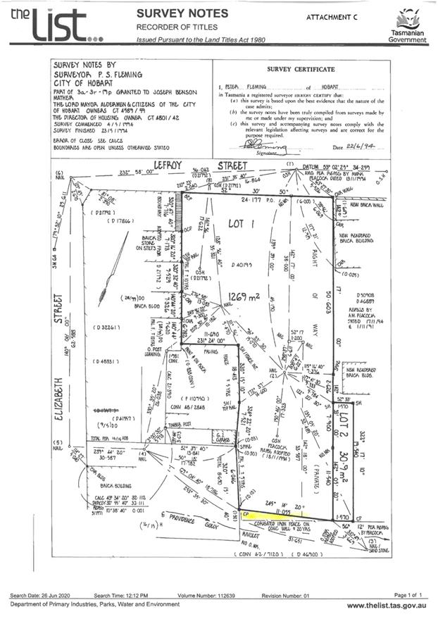
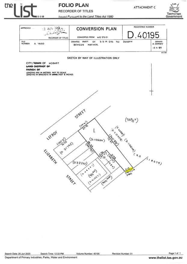
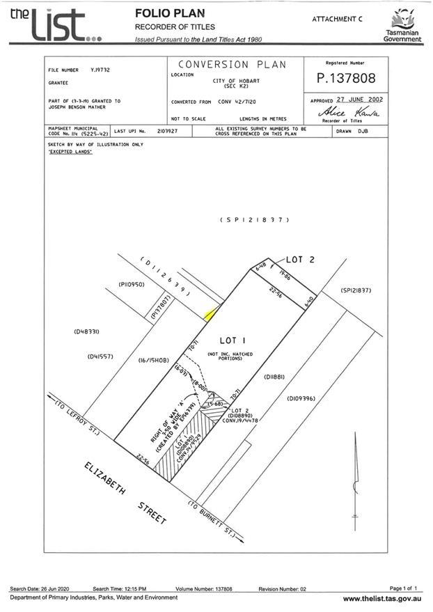
7.3.1 Amendment PSA-20-2 - Hobart Interim Planning Scheme 2015 - 321-323A to 325 Elizabeth Street and 16A Lefroy Street
Report of the Development Planner of 12 January 2021 and attachments.
Delegation: Council
|
Item No. 7.3.1 |
Agenda (Open Portion) City Planning Committee Meeting |
Page 982 |
|
|
18/1/2021 |
|
Memorandum: City Planning Committee
Amendment PSA-20-2 - Hobart Interim Planning Scheme 2015 - 321-323A to 325 Elizabeth Street and 16A Lefroy Street
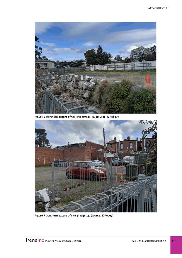
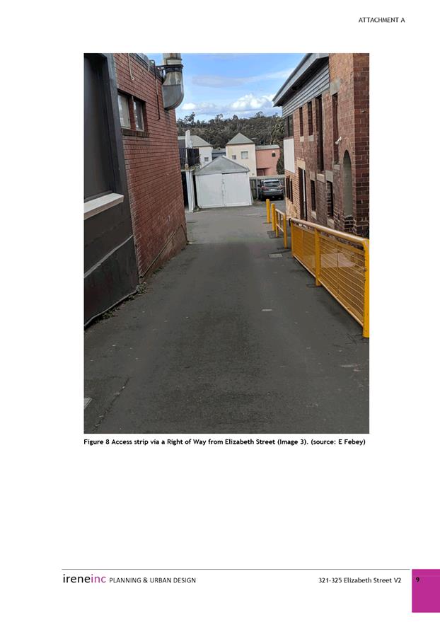
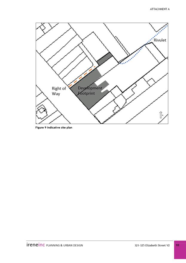
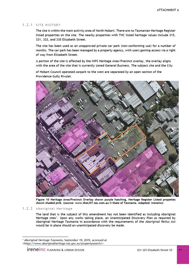
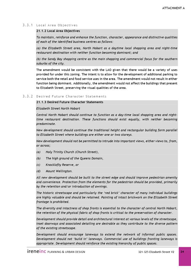
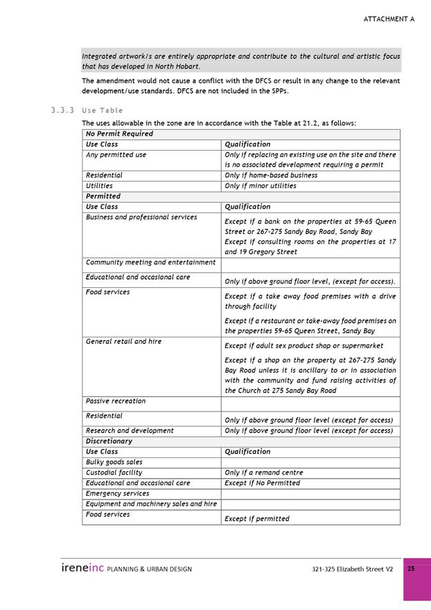
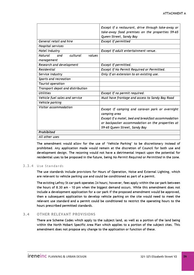
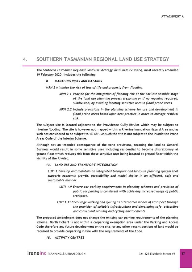
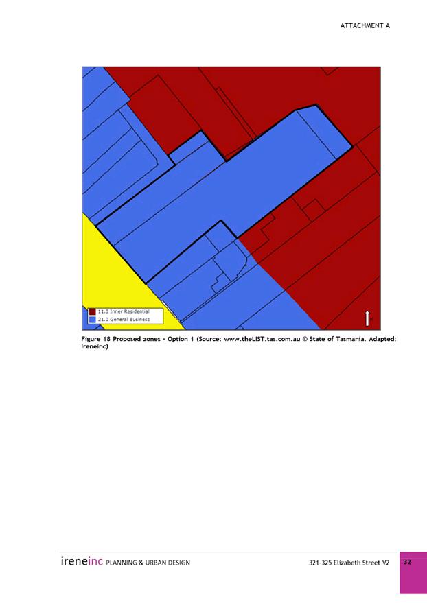
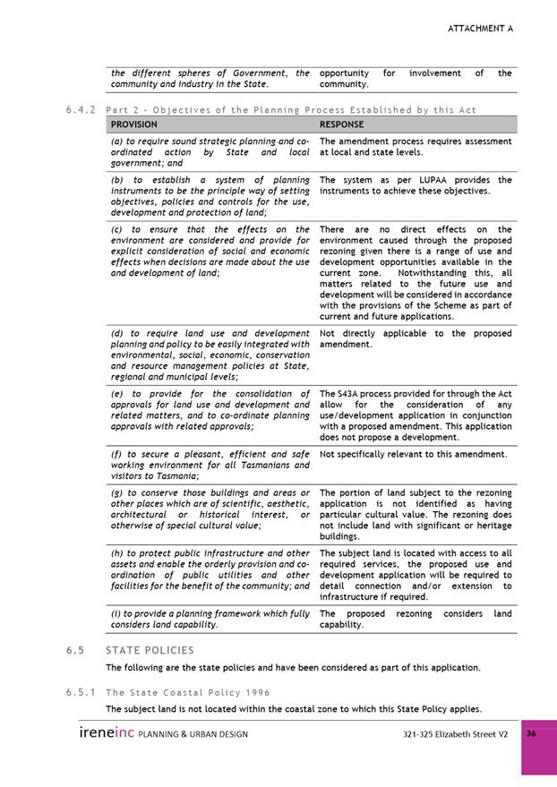
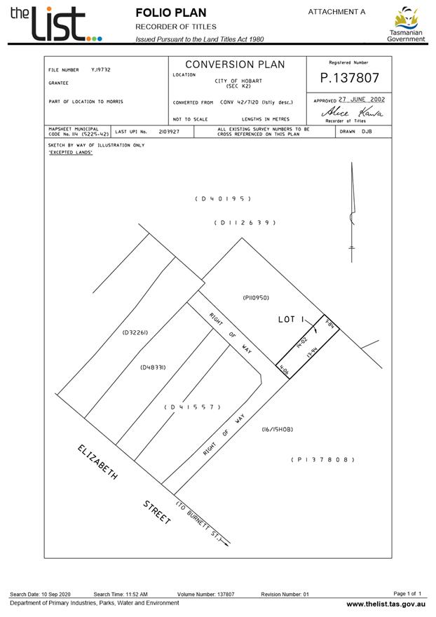
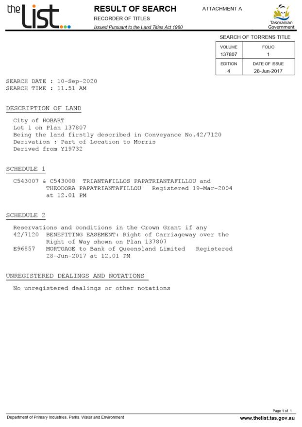
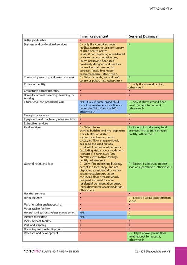
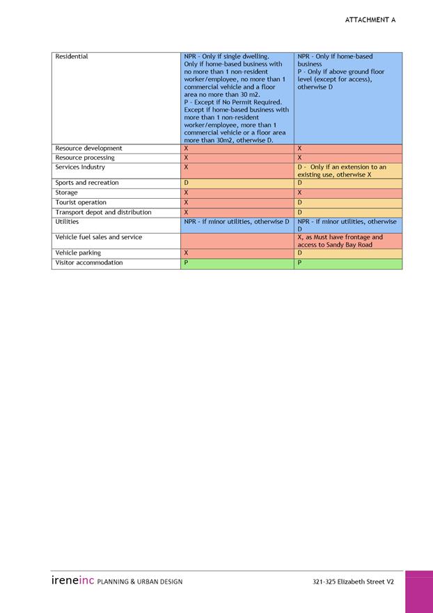
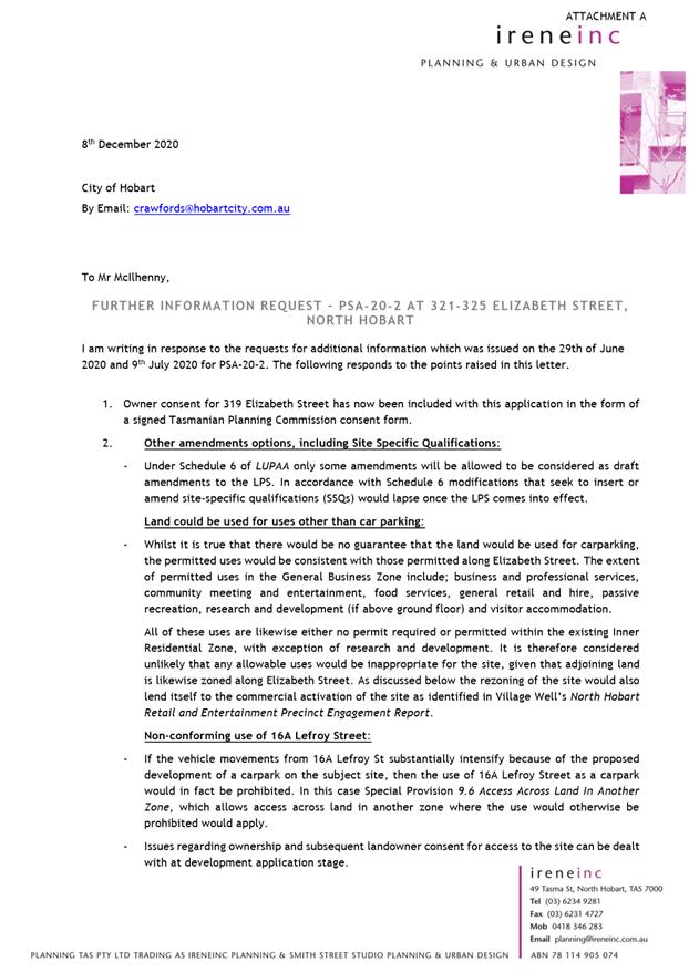
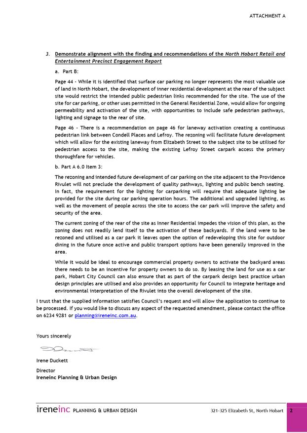
Amendment PSA-20-2 proposes the rezoning of part of 321-323A and 325 Elizabeth Street from Inner Residential to General Business. The sites are currently split zoned, and the amendment application proposes that these entire titles be zoned General Business. The application has been submitted by Ireneinc Planning & Urban Design, on behalf of the City of Hobart, in order to allow for the rear portion of 321-323A and 325 Elizabeth Street to be used for a public car park. Vehicle parking is a prohibited use under the Inner Residential Zone and is a discretionary use under the General Business Zone.
The amendment application has been independently assessed by JMG Engineers and Planners. The report and associated recommendations are provided in Attachment A. The report recommends that the site is not rezoned, but alternatively recommends the intent of the application be achieved by a site specific qualification to the Use Table of the Inner Residential Zone to allow for discretionary vehicle parking. The recommendations of that report are repeated below:
|
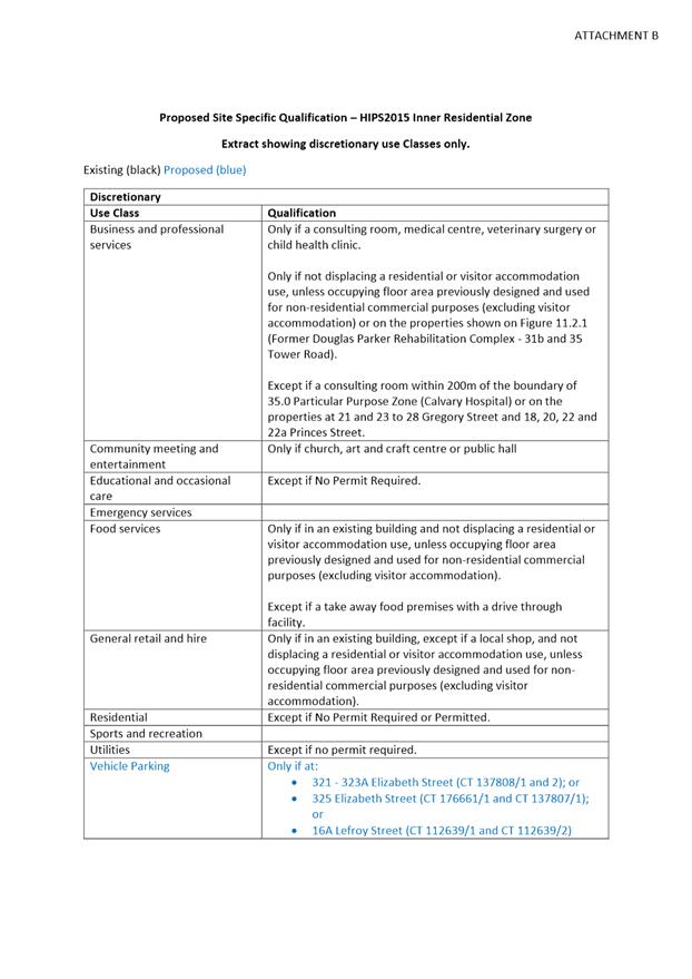
That: 1. Pursuant to Section 34(1) (a) of the former provisions of the Land Use Planning and Approvals Act 1993, the Council resolve to initiate an amendment to the Hobart Interim Planning Scheme 2015 to modify the Inner Residential zone Use Table to include Vehicle Parking as a discretionary use with the qualification “only if at 321- 323A Elizabeth Street (CT 137808/1 and 2); or 325 Elizabeth Street (CT 176661/1 and CT 137807/1); or 16A Lefroy Street (CT 112639/1 and CT 112639/2)”, as indicated in the revised Inner Residential Use Table provided in Attachment B.
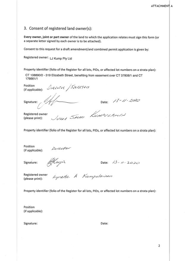
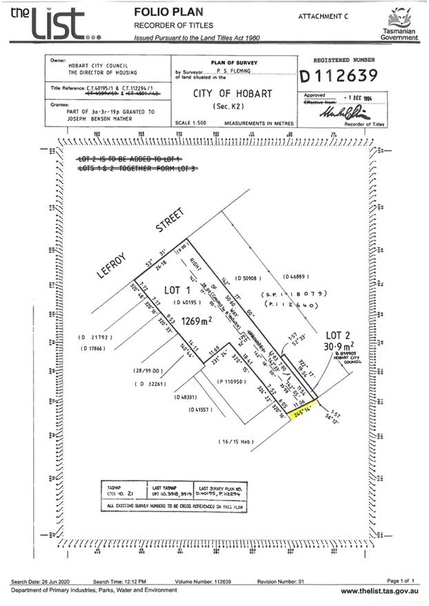
2. The applicant submit landowner consent from the City of Hobart General Manager as landowner of 16A Lefroy Street (CT 112639/1 and CT 112639/2) and the Director of Housing as landowner of 45A Burnett Street (CT 121837/1) prior to public exhibition of the amendment.
3. Pursuant to Section 35 of the former provisions of the Land Use Planning and Approvals Act 1993, the Council certify that the amendment to the Hobart Interim Planning Scheme 2015 PSA-20-2 meets the requirements of Section 32 of the former provisions of the Land Use Planning and Approvals Act 1993 and authorise the General Manager and the Deputy General Manager to sign the Instrument of Certification (Attachment E).
3. Pursuant to Section 38 of the former provisions of the Land Use Planning and Approvals Act 1993, the Council place Amendment PSA-20-2 to the Hobart Interim Planning Scheme 2015 on public exhibition for a 28 day period following certification. |
|
|
As signatory to this report, I certify that, pursuant to Section 55(1) of the Local Government Act 1993, I hold no interest, as referred to in Section 49 of the Local Government Act 1993, in matters contained in this report.
|
Sarah Crawford Development Planner |
Neil Noye Director City Planning |
Date: 12 January 2021
File Reference: F20/134169
Attachment a: PSA-20-2
- Amendment Report and Attachments ⇩ ![]()
|
Item No. 7.3.1 |
Agenda (Open Portion) City Planning Committee Meeting - 18/1/2021 |
Page 1082 ATTACHMENT a |


|
Agenda (Open Portion) City Planning Committee Meeting |
Page 1083 |
|
|
|
18/1/2021 |
|
8. Reports
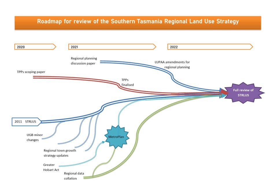
8.1 Southern Tasmania Regional Land Use Strategy - Proposed Review Process and Draft New Policy - Submission to the Minister for Planning
Report of the Development Planner of 13 January 2021 and attachments.
Delegation: Council
|
Item No. 8.1 |
Agenda (Open Portion) City Planning Committee Meeting |
Page 1092 |
|
|
18/1/2021 |
|
REPORT TITLE: Southern Tasmania Regional Land Use Strategy - Proposed Review Process and Draft New Policy - Submission to the Minister for Planning
REPORT PROVIDED BY: Development Planner
Director City Planning
1. Report Purpose and Community Benefit
1.1. This report considers the Minister for Planning’s ‘roadmap’ for review of the Southern Tasmania Regional Land Use Strategy 2010-2035 (STRLUS) and, more specifically, a draft policy amendment to the STRLUS that allows greater flexibility to consider rezoning for urban development outside of the Urban Growth Boundary without requiring an amendment of this boundary. The report seeks Council endorsement of a submission letter to the Minister for Planning.
1.2. This report benefits the community by allowing greater flexibility to ensure land is appropriately zoned and that development and use is undertaken in a fair and orderly manner.
2. Report Summary
2.1. The proposal is that a submission to the Minister for Planning, in response to a ‘roadmap’ for review of the Southern Tasmania Regional Land Use Strategy 2010-2035 (STRLUS) and proposed new interim policy relating to urban zoning beyond the Urban Growth Boundary (UGB), be endorsed.
2.2. The proposed submission is provided in Attachment A.
2.3. The documentation sent to the City of Hobart from the Minister for Planning is provided in Attachment B.
2.4. The roadmap for review summarises how the STRLUS will be managed and incrementally amended in the short, medium and long term, culminating in a full review of the STRLUS.
2.5. One of the short term measures proposed is a new interim policy that will detail the circumstances where a rezoning can be considered beyond the UGB without formally amending the STRLUS.
2.6. The intent of this new policy is to introduce a simplified process for dealing with minor deviations from the UGB that aren’t likely to significantly impact on the broader settlement strategy of the STRLUS.
2.7. Both the roadmap for review of the STRLUS and the intention of the proposed draft policy are generally supported subject to suggested clarifications and amendments.
2.8. A number of specific comments, queries or suggestions for improvement are provided in the attached submission to the Minister for Planning, which is recommended to be supported.
|
That: 1. Council endorse the submission to the Minister for Planning, in response to a roadmap for review of the Southern Tasmania Regional Land Use Strategy 2010-2035 and a proposed new interim policy relating to urban zoning beyond the Urban Growth Boundary, provided in Attachment A.
|
4. Background
4.1. The Minister for Planning wrote to Council in December 2020 to outline a ‘roadmap’ for review of the STRLUS, which summarises the processes underway and how they will work together towards a full review of the STRLUS (Attachment B).
4.2. The STRLUS sets out the medium to long term planning goals for the southern region of Tasmania.
4.3. The Greater Hobart Urban Growth Boundary (UGB) is a boundary drawn on a map within the STRLUS that aims to:
4.3.1. Set the physical extent for a 20 year supply of residential land (with the aim of a 50/50 greenfield to infill development ratio and a minimum net residential density of 15 dwellings per hectare);
4.3.2. Reflect infrastructure capacity, land hazards and environmental, landscape and heritage values;
4.3.3. Support increased density in areas around integrated transit corridors and principal and primary activity centres.
4.4. The Minister notes there are concerns that the regional strategy is out of date and may not adequately reflect current planning issues.
4.5. The MetroPlan project under the Greater Hobart Act 2019 (which will guide integrated development in the urban areas of greater Hobart) and development of the State Government’s Tasmanian Planning Policies will be critical projects that will inform a future full STRLUS review.
4.6. The roadmap for review, showing how the STRLUS will be managed and incrementally amended in the short, medium and long term is summarised in the following indicative graphic:
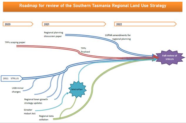
4.7. One of the proposed short term changes to the STRLUS is a new interim policy to provide for a more flexible approach to consider urban zoning beyond the UGB. The Minister is seeking councils’ feedback on this draft new policy in accordance with s.5A(4) of the Land Use Planning and Approvals Act 1993, as well as feedback on the roadmap more generally.
5. Proposal and Implementation
5.1. The proposal is that a submission to the Minister for Planning, in response to a ‘roadmap’ for review of the STRLUS and proposed new STRLUS interim policy relating to urban zoning beyond the UGB, be endorsed.
5.2. The proposed submission is provided in Attachment A.
5.3. The documentation sent to the City of Hobart from the Minister for Planning, including the draft new interim policy and explanatory documentation, is provided in Attachment B.
5.4. The wider roadmap for review of the STRLUS appears to follow a logical sequence of data collection and policy formation, considering the other major projects that are underway or about to be commenced. These major projects include the Tasmanian Planning Policies and the greater Hobart MetroPlan, which will play a significant role in shaping planning policy direction. However to provide greater certainty for all stakeholders an indicative timeframe should be established for the completion of the review.
5.5. One of the proposed short term changes to the STRLUS is a new policy to be inserted into the Settlement and Residential Policies of the STRLUS. The purpose of this new policy is to enable the consideration of proposals for urban zoning beyond the existing UGB in particular circumstances, without the need to amend the STRLUS.
5.6. Currently, proposals for urban zoning outside of the UGB must seek a formal amendment to the STRLUS from the Minister for Planning. Amendments of this type must be supported by all councils within the region.
5.7. The new policy intends to introduce a simplified approach to dealing with minor deviations from the UGB.
5.8. As the UGB was originally conceived as being indicative rather than definitive, there are apparent anomalies with land parcels being split by the UGB and seemingly appropriate areas being left out of the UGB.
5.9. The new policy is intended to be restricted in scope to address what appear to be anomalies and avoid detracting from the intent of the UGB which is to balance infill to greenfield development ratios in Greater Hobart.
5.10. The policy is proposed as an interim measure pending the outcomes of the Greater Hobart Metro Plan and the comprehensive review of the STRLUS.
5.11. The proposed wording of the new policy is as follows:
Notwithstanding SRD 2.2 and SRD 2.8, land outside the Urban Growth Boundary shown in Map 10 may be considered for rezoning for urban development if it:
a) Adjoins land within the Urban Growth Boundary;
b) Comprises a lot that is partially within the Urban Growth Boundary, with an area of not more than <2> hectares;
c) Does not constitute a significant increase in land zoned for urban development outside the UGB in that locality; and
d) Results in minimal potential for land use conflicts with adjoining land uses.
5.12. The maximum area for consideration under subclause b) of the draft policy will be informed by feedback from stakeholders. Suggested options in the background paper are 2 ha (potential for 30 dwellings at 15/ha, likely to have minimal impact on broader settlement strategy), 3 ha (45 dwellings at 15/ha, may have potential to lead to some impacts on the broader settlement strategy).
5.13. It is considered that a 2ha size limit would be reasonable. The analysis of dwelling yield provided in the explanatory document assumes the land can be fully developed and is within a zone that would allow for this density, however there are instances where a more restrictive zoning (such as Low Density Residential) or existing site constraints may reduce the achievable dwelling yield. An alternative possible approach could be to specify a different maximum land size depending on the proposed zone.
5.14. The City of Hobart has considered two proposals in the recent past for urban rezonings beyond the UGB, specifically 25 Stevens Farm Drive (amendment 5/2016) and 66 Summerhill Road (amendment PSA-18-2). Both proposals related to additional land adjoining a recent subdivision that was determined to have further development capacity following detailed investigation.
5.15. The rezoning to Low Density Residential at 25 Stevens Farm Drive (approx. 0.6 ha, resulting in 4 lots) was approved and the STRLUS UGB was subsequently amended. The application for rezoning to Low Density Residential at 66 Summerhill Road (approx. 1.2 ha, likely to accommodate around 4 lots due to site constraints) has been initiated but not yet determined. A request for an amendment to the STRLUS has also been submitted to the Minister relating to this application.
5.16. Future proposals to rezone beyond the UGB within the Hobart municipal area are likely to be minor in scale and close to services and regular public transport, and are therefore unlikely to pose unintended consequences such as contributing to urban sprawl or increased traffic congestion. It is noted that these unintended consequences may be a concern for less well serviced areas, however.
5.17. The UGB in the Hobart municipal area was primarily based on existing zone boundaries without detailed review of potential capacity of land beyond these existing zones. It is therefore possible that some modest areas of land beyond the existing UGB can be demonstrated, with detailed investigation, to be suitable for urban development.
5.18. The Hobart municipal area is largely constrained by natural features such as the River Derwent and kunanyi/Mount Wellington, and therefore rezonings beyond the UGB are unlikely to amount to a significant area.
5.19. The attached submission in Attachment A generally supports the roadmap for review of the STRLUS and the intent of the new policy amendment, however raises some queries and suggests for drafting improvements of the policy.
5.20. The main queries or suggestions for improvement are as follows:
5.20.1. Will there still be a process to request an amendment to the STRLUS to extend the UGB if a proposal for rezoning does not meet the proposed conditions of the new policy but may still be appropriate?
5.20.2. The subclause relating to the maximum area of land could be clarified further that the size only relates to the rezoned area beyond the UGB, even if the entire lot is larger due to a portion being within the UGB. It is noted that determining the exact size of land outside the UGB may be problematic given the scale and thickness of the UGB line as represented in the STRLUS.
5.20.3. Is it deliberately intended that partial rezoning of a larger lot is precluded? There may be circumstances where split zoning and concentration of development into a small area of a large lot is justifiable.
5.20.4. In response to requested feedback relating to maximum lot sizes, a 2ha limit would be supported, although it is suggested that an alternative approach is to specify a different maximum depending on the intended zone, as different zones will allow for different dwelling densities. However before a definitive limit is agreed to there should be an understanding of the overall potential of such a limit as the accumulation of such amendments could have a significant implication of the overall land supply that may have unintended consequences.
5.20.5. Provision should be made to ensure that such amendments do not simply lead to more land banking but rather any amendment achieves a meaningful redevelopment of the land within a specified period. Furthermore limiting such amendments to the Hobart metropolitan council areas should be considered to ensure unintended need for the expansion of public services are minimised.
5.20.6. The term ‘locality’ is not clearly defined, and it is suggested a definition should be added or a different term used.
5.20.7. The operation of the subclause that requires consideration of whether a proposed rezoning constitutes a significant increase in urban land outside the UGB should be clarified.
5.21. It is recommended that the submission to the Minister for Planning provided in Attachment A be supported.
6. Strategic Planning and Policy Considerations
6.1. Support of the proposed amendment is consistent with the objectives of the Capital City Strategic Plan 2019-29, in particular with the following outcomes:
6.1.1. Hobart keeps a strong sense of place and identity, even as the city changes;
6.1.2. In City decision-making, we consider how different aspects of Hobart life connect and contribute to sense of place;
6.1.3. Hobart has a diverse supply of housing and affordable homes;
6.1.4. Development enhances Hobart’s unique identity, human scale and built heritage.
7. Financial Implications
7.1. Funding Source and Impact on Current Year Operating Result
7.1.1. None.
7.2. Impact on Future Years’ Financial Result
7.2.1. None.
7.3. Asset Related Implications
7.3.1. None.
8. Legal, Risk and Legislative Considerations
8.1. The implementation of the draft policy amendment to the STRLUS will be undertaken in accordance with the process set out under the Land Use Planning and Approvals Act 1993.
9. Environmental Considerations
9.1. The draft new STRLUS policy will still require site conditions and environmental impacts to be considered as part of any proposed rezoning.
10. Social and Customer Considerations
10.1. The proposal is not considered to have any negative impact on social inclusion.
11. Marketing and Media
11.1. There are no marketing or branding implications of this proposal.
12. Community and Stakeholder Engagement
12.1. No engagement by Council is necessary as this report responds to proposals by the Minister for Planning.
13. Delegation
13.1. Delegation rests with the Council.
As signatory to this report, I certify that, pursuant to Section 55(1) of the Local Government Act 1993, I hold no interest, as referred to in Section 49 of the Local Government Act 1993, in matters contained in this report.
|
Sarah Crawford Development Planner |
Neil Noye Director City Planning |
Date: 13 January 2021
File Reference: F21/324
Attachment a: Attachment
- City Planning Committee - 18 January 2021 - Submission to Minister for
Planning ⇩ ![]()
Attachment
b: Documentation
from the Minister for Planning ⇩ ![]()
|
Item No. 8.1 |
Agenda (Open Portion) City Planning Committee Meeting - 18/1/2021 |
Page 1095 ATTACHMENT a |
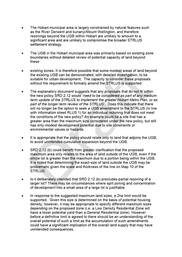
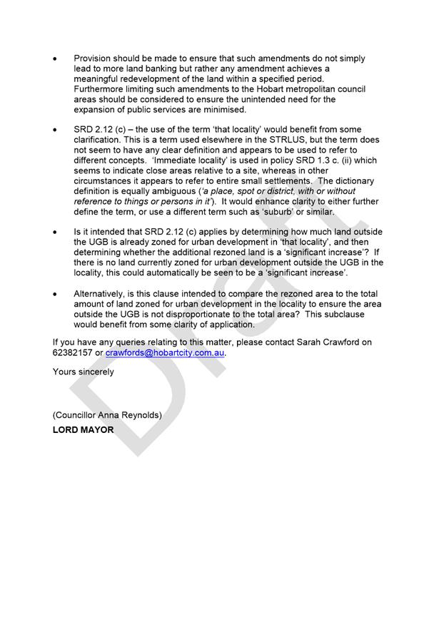
|
Agenda (Open Portion) City Planning Committee Meeting - 18/1/2021 |
Page 1097 ATTACHMENT b |
|
Agenda (Open Portion) City Planning Committee Meeting |
Page 1105 |
|
|
|
18/1/2021 |
|
8.2 Monthly Building Statistics - 1 December - 31 December 2020
Memorandum of the Director City Planning of 6 January 2021 and attachments.
Delegation: Council
|
Item No. 8.2 |
Agenda (Open Portion) City Planning Committee Meeting |
Page 1107 |
|
|
18/1/2021 |
|

Memorandum: City Planning Committee
Building and Planning Statistics 1 December - 31 December
2020
Attached is the monthly building and planning permit issue statistics for the period 1 December 2020 – 31 December 2020.
|
That:
During the period 1 December 2020 to 31 December 2020, 56 building permits were issued to the value of $11,649,479 which included:
(i) 31 for Extensions/Alterations to Dwellings to the value of $4,509,648;
(ii) 7 New Dwellings to the value of $2,567,000; and
(iii) 2 Major Projects:
(a) 21-27 Elizabeth Street, Hobart - Commercial Internal Alterations - $1,167,381; (b) 7 Wilks Road, Lenah Valley - New Commercial Building - $1,100,000;
During the period 1 December 2019 to 31 December 2019, 61 building permits were issue to the value of $32,977,425 which included:
(i) 35 for Extensions/Alterations to Dwellings to the value of $3,869,310;
(ii) 37 New Dwellings to the value of $15,935,615; and
(iii) 3 Major Projects:
(a) 110 Giblin Street, New Town - Multiple New Dwellings - $12,000,000; (b) 15-17 Liverpool Street, Hobart - Brooker Highway Pedestrian Bridge - $6,500,000; (c) 254-286 Liverpool Street, Hobart - Commercial Internal Alterations - $4,200,000;
1. In the twelve months ending December 2020, 641 building permits were issued to the value of $180,406,244 and
2. In the twelve months ending December 2019, 621 building permits were issued to the value of $341,462,108.
|
As signatory to this report, I certify that, pursuant to Section 55(1) of the Local Government Act 1993, I hold no interest, as referred to in Section 49 of the Local Government Act 1993, in matters contained in this report.
|
Neil Noye Director City Planning |
|
Date: 6 January 2021
File Reference: F21/1139
Attachment a: Number
of Monthly Building Permits Issued Bar Graph Dec 2020
⇩ ![]()
Attachment
b: Value
of Monthly Building Permits Issued Bar Graph Dec 2020
⇩ ![]()
Attachment
c: Monthly
Building Permits Issued 2017-2020 Line Graph ⇩ ![]()
Attachment
d: Value
of Monthly Building Permits Issued 2017-2020 Line Graph
⇩ ![]()
Attachment
e: Monthly
Comparison Planning Approvals Value Dec 2020 Line Graph
⇩ ![]()
Attachment
f: Monthly
Comparison Number of Planning Permit Issued Dec 2020 Line Graph ⇩ ![]()
Attachment
g: Number
of Planning Permits issued Accumulative Monthly Comparison Dec 2020 ⇩ ![]()
Attachment
h: Value
of Planning Permits issued Accumulative Monthly Comparison Dec 2020 ⇩ ![]()
|
Item No. 8.2 |
Agenda (Open Portion) City Planning Committee Meeting - 18/1/2021 |
Page 1108 ATTACHMENT a |
|
Item No. 8.2 |
Agenda (Open Portion) City Planning Committee Meeting - 18/1/2021 |
Page 1109 ATTACHMENT b |
|
Item No. 8.2 |
Agenda (Open Portion) City Planning Committee Meeting - 18/1/2021 |
Page 1110 ATTACHMENT c |
|
Item No. 8.2 |
Agenda (Open Portion) City Planning Committee Meeting - 18/1/2021 |
Page 1111 ATTACHMENT d |
|
Item No. 8.2 |
Agenda (Open Portion) City Planning Committee Meeting - 18/1/2021 |
Page 1112 ATTACHMENT e |
|
Item No. 8.2 |
Agenda (Open Portion) City Planning Committee Meeting - 18/1/2021 |
Page 1113 ATTACHMENT f |
|
Item No. 8.2 |
Agenda (Open Portion) City Planning Committee Meeting - 18/1/2021 |
Page 1114 ATTACHMENT g |
|
Item No. 8.2 |
Agenda (Open Portion) City Planning Committee Meeting - 18/1/2021 |
Page 1115 ATTACHMENT h |
|
Item No. 8.3 |
Agenda (Open Portion) City Planning Committee Meeting |
Page 1116 |
|
|
18/1/2021 |
|
8.3 Delegated Decision Report (Planning)
Memorandum of the Director City Planning of 12 January 2021 and attachment.
Delegation: Committee
|
Item No. 8.3 |
Agenda (Open Portion) City Planning Committee Meeting |
Page 1117 |
|
|
18/1/2021 |
|
Memorandum: City Planning Committee
Delegated Decision Report (Planning)
Attached is the delegated planning decisions report for the period 7 December 2020 to 8 January 2021.
|
That: 1. That the information be received and noted.
|
As signatory to this report, I certify that, pursuant to Section 55(1) of the Local Government Act 1993, I hold no interest, as referred to in Section 49 of the Local Government Act 1993, in matters contained in this report.
|
Neil Noye Director City Planning |
|
Date: 12 January 2021
File Reference: F21/2178
Attachment a: Delegated
Decision Report (Planning) ⇩ ![]()
|
Item No. 8.3 |
Agenda (Open Portion) City Planning Committee Meeting - 18/1/2021 |
Page 1121 ATTACHMENT a |
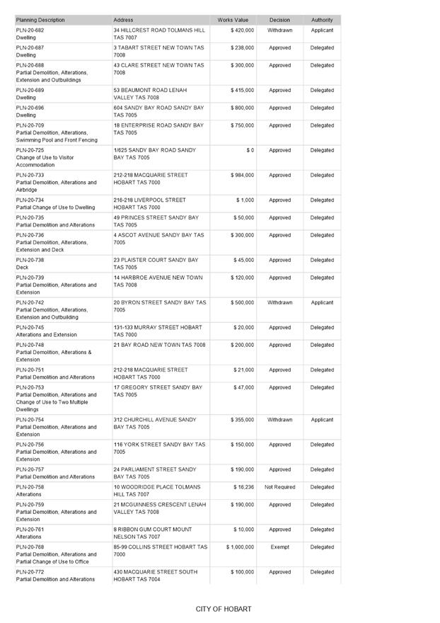
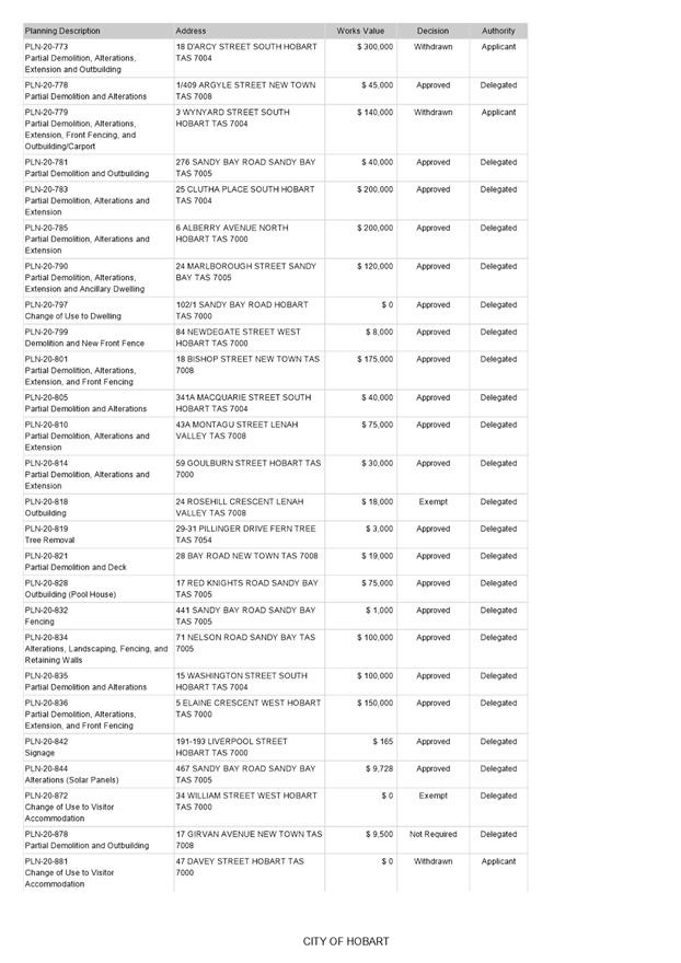

|
Agenda (Open Portion) City Planning Committee Meeting |
Page 1122 |
|
|
|
18/1/2021 |
|
8.4 City Planning - Advertising Report
Memorandum of the Director City Planning of 12 January 2021 and attachment.
Delegation: Committee
|
Item No. 8.4 |
Agenda (Open Portion) City Planning Committee Meeting |
Page 1123 |
|
|
18/1/2021 |
|
Memorandum: City Planning Committee
City Planning - Advertising Report
Attached is the advertising list for the period 7 December 2020 to 8 January 2021.
|
That: 1. That the information be received and noted.
|
As signatory to this report, I certify that, pursuant to Section 55(1) of the Local Government Act 1993, I hold no interest, as referred to in Section 49 of the Local Government Act 1993, in matters contained in this report.
|
Neil Noye Director City Planning |
|
Date: 12 January 2021
File Reference: F21/2329
Attachment a: City
Planning - Advertising Report ⇩ ![]()
|
Item No. 8.4 |
Agenda (Open Portion) City Planning Committee Meeting - 18/1/2021 |
Page 1127 ATTACHMENT a |
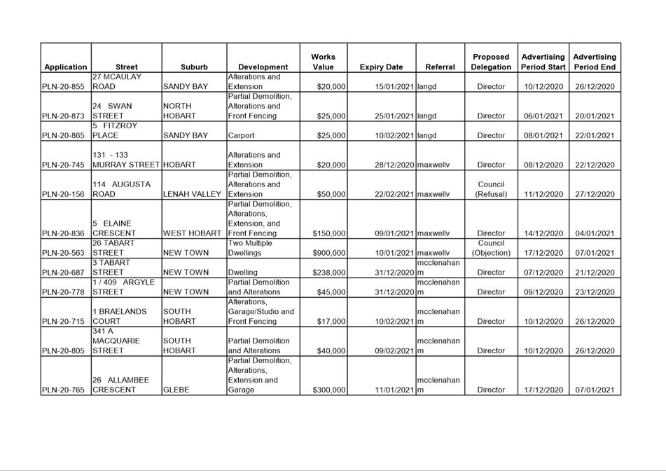
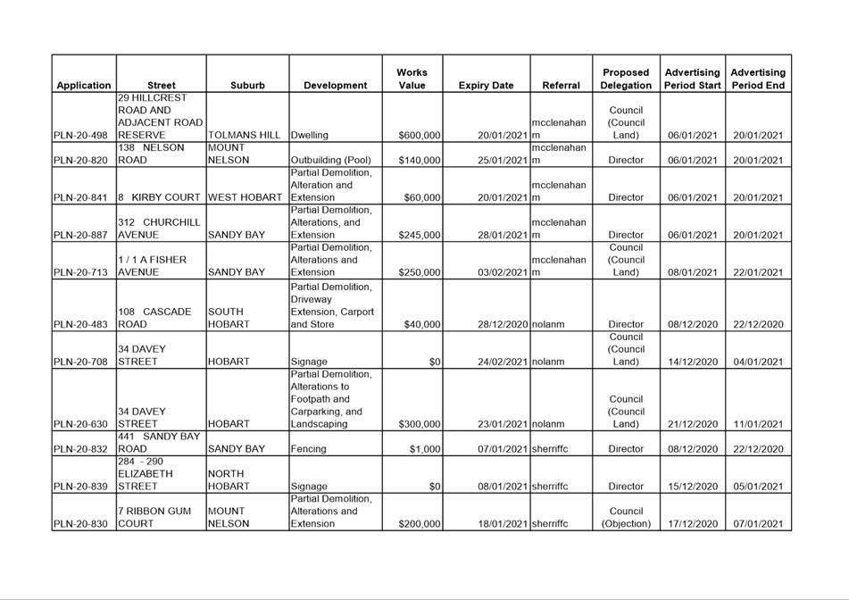
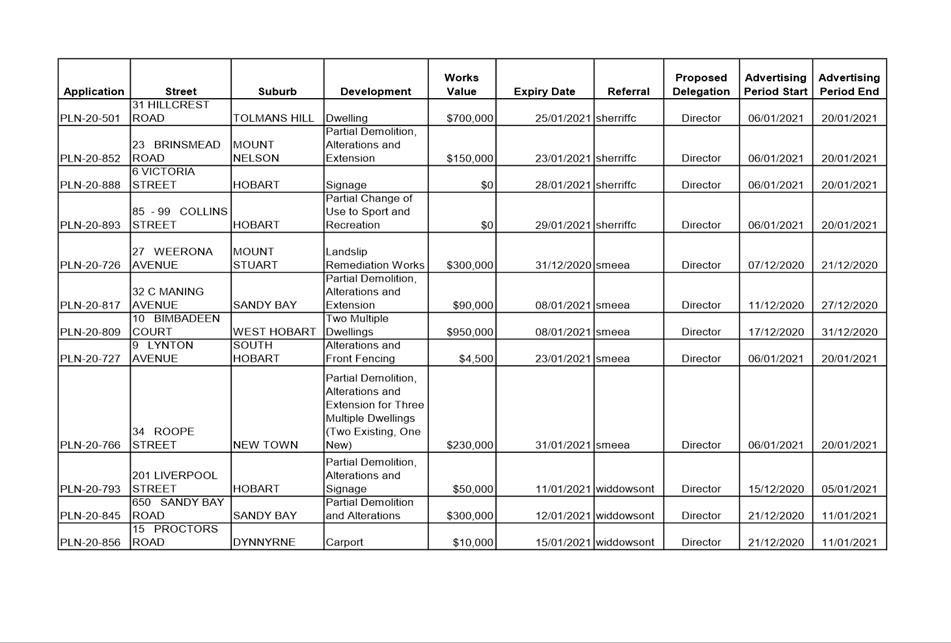
|
Agenda (Open Portion) City Planning Committee Meeting |
Page 1128 |
|
|
|
18/1/2021 |
|
Regulation 29(3) Local Government
(Meeting Procedures) Regulations 2015.
File Ref: 13-1-10
The General Manager reports:-
“In accordance with the procedures approved in respect to Questions Without Notice, the following responses to questions taken on notice are provided to the Committee for information.
The Committee is reminded that in accordance with Regulation 29(3) of the Local Government (Meeting Procedures) Regulations 2015, the Chairman is not to allow discussion or debate on either the question or the response.”
9.1 Bicycle Parking Provisions
File Ref: F20/114587; 13-1-10
Memorandum of the Director City Planning of 12 January 2021.
9.2 Design of Vehicle Access
File Ref: F20/114526; 13-1-10
Memorandum of the Director City Planning of 22 December 2020.
9.3 Overshadowing Protection
File Ref: F20/114589; 13-1-10
Memorandum of the Director City Planning of 12 January 2021.
9.4 55 Mount Stuart Road - Overlooking
File Ref: F20/124661; 13-1-10
Memorandum of the Director City Planning of 12 January 2021.
9.5 Building Permits - Timeframe
File Ref: F20/130582; 13-1-10
Memorandum of the Director City Planning of 13 January 2021 and attachment.
Delegation: Committee
|
That the information be received and noted.
|
|
Item No. 9.1 |
Agenda (Open Portion) City Planning Committee Meeting |
Page 1131 |
|
|
18/1/2021 |
|
Memorandum: Lord Mayor
Deputy Lord Mayor
Elected Members
Response to Question Without Notice
Bicycle Parking Provisions
|
Meeting: City Planning Committee
|
Meeting date: 19 October 2020
|
|
Raised by: Deputy Lord Mayor Burnet |
|
Question:
Given the number of inner city locations of applications with a focus on accommodation in the City coming before the Council, is the provision of bicycle parking for visitors something that can be reflected in the planning application process according to the Scheme?
Response:
The Hobart Interim Planning Scheme 2015 has a requirement to provide bicycle parking spaces in the Parking and Access Code E6.0. The number of spaces for visitors depends on the use which is proposed.
An extract of the Scheme is on the following page, showing the number of bicycle parking spaces required in Table E6.2.
The requirement to provide parking in accordance with Table E6.2 is an acceptable solution. If that requirement is not met by a proposal then a discretion may be exercised to approve a development where (in clause E6.6.4):
The number of on-site bicycle parking spaces provided
must have regard to all of the following:
|
(a) |
the nature of the use and its operations; |
|
(b) |
the location of the use and its accessibility by cyclists; |
|
(c) |
the balance of the potential need of both those working on a site and clients or other visitors coming to the site. |
Table E6.2:
|
Proposed Use |
Employee/resident bicycle parking requirement |
Visitor/customer/student bicycle parking requirement |
|
Bulky goods sales |
2 |
1 for each 2000 m2 floor area (minimum 2) |
|
1 for each 8 practitioners |
1 for each 4 practitioners |
|
|
1 for each 250 m2 floor area after the first 250 m2 floor area |
1 for each 1000 m2 of floor area if the floor area exceeds 1000 m2 |
|
|
1 for each 8 practitioners |
1 for each 8 practitioners |
|
|
Business and professional services, except as otherwise specified in this table. |
1 for each 250 m2 floor area after the first 250 m2 floor area |
1 for each 1000 m2 of floor area if the floor area exceeds 1000 m2 |
|
1 for each 500 m2 of floor area |
4 plus 2 for each 200 m2 floor area |
|
|
Educational and occasional care Childcare centre |
1 for each 20 employees |
1 for each 20 children |
|
Primary school |
1 for each 20 employees |
1 for each 10 students |
|
Secondary school |
1 for each 20 employees |
1 for each 10 students |
|
Tertiary institution (excl student accommodation) |
1 for each 20 employees |
1 for each 20 full time students |
|
Food services Restaurant |
1 for each 100 m2 of floor area available to the public |
for each 200 m2 floor area after the first 200 m2 floor area (minimum 2) |
|
1 for each 100 m2 of floor area available to the public |
1 for each 50 m2 floor area |
|
|
Food services, except as otherwise specified in this table. |
1 for each 100 m2 of floor area available to the public |
1 for each 200 m2 floor area after the first 200 m2 floor area (minimum 2) |
|
1 for each 500 m2 floor area after the first 500 m2 floor area |
2 plus 1 for each 50 m2 floor area |
|
|
Shop |
1 for each 500 m2 floor area after the first 500 m2 floor area |
1 for each 500 m2 floor area |
|
1 for each 15 patient beds |
1 for each 30 beds |
|
|
1 for each 25 m2 bar floor area plus 1 for each 100m2 lounge/beer garden area |
1 for each 25 m2 bar floor area plus 1 for each 100 m2 lounge, beer garden area |
|
|
1 for each 1000 m2 of floor area |
No requirement |
|
|
Residential aged care home |
1 for each 7 patient beds |
1 for each 30 beds |
|
1 for each 1000 m2 of floor area |
No requirement |
|
|
Visitor accommodation |
1 for each 40 accommodation rooms |
1 for each 30 accommodation rooms |
|
All other use classes |
No requirement |
No requirement |
As signatory to this report, I certify that, pursuant to Section 55(1) of the Local Government Act 1993, I hold no interest, as referred to in Section 49 of the Local Government Act 1993, in matters contained in this report.
|
Neil Noye Director City Planning |
|
Date: 12 January 2021
File Reference: F20/114587; 13-1-10
|
Item No. 9.2 |
Agenda (Open Portion) City Planning Committee Meeting |
Page 1133 |
|
|
14/12/2020 |
|
Memorandum: Lord Mayor
Deputy Lord Mayor
Elected Members
Response to Question Without Notice
Design of Vehicle Access
|
Meeting: City Planning Committee
|
Meeting date: 19 October 2020
|
|
Raised by: Deputy Lord Mayor Burnet |
|
Question:
The City of Hobart's HIPS 2015 Planning Scheme states in Clause E6.7.2 - Design of Vehicular Accesses - that the objective is: "To ensure safe and efficient access for all users, including drivers, passengers, pedestrians and cyclists by locating, designing and constructing vehicle access points safely relative to the road network".
However, as the Bicycle Network has repeatedly brought to Council's attention previously, the current IPWEA engineering drawings for driveway crossovers are highly dangerous for people who ride bikes and use small wheeled vehicles. The Type KC mountable kerb (TSD-R14) can be constructed without the dangerous 10mm lip that the current LGAT/IPWEA engineering drawings prescribe, with a much better outcome for bicycles. For uses on driveways where significant numbers of users are likely to be on a bicycle and turning off the traffic lane into an entrance, it is unsafe to not amend the standard requirement to a zero lip or smooth/flush entrance.
What is the likelihood that this safety element - to use a 0mm lip on the driveway crossover to developments - could be part of standard requirements for driveways in development applications?
Additionally, could the Council take a leadership role to actively work to improve the TSD-R14 standard engineering drawings of LGAT in order to roll out safer conditions for bike riders across the State?
Response:
The Council publishes departures from the Tasmanian Standard Drawings (TSDs) which are published by LGAT. The Council’s published departures for TSD-R14-v2 requires that there is no lip for vehicular crossings.
As part of its assessment of the development application or subsequent assessment of detailed drawings, the City Amenity (Roads) team will usually require compliance with the TSDs with Council’s departures.
As such, most (if not all) new developments will have a zero lip on crossovers.
As signatory to this report, I certify that, pursuant to Section 55(1) of the Local Government Act 1993, I hold no interest, as referred to in Section 49 of the Local Government Act 1993, in matters contained in this report.
|
Neil Noye Director City Planning |
|
Date: 22 December 2020
File Reference: F20/114526; 13-1-10
|
Item No. 9.3 |
Agenda (Open Portion) City Planning Committee Meeting |
Page 1136 |
|
|
14/12/2020 |
|
Memorandum: Lord Mayor
Deputy Lord Mayor
Elected Members
Response to Question Without Notice
Overshadowing Protection
|
Meeting: City Planning Committee
|
Meeting date: 19 October 2020
|
|
Raised by: Deputy Lord Mayor Burnet |
|
Question:
Can the Director please advise how access to important sunlight can be protected in Development Applications considered for tall buildings in the inner city zones, where there is no public open space nearby?
Is the need for sunlight for those living or working in adjacent properties regarded as less important to those where there are protections from overshadowing?
Will the Planning Scheme Amendments which become active in November be likely to address some of these issues?
Response:
The current planning provisions that apply to the inner city zones protect access to sunlight for priority streets. These streets are outlined in figure 22.2 of the Hobart Interim Planning Scheme 2015 (see below).
Furthermore the recently introduced planning scheme amendments concerning Residential and Visitor Accommodation Amenity provide some protection to access to natural daylight for new dwellings and accommodation land uses. The amendments do not protect access to direct sunlight. The Planning scheme makes clear distinction so far as protecting access to sunlight between commercial and residential zones. The objectives for business/commercial zones are focused on commercial and business interests at the same time as providing a safe, comfortable and pleasant environment for workers, residents and visitors through the provision of high quality urban spaces and urban design. Universal access to direct sunlight in these zones is not always compatible with the density and commercial purpose of the zones.
Residential zones on the other hand are much more focused on providing a high standard of residential amenity of which access to sunlight is a key component. People seeking high levels of residential amenity such as access to direct sunlight should therefore consider zones outside the inner central business and commercial zones.
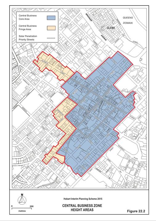
As signatory to this report, I certify that, pursuant to Section 55(1) of the Local Government Act 1993, I hold no interest, as referred to in Section 49 of the Local Government Act 1993, in matters contained in this report.
|
Neil Noye Director City Planning |
|
Date: 12 January 2021
File Reference: F20/114589; 13-1-10
|
Item No. 9.4 |
Agenda (Open Portion) City Planning Committee Meeting |
Page 1138 |
|
|
14/12/2020 |
|
Memorandum: Lord Mayor
Deputy Lord Mayor
Elected Members
Response to Question Without Notice
55 Mount Stuart Road - Overlooking
|
Meeting: City Planning Committee
|
Meeting date: 16 November 2020
|
|
Raised by: Alderman Briscoe |
|
Question:
Can the Director advise if officers will visit the neighbouring property at 53 Mount Stuart Road to compare the overlooking into the neighbour’s house and garden that is happening when the officers report for approval said there would be little or no effect. What steps could be taken to avoid such a situation in the future?
Response:
The assessment report for the planning application stated (at paragraph 7.14) as follows:
The proposal complies with the relevant planning scheme standards for overlooking of adjoining properties, as elements such as elevated decks and habitable room windows would either have the required setback or have obscure glass or screening. Any overshadowing impact caused by the development upon an adjoining lot would be limited to afternoon periods and is not considered to be unreasonable.
The proposal met the requirements of the Scheme and was recommended for approval on that basis. There was a privacy discretion, however this related to the separation between a bedroom window and a driveway, rather than potential overlooking of an adjoining property.
A Council Officer has visited the property at 53 Mount Stuart Road and met with the owners to discuss their concerns. That site visit confirmed that the development at 55 Mount Stuart Road is being constructed in accordance with the approved planning and building plans.
As signatory to this report, I certify that, pursuant to Section 55(1) of the Local Government Act 1993, I hold no interest, as referred to in Section 49 of the Local Government Act 1993, in matters contained in this report.
|
Neil Noye Director City Planning |
|
Date: 12 January 2021
File Reference: F20/124661; 13-1-10
|
Item No. 9.5 |
Agenda (Open Portion) City Planning Committee Meeting |
Page 1140 |
|
|
14/12/2020 |
|
Memorandum: Lord Mayor
Deputy Lord Mayor
Elected Members
Response to Question Without Notice
Building Permits - Timeframe
|
Meeting: City Planning Committee
|
Meeting date: 30 November 2020
|
|
Raised by: Alderman Briscoe |
|
Question:
Can the Director advise if we have any statistics on the range of time it takes to receive a building permit over the past 2 years?
Response:
See attached chart showing the range of days to issue a building permit for the period 1 October 2018 to 30 September 2020.
Under the Building Act 2016, the “clock” does not stop when Council requests further information. The attached chart includes the total period from when the application is received until the permit is issued. It does not differentiate between the days Council was assessing the application and the days the application was unable to be assessed and was on hold as the Council was waiting for further information from an applicant. That is, in many of the cases on the attached chart the permit cannot be issued as the Council is waiting for further information to assess the application and it is the period where the further information remained outstanding that explains the delay between lodgement of the application and issue of a permit.
Recent legislative change is expected to significantly reduce these timeframes as applicants are now required to satisfy planning conditions prior to lodging an application for a building permit. If the applicant fails to satisfy relevant planning conditions prior to lodging an application for a building permit Council is required to refuse the application rather than placing the application on hold and requesting further information.
As signatory to this report, I certify that, pursuant to Section 55(1) of the Local Government Act 1993, I hold no interest, as referred to in Section 49 of the Local Government Act 1993, in matters contained in this report.
|
Neil Noye Director City Planning |
|
Date: 13 January 2021
File Reference: F20/130582; 13-1-10
Attachment a: Building
Permits Assessment Days - Distribution - 1/10/2018 - 30/09/2020 ⇩ ![]()
|
Item No. 9.5 |
Agenda (Open Portion) City Planning Committee Meeting - 18/1/2021 |
Page 1141 ATTACHMENT a |
|
|
Agenda (Open Portion) City Planning Committee Meeting |
Page 1142 |
|
|
18/1/2021 |
|
Section 29 of the Local Government (Meeting Procedures) Regulations 2015.
File Ref: 13-1-10
An Elected Member may ask a question without notice of the Chairman, another Elected Member, the General Manager or the General Manager’s representative, in line with the following procedures:
1. The Chairman will refuse to accept a question without notice if it does not relate to the Terms of Reference of the Council committee at which it is asked.
2. In putting a question without notice, an Elected Member must not:
(i) offer an argument or opinion; or
(ii) draw any inferences or make any imputations – except so far as may be necessary to explain the question.
3. The Chairman must not permit any debate of a question without notice or its answer.
4. The Chairman, Elected Members, General Manager or General Manager’s representative who is asked a question may decline to answer the question, if in the opinion of the respondent it is considered inappropriate due to its being unclear, insulting or improper.
5. The Chairman may require a question to be put in writing.
6. Where a question without notice is asked and answered at a meeting, both the question and the response will be recorded in the minutes of that meeting.
7. Where a response is not able to be provided at the meeting, the question will be taken on notice and
(i) the minutes of the meeting at which the question is asked will record the question and the fact that it has been taken on notice.
(ii) a written response will be provided to all Elected Members, at the appropriate time.
(iii) upon the answer to the question being circulated to Elected Members, both the question and the answer will be listed on the agenda for the next available ordinary meeting of the committee at which it was asked, where it will be listed for noting purposes only.
|
|
Agenda (Open Portion) City Planning Committee Meeting |
Page 1143 |
|
|
18/1/2021 |
|