City
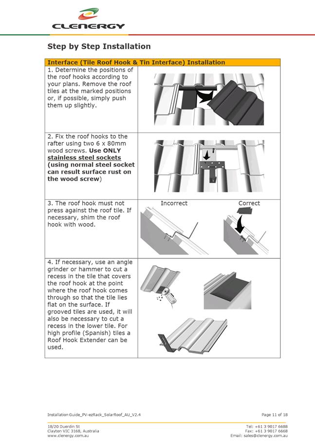
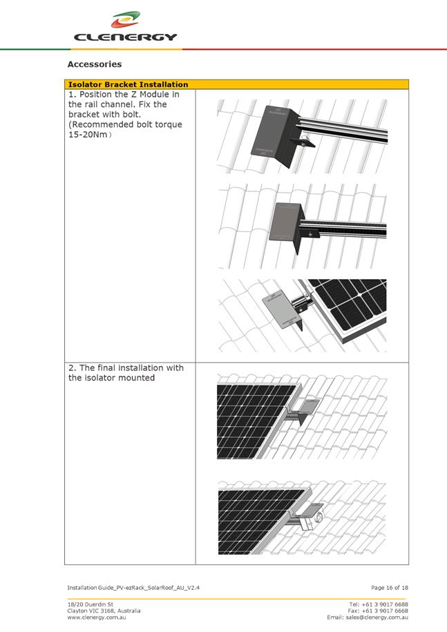
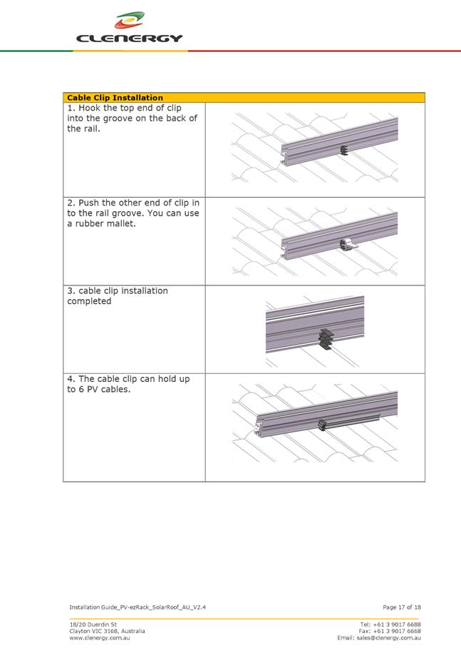
of hobart
AGENDA
City Planning Committee Meeting
Open Portion
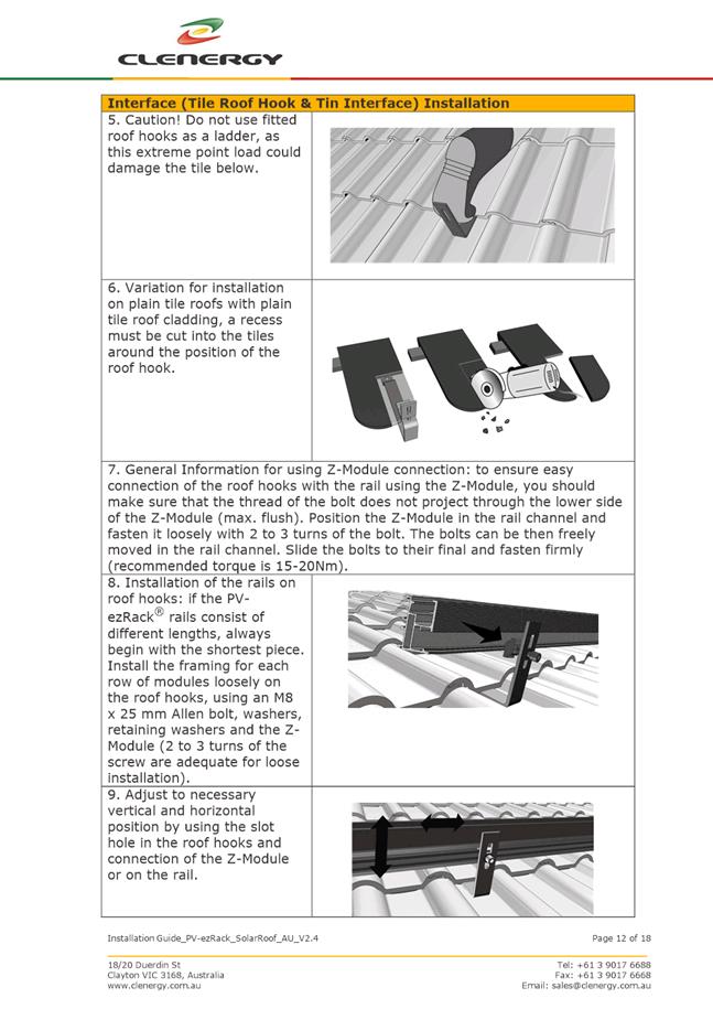
Monday, 10 December 2018
at 5:00 pm
Lady Osborne Room,Town Hall
City
of hobart
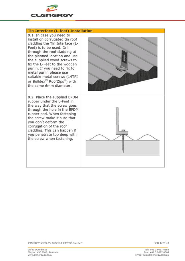
AGENDA
City Planning Committee Meeting
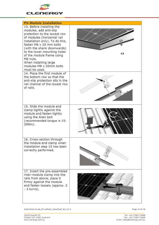
Open Portion
Monday, 10 December 2018
at 5:00 pm
Lady Osborne Room,Town Hall
THE MISSION
Our mission is to ensure good governance of our capital City.
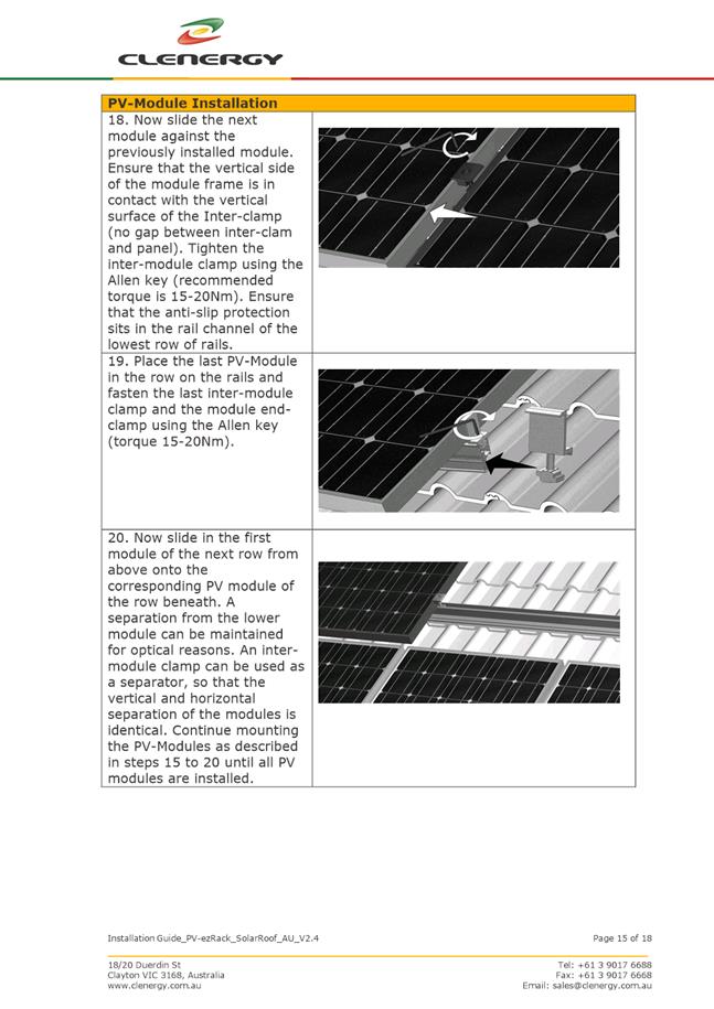
THE VALUES
The Council is:
|
about people |
We value people – our community, our customers and colleagues. |
|
professional |
We take pride in our work. |
|
enterprising |
We look for ways to create value. |
|
responsive |
We’re accessible and focused on service. |
|
inclusive |
We respect diversity in people and ideas. |
|
making a difference |
We recognise that everything we do shapes Hobart’s future. |
|
|
Agenda (Open Portion) City Planning Committee Meeting |
Page 3 |
|
|
10/12/2018 |
|
Business listed on the agenda is to be conducted in the order in which it is set out, unless the committee by simple majority determines otherwise.
APOLOGIES AND LEAVE OF ABSENCE
1. Co-Option of a Committee Member in the event of a vacancy
3. Consideration of Supplementary Items
4. Indications of Pecuniary and Conflicts of Interest
6. Planning Authority Items - Consideration of Items With Deputations
7. Committee Acting as Planning Authority
7.1 Applications under the Sullivans Cove Planning Scheme 1997
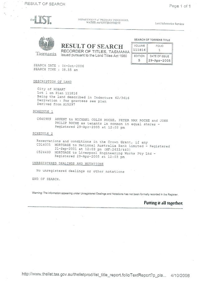
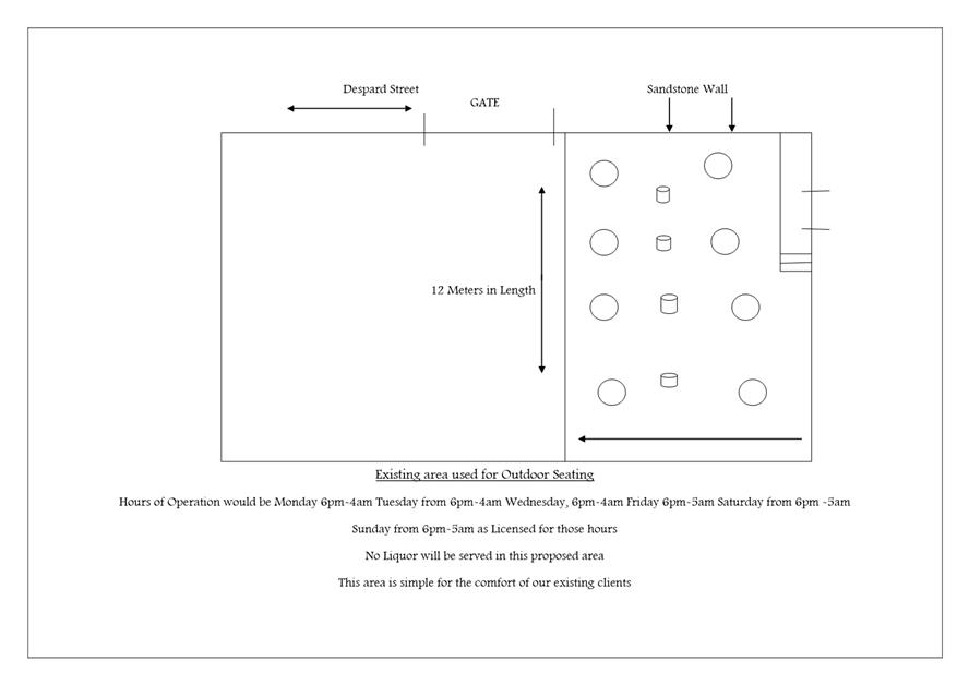
7.1.1 9 - 11 Murray Street, Hobart - Change of Operating Hours.
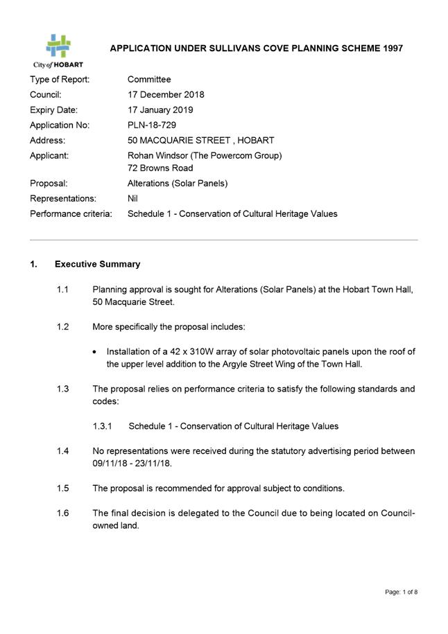
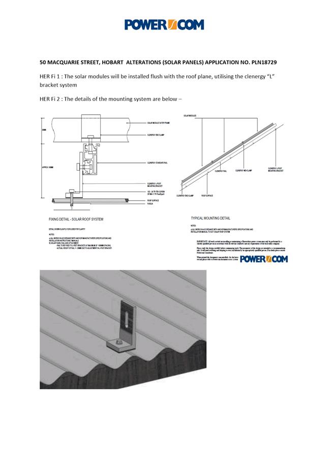
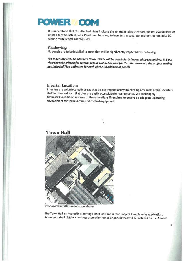
7.1.2 50 Macquarie Street Hobart - Alterations (Solar Panels)
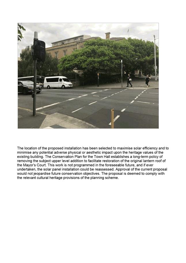
7.1.3 57 - 63 Macquarie Street, Hobart - (Alterations (Solar Panels)
7.2 Applications under the Hobart Interim Planning Scheme 2015
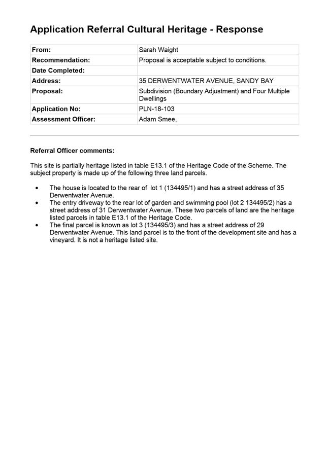
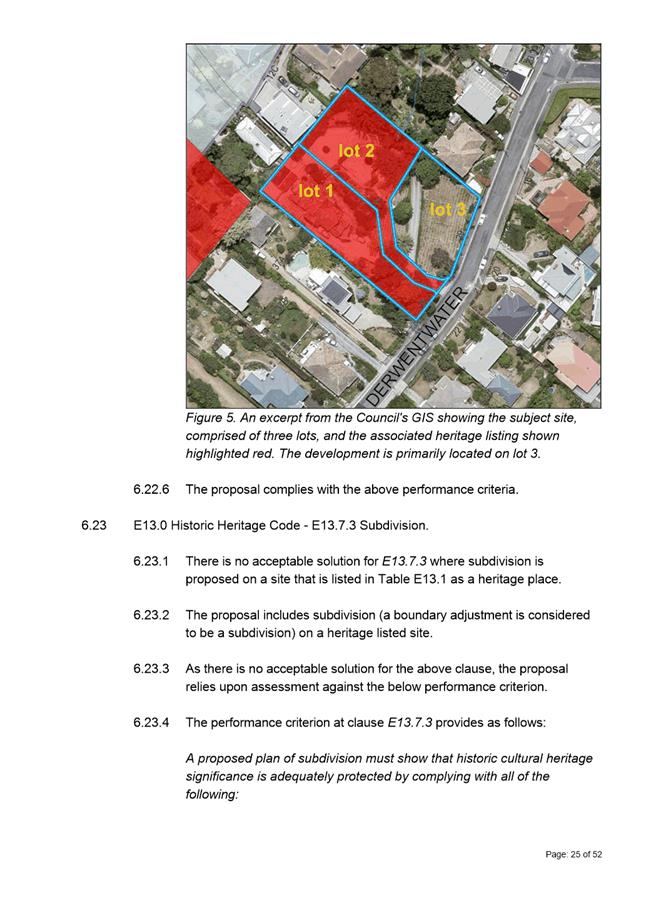
7.2.1 35 Derwentwater Avenue, Sandy Bay - Subdivision (Boundary Adjustment) and Multiple Dwellings
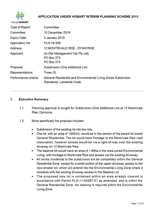
7.2.2 12 Montrivale Rise, Dynnyrne - Subdivision (One Additional Lot)
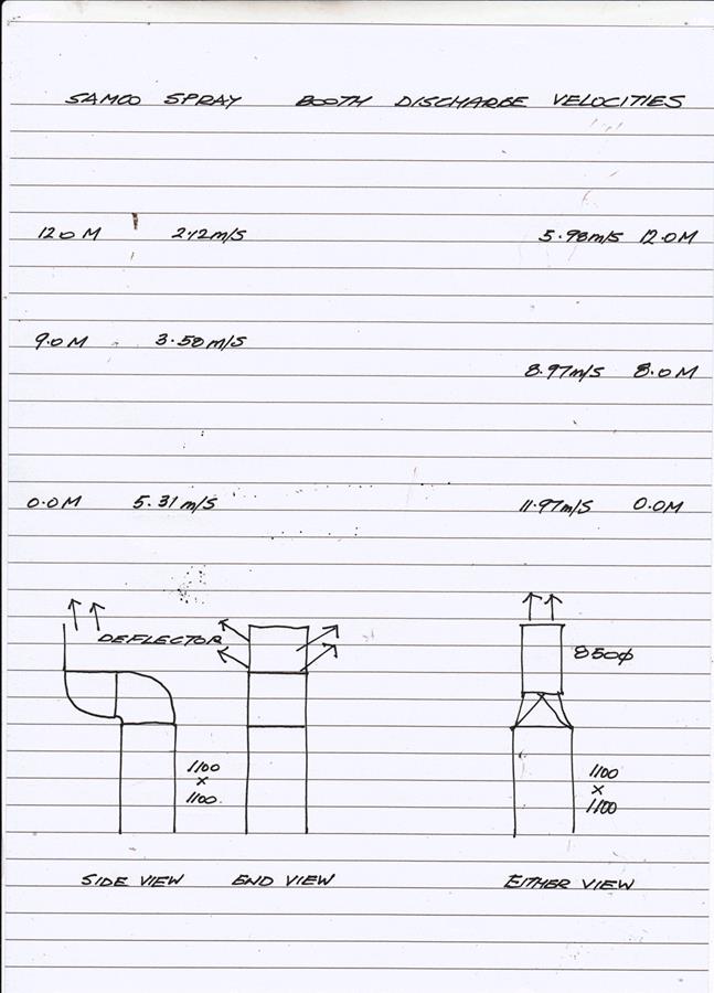
7.2.3 441 Macquarie Street, South Hobart - Alterations and Extension to Exhaust Stack
8.1 Local Government (Meeting Procedures) Regulations 2015 - Review of Meeting Times
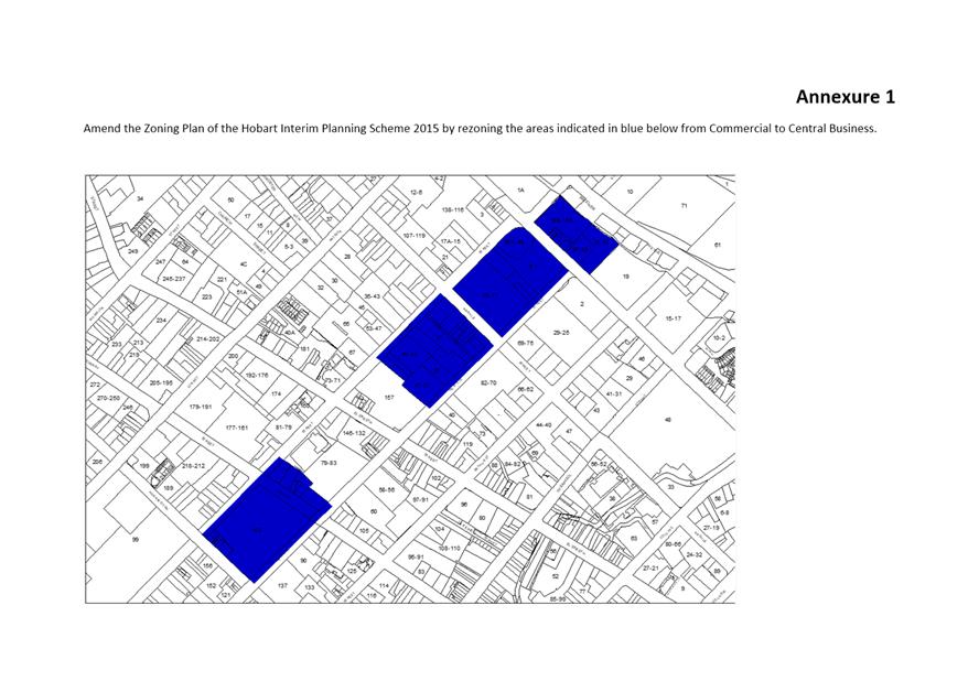
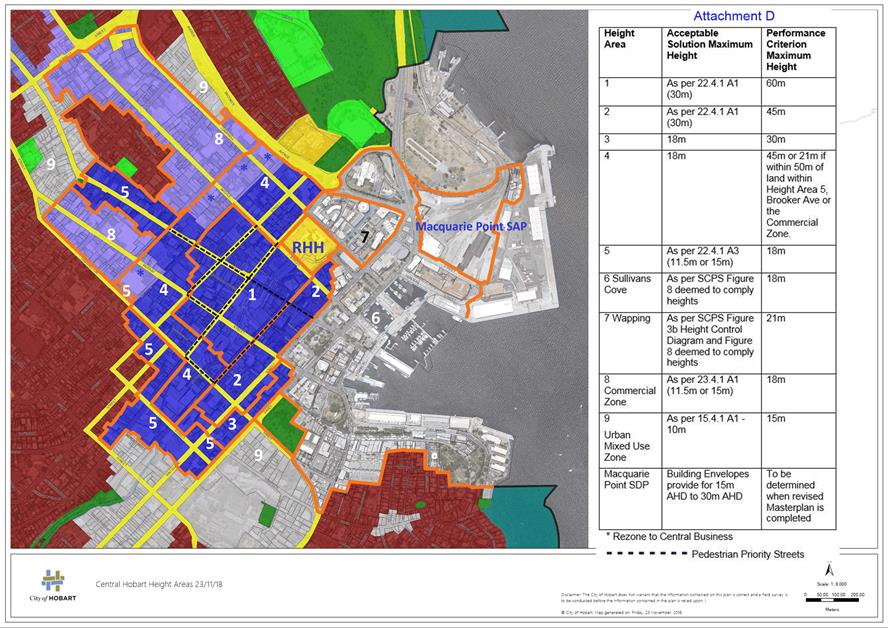
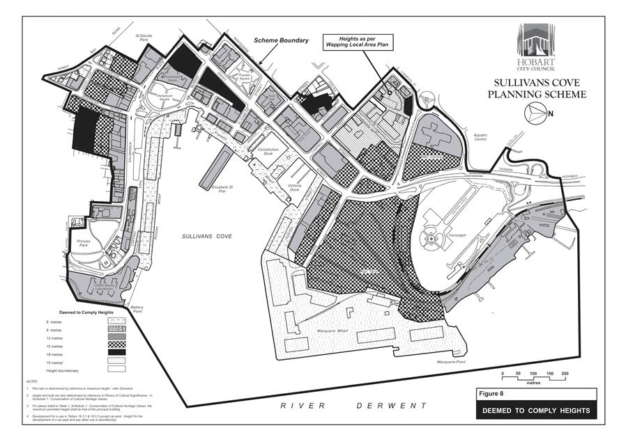
8.2 Central Hobart Building Height Standards Review Project - Proposed Planning Scheme Amendments
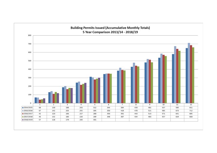
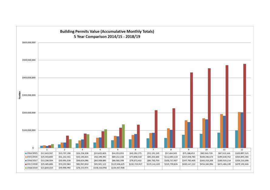
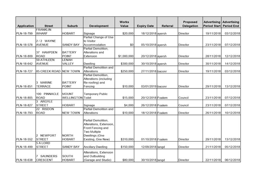
8.3 Monthly Building Statistics - 1 November 2018 - 30 November 2018.
8.4 City Planning - Advertising Report
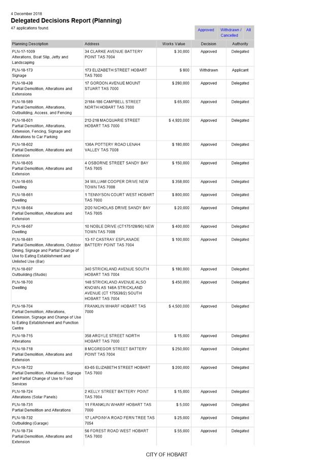
8.5 Delegated Decisions Report (Planning)
10. Closed Portion Of The Meeting
|
|
Agenda (Open Portion) City Planning Committee Meeting |
Page 5 |
|
|
10/12/2018 |
|
City Planning Committee Meeting (Open Portion) held Monday, 10 December 2018 at 5:00 pm in the Lady Osborne Room,Town Hall.
|
COMMITTEE MEMBERS Deputy Lord Mayor Burnet (Chairman) Briscoe Denison Harvey Behrakis
NON-MEMBERS Lord Mayor Reynolds Zucco Sexton Thomas Dutta Ewin Sherlock |
Apologies:
Leave of Absence: Councillor W F Harvey.
|
|
The minutes of the Open Portion of the City Planning Committee meeting held on Monday, 26 November 2018 and the Special City Planning Committee meeting held on Monday, 26 November 2018, are submitted for confirming as an accurate record.
|
Ref: Part 2, Regulation 8(6) of the Local Government (Meeting Procedures) Regulations 2015.
|
That the Committee resolve to deal with any supplementary items not appearing on the agenda, as reported by the General Manager.
|
Ref: Part 2, Regulation 8(7) of the Local Government (Meeting Procedures) Regulations 2015.
Members of the committee are requested to indicate where they may have any pecuniary or conflict of interest in respect to any matter appearing on the agenda, or any supplementary item to the agenda, which the committee has resolved to deal with.
Regulation 15 of the Local Government (Meeting Procedures) Regulations 2015.
A committee may close a part of a meeting to the public where a matter to be discussed falls within 15(2) of the above regulations.
In the event that the committee transfer an item to the closed portion, the reasons for doing so should be stated.
Are there any items which should be transferred from this agenda to the closed portion of the agenda, or from the closed to the open portion of the agenda?
In accordance with the requirements of Part 2 Regulation 8(3) of the Local Government (Meeting Procedures) Regulations 2015, the General Manager is to arrange the agenda so that the planning authority items are sequential.
In accordance with Part 2 Regulation 8(4) of the Local Government (Meeting Procedures) Regulations 2015, the Committee by simple majority may change the order of any of the items listed on the agenda, but in the case of planning items they must still be considered sequentially – in other words they still have to be dealt with as a single group on the agenda.
Where deputations are to be received in respect to planning items, past practice has been to move consideration of these items to the beginning of the meeting.
RECOMMENDATION
That in accordance with Regulation 8(4) of the Local Government (Meeting Procedures) Regulations 2015, the Committee resolve to deal with any items which have deputations by members of the public regarding any planning matter listed on the agenda, to be taken out of sequence in order to deal with deputations at the beginning of the meeting.
|
|
Agenda (Open Portion) City Planning Committee Meeting |
Page 7 |
|
|
10/12/2018 |
|
In accordance with the provisions of Part 2 Regulation 25 of the Local Government (Meeting Procedures) Regulations 2015, the intention of the Committee to act as a planning authority pursuant to the Land Use Planning and Approvals Act 1993 is to be noted.
In accordance with Regulation 25, the Committee will act as a planning authority in respect to those matters appearing under this heading on the agenda, inclusive of any supplementary items.
The Committee is reminded that in order to comply with Regulation 25(2), the General Manager is to ensure that the reasons for a decision by a Council or Council Committee acting as a planning authority are recorded in the minutes.
|
Agenda (Open Portion) City Planning Committee Meeting |
Page 8 |
|
|
|
10/12/2018 |
|
7.1 Applications under the Sullivans Cove Planning Scheme 1997
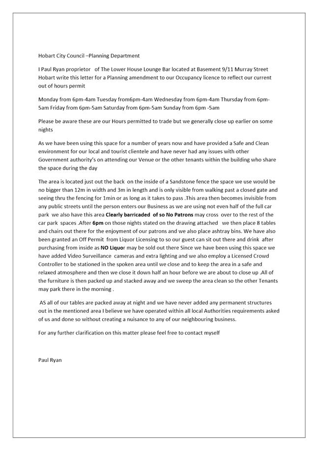
7.1.1 9 - 11 Murray Street, Hobart - Change of Operating Hours
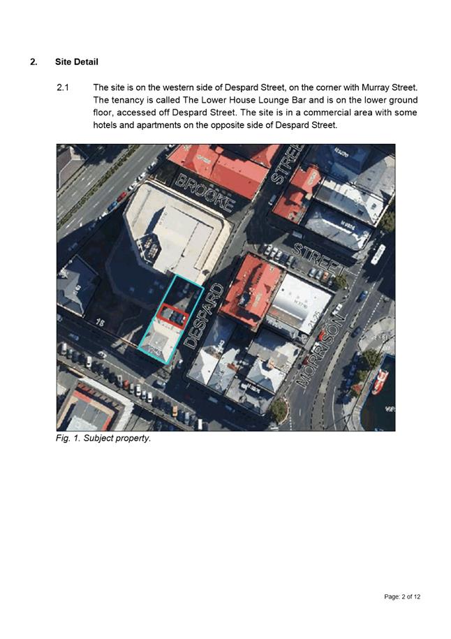
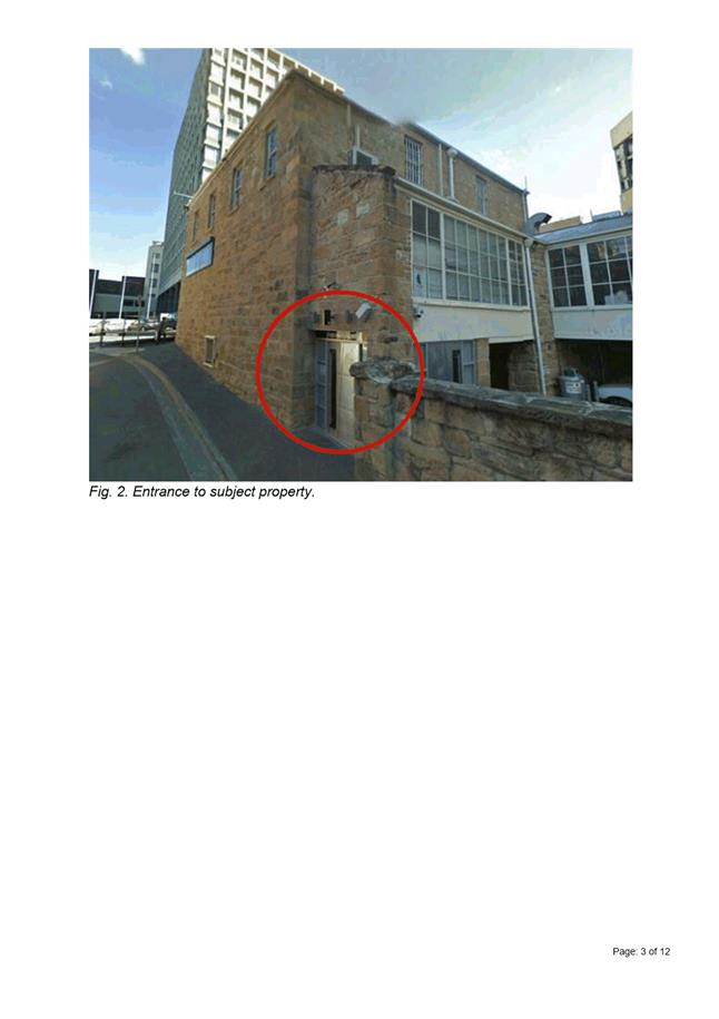
Address: 9 – 11 Murray Street, Hobart
Proposal: Change of Operating Hours
Expiry Date: 18 December 2018
Extension of Time: Not applicable
Author: Liz Wilson
|
REcommendation That: Pursuant to the Sullivans Cove Planning Scheme 1997, the Council approve the application for change of operating hours at 911 Murray Street HOBART for the reasons outlined in the officer’s report and a permit containing the following conditions be issued:
GEN
The use and/or development must be substantially in accordance with the documents and drawings that comprise PLN18777 911 MURRAY STREET HOBART TAS 7000 Final Planning Documents except where modified below.
Reason for condition
To clarify the scope of the permit.
PLN 6
The outdoor seating area must not be open to the public outside of the following hours:
· Monday 6pm to 4am · Tuesday 6pm to 4am · Wednesday 6pm to 4am · Friday 6pm to 5am · Saturday 6pm to 5am · Sunday 6pm to 5am
Reason for condition
To clarify the scope of the permit.
|
Attachment a: PLN-18-777
- 9-11 MURRAY STREET HOBART TAS 7000 - Planning Committee or Delegated Report ⇩ ![]()
Attachment
b: PLN-18-777
- 9-11 MURRAY STREET HOBART TAS 7000 - CPC Agenda Documents ⇩ ![]()
|
Item No. 7.1.1 |
Agenda (Open Portion) City Planning Committee Meeting - 10/12/2018 |
Page 10 ATTACHMENT a |
|
Agenda (Open Portion) City Planning Committee Meeting - 10/12/2018 |
Page 22 ATTACHMENT b |
|
Item No. 7.1.1 |
Agenda (Open Portion) City Planning Committee Meeting - 10/12/2018 |
Page 25 ATTACHMENT b |
|
Item No. 7.1.2 |
Agenda (Open Portion) City Planning Committee Meeting |
Page 26 |
|
|
10/12/2018 |
|
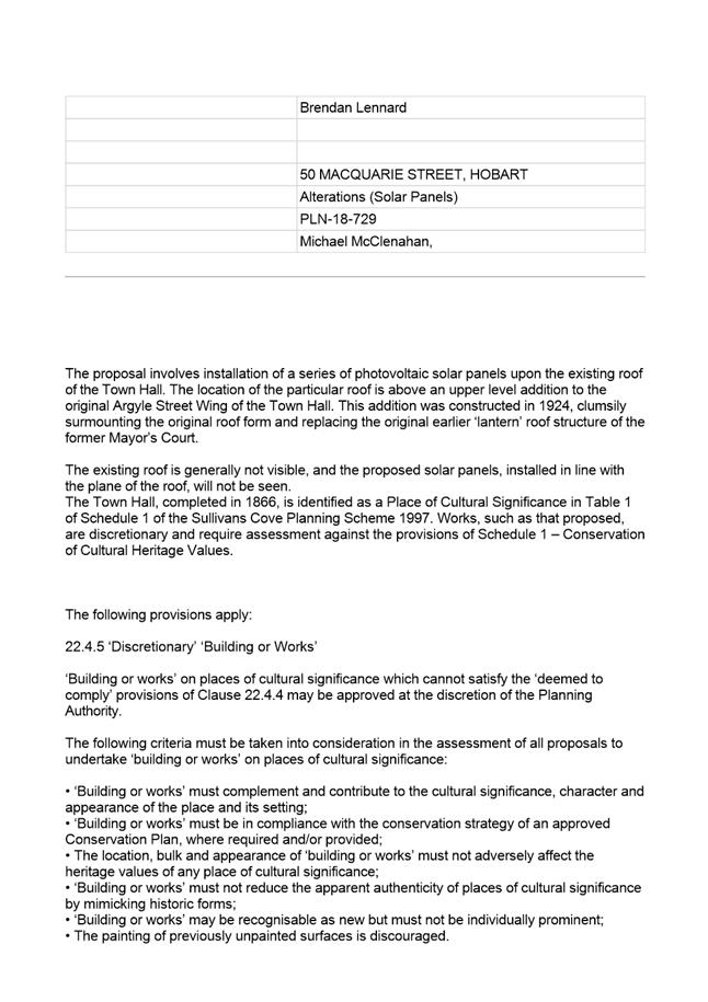
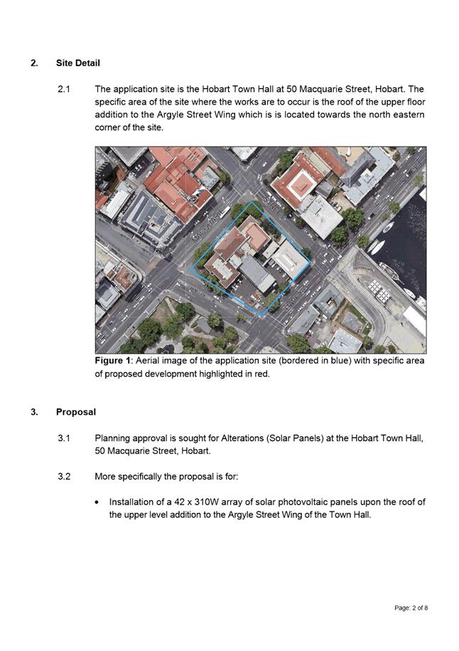
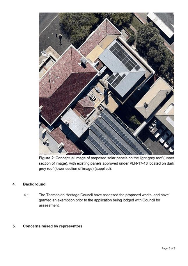
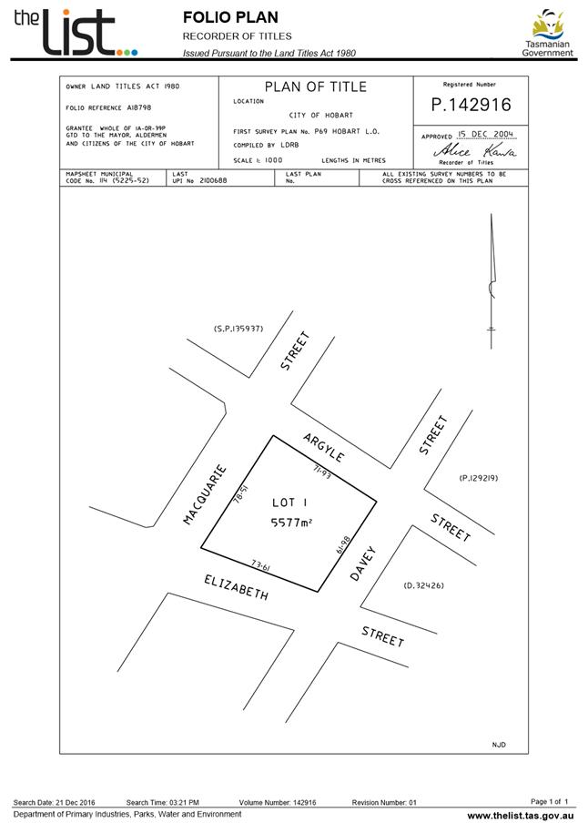
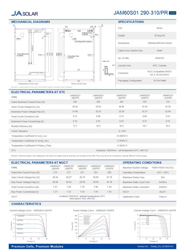
7.1.2 50 Macquarie Street Hobart - Alterations (Solar Panels)
Address: 50 Macquarie Street, Hobart
Proposal: Alterations (Solar Panels)
Expiry Date: 17 January 2019
Extension of Time: Not applicable
Author: Michael McClenahan
|
REcommendation That: Pursuant to the Sullivans Cove Planning Scheme 1997, the Council approve the application for alterations (solar panels) at 50 Macquarie Street, Hobart for the reasons outlined in the officer’s report and a permit containing the following conditions be issued:
GEN
The use and/or development must be substantially in accordance with the documents and drawings that comprise PLN18729 50 MACQUARIE STREET HOBART TAS 7000 Final Planning Documents except where modified below.
Reason for condition
To clarify the scope of the permit.
ADVICE
The following advice is provided to you to assist in the implementation of the planning permit that has been issued subject to the conditions above. The advice is not exhaustive and you must inform yourself of any other legislation, bylaws, regulations, codes or standards that will apply to your development under which you may need to obtain an approval. Visit the Council's website for further information.
Prior to any commencement of work on the site or commencement of use the following additional permits/approval may be required from the Hobart City Council.
BUILDING PERMIT
You may need building approval in accordance with the Building Act 2016. Click here for more information.
This is a Discretionary Planning Permit issued in accordance with section 57 of the Land Use Planning and Approvals Act 1993.
|
Attachment a: PLN-18-729
- 50 MACQUARIE STREET HOBART TAS 7000 - Planning Committee or Delegated Report ⇩ ![]()
Attachment
b: PLN-18-729
- 50 MACQUARIE STREET HOBART TAS 7000 - CPC Agenda Documents. ⇩ ![]()
Attachment
c: PLN-18-729
- 50 MACQUARIE STREET HOBART TAS 7000 - Planning Referral Officer Cultural
Heritage Report ⇩ ![]()
|
Item No. 7.1.2 |
Agenda (Open Portion) City Planning Committee Meeting - 10/12/2018 |
Page 28 ATTACHMENT a |
|
Agenda (Open Portion) City Planning Committee Meeting - 10/12/2018 |
Page 36 ATTACHMENT b |
|
Item No. 7.1.2 |
Agenda (Open Portion) City Planning Committee Meeting - 10/12/2018 |
Page 38 ATTACHMENT b |

|
Item No. 7.1.2 |
Agenda (Open Portion) City Planning Committee Meeting - 10/12/2018 |
Page 41 ATTACHMENT b |

|
Item No. 7.1.2 |
Agenda (Open Portion) City Planning Committee Meeting - 10/12/2018 |
Page 50 ATTACHMENT c |
|
Agenda (Open Portion) City Planning Committee Meeting |
Page 52 |
|
|
|
10/12/2018 |
|
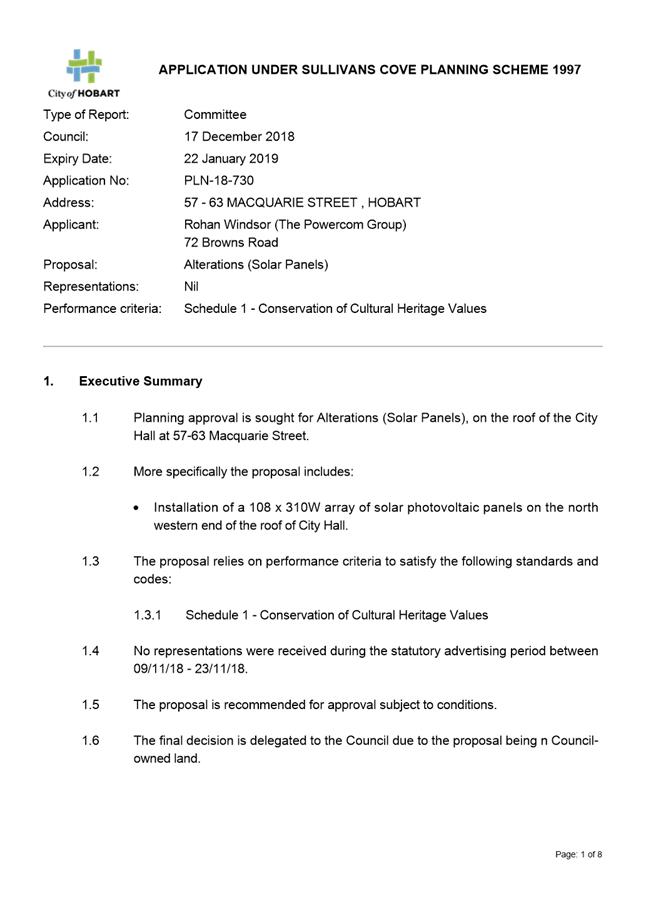
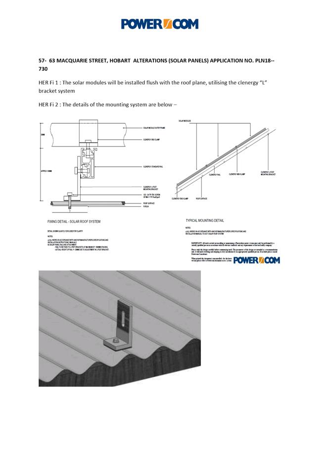
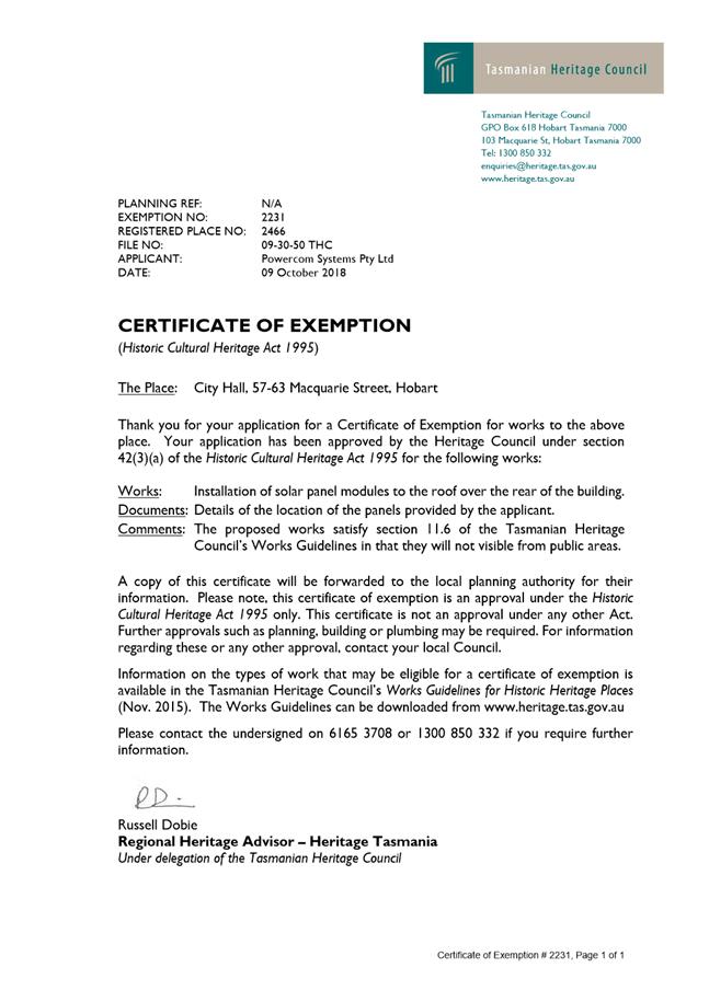
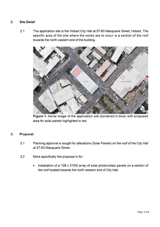
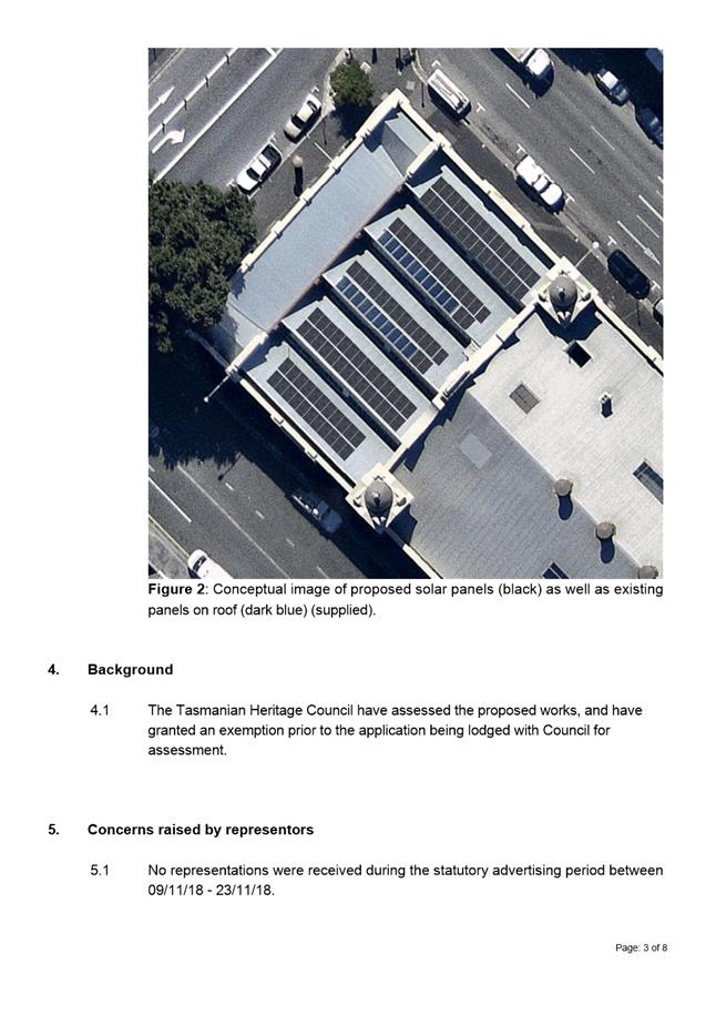
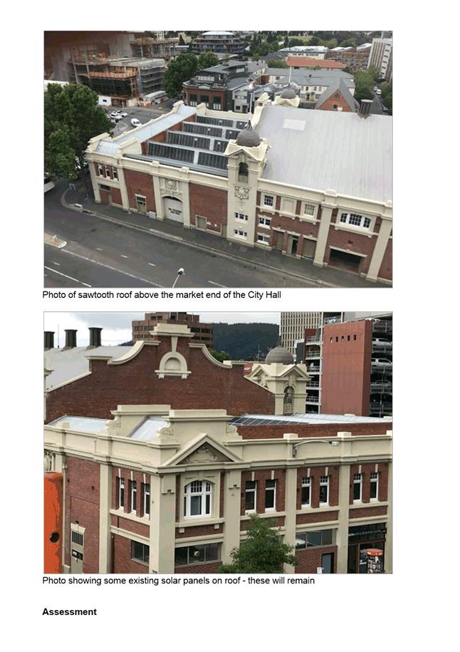
7.1.3 57 - 63 Macquarie Street, Hobart - (Alterations (Solar Panels)
Address: 57 – 63 Macquarie Street, Hobart
Proposal: Alterations (Solar Panels)
Expiry Date: 22 January 2019
Extension of Time: Not applicable
Author: Michael McClenahan
|
REcommendation That: Pursuant to the Sullivans Cove Planning Scheme 1997, the Council approve the application for alterations (solar panels) at 5763 Macquarie Street, Hobart for the reasons outlined in the officer’s report and a permit containing the following conditions be issued:
GEN
The use and/or development must be substantially in accordance with the documents and drawings that comprise PLN18730 5763 MACQUARIE STREET HOBART TAS 7000 Final Planning Documents except where modified below.
Reason for condition
To clarify the scope of the permit.
ADVICE
The following advice is provided to you to assist in the implementation of the planning permit that has been issued subject to the conditions above. The advice is not exhaustive and you must inform yourself of any other legislation, bylaws, regulations, codes or standards that will apply to your development under which you may need to obtain an approval. Visit the Council's website for further information.
Prior to any commencement of work on the site or commencement of use the following additional permits/approval may be required from the Hobart City Council.
BUILDING PERMIT
You may need building approval in accordance with the Building Act 2016. Click here for more information.
This is a Discretionary Planning Permit issued in accordance with section 57 of the Land Use Planning and Approvals Act 1993.
|
Attachment a: PLN-18-730
- 57-63 MACQUARIE STREET HOBART TAS 7000 - Planning Committee or Delegated
Report ⇩ ![]()
Attachment
b: PLN-18-730
- 57-63 MACQUARIE STREET HOBART TAS 7000 - CPC Agenda Documents. ⇩ ![]()
Attachment
c: PLN-18-730
- 57-63 MACQUARIE STREET HOBART TAS 7000 - Planning Referral Officer Cultural
Heritage Report ⇩ ![]()
|
Item No. 7.1.3 |
Agenda (Open Portion) City Planning Committee Meeting - 10/12/2018 |
Page 54 ATTACHMENT a |
|
Agenda (Open Portion) City Planning Committee Meeting - 10/12/2018 |
Page 62 ATTACHMENT b |

|
Item No. 7.1.3 |
Agenda (Open Portion) City Planning Committee Meeting - 10/12/2018 |
Page 69 ATTACHMENT b |
|
Item No. 7.1.3 |
Agenda (Open Portion) City Planning Committee Meeting - 10/12/2018 |
Page 70 ATTACHMENT b |

|
Item No. 7.1.3 |
Agenda (Open Portion) City Planning Committee Meeting - 10/12/2018 |
Page 93 ATTACHMENT c |

|
Agenda (Open Portion) City Planning Committee Meeting |
Page 96 |
|
|
|
10/12/2018 |
|
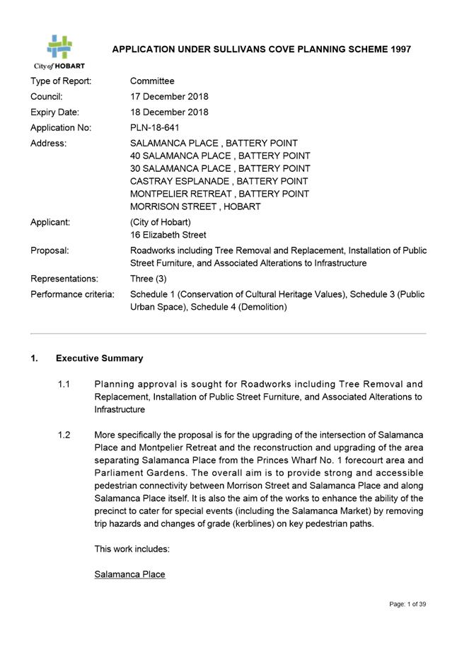
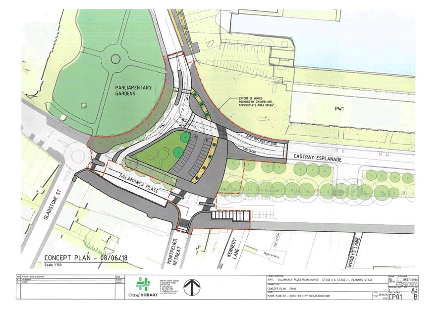
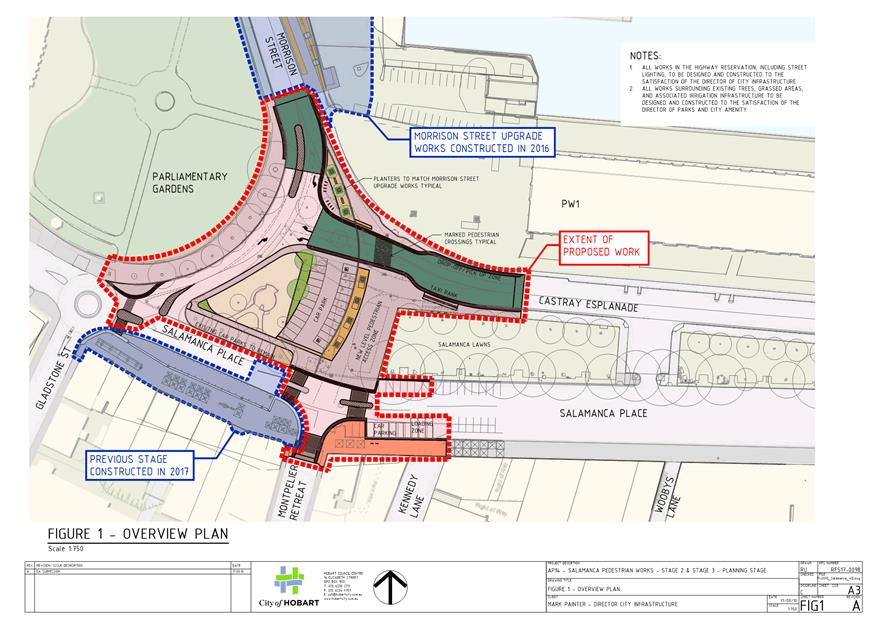
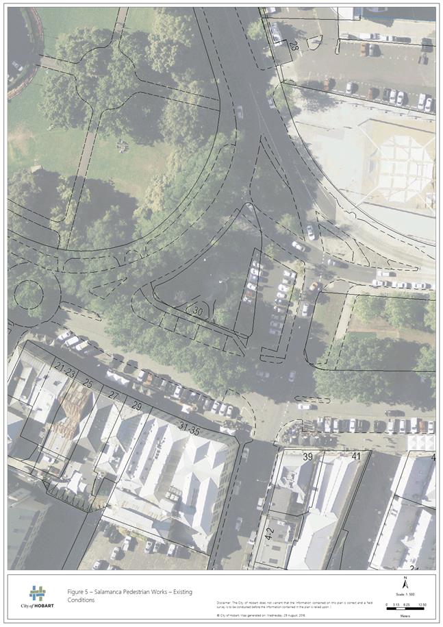
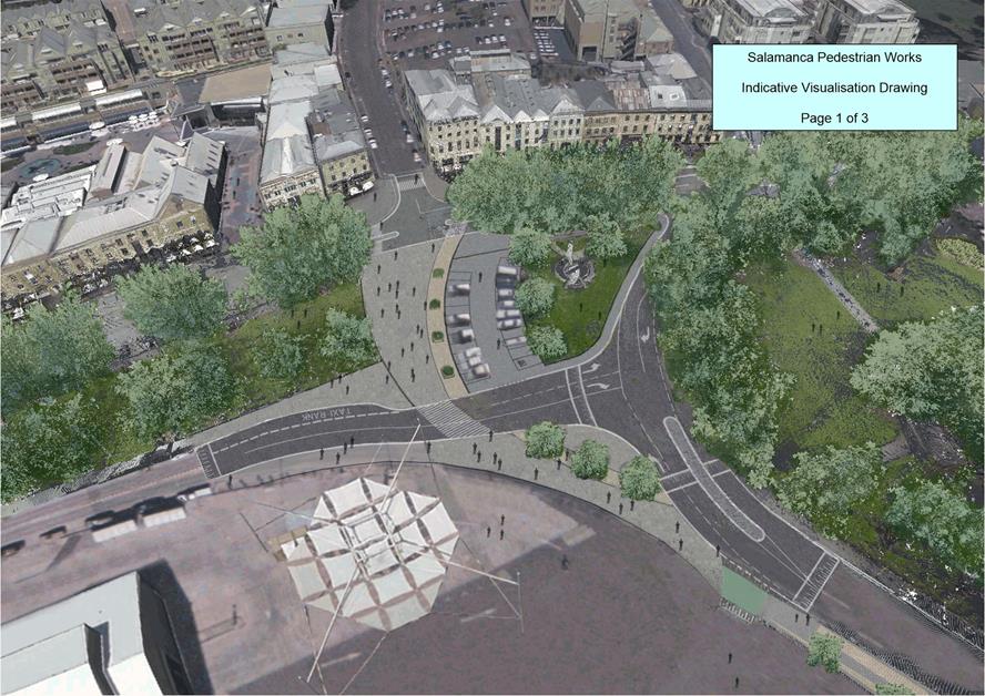
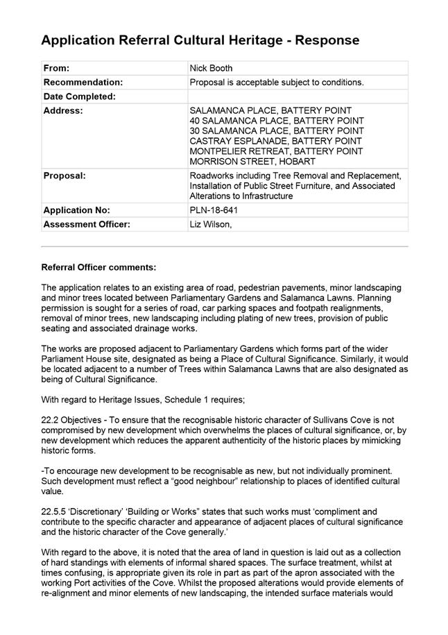
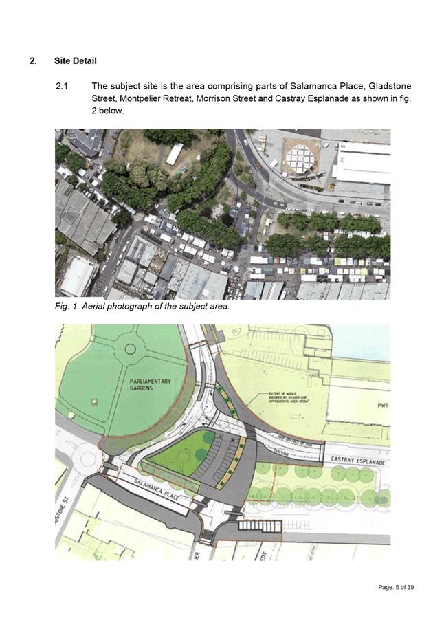
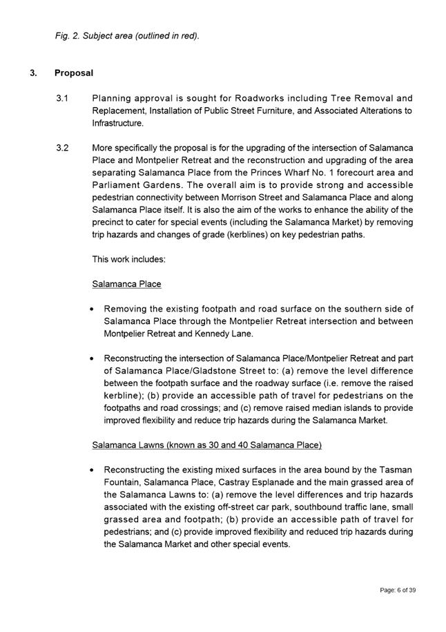
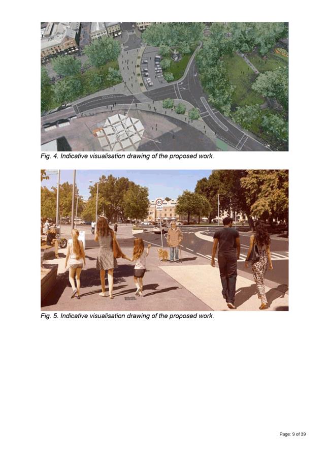
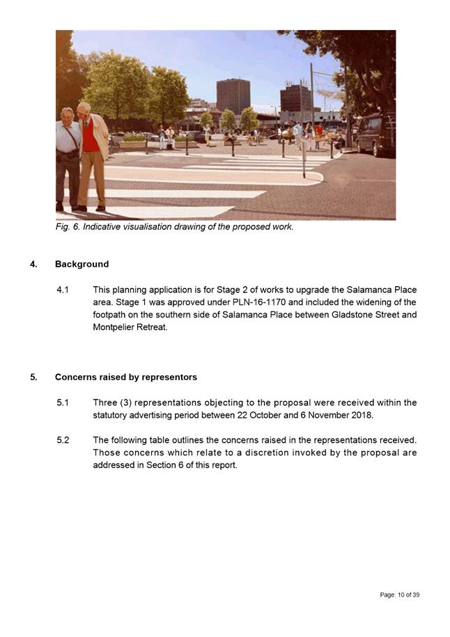
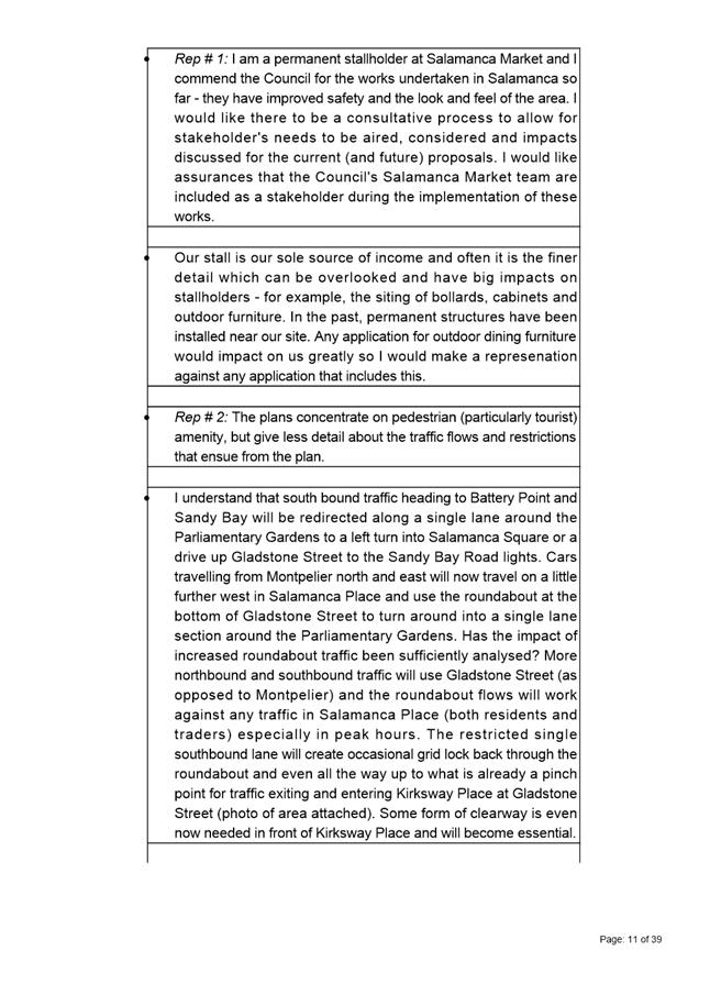
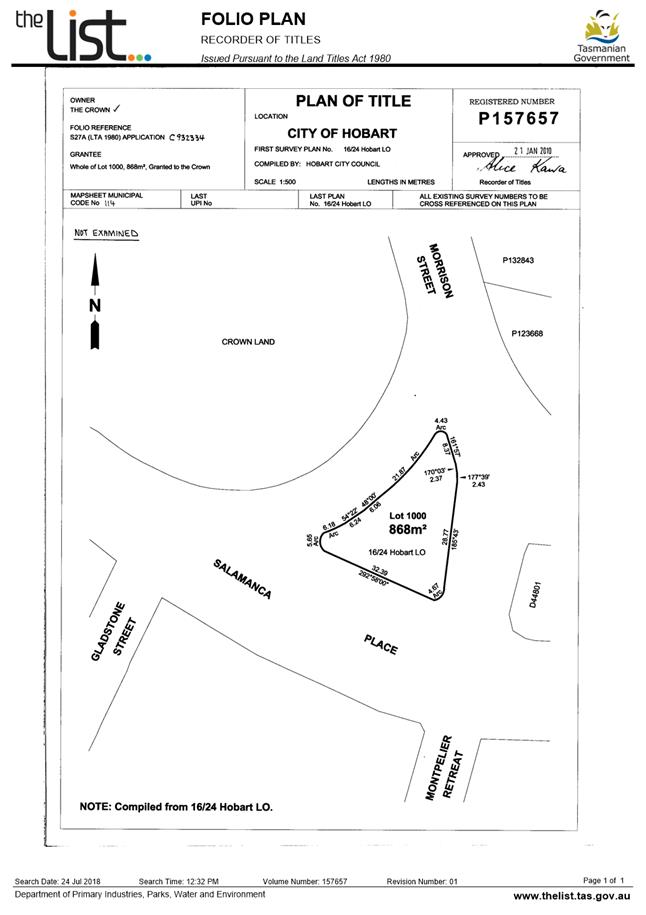
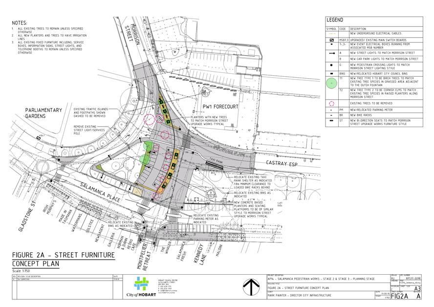
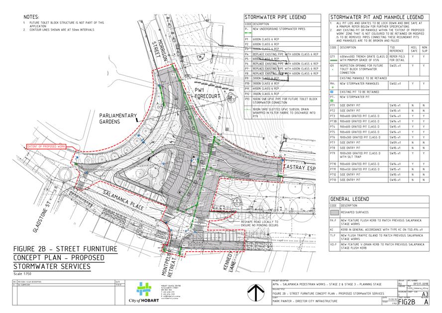
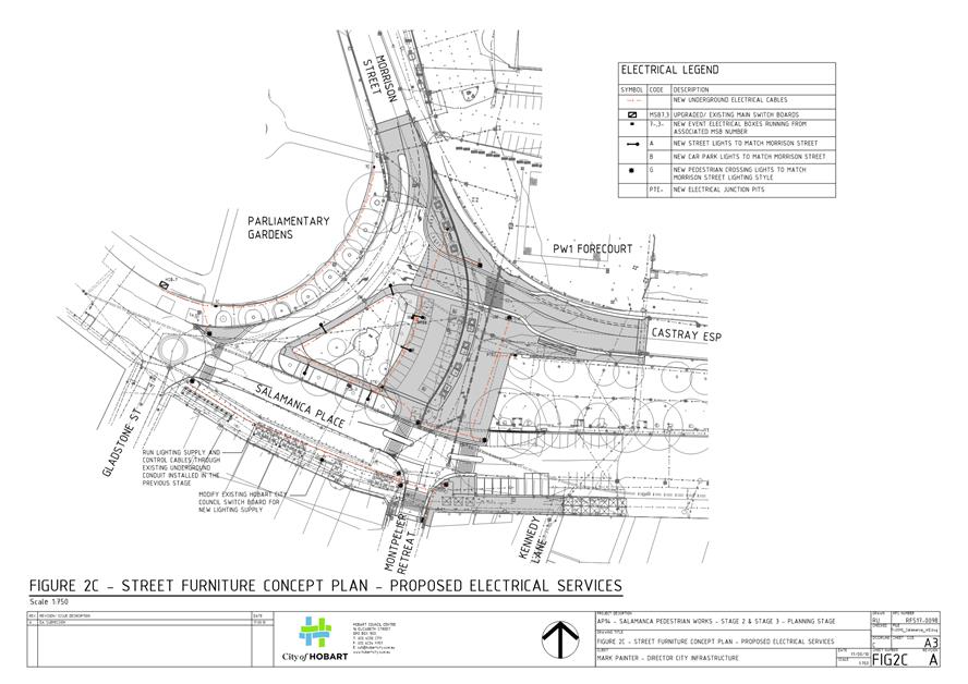
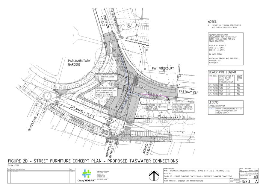
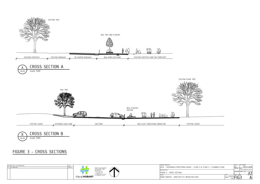
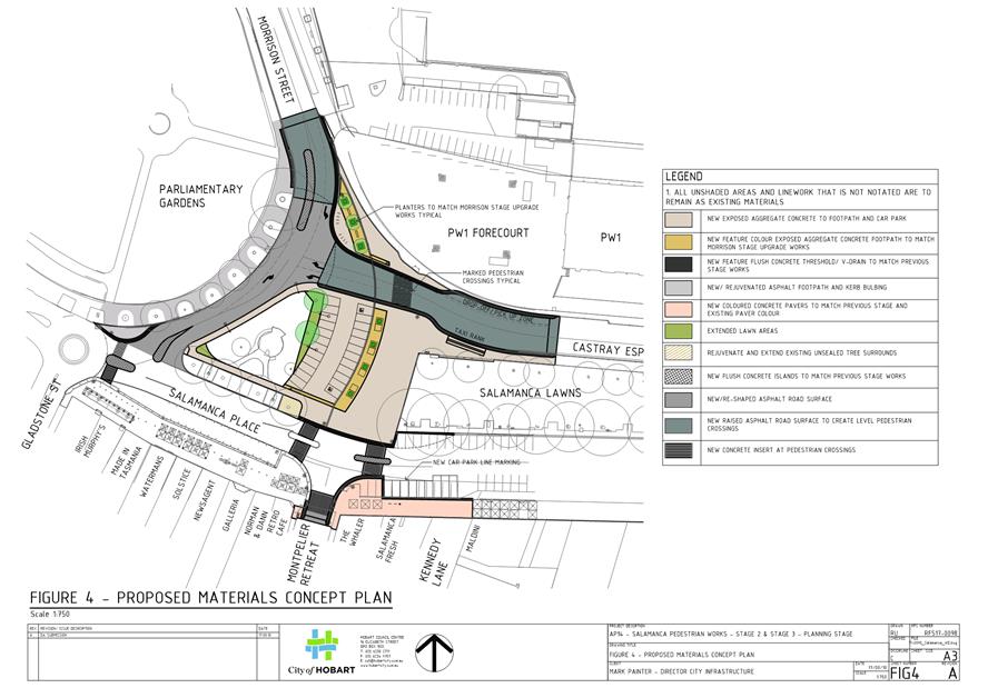
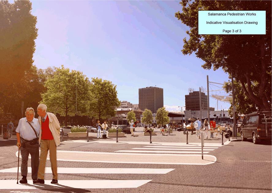
7.1.4 Salamanca Place & 40 Salamanca Place & 30 Salamanca Place & Castray Esplanade & Montpelier Retreat, Battery Point & Morrison Street, Hobart - Roadworks including Tree Removal and Replacement, installation of Public Street Furniture, and Associated Alterations to Infrastructure
Address: Salamanca Place & 40 Salamanca Place & 30 Salamanca Place & Castray Esplanade & Montpelier Retreat, Battery Point & Morrison Street, Hobart
Proposal: Roadworks including Tree Removal and Replacement, Installation of Public Street Furniture, and Associated Alterations to Infrastructure
Expiry Date: 18 December 2018
Extension of Time: Not applicable
Author: Liz Wilson
|
REcommendation That: Pursuant to the Sullivans Cove Planning Scheme 1997, the Council approve the application for roadworks including tree removal and replacement, installation of public street furniture, and associated alterations to infrastructure at Salamanca Place & 40 Salamanca Place & 30 Salamanca Place & Castray Esplanade & Montpelier Retreat, Battery Point & Morrison Street, Hobart for the reasons outlined in the officer’s report and a permit containing the following conditions be issued:
GEN
The use and/or development must be substantially in accordance with the documents and drawings that comprise PLN18641 SALAMANCA PLACE & 40 SALAMANCA PLACE & 30 SALAMANCA PLACE & CASTRAY ESPLANADE & MONTPELIER RETREAT, BATTERY POINT & MORRISON STREET, HOBART TAS 7004 Final Planning Documents except where modified below.
Reason for condition
To clarify the scope of the permit.
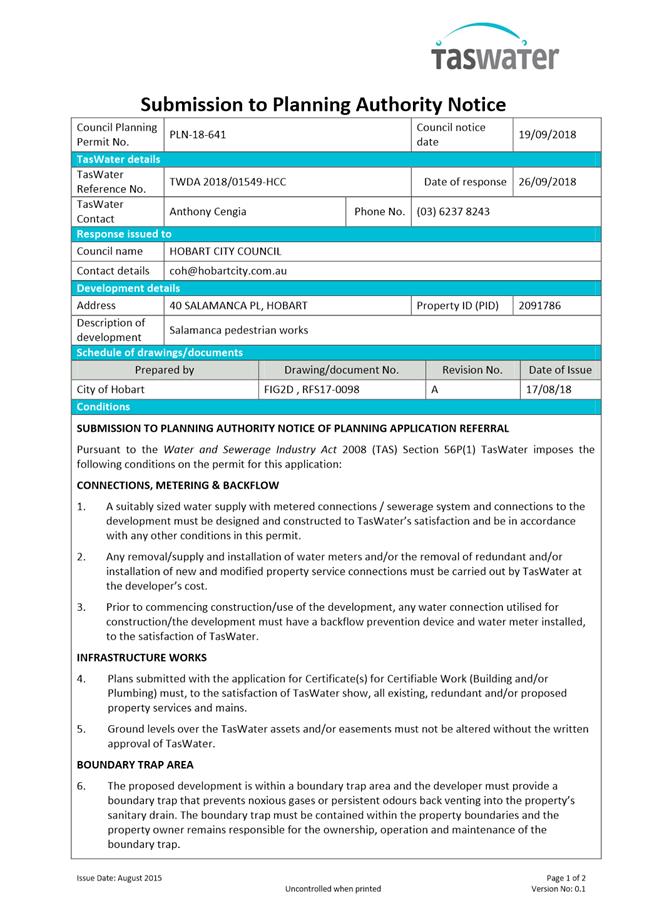
TW
The use and/or development must comply with the requirements of TasWater as detailed in the form Submission to Planning Authority Notice, Reference No. TWDA 2018/01549HCC dated 26 September 2018 as attached to the permit.
Reason for condition
To clarify the scope of the permit.
PLN s1
In the event of any discrepancies between the plans and the artist's impressions, the development must be constructed in accordance with the plans.
Reason for condition
To clarify the scope of the permit.
ENG sw2.1
A pre construction CCTV video of the Council stormwater mains beneath the proposed new pavement, along with photos of any drainage structures to be connected to or modified, must be submitted to Council prior to the commencement of work.
Reason for condition
To ensure that any of the Council infrastructure and/or siterelated service connections affected by the proposal will be altered and/or reinstated at the owner’s full cost.
ENG sw2.2
A post construction CCTV video of the Council stormwater mains beneath the new pavement, along with photos of any existing drainage structures connected to or modified as part of the development, must be submitted to Council upon completion of all work.
The post construction CCTV & photos will be relied upon to establish the extent of any damage caused to the Council’s infrastructure during construction. In the event that the owner/developer fails to provide to Council the pre construction CCTV, then any damage to Council's infrastructure identified in the post construction CCTV will be deemed to be the responsibility of the owner.
Reason for condition
To ensure that any of the Council infrastructure and/or siterelated service connections affected by the proposal will be altered and/or reinstated at the owner’s full cost.
ENG sw5
The new stormwater infrastructure must be designed and constructed prior to the commencement of the use.
Engineering plans and computations prepared by a suitably qualified and experienced civil engineer must be submitted to and approved by Council prior to commencement of work. The plans must include:
1. Plan and sectional views of the proposed stormwater infrastructure.
2. Finished surface contours of the proposed new pavement areas ensuring that all low points are adequately drained.
3. Longitudinal section and cross sections of the 1% AEP flow path.
4. Pavement design in accordance with the Austroads Guide to Pavement Technology.
5. Construction management plan that incorporates contingency measures to be implemented in the event of a significant storm occurring during replacement of the 600mm stormwater main.
All work required by this condition must be undertaken in accordance with the approved engineering drawings.
Advice:
· The applicant is required submit detailed design documentation to satisfy this condition via Council's planning condition endorsement process (noting there is a fee associated with condition endorsement approval of engineering drawings [see general advice on how to obtain condition endorsement and for fees and charges]). This is a separate process to any building approval under the Building Act 2016.
Reason for condition
To ensure Council’s hydraulic infrastructure meets acceptable standards.
ENG sw6
All stormwater from the proposed development must be discharged to the Council’s stormwater infrastructure with sufficient receiving capacity prior to commencement of use. All costs associated with works required by this condition are to be met by the owner.
Design drawings of the proposed connections to Council's stormwater infrastructure, prepared by a suitably experienced civil engineer, must be submitted to and approved by Council prior to the commencement of work. The design drawings and calculations must include:
1. Details of the proposed methods of connection.
2. Existing and proposed invert and finished surface levels, structure sizes and specifications etc.
3. A clear delineation between public and private drainage infrastructure where applicable.
All work required by this condition must be undertaken in accordance with the approved design drawings and the current standards and specifications of the City of Hobart.
Advice:
· The applicant is advised to submit detailed design drawings as part of their Plumbing Permit Application. If detailed design to satisfy this condition is submitted via the planning condition endorsement process there may be fees associated with the assessment, and once approved the applicant will still need to obtain a plumbing permit for the works.
Reason for condition
To ensure that stormwater from the site will be discharged to a suitable Council approved outlet.
ENG 3a
The vehicular access and parking module (parking spaces, aisles and manoeuvring area) for the proposed car park off of Castray Esplanade must be designed and constructed generally in accordance with Australian Standard AS/NZS2890.1:2004 and AS/NZS2890.6:2009, or a Council approved alternate design certified by a suitably qualified engineer to provide a safe and efficient access, and enable safe, easy and efficient use. A turning area must be provided to ensure vehicles can exit the car park in a forward direction.
Advice:
· It is advised that the designer consider left hand exit only from the Castray Esplanade car park access.
Reason for condition
To ensure the safety of users of the access and parking module, and compliance with the relevant Australian Standard. ENG 1
The cost of repair of any damage to the Council's infrastructure resulting from the implementation of this permit, must be met by the owners within 30 days of the completion of the development or as otherwise determined by the Council.
A photographic record of the Council's infrastructure adjacent to the subject site must be provided to the Council prior to any commencement of works.
A photographic record of the Council’s infrastructure (e.g. existing property service connection points, roads, buildings, stormwater, footpaths, driveway crossovers and nature strips, including if any, preexisting damage) will be relied upon to establish the extent of damage caused to the Council’s infrastructure during construction. In the event that the owner/developer fails to provide to the Council a photographic record of the Council’s infrastructure, then any damage to the Council's infrastructure found on completion of works will be deemed to be the responsibility of the owner.
Reason for condition
To ensure that any of the Council's infrastructure and/or siterelated service connections affected by the proposal will be altered and/or reinstated at the owner’s full cost.
ENG s1
Prior to the commencement of works, detail drawings of the proposed works within the highway reservations must be submitted to and approved by the Council's Director City Infrastructure. The detail drawings must include a street lighting design, tree planting details, location of new and existing infrastructure and ownership of infrastructure. All road infrastructure drawings are to be designed by a suitably qualified and experienced person in accordance with the Institute of Public Works Engineering Tasmanian Standard Drawings and Guidelines, the Department of State Growth Specifications, street lighting to AS/NZS 1158 series and all other relevant standards, guidelines and procedures.
All work required by this condition must be undertaken in accordance with the approved detail drawings.
Advice:
· Once the detail drawings have been approved, the Council will issue a condition endorsement (see general advice on how to obtain condition endorsement). · The street lighting must be provided in accordance with the requirements of TasNetwork and the City. · Speed humps will require the approval of State Growth to be obtained by the developer.
Reason for condition
To ensure works are undertaken in accordance with Council requirements.
ENG s2
Prior to the issue of a completion certificate, as constructed drawings and specifications for infrastructure within the highway reservations must be submitted to the City to the satisfaction of the Director City Infrastructure which includes detail electrical plans.
Reason for condition
To ensure works are undertaken in accordance with Council requirements.
ENV 1
Sediment and erosion control measures sufficient to prevent sediment from leaving the site must be installed prior to any disturbance of the site, and maintained until all areas of disturbance have been stabilized or revegetated.
Advice: For further guidance in preparing a Soil and Water Management Plan – in accordance with Fact sheet 3 Derwent Estuary Program click here.
Reason for condition
To avoid the sedimentation of roads, drains, natural watercourses, Council land that could be caused by erosion and runoff from the development, and to comply with relevant State legislation.
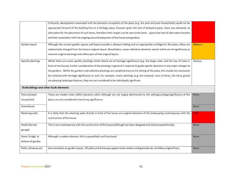
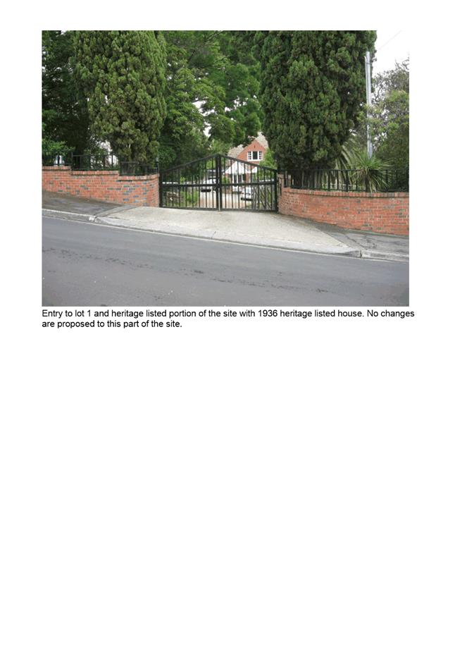
HER 12
The rocks and stonework that forms the boundary edge of the Parliamentary Gardens must be protected and conserved during the approved construction.
Prior to the issue of any approval under the Building Act 2016, documentation must be submitted and approved which details how the rocks and stonework are to be protected during construction process in accordance with the above requirement.
All work required by this condition must be undertaken in accordance with the approved documentation.
Reason for condition
To ensure that development at a heritage place is undertaken in a sympathetic manner which does not cause loss of historic cultural heritage significance.
HER 6
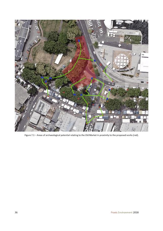
The Statement of Archaeological Potential and Archaeological Method Statement produced by Praxis Environment dated August 2018 shall be implemented in full in accordance with the recommendations of the report.
Within the Zones identified as being of medium to high potential, all onsite excavation and disturbance must be conducted and monitored by a suitably qualified archaeologist. All and any recommendations made by the archaeologist engaged in accordance with above must be complied with in full; and all features and/or deposits discovered must be reported to the Council within 2 working days of the discovery; and a copy of the archaeologists advice, assessment and recommendations obtained in accordance with above must be provided to Council within 5 working days of receipt of the advice, assessment and recommendations.
Excavation and/or disturbance must not recommence unless and until approval is granted from the Council.
Reason for condition
To ensure that work is planned and implemented in a manner that seeks to understand, retain, protect, preserve and manage significant archaeological evidence.
HER 18
All trees within the boundary of the site, or within 10 metres of the extent of the works except those already approved for removal must be protected throughout excavation and post construction.
A report must be submitted for approval prior to the commencement of work. The report must:
1. Be prepared by a suitable qualified person; and
2. Show all tree protection zones and relevant measures specified under Section 3 Determining the Protection Zones of the Selected Trees, Section 4 Tree Protection Measures and Section 5 Monitoring and Certification of AS49702009 Protection of trees on development sites, around (tree details).
All work required by this condition must be undertaken in accordance with the approved report.
Advice:
· Once the report has been approved, the Council will issue a condition endorsement (see general advice on how to obtain condition endorsement).
· Where building approval is also required, it is recommended that documentation for condition endorsement be submitted well before submitting documentation for building approval. Failure to address condition endorsement requirements prior to submitting for building approval may result in unexpected delays.
Reason for condition
To ensure that significant trees are not unnecessarily destroyed and are managed in a way that maintains their health and appearance.
ADVICE
The following advice is provided to you to assist in the implementation of the planning permit that has been issued subject to the conditions above. The advice is not exhaustive and you must inform yourself of any other legislation, bylaws, regulations, codes or standards that will apply to your development under which you may need to obtain an approval. Visit the Council's website for further information.
Prior to any commencement of work on the site or commencement of use the following additional permits/approval may be required from the Hobart City Council.
CONDITION ENDORSEMENT PLANNING
As a condition endorsement is required by a planning condition above, you will need to submit the relevant documentation to satisfy the condition via the Condition Endorsement Submission on Council's online services eplanning
Where building approval is also required, it is recommended that documentation for condition endorsement be submitted well before submitting documentation for building approval. Failure to address condition endorsement requirements prior to submitting for building approval may result in unexpected delays.
Once approved, the Council will respond to you via email that the condition has been endorsed (satisfied). Detailed instructions can be found here.
CONDITION ENDORSEMENT ENGINEERING
All engineering drawings required to be submitted and approved by this planning permit must be submitted to the City of Hobart as a CEP (Condition Endorsement) via the City’s Online Service Development Portal. When lodging a CEP, please reference the PLN number of the associated Planning Application. Each CEP must also include an estimation of the cost of works shown on the submitted engineering drawings. Once that estimation has been confirmed by the City’s Engineer, the following fees are payable for each CEP submitted and must be paid prior to the City of Hobart commencing assessment of the engineering drawings in each CEP:
Value of Building Works Approved by Planning Permit Fee:
· Up to $20,000: $150 per application. · Over $20,000: 2% of the value of the works as assessed by the City's Engineer per assessment.
These fees are additional to building and plumbing fees charged under the Building and Plumbing Regulations.
Once the CEP is lodged via the Online Service Development Portal, if the value of building works approved by your planning permit is over $20,000, please contact the City’s Development Engineer on 6238 2715 to confirm the estimation of the cost of works shown on the submitted engineering drawings has been accepted.
Once confirmed, pleased call one of the City’s Customer Service Officers on 6238 2190 to make payment, quoting the reference number (ie. CEP number) of the Condition Endorsement you have lodged. Once payment is made, your engineering drawings will be assessed.
BUILDING PERMIT
You may need building approval in accordance with the Building Act 2016. Click here for more information.
This is a Discretionary Planning Permit issued in accordance with section 57 of the Land Use Planning and Approvals Act 1993.
PLUMBING PERMIT
You may need plumbing approval in accordance with the Building Act 2016, Building Regulations 2016 and the National Construction Code. Click here for more information.
WASTE DISPOSAL
It is recommended that the developer liaise with the Council’s Cleansing and Solid Waste Unit regarding reducing, reusing and recycling materials associated with demolition on the site to minimise solid waste being directed to landfill.
Further information regarding waste disposal can also be found on the Council’s website.
DIAL BEFORE YOU DIG
Click here for dial before you dig information.
|
Attachment a: PLN-18-641
- SALAMANCA PLACE BATTERY POINT TAS 7004 - Planning Committee or Delegated
Report ⇩ ![]()
Attachment
b: PLN-18-641
- SALAMANCA PLACE & 40 SALAMANCA PLACE & 30 SALAMANCA PLACE &
CASTRAY ESPLANADE & MONTPELIER RETREAT, BATTERY POINT & MORRISON
STREET, HOBART TAS 7004 - CPC Agenda Documents ⇩ ![]()
Attachment
c: PLN-18-641
- SALAMANCA PLACE & 40 SALAMANCA PLACE & 30 SALAMANCA PLACE &
CASTRAY ESPLANADE & MONTPELIER RETREAT, BATTERY POINT & MORRISON
STREET, HOBART TAS 7004 - Planning Referral Officer Cultural Heritage Report ⇩ ![]()
|
Item No. 7.1.4 |
Agenda (Open Portion) City Planning Committee Meeting - 10/12/2018 |
Page 108 ATTACHMENT a |

|
Agenda (Open Portion) City Planning Committee Meeting - 10/12/2018 |
Page 147 ATTACHMENT b |
|
Item No. 7.1.4 |
Agenda (Open Portion) City Planning Committee Meeting - 10/12/2018 |
Page 153 ATTACHMENT b |
|
Item No. 7.1.4 |
Agenda (Open Portion) City Planning Committee Meeting - 10/12/2018 |
Page 156 ATTACHMENT b |
|
Item No. 7.1.4 |
Agenda (Open Portion) City Planning Committee Meeting - 10/12/2018 |
Page 169 ATTACHMENT b |
|
Item No. 7.1.4 |
Agenda (Open Portion) City Planning Committee Meeting - 10/12/2018 |
Page 177 ATTACHMENT b |
|
Item No. 7.1.4 |
Agenda (Open Portion) City Planning Committee Meeting - 10/12/2018 |
Page 178 ATTACHMENT b |

|
Item No. 7.1.4 |
Agenda (Open Portion) City Planning Committee Meeting - 10/12/2018 |
Page 182 ATTACHMENT b |


|
Item No. 7.1.4 |
Agenda (Open Portion) City Planning Committee Meeting - 10/12/2018 |
Page 222 ATTACHMENT c |

|
Agenda (Open Portion) City Planning Committee Meeting |
Page 226 |
|
|
|
10/12/2018 |
|
7.2 Applications under the Hobart Interim Planning Scheme 2015
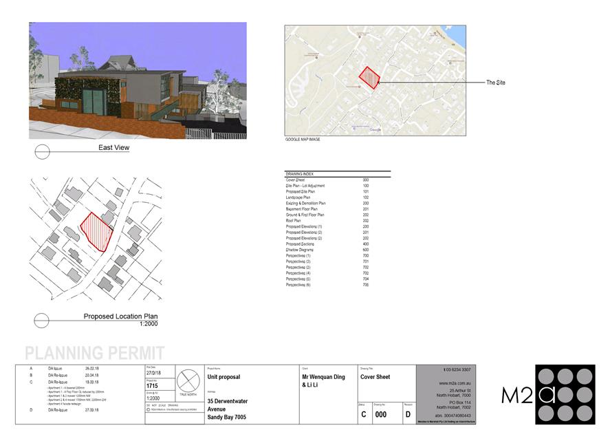
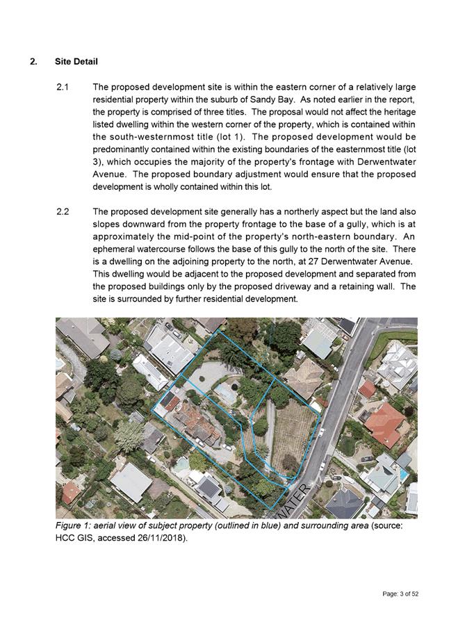
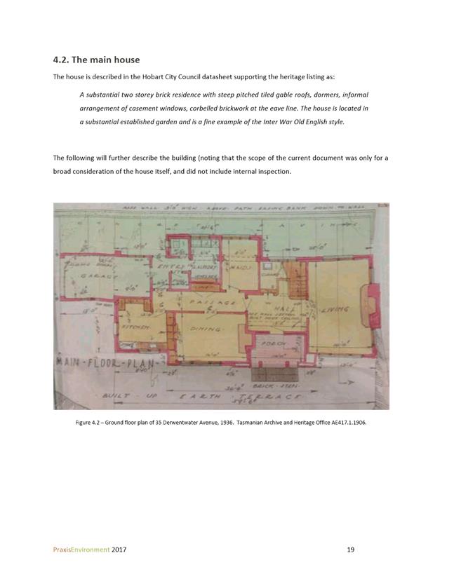
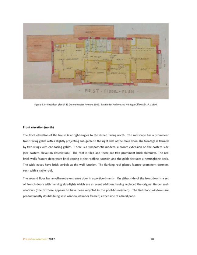
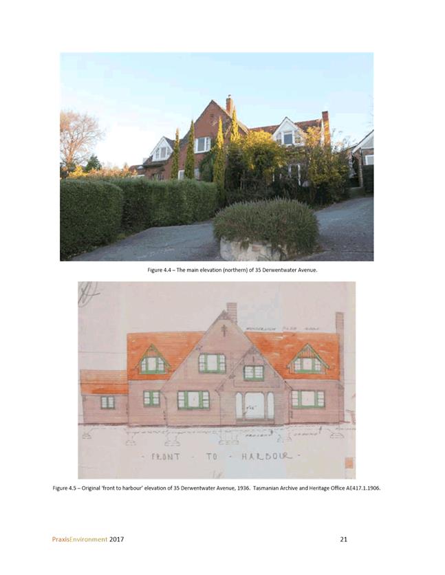
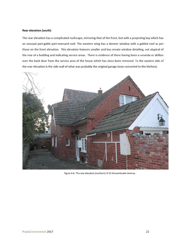
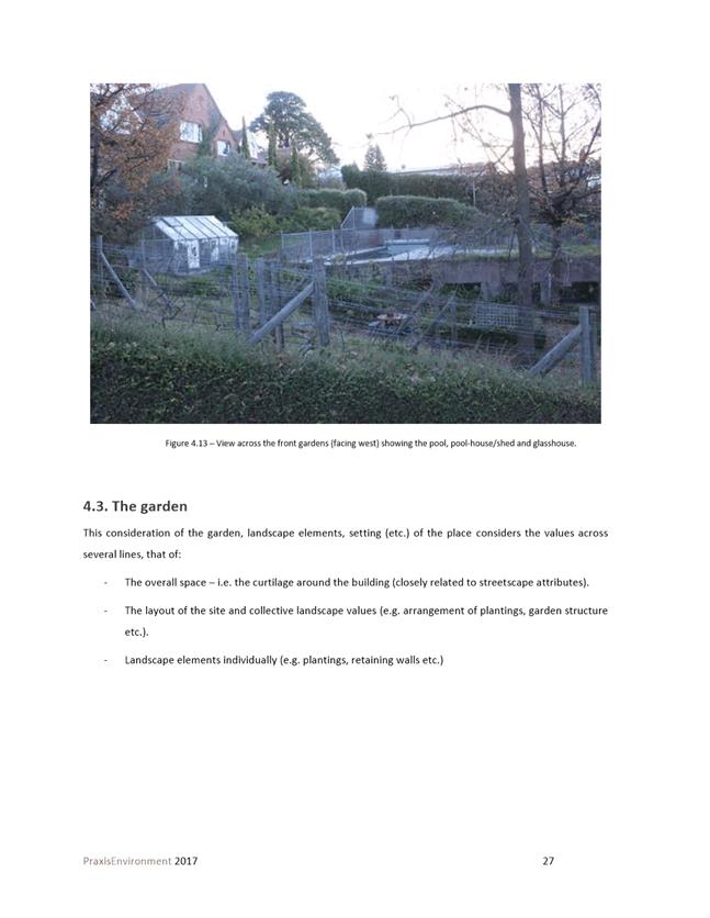
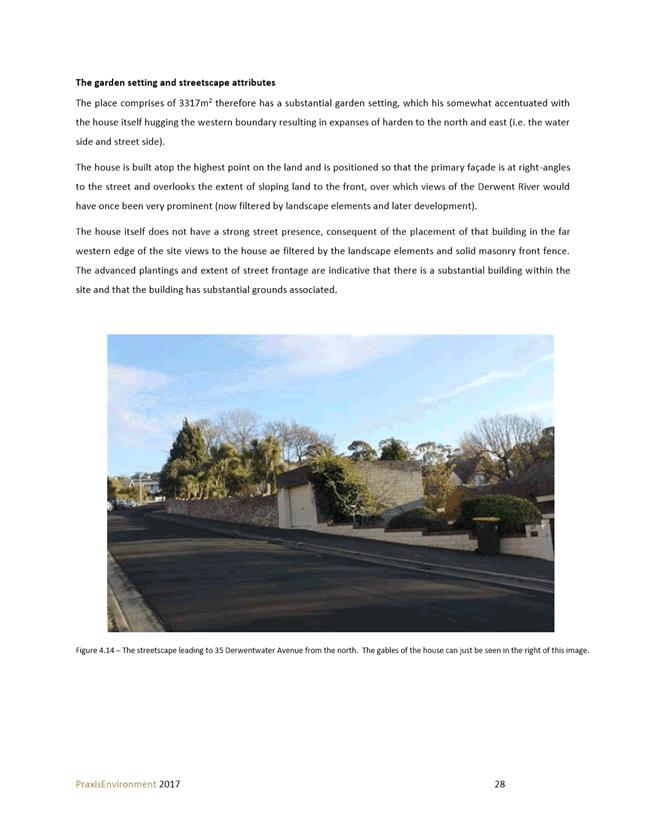
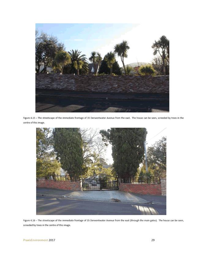
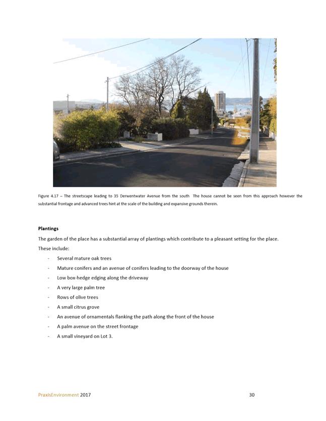
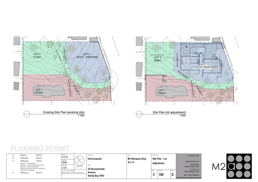
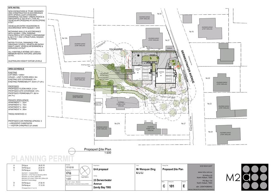
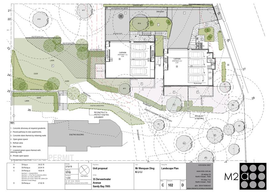
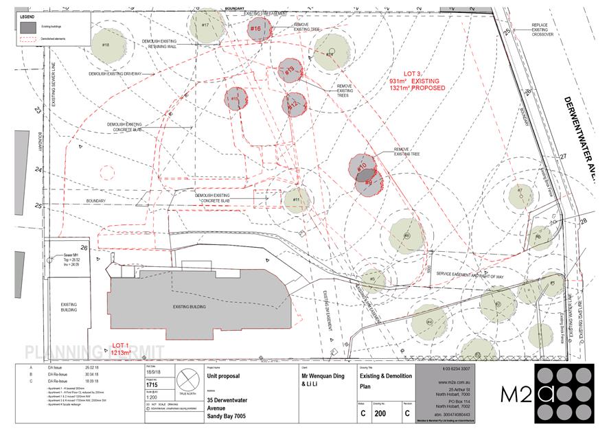
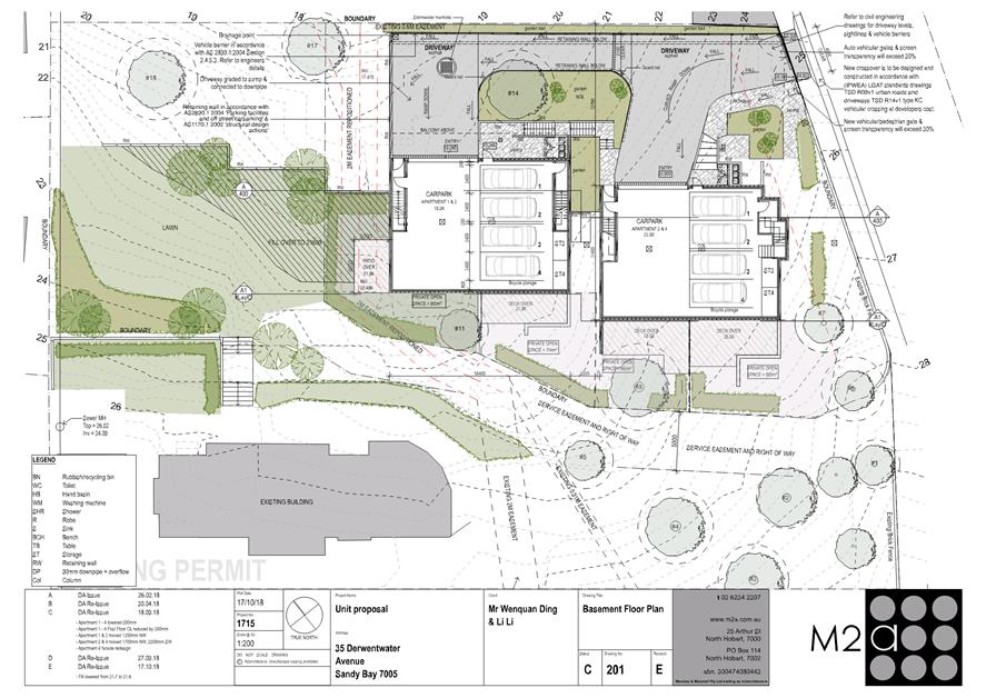
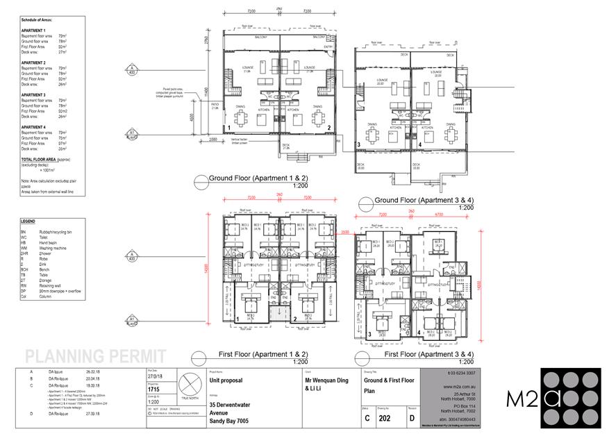
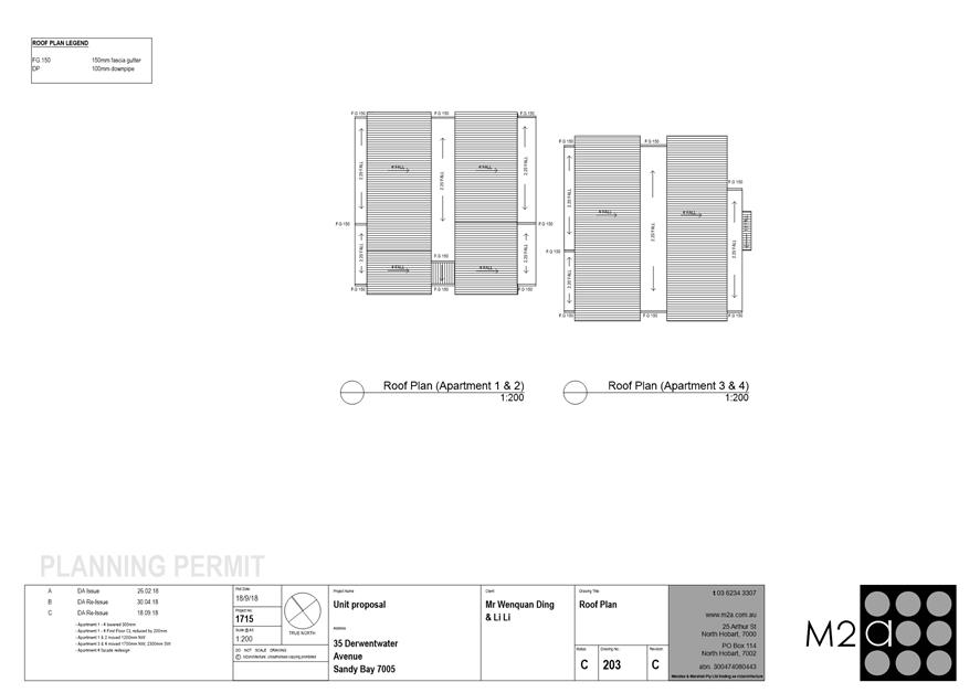
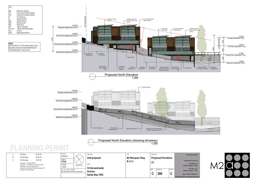
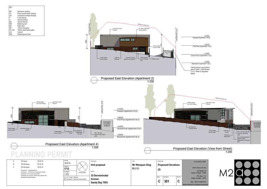
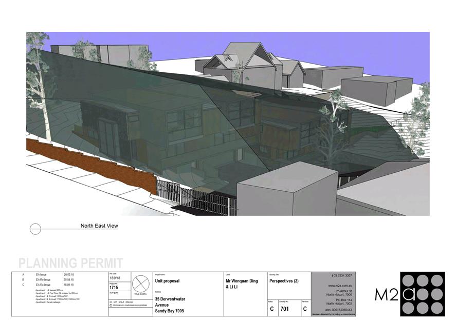
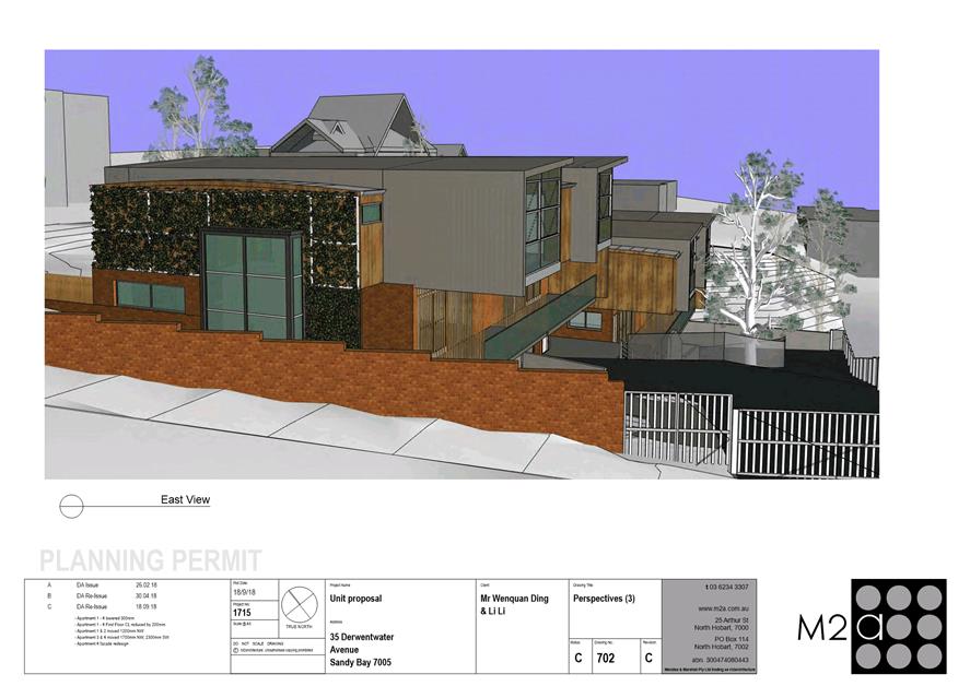
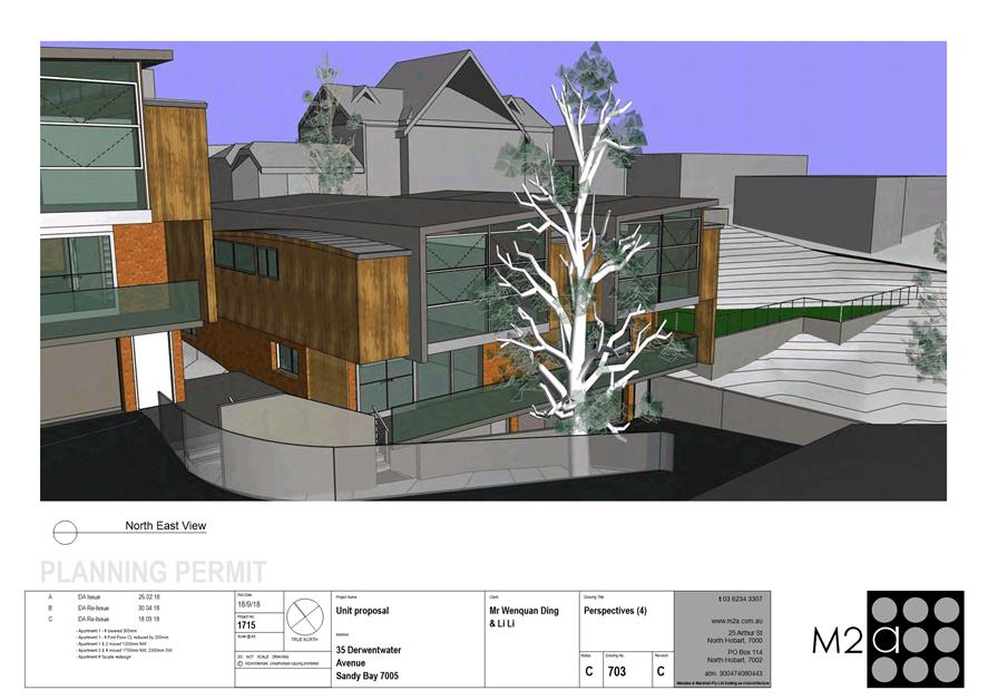
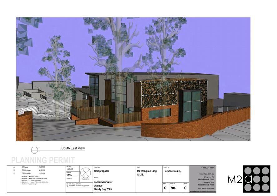
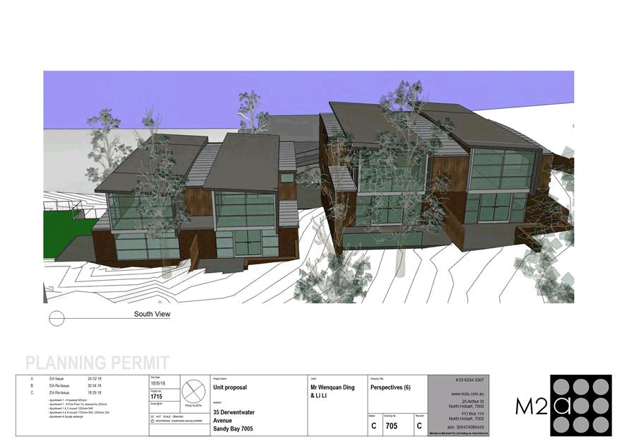
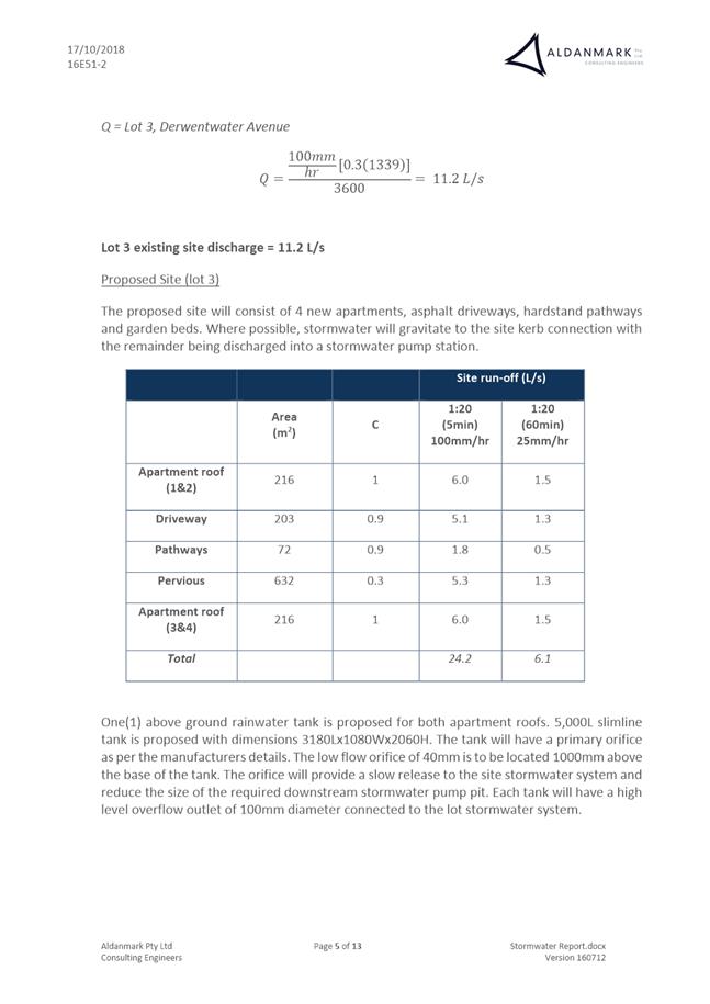
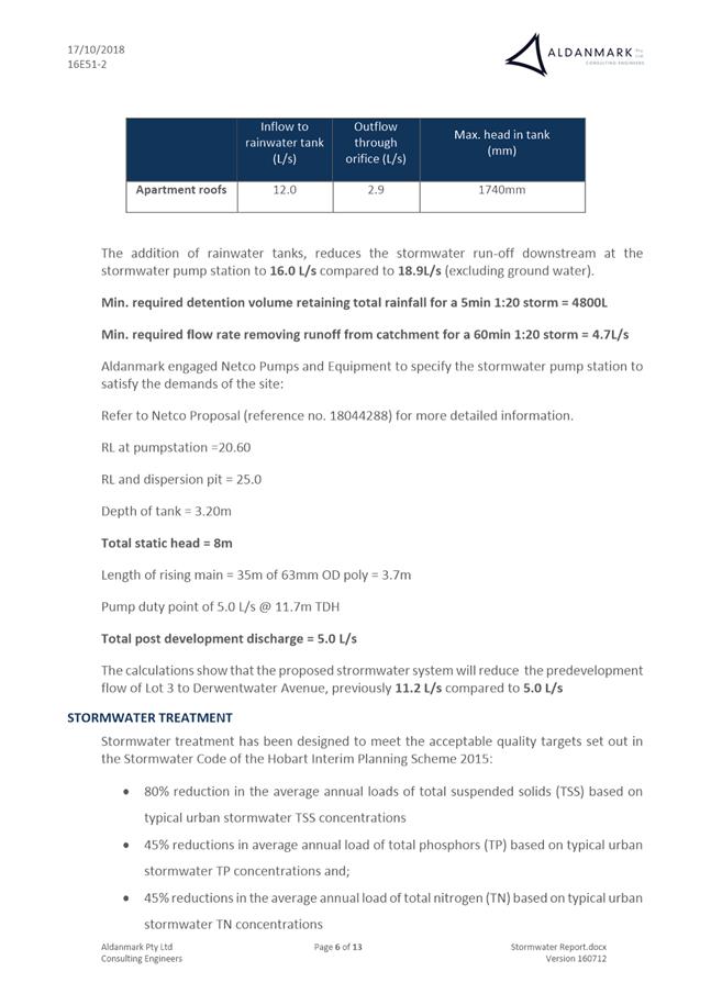
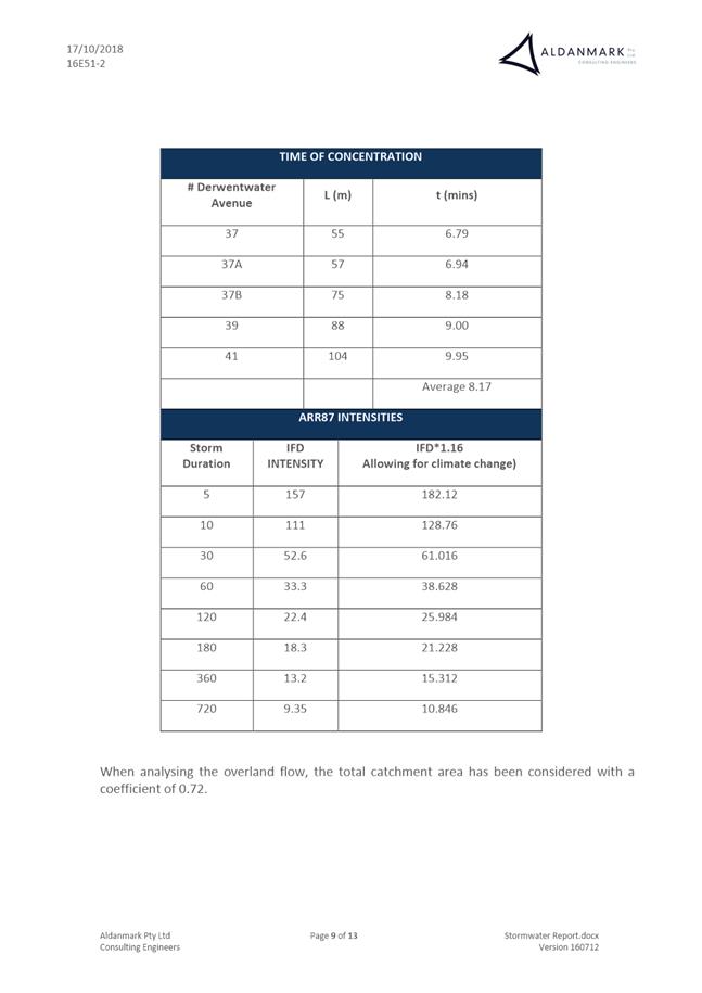
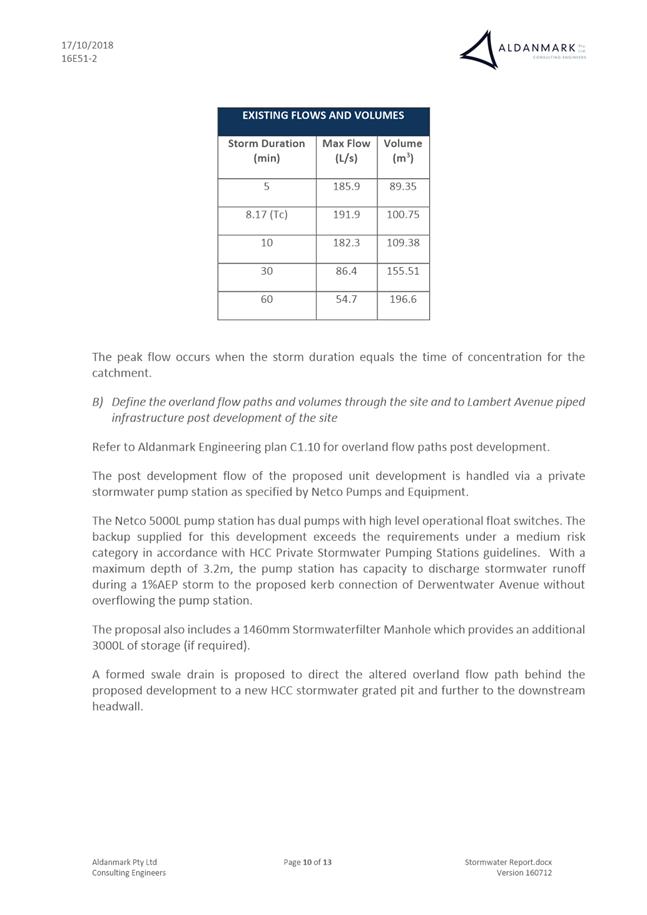
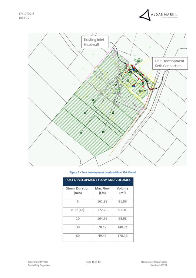
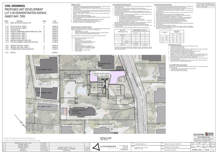
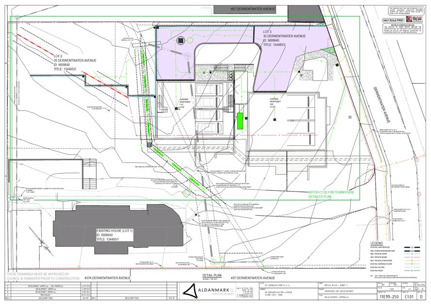
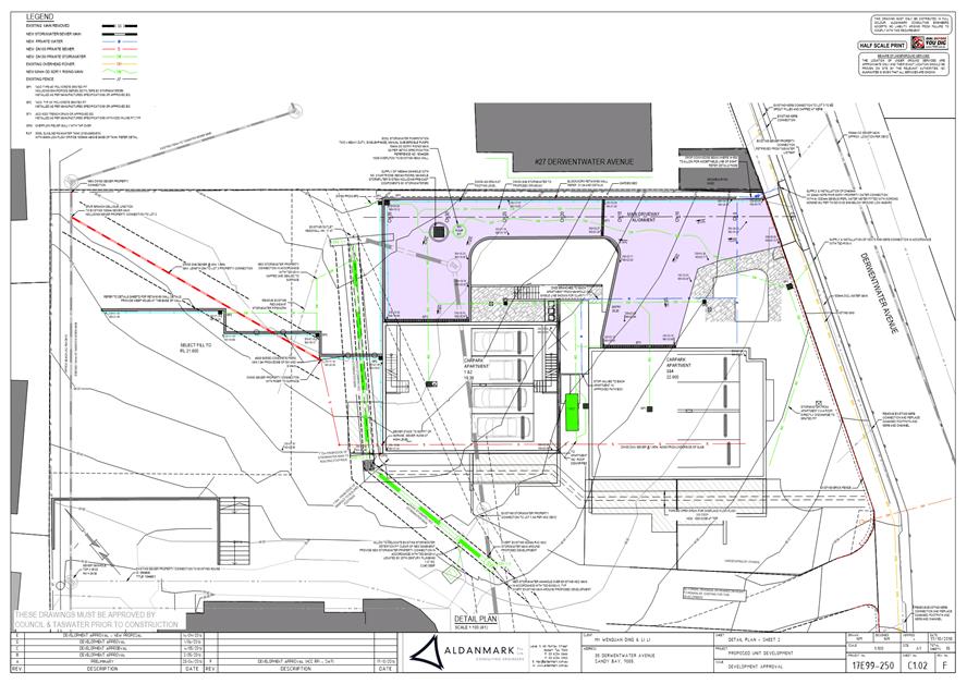
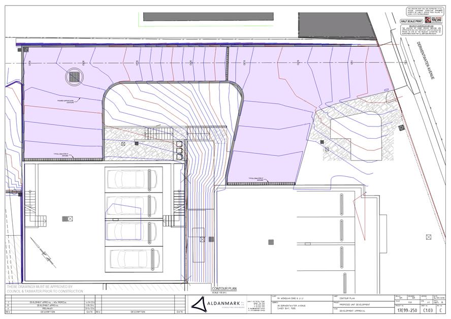
7.2.1 35 Derwentwater Avenue, Sandy Bay - Subdivision (Boundary Adjustment) and Multiple Dwellings
Address: 35 Derwentwater Avenue, Sandy Bay
Proposal: Subdivision (Boundary Adjustment) and Multiple Dwellings
Expiry Date: 17 December 2018
Extension of Time: Not applicable
Author: Adam Smee
|
REcommendation That: Pursuant to the Hobart Interim Planning Scheme 2015, the Council approve the application for subdivision (boundary adjustment) and multiple dwellings at 35 Derwentwater Avenue, Sandy Bay for the reasons outlined in the officer’s report and a permit containing the following conditions be issued:
GEN
The use and/or development must be substantially in accordance with the documents and drawings that comprise PLN18103 35 DERWENTWATER AVENUE SANDY BAY TAS 7005 Final Planning Documents except where modified below.
Reason for condition
To clarify the scope of the permit.
TW
The use and/or development must comply with the requirements of TasWater as detailed in the form Submission to Planning Authority Notice, Reference No. TWDA 2018/00290HCC as amended 25/9/2018 as attached to the permit.
Reason for condition
To clarify the scope of the permit.
PLN s1
The approved boundary adjustment must be completed prior to the issue of any consent under the Building Act 2016 for the multiple dwellings also approved by this permit. Confirmation that titles have been issued for lots that are substantially in accordance with the approved boundary adjustment must be provided with any application or notification under the Building Act 2016 for the multiple dwellings (including for low or medium risk work).
Reason for condition
To ensure that the residential density of the development is consistent with this approval.
ENG sw2.1
The Council’s stormwater infrastructure within the subject site must be protected from damage during the construction of the development.
Digital copies of preworks CCTV video and report of the Council stormwater infrastructure must be undertaken and submitted to Council:
1. Prior
to commencement of works on site for any part of main which will
not be replaced, and 2. The issue of Certificate of Practical Completion of the new section of main (taken no more than one month earlier).
The pre and postconstruction CCTVs will be relied upon to establish the extent of damage caused to the Council’s infrastructure during construction. In the event that the owner/developer fails to provide to the Council pre construction CCTV video of the Council’s infrastructure, then any damage to the Council infrastructure identified in the post construction CCTV will be deemed to be the responsibility of the owner.
Reason for condition
To ensure that any of the Council infrastructure and/or siterelated service connections affected by the proposal will be altered and/or reinstated at the owner’s full cost.
ENG sw2.2
The Council’s stormwater infrastructure within the subject site must be protected from damage during the construction of the development. Digital copies of a postconstruction CCTV video and report of the Council stormwater infrastructure must be undertaken and submitted to Council prior to first occupancy of the development.
The pre and postconstruction work CCTVs will be relied upon to establish the extent of damage caused to the Council’s stormwater infrastructure during construction.
In the event that the owner fails to provide to the Council a preconstruction works CCTV video of the Council’s stormwater infrastructure, then any damage to the Council infrastructure identified in the post construction CCTV will be deemed to be the responsibility of the owner.
Advice: Due to the diameter of the main, a tractor camera will be required to obtain adequately clear footage.
Reason for condition
To ensure that any of the Council infrastructure and/or siterelated service connections affected by the proposal will be altered and/or reinstated at the owner’s full cost.
ENG sw3
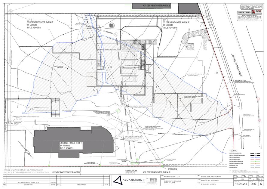
The proposed works (including fill, balustrades, retaining walls, footings and deck) must be designed to ensure the long term protection of and access to the Council’s stormwater infrastructure and the overland flow path. The main must be diverted clear of the proposed building.
Detailed engineering design must be submitted and approved prior to issue of any consent under the Building Act 2016 or commencement of works (whichever occurs first).
The detailed design must:
1. Demonstrate how the design will maintain the overland flow path,
provide adequate access
to the main,
impose no additional loads onto the main and that the structure will be fully independent of the main and its trenching. 2. Include
crosssections clearly showing the relationship both vertically
and horizontally between Council’s stormwater infrastructure and the proposed works (including footings), and stating the
minimum setbacks from the works to the nearest external surface of the main. 3. Include
a longsection of
Council's stormwater main
clearly showing proposed
cover. 4. Be certified by a suitably qualified engineer.
Prior to issue of first occupancy of the development, a suitably qualified engineer must confirm the installation of the works within five metres of Council’s stormwater is in accordance with the approved drawings and complies with this condition. Should any remediation works be required, these must be carried out at the developer’s cost.
All work required by this condition must be undertaken in accordance with the approved detailed design.
Advice: Once the detailed design has been approved the Council will issue a condition endorsement (see general advice on how to obtain condition endorsement).
Where building approval is also required, it is recommended that documentation for condition endorsement be submitted well before submitting documentation for building approval. Failure to address condition endorsement requirements prior to submitting for building approval may result in unexpected delays.
Reason for condition
To ensure the protection of the Council’s hydraulic infrastructure.
ENG sw5
The new public stormwater system (piped main and overland flow path) must be constructed prior to issue of any completion certificate, and the redundant section be abandoned and removed, at the owner's cost.
Engineering design drawings must be submitted and approved, prior to commencement of work or issue of any consent under the Building Act 2016 (whichever occur first). The engineering design drawings must:
1. Be certified by a qualified and experienced engineer. 2. Show in both plan
and longsection the proposed stormwater main, including but not limited
to, connections, flows, velocities, hydraulic
grade lines,
clearances, cover, gradients, sizing, material, pipe class,
adequate working platforms around manholes, easements, headwalls and
inspection openings. 3. Show in plan and
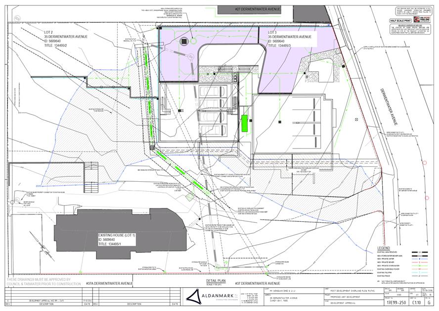
crosssection a defined overland flow path contained wholly
within the drainage easement and with a maximum
water level at
least 300mm
below the proposed floor level of habitable rooms on lot 3.
4. Show any
alterations proposed to the headwall and adequate scour/ erosion
control. 5. Include
the associated calculations and catchment area
plans. The stormwater system (including defined overland flow paths) must cater
for all 1% AEP flows
as at 2100 (i.e including climate change loading)
from a fully developed catchment. The main itself
must be sized to accommodate at
least the 5%
AEP flows from
a fullydeveloped catchment. 6. Clearly
distinguish between public and private infrastructure. 7. Clearly
state any maintenance requirements of the overland flow path. 8. Be substantially in accordance with the LGAT drawings.
All work required by this condition must be undertaken in accordance with the approved engineering design drawings.
Advice: Once the engineered drawings has been approved the Council will issue a condition endorsement (see general advice on how to obtain condition endorsement)
Where building approval is also required, it is recommended that documentation for condition endorsement be submitted well before submitting documentation for building approval. Failure to address condition endorsement requirements prior to submitting for building approval may result in unexpected delays.
Please note that once the condition endorsement has been issued you will need to contact Council’s City Infrastructure Division to obtain a Permit to Construct Public Infrastructure. A maintenance period of 12 months, and maintenance bond of 5% of the value of the works or $3000 (whichever is greater) will be required.
Reason for condition
To ensure Council’s hydraulic infrastructure meets acceptable standards.
ENG sw6
All stormwater from the proposed development (including hardstand runoff) must be discharged to the Council’s stormwater infrastructure with sufficient receiving capacity prior to first occupation. All costs associated with works required by this condition are to be met by the owner.
Design drawings and calculations of the proposed stormwater drainage and connections to the Council's stormwater infrastructure must be submitted and approved prior to the commencement of work. The design drawings and calculations must:
1. Be prepared by a
suitably qualified person; and 2. Demonstrate no increase in flows to the minor
watercourse; and 3. Include sufficient levels and grades to the point of discharge to demonstrate that all stormwater practicable is drained to the approved connections via gravity.
All work required by this condition must be undertaken in accordance with the approved design drawings and calculations.
Advice: The applicant is advised to submit detailed design drawings and calculations as part of their Plumbing Permit Application. If detailed design to satisfy this condition is submitted via the planning condition endorsement process there may be fees associated with the assessment, and once approved the applicant will still need to obtain a plumbing permit for the works.
Reason for condition
To ensure that stormwater from the site will be discharged to a suitable Council approved outlet.
ENG sw7
Stormwater pretreatment and detention for stormwater discharges from the development must be installed prior to first occupation of the development.
A stormwater management report and design must be submitted and approved, prior to commencement of work or issue of any approval under the Building Act 2016 (whichever occurs first). The stormwater management report and design must:
1. Be
prepared by a suitably qualified engineer. 2. Include detailed design of the proposed treatment train, including final estimations of contaminant removal.
3. Include
detailed design and
supporting calculations of
the detention tank, sized such that flows from lot 3 are limited to the receiving capacity
of the kerb and gutter.
All assumptions must be clearly stated. 4. Provide
maximum discharge rates to the minor watercourse for lots 1 and 2, such that there
would be no
increase in flows
from the developed site up to 5%
AEP storm events. 5. Include a Stormwater Management Summary Plan that outlines the obligations for future property owners to stormwater management, including a maintenance plan which outlines the operational and maintenance measures to check and ensure the ongoing effective operation of all systems, such as: inspection frequency; cleanout procedures; descriptions and diagrams of how the installed systems operate; details of the life of assets and replacement requirements.
All work required by this condition must be undertaken and maintained in accordance with the approved stormwater management report and design.
Advice: Once the stormwater management report and design has been approved the Council will issue a condition endorsement (see general advice on how to obtain
condition endorsement) Where building approval is also required, it is recommended that documentation for condition endorsement be submitted well before submitting documentation for building approval. Failure to address condition endorsement requirements prior to submitting for building approval may result in unexpected delays.
Reason for condition
To avoid the possible pollution of drainage systems and natural watercourses, to comply with relevant State legislation, and to ensure the development’s stormwater system takes into account limited receiving capacity of Council’s infrastructure.
ENG 2a
Vehicular barriers compliant with the Australian Standard AS1170.1 must be installed to prevent vehicles running off the edge of an access driveway or parking module (parking spaces, aisles and manoeuvring area) where the drop from the edge of the trafficable area to a lower level is 600mm or greater, and wheel stops (kerb) must be installed for drops between 150mm and 600mm. Barriers must not limit the width of the driveway access or parking and turning areas approved under the permit.
Advice: · Council does not consider a slope
greater than 1 in 4 to constitute a lower level as described in AS/NZS
2890.1:2004 Section 2.4.5.3. Slopes greater than 1 in 4 will require a vehicular barrier or wheel stop. · Designers are advised to consult the National Construction Code 2016 to determine if pedestrian handrails or safety barriers compliant with the NCC2016 are also required.
Reason for condition
To ensure the safety of users of the access driveway and parking module and compliance with the standard.
ENG 2b
A certified vehicle barrier design (including site plan with proposed location(s) of installation), prepared by a suitably qualified Engineer, compliant with Australian Standard AS1170.1, must be submitted to Council prior to the issue of any approval under the Building Act 2016, or the commencement of works on site. All works, required by this condition must be undertaken in accordance with certified design.
Advice: · Once the certification has been accepted, Council will issue
a condition endorsement (see general advice
on how to
obtain condition endorsement). · Where building approval is also required, it is recommended that documentation for condition endorsement be submitted well before submitting documentation for building approval. Failure to address condition endorsement requirements prior to submitting for building approval may result in unexpected delays.
Reason for condition
To ensure the safety of users of the access driveway and parking module and compliance with the standard.
ENG 2c
Prior to first occupation of the development, vehicular barriers must be inspected by a qualified engineer and certification submitted to Council confirming that the installed vehicular barriers comply with the certified design and Australian Standard AS1170.1.
Advice: Once the certification has been accepted, Council will issue a condition endorsement (see general advice on how to obtain condition endorsement).
Reason for condition
To ensure the safety of users of the access driveway and parking module and compliance with the relevant standards.
ENG 3c
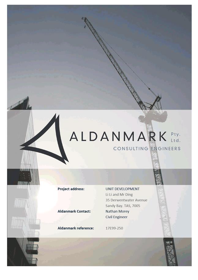
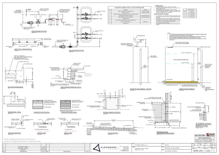
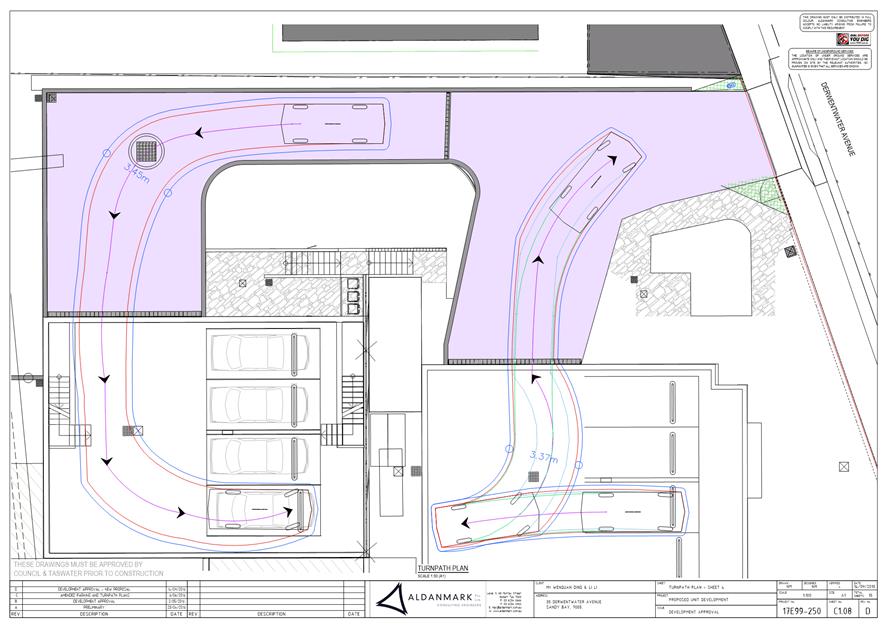
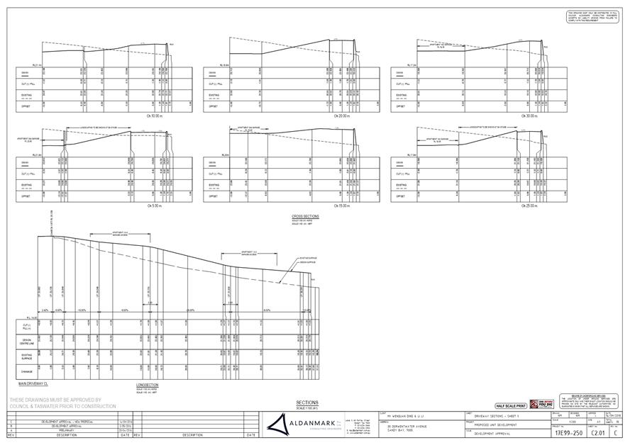
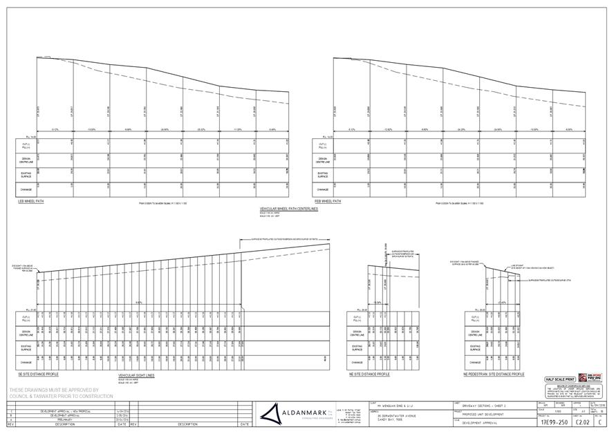
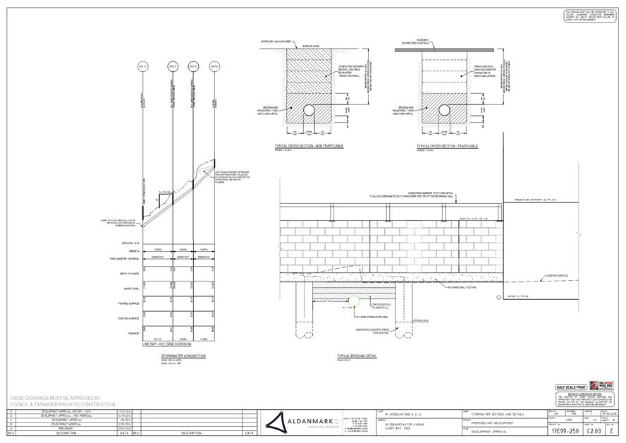
The access driveway(s), circulation roadways, ramps and parking module (parking spaces, aisles and manoeuvring area) must be constructed in accordance with the Aldanmark design drawings (17E99250) submitted to the Council on the 8th June 2018.
Prior to first occupation of the development, documentation by a suitably qualified engineer certifying that the access driveway and parking module has been constructed in accordance with the above drawings must be lodged with Council.
Advice: Certification may be submitted to Council as part of the Building Act 2016 approval process or via condition endorsement (see general advice on how to obtain condition endorsement).
Reason for condition
To ensure the safety of users of the access and parking module, and compliance with the relevant Australian Standard.
ENG 9
All car parking spaces must be delineated by means of white or yellow lines 80mm to 100mm wide, or white or yellow pavement markers, prior to the first occupation.
Reason for condition
In the interests of vehicle user safety and the amenity of the development.
ENG 11
Prior to the commencement of the use, the proposed crossover to the Derwentwater Avenue highway reservation must be designed and constructed in general accordance with:
1. Urban TSDR09v1 –
Urban Roads Driveways and TSD R14v1 Type
KC vehicular crossing; and 2. Footpath Urban Roads Footpaths TSDR11v1.
Reason for condition
In the interests of vehicle user safety and the amenity of the development.
ENG 1
The cost of repair of any damage to the Council's infrastructure or the minor watercourse resulting from the implementation of this permit, must be met by the owners within 30 days of the completion of the development or as otherwise determined by the Council. Any damage must be immediately reported to Council.
A photographic record of the Council's infrastructure adjacent to the subject site must be provided to the Council prior to any commencement of works.
A photographic record of the Council’s infrastructure (e.g. existing property service connection points, roads, buildings, stormwater, watercourse, footpaths, driveway crossovers and nature strips, including if any, preexisting damage) will be relied upon to establish the extent of damage caused to the Council’s infrastructure during construction. In the event that the owner/developer fails to provide to the Council a photographic record of the Council’s infrastructure, then any damage to the Council's infrastructure found on completion of works will be deemed to be the responsibility of the owner.
Reason for condition
To ensure that any of the Council's infrastructure and/or siterelated service connections affected by the proposal will be altered and/or reinstated at the owner’s full cost.
ENG 10
The front fencing and gate at Derwentwater Avenue must allow adequate sight distance between user vehicles, cyclists and pedestrians.
Amended drawings must be submitted and approved, prior to the commencement of work. The amended drawing must demonstrate how the fence either side of the driveway/s provides for adequate sight distance between user vehicles, cyclists and pedestrians by one of the following methods:
1. Compliance with Australian/NZ Standard, Parking facilities Part 1: Off
street car parking AS/NZS
2890.1: 2004 Fig
3.3; 2. Increasing the gate width of the driveway(s) to 5m; or 3. Increasing the transparency of fencing for at least 1m on each side of
driveway/s so that
those sections of
fencing are largely transparent; or 4. Setting driveway(s) gates back 1m from front fence line to achieve increased sight lines.
All work required by this condition must be undertaken in accordance with the approved drawings.
Advice: Once the amended drawing has been approved the Council will issue a condition endorsement (see general advice on how to obtain condition endorsement).
Where building approval is also required, it is recommended that documentation for condition endorsement be submitted well before submitting documentation for building approval. Failure to address condition endorsement requirements prior to submitting for building approval may result in unexpected delays.
Reason for condition
To ensure the safety of vehicles entering and leaving the development and of pedestrians and traffic in the vicinity.
ENV 2
Sediment and erosion control measures, sufficient to prevent sediment leaving the site and in accordance with an approved soil and water management plan (SWMP), must be installed prior to the commencement of work and maintained until such time as all disturbed areas have been stabilised and/or restored or sealed to the Council’s satisfaction.
A SWMP must be submitted prior to the issue of any approval under the Building Act 2016 or the commencement of work, whichever occurs first. The SWMP must be prepared in accordance with the Soil and Water Management on Building and Construction Sites fact sheets (Derwent Estuary Program, 2008), available here.
All work required by this condition must be undertaken in accordance with the approved SWMP.
Advice: Once the SWMP has been approved, the Council will issue a condition endorsement (see general advice on how to obtain condition endorsement).
Where building approval is also required, it is recommended that documentation for condition endorsement be submitted well before submitting documentation for building approval. Failure to address condition endorsement requirements prior to submitting for building approval may result in unexpected delays.
Reason for condition
To avoid the pollution and sedimentation of roads, drains and natural watercourses that could be caused by erosion and runoff from the development.
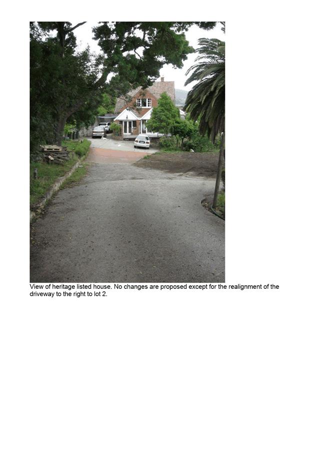
HER 18
The following trees #1, #2, #3, #4, #5, #6, #7, #8, #11, #14, #17 and #18, as shown on the submitted plans (Landscape Plan Drawing No. 102 Revision D, dated 27/09/2018 and Existing + Demolition plan, No. 200, Revision C, dated 18/09/2018) must be protected throughout excavation and post construction.
Prior to the issuing of any approval under the Building Act 2016, a report and/or plan must be submitted and approved and it must:
1. Be
prepared by a
suitable qualified person. 2. Show all tree
protection zones and relevant measures specified under Section
3 Determining the Protection Zones of the Selected Trees,
Section 4 Tree
Protection Measures and
Section 5 Monitoring and Certification of AS49702009 Protection of trees on development sites,
including fencing and appropriate signage around the above numbered trees. 3. Outline all works necessary to ensure the longevity, health and vigour of these trees.
All work required by this condition must be undertaken in accordance with the approved report and/or plan.
Reason for condition
To ensure that development is undertaken in a sympathetic manner which does not cause loss of heritage values.
SURV 1
The applicant must submit to the Council a copy of the surveyor’s survey notes at the time of lodging the final plan.
Reason for condition
To enable the Council to accurately update cadastral layers on the corporate Geographic Information System.
SURV 2
The final plan and schedule of easements must be submitted and approved in accordance with section 89 of the Local Government (Building & Miscellaneous Provisions) Act 1993.
Reason for condition
To ensure that the subdivision/boundary adjustment is carried out in accordance with the Council's requirements under the provisions of Part 3 of the Local Government (Building & Miscellaneous Provisions) Act 1993.
SURV 3
The final plan and schedule of easements must be submitted and approved under section 89 of the Local Government (Building & Miscellaneous Provisions) Act 1993.
The final plan and schedule of easements must provide easements to the satisfaction of the Council:
1. Over any proposed or existing stormwater, water or sewer
infrastructure (including mains, branches and headwalls)
passing through the
lots on the final plan, in favour
of the Hobart City Council and/orTasWater (minimum width of 2m, or 3m if they cover two pipes). 2. Over any existing or proposed private rights
of way, drainage and/or service easements
in favour of the lots they are required to serve. 3. Over any existing or proposed overland flow paths in favour of the Hobart City Council.
Advice: Drainage easement widths for public stormwater should be in general accordance with those specified in the LGAT/IPWEA Tasmanian Subdivision Guidelines 2013, and extend a minimum of one metre from the outside of the infrastructure.
Reason for condition
To ensure that there are no impediments to the provision of public and private services and access to the lots and the subdivision/boundary adjustment is carried out in accordance with the Council's requirements under the provisions of Part 3 of the Local Government (Building & Miscellaneous Provisions) Act 1993.
SURV 13
The final plan is to be notated in accordance with the provisions of section 83(7) (b) of the Local Government (Building & Miscellaneous Provisions) Act 1993 to the effect that the Tasmanian Water and Sewerage Corporation cannot provide a means of gravity reticulated sewerage disposal from lots 2 and 3 below a specified reduced level.
The final
plan must be submitted for approval by the Council. The final
plan must be notated to the satisfaction of the Council. The specified reduced level that may be required is to be provided by the owner’s Registered Land Surveyor who must supply the invert level (on State Datum) of the sewer connections constructed to serve Lots 2 and 3.
Reason for condition
To ensure that the limitation in TasWater’s ability to provide a means of gravity reticulated sewerage disposal from Lots 2 and 3 is noted on the final plan.
ENG 14
Services to each lot must be designed and installed to meet the needs of future development, prior to the sealing of the final plan.
Detailed engineering drawings must be submitted and approved prior to commencement of work on the site. The engineering drawings must:
1. Be prepared by a
suitable qualified person and experienced engineer. 2. Be
generally in accordance with LGAT
IPWEA Tasmanian Standard Drawings and
Subdivision Guidelines 2013. 3. Clearly
distinguish between public and private infrastructure. 4. Include
indicative longsections of the
proposed connections clearly showing clearances from
any nearby services, cover, size, material and delineation of public
and private infrastructure. Connections must be
freeflowing gravity. 5. Show the proposed
location, size and design of each lot connection such that the majority of the lot can be adequately and economically
drained, bearing
in mind the limited receiving capacity of the public
infrastructure. 6. Show the the existing private stormwater detention for lot 1 to be relocated such that it is within the revised lot boundary and upstream of the public
connection. 7. Show all
existing connections for
the Lots as to be abandoned at the
owner's cost. 8. Any connections to the open watercourse must have adequate scour and erosion control.
All work required by this condition must be constructed in accordance with the approved engineering drawings.
Advice: Once the engineering drawings have been approved the Council will issue a condition endorsement. Please note that once the condition endorsement has been issued you will need to contact Council’s City Infrastructure Division to obtain a Permit to Construct Public Infrastructure and an application for new stormwater connection. Please note consent under the Building Act may be required for any private plumbing work.
Reason for condition
To ensure that the subdivision of land provides adequate services to meet the projected needs of future development.
Part 5 1
Prior to the Council sealing the final plan of survey for the approved boundary adjustment, the owner(s) of the property must enter into an agreement with the Council pursuant to Part 5 of the Land Use Planning and Approvals Act 1993 with respect to the following issues:
· Building over Council's stormwater main. The owner of lot 3 must agree to:
· Indemnify Council
against any costs or claims arising from
building over the Council’s stormwater main or for damages
incurred in the act of performing operation, maintenance, or
replacement tasks on
the stormwater main; · Not perform
any future works to any structures within 1m of the
main, including replacement of footings without written
permission from Council; · Dismantle/ replace the structures at the owner’s cost at Council’s request to allow free access to Council’s infrastructure;
· The limited receiving capacity of Council's stormwater system:
· The owners
of lot 1 and lot 3 must agree to the ongoing
compliance with the
approved stormwater management plan for the detention systems of lot 1 and lot 3; · The owners of lots 1, 2 and 3 must agree to limit discharges into the piped minor watercourse passing through the site to pre development flows to the worst case 5% AEP event;
· The overland flow path through the site. The owners of the relevant lots must agree:
· to maintain all approved flood mitigation measures including
maintaining the capacity of the defined overland flow path through the
relevant Lots, and, · not without the written consent of the Hobart City Council to erect or permit to be erected any building or structure or carry out any landscaping that may change the contours of the land or restrict the free flow of water over the defined overland flow path.
· Multiple dwellings on lot 3:
· That lot 3 is designated for multiple dwelling use and development only.
All costs for the preparation and registration of the Part 5 Agreement must be met by the owner.
The owner must comply with the Part 5 Agreement which will be placed on the property title.
Advice: For further information with respect to the preparation of a Part 5 Agreement please contact Council's Development Engineering Staff.
Reason for condition
To ensure that the development does not increase risk to the property or thirdparty land and to clarify the intended future use and development of the lot and to ensure compliance with the requirements of Table 10.1 of the Hobart Interim Planning Scheme 2015 with regard to acceptable lot size.
SUB s1
An amendment to Sealed Plan 134495 under section 103 of the Local Government (Building & Miscellaneous Provisions) Act 1993 to delete the necessary portions of the Drainage Easement 0.91 wide and the Drainage Easement 3.00 wide and variable width from the sealed plan is to be submitted to Council and approved concurrently with the final plan of survey.
Reason for condition
To ensure that the easements are not brought forward to burden the lots in the subdivision.
SUB s2
Private sewer, stormwater (including surface drainage) and water services/connections must be entirely separate to each lot and contained wholly within the lots served.
The developer must verify compliance of the Separation of Services by supplying the Council with an asinstalled Services Plan prior to the sealing of the final plan. The plan must:
1. Clearly
indicate the location and details of all relevant services (entirely
contained within their respective lots); and 2. Be accompanied by certification from a suitably qualified person that all engineering work required by this permit have been completed.
Advice: Once the asinstalled Services Plan has been approved the Council will issue a condition endorsement (see general advice on how to obtain condition endorsement)
Any final plan submitted for sealing will not be processed unless it is accompanied by documentation by a qualified person that clearly certifies that this condition has been satisfied and that all the work required by this condition has been completed. A “qualified person” must be a Professional Engineer or Professional Surveyor or other persons acceptable to Council.
Reason for condition
To ensure that each lot is serviced separately.
ADVICE
The following advice is provided to you to assist in the implementation of the planning permit that has been issued subject to the conditions above. The advice is not exhaustive and you must inform yourself of any other legislation, bylaws, regulations, codes or standards that will apply to your development under which you may need to obtain an approval. Visit the Council's website for further information.
Prior to any commencement of work on the site or commencement of use the following additional permits/approval may be required from the Hobart City Council.
CONDITION ENDORSEMENT
If a condition endorsement is required by a planning condition above, you will need to submit the relevant documentation to satisfy the condition via the Condition Endorsement Submission on Council's online services eplanning
Where building approval is also required, it is recommended that documentation for condition endorsement be submitted well before submitting documentation for building approval. Failure to address condition endorsement requirements prior to submitting for building approval may result in unexpected delays.
Once approved, the Council will respond to you via email that the condition has been endorsed (satisfied). Detailed instructions can be found here.
BUILDING PERMIT
You may need building approval in accordance with the Building Act 2016. Click here for more information.
This is a Discretionary Planning Permit issued in accordance with section 57 of the Land Use Planning and Approvals Act 1993.
PLUMBING PERMIT
You may need plumbing approval in accordance with the Building Act 2016, Building Regulations 2016 and the National Construction Code. Click here for more information.
OCCUPATION OF AND WORKS IN THE PUBLIC HIGHWAY
You may require a permit for the occupation of the public highway for construction (e.g. placement of skip bin, crane, scissor lift etc). Click here for more information.
You may require a road closure permit for construction. Click here for more information.
You will require a Permit to Open Up and Temporarily Occupy a Highway for any work in the road reserve. Click here for more information.
BUILDING OVER AN EASEMENT
In order to build over the service easement, you will require the written consent of the person on whose behalf the easement was created, in accordance with section 74 of the Building Act 2016.
PERMIT TO CONSTRUCT PUBLIC INFRASTRUCTURE
You will require a permit to construct public infrastructure, with a 12 month maintenance period and bond. Please contact the Hobart City Council's City Infrastructure Division to initiate the permit process.
NEW SERVICE CONNECTION
Please contact the Hobart City Council's City Infrastructure Division to initiate the application process for your new stormwater connection.
WORK WITHIN THE HIGHWAY RESERVATION
Please note development must be in accordance with the Hobart City Council’s Highways By law. Click here for more information.
DRIVEWAY SURFACING OVER HIGHWAY RESERVATION
If a coloured or textured surface is used for the driveway access within the Highway Reservation, the Council or other service provider will not match this on any reinstatement of the driveway access within the Highway Reservation required in the future.
ACCESS
Designed in accordance with LGAT IPWEA – Tasmanian standard drawings. Click here for more information.
CROSS OVER CONSTRUCTION
The construction of the crossover can be undertaken by the Council or by a private contractor, subject to Council approval of the design. Click here for more information.
FEES AND CHARGES
Click here for information on the Council's fees and charges.
DIAL BEFORE YOU DIG
Click here for dial before you dig information.
ENGINEERING APPROVAL FEE
Prior to the issue of Council approved drawings or commencement of work on site (whichever occurs first), an engineering fee in accordance with Council's Fees and Charges 20182019, must be paid to the Council to meet the cost of processing and approving the engineering aspects of the working drawings and onsite inspections. This fee is additional to building and plumbing fees charged under the Building and Plumbing Regulations.
Click here for information on the Council's fees and charges.
SUBDIVISION ADVICE For information regarding standards and guidelines for subdivision works click here. All conditions imposed by this permit are in accordance with the Local Government Building & Miscellaneous Provisions) Act 1993 and the Conveyancing and Law of Property Act 1884.
|
Attachment a: PLN-18-103
- 35 DERWENTWATER AVENUE SANDY BAY TAS 7005 - Planning Committee or Delegated
Report ⇩ ![]()
Attachment
b: PLN-18-103
- 35 DERWENTWATER AVENUE SANDY BAY TAS 7005 - CPC Agenda Documents ⇩ ![]()
Attachment
c: PLN-18-103
- 35 DERWENTWATER AVENUE SANDY BAY TAS 7005 - Referral Officer Report -
Cultural Heritage ⇩ ![]()
|
Item No. 7.2.1 |
Agenda (Open Portion) City Planning Committee Meeting - 10/12/2018 |
Page 250 ATTACHMENT a |


|
Agenda (Open Portion) City Planning Committee Meeting - 10/12/2018 |
Page 302 ATTACHMENT b |

|
Item No. 7.2.1 |
Agenda (Open Portion) City Planning Committee Meeting - 10/12/2018 |
Page 322 ATTACHMENT b |
|
Item No. 7.2.1 |
Agenda (Open Portion) City Planning Committee Meeting - 10/12/2018 |
Page 323 ATTACHMENT b |


|
Item No. 7.2.1 |
Agenda (Open Portion) City Planning Committee Meeting - 10/12/2018 |
Page 349 ATTACHMENT b |
|
Item No. 7.2.1 |
Agenda (Open Portion) City Planning Committee Meeting - 10/12/2018 |
Page 352 ATTACHMENT b |
|
Item No. 7.2.1 |
Agenda (Open Portion) City Planning Committee Meeting - 10/12/2018 |
Page 355 ATTACHMENT b |
|
Item No. 7.2.1 |
Agenda (Open Portion) City Planning Committee Meeting - 10/12/2018 |
Page 375 ATTACHMENT b |
|
Item No. 7.2.1 |
Agenda (Open Portion) City Planning Committee Meeting - 10/12/2018 |
Page 387 ATTACHMENT b |
|
Item No. 7.2.1 |
Agenda (Open Portion) City Planning Committee Meeting - 10/12/2018 |
Page 404 ATTACHMENT c |

|
Agenda (Open Portion) City Planning Committee Meeting |
Page 412 |
|
|
|
10/12/2018 |
|
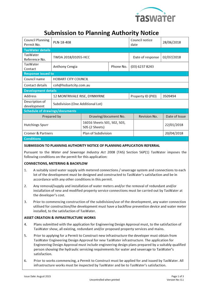
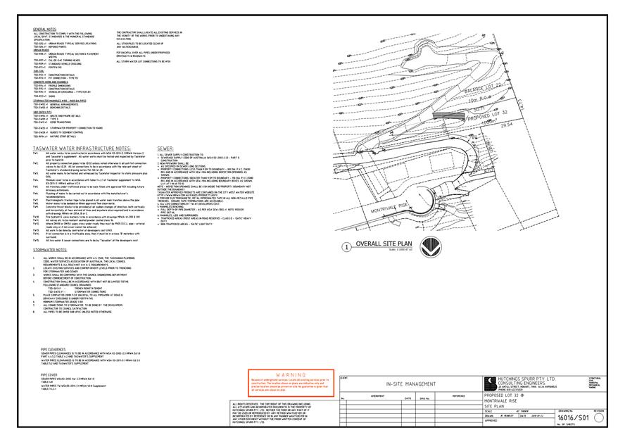
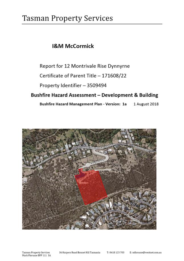
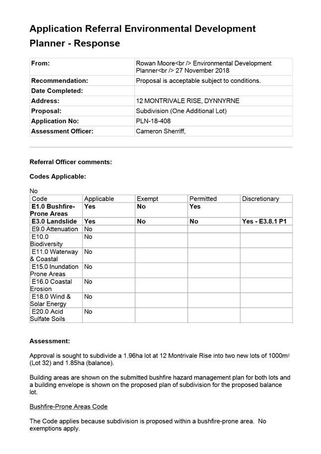
7.2.2 12 Montrivale Rise, Dynnyrne - Subdivision (One Additional Lot)
Address: 12 Montrivale Rise, Dynnyrne
Proposal: Subdivision (One Additional Lot)
Expiry Date: 3 January 2019
Extension of Time: Not applicable
Author: Cameron Sherriff
|
REcommendation That: Pursuant to the Hobart Interim Planning Scheme 2015, the Council approve the application for subdivision (one additional lot) at 12 Montrivale Rise, DYNNYRNE for the reasons outlined in the officer’s report and a permit containing the following conditions be issued:
GEN
The use and/or development must be substantially in accordance with the documents and drawings that comprise Application Document PLN18408 12 MONTRIVALE RISE DYNNYRNE TAS 7005 Final Planning Documents except where modified below.
Reason for condition
To clarify the scope of the permit.
TW
The use and/or development must comply with the requirements of TasWater as detailed in the form Submission to Planning Authority Notice, Reference No. TWDA 2018/01055HCC dated 02/07/2018 as attached to the permit.
Reason for condition
To clarify the scope of the permit.
ENG sw3
A recorded CCTV inspection and associated report of any new public stormwater infrastructure, must be undertaken within 1 month from completion of the 12 month maintenance period. In the event the CCTV or report identifies remedial work is required, such work must be undertaken within 30 days at the owners cost.
Advice: Upon the expiry of the 12 month maintenance period, please contact the Council to arrange inspection.
Reason for condition
To ensure that any of the Council infrastructure and/or siterelated service connections affected by the proposal will be altered and/or reinstated at the owner’s full cost.
ENG sw4
The proposed lot must be drained to Council infrastructure. Any new stormwater connection(s) required must be constructed, at the owner’s expense prior to sealing of the final plan.
Detailed design drawings showing both existing and proposed services must be submitted and approved, prior to commencement of work. The detailed design drawings must include:
1. Show the proposed location of lot connection such that the majority of the lot, including the driveway, can be adequately and economically drained.
2. Longsections of the proposed connection clearly showing any nearby services, cover, size, material and delineation of public and private infrastructure.
3. The final Lot boundaries, with each Lot serviced separately by Council infrastructure and all private plumbing contained within each Lot.
4. Specify lot connection sizes appropriate for the developable area of each lot.
5. Ensure provision is made for the lots to be developed to their maximum future potential.
6. Be checked and certified by a qualified and experienced engineer.
All work required by this condition must be undertaken in accordance with the approved detailed design drawings.
Advice:
· Once the detailed design drawings have been approved the Council will issue a condition endorsement (see general advice on how to obtain condition endorsement) · Please note that once the condition endorsement has been issued you will need to contact Council’s City Infrastructure Division to initiate an application for service connection. · Note that the lots will also require adequate water and sewer service connections to TasWater mains/systems. The Services Plan must clearly show the existing/ proposed water, sewer and stormwater service connections for each lot. Check the TasWater conditions located in the Appendix. · Consideration must be given to the location of stormwater connections: these should be positioned at the most practicable location to adequately and economically drain the majority of the lot including the driveway
Reason for condition
To ensure the site is drained adequately.
ENG sw5
The new stormwater infrastructure must be constructed prior to the sealing of the final plan.
Engineering design drawings must be submitted and approved, prior to commencement of work. The engineering drawings must:
1. Be certified by a qualified and experienced engineer.
2. Show in both plan and longsection the proposed stormwater mains, including but not limited to, connections, flows, velocities, hydraulic grade lines, clearances, cover, gradients, sizing, material, pipe class, adequate working platforms around manholes, easements and inspection openings.
3. Include the associated calculations and catchment area plans. The stormwater system (including defined overland flow paths) must cater for all 1% AEP flows as at 2100 (i.e including climate change loading) from a fully developed catchment. The main itself must be sized to accommodate at least the 5% AEP flows from a fullydeveloped catchment.
4. Clearly distinguish between public and private infrastructure.
5. Be substantially in accordance with the LGAT drawings.
All work required by this condition must be undertaken in accordance with the approved engineered drawings.
Advice:
· Once the engineered drawings has been approved the Council will issue a condition endorsement (see general advice on how to obtain condition endorsement). · Please note that once the condition endorsement has been issued you will need to contact Council’s City Infrastructure Division to obtain a Permit to Construct Public Infrastructure.
Reason for condition
To ensure Council’s hydraulic infrastructure meets acceptable standards.
ENG 1
The cost of repair of any damage to the Council's infrastructure resulting from the implementation of this permit, must be met by the owners within 30 days of the completion of the development or as otherwise determined by the Council.
A photographic record of the Council's infrastructure adjacent to the subject site must be provided to the Council prior to any commencement of works.
A photographic record of the Council’s infrastructure (e.g. existing property service connection points, roads, buildings, stormwater, footpaths, driveway crossovers and nature strips, including if any, preexisting damage) will be relied upon to establish the extent of damage caused to the Council’s infrastructure during construction. In the event that the owner/developer fails to provide to the Council a photographic record of the Council’s infrastructure, then any damage to the Council's infrastructure found on completion of works will be deemed to be the responsibility of the owner.
Reason for condition
To ensure that any of the Council's infrastructure and/or siterelated service connections affected by the proposal will be altered and/or reinstated at the owner’s full cost.
ENG s1
Prior to the sealing of the final plan, private sewer, stormwater and water services/connections must be entirely separate to each lot and contained entirely within the lots served.
The developer must verify compliance of the separation of services by supplying the Council with an asbuilt services plan, clearly indicating the location and details of all relevant services, prior to the sealing of the final plan.
The services plan must be accompanied by certification from a suitably qualified person that all engineering work required by this permit has been completed.
Advice: Any final plan submitted for sealing will not be processed unless it is accompanied by documentation by a qualified person that clearly certifies that this condition has been satisfied and that any work required by this condition has been completed. A “qualified person” must be a Professional Engineer or Professional Surveyor or other persons acceptable to Council.
Reason for condition
To ensure that each lot is serviced separately and that the Developer provides the Council with clear written confirmation that the separation of services is complete.
ENV 8
Prior to sealing the final plan a Part 5 Agreement pursuant to section 71 of the Land Use Planning and Approvals Act 1993 must be entered into that:
Landslide: 1. Requires the owner(s) of Lot 32 to implement the recommendations in Table 3.3 of Attachment 3 and the good hillside engineering practices specified in Attachment 4 of the Landslide Risk Management Report by William C Cromer Pty Ltd dated 6 September 2018, unless the written consent of the Planning Authority is obtained; and
2. Includes a copy of the Landslide Risk Management Report as an attachment to the Agreement.
Bushfire: 1. Requires the owner(s) of the balance lot to allow the owners (or agents of the owners) of Lot 32 to implement and maintain a bushfire hazard management area on the balance lot in accordance with a certified bushfire hazard management plan for an approved dwelling on Lot 32 to achieve separation distances necessary for BAL19 in accordance with AS3959 – Construction of buildings in bushfireprone areas, to a maximum distance of 7m east of the eastern boundary of Lot 32 and 13.5m from the southern boundary of Lot 32, unless the written consent of the Planning Authority is obtained; and
2. Prohibits the placement or construction of fencing, buildings, landscaping or other obstacles that may significantly obstruct the lay of a fire hose in the area designated on the submitted bushfire hazard management plan by Tasman Property Services dated 1 August 2018, unless the written consent of the Planning Authority is obtained; and
3. Includes a simple plan showing the approximate location of the allowable hazard management area zone and area to be kept free of obstructions. The applicant is responsible for preparation of the plan showing the allowable hazard management area zone and area to be kept free of obstructions.
The Agreement must be registered on the Title of Lot 32 at the time of issue. The Planning Authority will have its solicitors prepare the Agreement for signing by the property owner(s). The Planning Authority will then lodge the Agreement with the Lands Titles Office. The cost of preparing the Agreement and registration with the Land Titles Office is to be met by the applicant.
Advice: Please note that landslide risk management and bushfire risk management requirements of this permit may be addressed by a single Agreement. Please contact the Environmental Development Planner on 6238 2715 to initiate the Part 5 Agreement process.
Reason for condition
To reduce the risk to life and property, and the cost to the community, caused by landslides and bushfire
ENV 9
No clearing or modification of vegetation within the Biodiversity Protection Area specified in the Hobart Interim Planning Scheme 2015 is approved under this permit.
Reason for condition
To clarify the scope of the permit
ENV 1
Sediment and erosion control measures sufficient to prevent sediment from leaving the site must be installed prior to any disturbance of the site, and maintained until all areas of disturbance have been stabilized or revegetated.
Advice: For further guidance in preparing a Soil and Water Management Plan – in accordance with Fact sheet 3 Derwent Estuary Program click here.
Reason for condition
To avoid the sedimentation of roads, drains, natural watercourses, Council land that could be caused by erosion and runoff from the development, and to comply with relevant State legislation.
ENV s1
The building envelope for the proposed balance lot shown on the proposed Plan of Subdivision by Cromer and Partners is not approved as a building area under this permit and must not be shown on the final plan.
Reason for condition
To clarify the scope of the permit.
ENV s2
The building area and hazard management area for the balance lot are not approved under this permit.
Reason for condition
To clarify the scope of the permit.
SURV 1
The applicant must submit to the Council a copy of the surveyor’s survey notes at the time of lodging the final plan.
Reason for condition
To enable the Council to accurately update cadastral layers on the corporate Geographic Information System.
SURV 2
The final plan and schedule of easements must be submitted and approved in accordance with section 89 of the Local Government (Building & Miscellaneous Provisions) Act 1993.
Reason for condition
To ensure that the subdivision/boundary adjustment is carried out in accordance with the Council's requirements under the provisions of Part 3 of the Local Government (Building & Miscellaneous Provisions) Act 1993.
SURV 3
The final plan and schedule of easements must be submitted and approved under section 89 of the Local Government (Building & Miscellaneous Provisions) Act 1993.
The final plan and schedule of easements must provide easements to the satisfaction of the Council:
1. Over any existing or proposed private rights of way, drainage and/or service easements in favour of the lots they are required to serve.
2. Over any existing, proposed or required private road embankments or private road batters in favour of the lots that require the easements.
Reason for condition
To ensure that there are no impediments to the provision of private services and access to the lots.
ENG 14
All lots shown on the final plan must be provided with adequate water, sewer and stormwater service connections.
Services to each lot must be designed and installed to meet the needs of future development, prior to the sealing of the final plan.
Engineering drawings of all required services must be submitted and approved prior to commencement of work on the site. The drawings must:
1. Be prepared by a suitable qualified person and experienced engineer; and
2. Be generally in accordance with LGAT IPWEA Tasmanian Standard Drawings and Subdivision Guidelines 2013.
All work required by this condition must be constructed in accordance with the approved engineering drawings.
Prior to the sealing of the final plan, a detailed Services Plan showing the existing services and accesses to all lots on the site must be submitted to Council.
Advice: · Once the forconstruction engineering drawings have been approved the Council will issue a condition endorsement. · Please note that once the condition endorsement has been issued you will need to contact Council’s City Infrastructure Division to apply for new stormwater connection if required.
Reason for condition
To ensure that the subdivision of land provides each lot with adequate services to meet the projected needs of future development.
ENG 15
All driveways subject to right of way access for the proposed Lot 32 must be designed and constructed to a sealed standard prior to the sealing of the final plan. This includes the existing driveway at 12 Montrivale Rise that leads up to the driveway to Lot 32. The sealed driveway must extend at least up to the boundary of Lot 32, but the driveway (sealed or unsealed) must also extend into the lot to provide practical access for construction vehicles.
Design drawings must be submitted and approved, prior to commencement of work. The drawings must:
1. Be in accordance with the Australian Standard Parking facilities, Part 1: OffStreet Carparking, AS 2890.1 – 2004;
2. Be prepared and certified by a suitably qualified professional.
All work required by this condition must be undertaken in accordance with the approved design drawings.
Advice: Once the design drawings has been approved the Council will issue a condition endorsement (see general advice on how to obtain condition endorsement).
Reason for condition
To ensure that the driveway for the development is constructed to to ensure public safety standards.
OPS 1
The owner must pay a cash contribution to the Council for contribution to public open space, prior to sealing of the final plan.
The open space contribution is equal to 5% of the undeveloped value of 'Lot 32' comprised in the final plan, in lieu of the provision of public open space within the subdivision.
Advice: The value is to be determined by a registered valuer commissioned by the Council at the developer's cost. A Cash in Lieu Valuation Request Form must be completed and returned to the Council to enable the valuation to be undertaken. The form can be downloaded here.
Reason for condition
Approval of the subdivision will create further demand upon Hobart's Public Open Space System. The funds obtained will be used for future expenditure on the purchase or improvement of land for public open space in Hobart.
ADVICE
The following advice is provided to you to assist in the implementation of the planning permit that has been issued subject to the conditions above. The advice is not exhaustive and you must inform yourself of any other legislation, bylaws, regulations, codes or standards that will apply to your development under which you may need to obtain an approval. Visit the Council's website for further information.
Prior to any commencement of work on the site or commencement of use the following additional permits/approval may be required from the Hobart City Council.
CONDITION ENDORSEMENT ENGINEERING
All engineering drawings required to be submitted and approved by this planning permit must be submitted to the City of Hobart as a CEP (Condition Endorsement) via the City’s Online Service Development Portal. When lodging a CEP, please reference the PLN number of the associated Planning Application. Each CEP must also include an estimation of the cost of works shown on the submitted engineering drawings. Once that estimation has been confirmed by the City’s Engineer, the following fees are payable for each CEP submitted and must be paid prior to the City of Hobart commencing assessment of the engineering drawings in each CEP:
Value of Building Works Approved by Planning Permit Fee:
· Up to $20,000: $150 per application. · Over $20,000: 2% of the value of the works as assessed by the City's Engineer per assessment.
These fees are additional to building and plumbing fees charged under the Building and Plumbing Regulations.
Once the CEP is lodged via the Online Service Development Portal, if the value of building works approved by your planning permit is over $20,000, please contact the City’s Development Engineer on 6238 2715 to confirm the estimation of the cost of works shown on the submitted engineering drawings has been accepted.
Once confirmed, pleased call one of the City’s Customer Service Officers on 6238 2190 to make payment, quoting the reference number (ie. CEP number) of the Condition Endorsement you have lodged. Once payment is made, your engineering drawings will be assessed.
PERMIT TO CONSTRUCT PUBLIC INFRASTRUCTURE
You may require a permit to construct public infrastructure, with a 12 month maintenance period and bond (please contact the Hobart City Council's City Infrastructure Division to initiate the permit process).
NEW SERVICE CONNECTION
Please contact the Hobart City Council's City Infrastructure Division to initiate the application process for your new stormwater connection.
WEED CONTROL
Effective measures are detailed in the Tasmanian Washdown Guidelines for Weed and Disease Control: Machinery, Vehicles and Equipment (Edition 1, 2004). The guidelines can be obtained from the Department of Primary Industries, Parks, Water and Environment website.
SUBDIVISION ADVICE For information regarding standards and guidelines for subdivision works click here. All conditions imposed by this permit are in accordance with the Local Government Building & Miscellaneous Provisions) Act 1993 and the Conveyancing and Law of Property Act 1884.
PUBLIC OPEN SPACE CASH IN LIEU REQUEST FORM
The form can be downloaded here.
|
Attachment a: PLN-18-408
- 12 MONTRIVALE RISE DYNNYRNE TAS 7005 - Planning Committee or Delegated Report ⇩ ![]()
Attachment
b: PLN-18-408
- 12 MONTRIVALE RISE DYNNYRNE TAS 7005 - CPC Agenda Documents ⇩ ![]()
Attachment
c: PLN-18-408
- 12 MONTRIVALE RISE DYNNYRNE TAS 7005 - Planning Referral Officer
Environmental Development Planner Report ⇩ ![]()
|
Item No. 7.2.2 |
Agenda (Open Portion) City Planning Committee Meeting - 10/12/2018 |
Page 426 ATTACHMENT a |
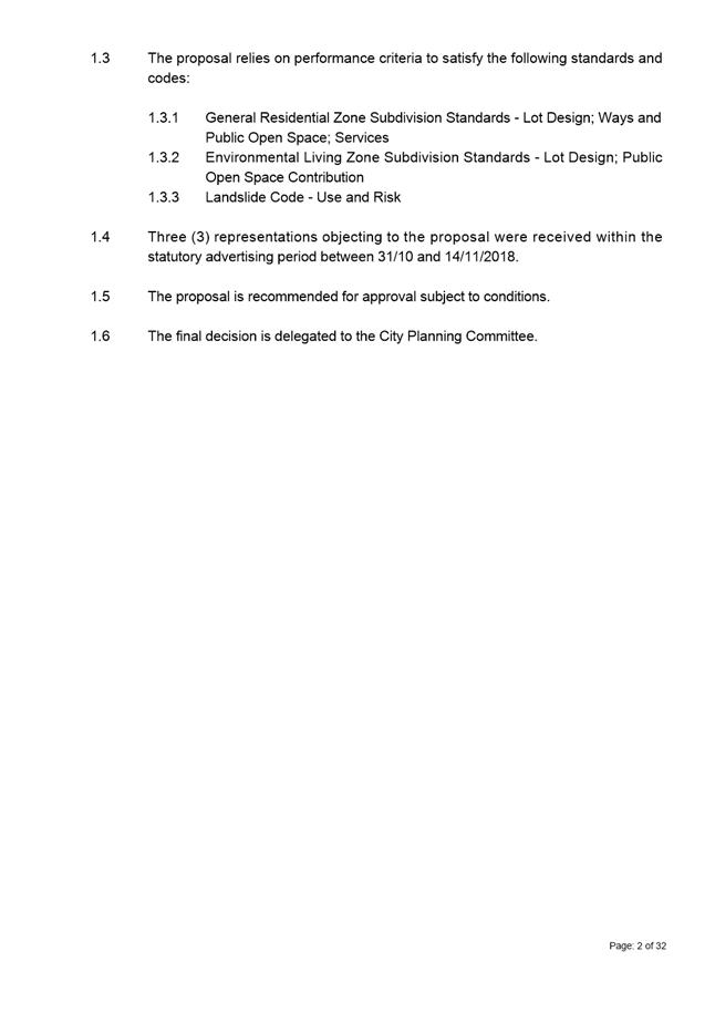
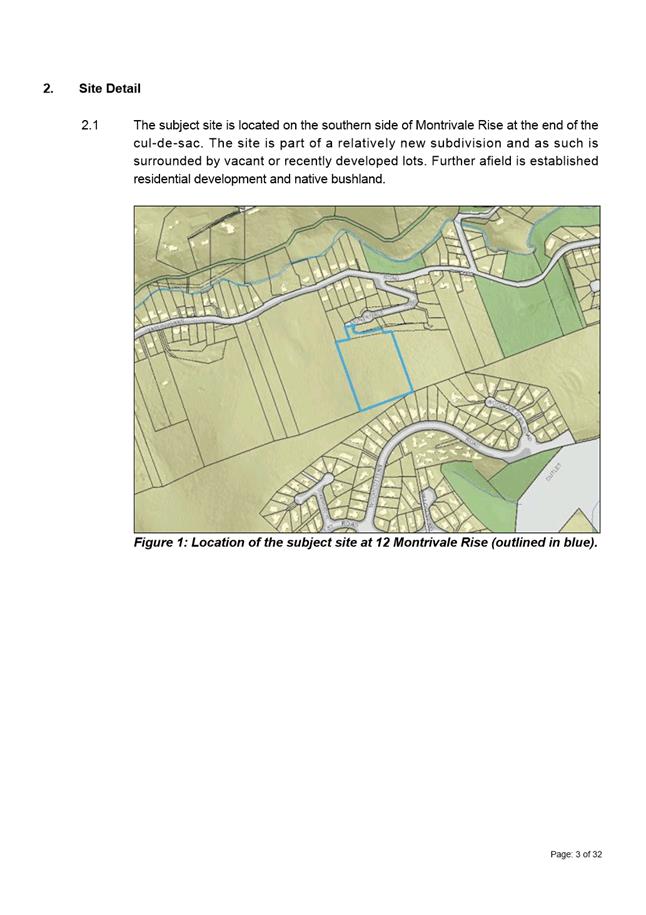
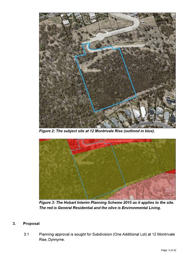
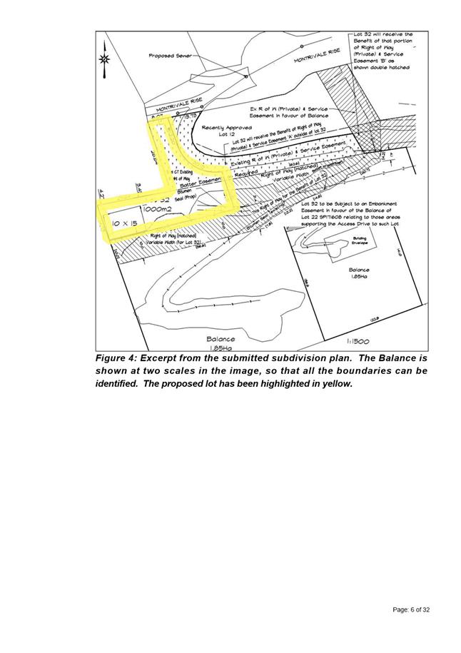
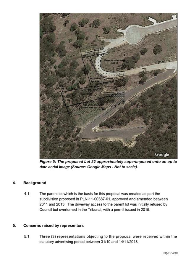

|
Agenda (Open Portion) City Planning Committee Meeting - 10/12/2018 |
Page 458 ATTACHMENT b |
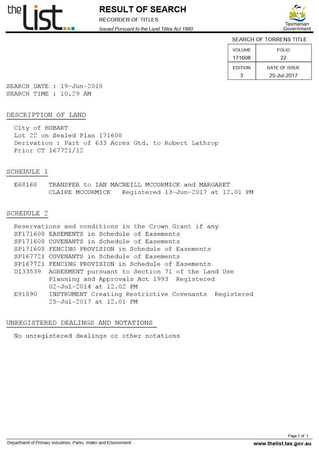
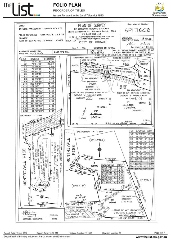
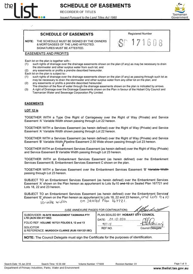
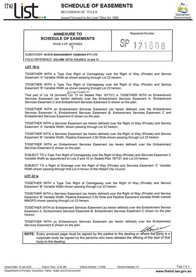
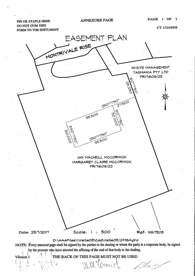
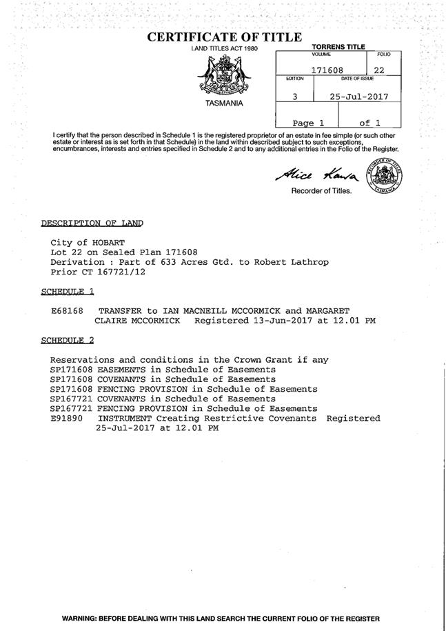
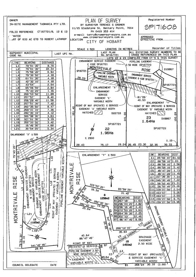
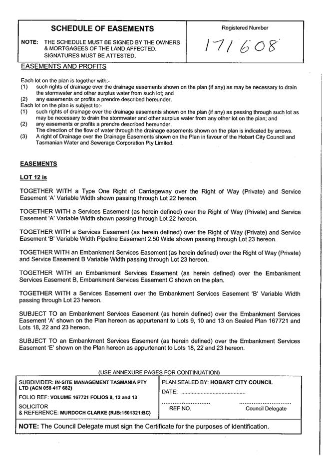
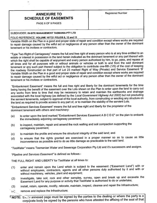
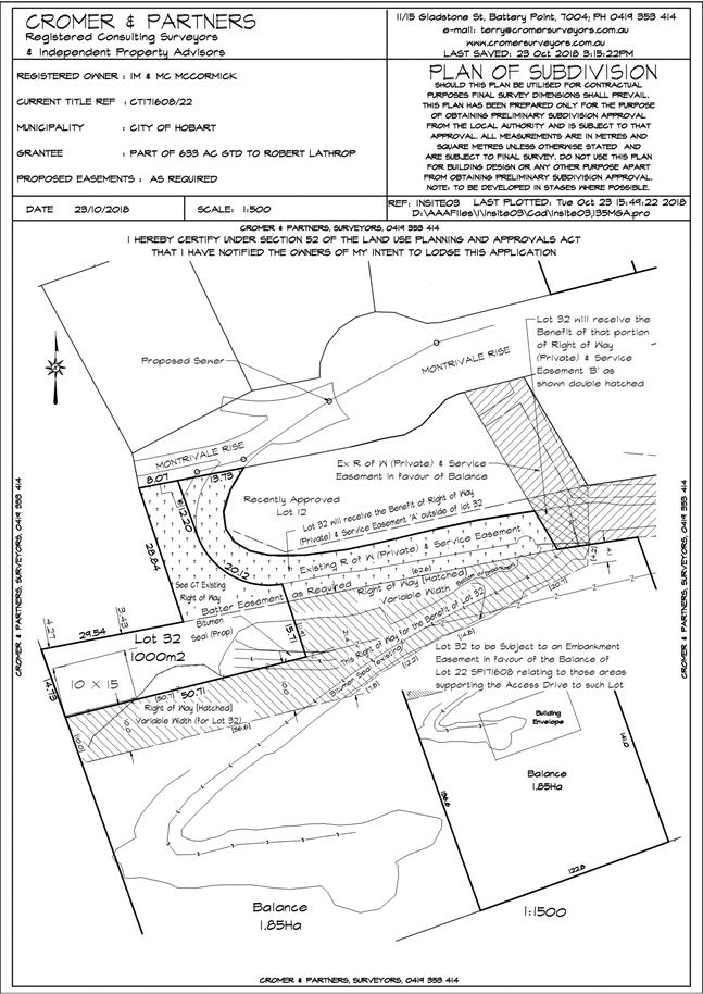
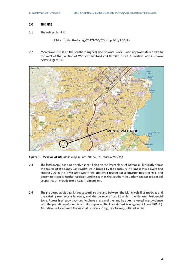
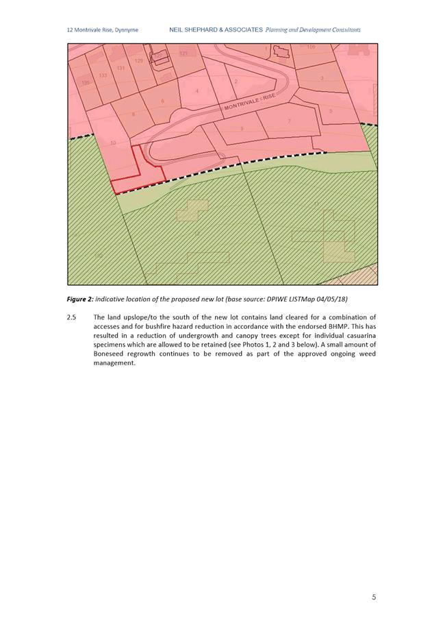
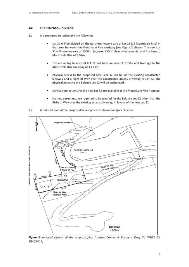

|
Item No. 7.2.2 |
Agenda (Open Portion) City Planning Committee Meeting - 10/12/2018 |
Page 502 ATTACHMENT b |
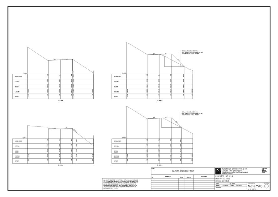
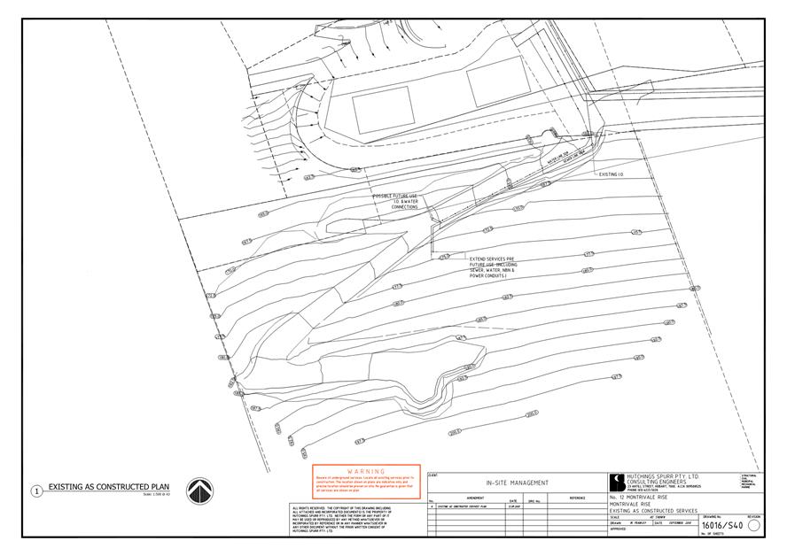
|
Item No. 7.2.2 |
Agenda (Open Portion) City Planning Committee Meeting - 10/12/2018 |
Page 509 ATTACHMENT b |
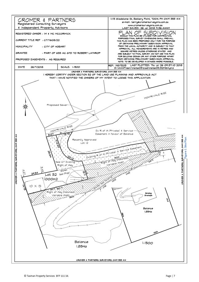
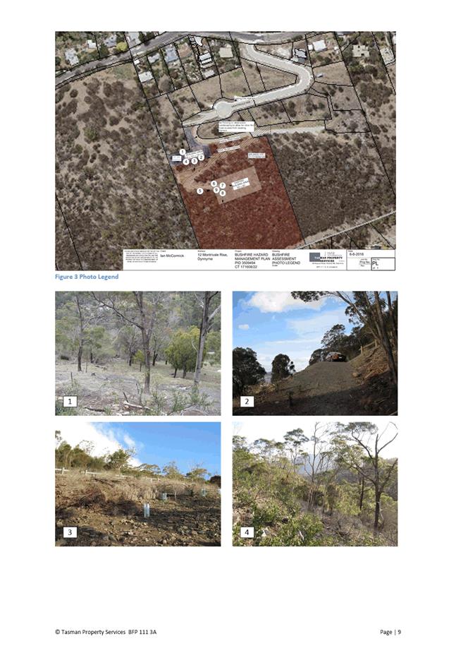
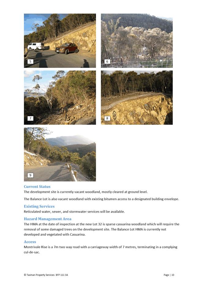
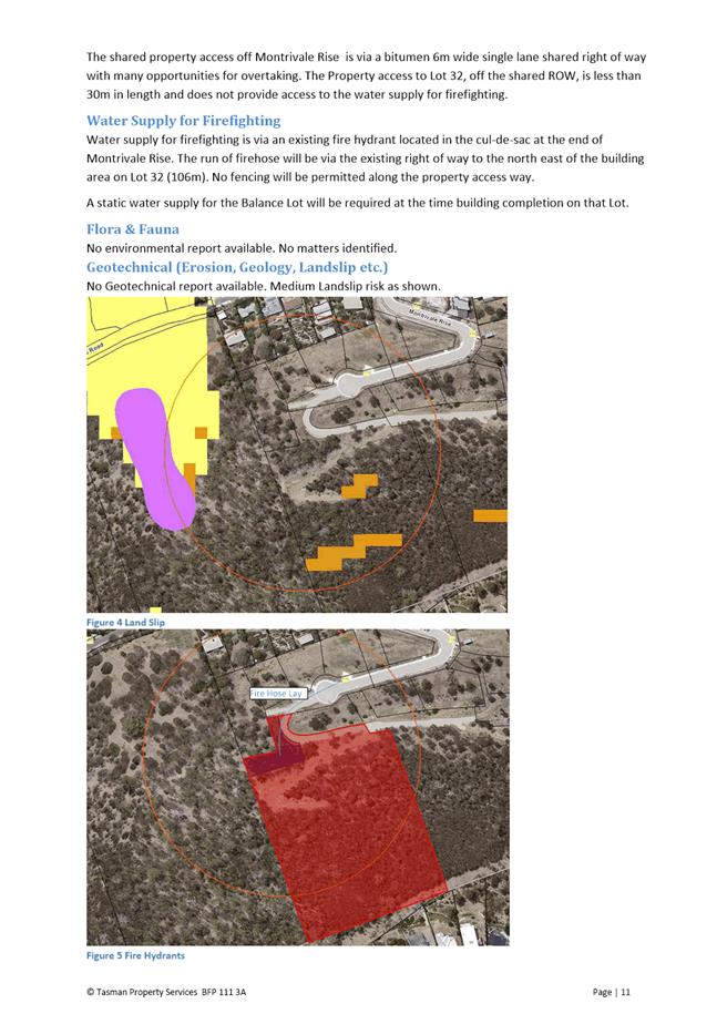
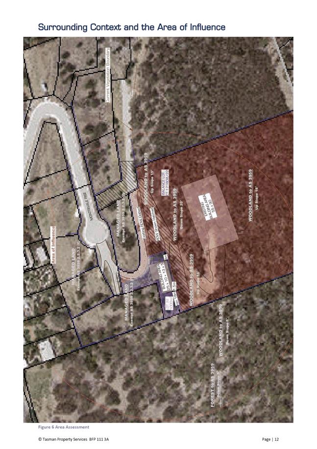
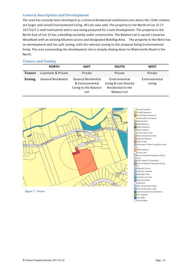
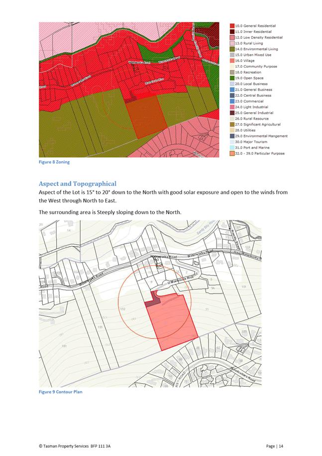
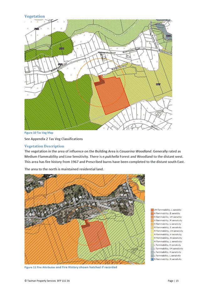
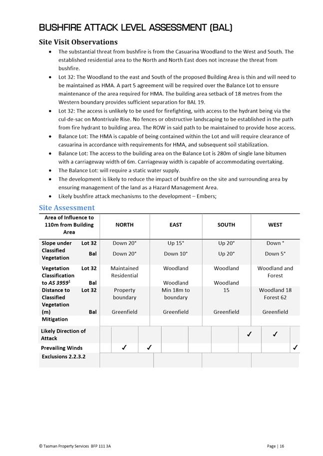
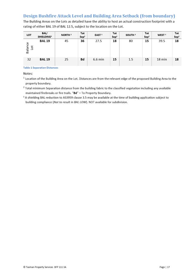
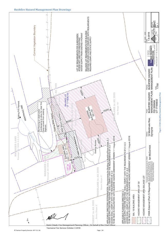
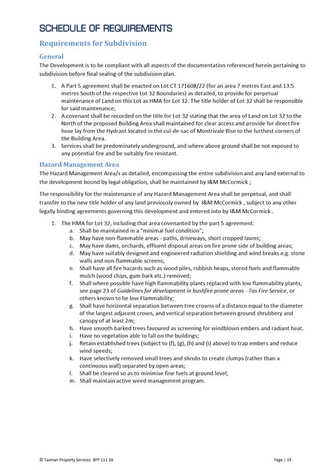
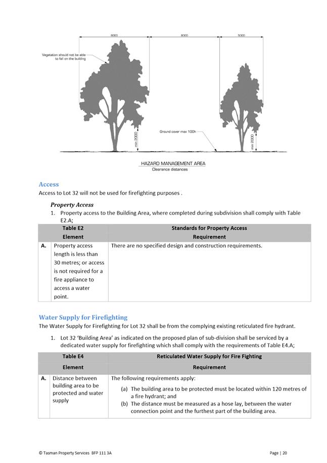

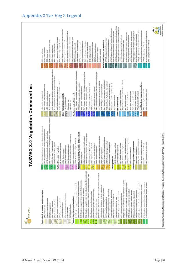
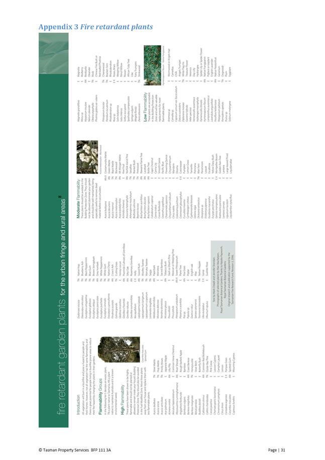
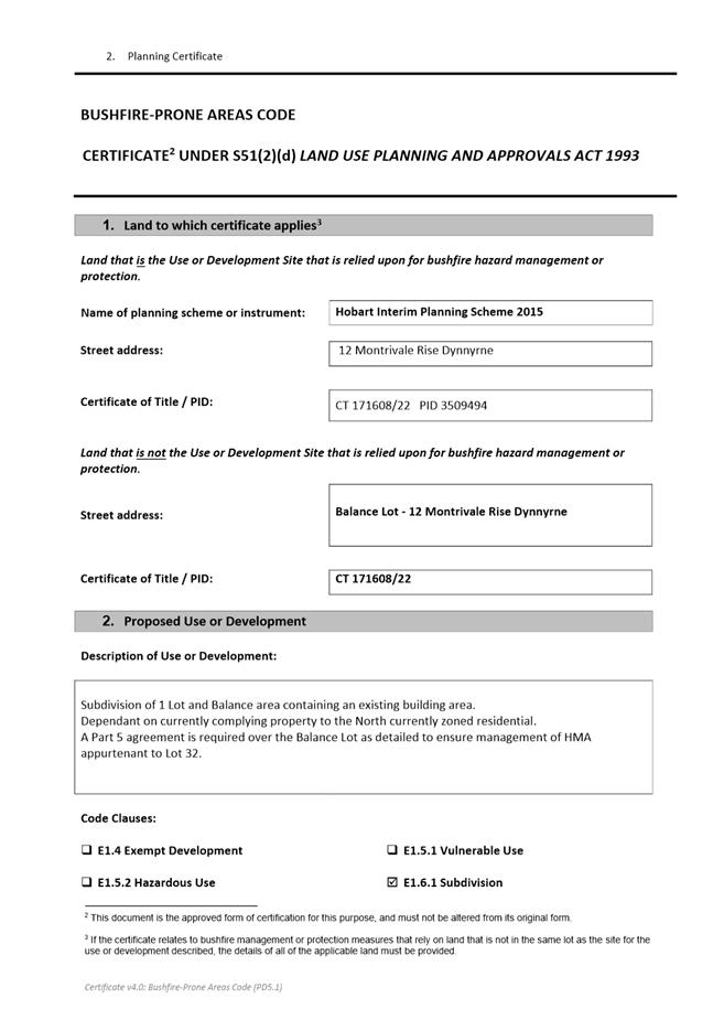
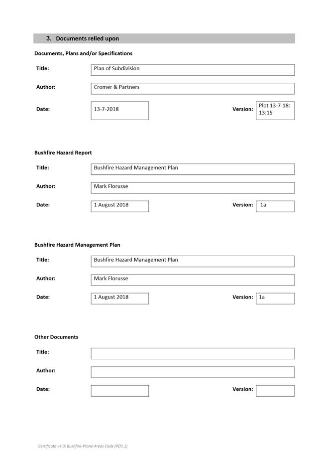
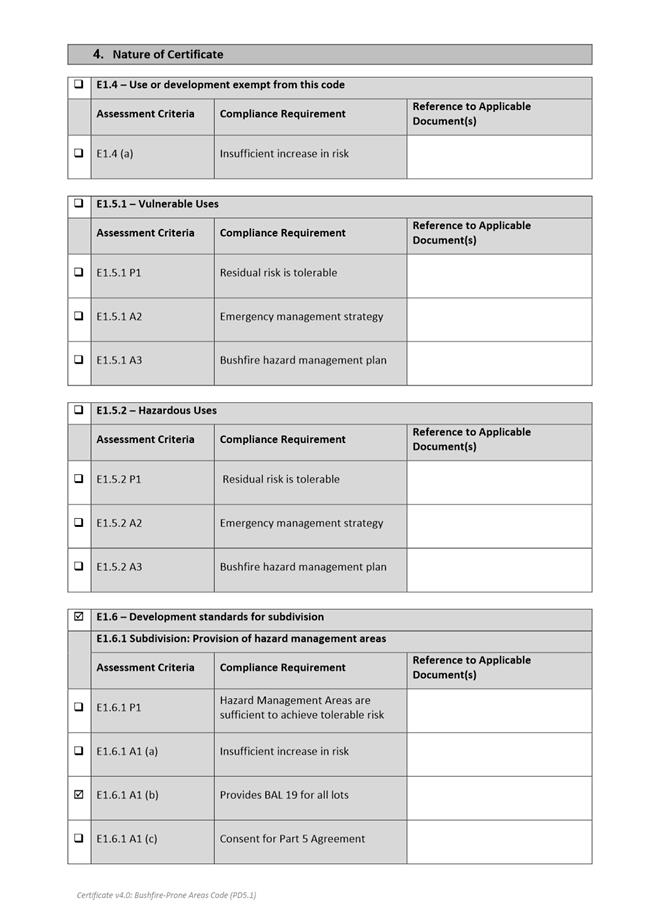
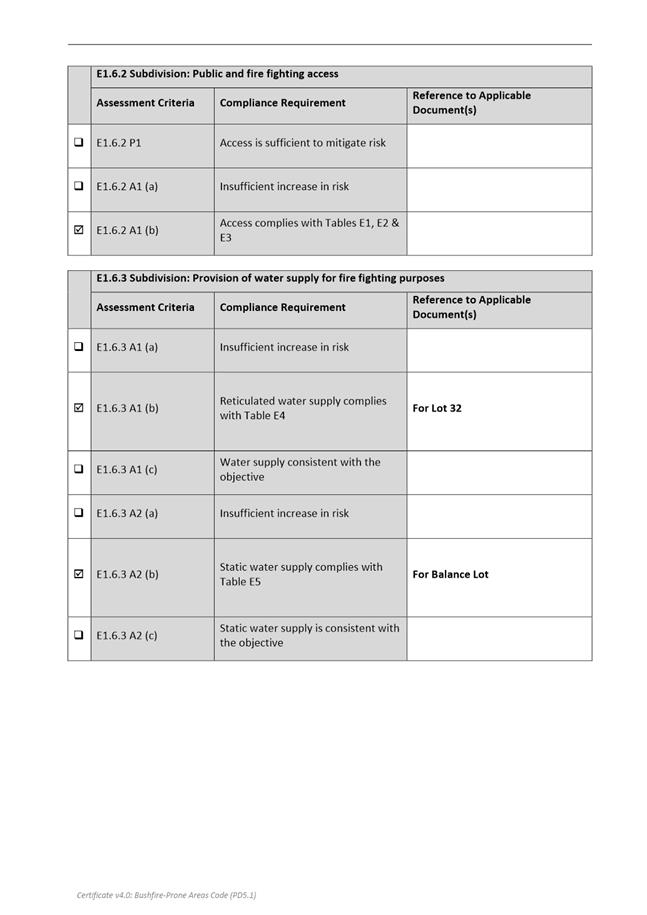
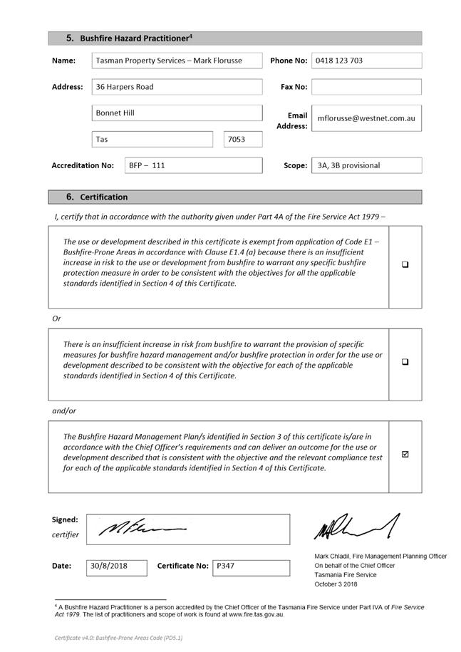
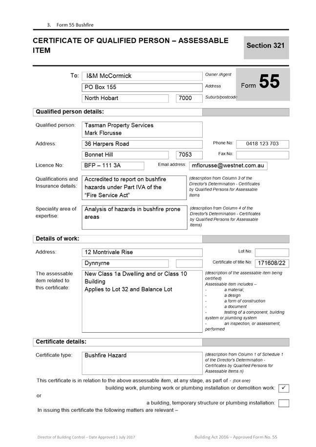
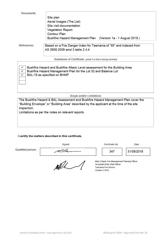
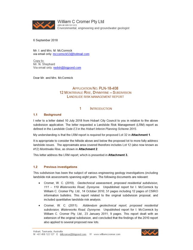
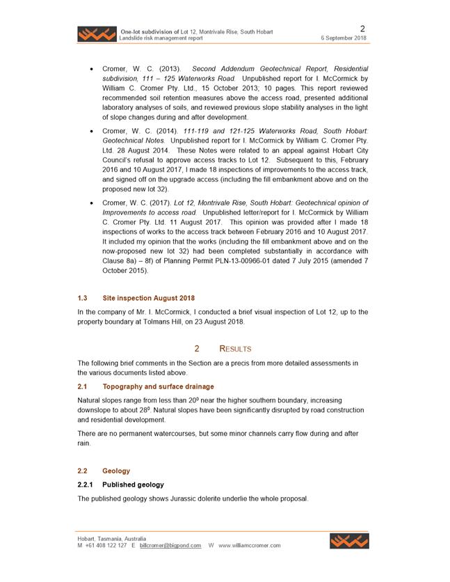
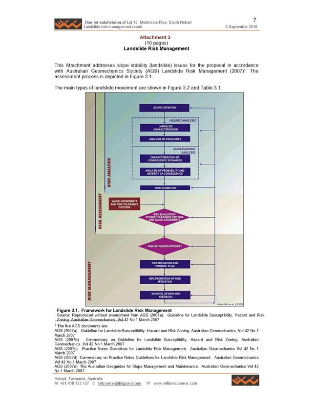
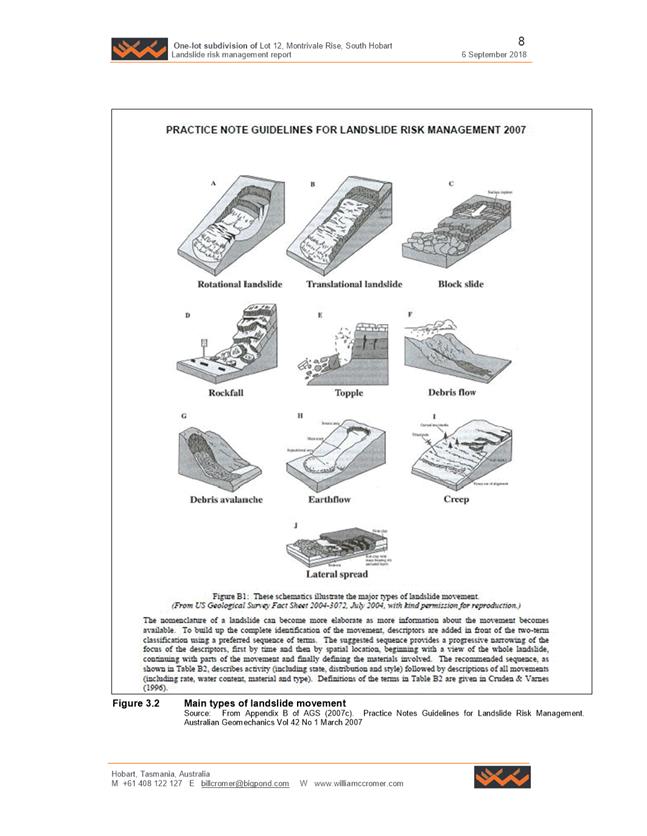
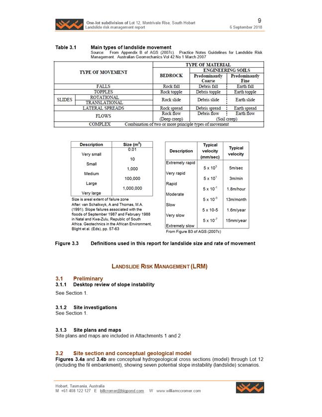
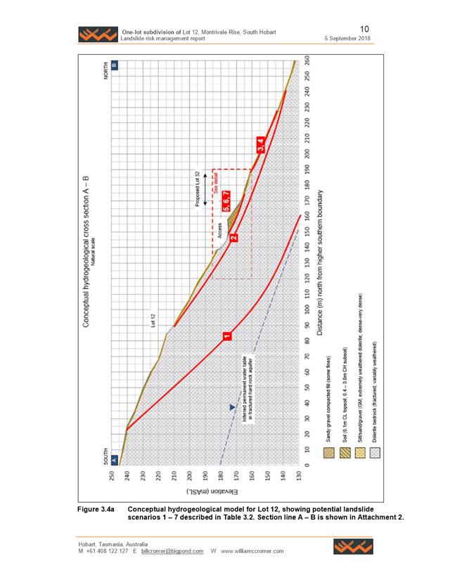
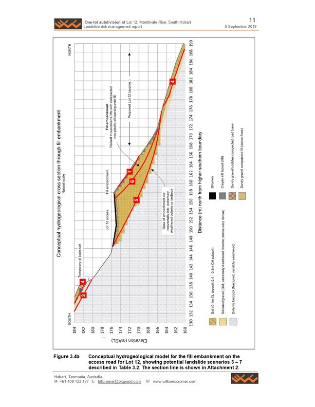
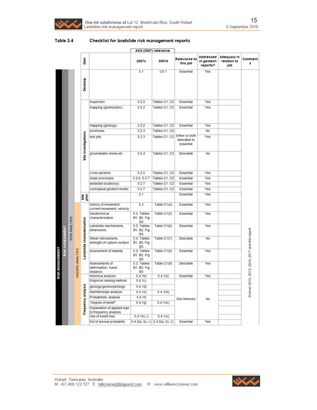
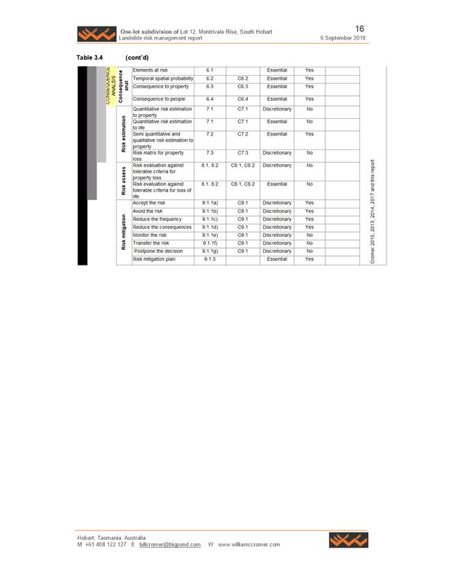
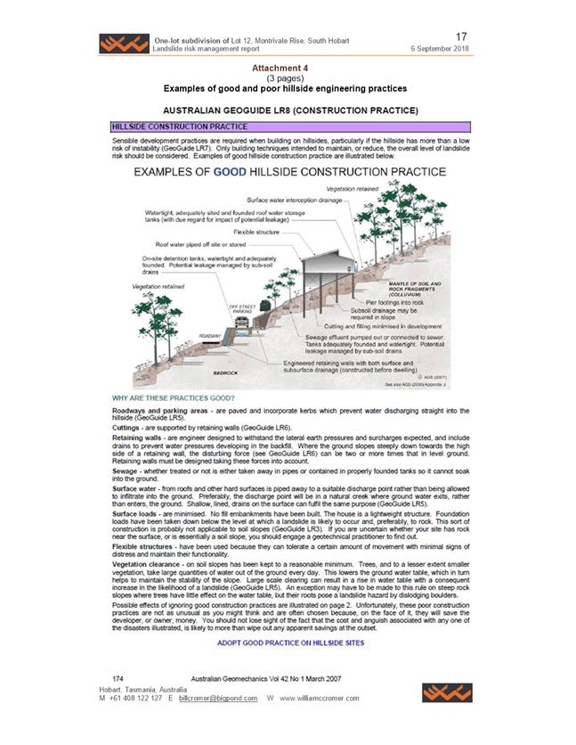
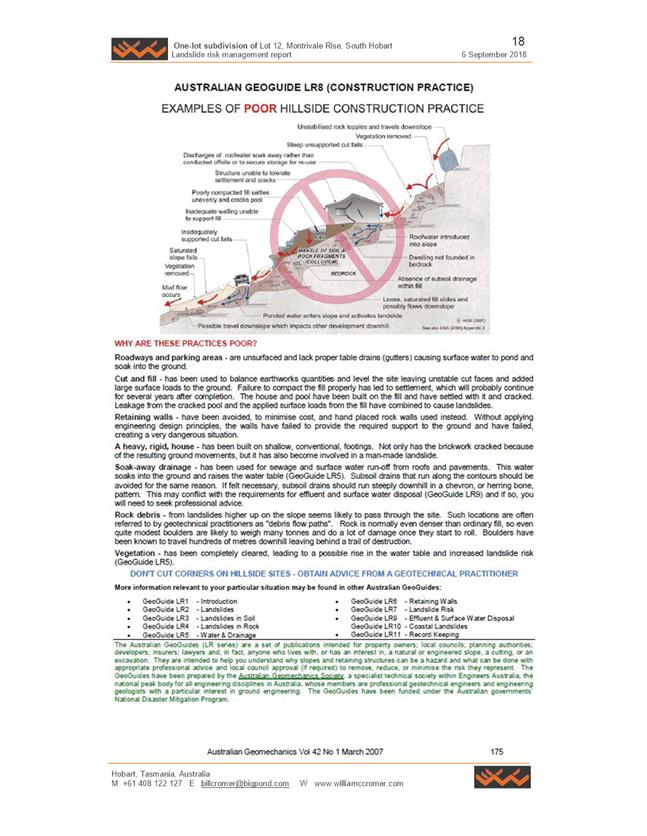
|
Item No. 7.2.2 |
Agenda (Open Portion) City Planning Committee Meeting - 10/12/2018 |
Page 567 ATTACHMENT c |
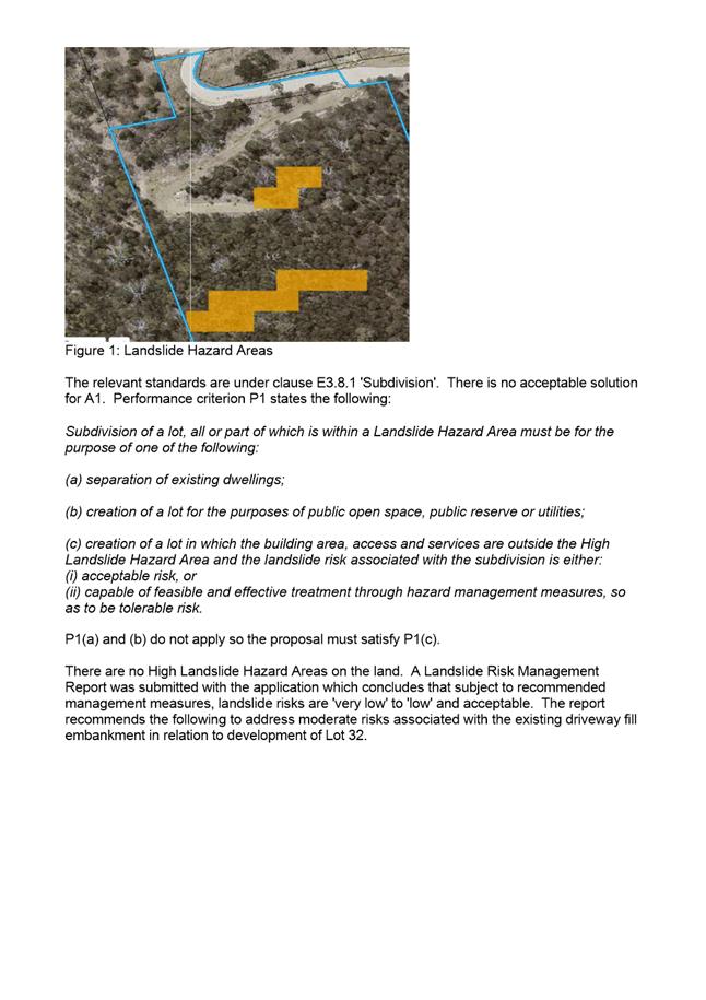
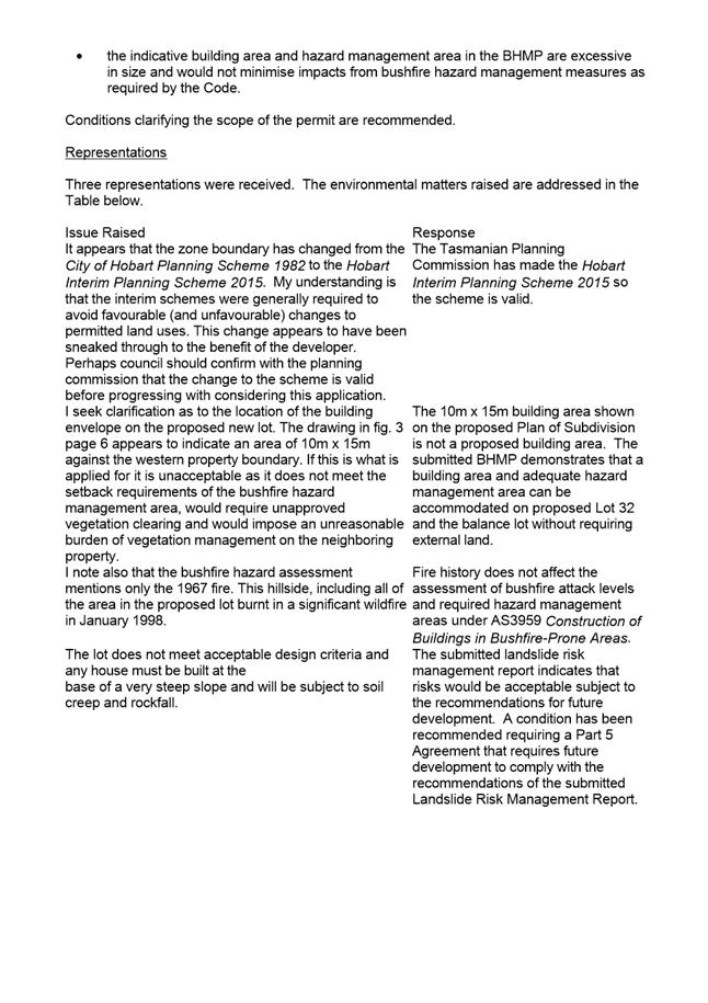
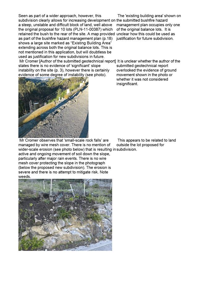
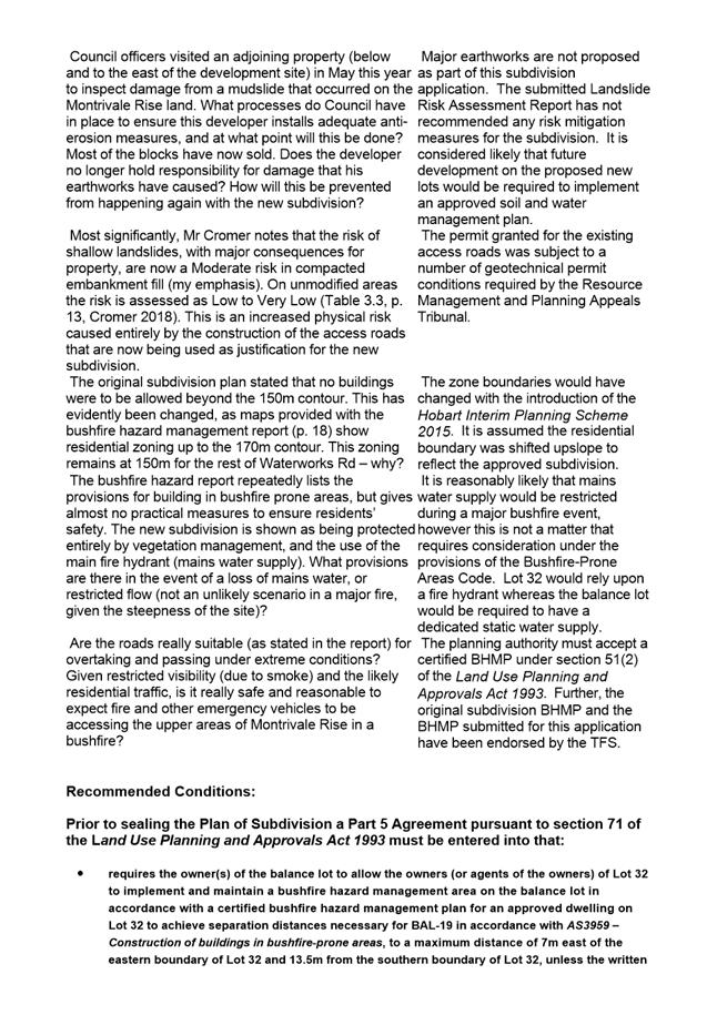
|
Agenda (Open Portion) City Planning Committee Meeting |
Page 577 |
|
|
|
10/12/2018 |
|
7.2.3 441 Macquarie Street, South Hobart - Alterations and Extension to Exhaust Stack
Address: 441 Macquarie Street, South Hobart
Proposal: Alterations and Extension to Exhaust Stack
Expiry Date: 4 January 2019
Extension of Time: Not applicable
Author: Helen Ayers
|
REcommendation That: Pursuant to the Hobart Interim Planning Scheme 2015, the Council approve the application for alterations and extension to exhaust stack at 441 Macquarie Street, South Hobart for the reasons outlined in the officer’s report and a permit containing the following conditions be issued:
GEN
The use and/or development must be substantially in accordance with the documents and drawings that comprise PLN18538 441 MACQUARIE STREET SOUTH HOBART TAS 7004 Final Planning Documents, except where modified below.
Reason for condition
To clarify the scope of the permit.
ADVICE
The following advice is provided to you to assist in the implementation of the planning permit that has been issued subject to the conditions above. The advice is not exhaustive and you must inform yourself of any other legislation, bylaws, regulations, codes or standards that will apply to your development under which you may need to obtain an approval. Visit the Council's website for further information.
Prior to any commencement of work on the site or commencement of use the following additional permits/approval may be required from the Hobart City Council.
BUILDING PERMIT
You may need building approval in accordance with the Building Act 2016. Click here for more information.
This is a Discretionary Planning Permit issued in accordance with section 57 of the Land Use Planning and Approvals Act 1993.
PLANNING
The applicant is encouraged to design and locate the stack's guyropes in such a way as to minimise any visual impact they might cause for neighbouring properties, so far as practicable.
|
Attachment
a: PLN-18-538
- 441 MACQUARIE STREET SOUTH HOBART TAS 7004 - Planning Committee or Delegated
Report ⇩ ![]()
Attachment
b: PLN-18-538-
441 MACQUARIE STREET SOUTH HOBART TAS 7004 - CPC Agenda Documents ⇩ ![]()
|
Item No. 7.2.3 |
Agenda (Open Portion) City Planning Committee Meeting - 10/12/2018 |
Page 579 ATTACHMENT a |
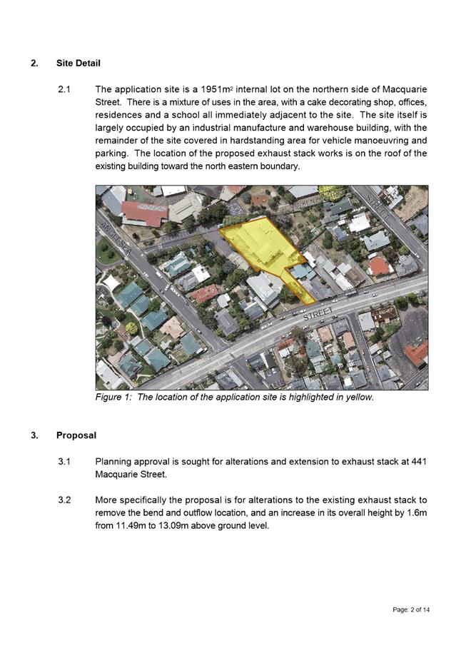
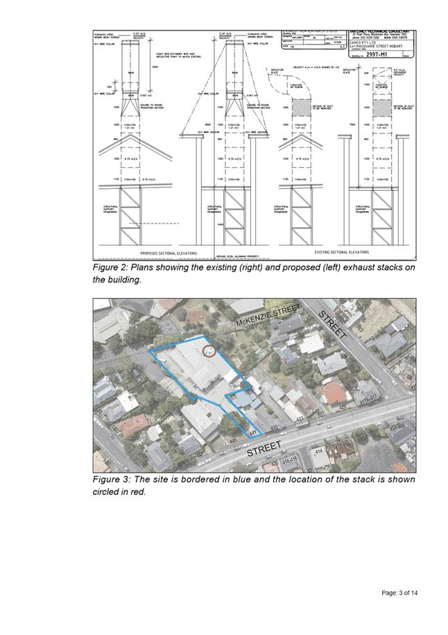
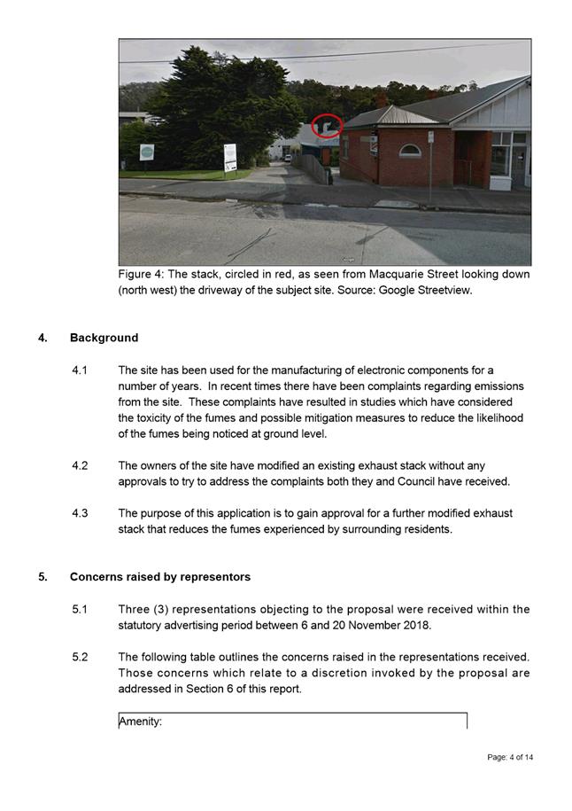

|
Agenda (Open Portion) City Planning Committee Meeting - 10/12/2018 |
Page 593 ATTACHMENT b |
|
Item No. 7.2.3 |
Agenda (Open Portion) City Planning Committee Meeting - 10/12/2018 |
Page 594 ATTACHMENT b |
|
Item No. 7.2.3 |
Agenda (Open Portion) City Planning Committee Meeting - 10/12/2018 |
Page 595 ATTACHMENT b |
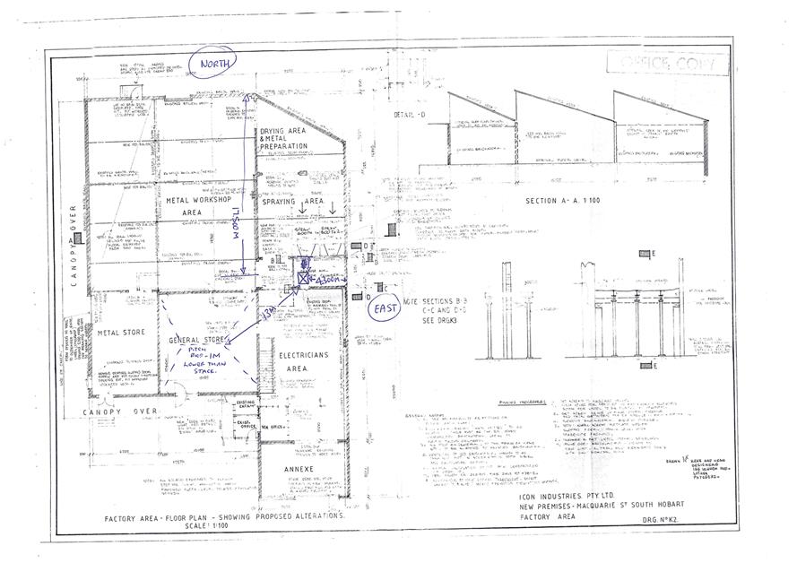
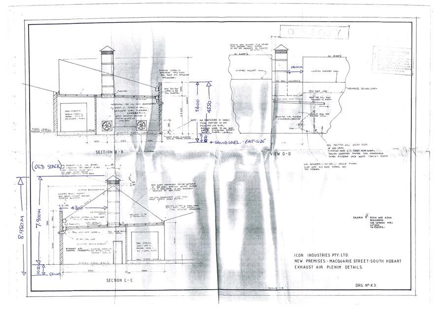
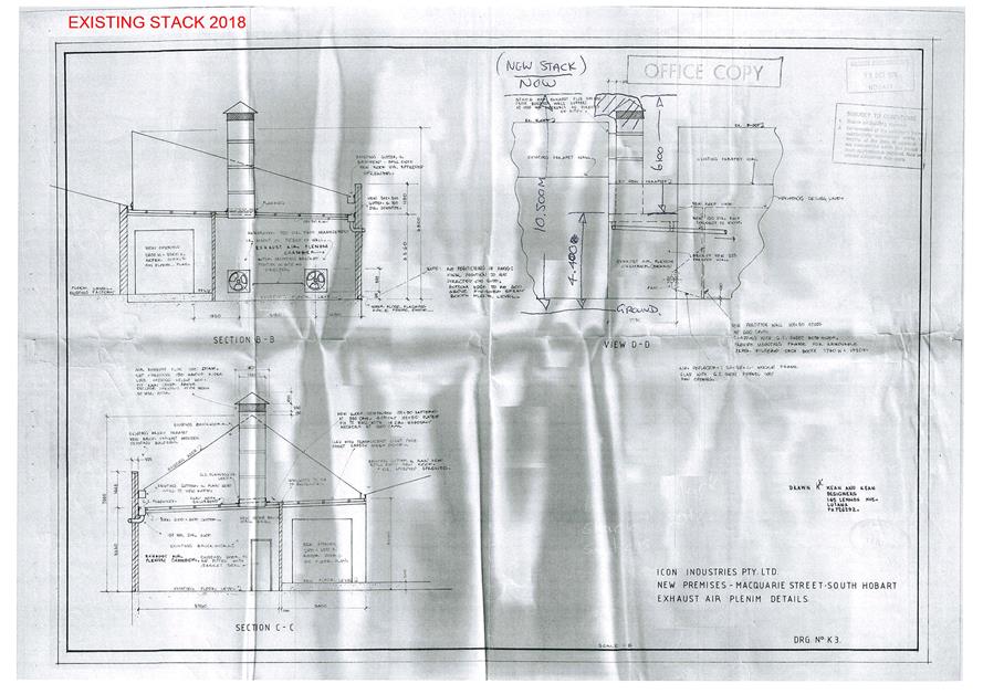
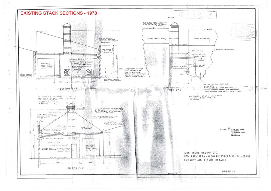
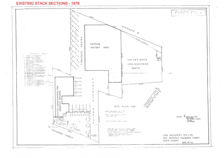
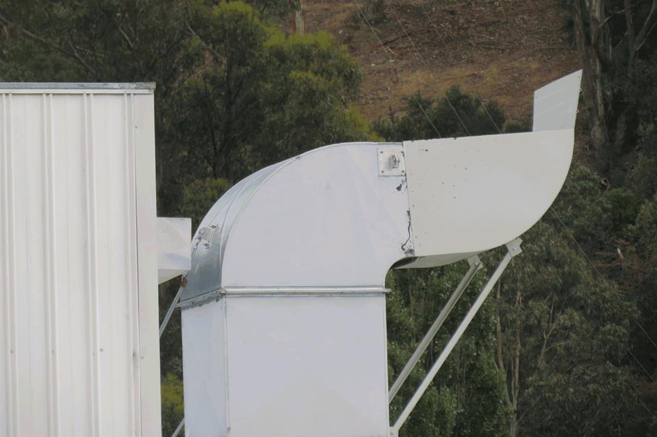
|
Item No. 7.2.3 |
Agenda (Open Portion) City Planning Committee Meeting - 10/12/2018 |
Page 603 ATTACHMENT b |
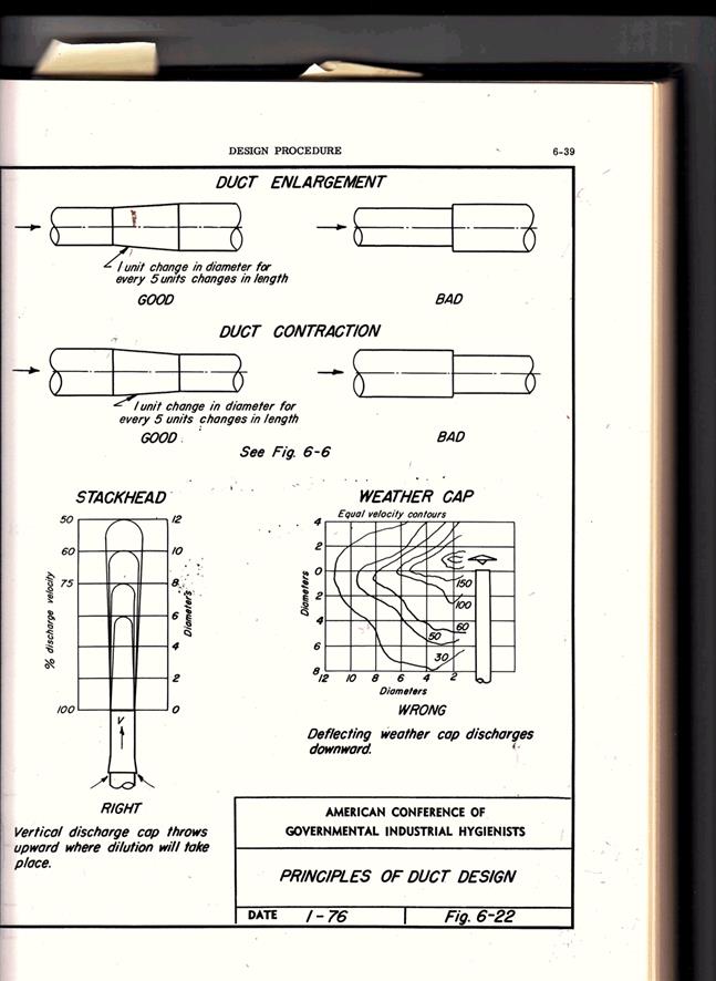
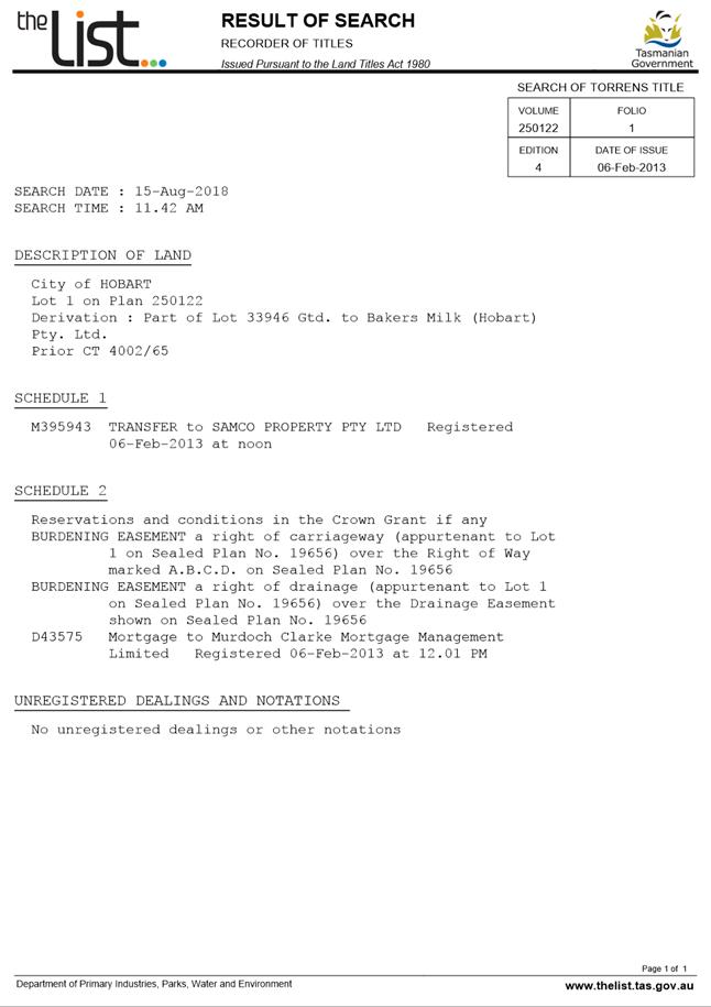
|
Agenda (Open Portion) City Planning Committee Meeting |
Page 607 |
|
|
|
10/12/2018 |
|
8. Reports
8.1 Local Government (Meeting Procedures) Regulations 2015 - Review of Meeting Times
Memorandum of the General Manager of 4 December 2018.
Delegation: Committee
|
Item No. 8.1 |
Agenda (Open Portion) City Planning Committee Meeting |
Page 608 |
|
|
10/12/2018 |
|
Memorandum: City Planning Committee
Local Government (Meeting Procedures) Regulations 2015 - Review of Meeting Times
Regulation 6(2) of the Local Government (Meeting Procedures) Regulations 2015 require that after each ordinary election, a council and council committee are to review the times of commencement of their meetings.
Regulation 6(1) states that a meeting is not to start before 5:00 pm unless otherwise determined by the council committee by simple majority.
Accordingly, the commencement time for ordinary meetings of the City Planning Committee is submitted for consideration.
|
That in accordance with Regulation 6(2) of the Local Government (Meeting Procedures) Regulations 2015, the Committee determine the commencement time for ordinary meetings of the City Planning Committee.
|
As signatory to this report, I certify that, pursuant to Section 55(1) of the Local Government Act 1993, I hold no interest, as referred to in Section 49 of the Local Government Act 1993, in matters contained in this report.
|
N.D Heath General Manager |
|
Date: 4 December 2018
File Reference: F18/141707; 13-1-2
|
Item No. 8.2 |
Agenda (Open Portion) City Planning Committee Meeting |
Page 609 |
|
|
10/12/2018 |
|
8.2 Central Hobart Building Height Standards Review Project - Proposed Planning Scheme Amendments
Report of the Manager Planning Policy and Heritage and the Director City Planning of 5 December 2018 and attachments.
Delegation: Council
|
Item No. 8.2 |
Agenda (Open Portion) City Planning Committee Meeting |
Page 610 |
|
|
10/12/2018 |
|
REPORT TITLE: Central Hobart Building Height Standards Review Project - Proposed Planning Scheme Amendments
REPORT PROVIDED BY: Manager Planning Policy and Heritage
Director City Planning
1.1. This report considers the outcomes of the community consultation on the Building Height Standards Review Project (Leigh Woolley June 2018) (Attachment A) and proposes amendments to the Hobart Interim Planning Scheme 2015 (HIPS 2015) and the Sullivans Cove Planning Scheme 1997 (SCPS 1997) to implement the outcomes of the review.
1.2. The proposal benefits the community by helping to ensure that the height of development in the central area of Hobart and Sullivans Cove makes a positive contribution to the streetscape and townscape values and meets community expectations.
2. Report Summary
2.1. This report considers the outcomes of the community consultation on the Building Height Standards Review Project (Leigh Woolley June 2018) (Attachment A) and proposes amendments to the HIPS 2015 and the SCPS 1997 to implement the outcomes of the review.
2.2. At its meeting on 3 September 2018, the Council endorsed the release of the Building Height Standards Review (L Woolley, 30 June 2018) report and the suggested planning scheme amendments to implement its recommendations, for public comment for a 6 week period, prior to consideration of formally endorsing the report and initiating any planning scheme amendments in response.
2.3. A total of 319 submissions were received at the end of the consultation period. A detailed analysis of the submissions is provided in Attachment C. The key conclusions are as follows:
2.3.1. 275 (86%) respondents support the concept of including absolute maximum height limits in the planning schemes;
2.3.2. 22 (7%) respondents did not support the concept of including maximum height limits in the planning schemes and in the remaining 21 (6.5%) it was unclear whether height limits were supported or not;
2.3.3. Of the respondents that supported maximum height limits; 83 (30%) supported the limits suggested in the draft planning scheme amendments, 69 (25%) did not support the limits suggested, 22 (8%) expressed partial support and in the other 101 (37%) submissions support for or against was not clear;
2.3.4. Of the respondents that did not agree with, or only partially agreed with, the limits suggested in the draft planning scheme amendments, 89 (98%) considered that the limits were too high;
2.3.5. 21 (7%) respondents specifically stated that a maximum building height of 60m was too high;
2.3.6. A number of suggestions were made as to what the maximum height limits should be; these ranged from a maximum of 15m for the whole city to a maximum of 75m. In Sullivans Cove suggested maximum heights ranged from 12m to 18m.
2.4. It is apparent from the submissions received during the community engagement process that the vast majority (86%) of respondents support the concept of including absolute maximum building height limits in the planning schemes. There are a wide variety of opinions however as to what the actual absolute maximum heights should be.
2.5. The proposed planning scheme amendments based on the outcomes of the Review are provided in Attachment B along with a summary and explanation of each amendment. In the Central Business Zone it is proposed that the height control planes be implemented by the designation of 5 Height Areas as shown on the map in Attachment D. The key amendments are outlined in section 5 of this report.
2.6. It is recommended that the Council endorse the Building Height Standards Review (L Woolley, 30 June 2018) report (Attachment A) and the amendments to the HIPS 2015 and SCPS 1997 provided in Attachment B be initiated.
|
That: 1. The outcomes of Building Height Standards Review (L Woolley, 30 June 2018) report (Attachment A) be endorsed. 2. Pursuant to Section 34(1) (b) of the former provisions of the Land Use Planning and Approvals Act 1993, the Council resolve to initiate the amendments provided in Attachment B to the Hobart Interim Planning Scheme 2015 and the Sullivans Cove Planning Scheme 1997.
3. Pursuant to Section 35 of the former provisions of the Land Use Planning and Approvals Act 1993, the Council certify that the PSA-18-4 Amendment to the Hobart Interim Planning Scheme 2015 and the PSA-18-1 Amendment to the Sullivans Cove Planning Scheme 1997 meets the requirements of Section 32 of the former provisions of the Land Use Planning and Approvals Act 1993 and authorise the General Manager and the Deputy General Manager to sign the Instruments of Certification (Attachment I). 4. Pursuant to Section 38 of the former provisions of the Land Use Planning and Approvals Act 1993, the Council place the PSA-18-4 Amendment to the Hobart Interim Planning Scheme 2015 and the PSA-18-1 Amendment to the Sullivans Cove Planning Scheme 1997 on public exhibition for a 28 day period following certification.
|
4. Background
4.1. The current development standards for buildings in the Central Business Zone in the HIPS2015 were formulated after a detailed review and analysis of land use and development patterns in the central city area. The development standards address building height, setbacks, design, passive surveillance, outdoor storage, pedestrian links, heritage, streetscape and sense of scale, wind effects and solar penetration.
4.2. At its meeting on 3 July 2017, the Council endorsed the recommendations of the Central Business Zone Height Standards – Performance Criteria Review report (Woolley 2016) and initiated the PSA-17-3 Amendments to the HIPS2015 to implement the recommendations of that report in relation to streetscape and townscape values. A modified version of those amendments were approved by the Tasmanian Planning Commission on 3 August 2018.
4.3. At its meeting on 3 July
2017, the Council also resolved that:
A further report to Council be prepared addressing the additional
analysis required in relation to a number of issues including the preparation
of design guidelines, modelling of buildings in certain locations, development
of spatial principles to inform appreciation of the ‘urban
amphitheatre’, designation of additional view protection planes, height
control planes and specification of maximum height limits.
4.4. At its meeting on 9 October 2017, the Council endorsed the project brief for that work and subsequently Leigh Woolley - Architect and Urban Design Consultant was commissioned to undertake the project.
4.5. At its meeting on 3 September 2018, the Council endorsed the release of the Building Height Standards Review (L Woolley, 30 June 2018) report and the suggested planning scheme amendments to implement its recommendations, for public comment for a 6 week period, prior to consideration of formally endorsing the report and initiating any planning scheme amendments in response.
5. Proposal and Implementation
5.1. It is proposed that the Council endorse the Building Height Standards Review (L Woolley, 30 June 2018) report (Attachment A) and the draft amendments to the HIPS 2015 and the SCPS 1997 provided in Attachment B be initiated.
Building Height Standards Review (Woolley 2018)
5.2. The outcomes of the Building Height Standards Review (L Woolley, 30 June 2018) is a comprehensive response to the project brief and is a significant body of work that adds considerably to the appreciation of the urban context of Hobart. The work builds on that undertaken by Leigh Woolley in 2016 in relation to the townscape and streetscape values of central Hobart and these are now identified in the Central Business Zone Desired Future Character Statement in the Hobart Interim Planning Scheme 2015.
5.3. The key conclusions from the Building Height Standards Review are as follows:
5.3.1. To maintain the transition in scale from the low-rise residential precincts (on adjacent slopes) to a compact centre, development intensity should be located on the lower contours of the ‘basin’ of the Central Business Zone, rather than its higher contours.
5.3.2. Height control zones stepping back from the Cove and the inner hills assist in identifying an ‘Inner Core’ precinct within the ‘basin’. Modelling suggests that development above the Amenity Building Envelope could be pursued within this precinct, without intruding into primary view cones.
5.3.3. Initial modelling of the ‘inner core’ urban blocks, the amenity building envelope, identified view cones, while acknowledging townscape provisions, indicates capacity for development above 45m, with limited opportunity on most urban blocks above 65m. In some locations height could rise to 75m without impacting primary view cones, subject to heritage and detailed townscape provisions.
5.3.4. In considering appropriate height control planes for Sullivans Cove and Central Hobart the following are recommended in the Review:
- An Escarpment Zone rising from 18m to 30m (+ natural rise);
- A Cove Face Zone rising from 30m to 45m, (+ natural rise;
- A Hill Face Zone rising from 18m to 45m (+ natural rise).
5.3.5. Within the inner core precinct; amenity, townscape and heritage provisions and identified view cones should determine height outcomes.
5.3.6. The combination of proposed height control planes with view protection planes will assist in maintaining Central Hobart as a ‘compact’ and ‘contained’ urban form.
Consultation Outcomes
5.4. The Building Height Standards Review report and the suggested planning scheme amendments to implement its recommendations, were made available for public comment for a 6 week period from 5 September until 17 October 2018. The community engagement process included extensive media coverage, a public forum and drop-in session and the Your Say Hobart web page which received a total of 751 visits. A total of 319 submissions were received at the end of the consultation period.
5.5. A detailed analysis of the submissions is provided in Attachment C. The key conclusions are as follows:
5.5.1. 275 (86%) respondents support the concept of including absolute maximum height limits in the planning schemes;
5.5.2. 22 (7%) respondents did not support the concept of including maximum height limits in the planning schemes and in the remaining 21 (6.5%) it was unclear whether height limits were supported or not;
5.5.3. Of the respondents that supported maximum height limits; 83 (30%) supported the limits suggested in the draft planning scheme amendments, 69 (25%) did not support the limits suggested, 22 (8%) expressed partial support and in the other 101 (37%) submissions support for or against was not clear;
5.5.4. Of the respondents that did not agree with, or only partially agreed with, the limits suggested in the draft planning scheme amendments, 89 (98%) considered that the limits were too high;
5.5.5. 21 (7%) respondents specifically stated that a maximum building height of 60m was too high;
5.5.6. A number of suggestions were made as to what the maximum height limits should be; these ranged from a maximum of 15m for the whole city to a maximum of 75m. In Sullivans Cove suggested maximum heights ranged from 12m to 18m;
5.5.7. Other suggestions or comments made related to issues such as; quality of design, building energy efficiency, development feasibility and impact on housing affordability.
5.6. Common arguments made in the submissions for and against maximum building height limits being included in the planning schemes are summarised in Attachment C along with summaries of submissions by groups and organisations such as the Property Council, Australian Institute of Architects and Hobart Not Highrise.
5.7. It is apparent from the submissions received during the community engagement process that the vast majority (86%) of respondents support the concept of including absolute maximum building height limits in the planning schemes.
5.8. In relation to what the actual absolute maximum heights should be, opinion is more diversified with a range of views expressed that the maximum height limits suggested in the draft planning scheme amendments were either acceptable or too high.
5.9. 37% of respondents who agreed with the concept of maximum height limits did not indicate whether the suggested height limits were supported or opposed. Only 1 respondent suggested that they were too low.
5.10. A number of responses were received through a website set up by Hobart not Highrise, which paid particular attention to the proposed maximum height limits in relation to developments proposed on land owned by the Fragrance Group. 20 of the responses that supported the suggested maximum height limits only specifically referenced support of heights in these areas.
Discussion
5.11. In determining appropriate maximum building height limits it is necessary to achieve a balance between protecting Hobart’s townscape and streetscape values and providing for an appropriate level of economic development.
5.12. Under the Southern Tasmania Regional Land Use Strategy (STRLUS), Central Hobart is the Primary Activity Centre and is intended to be the densest and most compact development precinct in the state and the ‘primary hub’ for Tasmania where a significant proportion of all employment opportunities within the region should continue to be focussed.
5.13. Maximum building heights of up to 45m in proposed Height Areas 2 and 4 and up to 60m in Height Area 1 are not considered to be a significant constraint to economically viable building development in these areas given a number of development proposals approved in recent years have been below or only marginally above these heights.
5.14. Many of the submissions considered that Hobart should preserve a very low townscape in keeping with its heritage buildings, and some suggested moving high-rise structures outside of Hobart city to enable this. It is considered, however, that restricting almost all development in the city and decentralising development would contravene the STRLUS and exacerbate urban sprawl and transport issues in and around Hobart. These submissions deny the built reality of the CBD with numerous examples of buildings exceeding 45 metres in height. The CBD is not a homogenous low rise heritage precinct although it does have numerous important heritage buildings.
5.15. A reasonably common suggestion within the submissions was for the maximum height to be lowered to 45m in the inner core area (Height Area 1). It is considered, however, that a 45m absolute maximum for the intensification area of a capital city is overly restrictive.
5.16. It is noted that overall height is only one component of the proposed amendments, and development on many city blocks would not be capable of reaching the maximum height and still satisfy all other performance criteria. For those sites that are capable of achieving the maximum height while meeting all other criteria, 60m is not considered to be excessive.
5.17. It is considered that the outcomes of the Building Height Standards Review provides a sound basis for the designation of maximum height limits. These maximum height limits along with the other recommended planning scheme amendments will assist in maintaining the streetscape and townscape values of Central Hobart and Sullivans Cove and provide greater certainty and direction in the consideration of discretionary proposals while providing for appropriate levels of development.
5.18. A number of issues raised in submissions, such as those related to building energy efficiency are outside the scope of this review. The need for improved building design was mentioned in a number of submissions and this is addressed in the proposed requirement for an urban context report and design response. The need for additional pedestrian priority streets should be considered as part of any future review of the Inner City Action Plan.
Draft Planning Scheme Amendments
5.19. The recommended draft planning scheme amendments based on the outcomes of the Building Height Standards Review are provided in Attachment B along with a summary and explanation of each amendment. These amendments are substantially the same as those made available for public comment with the following exceptions:
5.19.1. The boundary between proposed Height Areas 1 and 4 has been adjusted 25m to the south west to follow Watchhorn Street in order to simplify implementation. This change is proposed in response to a submission received.
5.19.2. The boundary between Height Areas 2 and 3 has been amended to follow the mid-block lot boundaries between Harrington and Murray Streets rather than Macquarie Street. This change is proposed in response to a submission received noting there are already a number of higher buildings in this block and the topographic boundary identified in the Building Height Standards Review cut through the middle of the street block; and
5.19.3. In Height Area 4 the requirement for a transition in height from Height Area 5 or the Commercial Zone has also been applied to the Brooker Highway in response to a suggestion from the Urban Design Advisory Panel.
5.19.4. The performance criteria in clause 22.4.1 have been clarified in relation to consideration of view cones, view shafts and view fields and definitions of these terms have been added to clause 4.1.
5.20. The key amendments are outlined below:
5.21. In the Central Business Zone it is proposed that the height control planes be implemented by the designation of 5 Height Areas as shown on the map in Attachment D.
5.22. The boundaries of the height control planes have been modified in order to simplify implementation and take account of streets, property boundaries, zone boundaries, existing development, heritage constraints and the boundary of the Sullivans Cove Planning Scheme 1997. The overall intent of the recommended height control planes has however been maintained.
5.23. As indicated in the summary table in Attachment D, for each of Height Areas 1 to 5 an acceptable solution (permitted) maximum height is specified along with a suggested absolute maximum height that would be contained in the performance criteria. These range from 18m in Height Area 5 to 60m in Height Area 1. The Height Areas would be included in the Planning Scheme in a new Figure 22.2.
5.24. The performance criteria for the Height Areas are included in an amended clause 22.4.1 and require consideration of compatibility with existing buildings in the area, preventing unreasonable impacts on identified views, overshadowing of Pedestrian Priority Streets, overshadowing of public open space, adverse wind conditions and consistency with the Desired Future Character Statements in clause 22.1.3.
5.25. The performance criteria for Height Areas 1 to 4 also require that a design response must be provided that demonstrates the form, design, materials and detailing of the proposed development derives from and responds to characteristics identified in an urban context report in a way that makes a positive contribution to the streetscape and townscape. In addition development outside the amenity building envelope must provide significant civic amenities.
5.26. In Height Area 4 the performance criteria also requires a transition in the height of development within Height Area 4 between higher buildings in the inner core of the Central Business Zone (Height Area 1) and lower buildings in adjacent zones and Height Area 5. In Height Area 4 the absolute height limit proposed is 45m or 21m if within 50m of land within Height Area 5, the Commercial Zone or the Brooker Highway.
5.27. In the inner core of the Central Business Zone (Height Area 1) the suggested absolute maximum height is 60m. This is based on a detailed block by block analysis (see Attachment E) taking into account; topography, existing development, lot size and arrangement and heritage constraints. It is clear that in many circumstances, the maximum potential height as modelled in the Building Height Standards Review would not be able to be practically achieved.
5.28. The Central Business Zone clause 22.1.3 Desired Future Character Statements is proposed to be amended so that the statements reflect the Review outcomes and ensure the statements are considered for all developments discretionary for height, not just those outside the Amenity Building Envelope. A definition of ‘urban context report’ is also proposed to be included in clause 4.1.
5.29. The Central Business Zone Figure 22.6 is proposed to be amended to include the additional view lines and view cones identified in Section 4 of the Building Height Standards Review Report. Some submissions suggested that additional views should be included. The significant number of views already identified are considered to be a representative sample and it is not possible to identify every important viewing point. It may be possible for a future study to identify additional important views.
5.30. It is also proposed that the sites currently zoned Commercial between Melville and Brisbane Streets be rezoned to Central Business. The types of uses encouraged in the Commercial Zone such as bulky goods sales are not considered the most desirable for this location on the fringe of the CBD. The Central Business Zone will more accurately reflect the current uses on the blocks and will generally allow for increased development potential in a well located and well serviced area on the fringe of the CBD. A detailed assessment of the appropriate zoning of this area is provided in Attachment F.
5.31. The current HIPS2015 Central Business Zone provisions related to development standards for buildings are provided in Attachment G.
Commercial Zone
5.32. The proposed amendments to the Commercial Zone clause 23.4.1 Building Height are intended to make the height provisions of the Commercial Zone more consistent with the Central Business Zone and also set an absolute maximum height limit of 18m. The permitted height in this zone is 11.5m or 15m if the development provides at least 50% of the floor space above ground level for residential use.
Urban Mixed Use Zone
5.33. In the Urban Mixed Use Zone clause 15.4.1 Building Height P1 and P2 it is proposed to insert an absolute maximum building height of 15m for the whole of the Urban Mixed Use Zone in order to provide a transition in height from the Inner Residential Zone. The permitted height in this zone is 10m.
Sullivans Cove Planning Scheme 1997
5.34. The SCPS Wapping Local Area Plan clause 15.5.9 Height is proposed to be amended to introduce an absolute maximum height of 21m for Wapping which is currently the highest ‘deemed to comply’ (permitted) height under the Wapping Local Area Plan.
5.35. 8 of the submissions received suggested that the maximum height in Wapping should be 18m which is the same as suggested for the rest of Sullivans Cove. This is not consistent with the outcomes of the Building Height Standards Review which concluded that Wapping could accommodate higher buildings than the floor of Sullivans Cove. It is also noted that the ‘deemed to comply’ heights in Wapping were established following preparation of a detailed urban design study and 21m could only be achieved on sites with a lower ‘deemed to comply’ height if all of the other relevant Scheme standards are met.
5.36. It is proposed that Schedule 2 Urban Form clause 23.6.2 ‘Discretionary’ Buildings be amended to include an absolute maximum height of 18m for the remainder of the SCPS. 18m is currently the highest ‘deemed to comply’ (permitted) height under clause 23.6.1 A and Figure 8 Deemed to Comply Heights (Attachment H). No change is proposed to the permitted heights.
5.37. Whether or not maximum building heights will be specified in the Macquarie Point Site Development Plan (SDP) is yet to be determined. The Master Plan is currently under review by the Macquarie Point Development Corporation. If the Macquarie Point Development Corporation Amendment Bill 2018 is passed by Parliament amendments to the SDP will be made through the process established under the Macquarie Point Development Corporation Act 2012.
Urban Design Advisory Panel Consideration
5.38. The Urban Design Advisory Panel considered the Building Height Standards Review at its meeting on 27 July 2018 and advised that it supports the underlying approach taken by the Building Height Standards Review in determining appropriate maximum building heights for the Central Business Zone and adjacent Zones. In doing so the Panel strongly affirms the comments made in the report that the maximum heights nominated must be expected to be further moderated on a site by site basis after having taken into consideration local townscape, streetscape, heritage and other urban design matters.
6. Strategic Planning and Policy Considerations
6.1. The proposed planning scheme amendments will assist in the achievement of the strategic objectives of the Capital City Strategic Plan 2015-2025 particularly in relation to Goal 2 Urban Management - 2.3 "City and regional planning ensures quality design, meets community needs...."
6.2. The implementation of the outcomes of the Building Height Standards Review is consistent with; Hobart: A community vision for our island capital, particularly in relation to the statements in Pillar 1. Sense of Place and Pillar 7. Built Environment.
7. Financial Implications
7.1. Funding Source and Impact on Current Year Operating Result
7.1.1. None.
7.2. Impact on Future Years’ Financial Result
7.2.1. None.
7.3. Asset Related Implications
7.3.1. None.
8. Legal, Risk and Legislative Considerations
8.1. The Land Use Planning and Approvals Act 1993 (LUPAA) requires that planning scheme amendments must seek to further the objectives of Schedule 1 of the Act and be prepared in accordance with State Policies.
8.2. The objectives of the Act require use and development to occur in a fair, orderly and sustainable manner and for the planning process to facilitate economic development in accordance with the other Schedule 1 objectives.
8.3. It is considered that the proposed amendment meets the objectives of LUPAA, in particular it:
8.3.1. Assists sound strategic planning by assisting in the achievement of the relevant Zone Objectives and the Southern Tasmania Regional Land Use Strategy (STRLUS) policies;
8.3.2. Is consistent with the objective to establish a system of planning instruments to be the principal way of setting objectives, policies and controls for the use, development and protection of land;
8.3.3. Assists in the provision of a pleasant living and working environment by protecting key townscape and streetscape values; and
8.3.4. Assists in the conservation of places of special cultural value by helping to protect key townscape and streetscape values.
8.4. The amendment does not conflict with the State Policies - Coastal, Agricultural Land and Water Quality.
8.5. S32(e) of the former provisions of LUPAA requires that planning scheme amendments must avoid the potential for land use conflicts in adjacent planning scheme areas. The proposed amendment will not result in any land use conflict.
8.6. S32(f) of the former provisions of LUPAA requires that planning scheme amendments must have regard to the impact that the use and development permissible under the amendment will have on the use and development of the region as an entity in environmental, economic and social terms. The amendment is consistent with the STRLUS activity centre policies and provides for an appropriate level of development in the Primary Activity Centre.
8.7. Section 30O of LUPAA requires that an amendment to an interim planning scheme is as far as practicable, consistent with the regional land use strategy. The proposed amendment is consistent with the following activity centre policies in the STRLUS:
8.7.1. AC 1 Focus employment, retail and commercial uses, community services and opportunities for social interaction in well-planned, vibrant and accessible regional activity centres that are provided with a high level of amenity and with good transport links with residential areas;
8.7.2. AC 1.5 Ensure high quality urban design and pedestrian amenity through the respective development standards;
8.7.3. AC 1.8 Ensure that new development and redevelopment in established urban areas reinforce the strengths and individual character of the urban area in which the development occurs;
8.7.4. AC 2.2 Achieve high quality design for all new prominent buildings and public spaces in the Primary and Principal Activity Centres.
9. Community and Stakeholder Engagement
9.1. The Council has requested that reports which recommend the initiation of planning scheme amendments address the need to conduct a public meeting or forum to explain the proposed amendments an also outline the explanatory information to be made available. These are addressed below:
9.2. It is considered that a public briefing is desirable to further explain the proposed amendments and the consultation outcomes to the public given the current community interest in the issue of building height in the Central Hobart.
9.3. The following information will be made available on the website: a copy of this report, the formal amendment documents, explanatory documents and the Building Height Standards Review (L Woolley, 30 June 2018) report.
9.4. If the Council endorsers the recommendations, it is proposed that the 28 day public exhibition period and briefing(s) would occur after the Christmas/ New Year holiday period.
9.5. Council will have the opportunity to recommend to the Tasmanian Planning Commission modifications or refusal of the amendment after the 28 day public advertising period.
10. Delegation
10.1. This matter is delegated to the Council.
As signatory to this report, I certify that, pursuant to Section 55(1) of the Local Government Act 1993, I hold no interest, as referred to in Section 49 of the Local Government Act 1993, in matters contained in this report.
|
James McIlhenny Manager Planning Policy and Heritage |
Neil Noye Director City Planning |
Date: 5 December 2018
File Reference: F18/137234; 17/167
Attachment a: Building
Height Standards Review Woolley Report ⇩ ![]()
Attachment
b: Amendments
and Summary ⇩ ![]()
Attachment
c: Summary
of Submissions ⇩ ![]()
Attachment
d: Height
Areas Map ⇩ ![]()
Attachment
e: Block
Analysis for Height Limits ⇩ ![]()
Attachment
f: Central
Business Zone Extension Assessment ⇩ ![]()
Attachment
g: HIPS2015
Central Business Zone Provisions ⇩ ![]()
Attachment
h: Sullivans
Cove Planning Scheme Deemed to Comply Heights ⇩ ![]()
Attachment
i: Instruments
of Certification ⇩ ![]()
|
Item No. 8.2 |
Agenda (Open Portion) City Planning Committee Meeting - 10/12/2018 |
Page 623 ATTACHMENT a |


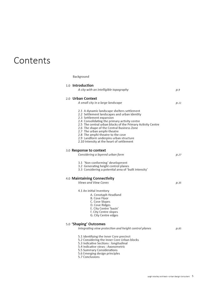

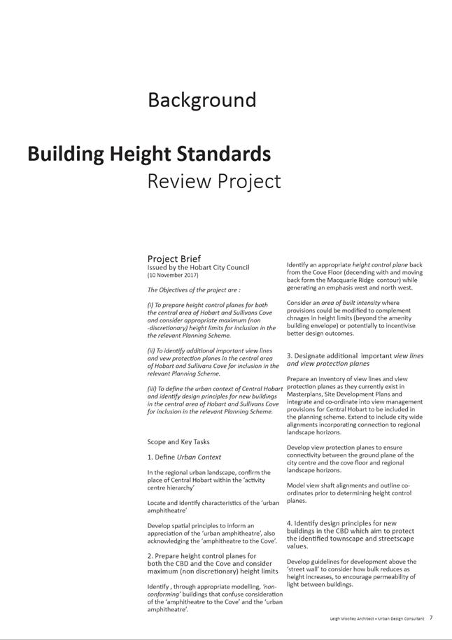
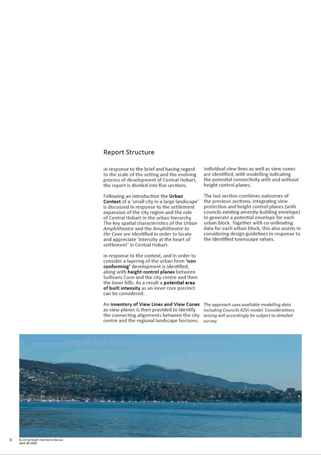
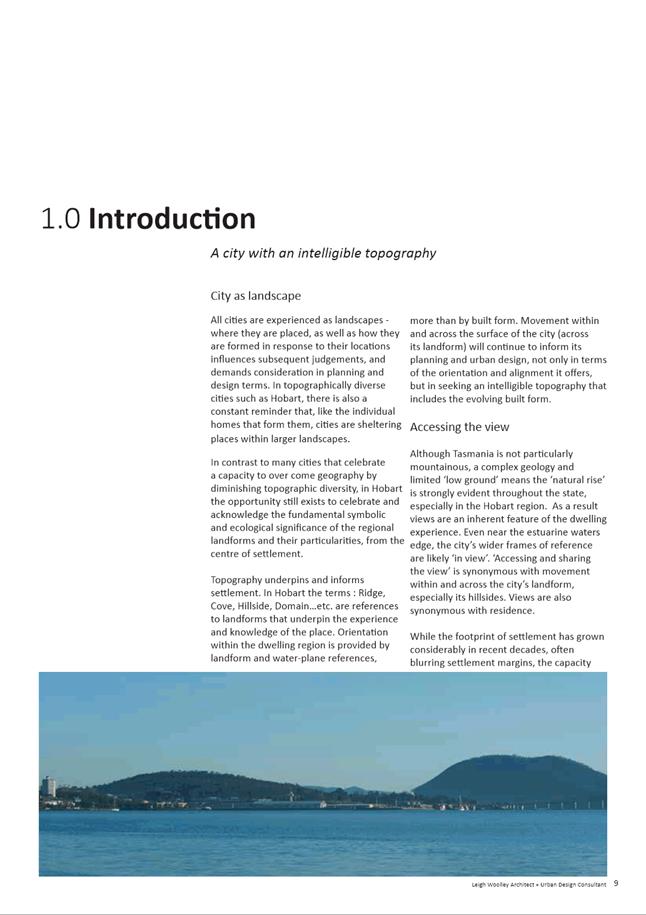
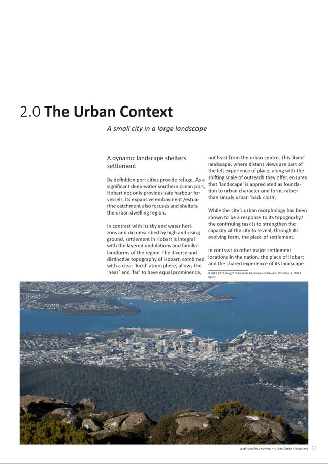
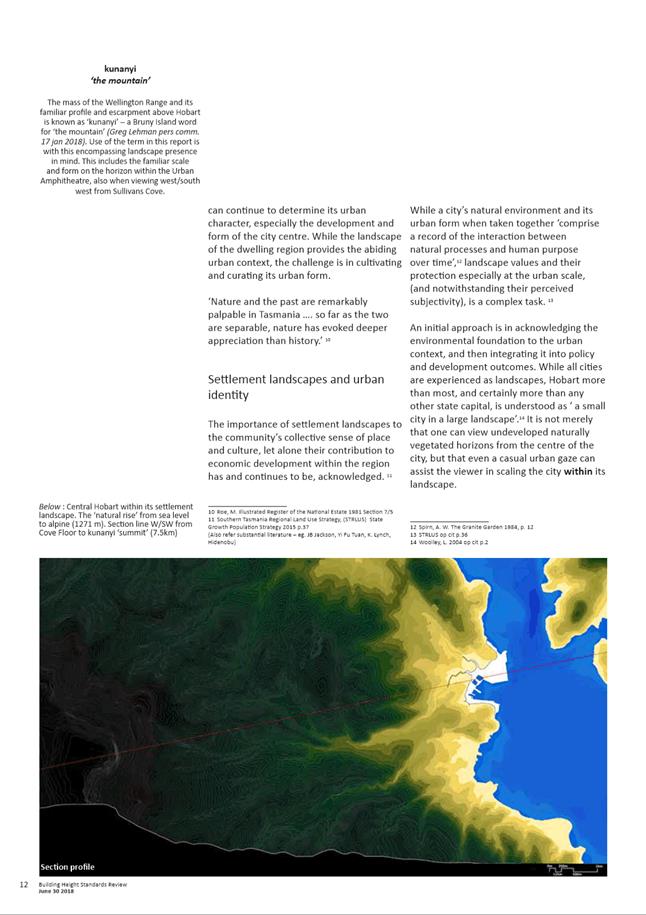
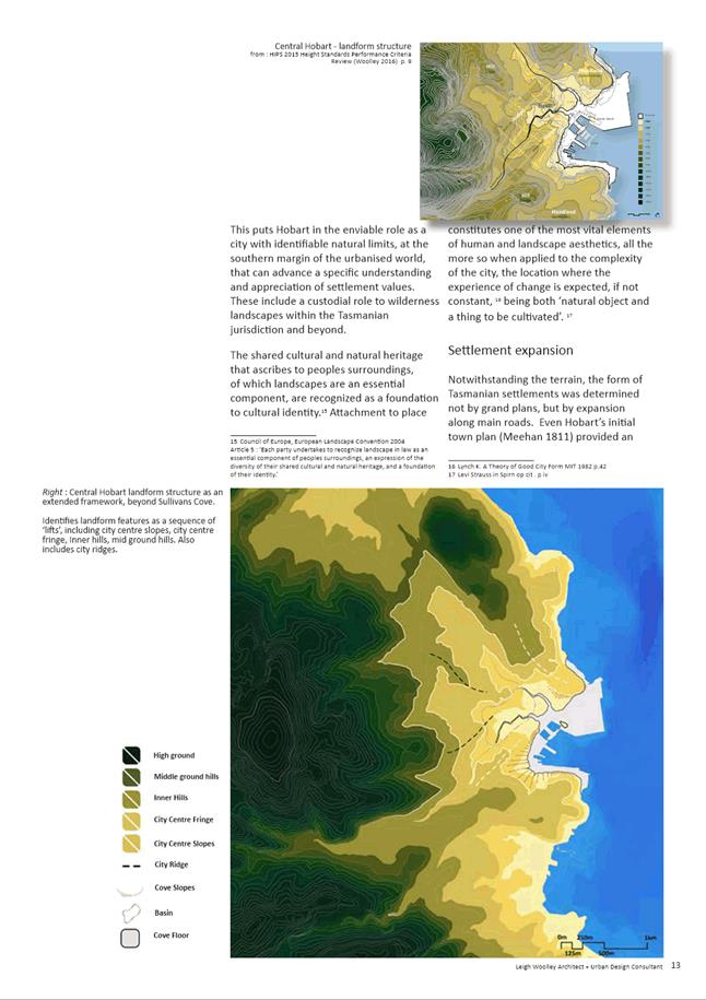
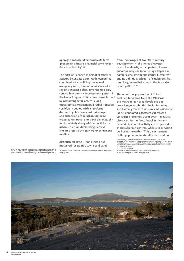
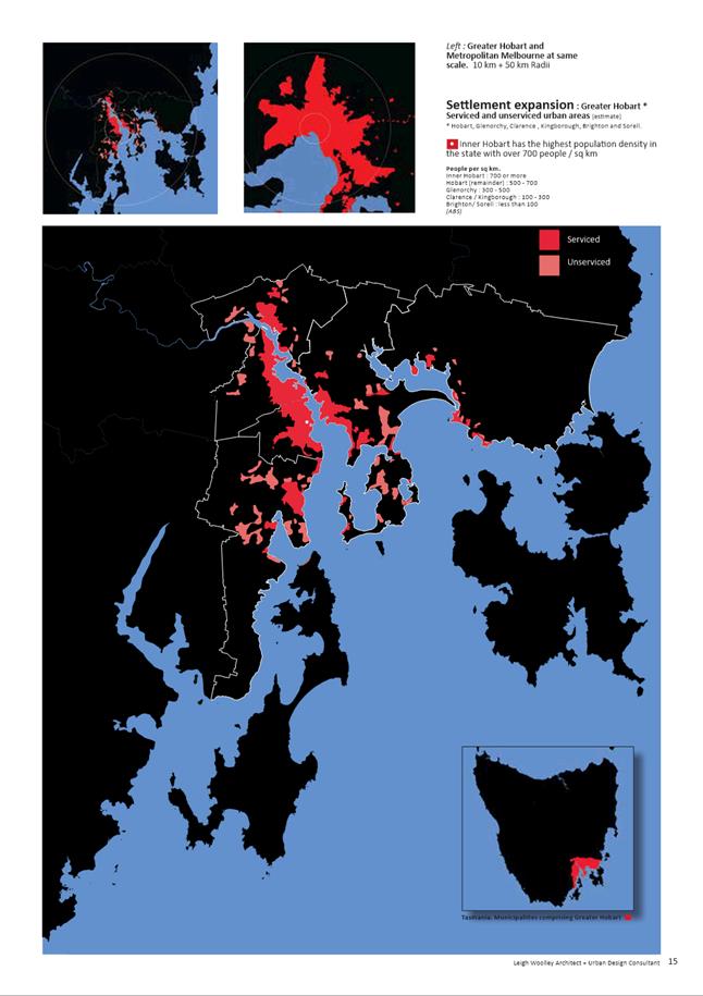
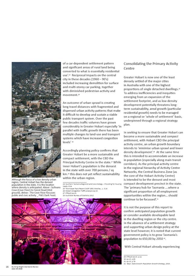
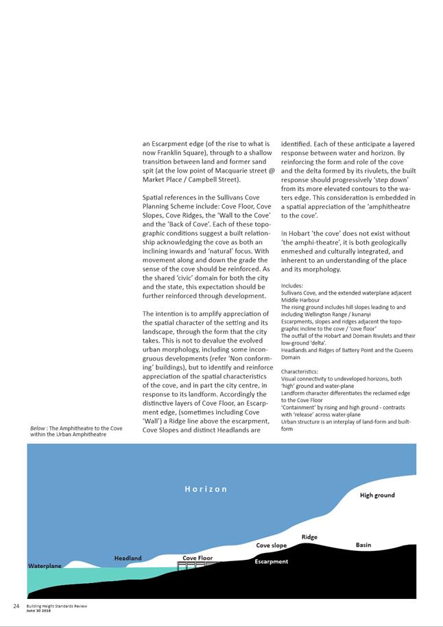
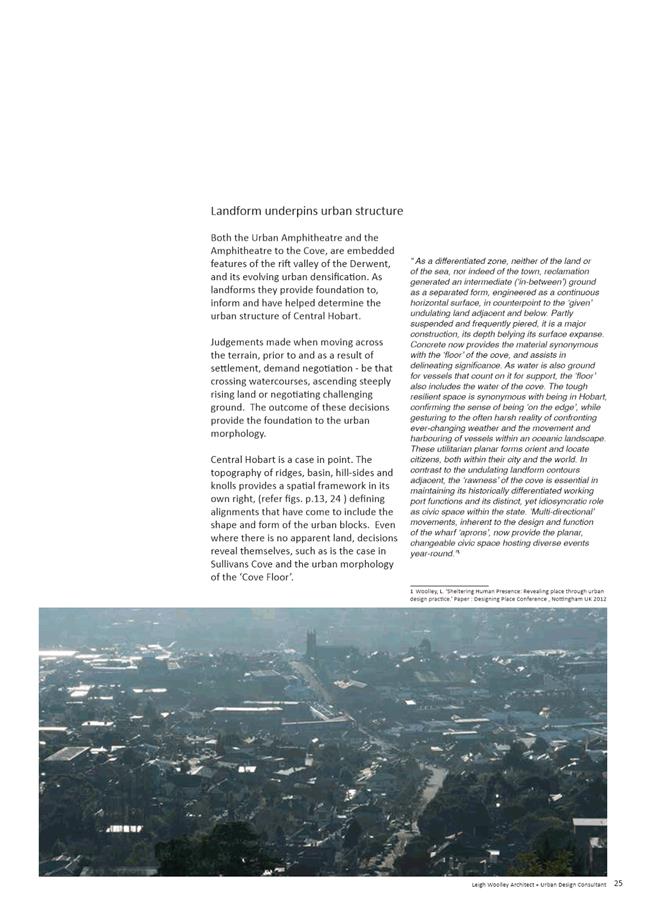
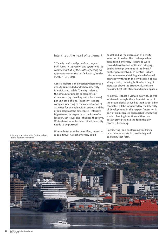
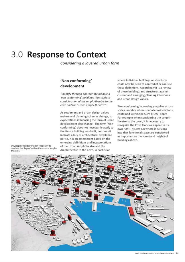
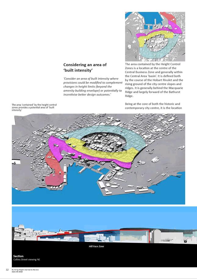
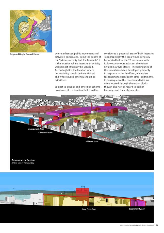
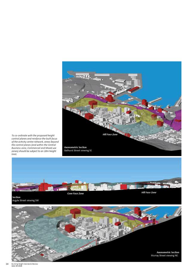
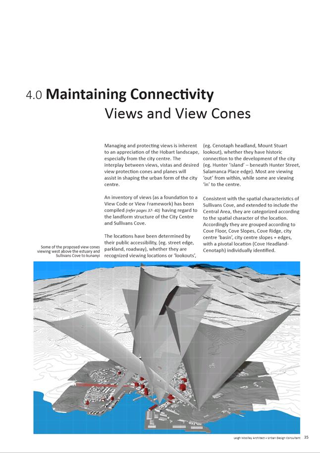
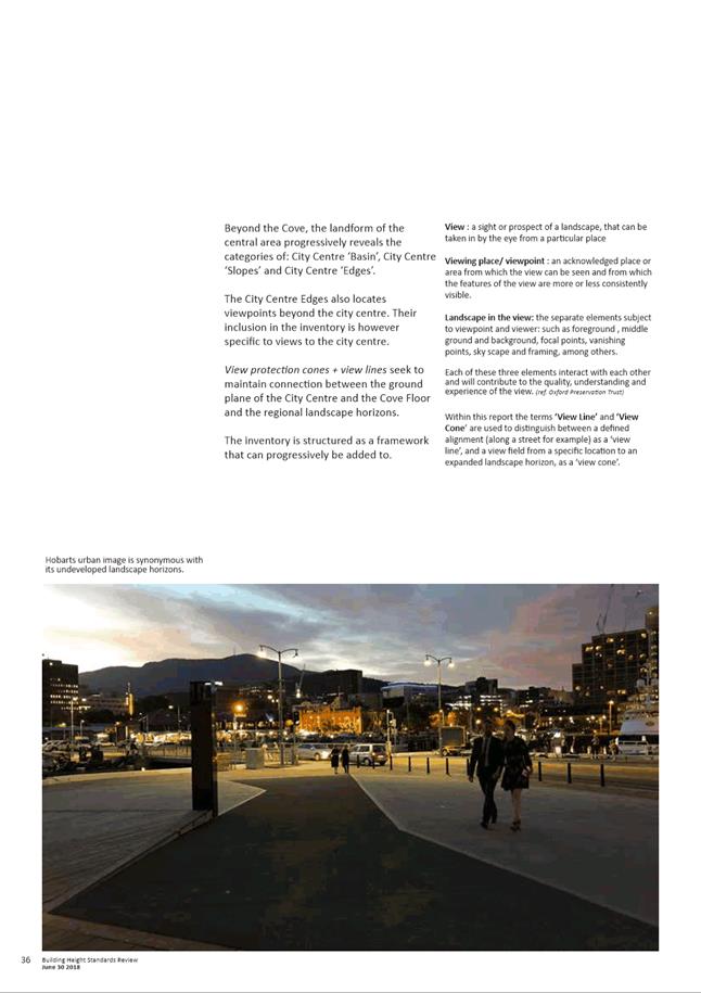

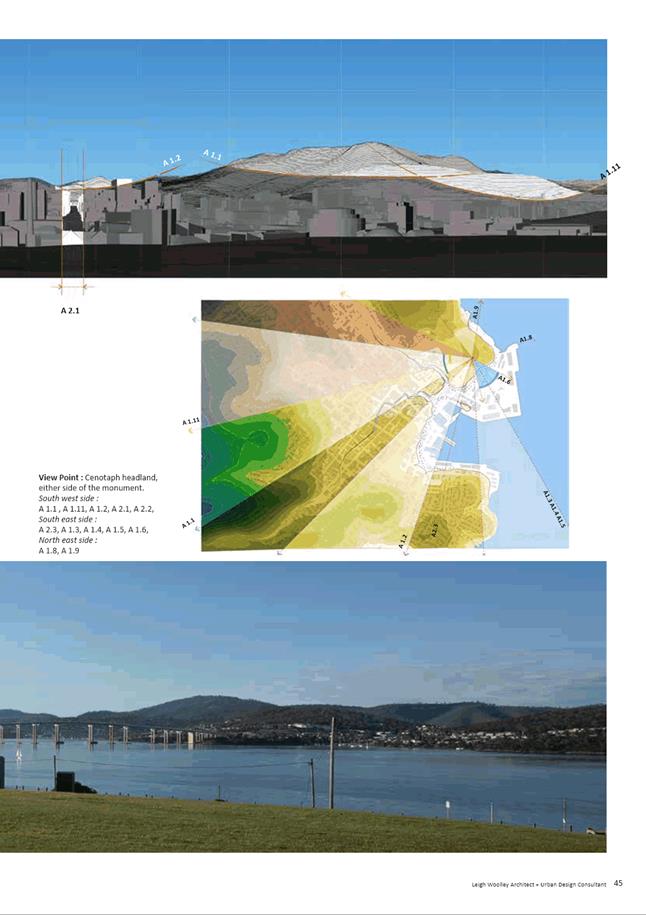
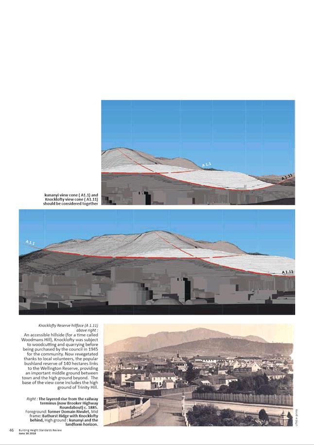
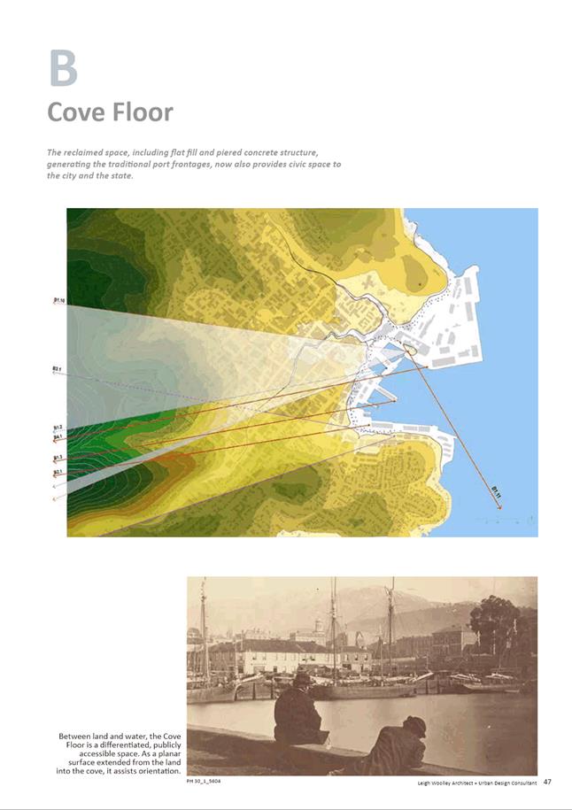
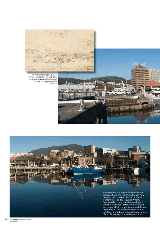
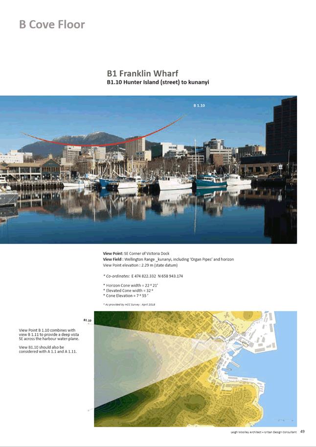
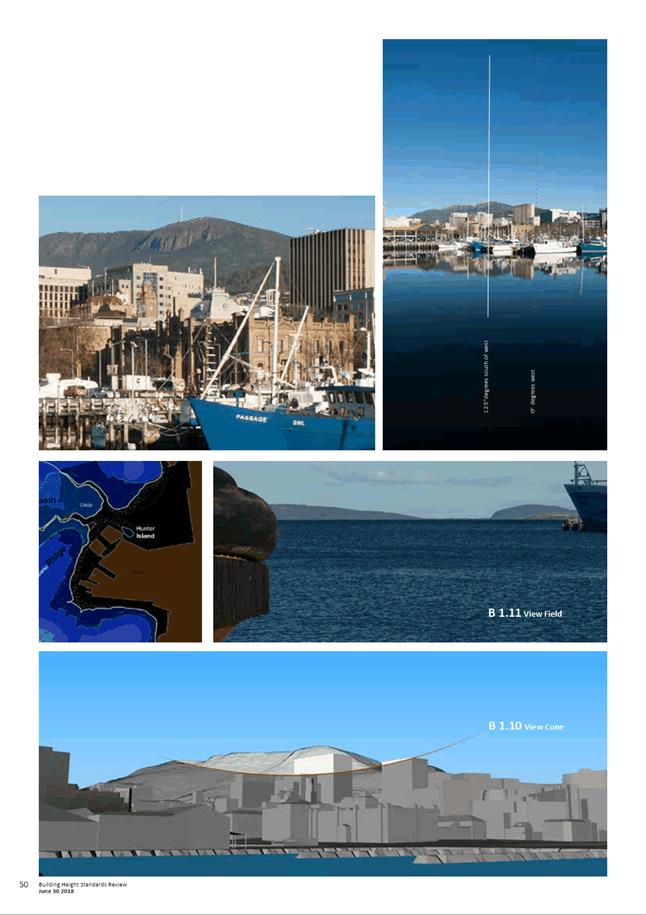
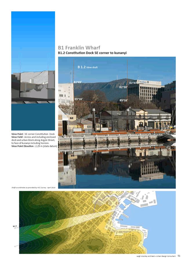
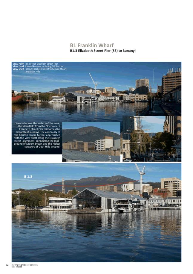
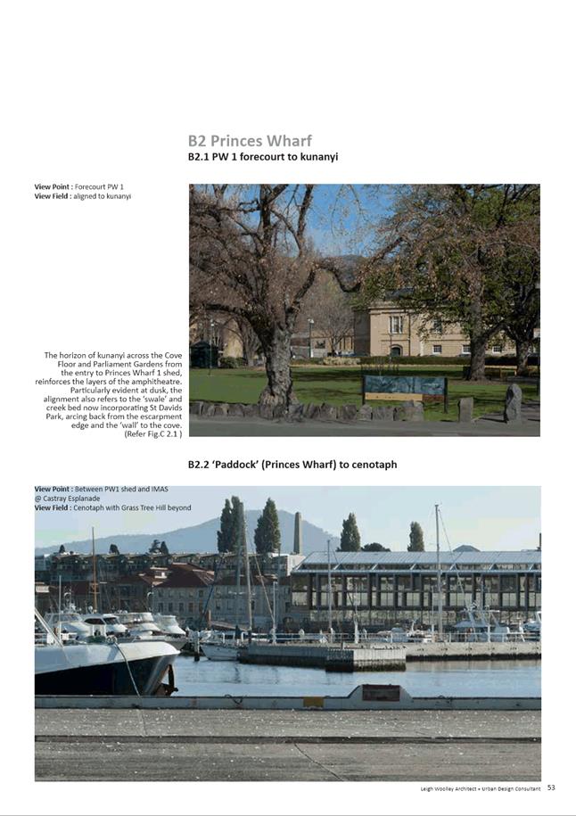
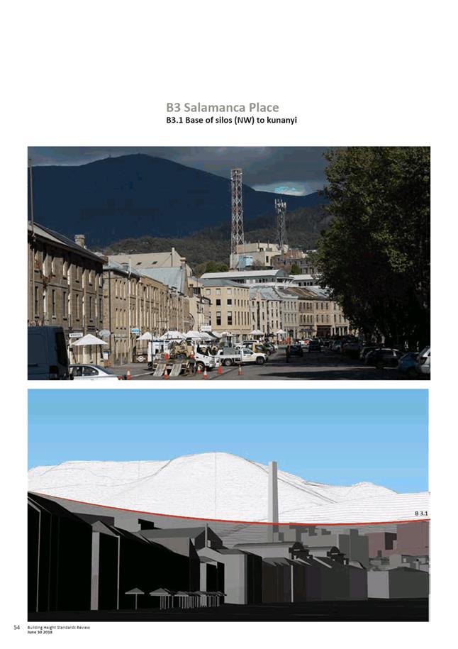
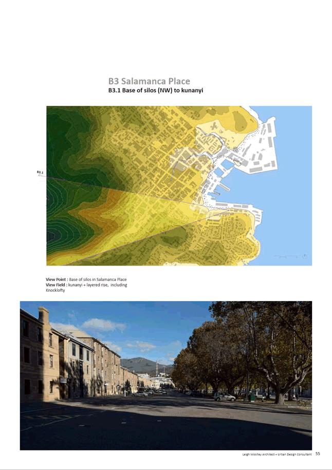
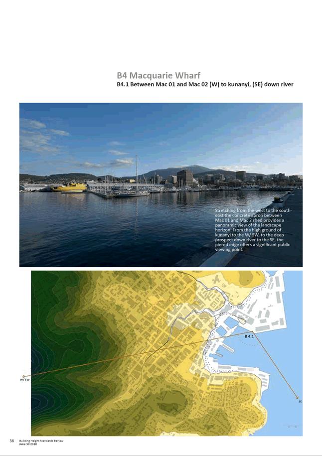
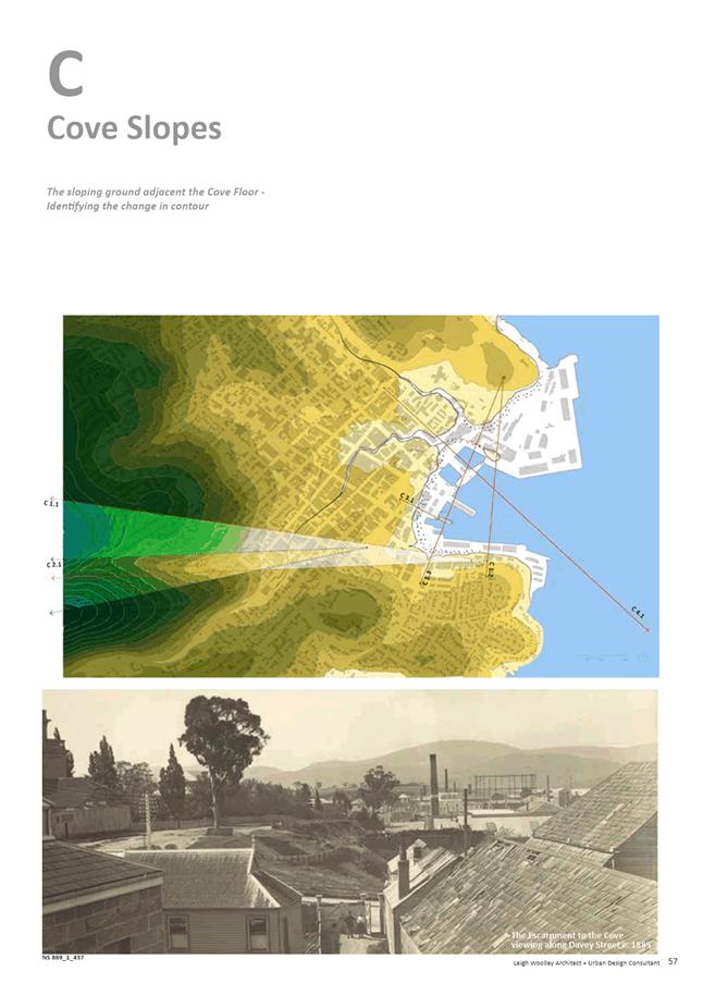
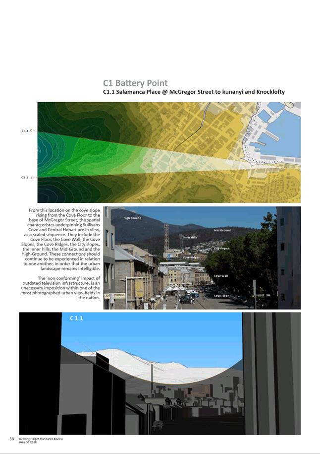
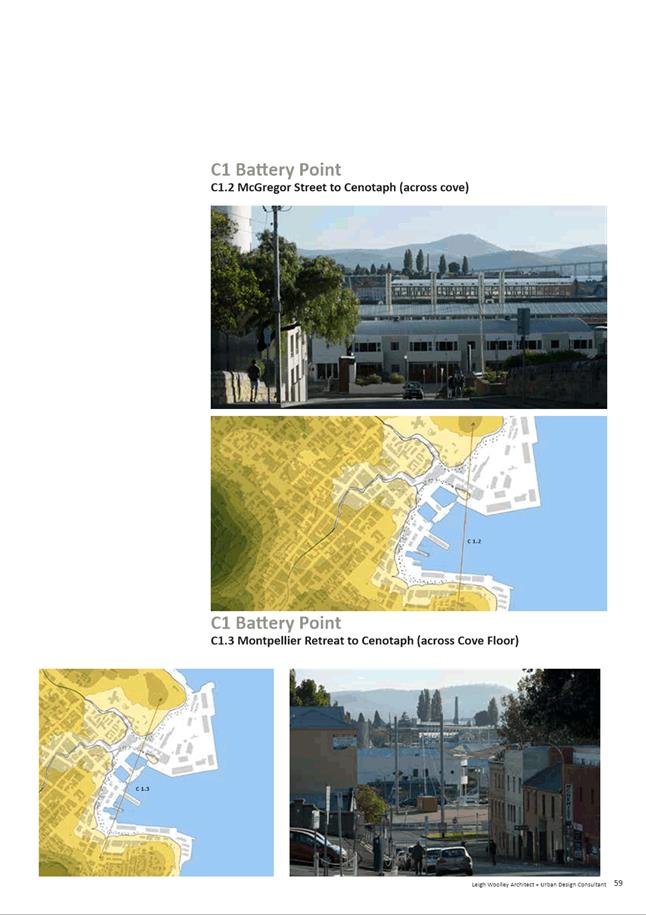
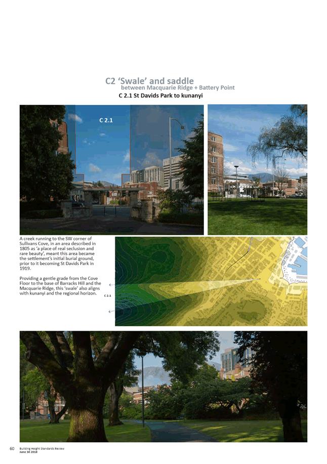
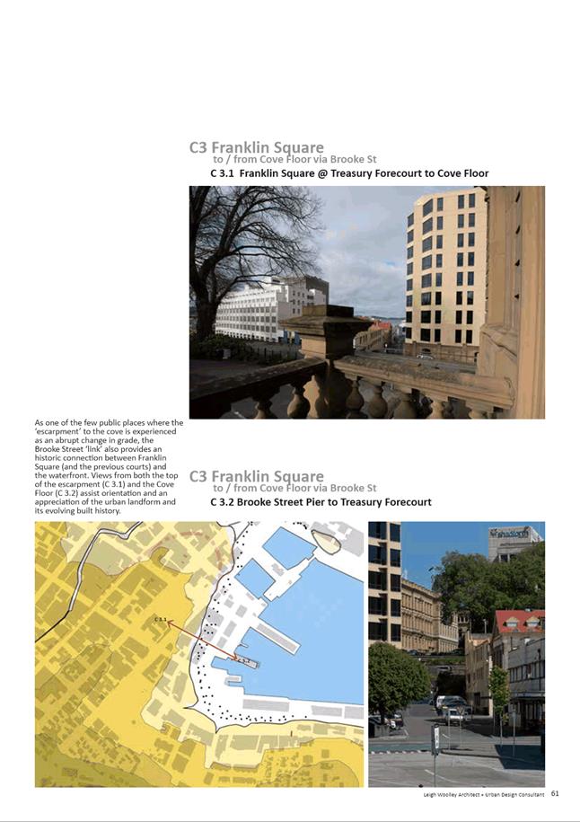
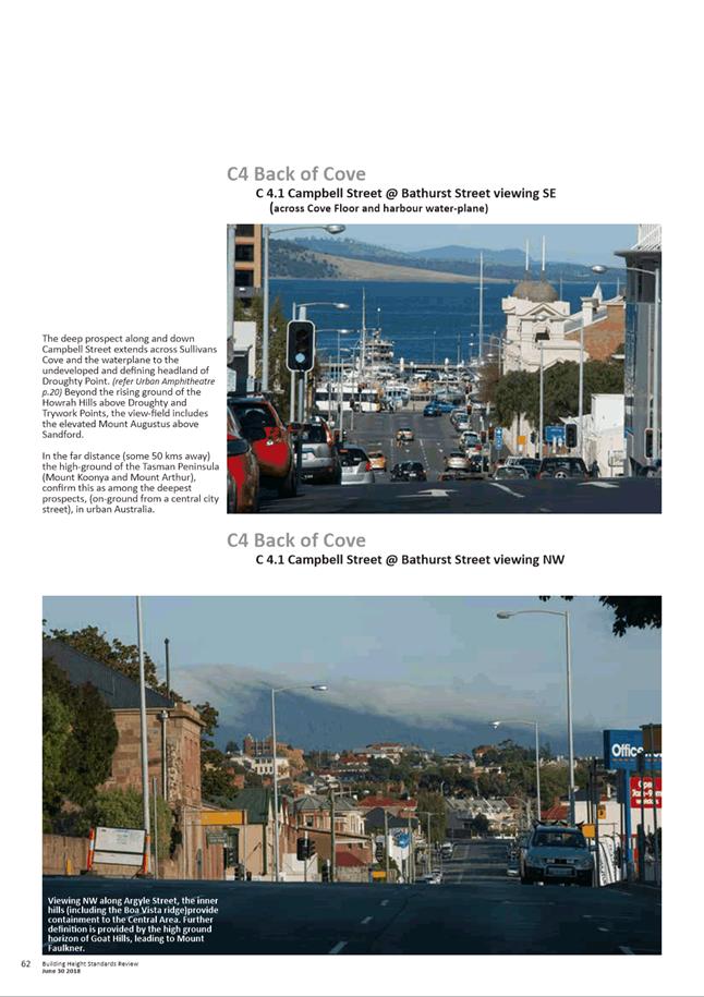
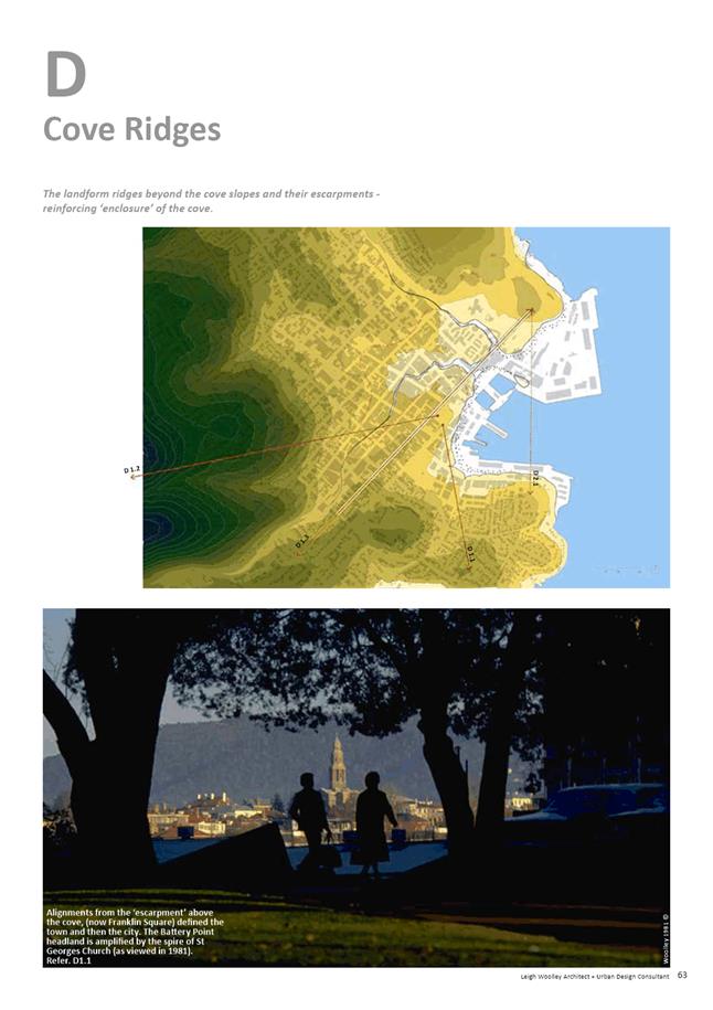
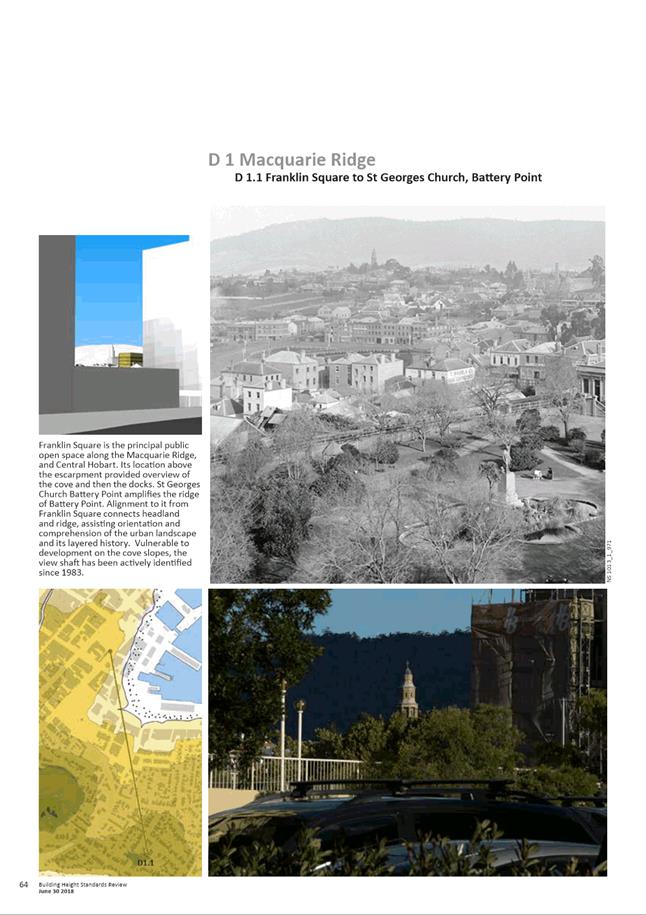
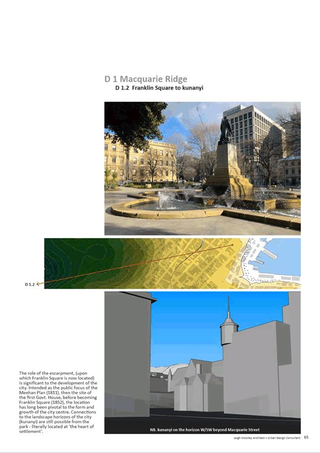
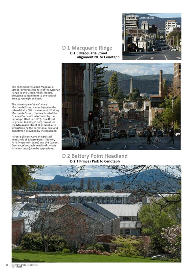
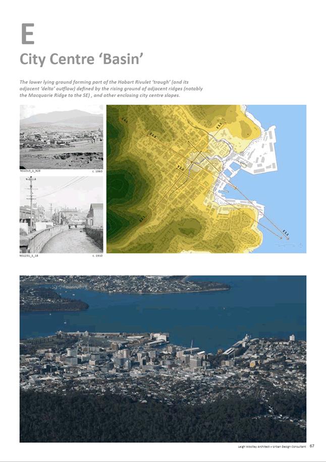
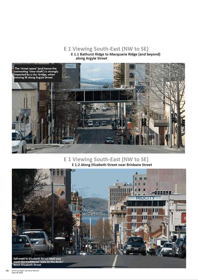
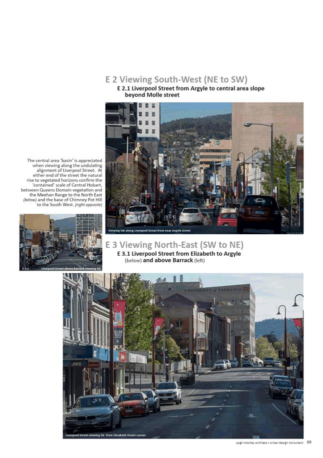
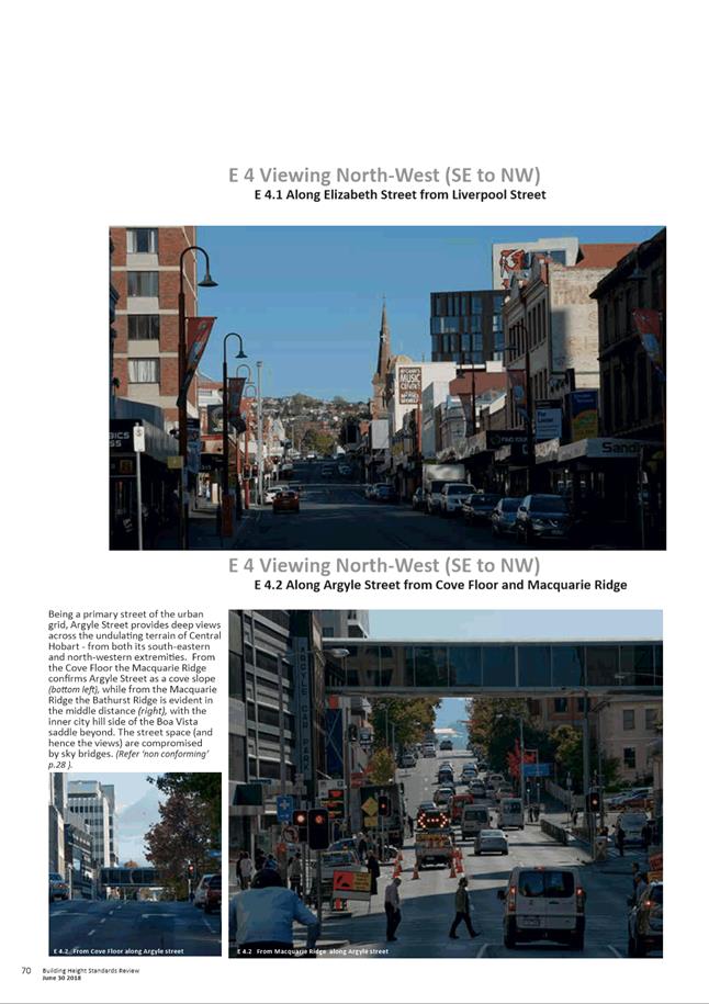
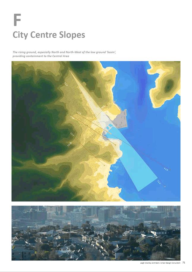
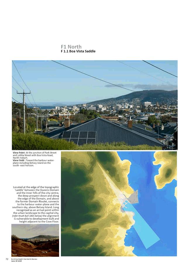
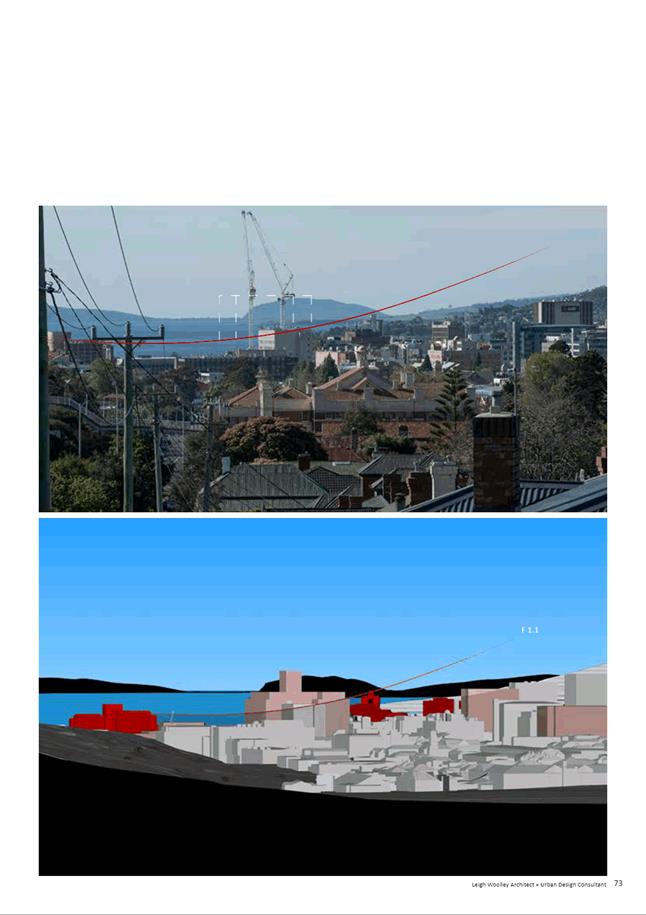
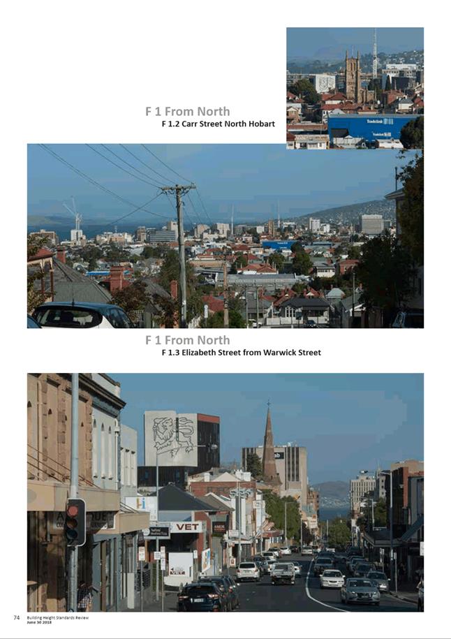
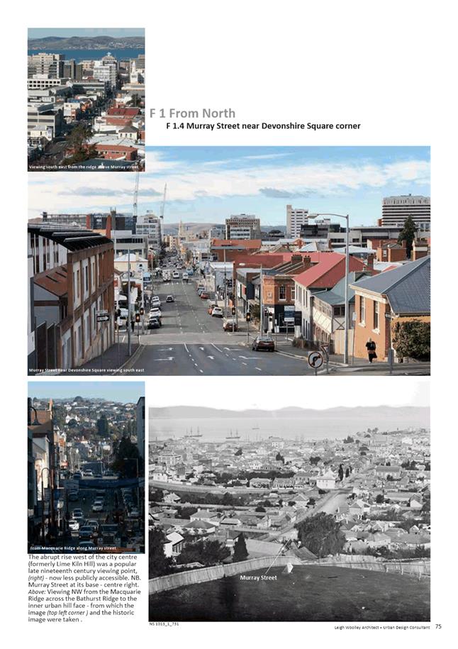
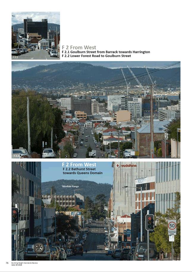
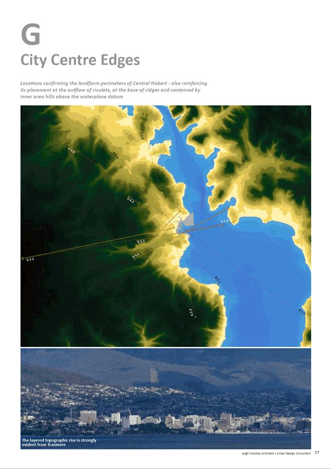
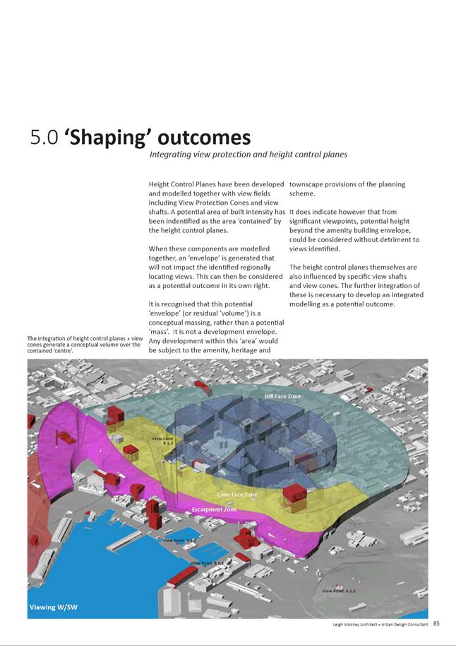
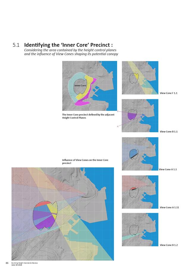
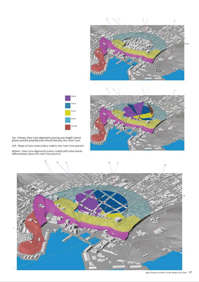
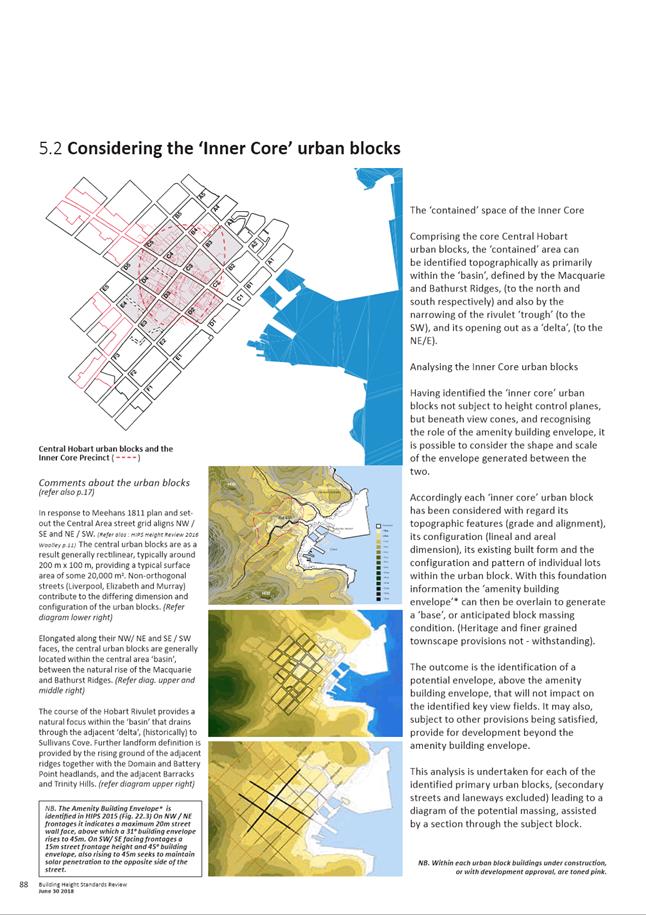
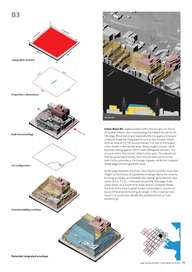
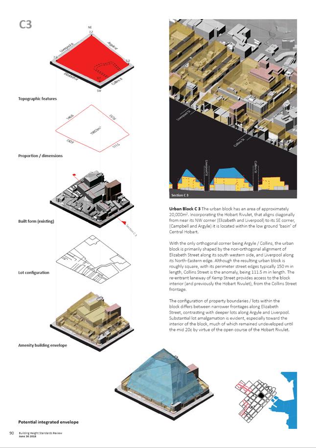
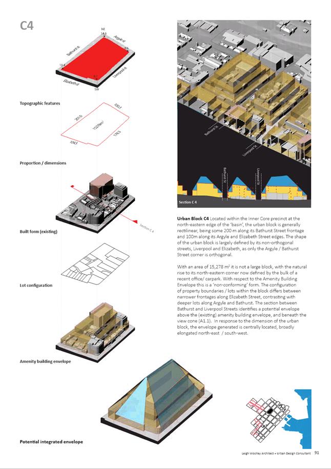
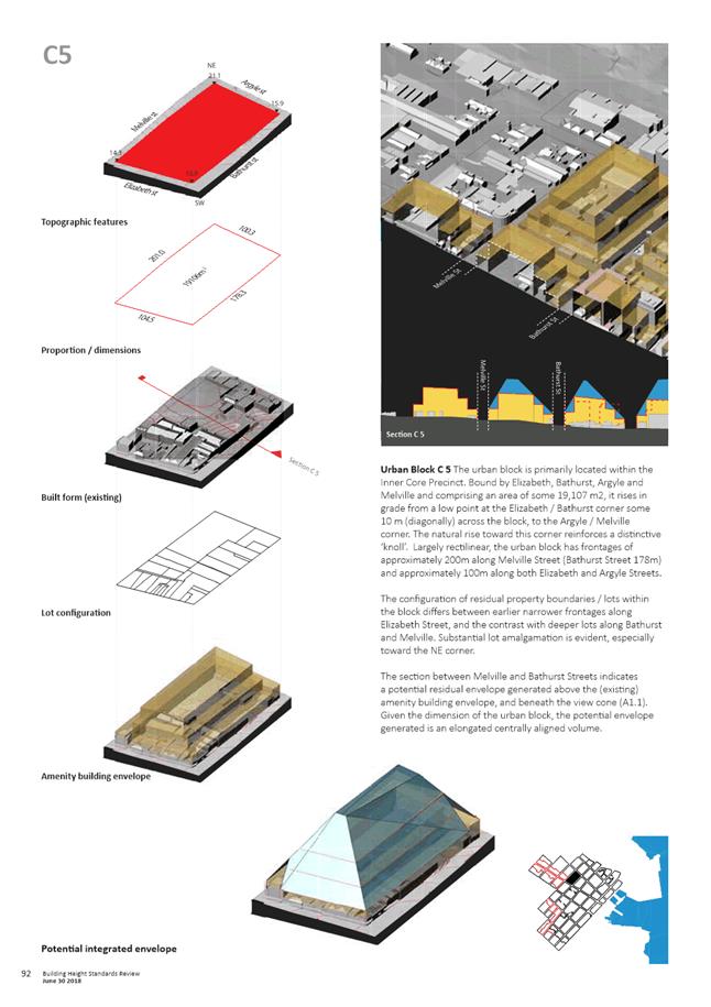
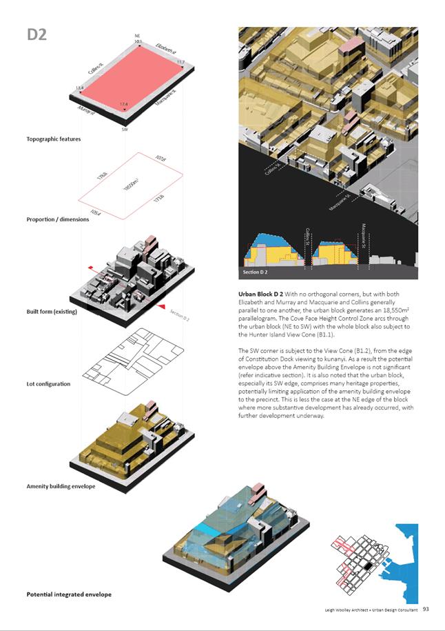
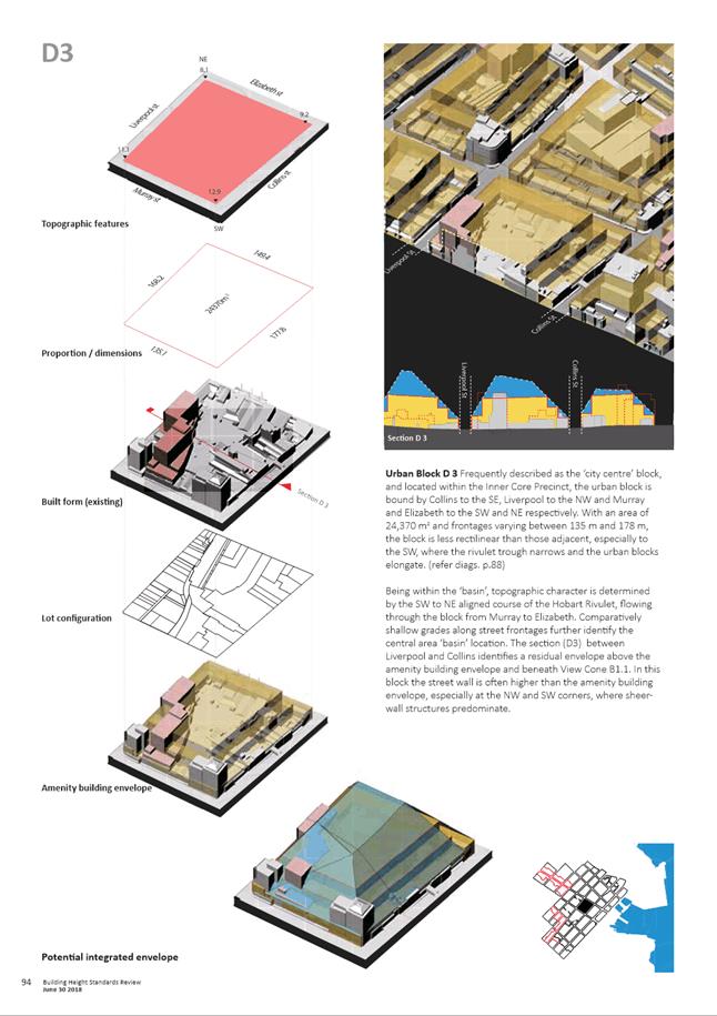
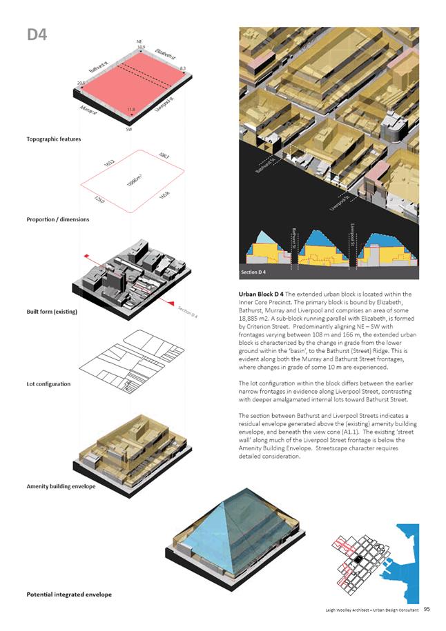
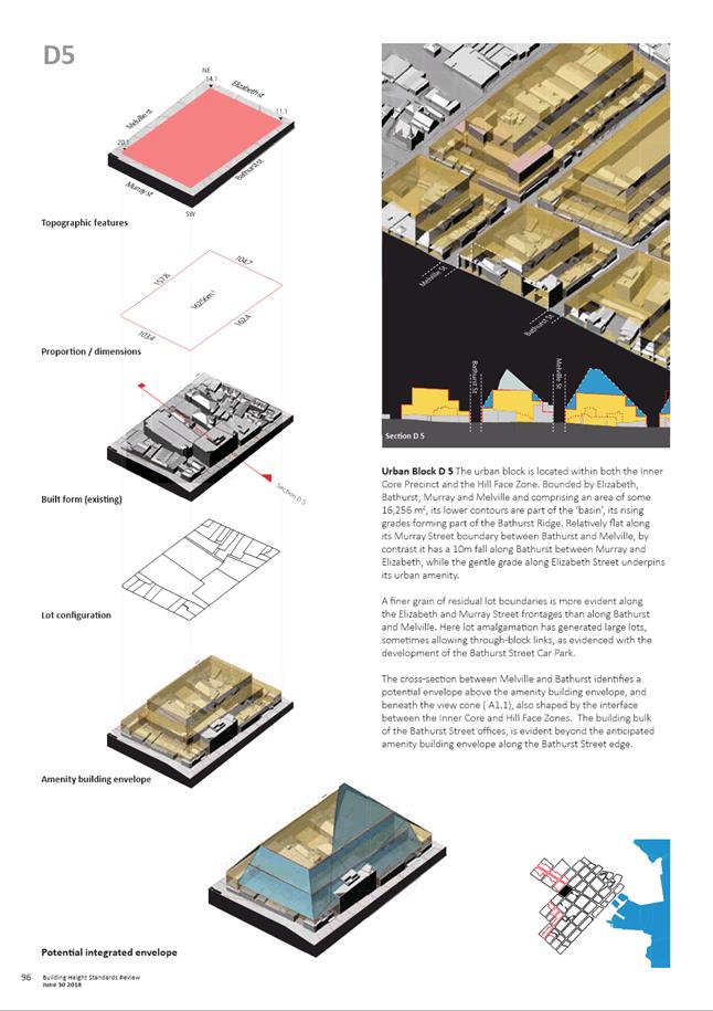
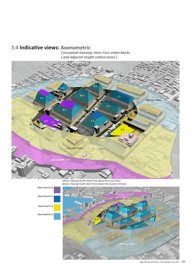
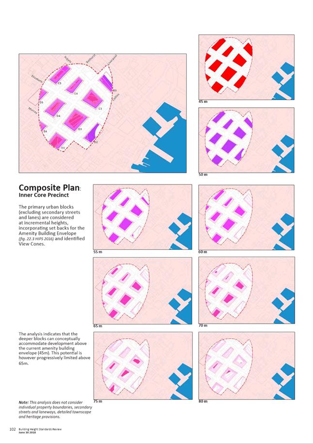
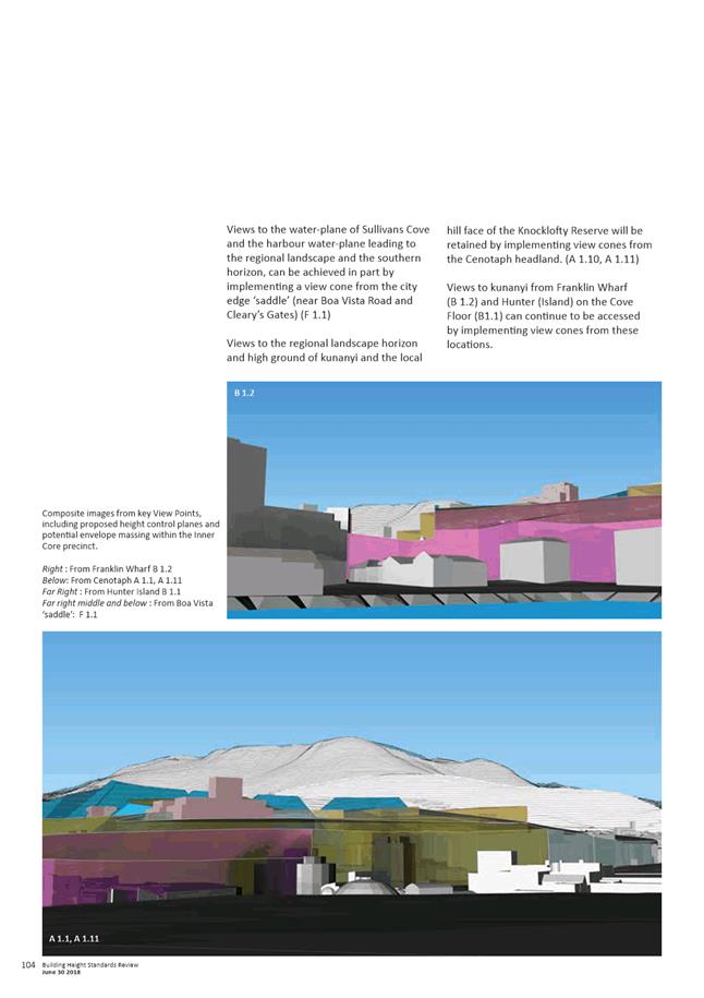
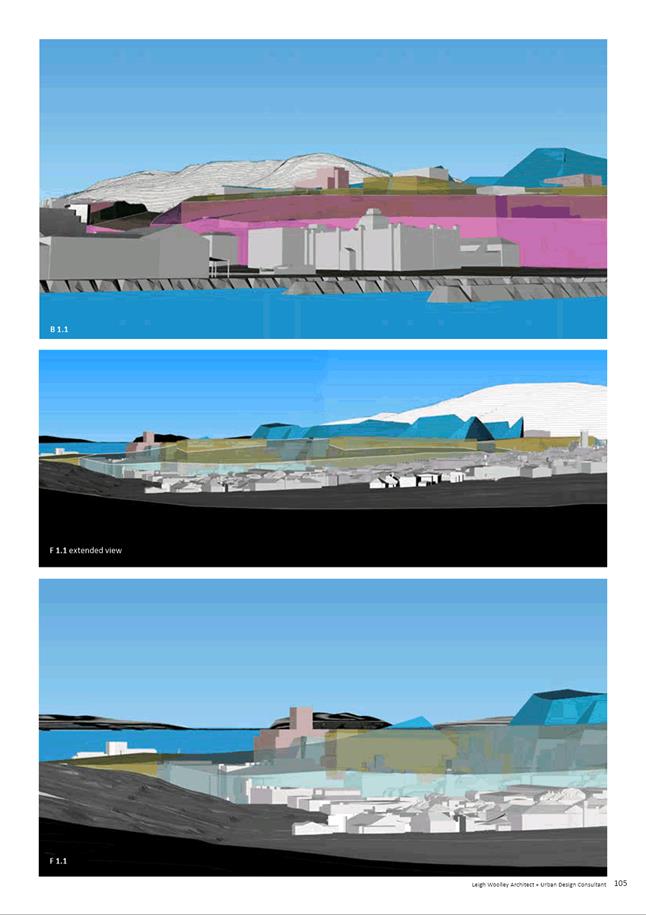
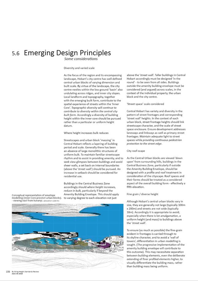
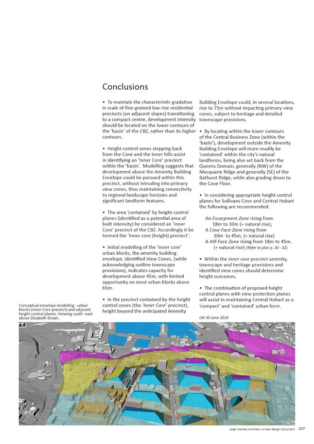
|
Agenda (Open Portion) City Planning Committee Meeting - 10/12/2018 |
Page 730 ATTACHMENT b |
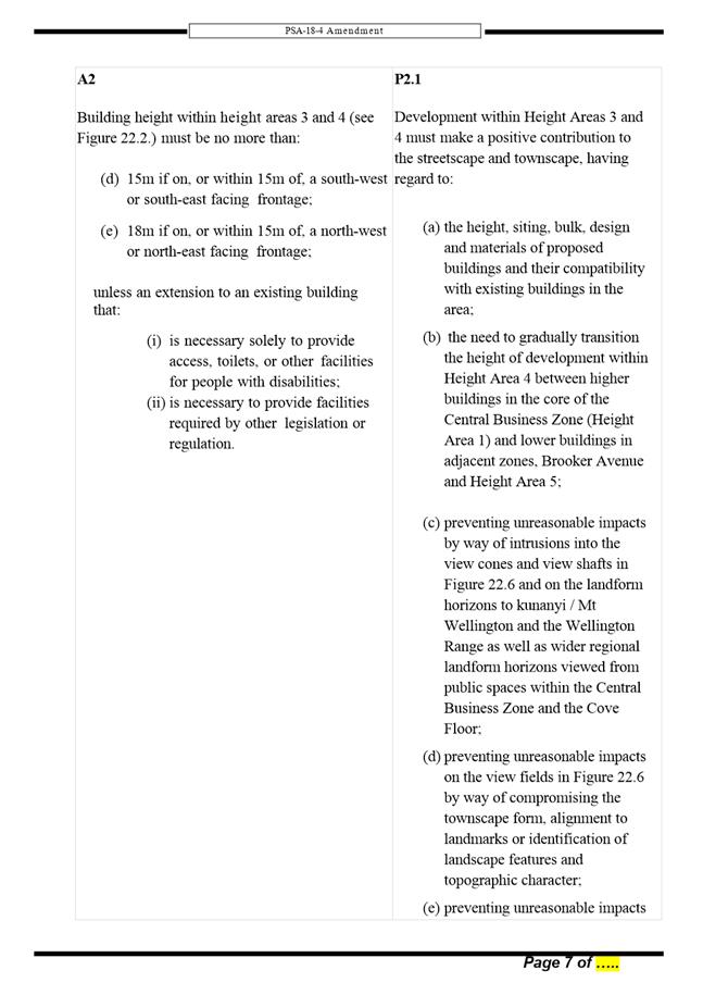
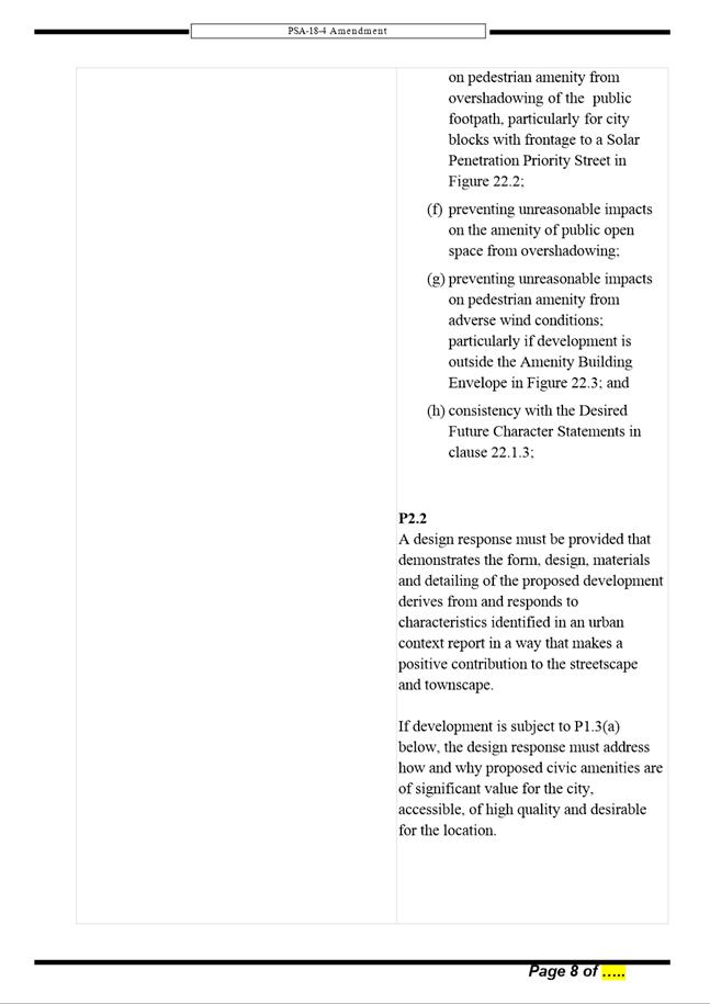
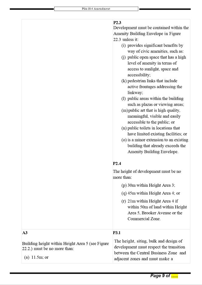
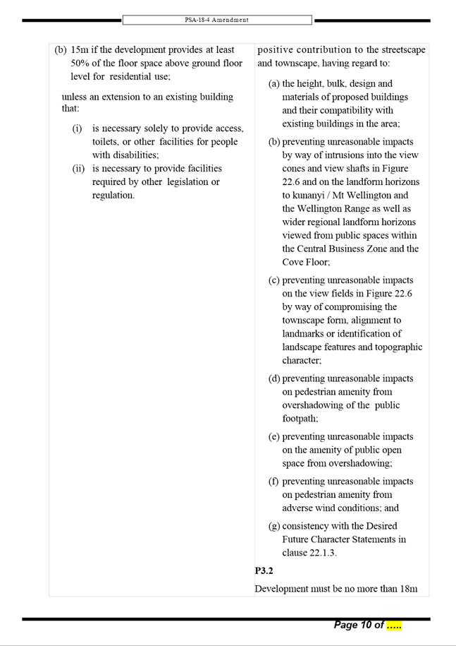
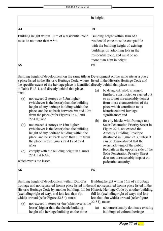
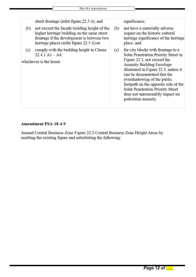
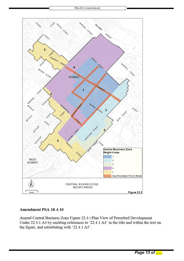
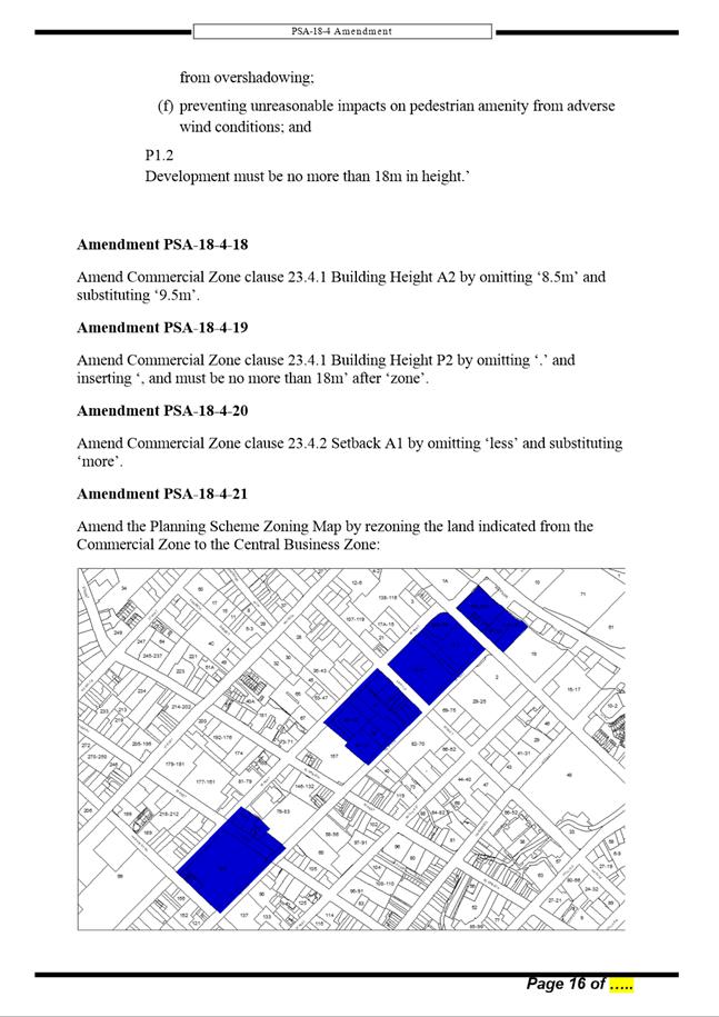
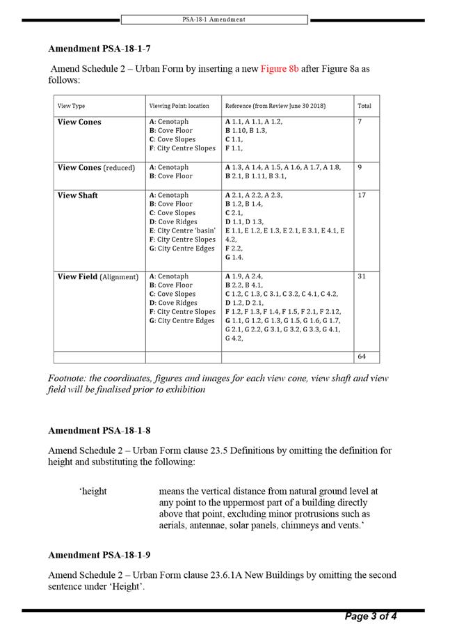
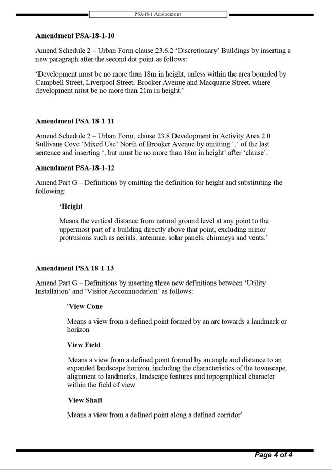
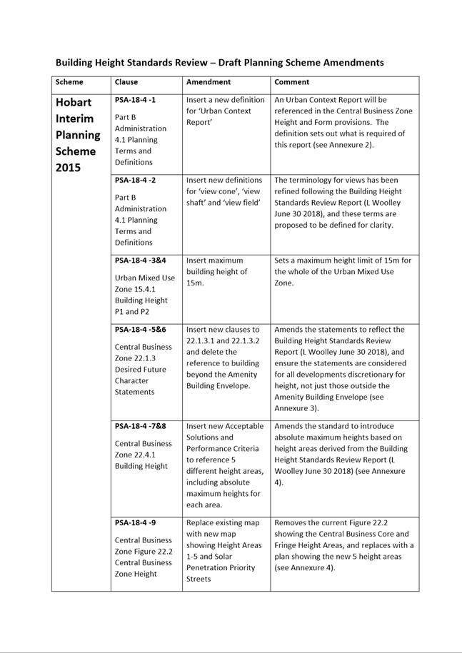
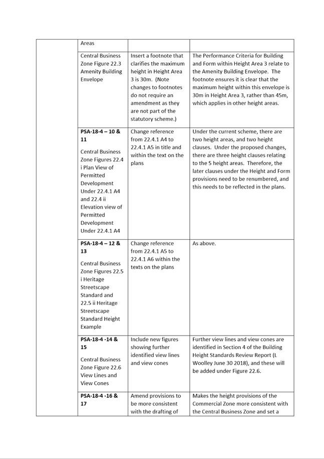

|
Item No. 8.2 |
Agenda (Open Portion) City Planning Committee Meeting - 10/12/2018 |
Page 756 ATTACHMENT b |
|
Item No. 8.2 |
Agenda (Open Portion) City Planning Committee Meeting - 10/12/2018 |
Page 757 ATTACHMENT b |
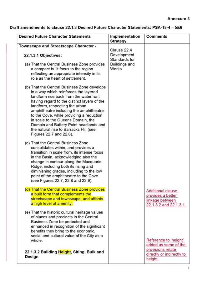
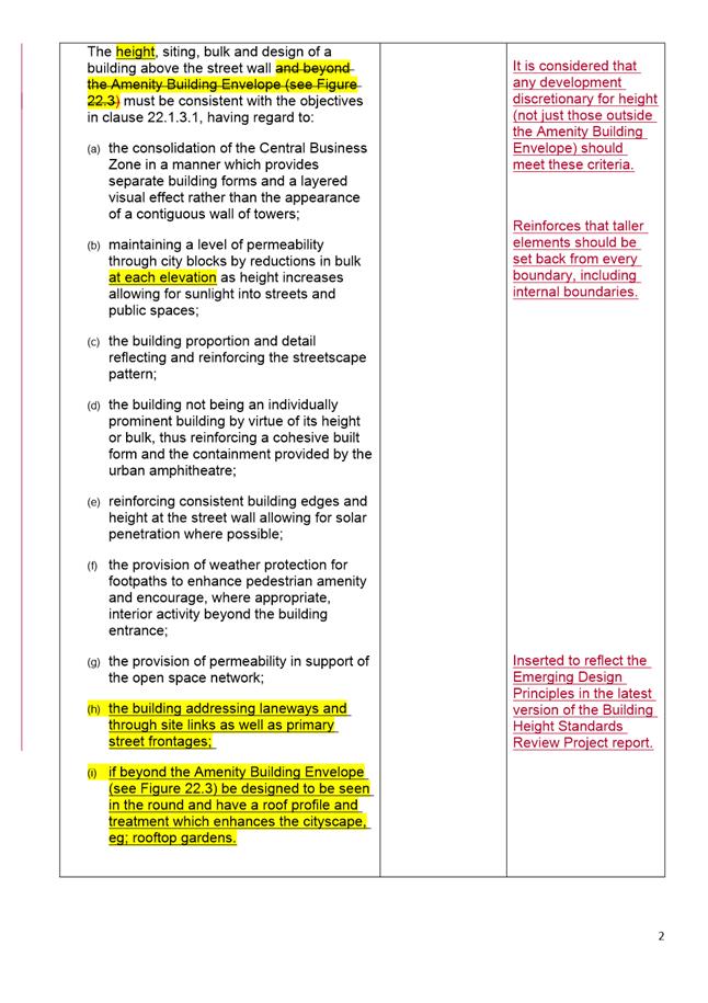
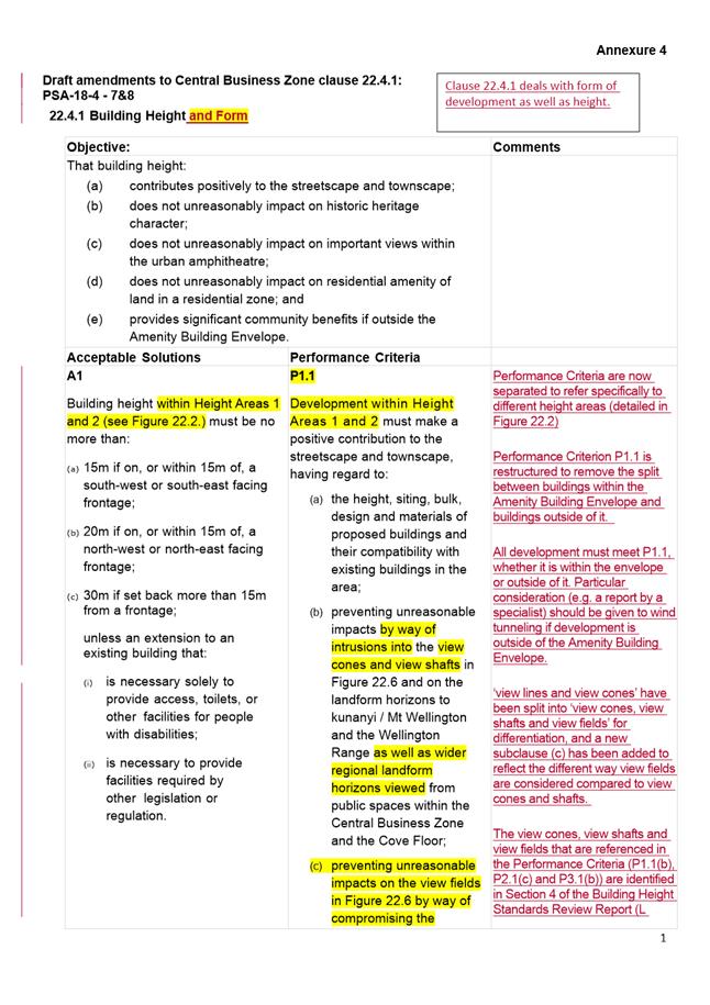
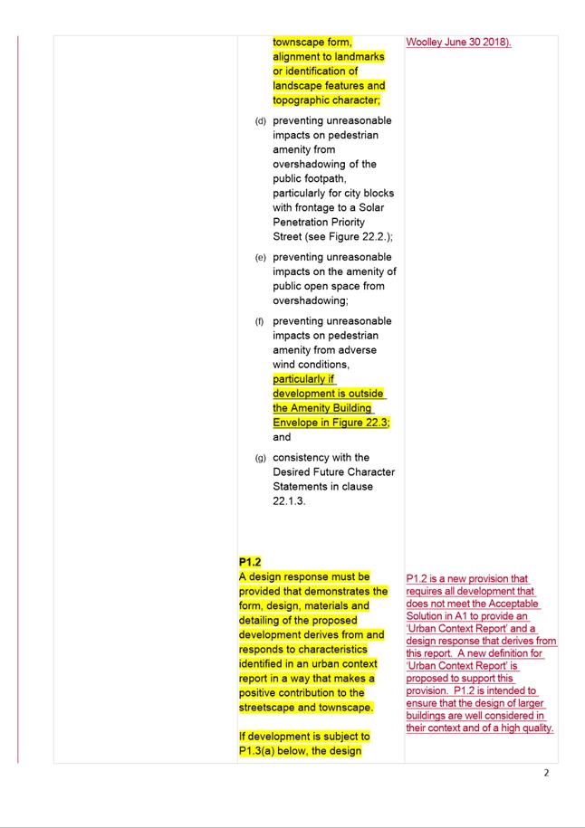
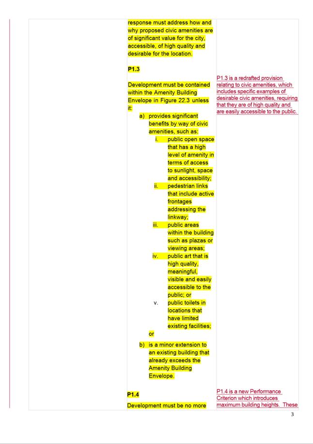
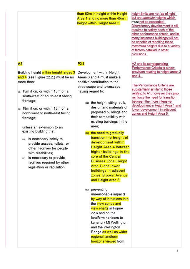
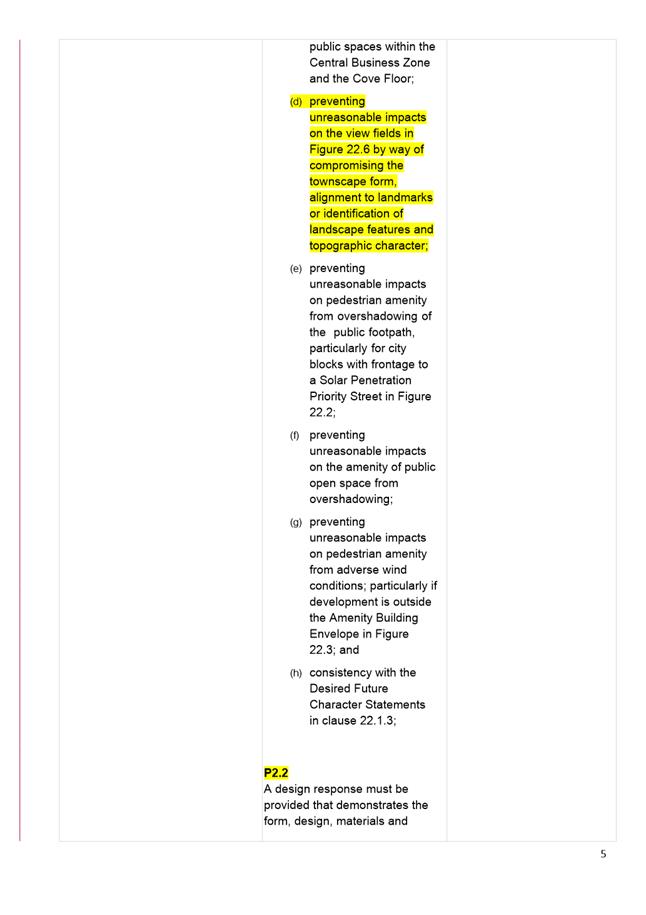
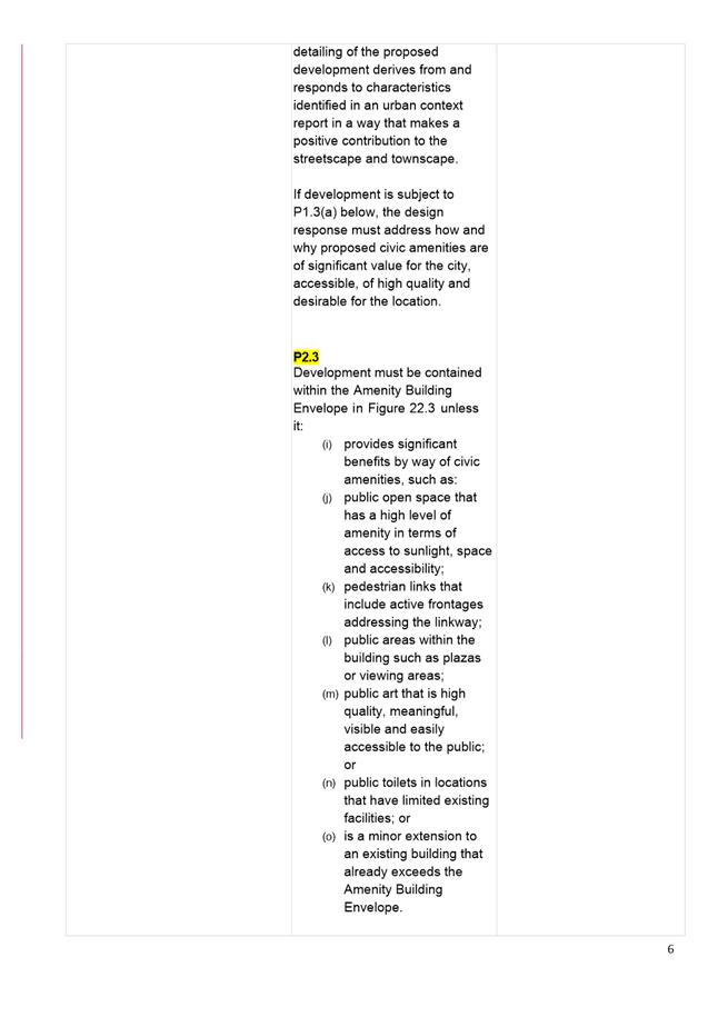
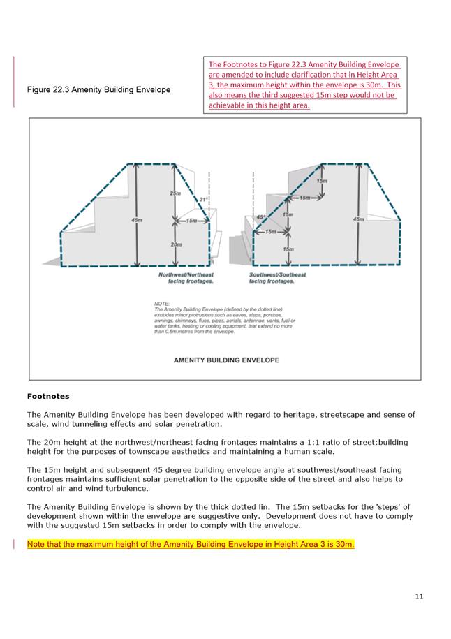
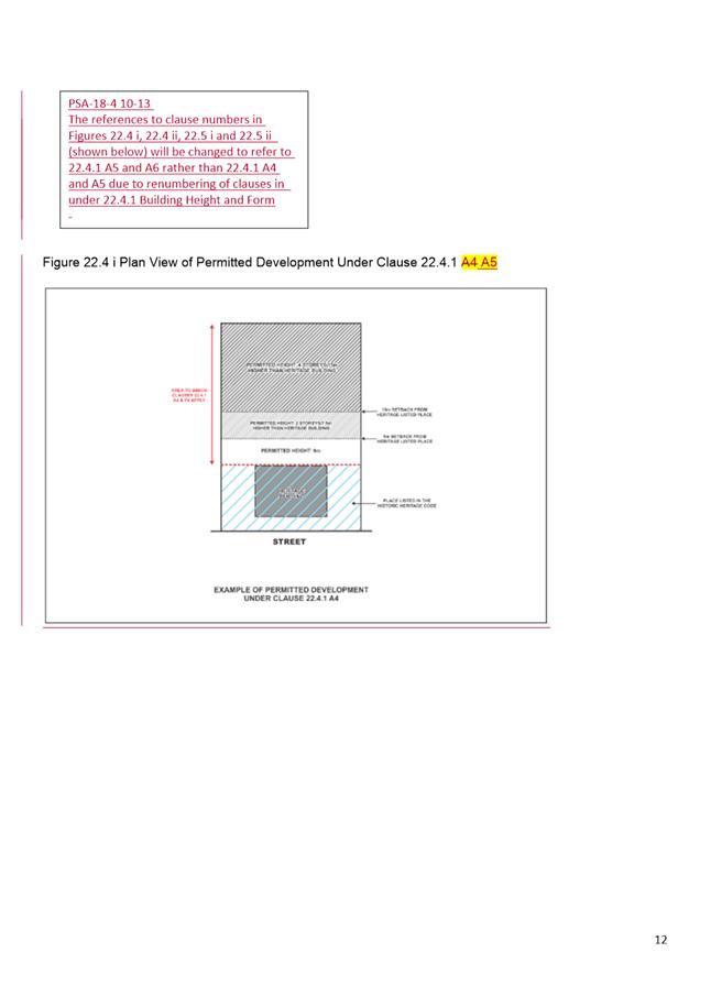
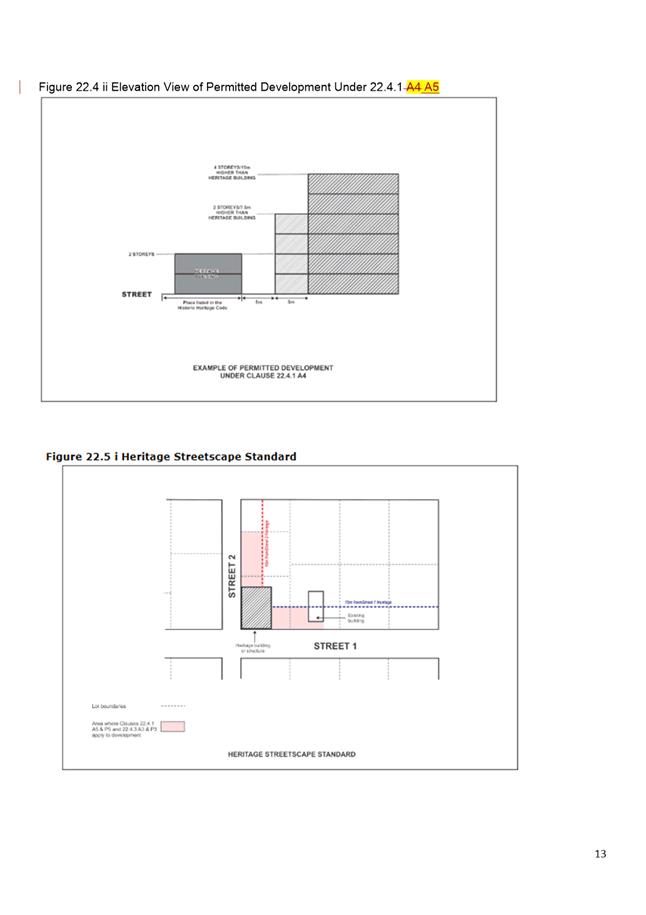
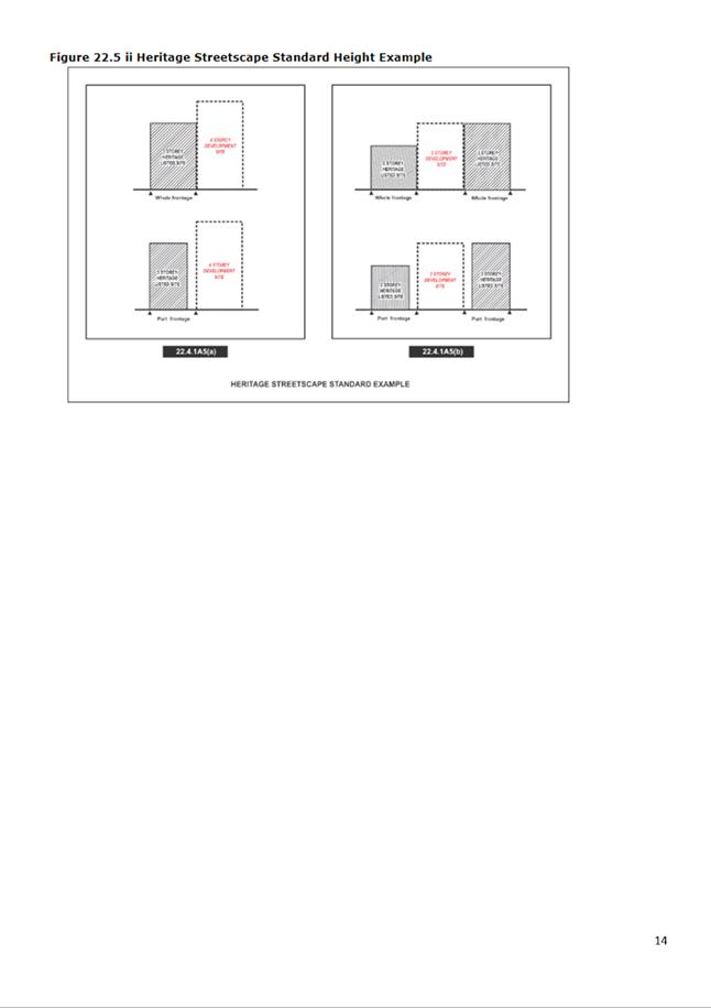

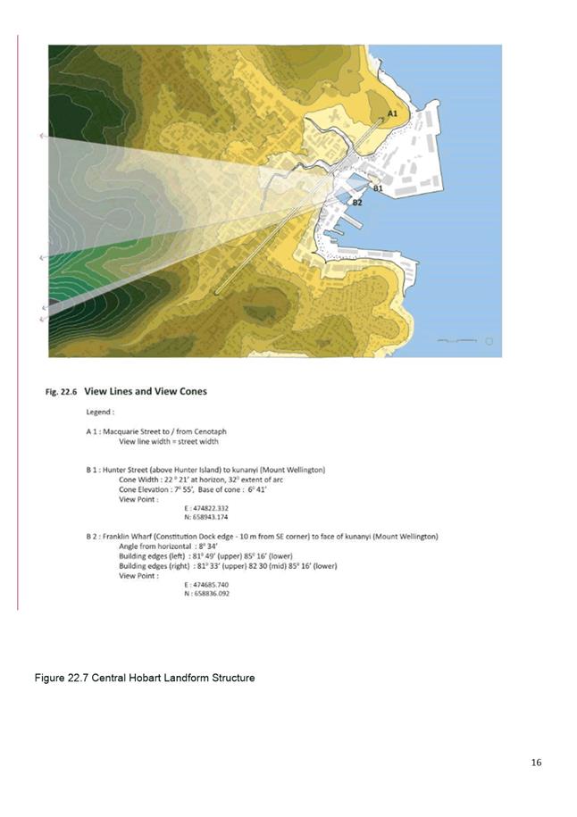
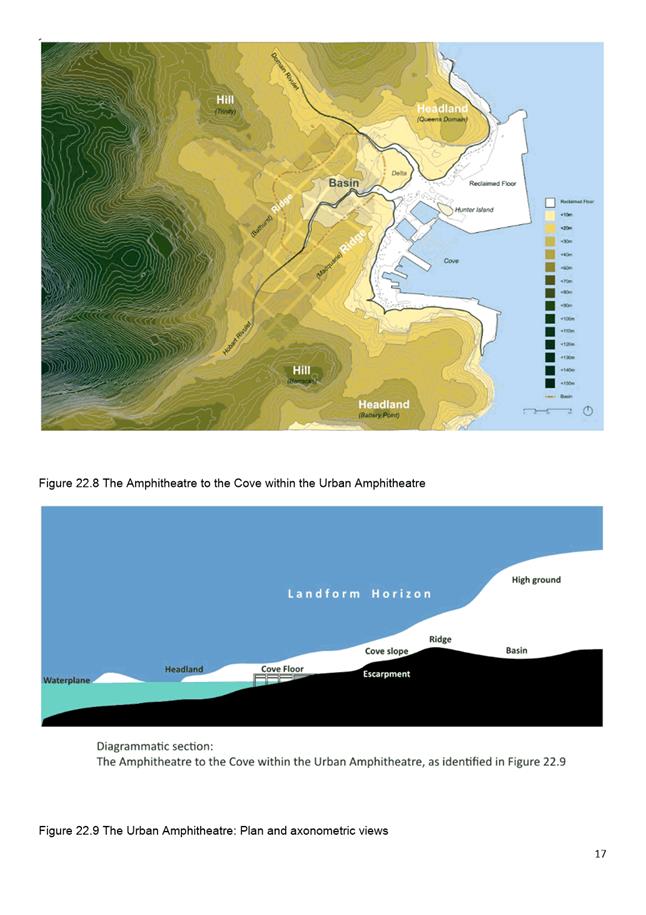
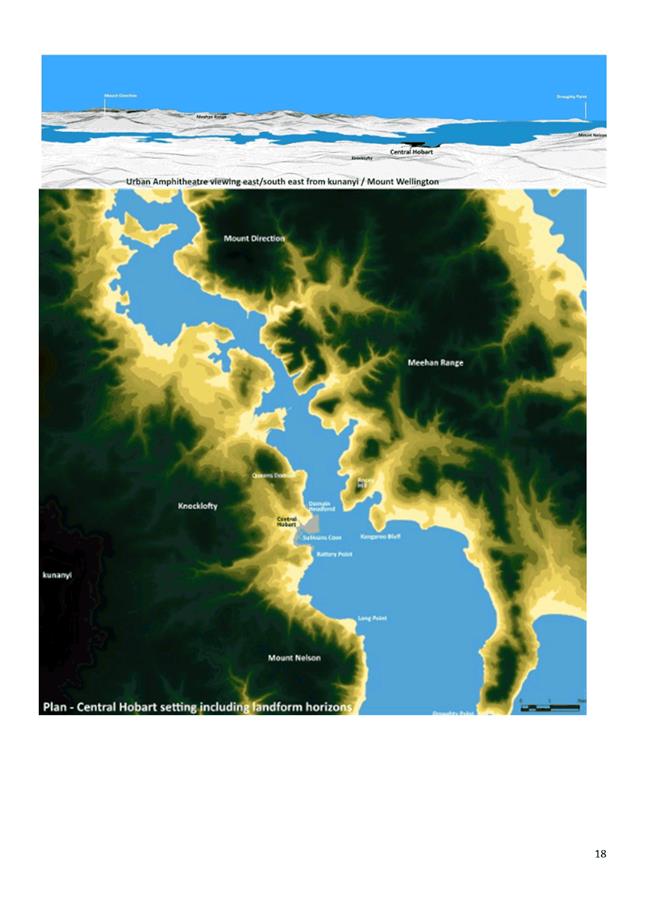
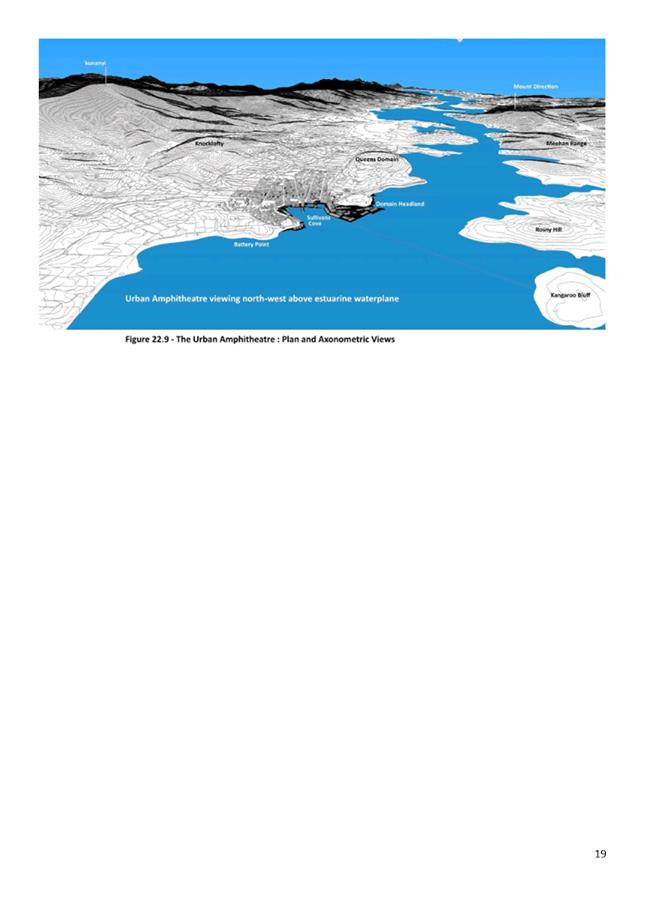
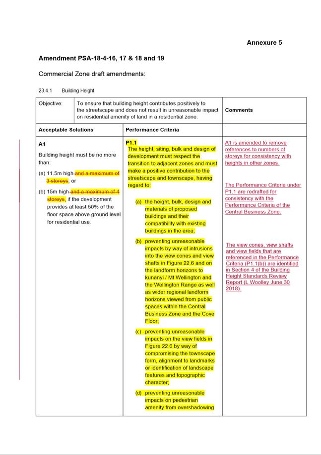
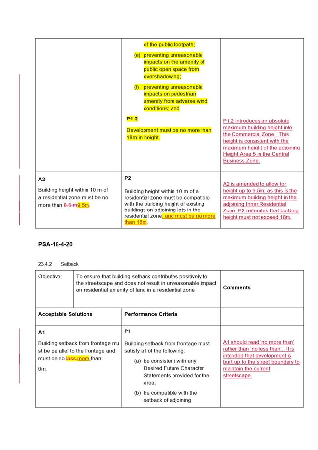
|
Item No. 8.2 |
Agenda (Open Portion) City Planning Committee Meeting - 10/12/2018 |
Page 783 ATTACHMENT c |
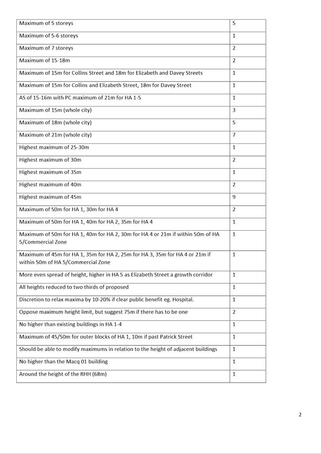
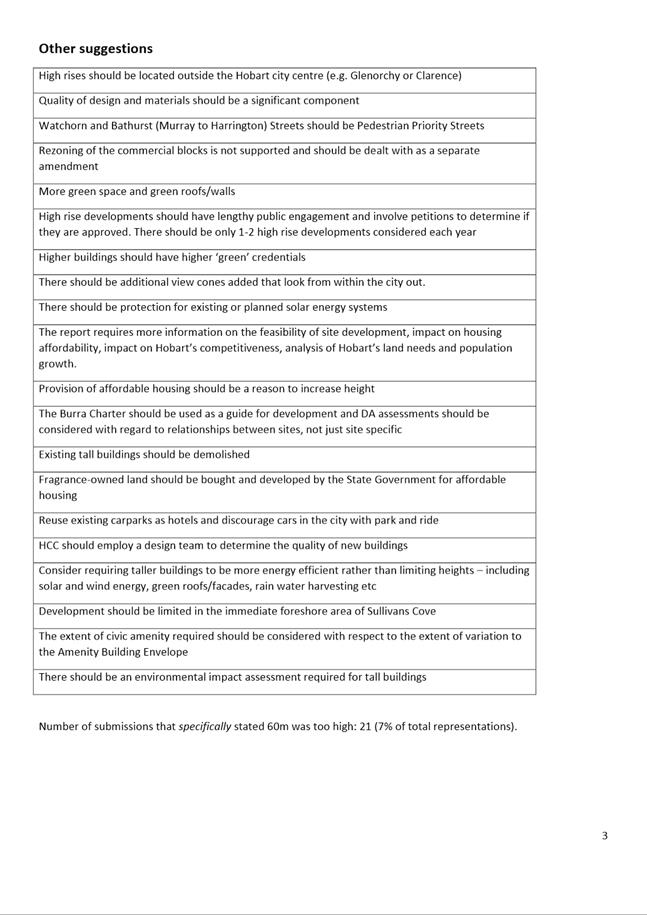
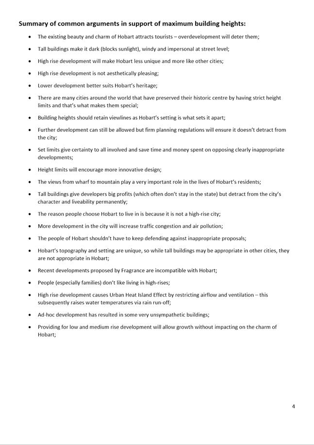
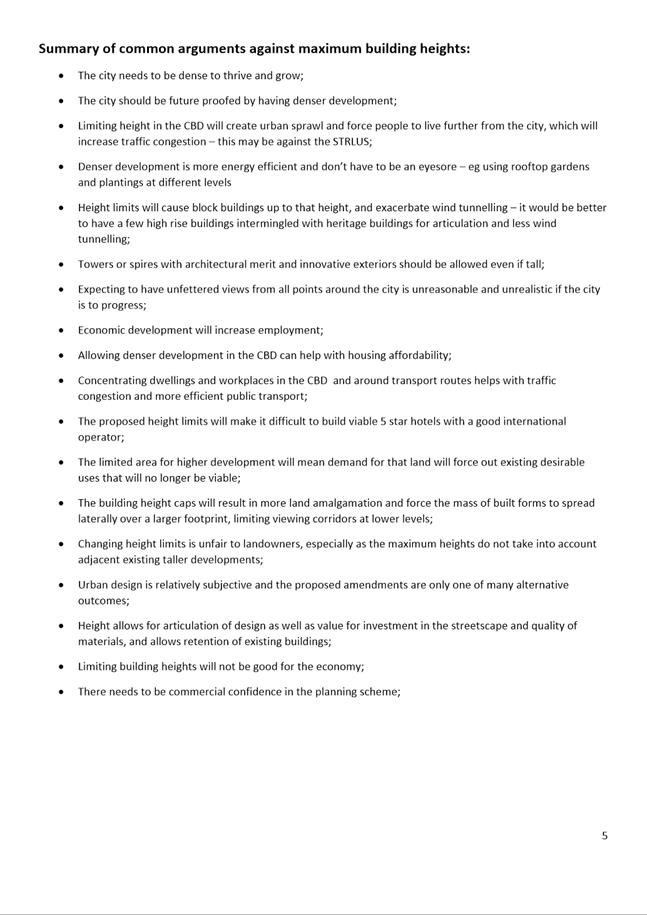
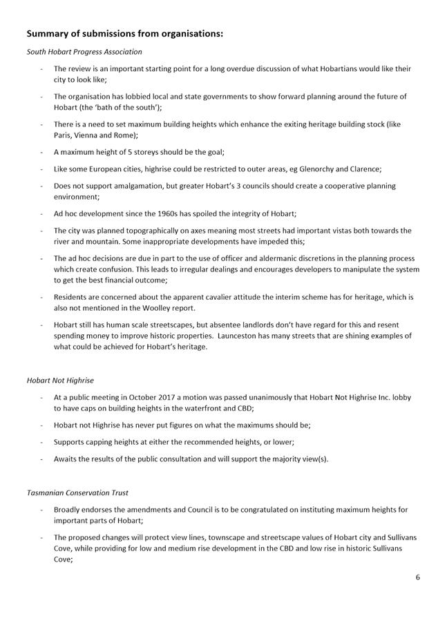
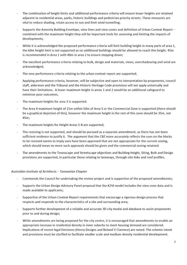

|
Agenda (Open Portion) City Planning Committee Meeting - 10/12/2018 |
Page 792 ATTACHMENT d |
|
Agenda (Open Portion) City Planning Committee Meeting - 10/12/2018 |
Page 793 ATTACHMENT e |
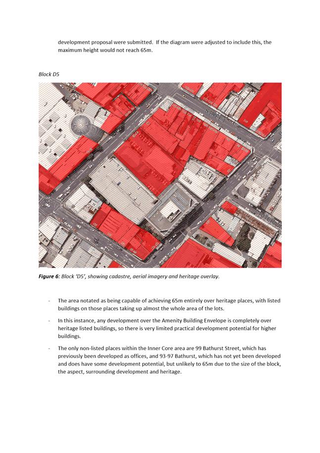
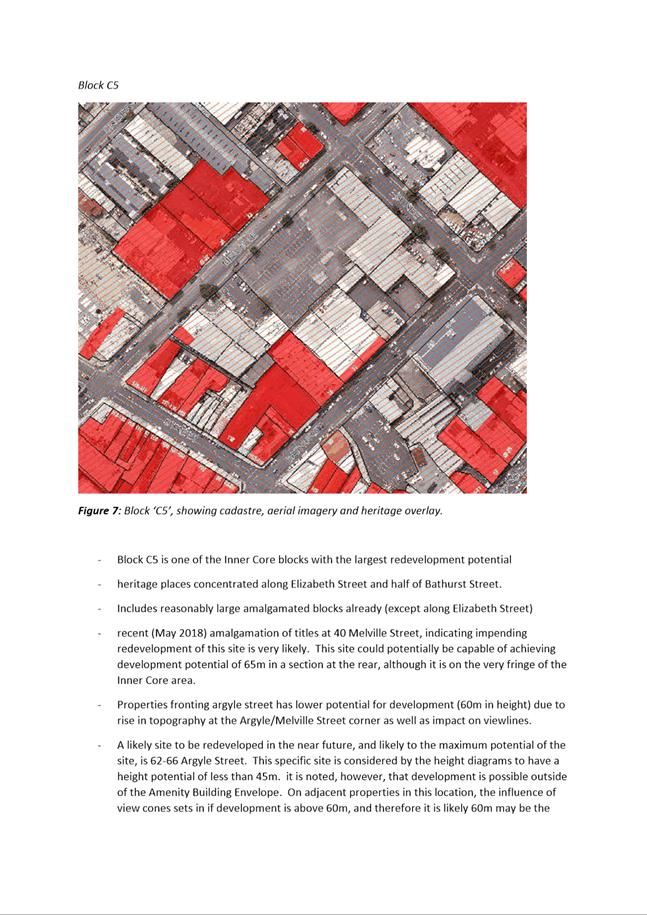
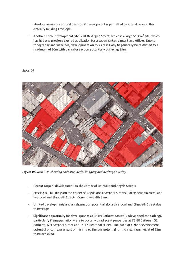
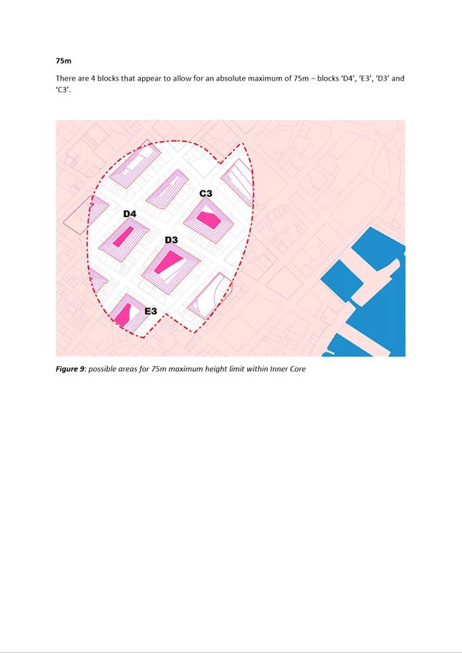
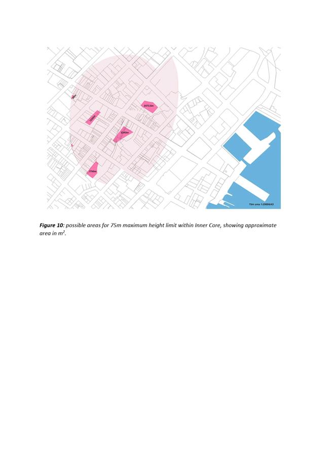
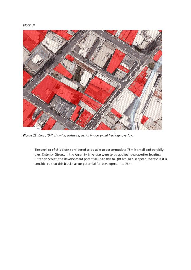
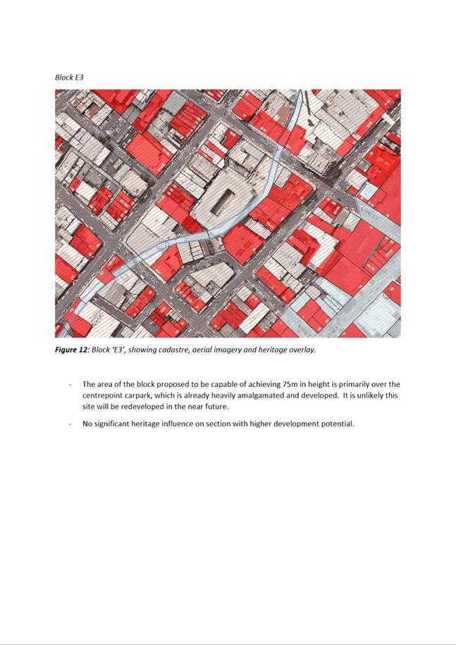
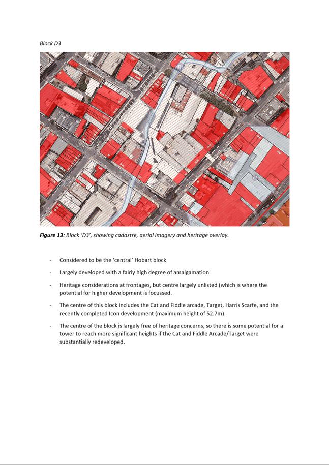
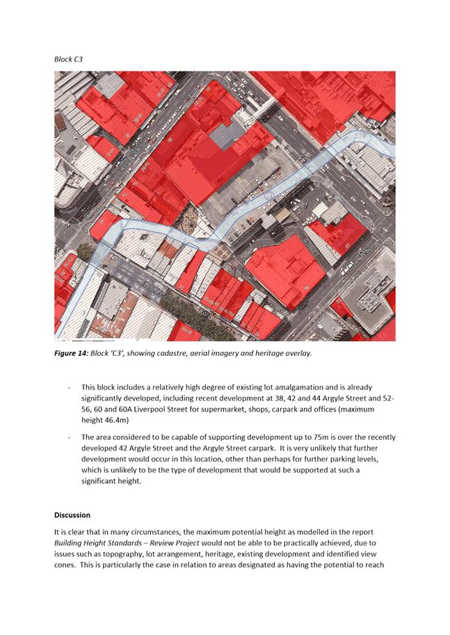
|
Agenda (Open Portion) City Planning Committee Meeting - 10/12/2018 |
Page 807 ATTACHMENT f |
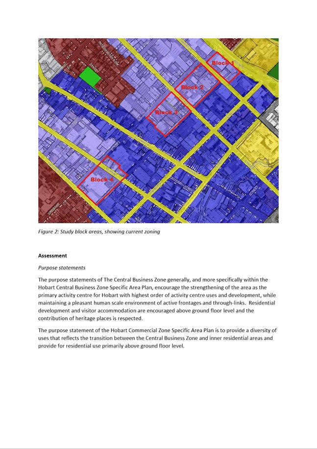
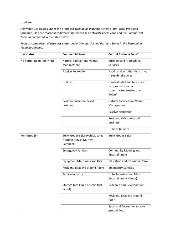
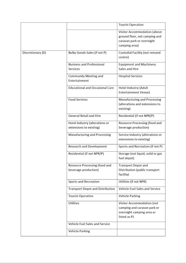
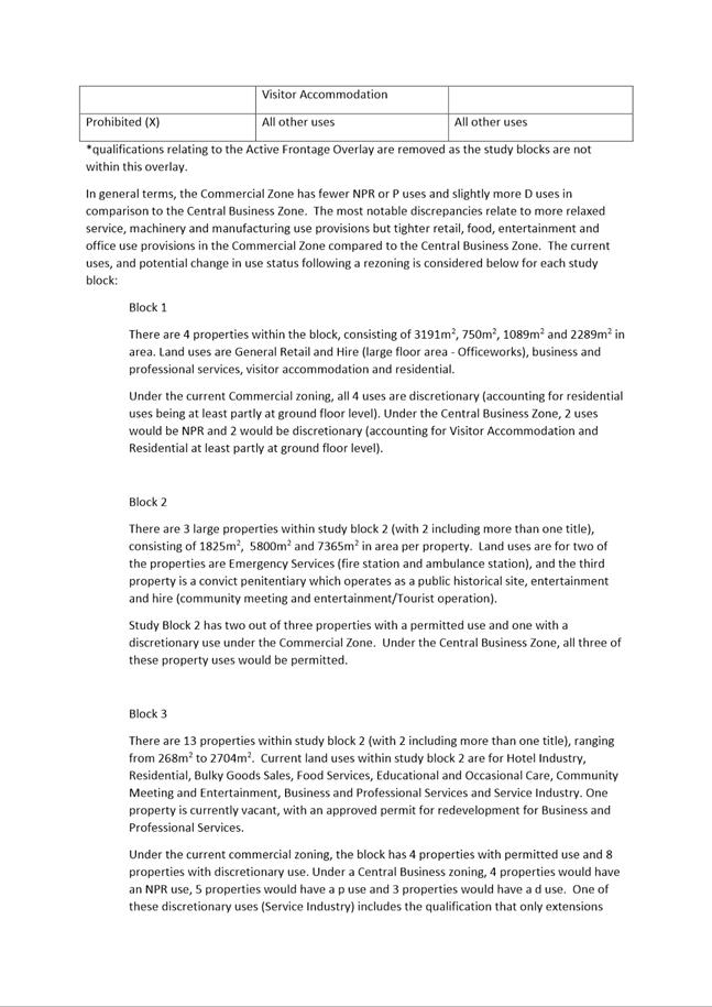
|
Agenda (Open Portion) City Planning Committee Meeting - 10/12/2018 |
Page 815 ATTACHMENT g |
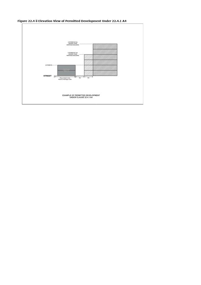
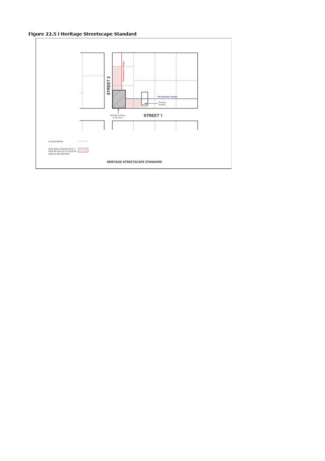
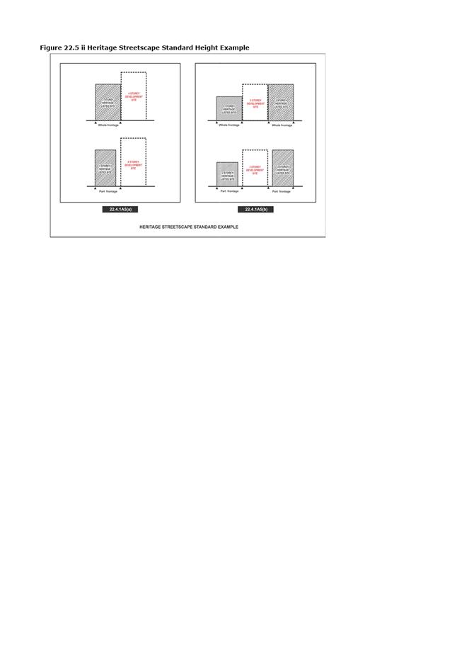
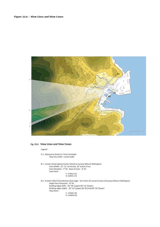
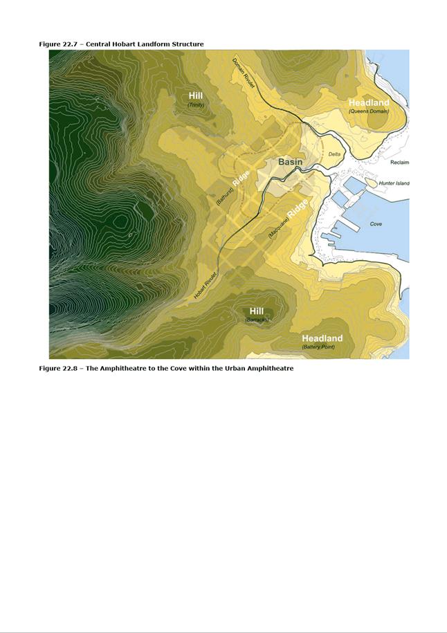
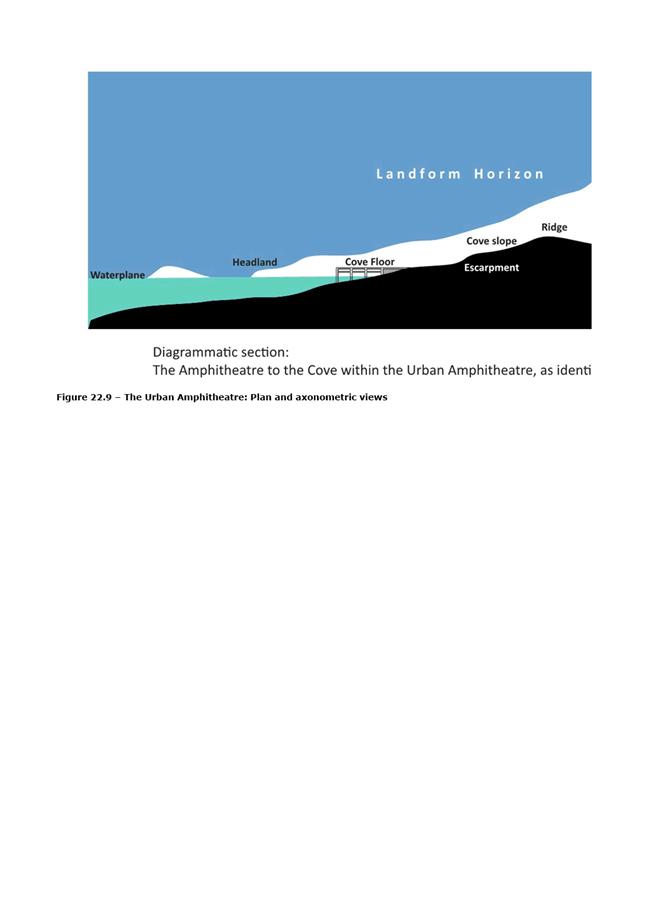
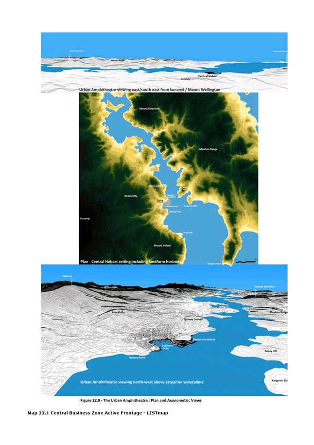
|
Agenda (Open Portion) City Planning Committee Meeting - 10/12/2018 |
Page 834 ATTACHMENT h |
|
Agenda (Open Portion) City Planning Committee Meeting - 10/12/2018 |
Page 835 ATTACHMENT i |
|
Agenda (Open Portion) City Planning Committee Meeting |
Page 837 |
|
|
|
10/12/2018 |
|
8.3 Monthly Building Statistics - 1 November 2018 - 30 November 2018
Memorandum of the Director City Planning of 5 December 2018 and attachments.
Delegation: Council
|
Item No. 8.3 |
Agenda (Open Portion) City Planning Committee Meeting |
Page 838 |
|
|
10/12/2018 |
|

Memorandum: City Planning Committee
Monthly Building Statistics - 1 November 2018 – 30 November 2018
Attached is the Monthly Building Statistics for the period 1 November 2018 to 30 November 2018.
|
That the information be received and noted:
The Director City Planning reports:
A. 1. During the period 1 November 2018 to 30 November 2018, 61 permits were issued to the value of $28,156,982 which included:
(i) 26 for Extensions/Alterations to Dwellings to the value of $4,921,043;
(ii) 13 New Dwellings to the value of $6,284,275; and
(iii) 2 Major Projects:
a) 34 Davey Street, Hobart - Structural Work for Alterations & Additions (Hotel) - $14,900,000;
b) 10 Stephanie Close, Sandy Bay - House - $1,900,000;
2. During the period 1 November 2017 to 30 November 2017, 80 permits were issued to the value of $20,005,503 which included:
(i) 43 Extensions/Alterations to Dwellings to the value of $6,009,550
(ii) 14 New Dwellings to the value of $8,602,953; and
(iii) 3 Major Projects:
a) 8 Wynyard Street - South Hobart - New Buildings and Structures 24 Units - $5,000,000;
b) 85-99 Collins Street, Hobart - Alterations, Internal Fit out (Harris Scarfe) - $1,500,000;
c) 6-8 Market Place, Hobart - Partial Demolition, Alterations and Additions (Carpark) - $1,200,000;
B. 1. In the twelve months ending 30 November 2018, 657 permits were issued to the value of $521,629,783; and
2. In the twelve months ending 30 November 2017, 725 permits were issued to the value of $252,139,593.
|
As signatory to this report, I certify that, pursuant to Section 55(1) of the Local Government Act 1993, I hold no interest, as referred to in Section 49 of the Local Government Act 1993, in matters contained in this report.
|
Neil Noye Director City Planning |
|
Date: 5 December 2018
File Reference: F18/143882
Attachment a: Building
Permits Issued(Accumulative Monthly Totals) 5 Year Comparison ⇩ ![]()
Attachment
b: Building
Permits Value.(Accumulative Monthly Totals) 5 Year Comparison ⇩ ![]()
|
Item No. 8.3 |
Agenda (Open Portion) City Planning Committee Meeting - 10/12/2018 |
Page 840 ATTACHMENT a |
|
Agenda (Open Portion) City Planning Committee Meeting - 10/12/2018 |
Page 841 ATTACHMENT b |
|
Agenda (Open Portion) City Planning Committee Meeting |
Page 842 |
|
|
|
10/12/2018 |
|
8.4 City Planning - Advertising Report
Memorandum of the Director City Planning of 5 December 2018 and attachment.
Delegation: Committee
|
Item No. 8.4 |
Agenda (Open Portion) City Planning Committee Meeting |
Page 843 |
|
|
10/12/2018 |
|
Memorandum: City Planning Committee
City Planning - Advertising Report
Attached is the advertising list for the period 19 November 2018 – 30 November 2018.
|
That the information contained in the memorandum titled ‘City Planning – Advertising Report’ of 5 December 2018 be received and noted.
|
As signatory to this report, I certify that, pursuant to Section 55(1) of the Local Government Act 1993, I hold no interest, as referred to in Section 49 of the Local Government Act 1993, in matters contained in this report.
|
Neil Noye Director City Planning |
|
Date: 5 December 2018
File Reference: F18/143904
Attachment a: City
Planning - Advertising Report ⇩ ![]()
|
Item No. 8.4 |
Agenda (Open Portion) City Planning Committee Meeting - 10/12/2018 |
Page 844 ATTACHMENT a |
|
Agenda (Open Portion) City Planning Committee Meeting |
Page 849 |
|
|
|
10/12/2018 |
|
8.5 Delegated Decisions Report (Planning)
Memorandum of the Director City Planning of 5 December 2018 and attachment.
Delegation: Committee
|
Item No. 8.5 |
Agenda (Open Portion) City Planning Committee Meeting |
Page 850 |
|
|
10/12/2018 |
|

Memorandum: City Planning Committee
Delegated Decisions Report (Planning)
Attached is the delegated planning decisions report for the period 20 November until 4 December 2018.
|
That the information contained in the memorandum titled ‘Delegated Decisions Report (Planning)’ of 5 December 2018 be received and noted.
|
As signatory to this report, I certify that, pursuant to Section 55(1) of the Local Government Act 1993, I hold no interest, as referred to in Section 49 of the Local Government Act 1993, in matters contained in this report.
|
Neil Noye Director City Planning |
|
Date: 5 December 2018
File Reference: F18/144107
Attachment a: Delegated
Decisions Report (Planning) ⇩ ![]()
|
Item No. 8.5 |
Agenda (Open Portion) City Planning Committee Meeting - 10/12/2018 |
Page 851 ATTACHMENT a |
|
|
Agenda (Open Portion) City Planning Committee Meeting |
Page 853 |
|
|
10/12/2018 |
|
Section 29 of the Local Government (Meeting Procedures) Regulations 2015.
File Ref: 13-1-10
An Alderman or Councillor may ask a question without notice of the Chairman, another Alderman or Councillor, the General Manager or the General Manager’s representative, in line with the following procedures:
1. The Chairman will refuse to accept a question without notice if it does not relate to the Terms of Reference of the Council committee at which it is asked.
2. In putting a question without notice, an Alderman or Councillor must not:
(i) offer an argument or opinion; or
(ii) draw any inferences or make any imputations – except so far as may be necessary to explain the question.
3. The Chairman must not permit any debate of a question without notice or its answer.
4. The Chairman, Aldermen, Councillor, General Manager or General Manager’s representative who is asked a question may decline to answer the question, if in the opinion of the respondent it is considered inappropriate due to its being unclear, insulting or improper.
5. The Chairman may require a question to be put in writing.
6. Where a question without notice is asked and answered at a meeting, both the question and the response will be recorded in the minutes of that meeting.
7. Where a response is not able to be provided at the meeting, the question will be taken on notice and
(i) the minutes of the meeting at which the question is asked will record the question and the fact that it has been taken on notice.
(ii) a written response will be provided to all Aldermen and Councillors, at the appropriate time.
(iii) upon the answer to the question being circulated to Aldermen and Councillors, both the question and the answer will be listed on the agenda for the next available ordinary meeting of the committee at which it was asked, where it will be listed for noting purposes only.
|
|
Agenda (Open Portion) City Planning Committee Meeting |
Page 854 |
|
|
10/12/2018 |
|