City
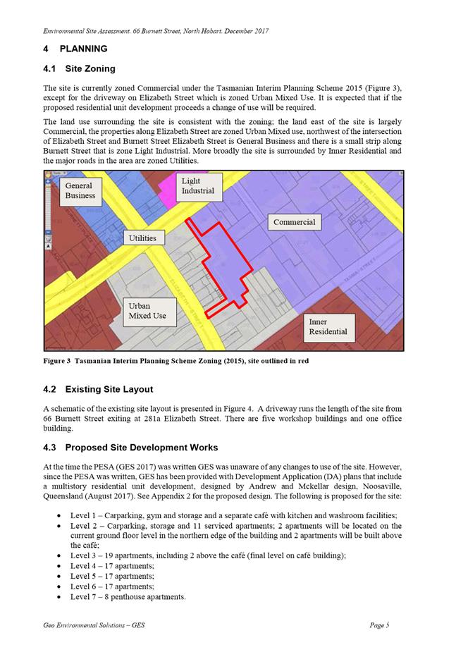
of hobart
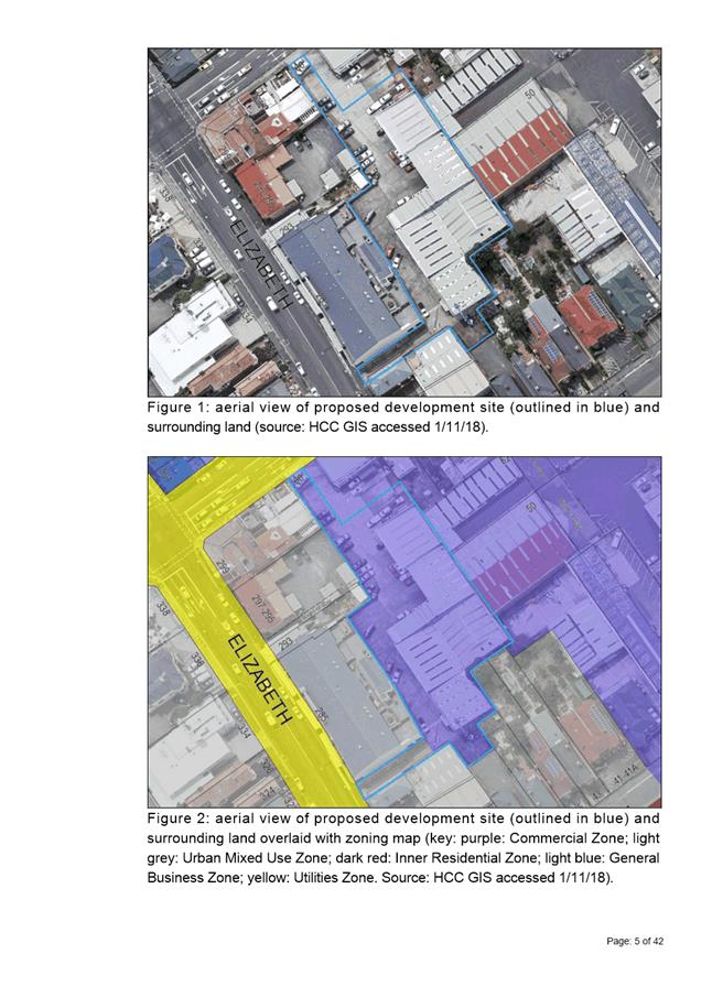
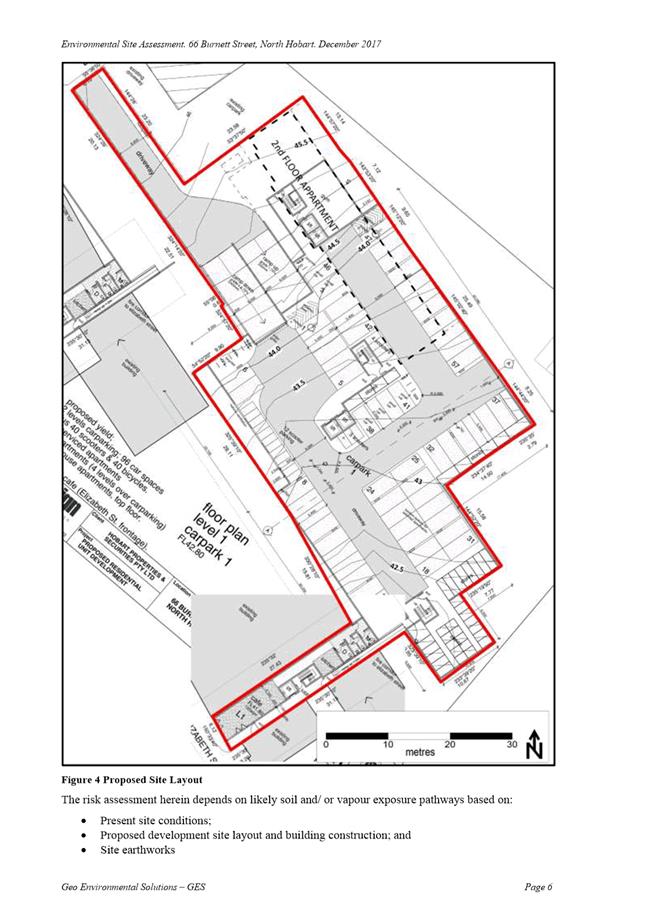
AGENDA
Special City Planning Committee Meeting
Open Portion
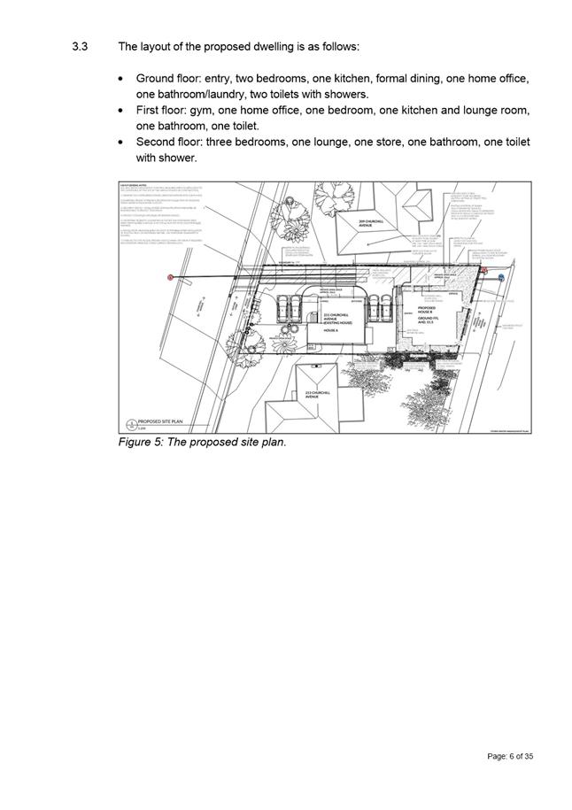
Tuesday, 13 November 2018
at 5:30 pm
Lady Osborne Room, Town Hall
City
of hobart
AGENDA
Special City Planning Committee Meeting
Open Portion
Tuesday, 13 November 2018
at 5:30 pm
Lady Osborne Room, Town Hall
THE MISSION
Our mission is to ensure good governance of our capital City.
THE VALUES
The Council is:
|
about people |
We value people – our community, our customers and colleagues. |
|
professional |
We take pride in our work. |
|
enterprising |
We look for ways to create value. |
|
responsive |
We’re accessible and focused on service. |
|
inclusive |
We respect diversity in people and ideas. |
|
making a difference |
We recognise that everything we do shapes Hobart’s future. |
|
|
Agenda (Open Portion) Special City Planning Committee Meeting |
Page 3 |
|
|
13/11/2018 |
|
Business listed on the agenda is to be conducted in the order in which it is set out, unless the committee by simple majority determines otherwise.
APOLOGIES AND LEAVE OF ABSENCE
1. Indications of Pecuniary and Conflicts of Interest
2. Committee Acting as Planning Authority
2.1 Applications under the City of Hobart Planning Scheme
2.2 Applications under the Hobart Interim Planning Scheme 2015
2.2.1 55 Runnymede Street Battery Point - Partial Change of Use to Visitor Accommodation
2.2.4 6 / 15 Lansdowne Crescent, West Hobart - Partial Change of Use to Visitor Accommodation
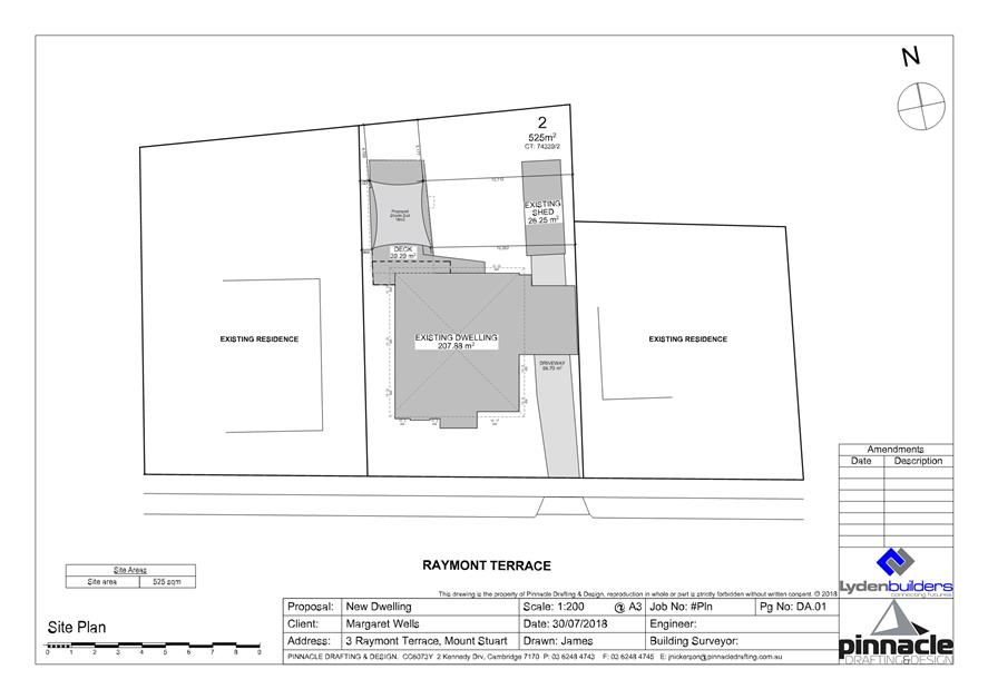
2.2.5 3 Raymont Terrace Mount Stuart - Alterations
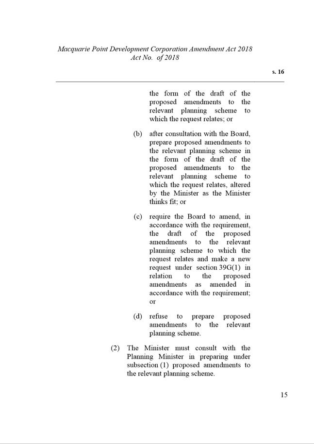
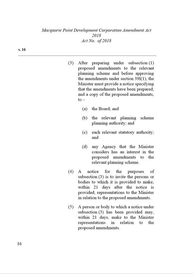
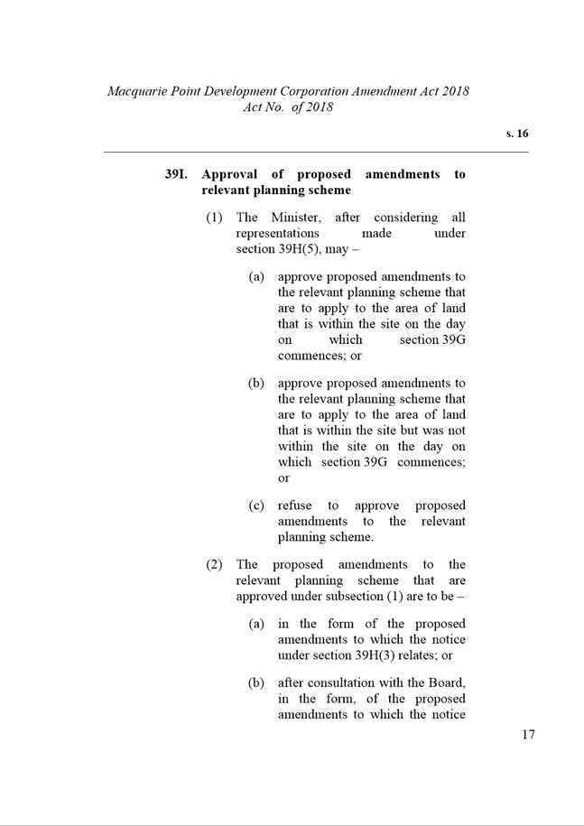
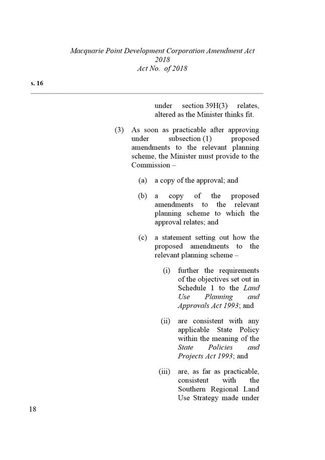
3.1 Macquarie Point Development Corporation Amendment Bill 2018 - Site Development Plan
|
|
Agenda (Open Portion) Special City Planning Committee Meeting |
Page 4 |
|
|
13/11/2018 |
|
Special City Planning Committee Meeting (Open Portion) held Tuesday, 13 November 2018 at 5:30 pm in the Lady Osborne Room, Town Hall.
|
ALDERMEN Lord Mayor A M Reynolds Deputy Lord Mayor H Burnet Alderman M Zucco Alderman J R Briscoe Alderman Dr P T Sexton Alderman D C Thomas Alderman T M Denison Alderman W F Harvey Alderman S Behrakis Alderman M Dutta Alderman H Ewin Alderman Z Sherlock |
Apologies: Alderman T M Denison.
Leave of Absence: Nil.
|
Ref: Part 2, Regulation 8(7) of the Local Government (Meeting Procedures) Regulations 2015.
Aldermen are requested to indicate where they may have any pecuniary or conflict of interest in respect to any matter appearing on the agenda, or any supplementary item to the agenda, which the committee has resolved to deal with.
In accordance with the provisions of Part 2 Regulation 25 of the Local Government (Meeting Procedures) Regulations 2015, the intention of the Committee to act as a planning authority pursuant to the Land Use Planning and Approvals Act 1993 is to be noted.
In accordance with Regulation 25, the Committee will act as a planning authority in respect to those matters appearing under this heading on the agenda, inclusive of any supplementary items.
The Committee is reminded that in order to comply with Regulation 25(2), the General Manager is to ensure that the reasons for a decision by a Council or Council Committee acting as a planning authority are recorded in the minutes.
|
Agenda (Open Portion) Special City Planning Committee Meeting |
Page 5 |
|
|
|
13/11/2018 |
|
2.1 Applications under the City of Hobart Planning Scheme
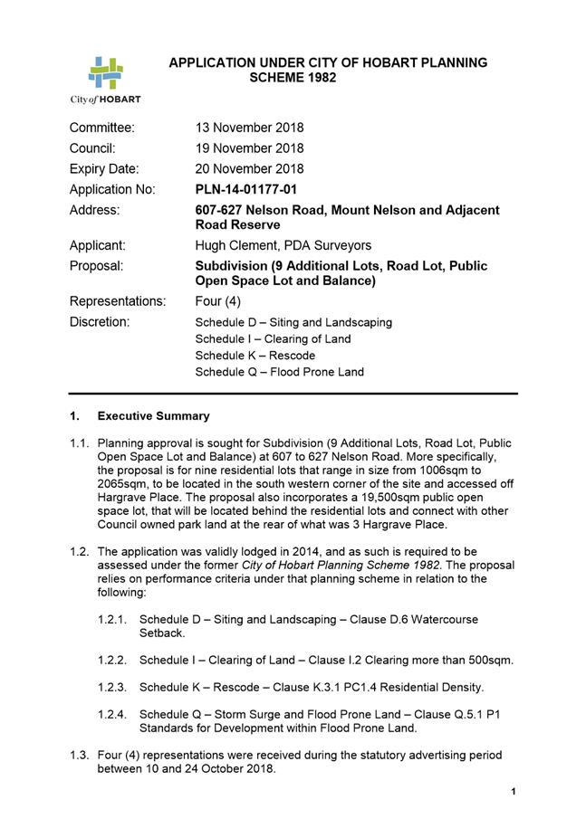
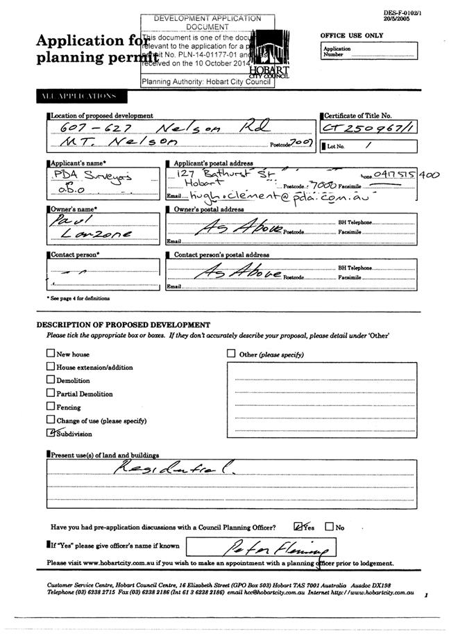
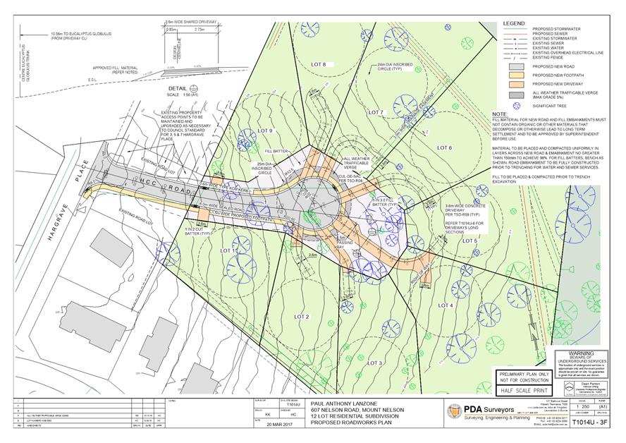
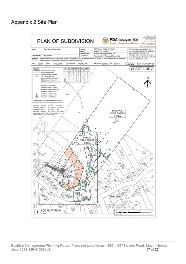
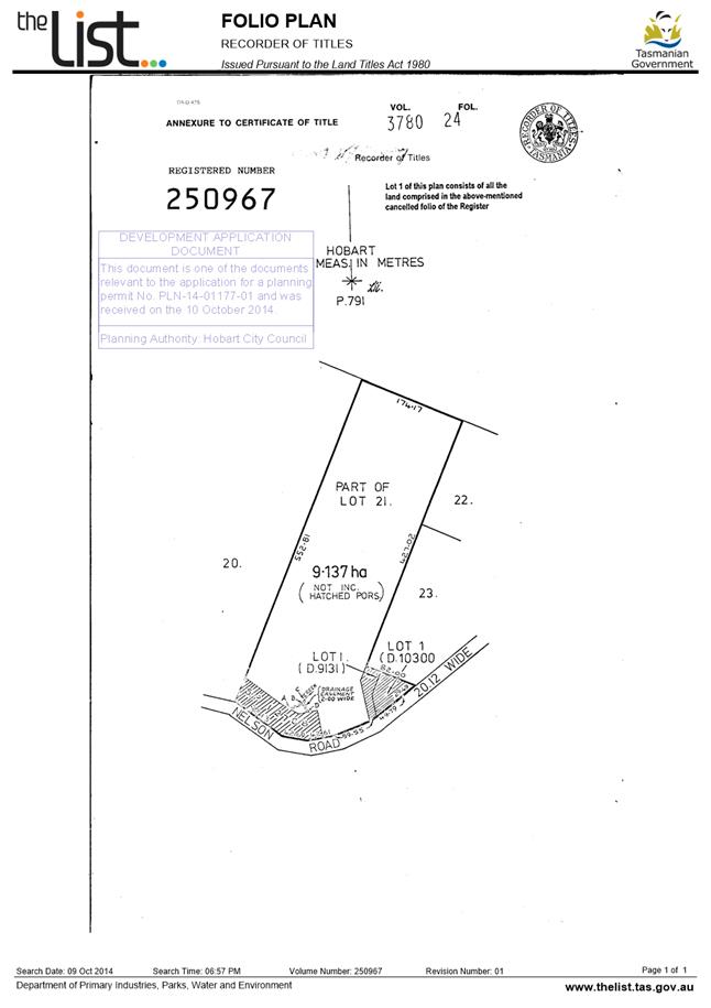
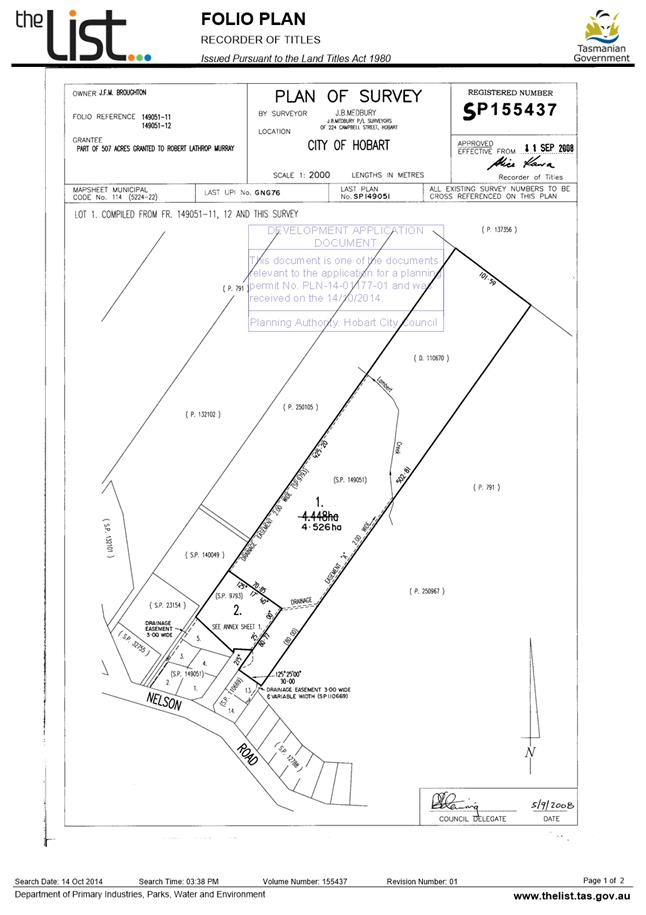
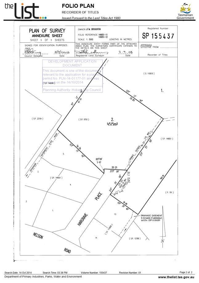
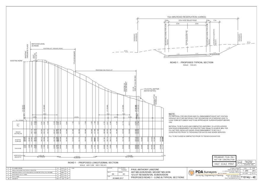
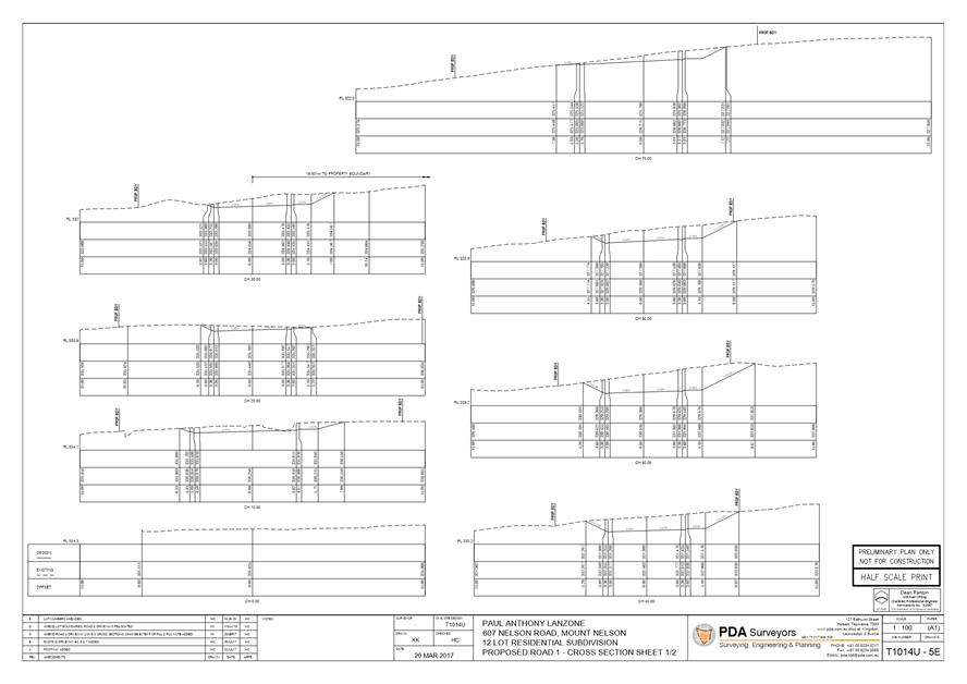
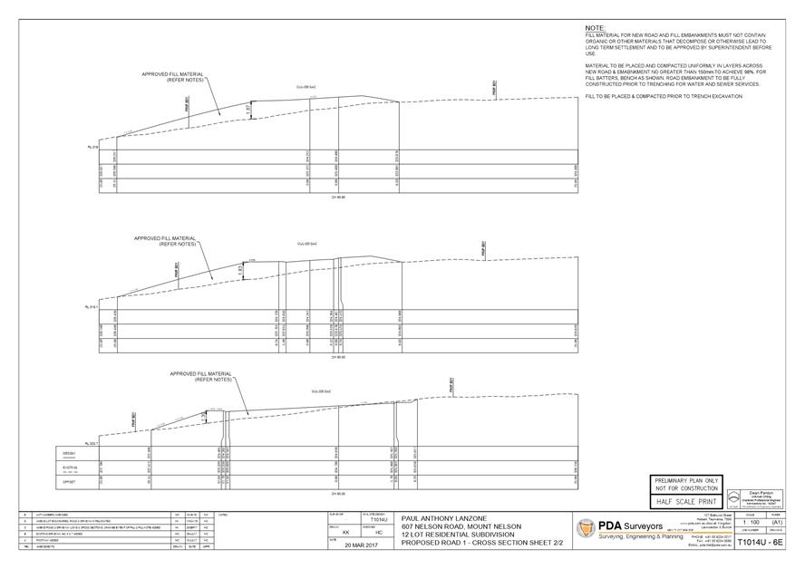
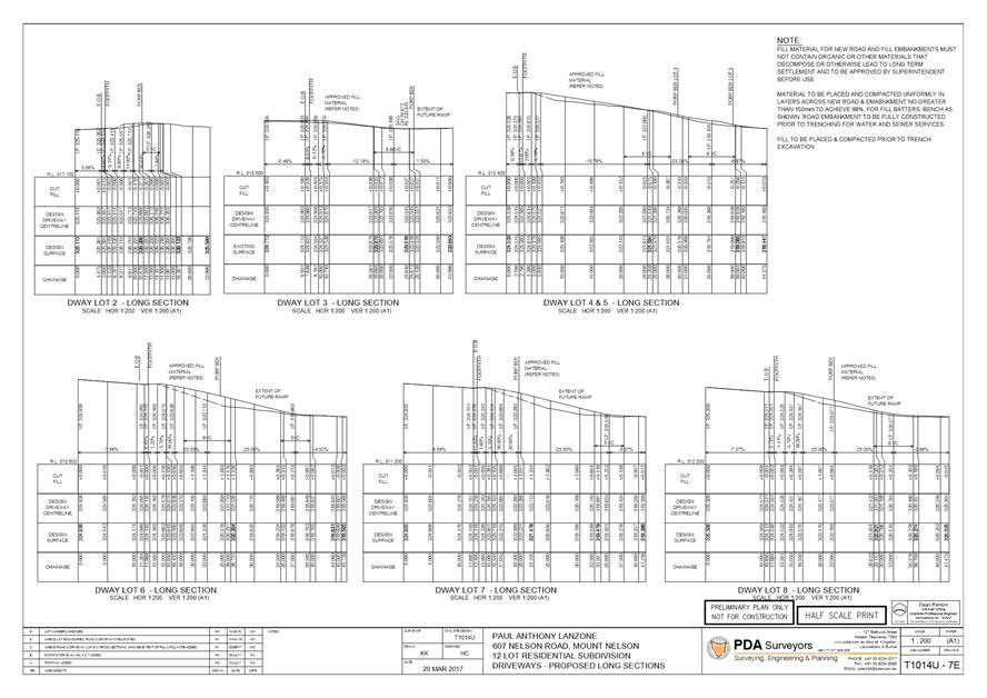
2.1.1 607-627 Nelson Road, Mount Nelson and Adjacent Road Reserve - Subdivision (9 Additional Lots, Road Lot, Public Open Space Lot and Balance)
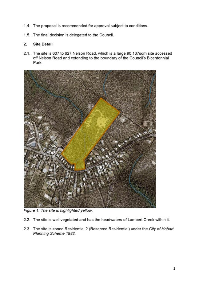
Address: 607-627 Nelson Road, Mount Nelson and Adjacent Road Reserve
Proposal: Subdivision (9 Additional Lots, Road Lot, Public Open Space Lot and Balance)
Expiry Date: 20 November 2018
Extension of Time: Not applicable
Author: Ben Ikin
|
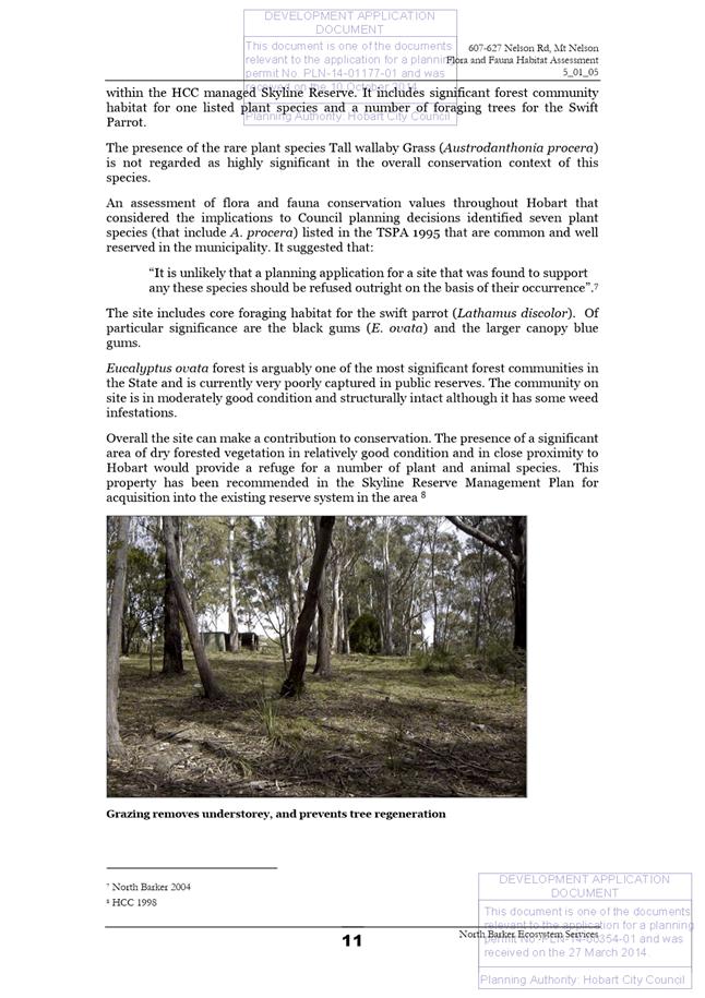
REcommendation That: Pursuant to the City of Hobart Planning Scheme 1982, the Council approve the application for subdivision (9 additional lots, road lot, public open space lot and balance) at 607 to 627 Nelson Road, Mount Nelson and adjacent road reserve for the reasons outlined in the officer’s report and a permit containing the following conditions be issued:
GEN
TW
ENG sw2
Where all approved works have been completed and prior to the sealing of the final survey plan, the developer must submit a recorded CCTV inspection and associated report of any new public stormwater infrastructure, taken no more than one month prior to commencement of the maintenance period. A maintenance period of 12 months (roads, piped infrastructure) or 24 months (vegetated stormwater infrastructure) will apply. Council will perform a final inspection at the end of the maintenance period. Should any rectification works be required, these must be done at the Developer's cost within a time frame specified by Council, and an additional 12 month maintenance period may be applied.
Advice: A maintenance bond of 5% of the contract value of the works will be required by the Council. Upon the expiry of the maintenance period, please contact the Council’s Project and Development Inspector on telephone 6238 2967 to arrange the final inspection prior to the release of the security bond.
Reason for condition
To ensure that the Lots are serviced by adequate public infrastructure.
ENG sw4
The new storm water connections for the existing lots fronting Nelson Road must be constructed and existing abandoned connections sealed at the owner’s expense, prior to the sealing of the final plan.
Detailed engineering drawings must be submitted and approved, prior to commencement of work. The detailed engineering drawings must include the location and size of the proposed connections
All work required by this condition must be undertaken in accordance with the approved detailed engineering drawings.
Advice: Once the detailed engineered drawings have been approved the Council will issue a condition endorsement (see general advice on how to obtain condition endorsement).
Please note that once the condition endorsement has been issued you will need to contact Council’s City Infrastructure Unit to initiate an application for service connection.
Reason for condition
To ensure the site is drained adequately.
ENG sw5
The new stormwater system must be constructed prior to the sealing of the final plan. All costs associated with works required by this condition are to be met by the owner.
Engineering design plans in accordance with the relevant standards and specifications must be submitted and approved prior to the commencement of works. The engineering design plans must:
1. Be
certified by a suitably qualified and experienced engineer. 2. Show
the direction of stormwater run-off. 3. Include
independent drainage and a point of discharge for each lot. 4. Show
in both plan and longitudinal section the proposed stormwater infrastructure
including (but not limited to): connections, flows, velocities, hydraulic
grade lines, clearances, cover, gradients, sizing, material, pipe class,
adequate working platforms around manholes, easements and inspection
openings. 5. Include
the associated calculations and catchment area plans. The stormwater system
must be designed using the major/minor concept with the major system catering
for 1% AEP flows as at 2100 (i.e. including climate change loading) from a
fully developed catchment, and the minor (underground pipe) system sized to
accommodate 5% AEP flows from a fully-developed catchment. 6. Provide
sufficient detail to demonstrate that overland flow from the 1% AEP storm
event is contained and safely conveyed within the proposed overland flow path
(and drainage easement). 7. Detail
suitable erosion and scour protection at the drainage outfall points. 8. Provide details of infrastructure to convey stormwater from Nelson Road to Lambert Rivulet via the proposed public open space.
All work required by this condition must be undertaken in accordance with the approved engineering design drawings.
Advice: · The proposed drainage outfalls should discharge as near as practicable to the defined rivulet centreline.
· Drainage from Nelson Rd
passing through the public open space must be conveyed formally in public
infrastructure.
· Once the engineering design
drawings have been approved the Council will issue a condition endorsement
(see general advice on how to obtain condition endorsement). · Please note that once the condition endorsement has been issued you will need to contact Council’s City Infrastructure Division to obtain a Permit to Construct Public Infrastructure.
Reason for condition
To ensure Council’s hydraulic infrastructure meets acceptable standards.
ENG sw6
Construction of the proposed infrastructure must not adversely impact the Lambert Rivulet. A Construction Management Plan must be submitted and approved prior to commencement of works. The plan must:
1. Be
prepared by a suitably qualified and experienced person. 2. Detail
the proposed works and construction methodology including the machinery
expected to be used in the vicinity of the rivulet, the potential adverse
environmental impacts of the construction activity and suitable methods of
mitigating those impacts. 3. Include a relevant impact monitoring system and schedule.
All work required by this condition must be undertaken in accordance with the approved plan.
Reason for condition
To ensure the protection of the Council’s hydraulic infrastructure.
ENG 1
The cost of repair of any damage to the Council infrastructure resulting from the implementation of this permit, must be met by the owners within 30 days of the completion of the development or as otherwise determined by the Council. Any damage must be immediately reported to Council.
A photographic record of the Council infrastructure adjacent to the subject site must be provided to the Council prior to any commencement of works.
A photographic record of the Council’s infrastructure (e.g. existing property service connection points, roads, buildings, stormwater, footpaths, driveway crossovers and nature strips, including if any, pre-existing damage) will be relied upon to establish the extent of damage caused to the Council’s infrastructure during construction. In the event that the owner/developer fails to provide to the Council a photographic record of the Council’s infrastructure, then any damage to the Council infrastructure found on completion of works will be deemed to be the responsibility of the owner.
Reason for condition
To ensure that any of the Council infrastructure and/or site-related service connections affected by the proposal will be altered and/or reinstated at the owner’s full cost.
ENG 3b
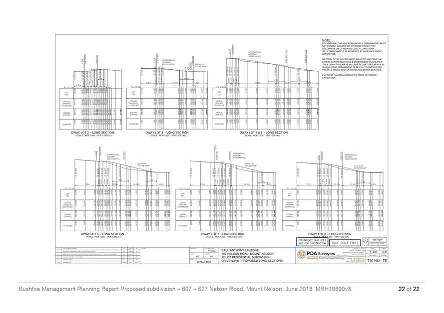
The design of the access driveways must be submitted and approved, prior to the commencement of work.
The design must:
1. Be
prepared and certified by a suitably qualified engineer. 2. Be
generally in accordance with the Australian Standard AS/NZS2890.1:2004.
3. Where
it deviates from AS/NZS2890.1:2004, demonstrate that the design will provide
a safe and efficient access, and enable safe, easy and efficient use. 4. Show
dimensions, levels, gradients and transitions, and other details as Council
deem necessary to satisfy the above requirement, including showing: a. Long
sections for the driveways onto each lot. b. Practical
access onto each lot. I.e. construction vehicles must be able to access and
park within the lots. c. A
sealed driveway up to the front boundary of each lot, noting that driveways
must be sealed where subject to a right of way. d. A
separate long section along the inside wheel track where there is a bend in a
driveway with a centerline gradient exceeding 20%. e. A long section along the centerline for the driveway onto lot 4 (where separate from shared driveway to lot 5) demonstrating acceptable gradients. Refer to Advice clause immediately below.
All work required by this condition must be undertaken in accordance with the approved design.
Advice: Once the design has been approved, the Council will issue a condition endorsement (see general advice on how to obtain condition endorsement).
Access onto lot 4 should branch off the shared driveway with lot 5 before the bend north towards lot 5, that is, try to avoid turning left then right with steep gradients.
Reason for condition
To ensure the safety of users of the access and parking module, and compliance with the relevant Australian Standard.
ENG 3c
The access driveways must be constructed in accordance with the design drawings approved by Condition ENG 3b.
Prior to the sealing of the final plan, documentation by a suitably qualified engineer certifying that the driveways have been constructed in accordance with the above drawings must be lodged with Council.
Reason for condition
To ensure the safety of users of the access and parking module, and compliance with the relevant Australian Standard.
ENG 4
The access driveway to each lot approved by this permit must be constructed to a sealed standard (spray seal, asphalt, concrete, pavers or equivalent Council approved) and surface drained to the satisfaction of the Council's Director City Infrastructure prior to the sealing of the final plan.
Reason for condition
To ensure the safety of users of the access driveway, and so that it does not detract from the amenity of users, adjoining occupiers or the environment by preventing dust, mud and sediment transport.
ENG r7
Residential underground power to each lot and street lighting must be installed prior to the sealing of the final plan.
A street lighting design for all roads and footways must be submitted and approved, prior to sealing of the final plan. The street lighting design must:
1. Be
in accordance with AS/NZS 1158.3.1 category P4 series to the requirements of
Tas Networks and Council; 2. Include
Tas Networks light standard supplied poles and energy-efficient road light
fittings; and 3. Be certified by a qualified person.
All work required by this condition must be undertaken in accordance with the approved street lighting design.
Advice: Once the street lighting design has been approved the Council will issue a condition endorsement (see general advice on how to obtain condition endorsement).
Reason for condition
To ensure that the subdivision of land provides adequate services to meet the projected needs of future development.
ENG r8
The subdivision must provide adequate services to meet future development.
Engineering drawings must be submitted and approved prior to commencement of work on the site. The engineering drawings must:
1. Be
prepared and certified by a suitable qualified professional and experienced
engineer. 2. Be
in accordance with LGAT-Tasmania Standard Drawings and Subdivision Guidelines
2013, the Department of State Growth Specifications and all other relevant
Standards, Guidelines and procedures or to the approval of the Director City
Infrastructure. 3. Show
long and cross sections of the footpaths, footway and driveways onto each lot
and concept landscaping plan. 4. Show
the existing and new driveway access design onto the existing lots 3, 5 and 7
Hargrave Place. 5. Show
the existing and new intersection design from Hargrave Place onto the new
road and include the location of the power pole and stay-wire with any
modifications required. 6. Show
location of fences, barriers or landscaping required adjacent to footpaths
due to slope of land. 7. Show
parking restrictions in particular No Stopping around cul-de-sac and on one
side of the road when less than 7m wide to allow fire trucks to gain access. 8. Show
any embankment easements. 9. Include designs of any excavation and/or any batter fill and/or any earth-retaining structures (i.e. embankments, cuttings, fills, retaining walls) and associated structures certificates for any structures. The design must:
a. Show
the batter filling be designed in accordance with AS1289 and/or earth
retaining structure be designed in accordance with AS4678, with a design life
in accordance with table 3.1 typical application major public infrastructure
works. b. Take
into account any additional surcharge loadings as required by relevant
Australian Standards and any Geotechnical findings. c. Detail
any mitigation measures required. d. The structure certificated and/or design should note accordingly the above.
10. Include
design and certification of pedestrian and vehicle barriers in accordance
with the Department of State Growth Specifications Guidelines and procedures,
Australian/New Zealand Standard AS/NZS 1170.1 and/or the (IPWEA) LGAT -
Tasmania Standard Drawings. Upon completion the barriers must be inspected by
a qualified engineer and a certification submitted to the Council, confirming
that the installed barriers comply with the above requirement. 11. Include a safe design of structures assessment in accordance with the Safe Design of Structures Code of Practice (as adopted under section 274 of the Work Health and Safety Act 2012) and supply to the Council any documentation for the ongoing maintenance and replacement of any structures within the Highway Reservation.
All work required by this condition must be constructed in accordance with the approved engineering drawings.
Advice: Once the engineering drawings have been approved the Council will issue a condition endorsement (see general advice on how to obtain condition endorsement).
Reason for condition
To ensure that the subdivision of land provides adequate services to meet the projected needs of future development.
SURV 1
The applicant must submit to the Council a copy of the surveyor’s survey notes at the time of lodging the final plan.
Reason for condition
To enable the Council to accurately update cadastral layers on the corporate Geographic Information System.
SURV 2
The final plan and schedule of easements must be submitted and approved in accordance with section 89 of the Local Government (Building and Miscellaneous Provisions) Act 1993.
Reason for condition
To ensure that the subdivision is carried out in accordance with the Councils requirements under the provisions of Part 3 of the Local Government (Building and Miscellaneous Provisions) Act 1993.
SURV 3
The final plan and schedule of easements must be submitted and approved under section 89 Local Government (Building and Miscellaneous Provisions) Act 1993.
The final plan and schedule of easements must provide easements to the satisfaction of the Council:
1. Over
any proposed or existing stormwater, water or sewer mains passing through the
lots on the final plan, in favour of the Hobart City Council and/or TasWater. 2. Over
any existing or proposed overland flow paths in favour of the Hobart City
Council. 3. Over
any existing or proposed private right of ways, drainage and/or service
easements in favour of the lots they are required to serve. 4. Over
any existing, proposed or required road embankments or road batters in favour
of the Hobart City Council. 5. Over the proposed right of way and services easement in favour of the Hobart City Council.
Advice: Easement widths should be in general accordance with the LGAT (2013) Tasmanian Subdivision Guidelines.
Reason for condition
To ensure that there are no impediments to the provision of public and private services and access to the lots.
SURV 5
The proposed Road and Public Open Space lots are to be transferred in fee simple to the Council at nominal consideration.
Prior to the sealing of the final plan an executed and stamp duty assessed Land Titles Office transfer instrument is to be forwarded to the Council together with a cheque made payable to the Land Titles Office for the associated Land Titles Office registration fees.
Reason for condition
To ensure that titles to the proposed road and public open space lots issue in the Council.
SURV 12
Lots 5, 6, 7, and 8 on the final plan are to be notated in accordance with the provisions of section 83(5)(a)(ii) of the Local Government (Building and Miscellaneous Provisions) Act 1993, to the effect that the Hobart City Council cannot provide a means of gravity reticulated stormwater disposal for the parts of the lots on the north-eastern and eastern side of the of the proposed Pipeline and Services Easement 3.00 Wide passing through the lots.
The final plan must be submitted for approval by Council. The final plan must be notated to the satisfaction of Council.
Reason for condition
To ensure that the restriction in the Council’s ability to provide a means of gravity reticulated stormwater disposal is noted on the final plan.
SURV 13
The final plan is to be notated in accordance with the provisions of section 83(7) (b) of the Local Government (Building and Miscellaneous Provisions) Act 1993 to the effect that the Tasmanian Water and Sewerage Corporation cannot provide a means of gravity reticulated sewerage disposal from lots 5, 6, 7 and 8 on the north-eastern and eastern side of the proposed Pipeline and Services Easement 3.00 Wide passing through the lots.
The final plan must be submitted for approval by Council.
The final plan must be notated to the satisfaction of the Council.
Reason for condition
To ensure that the limitation in TasWater’s ability to provide a means of gravity reticulated sewerage disposal from Lots 5, 6, 7 and 8 is noted on the final plan.
SUB s1
An amendment to Sealed Plan No. 12788 to delete the Rights of Drainage (appurtenant to Lots 1 to 5 on Sealed Plan No. 12788) over the Drainage Easement marked A. B. C. on SP 127888 and (appurtenant to Lots 6, 7 and 8 on Sealed Plan No. 127888) marked D.B.C. on SP 127888 burdening C.T. 250967/1 is to be lodged concurrently at the Land Titles Office with the sealed final plan of survey for the subdivision.
Reason for condition
To ensure that redundant rights of drainage are not brought forward to burden lots in the subdivision.
SUB s2
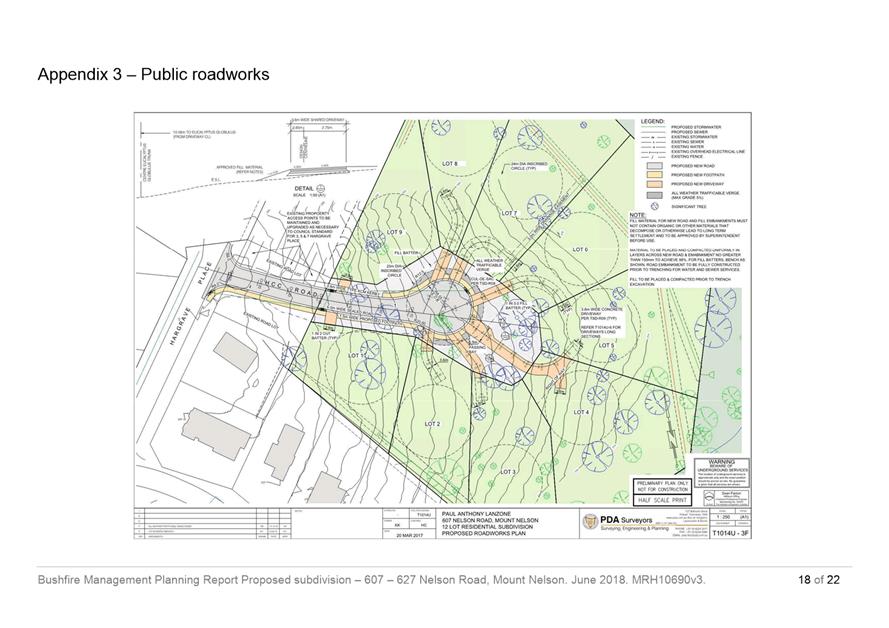
The Highway Reservation area at the cul-de-sac must be minimised while still providing frontage to the properties. The engineering plans must be amended to reduce the amount of land to be dedicated as Highway Reservation to the satisfaction of the Director City Infrastructure prior to commencement of work on the site. Any other associated plans affected must be amended accordingly prior to commencement of work on the site.
Reason for condition
To reduce the amount of Highway Reservation that would be required to be maintained by the City.
OPS 1
The title boundary shared between the Public Open Space lot as shown on the final plan of subdivision, and the adjoining lots (Lots 4, 5, 6, 7, and 8 and the Balance) must be clearly marked by the owner on the ground before any works commence.
Reason for condition
To protect the riparian and recreational values of the Public Open Space lot.
OPS 4
The lot notated as Public Open Space (1.95ha) on the final plan of subdivision must be transferred to the Council in fee simple for nominal consideration, prior to the sealing of the final plan.
The final boundaries of the Public Open Space must be modified along the eastern boundary to the satisfaction of the Director Parks and City Amenity.
Advice: It is noted that the amended boundary is to be in accordance with that agreed 29 October 2018 during the site meeting.
Reason for condition
Approval of the subdivision will create further demand upon Hobart's Public Open Space System. The land acquired will contribute to Hobart City Council’s open space network for recreational use.
ENV 2
Sediment and erosion control measures, in accordance with an approved soil and water management plan (SWMP), must be installed prior to the commencement of work and maintained until such time as all disturbed areas have been stabilised and/or restored or sealed to the Council’s satisfaction.
A SWMP must be submitted and approved, prior to the commencement of work. The SWMP must be prepared in accordance with:
1. The
Soil and Water Management on Building and Construction Sites fact sheets
(Derwent Estuary Program, 2008), available here; and 2. The Waterways and Wetlands Works Manual (DPIWE, 2003).
The SWMP must detail remediation works.
All work required by this condition must be undertaken in accordance with the approved SWMP.
Advice: Once the SWMP has been approved, the Council will issue a condition endorsement (see general advice on how to obtain condition endorsement).
Reason for condition
To avoid the pollution and sedimentation of roads, drains and natural watercourses that could be caused by erosion and runoff from the development.
ENV 9
No vegetation clearing or disturbance may occur other than the minimum necessary to facilitate the essential subdivision works (i.e. construction of road, driveways and provisions of services).
Reason for condition
To clarify the scope of the permit
ENV 12
An approved Weed Management Plan (WMP) for Lots 1 to 9, 101 and the public open space lot, must be implemented. A WMP must be submitted and approved prior to the commencement of works.
The WMP must:
1. Identify
and illustrate the woody environmental weeds on the site; 2. Set
out an environmentally-appropriate methodology and program for eradicating
these weeds (including appropriate disposal) based on defined management
zones (noting that eradication of many species will require follow-up
treatments for several years, however weed management prescriptions for the
public open space lot must be limited to primary works only); 3. Include
a concise action table that provides clear and detailed actions, the area to
be targeted, the timing of each action and the persons/parties responsible
for undertaking all actions; 4. Include
requirements to notify the Council in writing of progress in implementation
of the plan; 5. Include
a simple map of the property that defines the management zones for specific
actions; 6. Include
prescriptions to minimise impacts on native vegetation and minimise soil
disturbance; and 7. Include
a prohibition on the planting of potentially invasive species listed in
Council’s Restricted Plant List; 8. Specify
that no soil is to be imported onto the site unless it is certified weed
propagule free in accordance with Australian Standard AS4419 Soils for
Landscaping and Garden Use; and 9. Be clear and concise so that follow-up treatments can be easily implemented by future landowners (however the bulk of primary weed control works must be scheduled to occur as part of the subdivision works). Advice: Once the weed management plan has been approved the Council will issue a condition endorsement (see general advice on how to obtain condition endorsement).
Reason for condition
To ensure the development does not contribute to the spread of weeds and to offset the biodiversity impacts associated with the development.
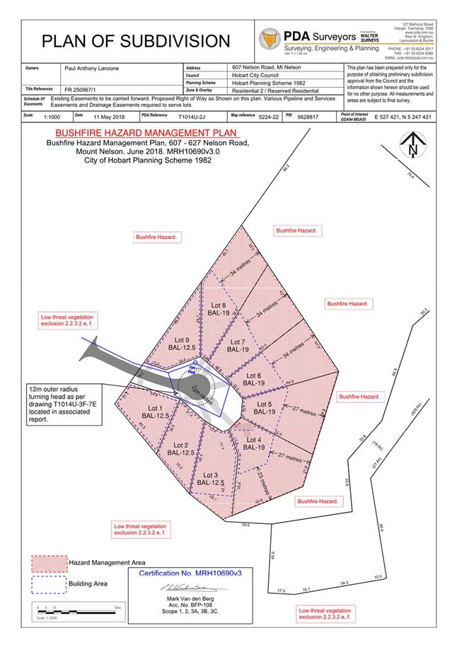
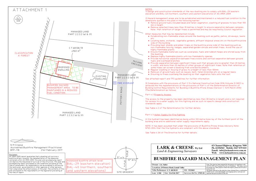
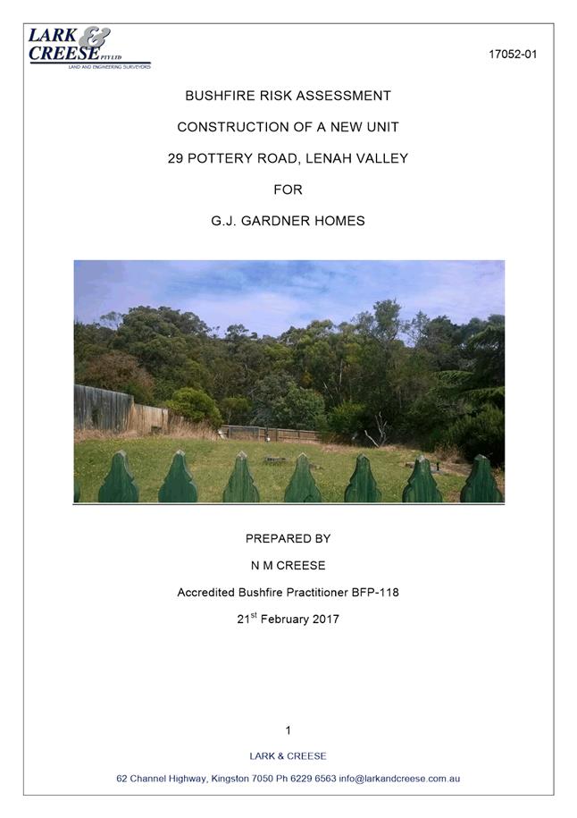
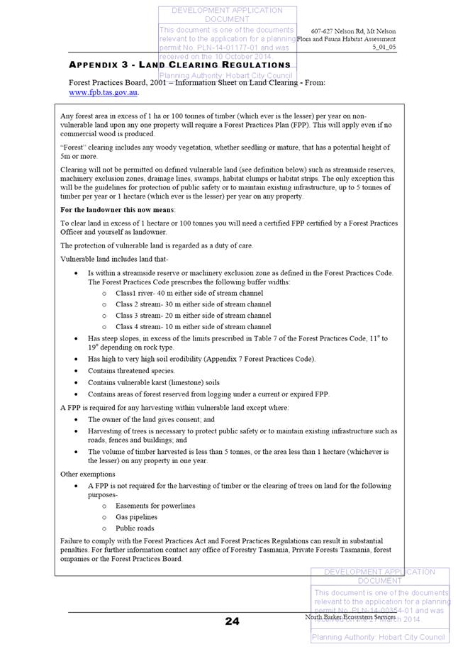
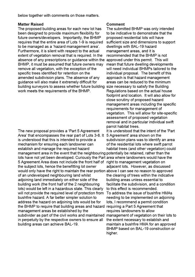
ENV 3
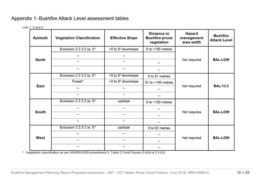
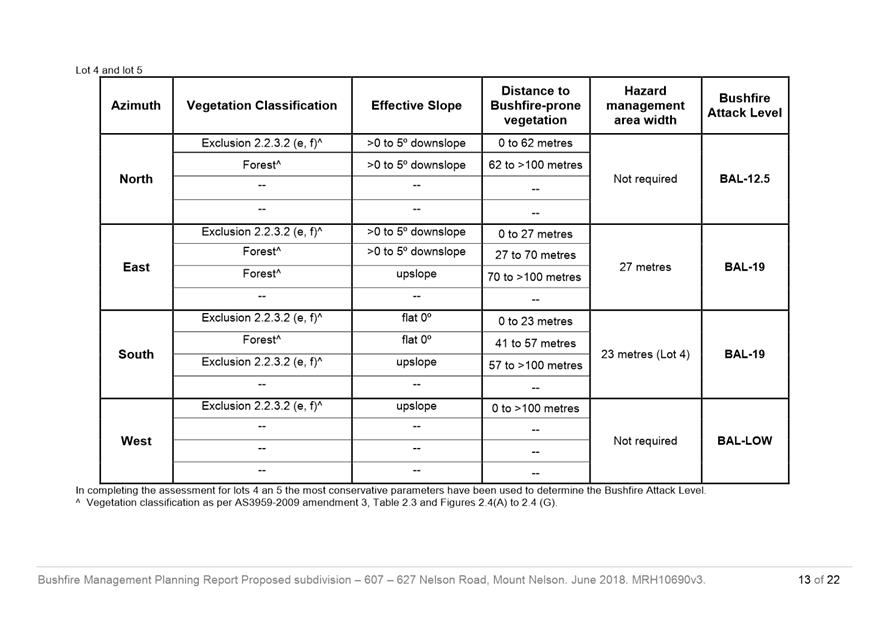
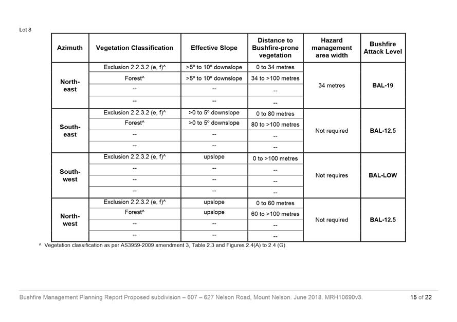
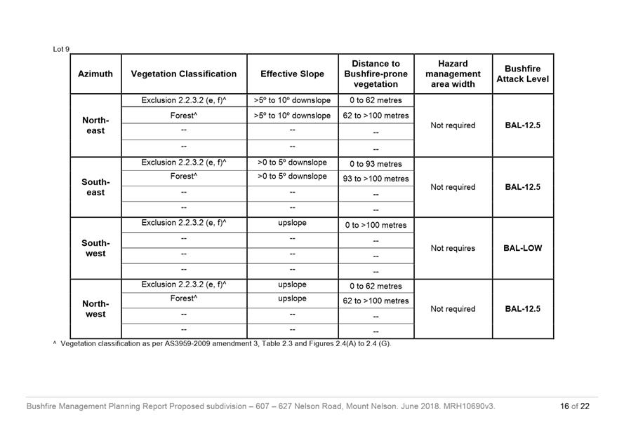
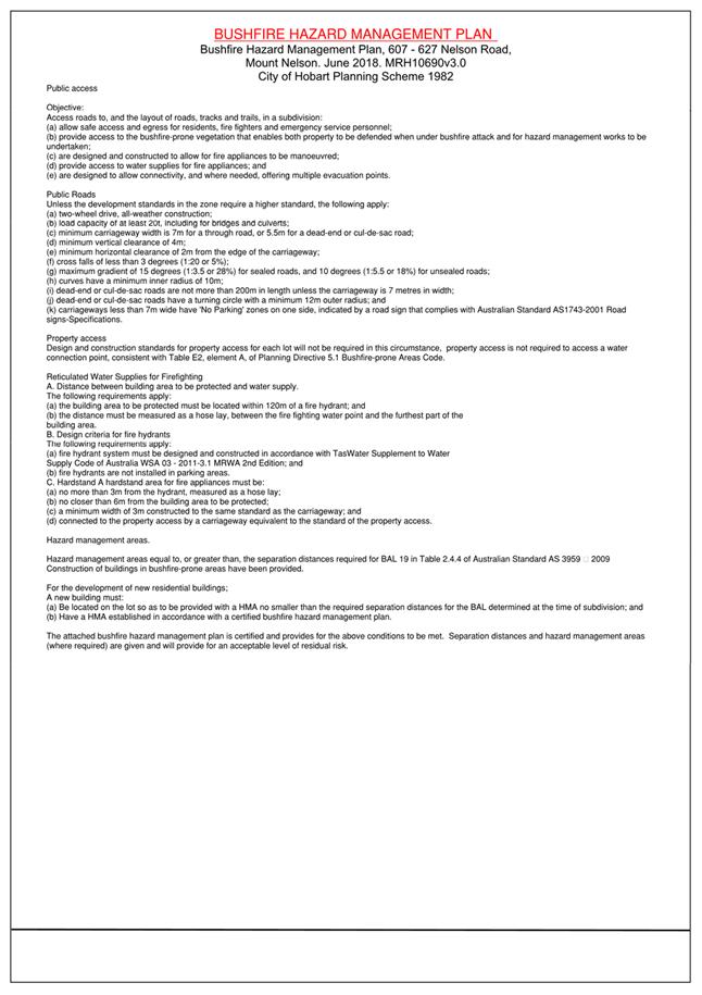
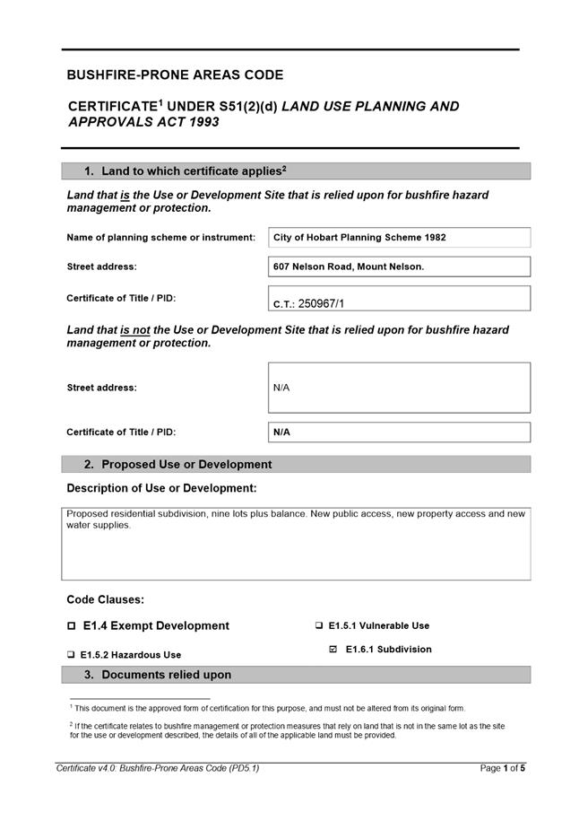
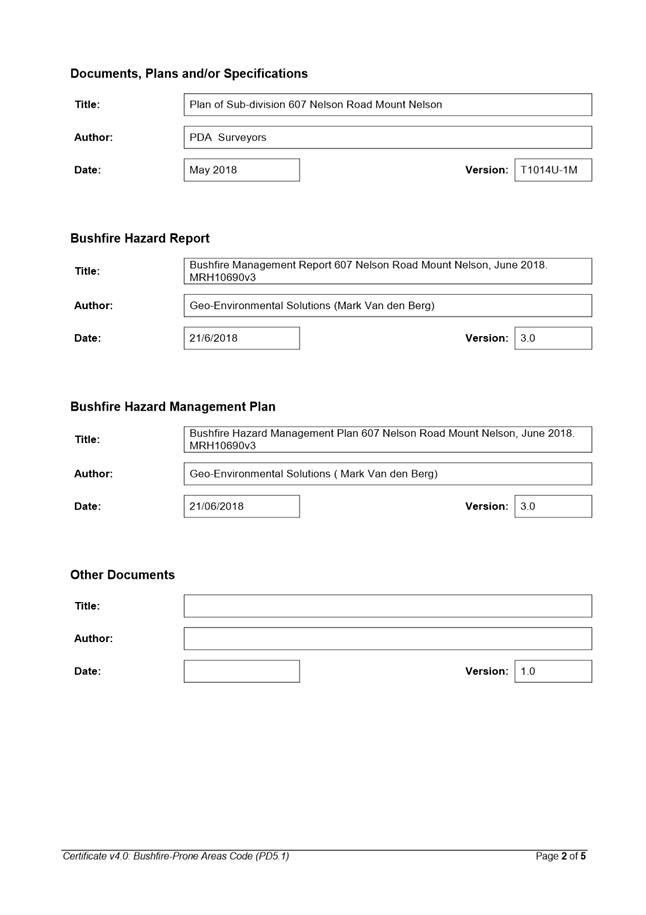
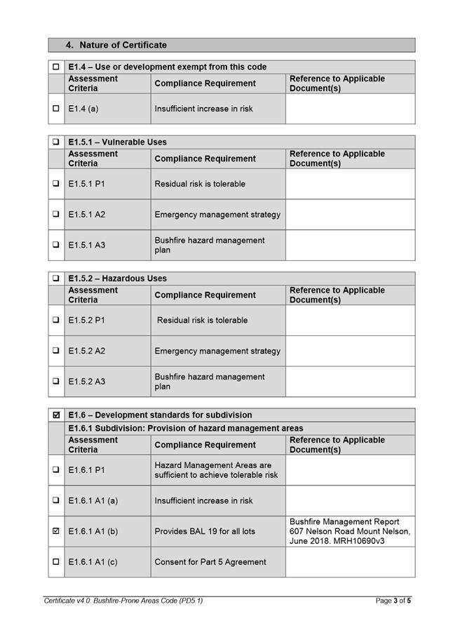
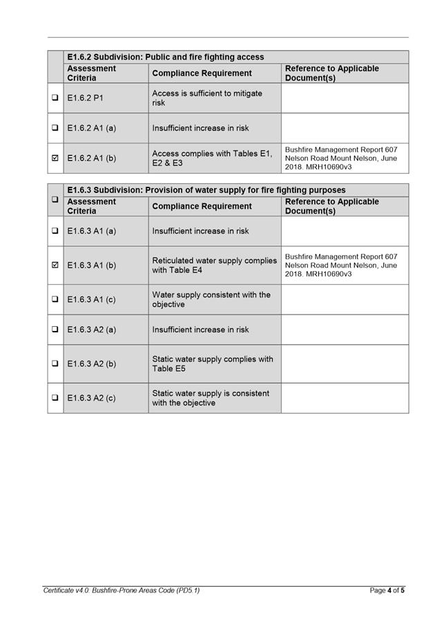
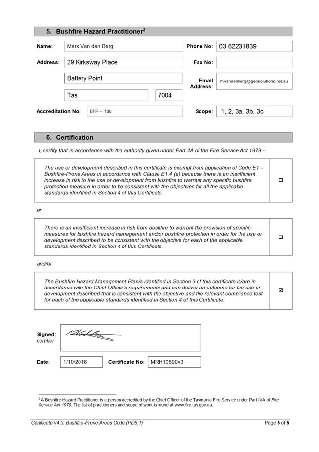
The hazard management areas shown on the bushfire hazard management plan by Geo-Environmental Solutions dated June 2018 (MRH10690v3) are not approved and must not be implemented.
Reason for condition
To clarify the scope of the permit
ENV 4
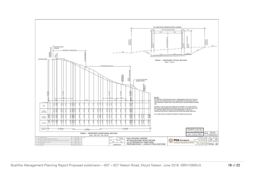
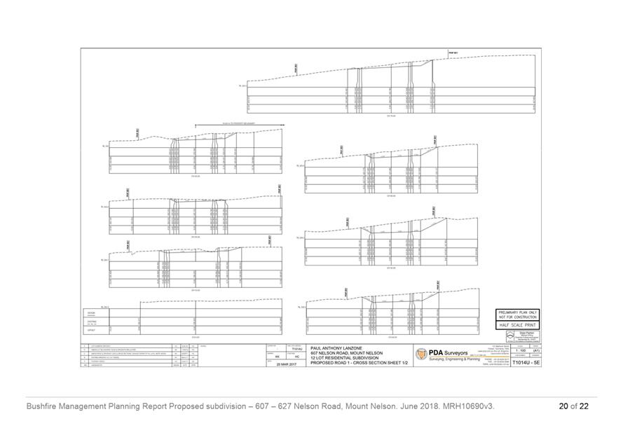
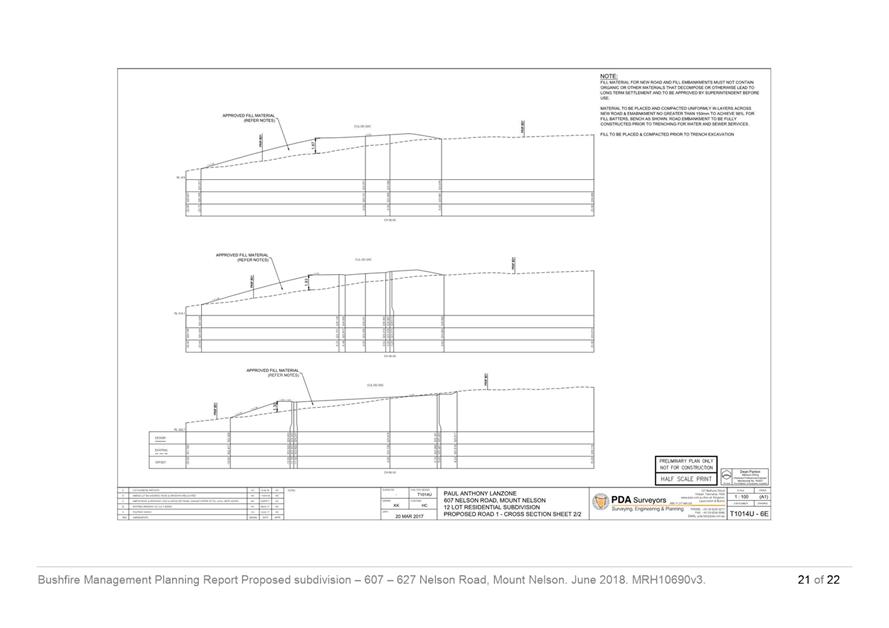
The public road and fire-fighting water supply system must be designed and constructed in accordance with prescriptions of the bushfire report and bushfire hazard management system by Geo-Environmental Solutions dated June 2018 (MRH10690v3).
Reason for condition
To reduce the risk to life and property, and the cost to the community, caused by bushfires
ENV 5
Prior to sealing of the final plan, certification from a suitably qualified person must be submitted to the Council confirming that the public road and fire-fighting water supply system have been designed and constructed in accordance with prescriptions of the bushfire report and bushfire hazard management system by Geo-Environmental Solutions dated June 2018 (MRH10690v3).
Reason for condition
To reduce the risk to life and property, and the cost to the community, caused by bushfires
ENV s1
An approved Construction Environmental Management Plan (CEMP) must be implemented.
A CEMP must be submitted and approved prior to the commencement of works.
The CEMP must:
1. Show
all areas of proposed subdivision works, including ground disturbance and
vegetation clearing, in relation to the vegetation communities, swift parrot
foraging trees, watercourses and drainage lines; 2. Show
all swift parrot foraging trees proposed to be removed, or likely to have
their root zones disturbed; 3. Specify
the proposed works methodology, particularly for vegetation clearing and soil
disturbance, and particularly for proposed works within the public open space
lot; 4. Demonstrate
that vegetation clearing, vegetation disturbance and soil disturbance has
been minimised as far as practicable, and that vegetation and soil
disturbance will be the minimum necessary to facilitate the essential
subdivision works; 5. Include
proposed measures to help ensure that vegetation and soil disturbance is
compliant with the approved CEMP, particularly works in proximity to swift
parrot foraging trees, the Eucalyptus ovata dry forest/woodland vegetation
community and the watercourse/drainage lines; 6. Include
measures to minimise the risk of erosion and sediment transport; 7. Include
measures to minimise the risk weed introductions/transfers (including
machinery and vehicle washdown and management of any imported soil); 8. Include
measures to rehabilitate area of temporary disturbance, including replacement
of removed vegetation; and 9. Identify responsible persons, monitoring and maintenance measures.
All measures and works required by this condition must be undertaken in accordance with the approved CEMP.
Advice: Once the CEMP has been approved the Council will issue a condition endorsement (see general advice on how to obtain condition endorsement).
Reason for condition
To minimise the potential for impacts to vegetation and watercourses from the construction works
ENV s2
A Part 5 Agreement pursuant to section 71 of the Land Use Planning and Approvals Act 1993 must be registered on the new Titles for lots 1 to 9 at the time of issue.
The Agreement must specify that unless the written consent of the Council is obtained:
1. The
approved Weed Management Plan must be implemented and complied with; 2. No
removal of native vegetation may occur; 3. All
development must be generally in accordance with the WWF-Australia
publication Minimising The Swift Parrot Collision Threat: Guidelines and
recommendations for parrot-safe building design (2008); and 4. The owner(s) (Owner A) must allow the owner(s) (Owner B) of an adjacent lot to establish and maintain a bushfire hazard management area on the land owned by Owner A, in accordance with a bushfire hazard management plan based on BAL-19 or lesser separation distances certified by an accredited bushfire hazard practitioner, and approved as part of a permit granted under the Building Act 2016, at any time the land owned by Owner A that is within the hazard management area under the approved bushfire hazard management plan of Owner B is not in accordance with the prescriptions for the hazard management area as specified in the approved bushfire hazard management plan.
The Council will have its solicitors prepare the Agreement for signing by property owner(s). The Council will then lodge the Agreement with the Lands Titles Office. The cost of preparing the Agreement and registration with the Land Titles Office is to be met by the applicant. Please contact the Development Appraisal Planner on 6238 2715 to initiate preparation of the Agreement.
Reason for condition
To ensure future development on the lots can achieve an acceptable level of bushfire risk
ADVICE
The following advice is provided to you to assist in the implementation of the planning permit that has been issued subject to the conditions above. The advice is not exhaustive and you must inform yourself of any other legislation, by-laws, regulations, codes or standards that will apply to your development under which you may need to obtain an approval. Visit the Council's website for further information.
Prior to any commencement of work on the site or commencement of use the following additional permits/approval may be required from the Hobart City Council.
CONDITION ENDORSEMENT PLANNING
If a condition endorsement is required by a planning condition above, you will need to submit the relevant documentation to satisfy the condition via the Condition Endorsement Submission on Council's online services e-planning
Where building approval is also required, it is recommended that documentation for condition endorsement be submitted well before submitting documentation for building approval. Failure to address condition endorsement requirements prior to submitting for building approval may result in unexpected delays.
Once approved, the Council will respond to you via email that the condition has been endorsed (satisfied). Detailed instructions can be found here.
CONDITION ENDORSEMENT ENGINEERING
All engineering drawings required to be submitted and approved by this planning permit must be submitted to the City of Hobart as a CEP (Condition Endorsement) via the City’s Online Service Development Portal. When lodging a CEP, please reference the PLN number of the associated Planning Application. Each CEP must also include an estimation of the cost of works shown on the submitted engineering drawings. Once that estimation has been confirmed by the City’s Engineer, the following fees are payable for each CEP submitted and must be paid prior to the City of Hobart commencing assessment of the engineering drawings in each CEP:
Value of Building Works Approved by Planning Permit Fee:
Up to $20,000: $150 per
application. Over $20,000: 2% of the value of the works as assessed by the City's Engineer per assessment.
These fees are additional to building and plumbing fees charged under the Building and Plumbing Regulations.
Once the CEP is lodged via the Online Service Development Portal, if the value of building works approved by your planning permit is over $20,000, please contact the City’s Development Engineer on 6238 2715 to confirm the estimation of the cost of works shown on the submitted engineering drawings has been accepted.
Once confirmed, pleased call one of the City’s Customer Service Officers on 6238 2190 to make payment, quoting the reference number (i.e. CEP number) of the Condition Endorsement you have lodged. Once payment is made, your engineering drawings will be assessed.
BUILDING PERMIT
Building permit in accordance with the Building Act 2016. Click here for more information.
PLUMBING PERMIT
Plumbing permit in accordance with the Building Act 2016, Building Regulations 2016 and the National Construction Code. Click here for more information.
OCCUPATION OF THE PUBLIC HIGHWAY
Permit for the occupation of the public highway for construction or special event (e.g. placement of skip bin, crane, scissor lift etc). Click here for more information.
Occupational license for structures in the Hobart City Council highway reservation, in accordance with conditions to be established by the Council. Click here for more information.
Road closure permits for construction or special event. Click here for more information.
Permit to Open Up and Temporarily Occupy a Highway (for work in the road reserve). Click here for more information.
PERMIT TO CONSTRUCT PUBLIC INFRASTRUCTURE
Permit to construct public infrastructure with a 12 month maintenance period and bond (please contact the Hobart City Council's City Infrastructure Division to initiate the permit process).
NEW SERVICE CONNECTION
New service connection (please contact the Hobart City Council's City Infrastructure Division to initiate the application process).
STORM WATER
Please note that in addition to a building and/or plumbing permit, development must be in accordance with the Hobart City Council’s Hydraulic Services By law. Click here for more information.
WORK WITHIN THE HIGHWAY RESERVATION
Please note development must be in accordance with the Hobart City Council’s Highways By law. Click here for more information.
STORM WATER / ROADS / ACCESS
Services to be designed and constructed in accordance with the (IPWEA) LGAT - standard drawings. Click here for more information.
COUNCIL RESERVES
This permit does not authorise any works on the adjoining Council land. Any act that causes, or is likely to cause damage to Council’s land may be in breach of the Council’s Parks, Recreation and Natural Areas Bylaw and penalties may apply. The by law is available here.
WEED CONTROL
Effective measures are detailed in the Tasmanian Washdown Guidelines for Weed and Disease Control: Machinery, Vehicles and Equipment (Edition 1, 2004). The guidelines can be obtained from the Department of Primary Industries, Parks, Water and Environment website.
FEES AND CHARGES
Click here for information on the Council's fees and charges.
DIAL BEFORE YOU DIG
Click here for dial before you dig information.
PART 5 AGREEMENT
This property possesses conservation values which may be of national environmental significance (habitat for the endangered Swift Parrot). The proposed development includes activities that may adversely impact on these values (removal of Eucalyptus globulus and Eucalyptus ovata trees), and therefore may be subject to the Commonwealth Environment Protection and Biodiversity Conservation Act 1999. It is therefore recommended that the applicant refer the proposal to the Commonwealth Environment Minister for determination as to whether the development requires approval under the Environment Protection and Biodiversity Conservation Act 1999. For more information on how to make a referral visit Environment Australia’s website.
SUBDIVISION ADVICE
All conditions imposed by this permit are in accordance with the Local Government Building and Miscellaneous Provisions) Act 1993 and the Conveyancing and Law of Property Act 1884. Refer to www.thelaw.tas.gov.au.
For information regarding standards and guidelines for subdivision works click here.
A permit to construct public infrastructure must be obtained for any public infrastructure works and includes a12 month maintenance period (please contact the Council City Infrastructure Divisions to initiate the permit process)
Infrastructure to be designed and constructed in accordance with the (IPWEA) LGAT Tasmanian Standard Drawings (TSD).
Naming of new roads is undertaken by Council as per the Rules for Place Names in Tasmania by the Nomenclature Board of Tasmania. New roads should be named before the final plan of subdivision is approved by Council. The road naming process takes at least three months. Please contact Council’s Road Services Engineer for advice on naming new roads.
|
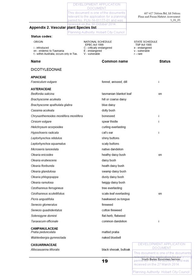
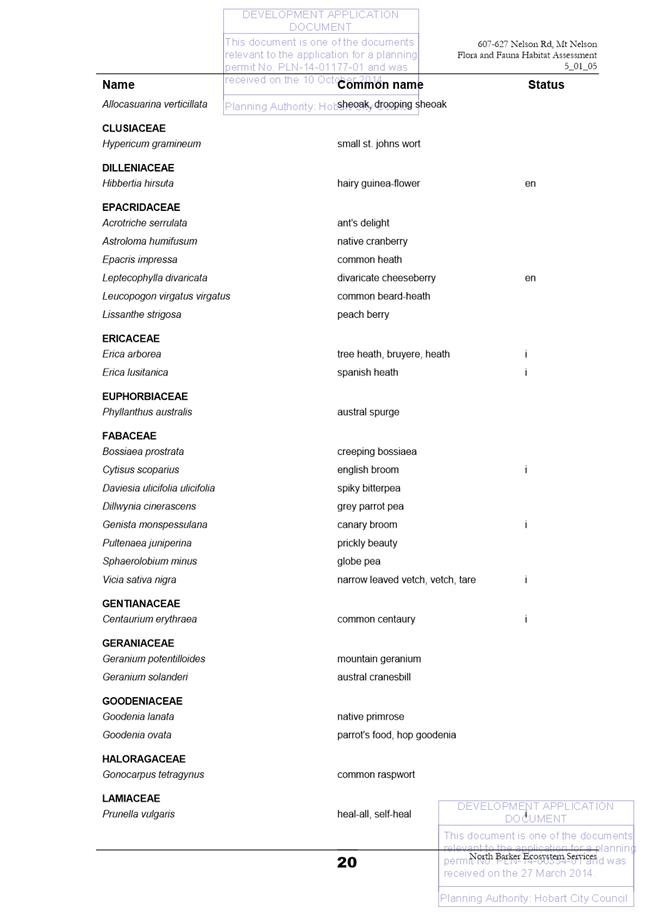
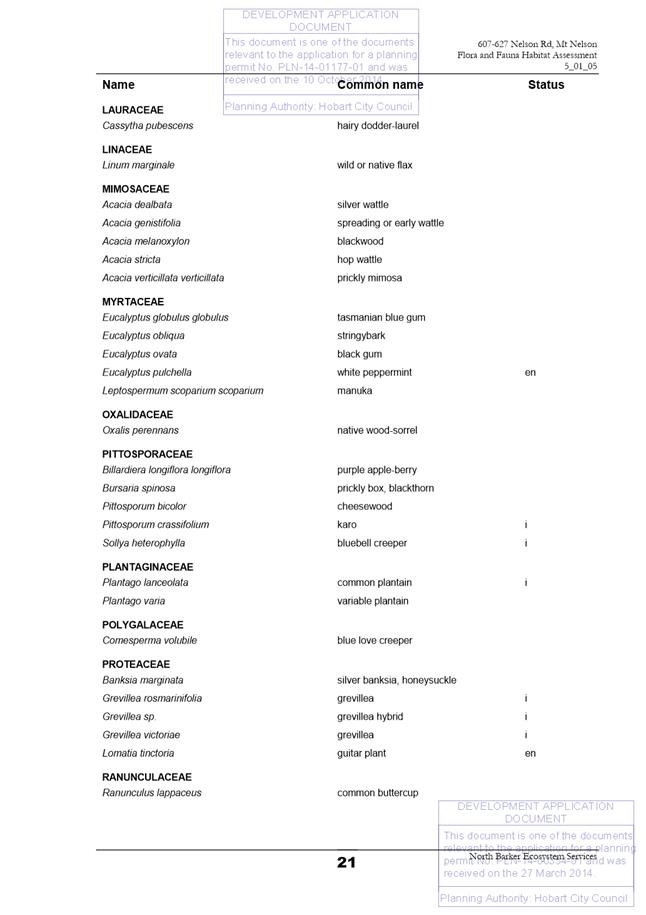
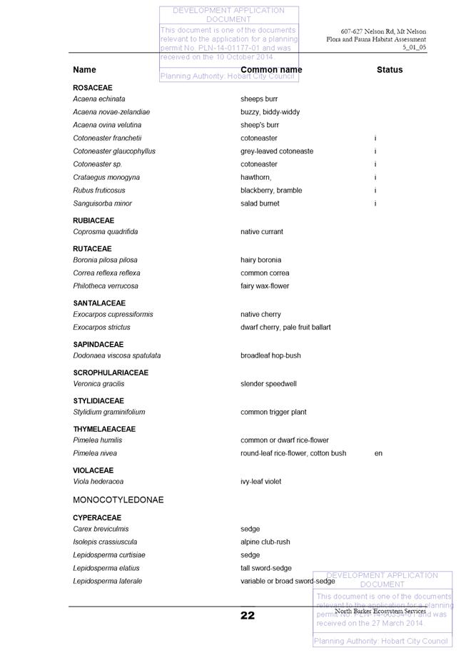
Attachment a: PLN-14-01177-01
- 607-627 Nelson Road - MOUNT NELSON - Committee Report
⇩ ![]()
Attachment
b: PLN-14-01177-01
- 607-627 NELSON ROAD MOUNT NELSON TAS 7007 - CPC Agenda Documents ⇩ ![]()
Attachment
c: PLN-14-01177-01
- 607-627 NELSON ROAD MOUNT NELSON TAS 7007 - Planning Referral Officer
Environmental Development Planner Report ⇩ ![]()
|
Item No. 2.1.1 |
Agenda (Open Portion) Special City Planning Committee Meeting - 13/11/2018 |
Page 29 ATTACHMENT a |

|
Agenda (Open Portion) Special City Planning Committee Meeting - 13/11/2018 |
Page 78 ATTACHMENT b |
|
Item No. 2.1.1 |
Agenda (Open Portion) Special City Planning Committee Meeting - 13/11/2018 |
Page 91 ATTACHMENT b |
|
Item No. 2.1.1 |
Agenda (Open Portion) Special City Planning Committee Meeting - 13/11/2018 |
Page 97 ATTACHMENT b |


|
Item No. 2.1.1 |
Agenda (Open Portion) Special City Planning Committee Meeting - 13/11/2018 |
Page 141 ATTACHMENT b |

|
Item No. 2.1.1 |
Agenda (Open Portion) Special City Planning Committee Meeting - 13/11/2018 |
Page 147 ATTACHMENT b |
|
Item No. 2.1.1 |
Agenda (Open Portion) Special City Planning Committee Meeting - 13/11/2018 |
Page 148 ATTACHMENT b |
|
Item No. 2.1.1 |
Agenda (Open Portion) Special City Planning Committee Meeting - 13/11/2018 |
Page 154 ATTACHMENT b |
|
Item No. 2.1.1 |
Agenda (Open Portion) Special City Planning Committee Meeting - 13/11/2018 |
Page 164 ATTACHMENT c |

|
Agenda (Open Portion) Special City Planning Committee Meeting |
Page 198 |
|
|
|
13/11/2018 |
|
2.2 Applications under the Hobart Interim Planning Scheme 2015
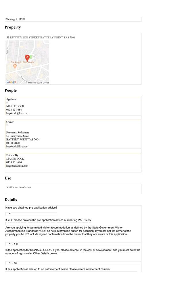
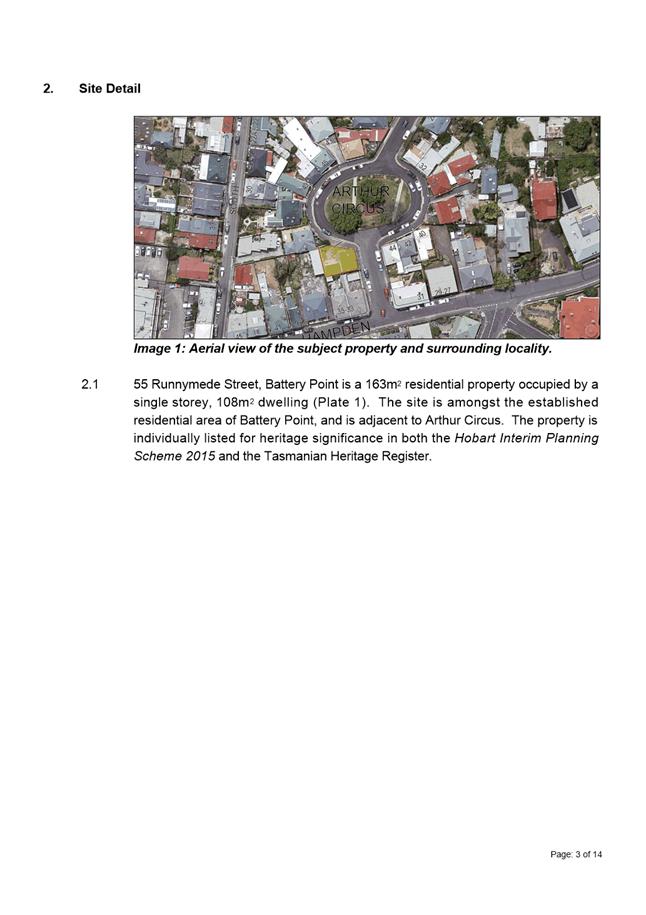
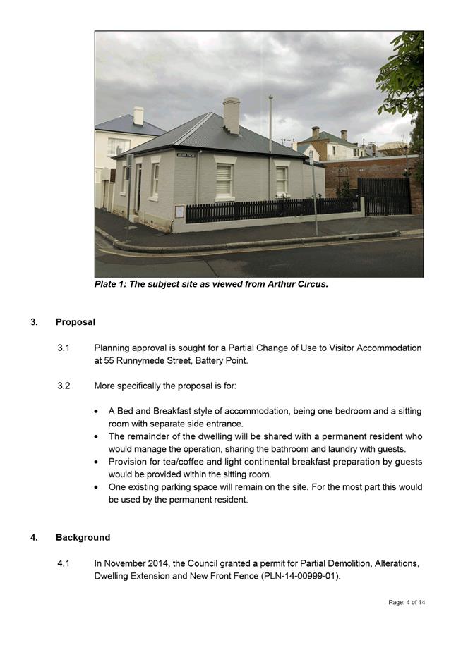
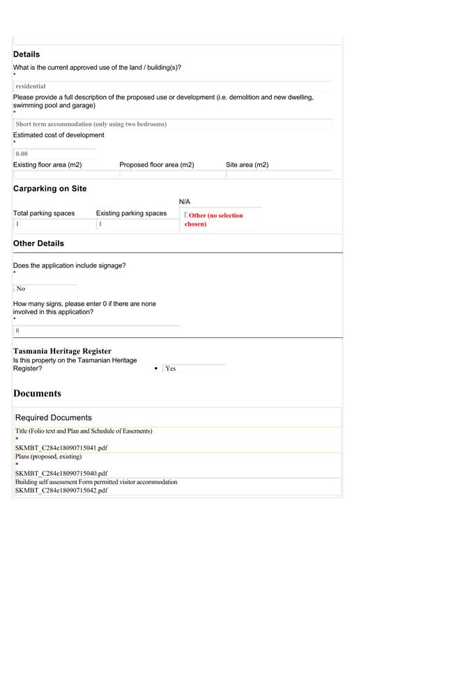
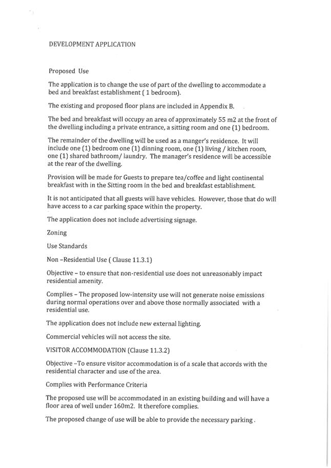
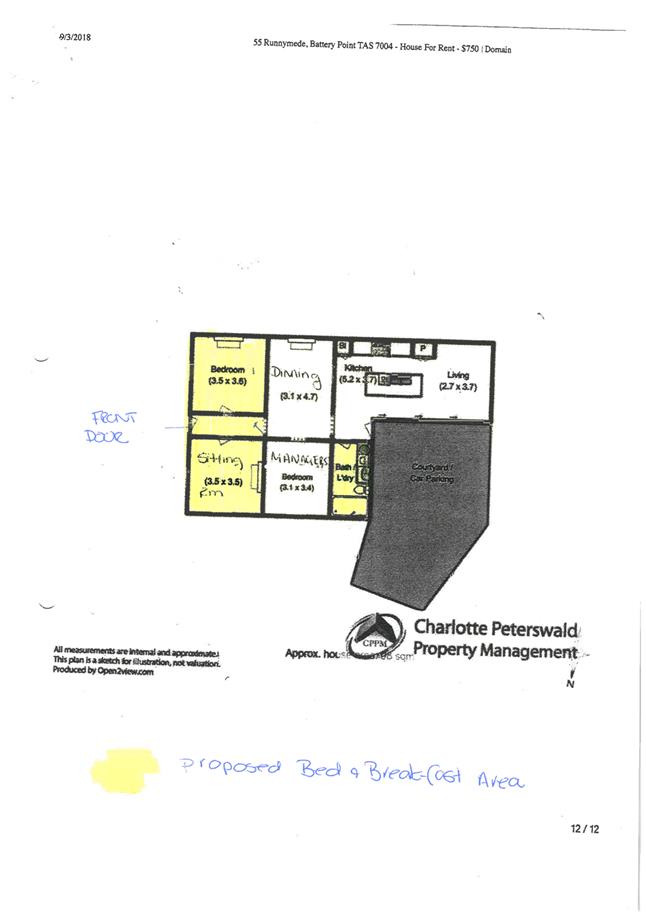
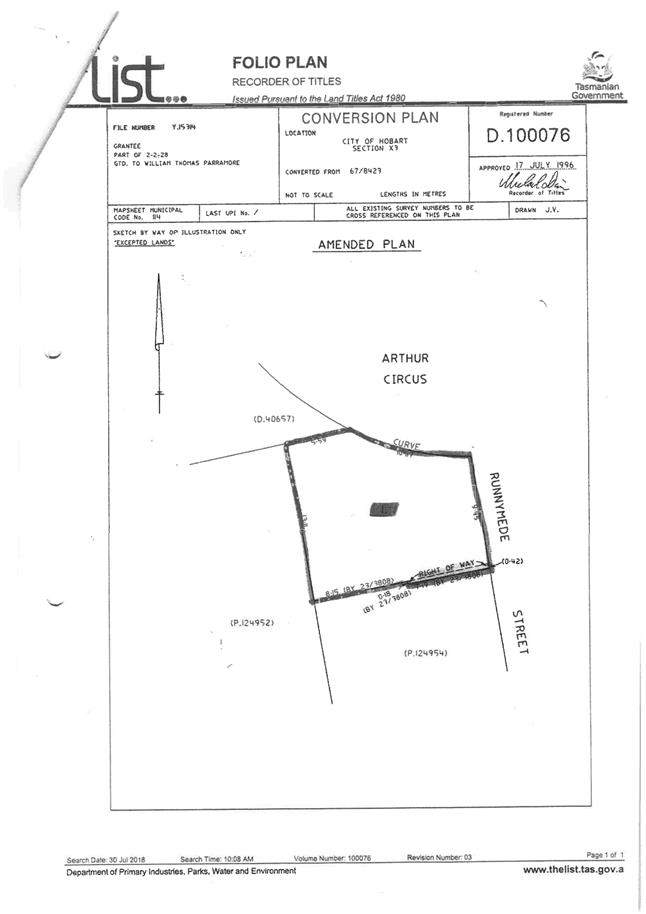
2.2.1 55 Runnymede Street Battery Point - Partial Change of Use to Visitor Accommodation
Address: 55 Runnymede Street, Battery Point
Proposal: Partial Change of Use to Visitor Accommodation
Expiry Date: 7 December 2018
Extension of Time: Not applicable
Author: Cameron Sherriff
|
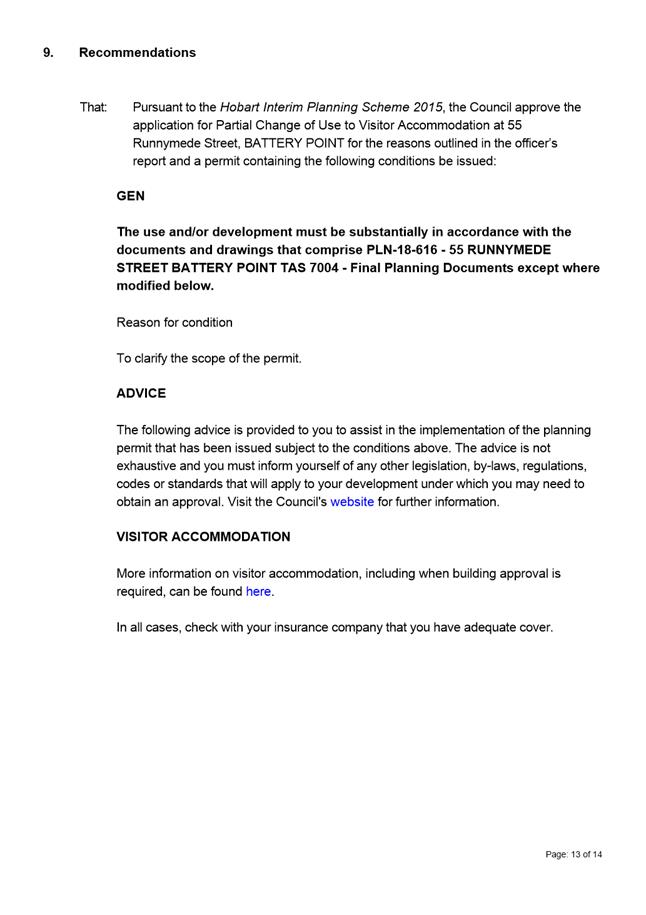
REcommendation That: Pursuant to the Hobart Interim Planning Scheme 2015, the Council approve the application for partial change of use to visitor accommodation at 55 Runnymede Street, BATTERY POINT for the reasons outlined in the officer’s report and a permit containing the following conditions be issued:
GEN
The use and/or development must be substantially in accordance with the documents and drawings that comprise PLN18616 55 RUNNYMEDE STREET BATTERY POINT TAS 7004 Final Planning Documents except where modified below.
Reason for condition
To clarify the scope of the permit.
ADVICE
The following advice is provided to you to assist in the implementation of the planning permit that has been issued subject to the conditions above. The advice is not exhaustive and you must inform yourself of any other legislation, bylaws, regulations, codes or standards that will apply to your development under which you may need to obtain an approval. Visit the Council's website for further information.
VISITOR ACCOMMODATION
More information on visitor accommodation, including when building approval is required, can be found here.
|
Attachment a: PLN-18-616
- 55 RUNNYMEDE STREET BATTERY POINT TAS 7004 - Planning Committee or Delegated
Report ⇩ ![]()
Attachment
b: PLN-18-616
- 55 RUNNYMEDE STREET BATTERY POINT TAS 7004 - CPC Agenda Documents ⇩ ![]()
|
Item No. 2.2.1 |
Agenda (Open Portion) Special City Planning Committee Meeting - 13/11/2018 |
Page 200 ATTACHMENT a |


|
Agenda (Open Portion) Special City Planning Committee Meeting - 13/11/2018 |
Page 214 ATTACHMENT b |

|
Agenda (Open Portion) Special City Planning Committee Meeting |
Page 224 |
|
|
|
13/11/2018 |
|
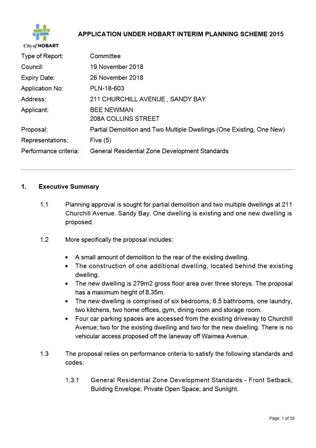
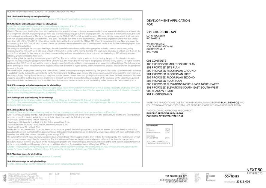
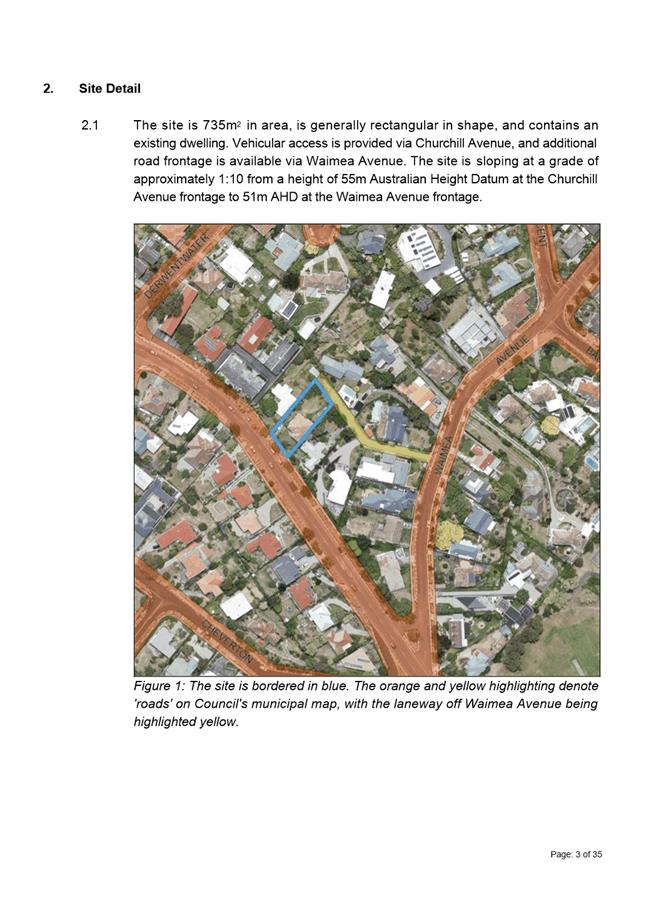
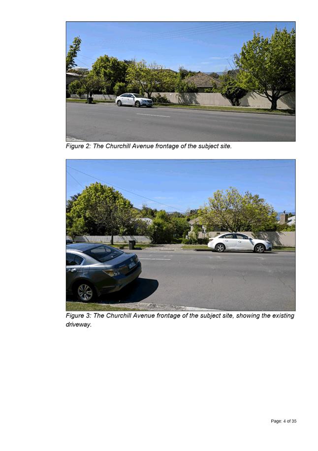
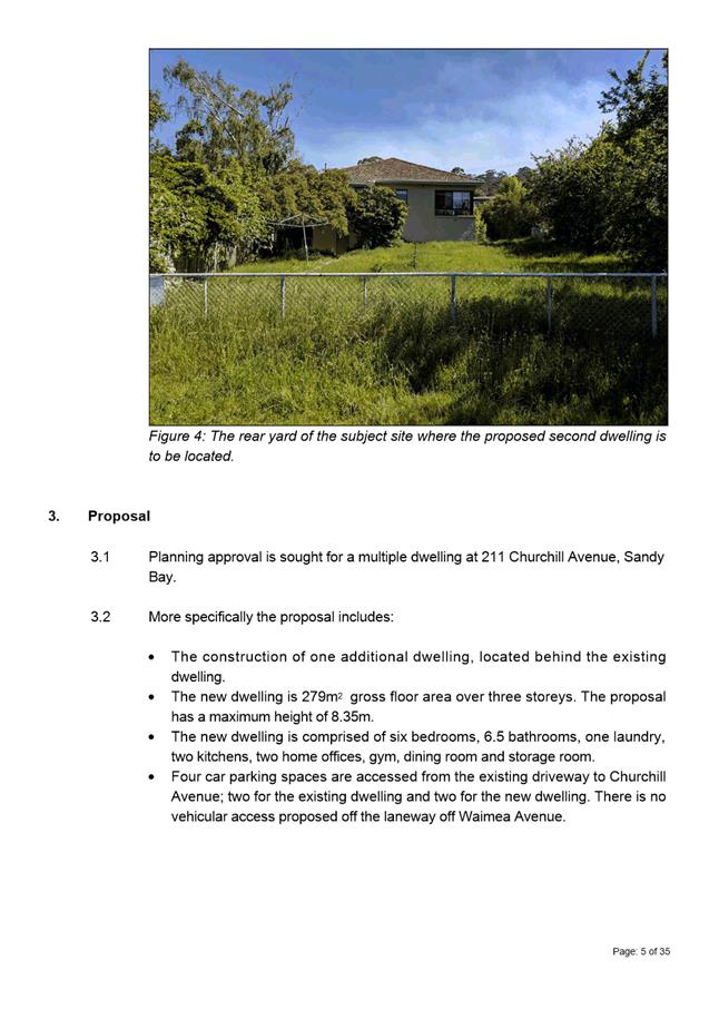
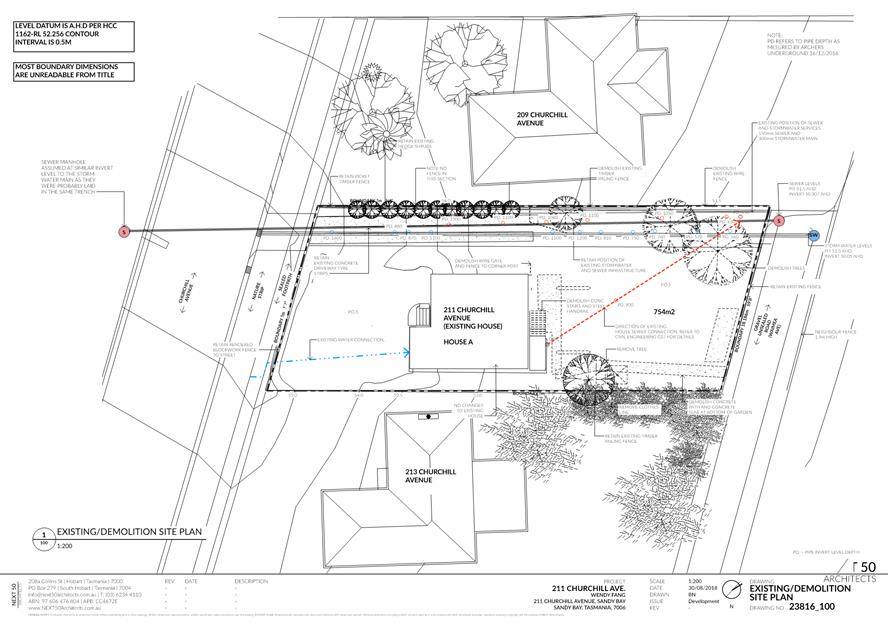
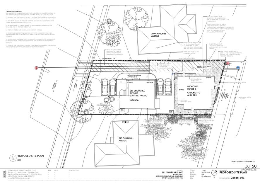
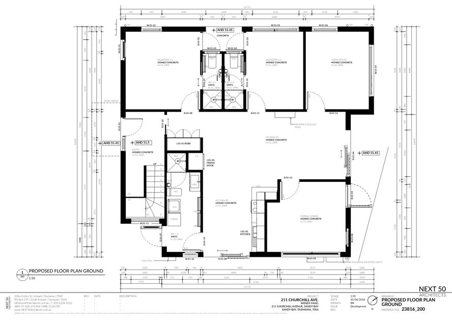
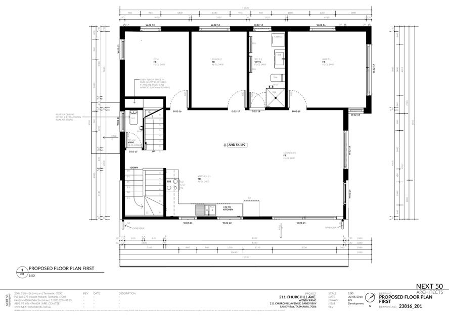
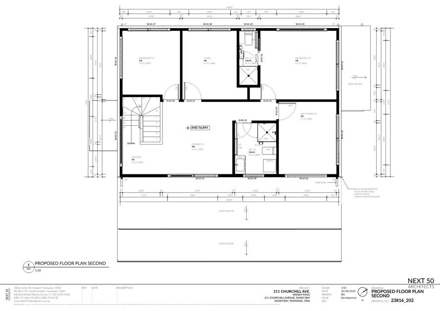
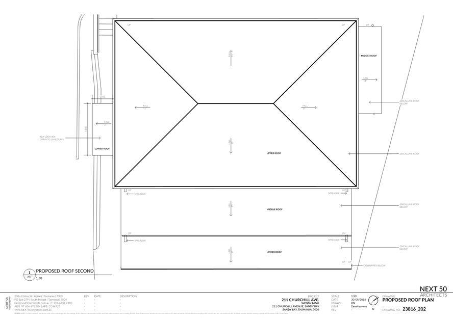
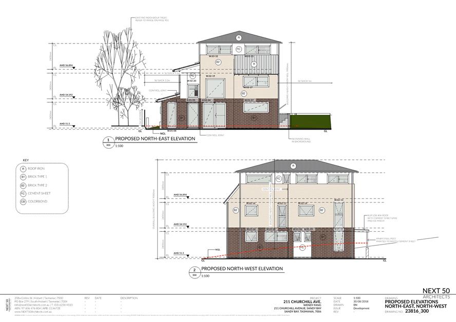
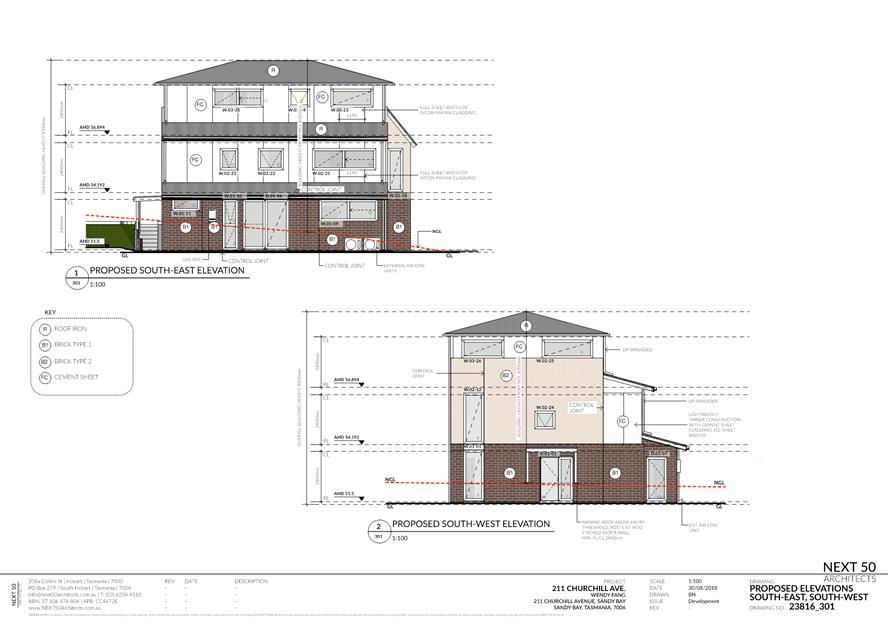
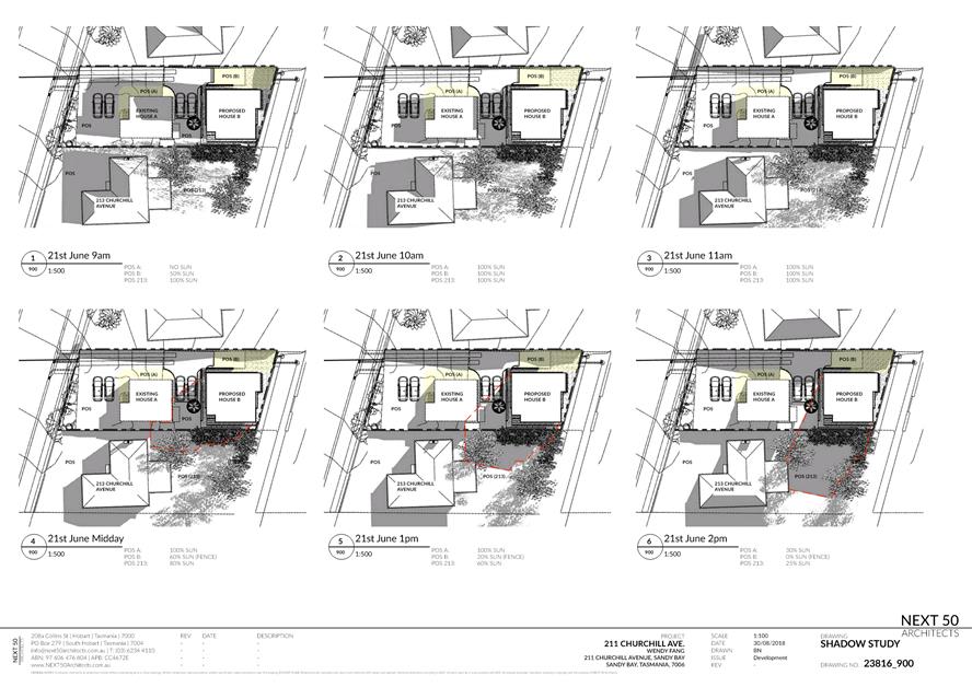
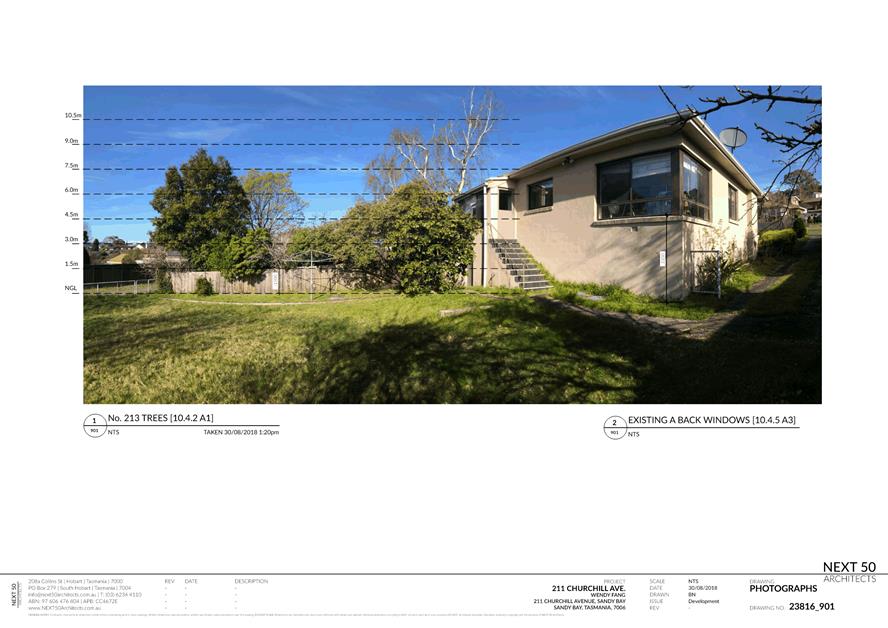
2.2.2 211 Churchill Avenue, Sandy Bay - Partial Demolition and Two Multiple Dwellings (One Existing, One New)
Address: 211 Churchill Avenue, Sandy Bay
Proposal: Partial Demolition and Two Multiple Dwellings (One Existing, One New)
Expiry Date: 26 November 2018
Extension of Time: Not applicable
Author: Ben Ikin
|
REcommendation That: Pursuant to the Hobart Interim Planning Scheme 2015, the Council approve the application for partial demolition and two multiple dwellings (one existing, one new) at 211 Churchill Avenue, Sandy Bay for the reasons outlined in the officer’s report and a permit containing the following conditions be issued:
GEN
The use and/or development must be substantially in accordance with the documents and drawings that comprise PLN18603 211 CHURCHILL AVENUE SANDY BAY TAS 7005 Advertised Documents except where modified below.
Reason for condition
To clarify the scope of the permit.
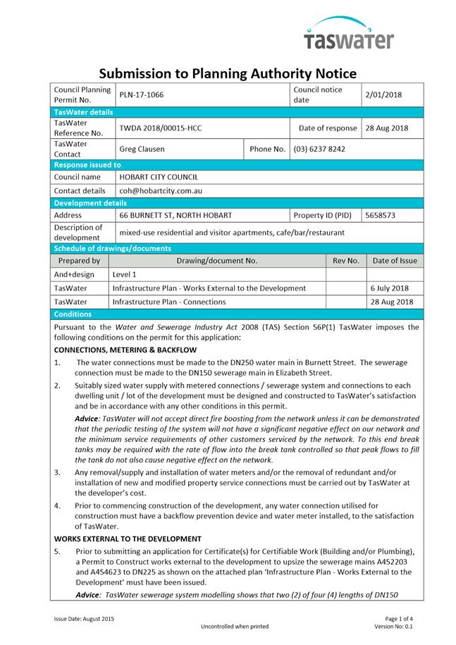
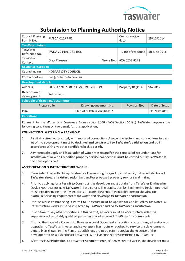
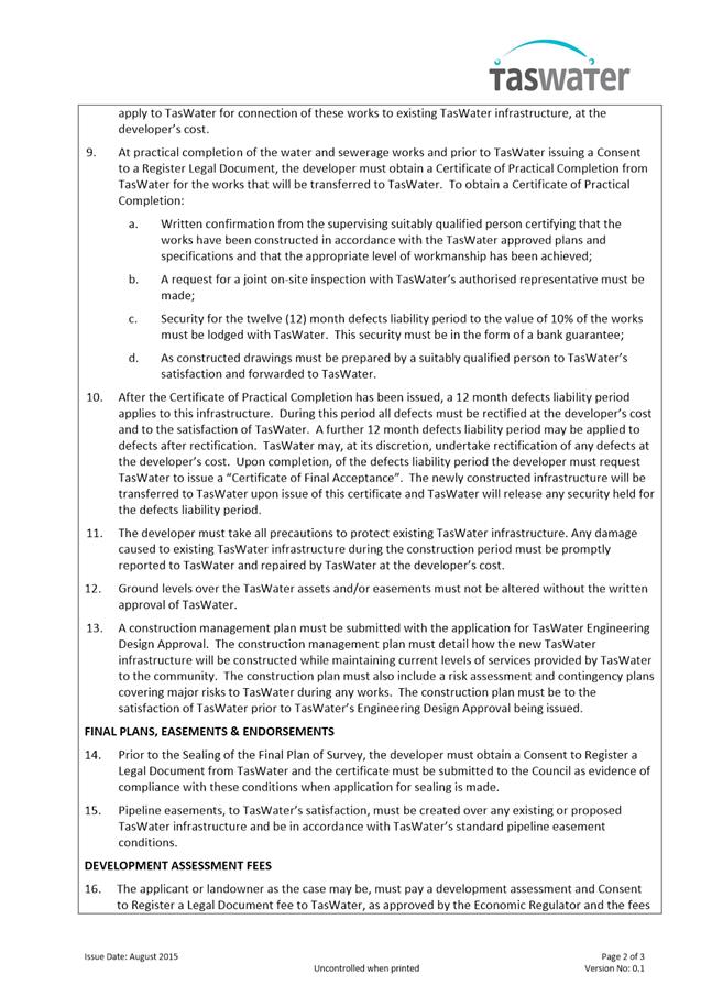
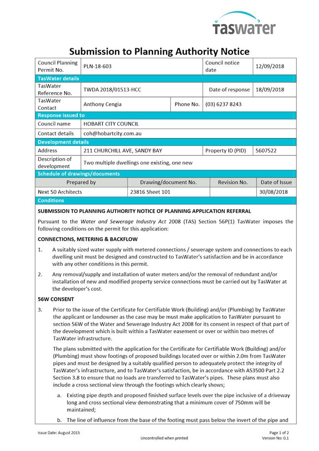
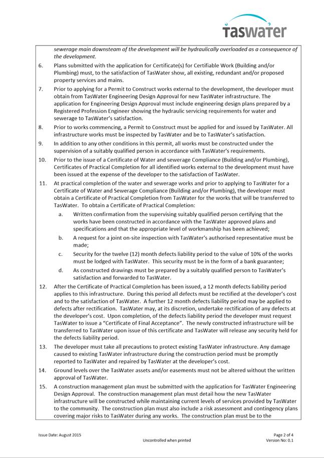
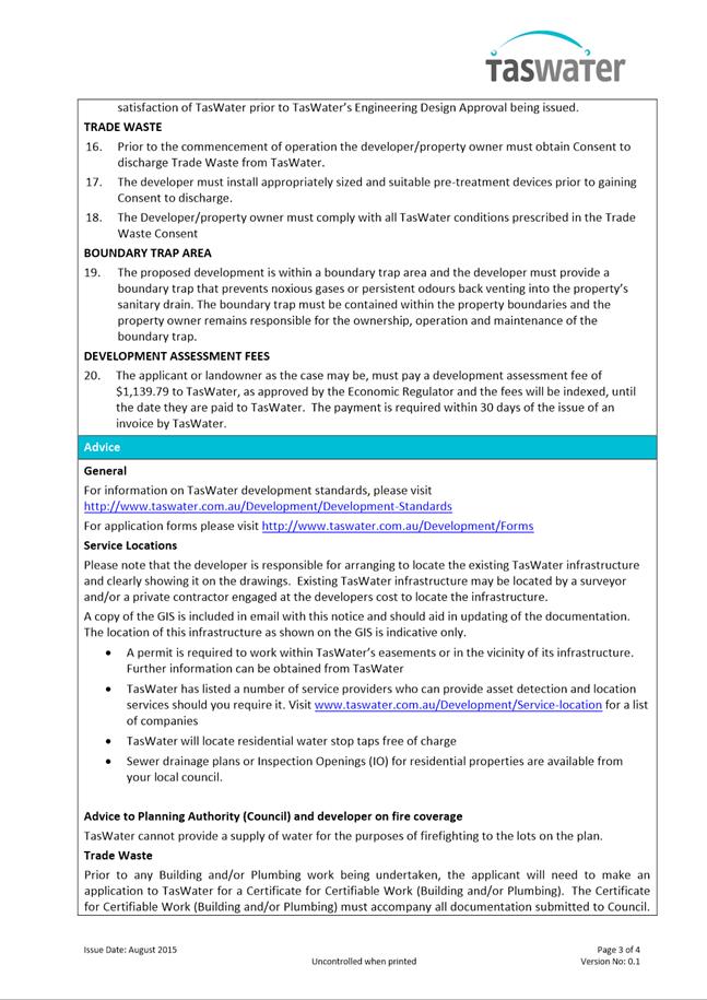
TW
The use and/or development must comply with the requirements of TasWater as detailed in the form Submission to Planning Authority Notice, Reference No. TWDA 2018/01513HCC dated 18/09/2018 as attached to the permit.
Reason for condition
To clarify the scope of the permit.
PLN s1
This planning permit approves two multiple dwellings only, for one existing dwelling and one new dwelling.
Advice: Any proposal to further divide either of the dwellings approved by this permit into multiple dwellings will require further and separate planning approval.
Reason for condition
To clarify the scope of the permit.
PLN s2
No more than one laundry is approved in the new multiple dwelling.
Prior to the issue of any plumbing permit, revised plans must be submitted and approved showing the new dwelling with no more than one laundry.
All work required by this condition must be undertaken in accordance with the approved revised plan.
Reason for condition
To clarify the scope of the permit.
ENG sw2.1
A preconstruction CCTV video of the Council stormwater main that runs under the driveway on the western side of the site must be undertaken and submitted to Council prior to the commencement of work.
The postconstruction CCTV will be relied upon to establish the extent of damage caused to the Council’s infrastructure during construction. In the event that the owner/developer fails to provide to the Council preconstruction CCTV video of the Council’s infrastructure, then any damage to the Council infrastructure identified in the post construction CCTV will be deemed to be the responsibility of the owner.
Reason for condition
To ensure that any of the Council infrastructure and/or siterelated service connections affected by the proposal will be altered and/or reinstated at the owner’s full cost.
ENG sw2.2
A postconstruction CCTV video of the Council stormwater main that passes through the site must be undertaken and submitted to Council on completion of all work.
The postconstruction CCTV video will be relied upon to establish the extent of any damage caused to the Council’s infrastructure during construction. In the event that the owner/developer fails to provide to the Council a pre construction CCTV video of the Council’s infrastructure, then any damage to the Council infrastructure identified in the postconstruction CCTV video will be deemed to be the responsibility of the owner.
Reason for condition
To ensure that any of the Council infrastructure and/or siterelated service connections affected by the proposal will be altered and/or reinstated at the owner’s full cost.
ENG sw3
The proposed building and structures including foundations and overhangs must be designed to ensure the protection and access to the Council’s stormwater main.
Design drawings must be submitted and approved prior to the issuing of any approval under the Building Act 2016.
The design drawings must:
1. Show the location of the building and structures clear of any easement and 1m from any stormwater main (measured horizontally to the nearest external surface of the pipe).
2. Include a typical crosssection drawing showing the relationship both vertically and horizontally between the structure (including foundations and including any retaining wall) and the mains which demonstrates that:
1. No
additional loads are
imposed on the
stormwater main; 2. The structure is entirely independent of the main and its trenching; and 3. Sufficient cover over the stormwater main will be maintained to withstand any proposed vehicular loading.
All work required by this condition must be undertaken in accordance with the approved design drawings.
Advice: · The applicant is required to submit
detailed design documentation to satisfy this condition via Council's planning condition endorsement process
(noting there is a fee
associated with condition endorsement approval of
engineering drawings [see
general advice on how to obtain condition endorsement and for
fees and charges]). This is a
separate process to
any building approval under the Building Act 2016. · Failure to address condition requirements prior to submitting for building approval may result in unexpected delays.
· Adequate cover for residential vehicular
loading shall be defined as either 750mm or the depth determined from
embedment calculations. Note that a reinforced concrete slab over the main will help to spread the loads and reduce
pressure on mains. · All work required by this condition must be undertaken in accordance with the approved design drawings.
Reason for condition
To ensure the protection of the Council’s hydraulic infrastructure.
ENG sw4
The new storm water connection to Council's infrastructure must be constructed and any existing abandoned connections sealed by the Council at the owner’s expense, prior to the first occupation/new use.
Detailed engineering drawings must be submitted and approved, prior to commencement of work. The drawings must include:
1. The location of
the proposed connection; and 2. The size of the connection appropriate to satisfy the needs of the development.
All work required by this condition must be undertaken in accordance with the approved detailed engineering drawings.
Advice: · The applicant is advised to submit
detailed design drawings via a Council City Infrastructure Division application for a new stormwater connection. If detailed
design to satisfy this condition is submitted via the planning condition endorsement process there may be fees associated with the assessment, and
once approved the
applicant will still
need to submit
an application for a new stormwater connection with Council City Infrastructure
Division. · Where building / plumbing approval is also required, it is recommended that documentation to satisfy this condition is submitted well before submitting documentation for building/plumbing approval. Failure to address planning condition requirements prior to submitting for building/plumbing approval may result in unexpected delays.
Reason for condition
To ensure the site is drained adequately.
ENG sw5
If a new stormwater main is required, it must be designed and constructed prior to the first occupation/new use.
Engineering drawings must be submitted and approved, prior to commencement of work. The engineering drawings must:
1. Be certified by a qualified and experienced civil engineer; 2. Include a plan and
longsection of the
proposed stormwater main; 3. Include the
associated calculations and
catchment area plans.
These should include, but not be limited to, connections, flows, velocities,
clearances, cover,
gradients, sizing, material, pipe class, easements and inspection openings; and 4. Include a construction program and method for the proposed diversion of the stormwater main, to satisfy the above requirement.
All work required by this condition must be undertaken in accordance with the approved engineering drawings.
Advice: · The applicant is required submit detailed
design documentation to satisfy this condition via Council's planning condition endorsement process
(noting there is a fee associated with condition endorsement approval of engineering drawings [see
general advice on how to obtain condition endorsement and for
fees and charges]). This is a
separate process to
any building approval under the Building Act 2016. · Failure to address condition endorsement requirements prior to submitting for building approval may result in unexpected delays.
Reason for condition
To ensure Council’s hydraulic infrastructure meets acceptable standards.
ENG sw6
All stormwater runoff from the proposed development (including hardstand runoff) must be discharged to the Council’s stormwater infrastructure prior to the new use/ first occupation. All costs associated with works required by this condition are to be met by the owner.
Design drawings and calculations of the proposed stormwater drainage system and connections to the Council's stormwater infrastructure must be submitted and approved prior to the commencement of work. The design drawings and calculations must:
1. Be prepared by a
suitably qualified person; and 2. Include long section(s)/levels and grades to the point of discharge, as required.
All work required by this condition must be undertaken in accordance with the approved design drawings and calculations.
Advice: The applicant is advised to submit detailed design drawings and calculations as part of their Plumbing Permit Application. If detailed design to satisfy this condition is submitted via the planning condition endorsement process there may be fees associated with the assessment, and once approved the applicant will still need to obtain a plumbing permit for the works.
Reason for condition
To ensure that stormwater from the site will be discharged to a suitable Council approved outlet.
ENG 2a
Prior to first occupation or commencement of use (whichever occurs first), vehicular barriers compliant with the Australian Standard AS/NZS1170.1:2002 must be installed to prevent vehicles running off the edge of an access driveway or parking module (parking spaces, aisles and manoeuvring area) where the drop from the edge of the trafficable area to a lower level is 600mm or greater, and wheel stops (kerb) must be installed for drops between 150mm and 600mm. Barriers must not limit the width of the driveway access or parking and turning areas approved under the permit.
Advice: · The Council
does not consider a slope
greater than 1 in 4 to constitute a lower level as described in AS/NZS
2890.1:2004 Section 2.4.5.3. Slopes greater than 1 in 4 will require a vehicular barrier or wheel stop. · Designers are advised to consult the National Construction Code 2016 to determine if pedestrian handrails or safety barriers compliant with the NCC2016 are also required in the parking module this area may be considered as a path of access to a building.
Reason for condition
To ensure the safety of users of the access driveway and parking module and compliance with the standard.
ENG 2b
If a vehicular safety barrier is required under condition ENG 2a, then prior to the issue of any approval under the Building Act 2016 or the commencement of works on site (whichever occurs first), a certified vehicle barrier design (including site plan with proposed location(s) of installation) prepared by a suitably qualified engineer, compliant with Australian Standard AS/NZS1170.1:2002, must be submitted to Council.
Advice: · If the development's building approval includes the need for a Building Permit from Council, the applicant is advised to submit
detailed design of vehicular barrier as part of the Building Application. · If the development's building approval is covered under Notifiable Work the applicant is advised to submit detailed design of vehicular barrier as a condition endorsement of the planning permit condition. Once the certification has been accepted, the Council will issue a condition endorsement (see general advice on how to obtain condition endorsement).
Reason for condition
To ensure the safety of users of the access driveway and parking module and compliance with the standard.
ENG 3b
The design of the access driveway, parking and turning areas must be submitted and approved, prior to the issuing of any approval under the Building Act 2016.
The design must:
1. Be prepared and certified by a suitably qualified engineer. 2. Be
generally in accordance with the Australian Standard AS/NZS2890.1:2004. 3. Where it deviates from AS/NZS2890.1:2004, demonstrate that it will provide a safe and efficient access, and enable safe, easy and efficient use.
4. Show dimensions, levels, gradients and transitions, and other details as
Council deem necessary to
satisfy the above
requirement. 5. Show the proposed
vehicle turning area in front of House B (as shown on site
plan, dwg 101, dated 30/8/18) having a larger
radius turn, similar
to those in front
of House A. This will require an amendment to the
design of the
retaining wall and
stairs at the
southwest corner of
House B. 6. Include certification from a suitably qualified engineer that the layout of the driveway, parking and turning areas will allow B85 vehicles to get in/out of the parking spaces with no more than a 3point turn.
Advice: · It is advised that designers consider the detailed design
of the access
and parking areas prior to finalising the Finished Floor Level (FFL)
of the parking spaces, as failure to do so may result in difficulty complying with this
condition. · Once the design
has been approved, the Council will
issue a condition endorsement (see general advice on how
to obtain condition endorsement) · Where building approval is also required, it is recommended that documentation for condition endorsement be submitted well before submitting documentation for building approval. Failure to address condition endorsement requirements prior to submitting for building approval may result in unexpected delays.
Reason for condition
To ensure the safety of users of the access and parking module, and compliance with the relevant Australian Standard.
ENG 3c
The driveway, parking and turning areas must be constructed in accordance with the design drawings approved by Condition ENG 3b.
Prior to the first occupation / commencement of use, documentation by a suitably qualified engineer certifying that the driveway has been constructed in accordance with the above drawings must be lodged with Council.
Advice: Certification may be submitted to Council as part of the Building Act 2016 approval process or via condition endorsement (see general advice on how to obtain condition endorsement).
Reason for condition
To ensure the safety of users of the access and parking module, and compliance with the relevant Australian Standard.
ENG 4
The access driveway and parking areas approved by this permit must be constructed to a sealed standard (spray seal, asphalt, concrete, pavers or equivalent Council approved) and surface drained to the Council's stormwater infrastructure prior to the first occupation/commencement of use.
Reason for condition
To ensure the safety of users of the access driveway and parking module, and that it does not detract from the amenity of users, adjoining occupiers or the environment by preventing dust, mud and sediment transport.
ENG 11
If a new or altered driveway crossover is required, then prior to the first occupation/new use, the proposed crossover to the Churchill Avenue highway reservation must be designed and constructed in general accordance with LGAT/ IPWEA standard drawings:
1. LGAT Standard
Drawing Urban TSDR09v1 – Urban Roads Driveways and TSD R14v1 Type KC vehicular crossing; 2. LGAT Standard
Drawing Footpath Urban Roads Footpaths TSDR11
v1; or 3. A Council City Infrastructure Division approved alternate design.
Advice: · Local Government Association (LGAT)
Tasmanian Standard Drawings (TSD) can be viewed electronically via the LGAT Website. · Please contact Council City
Infrastructure Division to discuss approval of alternate designs. Based on a
site specific assessment, Council City Infrastructure Division Road Engineer
may permit extending nonapproved concrete slab crossover, and where nonstandard kerb and channel exists a concrete plinth
to Council standards may be permitted for construction at
the gutter. · You are likely to require a Permit to Open Up and Temporarily Occupy a Highway (for work within the highway reservation). Click here for more information.
Reason for condition
In the interests of vehicle user safety and the amenity of the development.
ENG 1
The cost of repair of any damage to the Council's infrastructure resulting from the implementation of this permit, must be met by the owners within 30 days of the completion of the development or as otherwise determined by the Council.
A photographic record of the Council's infrastructure adjacent to the subject site must be provided to the Council prior to any commencement of works.
A photographic record of the Council’s infrastructure (e.g. existing property service connection points, roads, buildings, stormwater, footpaths, driveway crossovers and nature strips, including if any, preexisting damage) will be relied upon to establish the extent of damage caused to the Council’s infrastructure during construction. In the event that the owner/developer fails to provide to the Council a photographic record of the Council’s infrastructure, then any damage to the Council's infrastructure found on completion of works will be deemed to be the responsibility of the owner.
Reason for condition
To ensure that any of the Council's infrastructure and/or siterelated service connections affected by the proposal will be altered and/or reinstated at the owner’s full cost.
ENG 13
Any new front fencing or driveway gate at 211 Churchill Avenue (on the Churchill Avenue frontage) must allow adequate sight distance between user vehicles, cyclists and pedestrians.
Amended drawings must be submitted and approved, prior to the issuing of any approval under the Building Act 2016. The drawings must demonstrate how the fence either side of the driveway provides for adequate sight distance between user vehicles, cyclists and pedestrians by one or more of the following methods:
1. Compliance with Australian/NZ Standard, Parking facilities Part 1: Off
street car parking AS/NZS
2890.1: 2004 Fig
3.3; 2. Ensuring the gate width of the driveway is at least 5.0m; 3. Ensuring the
height of fence/gate is low; 4. Setting
driveway(s) gates back
1m from front
fence line to achieve
increased sight
lines (at least 1m sight triangles either side of a 3m wide driveway); 5. A combination of the above, to the satisfaction of the Council's Director City Planning.
All work required by this condition must be undertaken in accordance with the approved drawings.
Advice: · The applicant may submit amended drawings
to satisfy this condition as either part of a Building Application, or alternatively via Council's planning condition endorsement process (noting there is a fee associated with condition endorsement approval of
engineering drawings [see general advice on how to obtain condition endorsement and for fees and charges]). · Failure to address condition requirements prior to submitting for building approval may result in unexpected delays.
Reason for condition
To ensure the safety of vehicles entering and leaving the development and of pedestrians and traffic in the vicinity.
ENV 1
Sediment and erosion control measures sufficient to prevent sediment from leaving the site must be installed prior to any disturbance of the site, and maintained until all areas of disturbance have been stabilized or revegetated.
Advice: For further guidance in preparing a Soil and Water Management Plan – in accordance with Fact sheet 3 Derwent Estuary Program click here.
Reason for condition
To avoid the sedimentation of roads, drains, natural watercourses, Council land that could be caused by erosion and runoff from the development, and to comply with relevant State legislation.
ADVICE
The following advice is provided to you to assist in the implementation of the planning permit that has been issued subject to the conditions above. The advice is not exhaustive and you must inform yourself of any other legislation, bylaws, regulations, codes or standards that will apply to your development under which you may need to obtain an approval. Visit the Council's website for further information.
Prior to any commencement of work on the site or commencement of use the following additional permits/approval may be required from the Hobart City Council.
CONDITION ENDORSEMENT ENGINEERING
All engineering drawings required to be submitted and approved by this planning permit must be submitted to the City of Hobart as a CEP (Condition Endorsement) via the City’s Online Service Development Portal. When lodging a CEP, please reference the PLN number of the associated Planning Application. Each CEP must also include an estimation of the cost of works shown on the submitted engineering drawings. Once that estimation has been confirmed by the City’s Engineer, the following fees are payable for each CEP submitted and must be paid prior to the City of Hobart commencing assessment of the engineering drawings in each CEP:
Value of Building Works Approved by Planning Permit Fee:
· Up to $20,000: $150 per application.
· Over $20,000: 2% of the value of the works as assessed by the City's Engineer per assessment.
These fees are additional to building and plumbing fees charged under the Building and Plumbing Regulations.
Once the CEP is lodged via the Online Service Development Portal, if the value of building works approved by your planning permit is over $20,000, please contact the City’s Development Engineer on 6238 2715 to confirm the estimation of the cost of works shown on the submitted engineering drawings has been accepted.
Once confirmed, pleased call one of the City’s Customer Service Officers on 6238 2190 to make payment, quoting the reference number (ie. CEP number) of the Condition Endorsement you have lodged. Once payment is made, your engineering drawings will be assessed.
BUILDING PERMIT
You may need building approval in accordance with the Building Act 2016. Click here for more information.
This is a Discretionary Planning Permit issued in accordance with section 57 of the Land Use Planning and Approvals Act 1993.
PLUMBING PERMIT
You may need plumbing approval in accordance with the Building Act 2016, Building Regulations 2016 and the National Construction Code. Click here for more information.
OCCUPATION OF THE PUBLIC HIGHWAY
You may require a permit for the occupation of the public highway for construction or special event (e.g. placement of skip bin, crane, scissor lift etc). Click here for more information.
You may require a Permit to Open Up and Temporarily Occupy a Highway (for work in the road reserve). Click here for more information.
NEW SERVICE CONNECTION
Please contact the Hobart City Council's City Infrastructure Division to initiate the application process for your new stormwater connection.
STORM WATER
Please note that in addition to a building and/or plumbing permit, development must be in accordance with the Hobart City Council’s Hydraulic Services By law. Click here for more information.
WEED CONTROL
Effective measures are detailed in the Tasmanian Washdown Guidelines for Weed and Disease Control: Machinery, Vehicles and Equipment (Edition 1, 2004). The guidelines can be obtained from the Department of Primary Industries, Parks, Water and Environment website.
NOISE REGULATIONS
Click here for information with respect to noise nuisances in residential areas.
WASTE DISPOSAL
It is recommended that the developer liaise with the Council’s Cleansing and Solid Waste Unit regarding reducing, reusing and recycling materials associated with demolition on the site to minimise solid waste being directed to landfill.
Further information regarding waste disposal can also be found on the Council’s website.
FEES AND CHARGES
Click here for information on the Council's fees and charges.
DIAL BEFORE YOU DIG
Click here for dial before you dig information.
|
Attachment a: PLN-18-603
- 211 CHURCHILL AVENUE SANDY BAY TAS 7005 - Planning Committee or Delegated
Report ⇩ ![]()
Attachment
b: PLN-18-603
- 211 CHURCHILL AVENUE SANDY BAY TAS 7005 - CPC Agenda Documents ⇩ ![]()
|
Item No. 2.2.2 |
Agenda (Open Portion) Special City Planning Committee Meeting - 13/11/2018 |
Page 241 ATTACHMENT a |


|
Agenda (Open Portion) Special City Planning Committee Meeting - 13/11/2018 |
Page 276 ATTACHMENT b |
|
Item No. 2.2.2 |
Agenda (Open Portion) Special City Planning Committee Meeting - 13/11/2018 |
Page 288 ATTACHMENT b |
|
Item No. 2.2.3 |
Agenda (Open Portion) Special City Planning Committee Meeting |
Page 293 |
|
|
13/11/2018 |
|
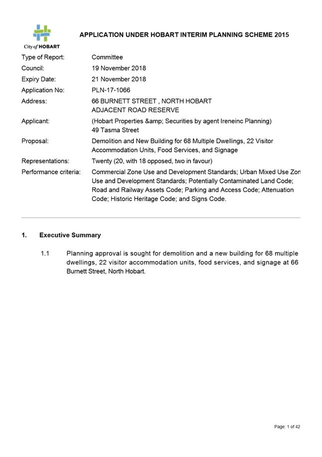
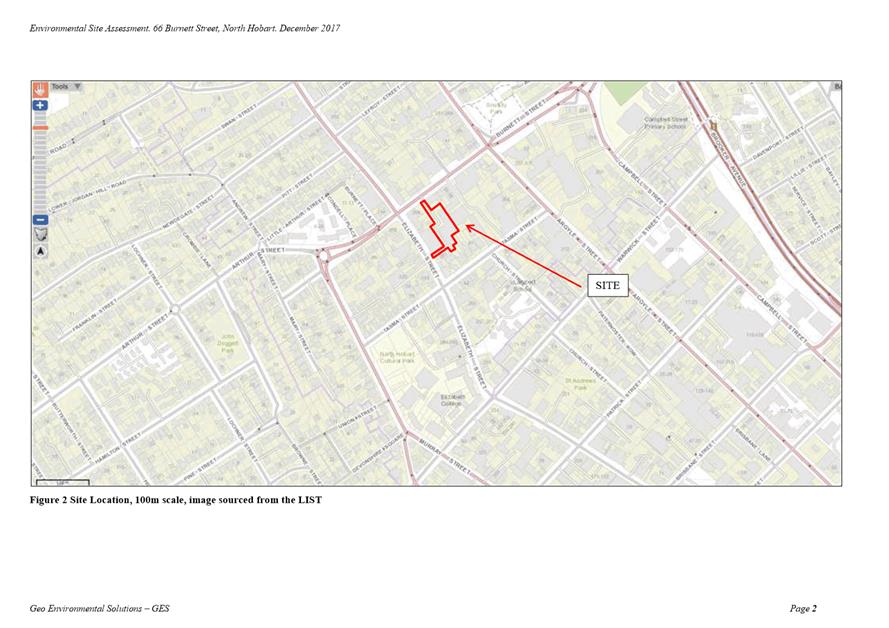
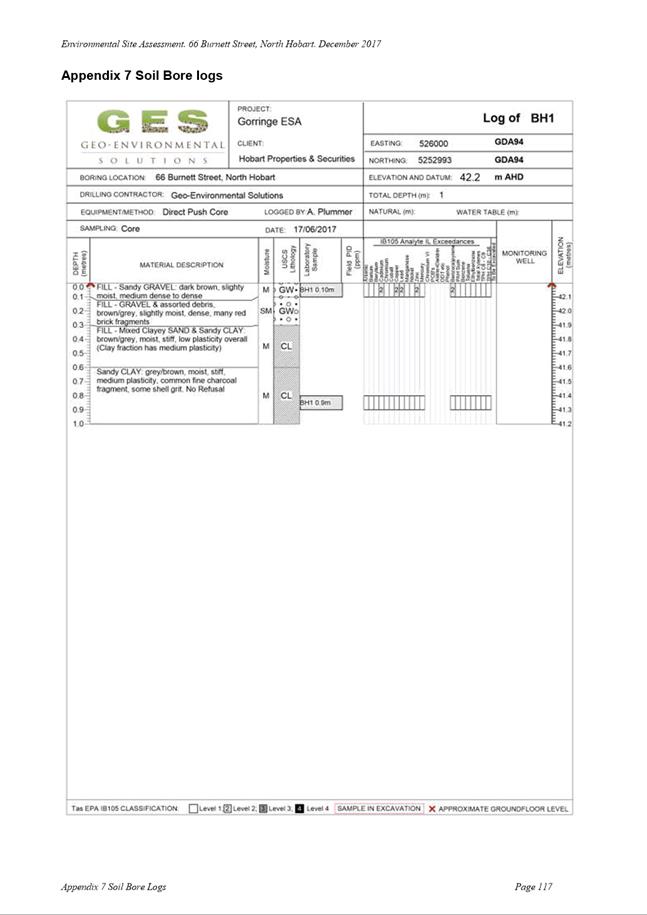
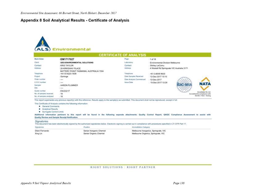
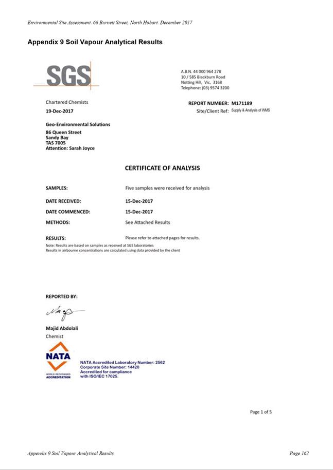
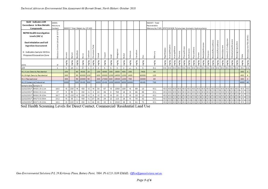
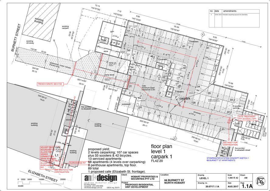
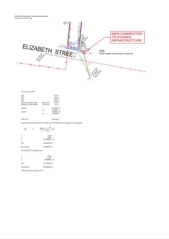
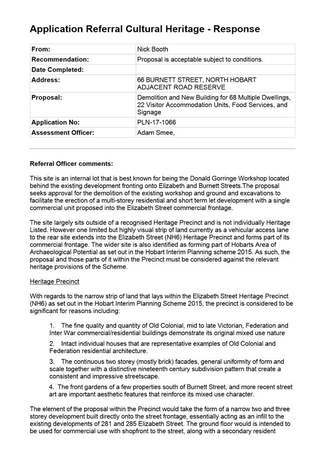
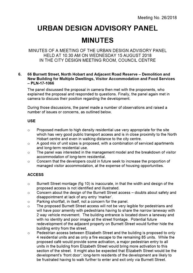
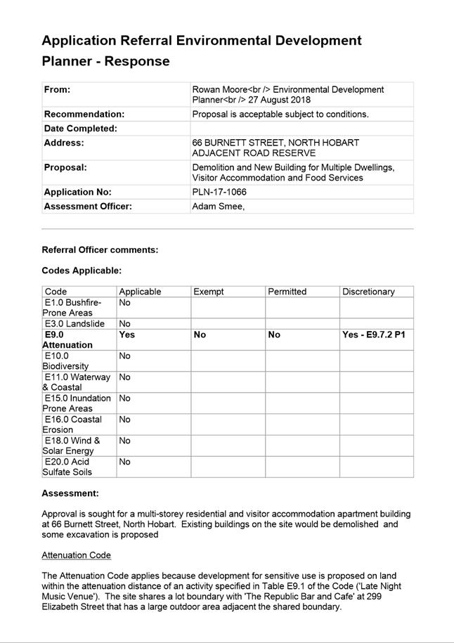
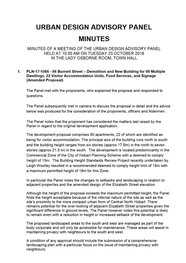
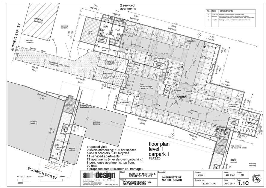
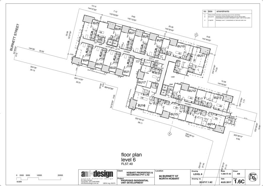
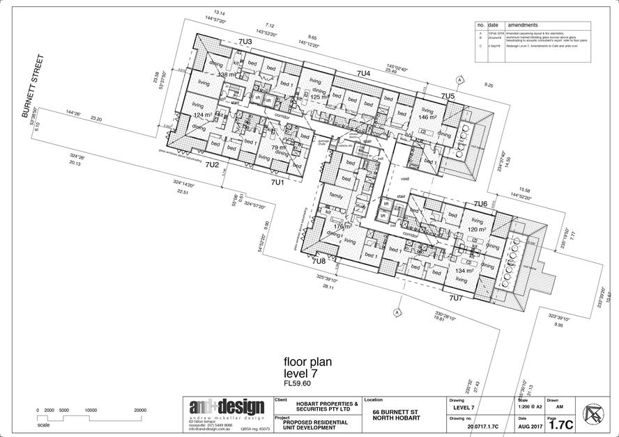
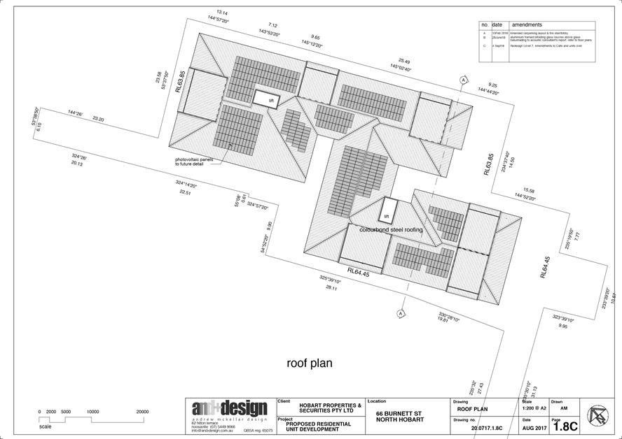
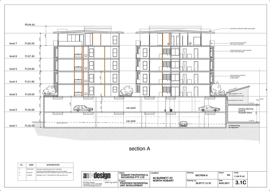
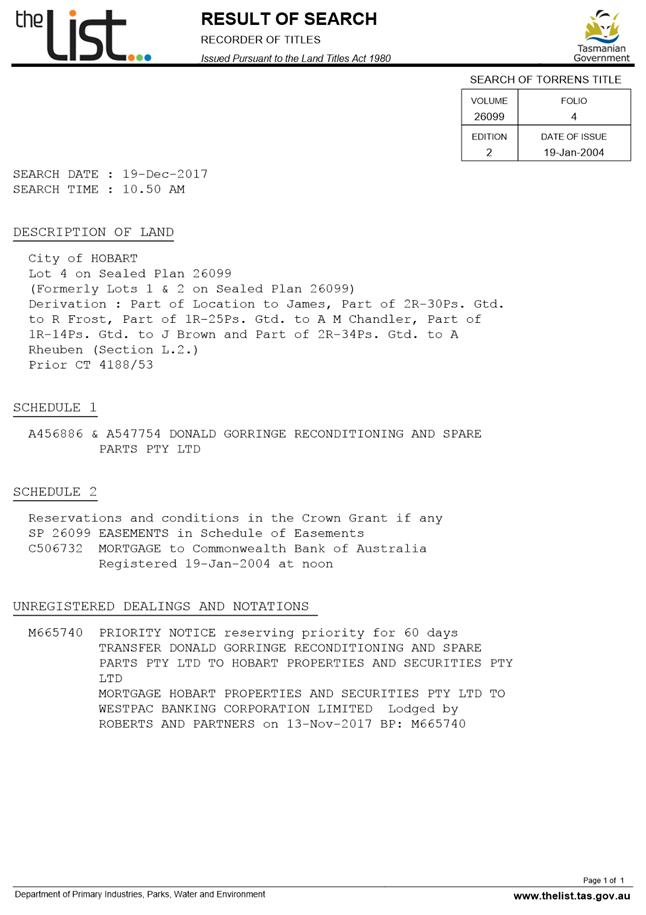
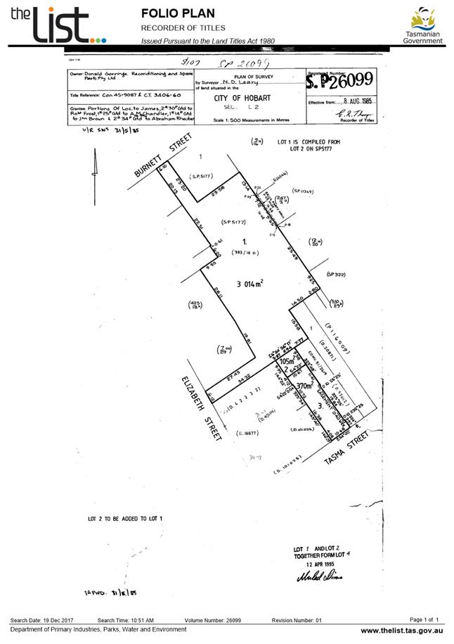
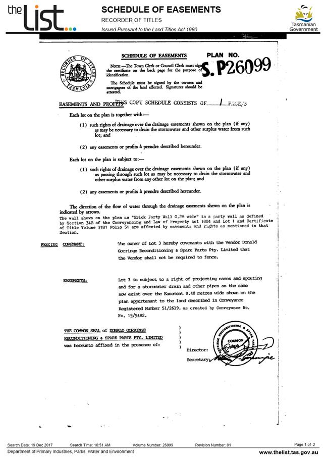
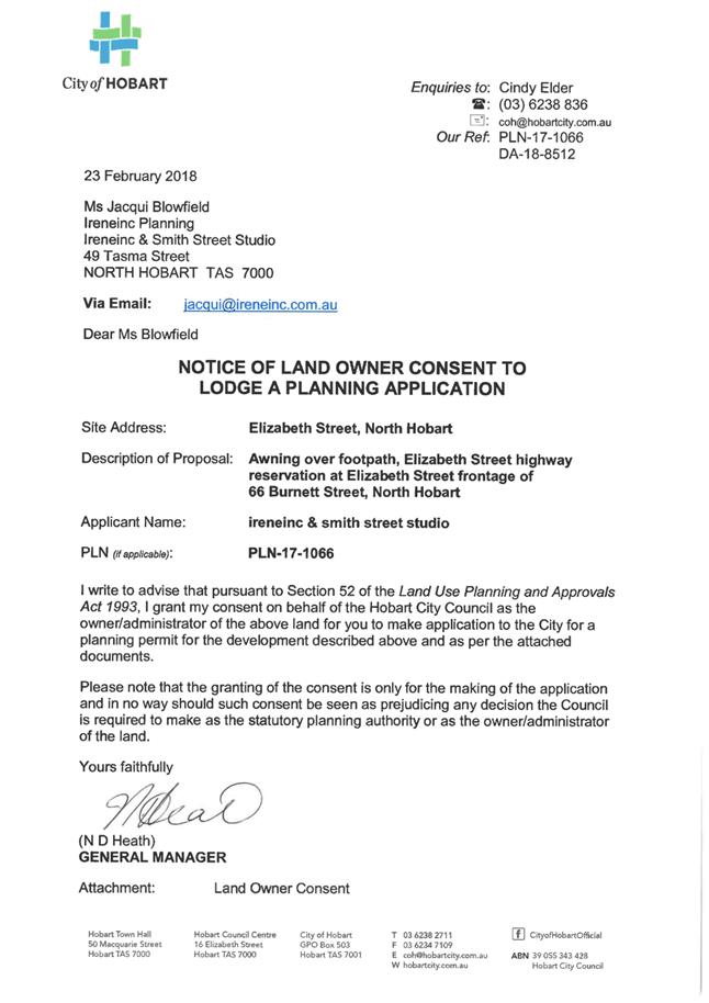
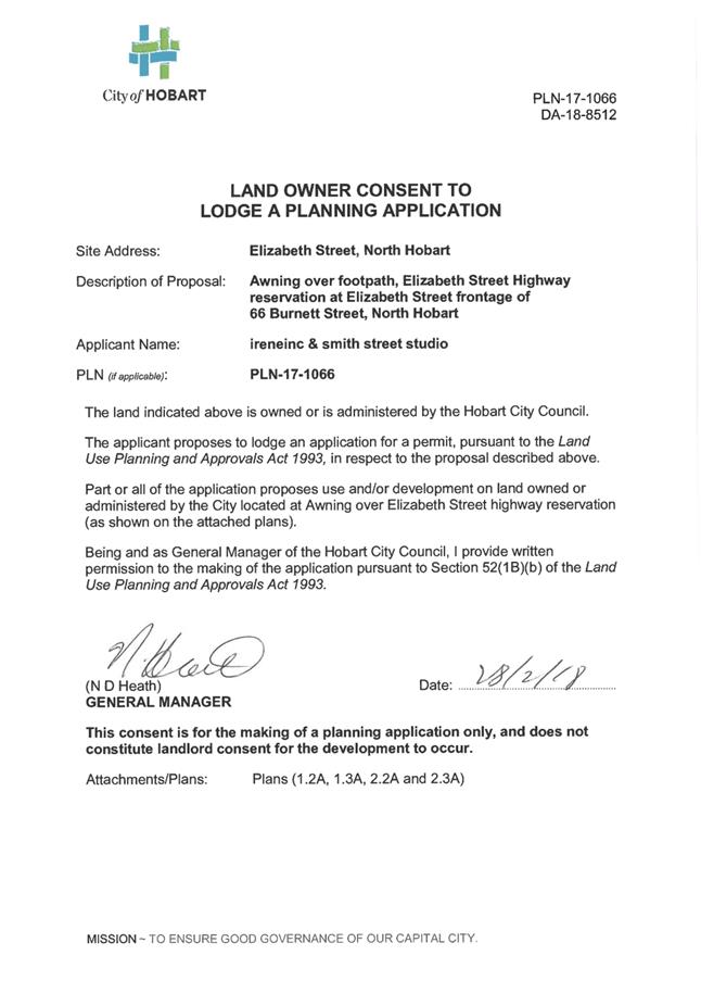
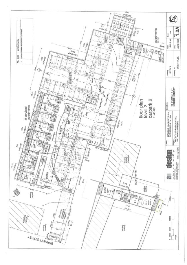
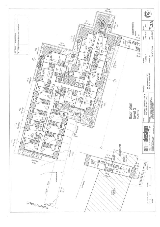
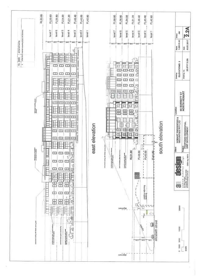
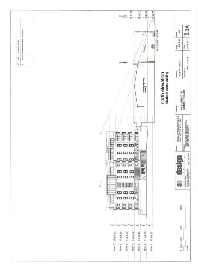
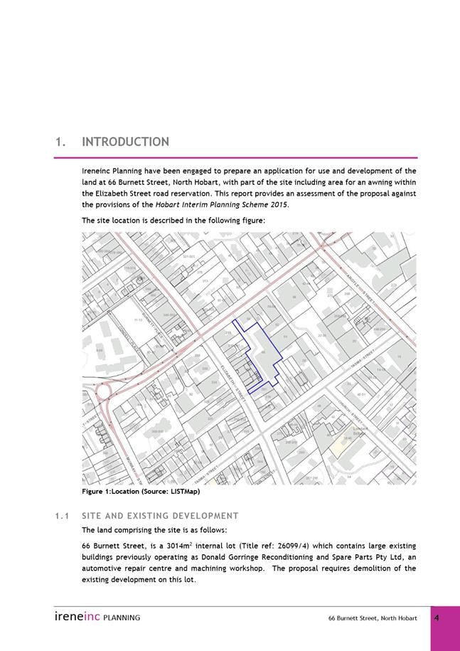
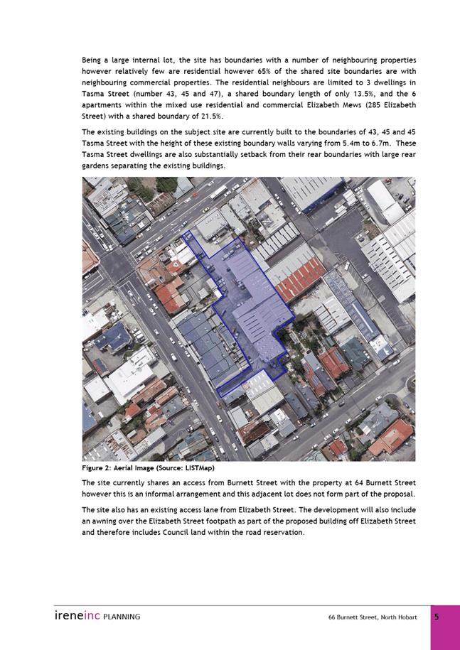
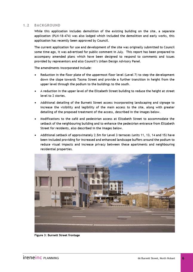
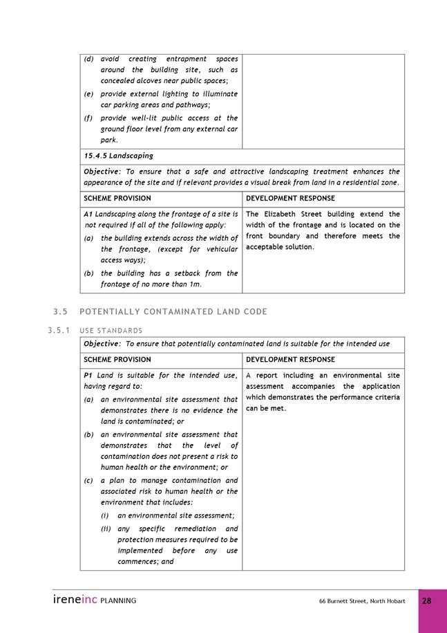
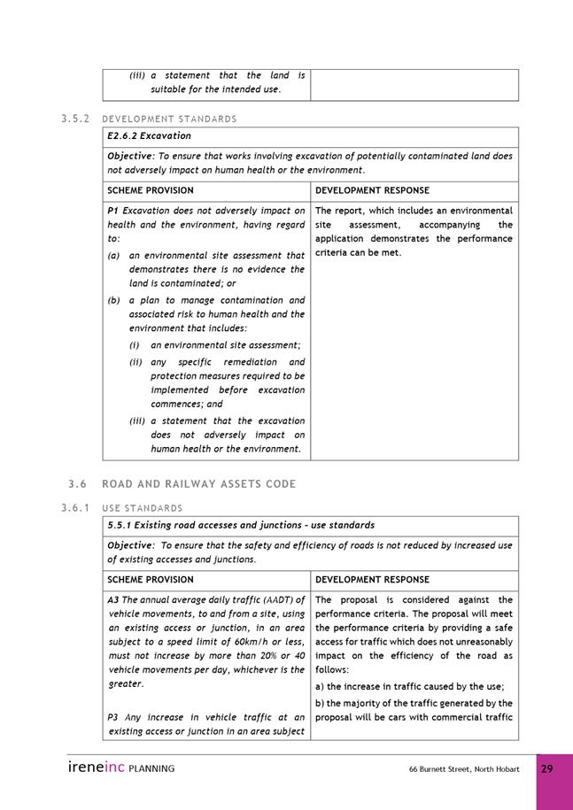
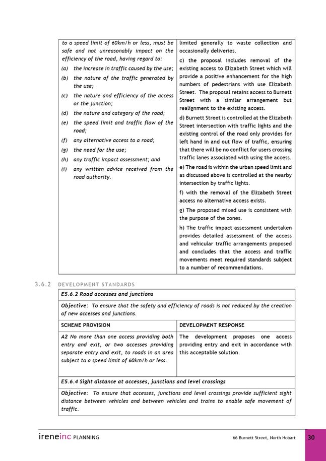
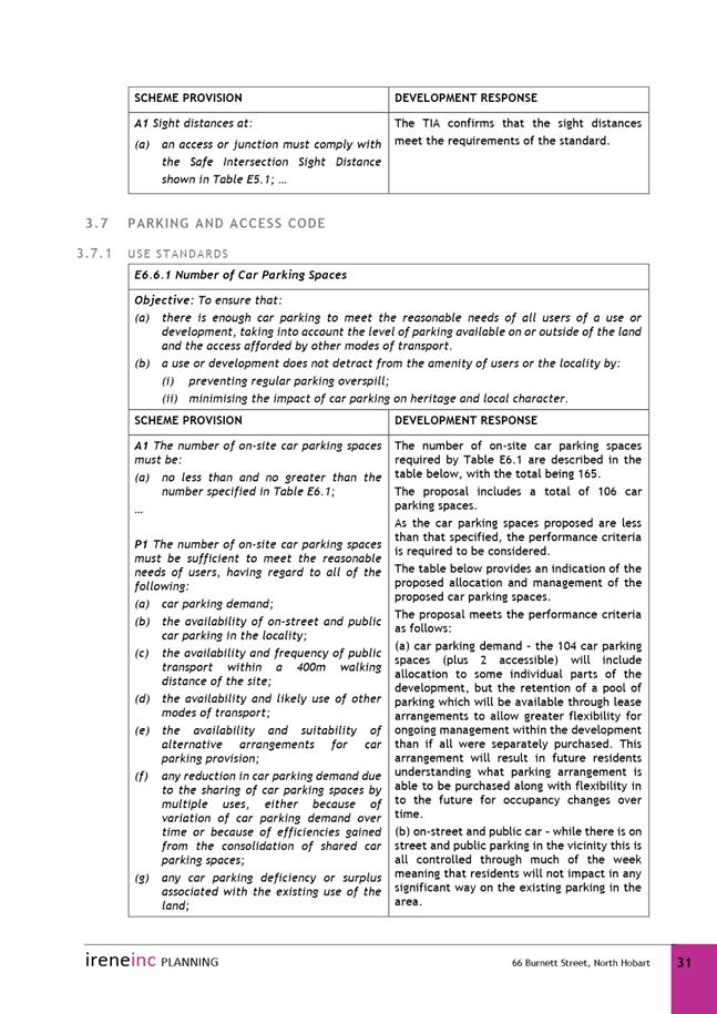
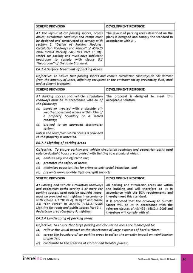
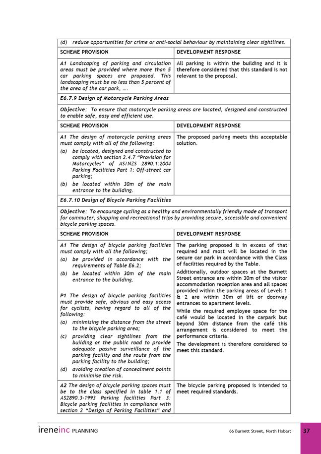
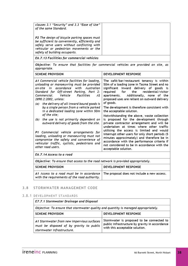
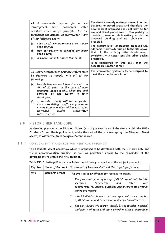
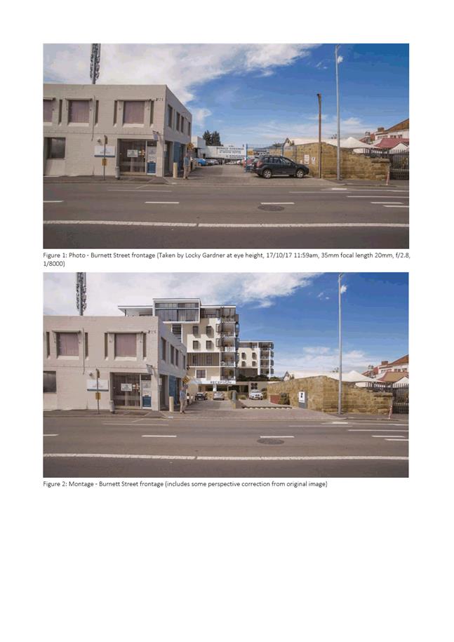
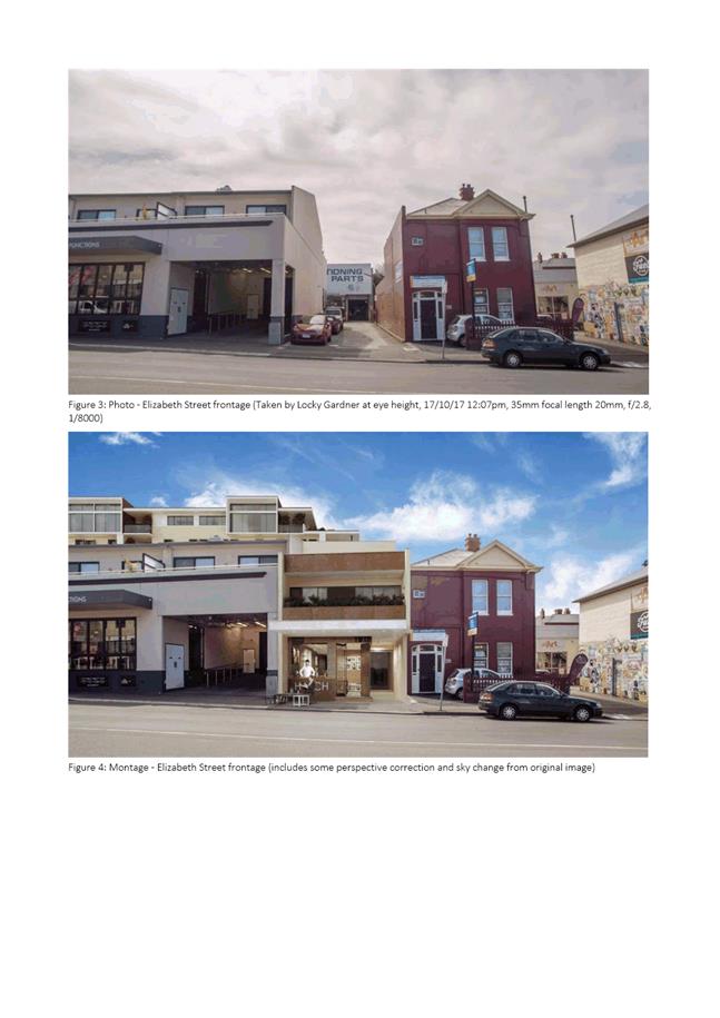
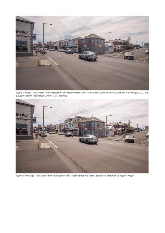
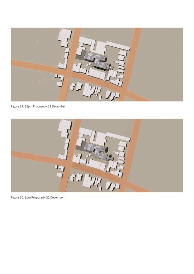
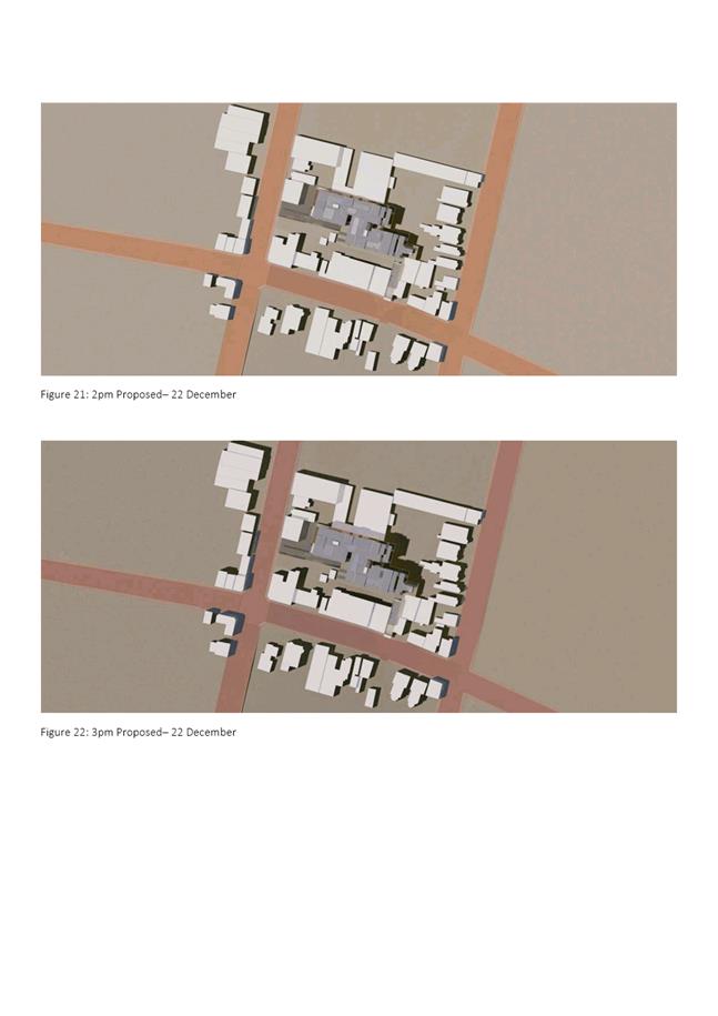
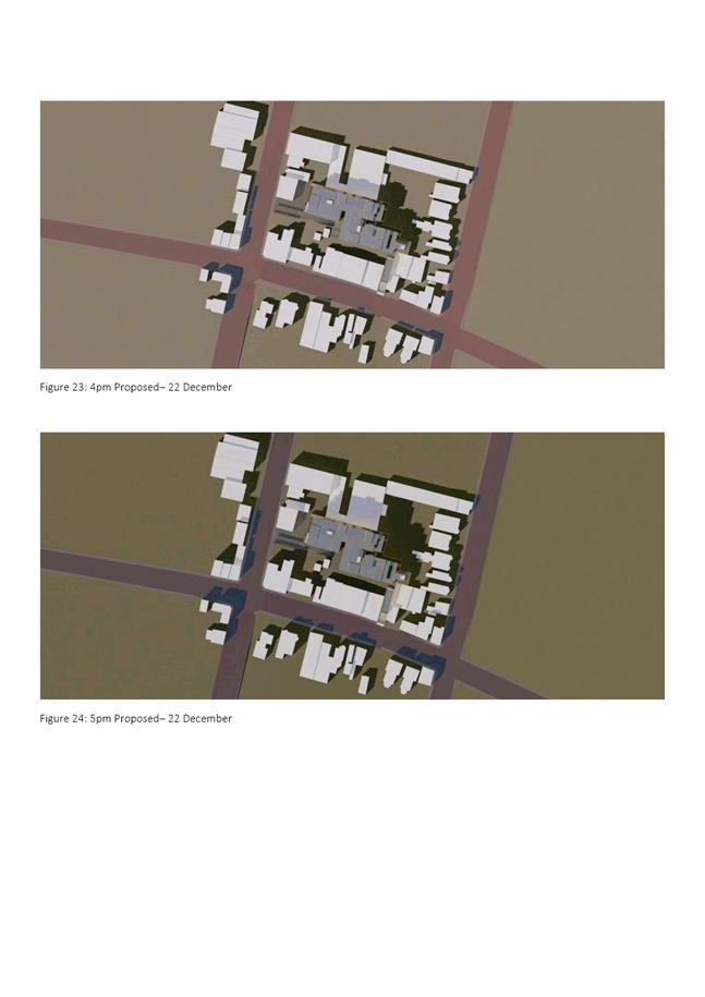
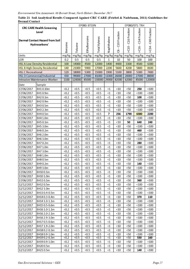
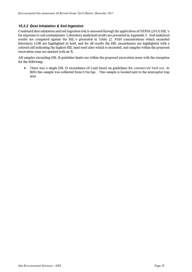
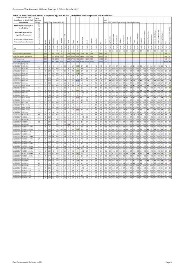
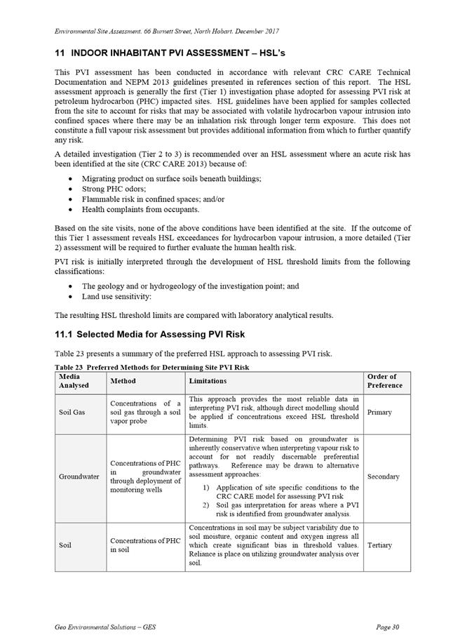
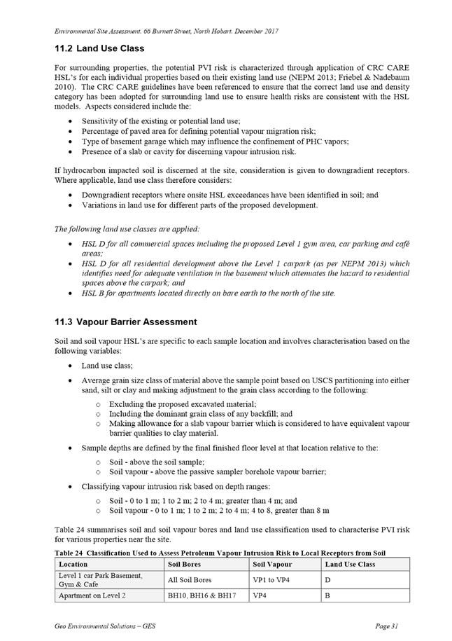
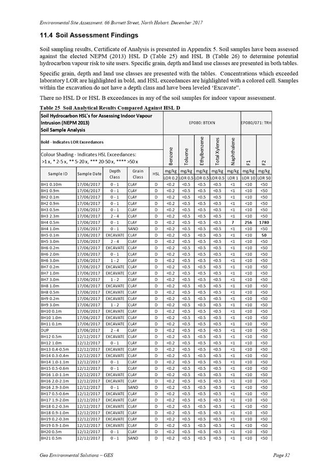
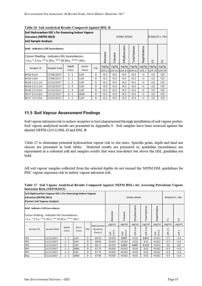
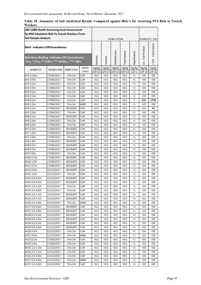
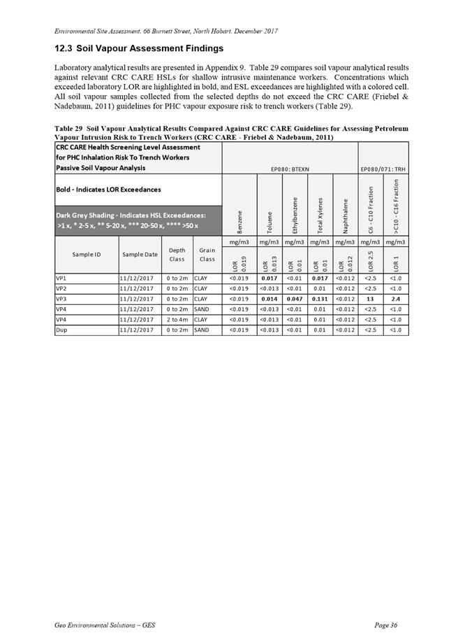
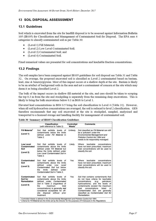
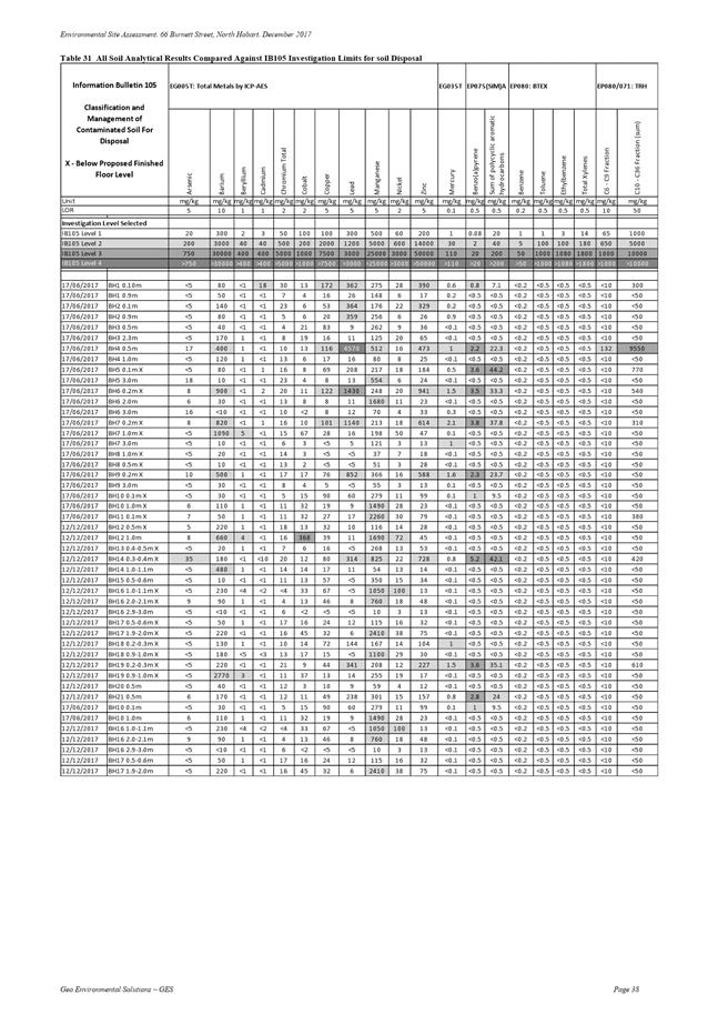
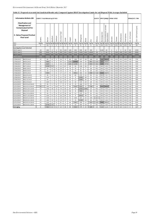
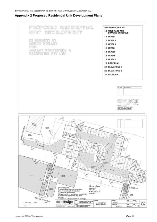
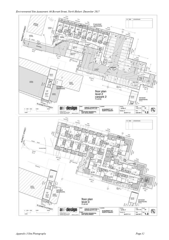
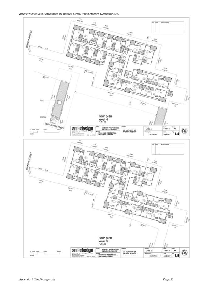
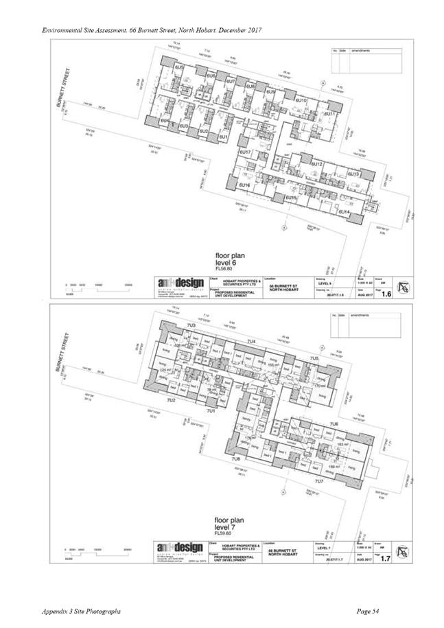
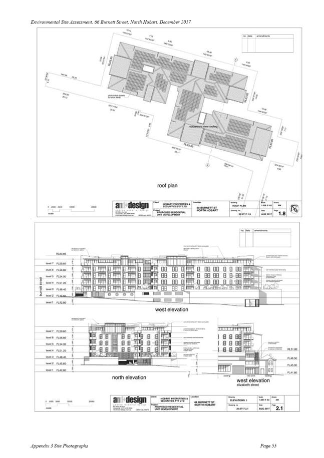
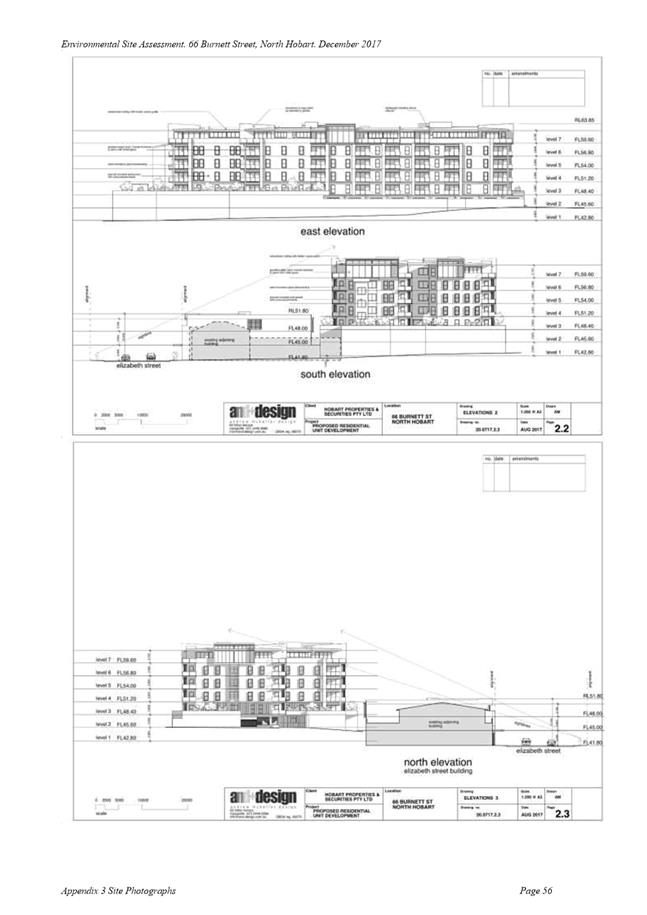
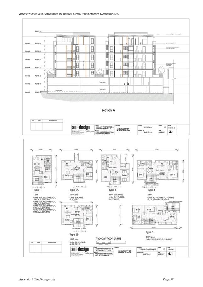
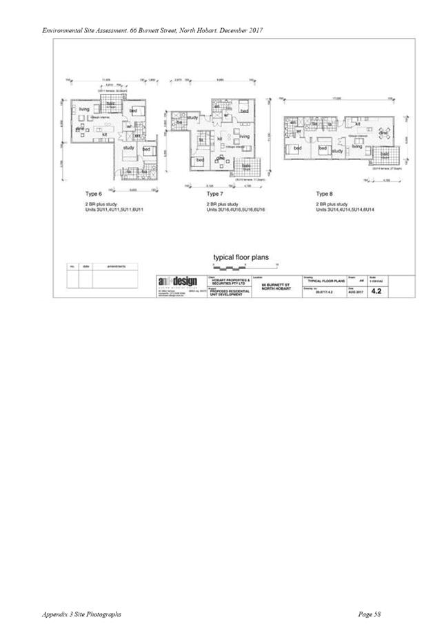
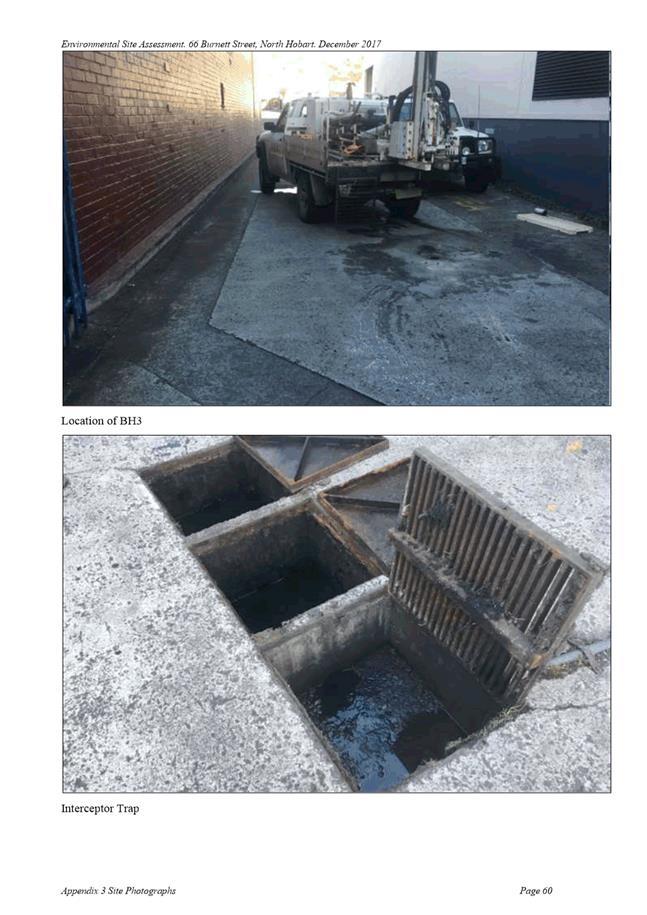
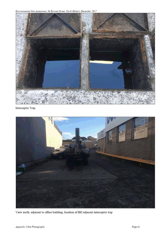
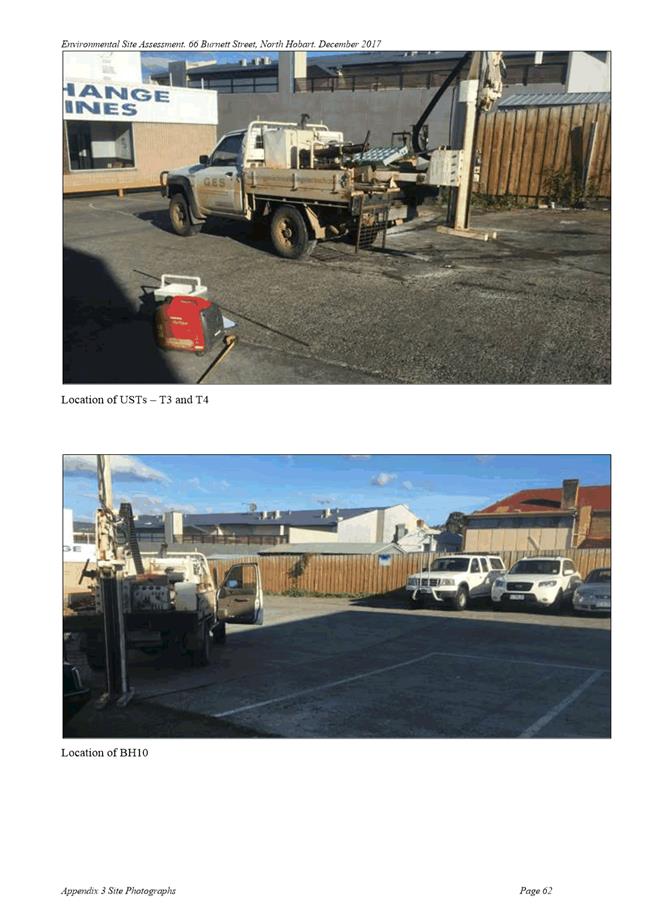
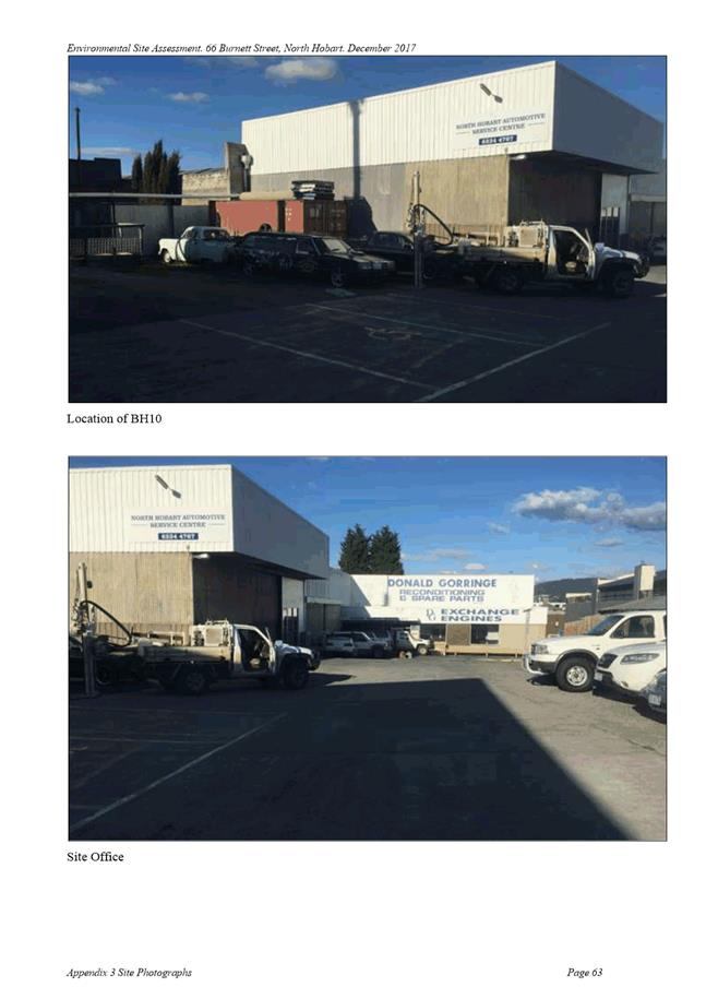
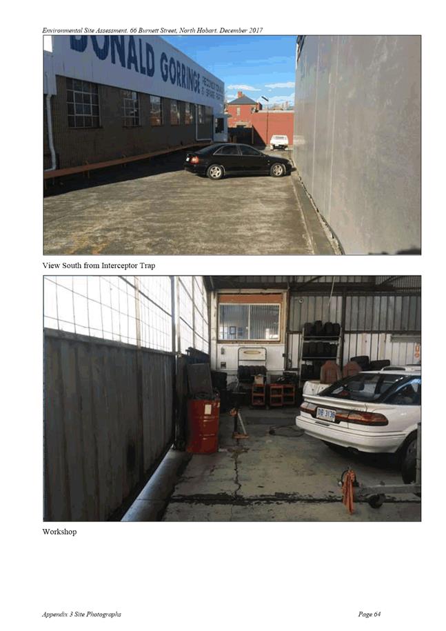
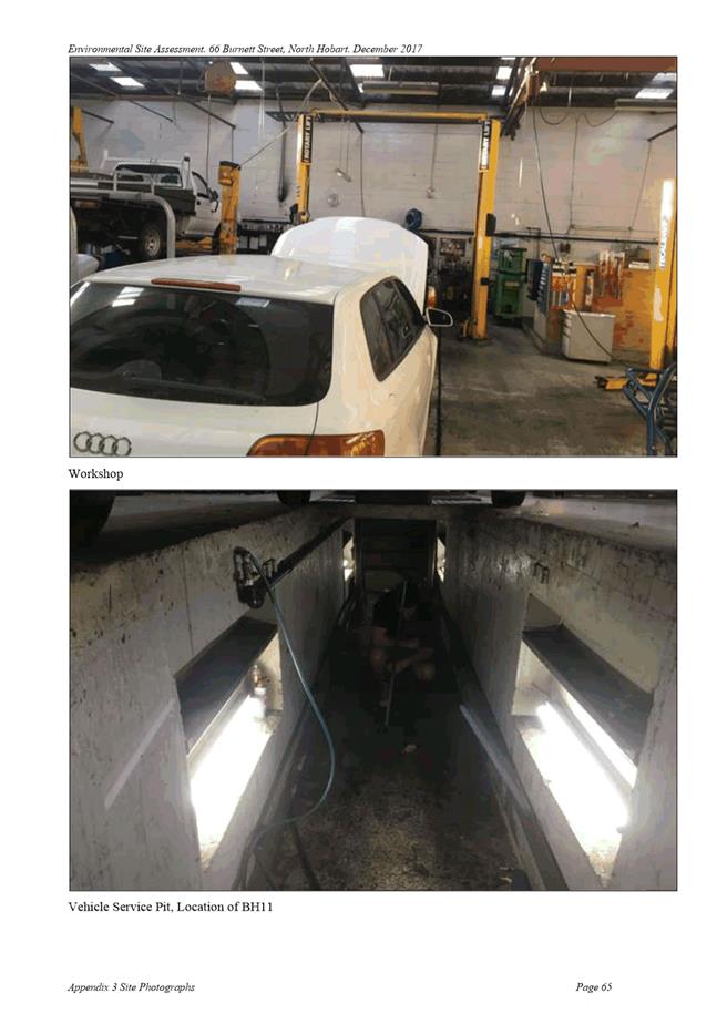
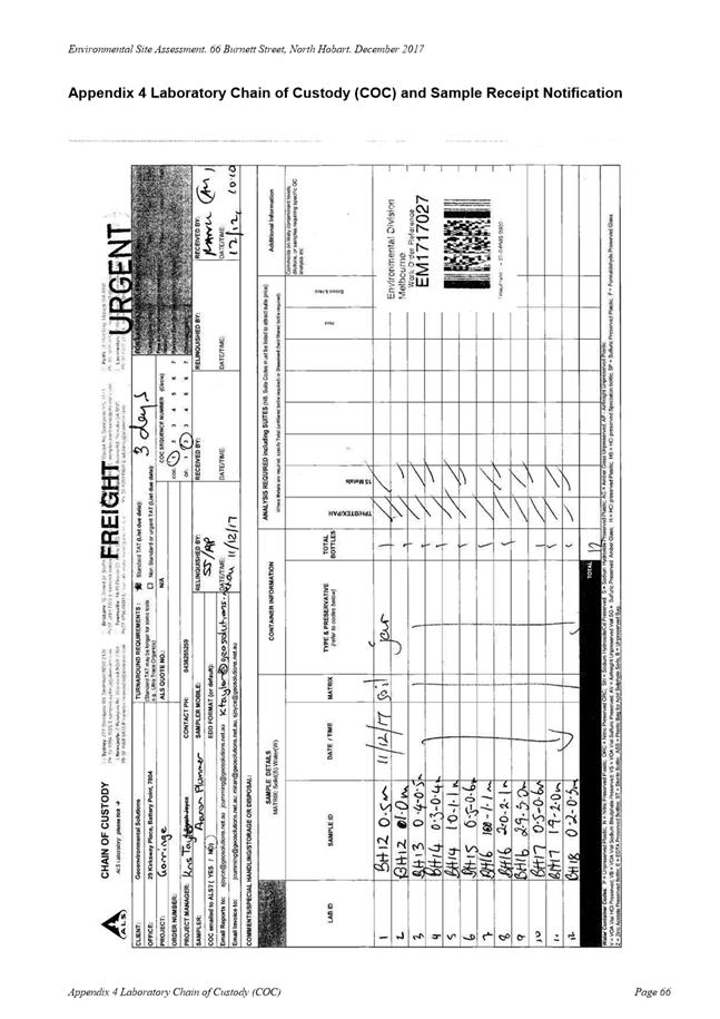
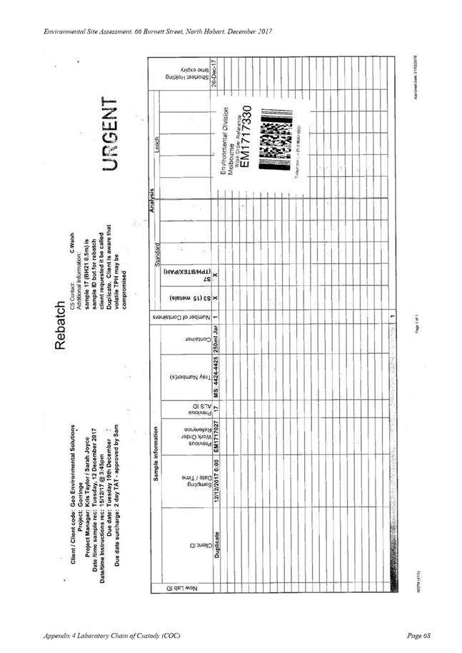
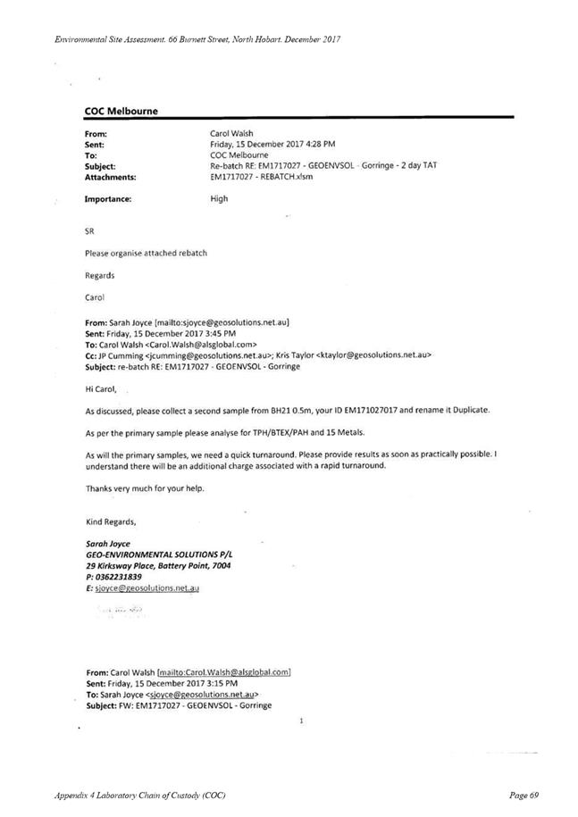
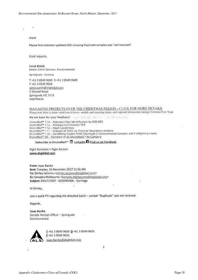
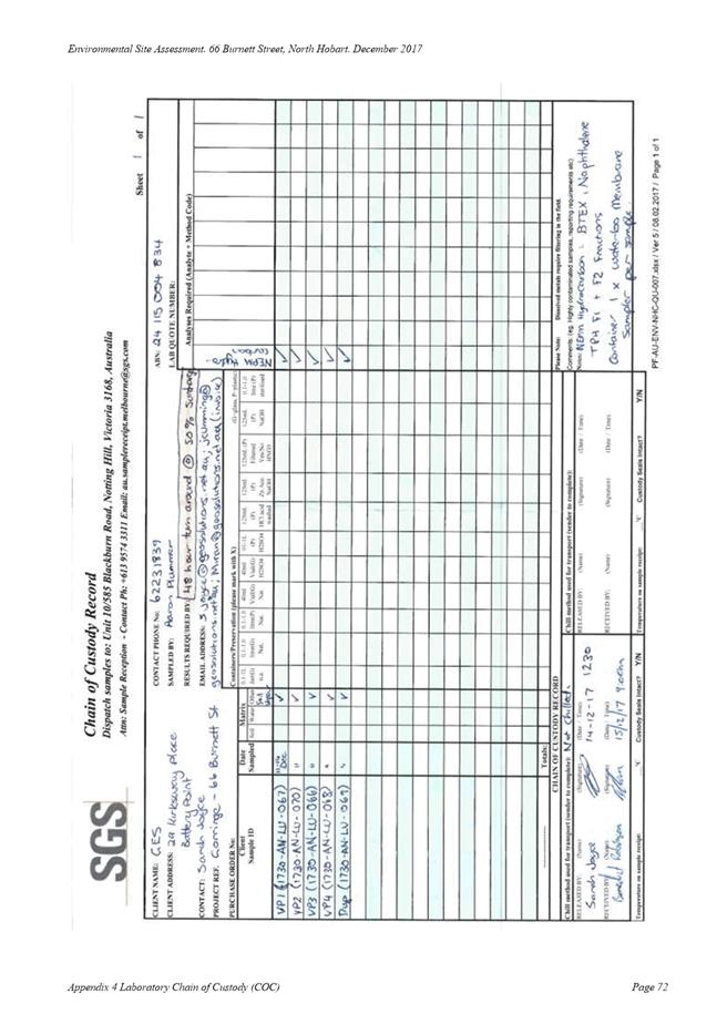
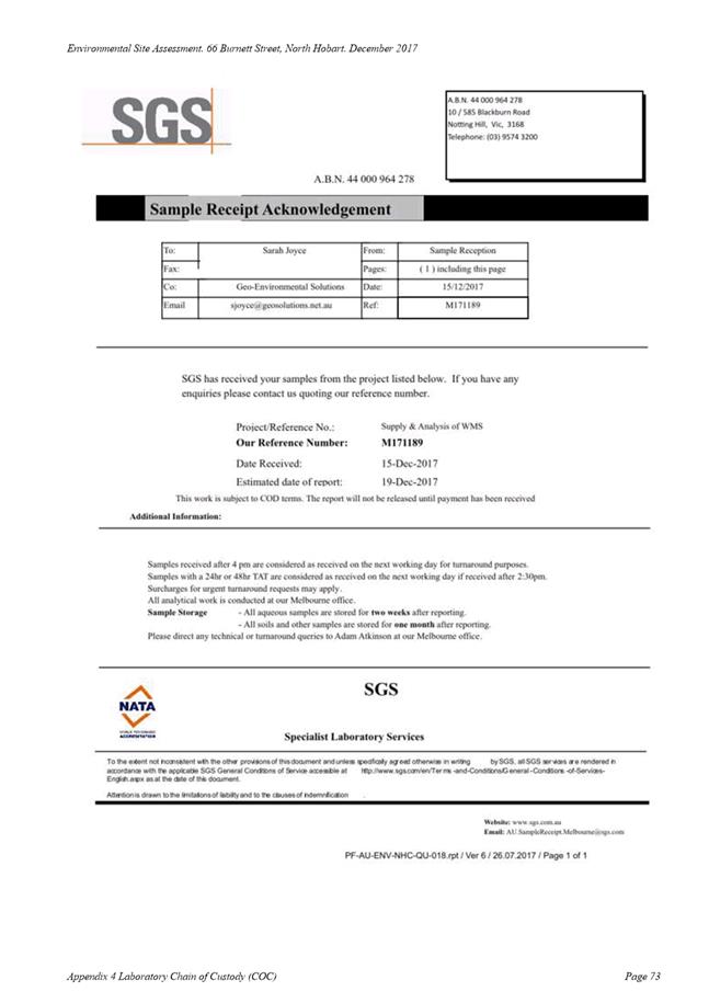
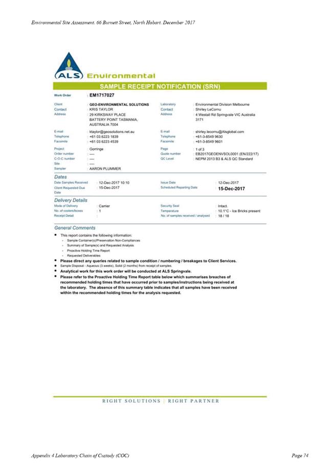
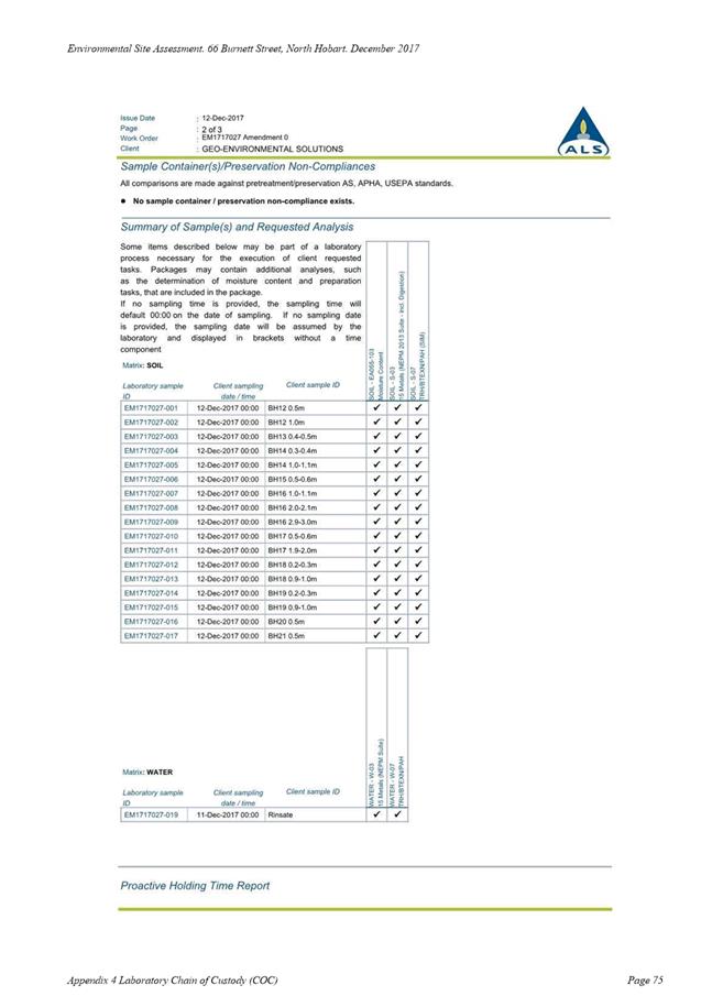
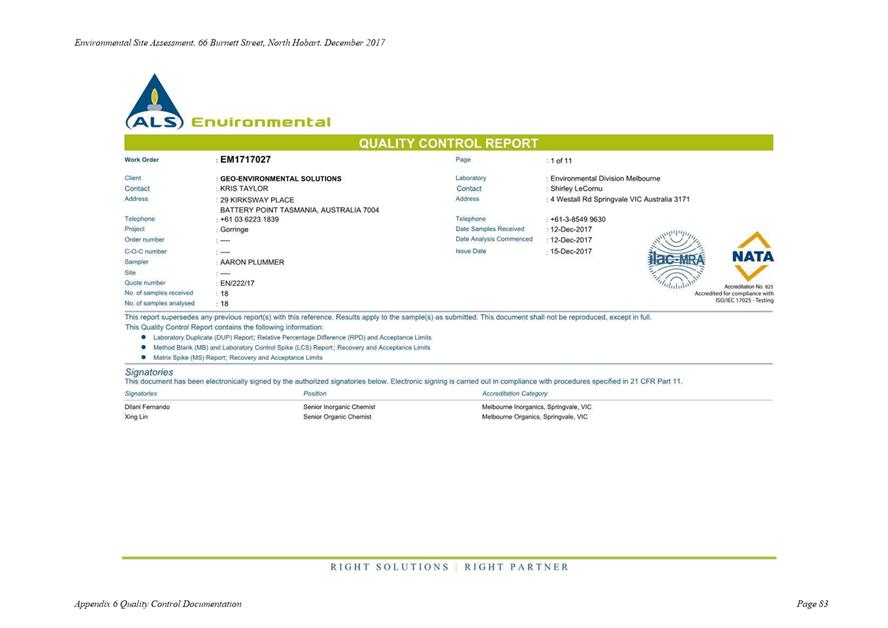
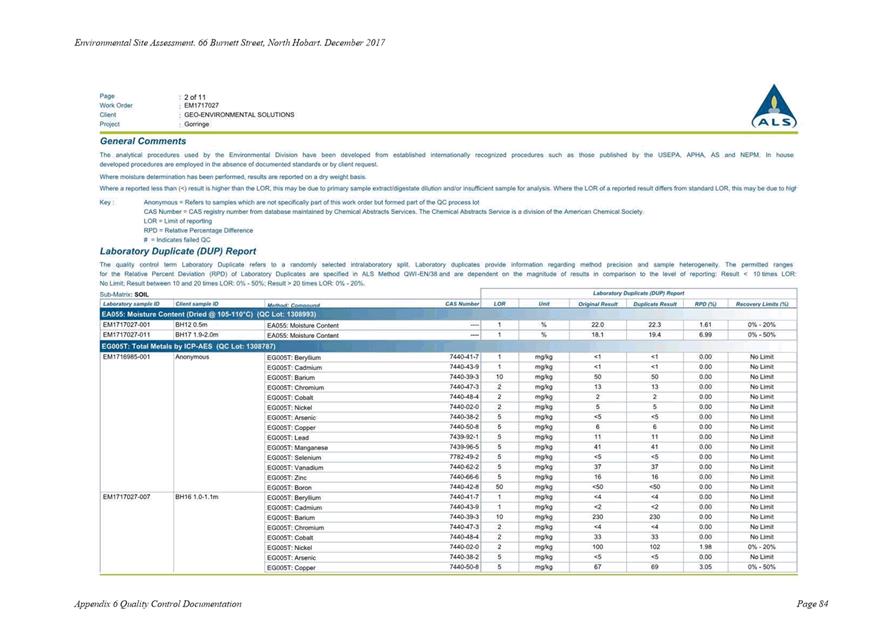
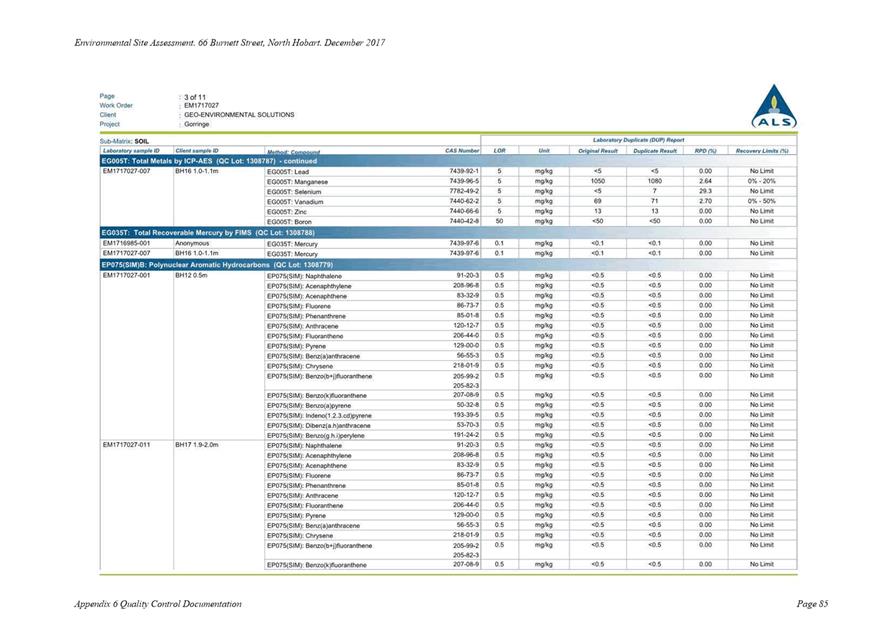
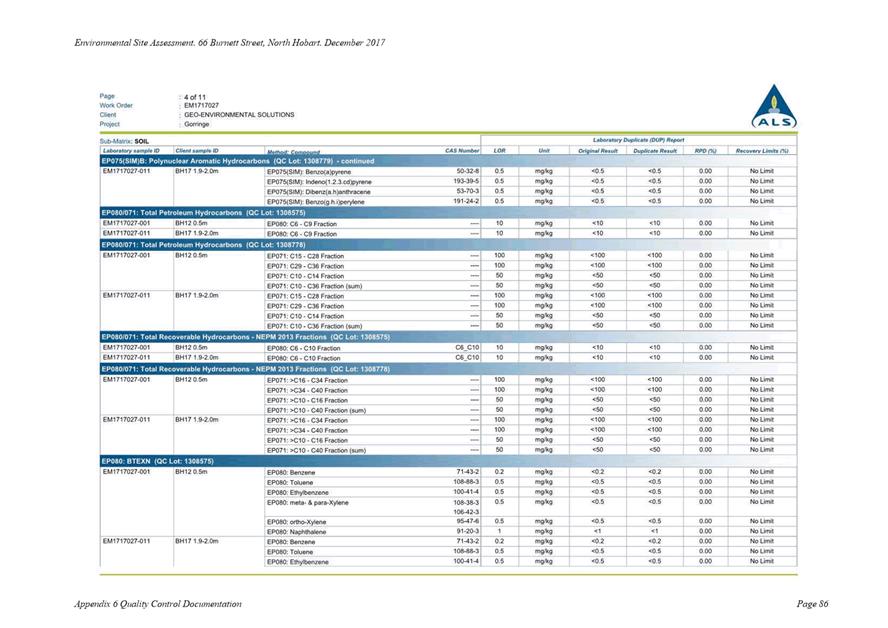
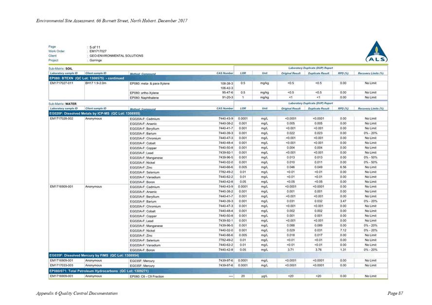
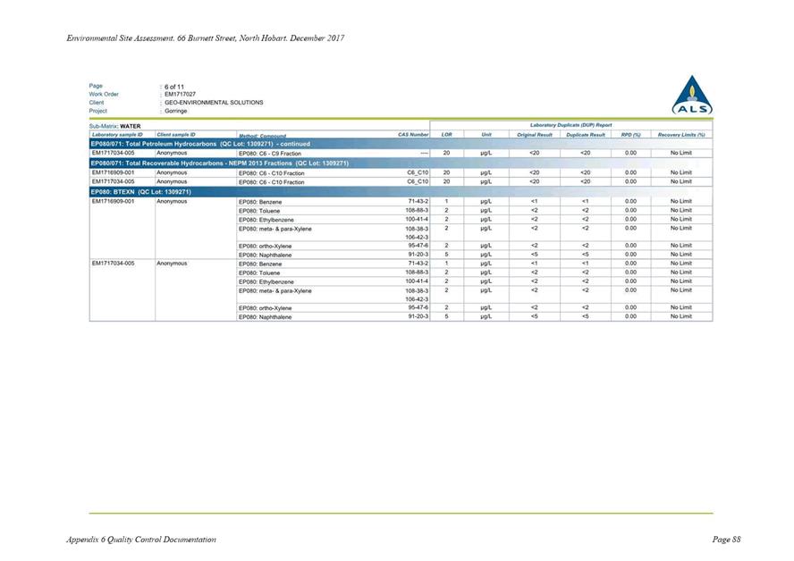
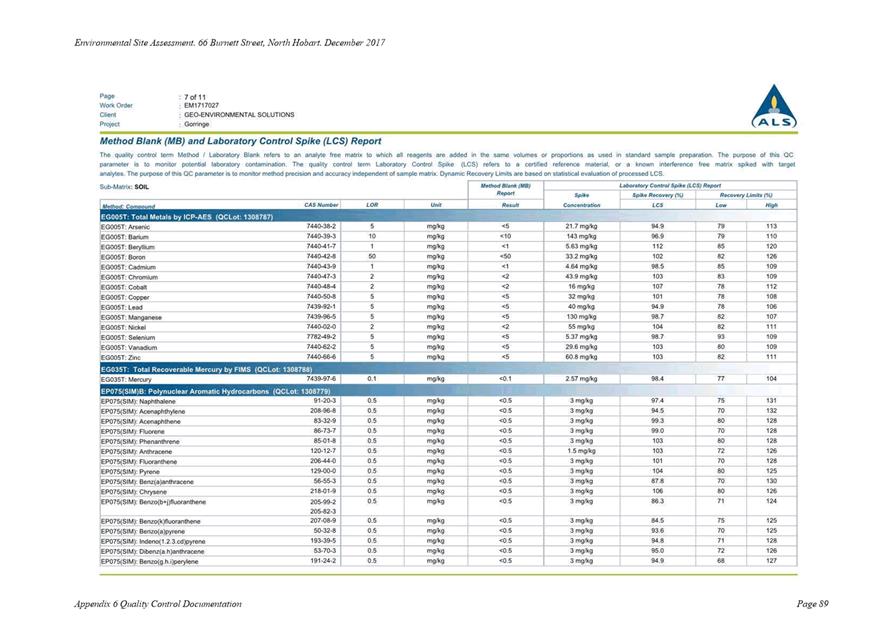
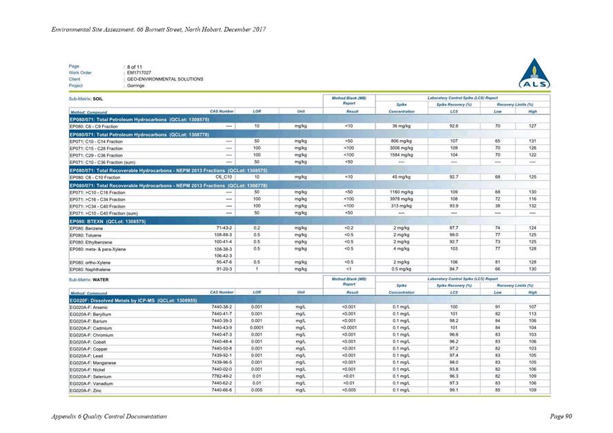
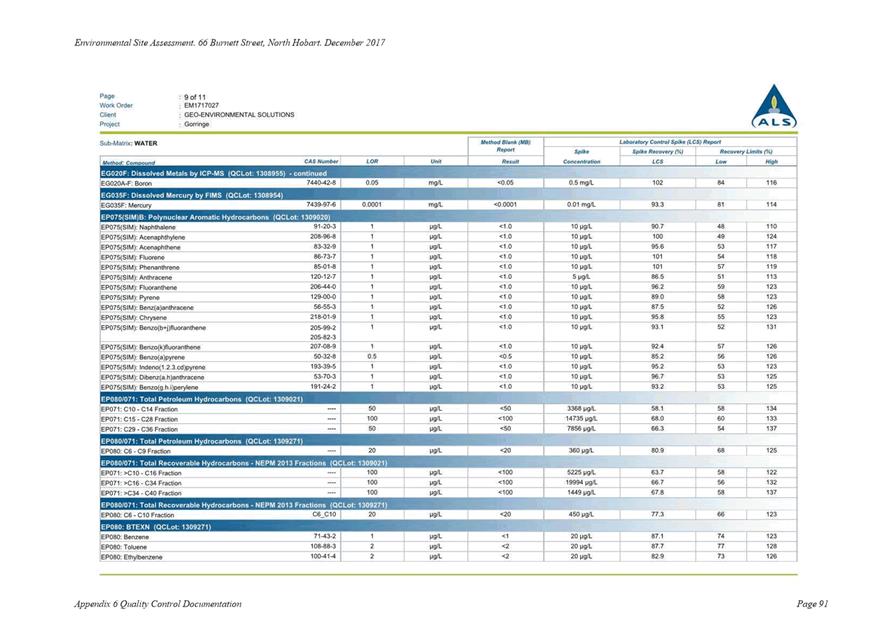
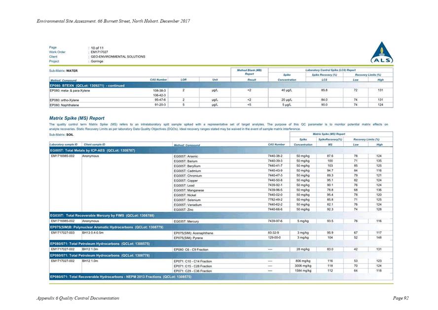
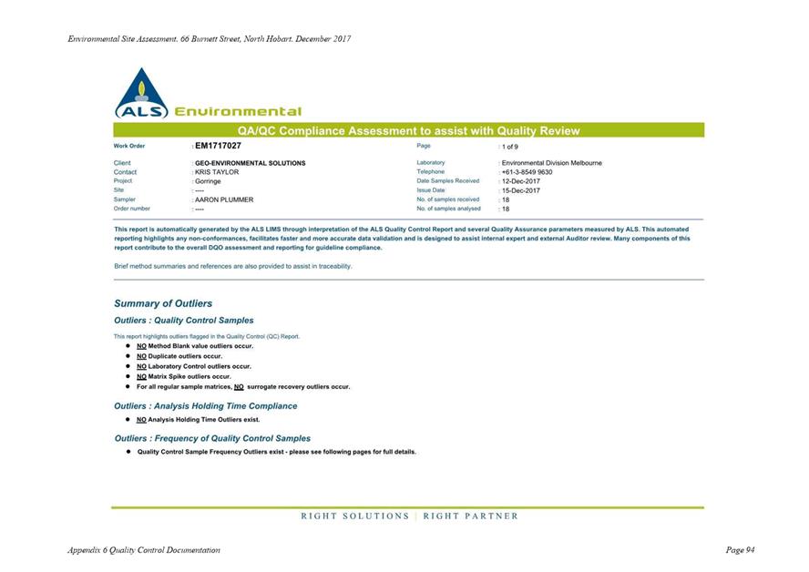
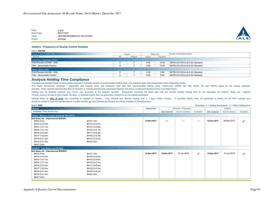
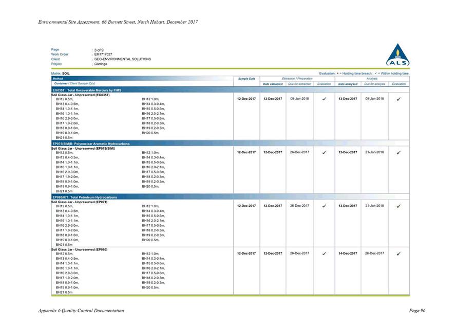
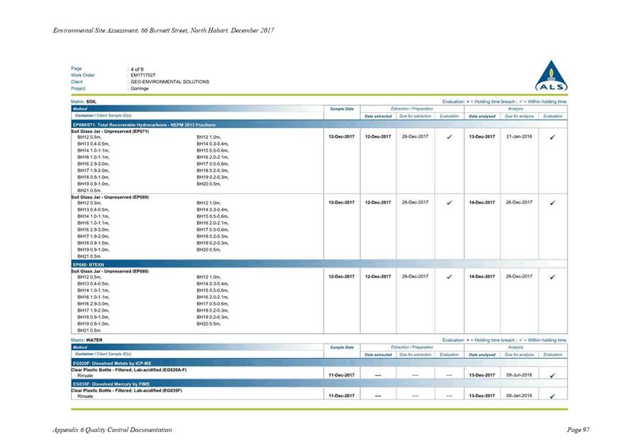
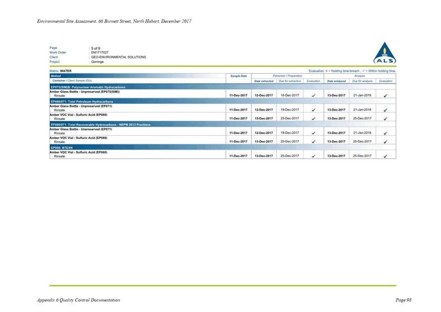
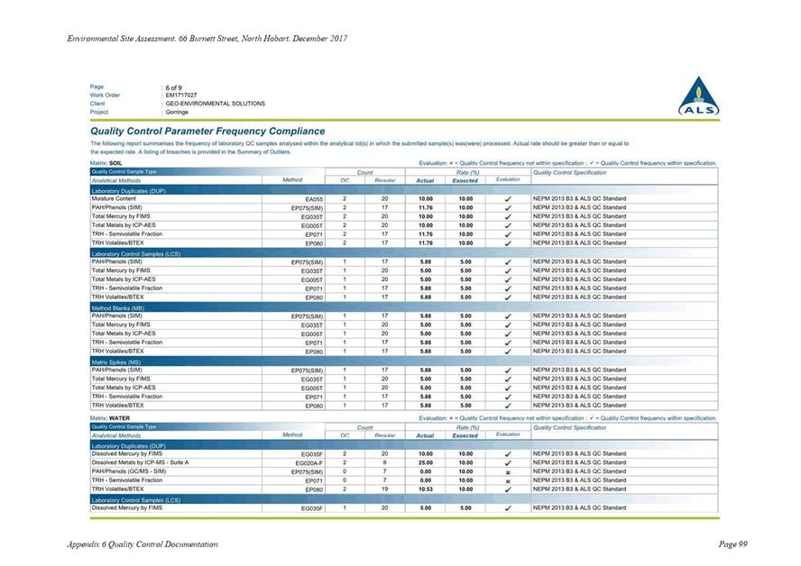
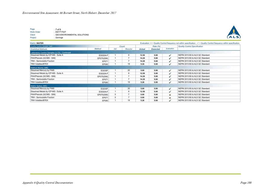
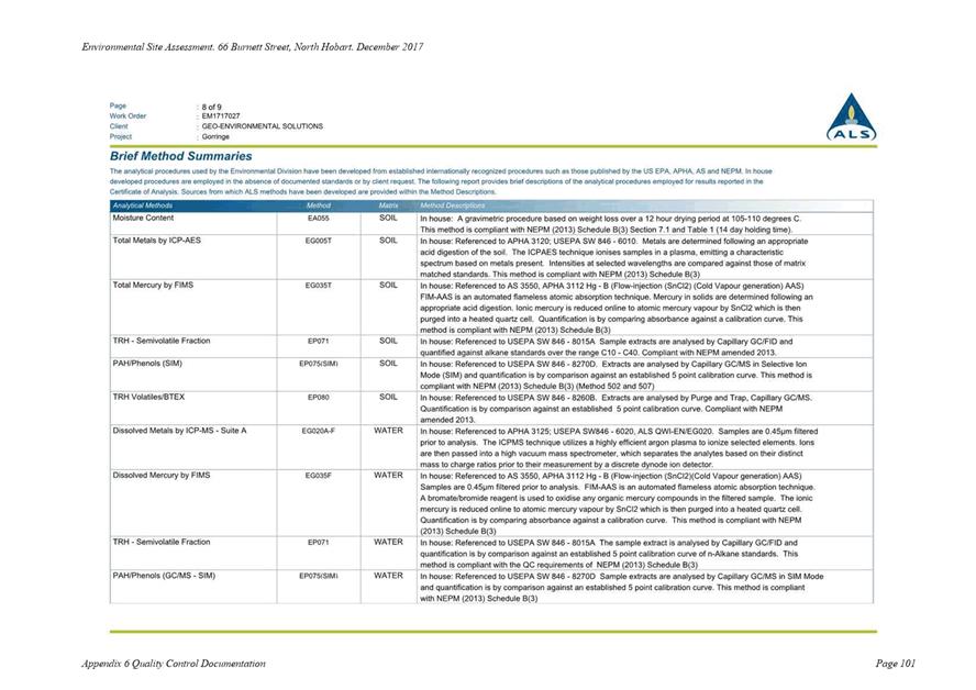
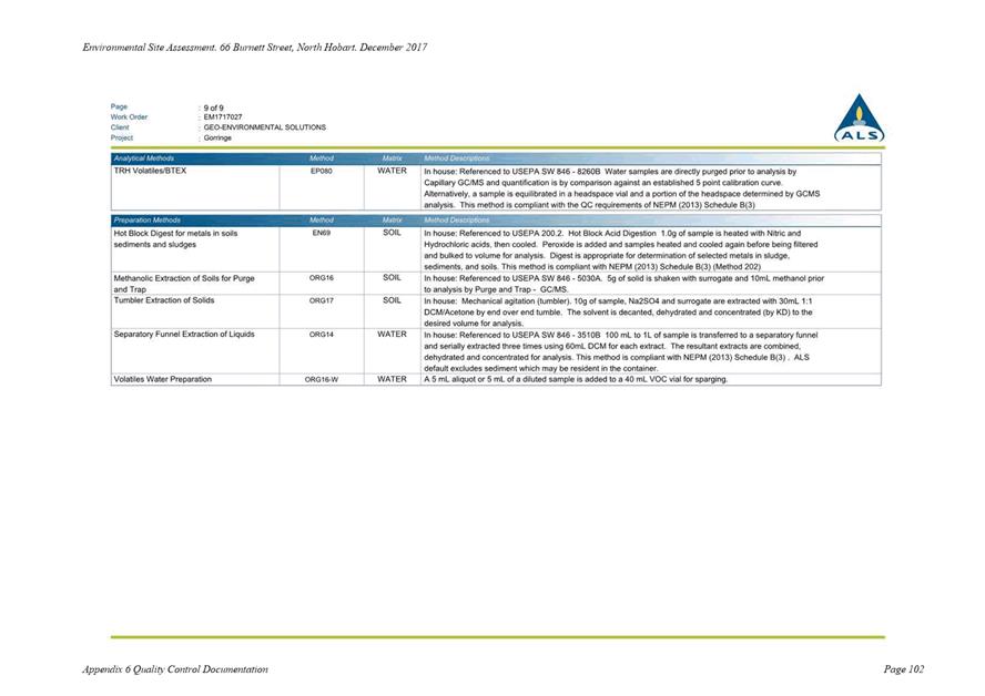
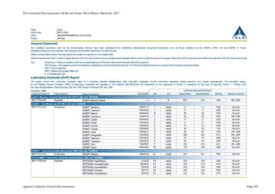
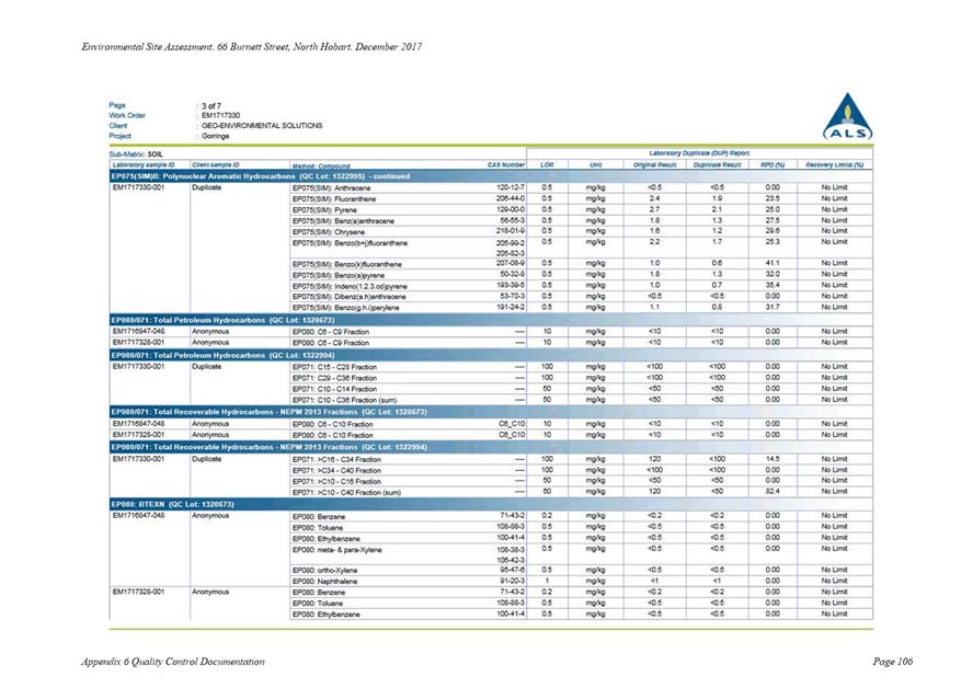
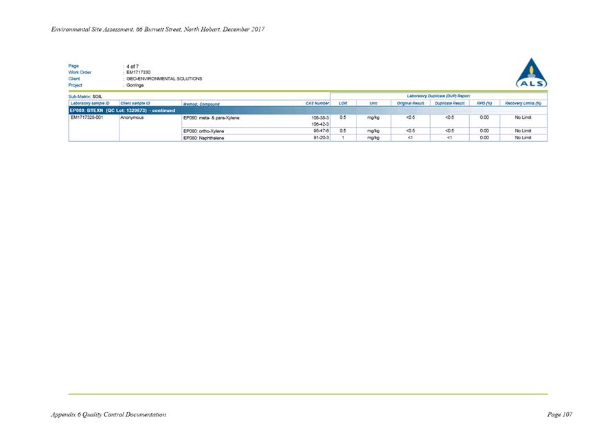
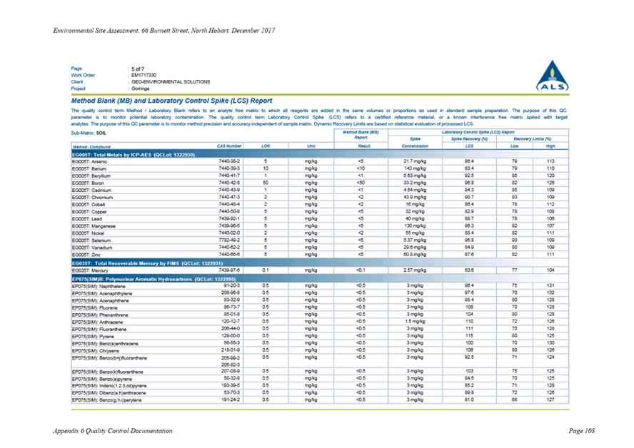
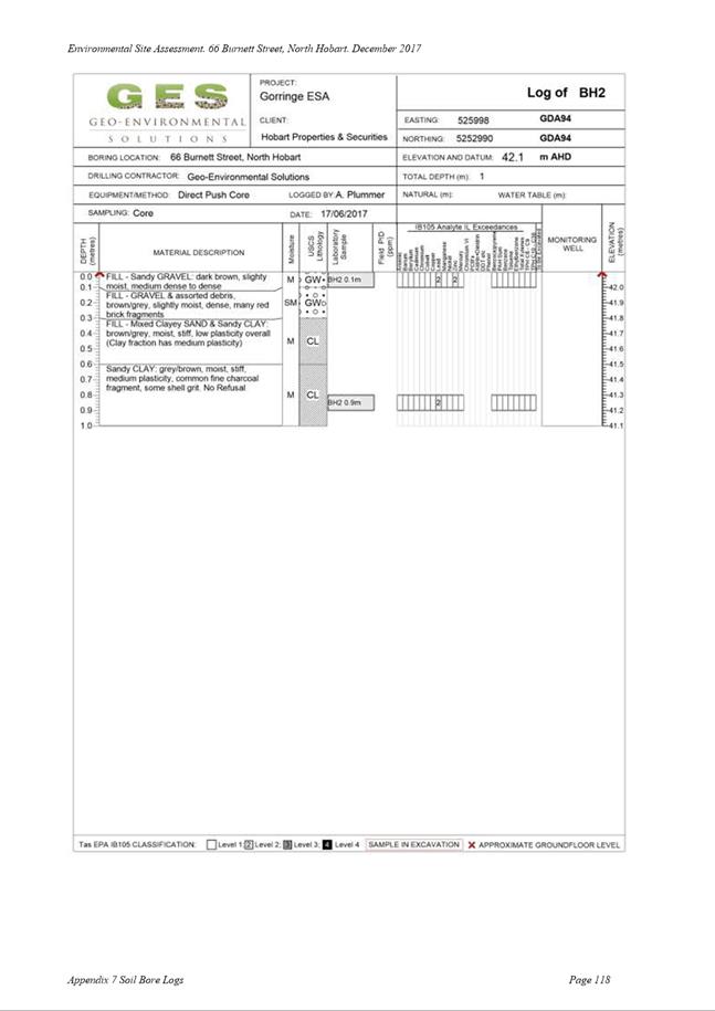
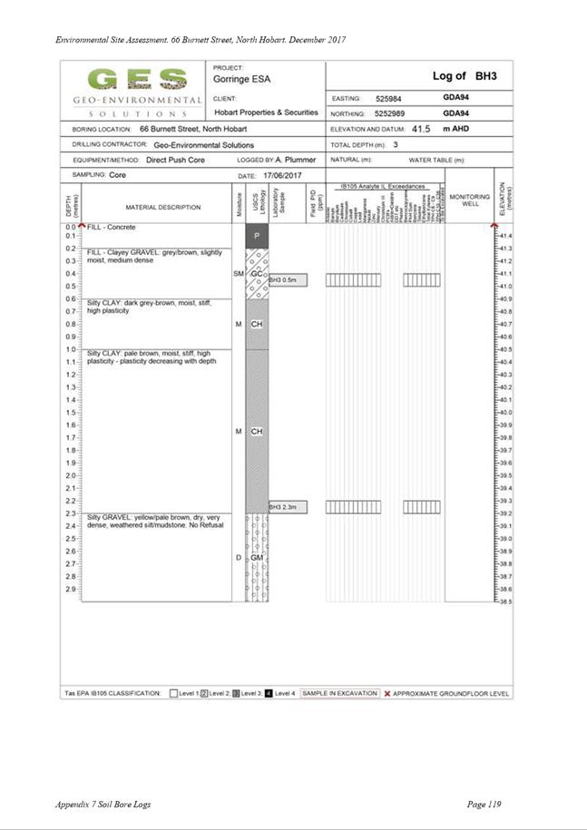
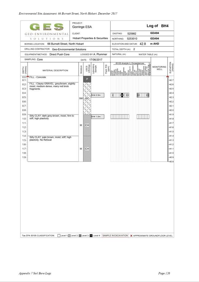
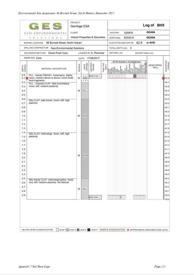
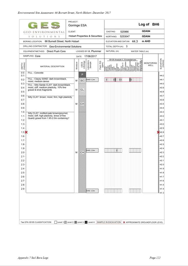
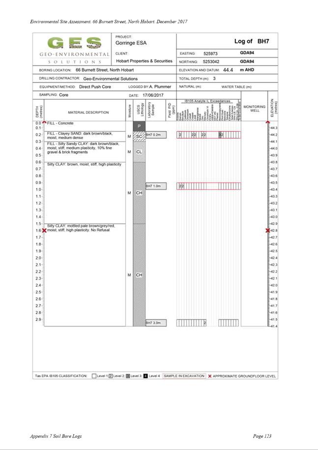
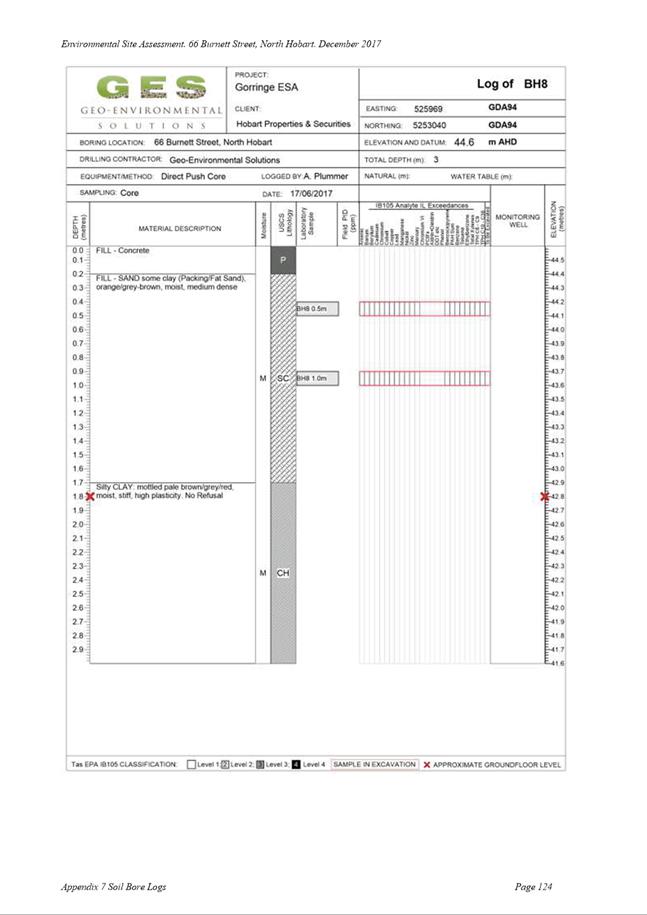
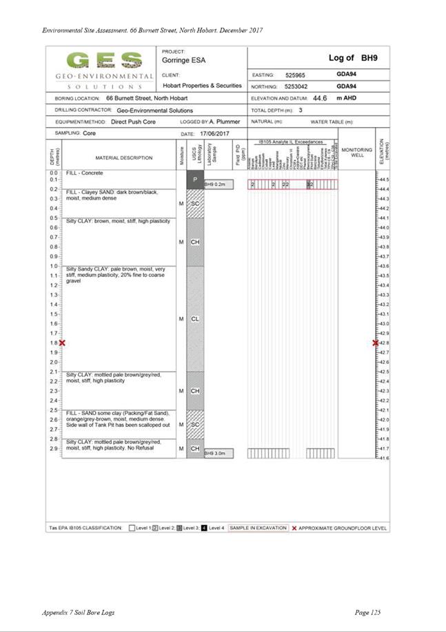
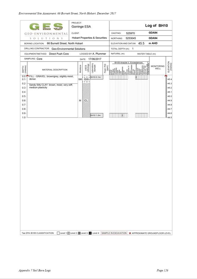
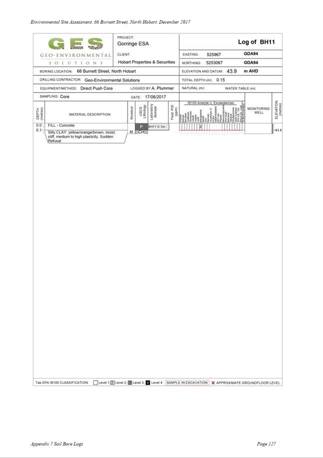
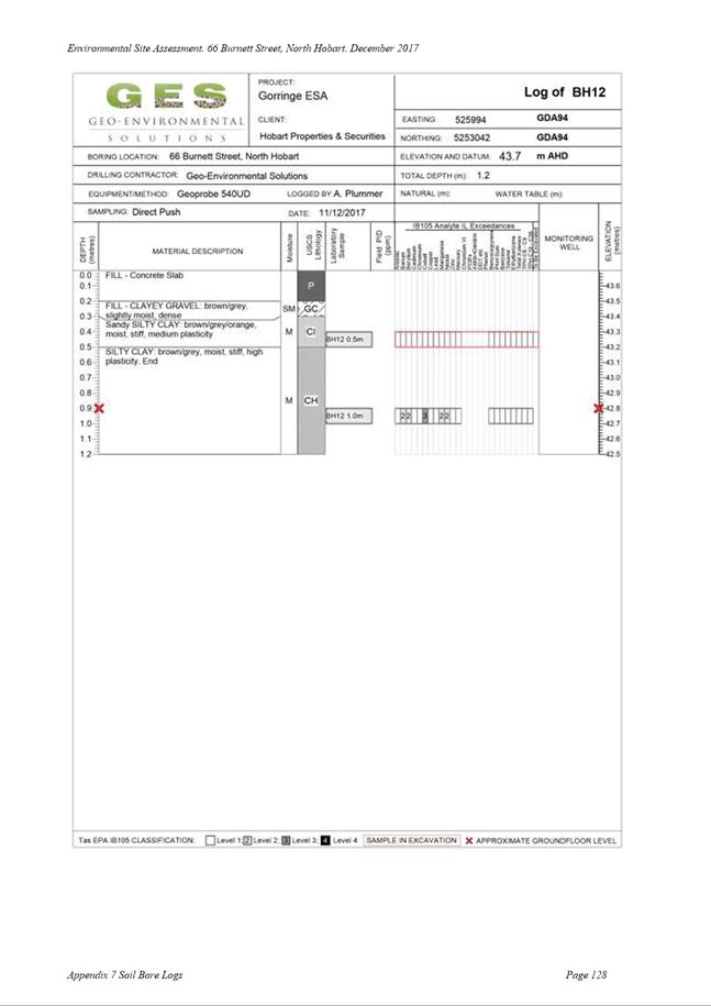
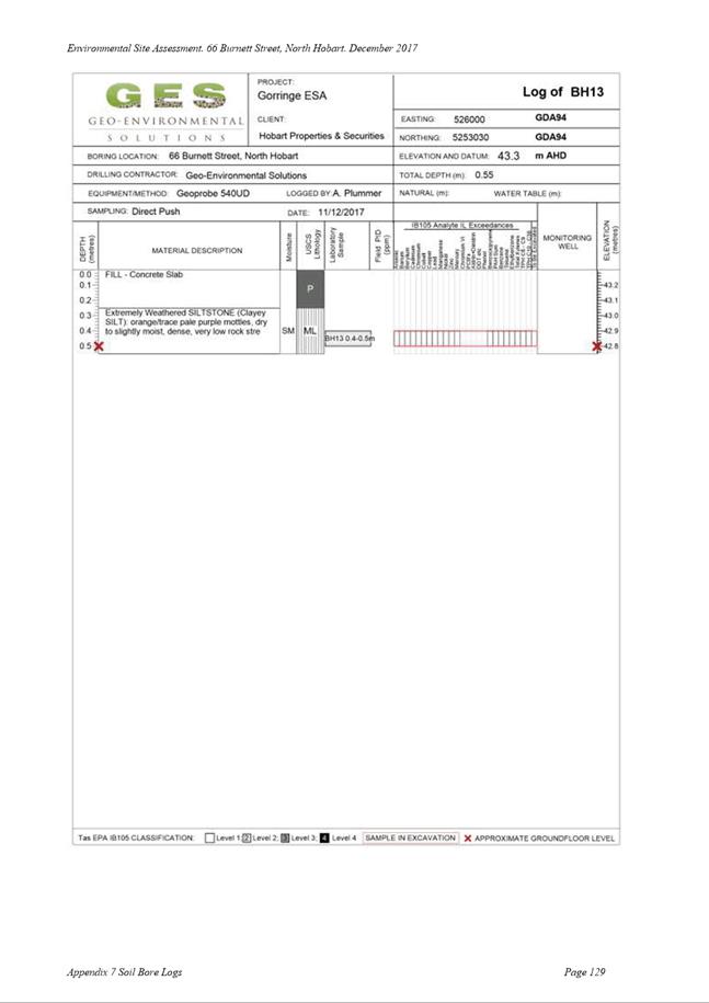
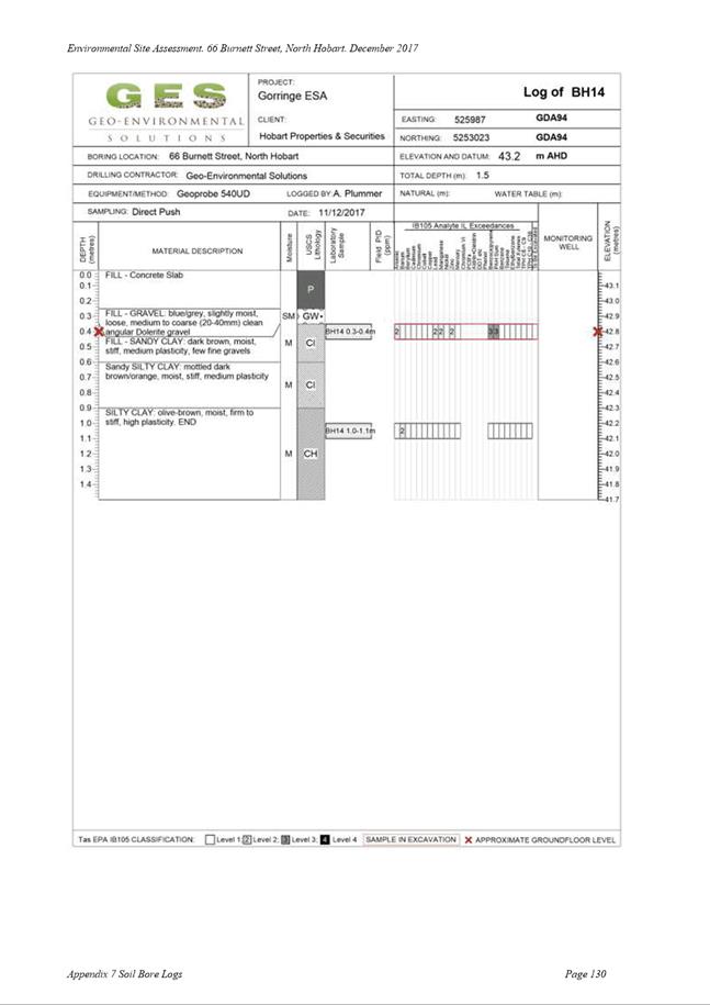
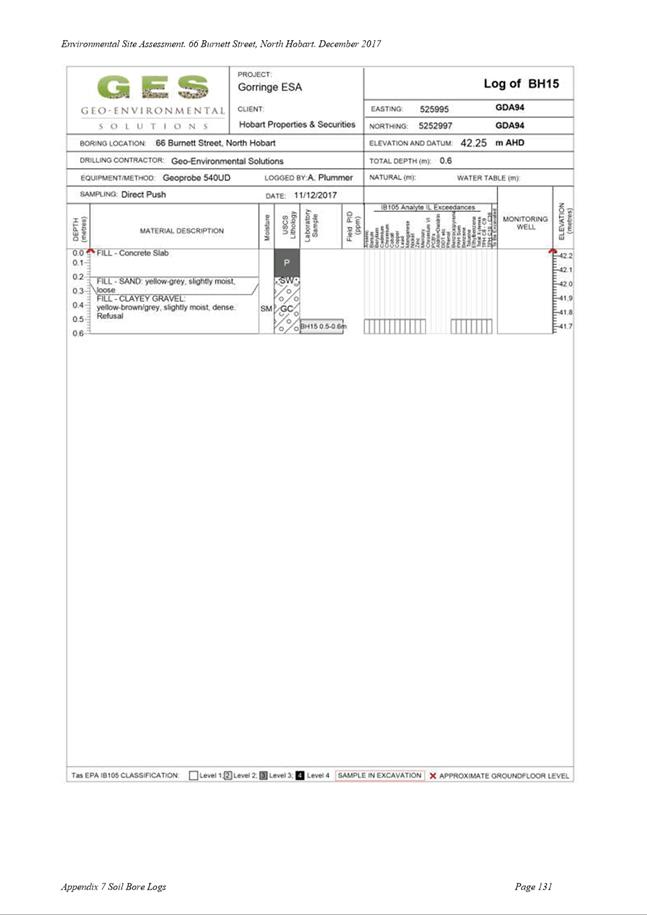
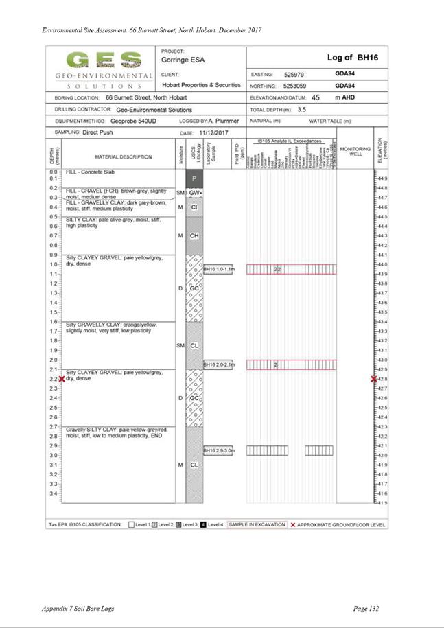
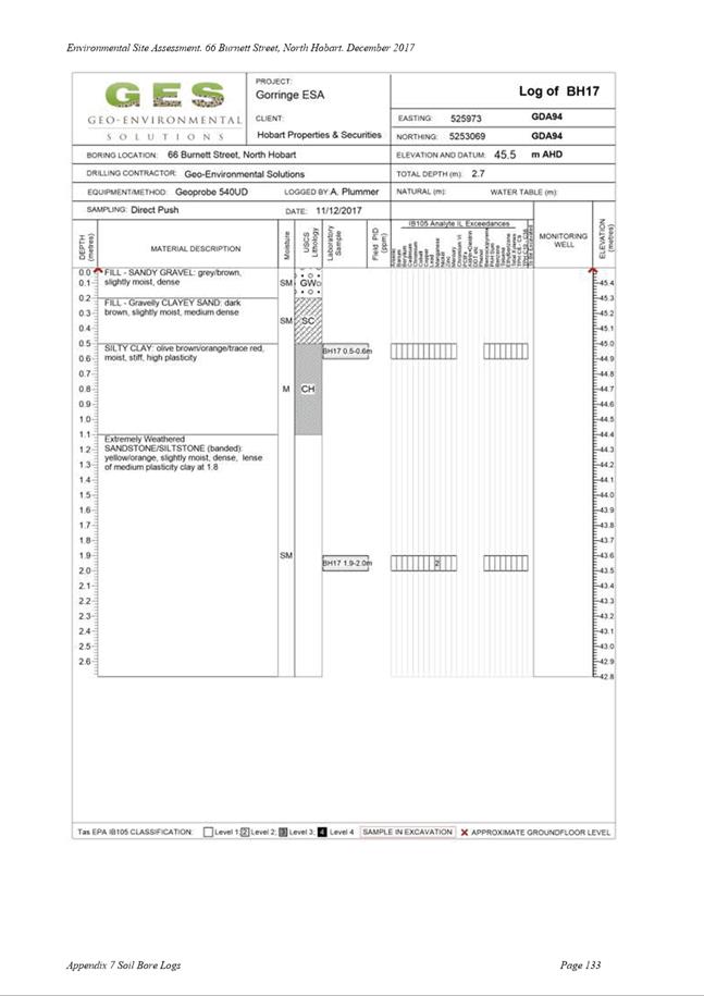
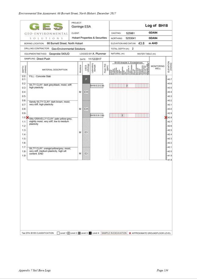
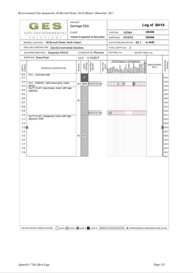
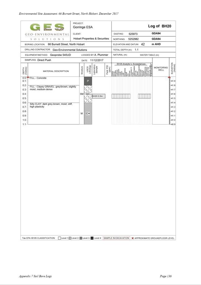
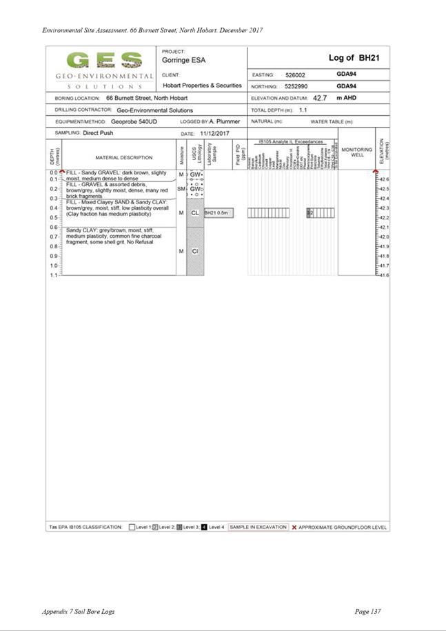
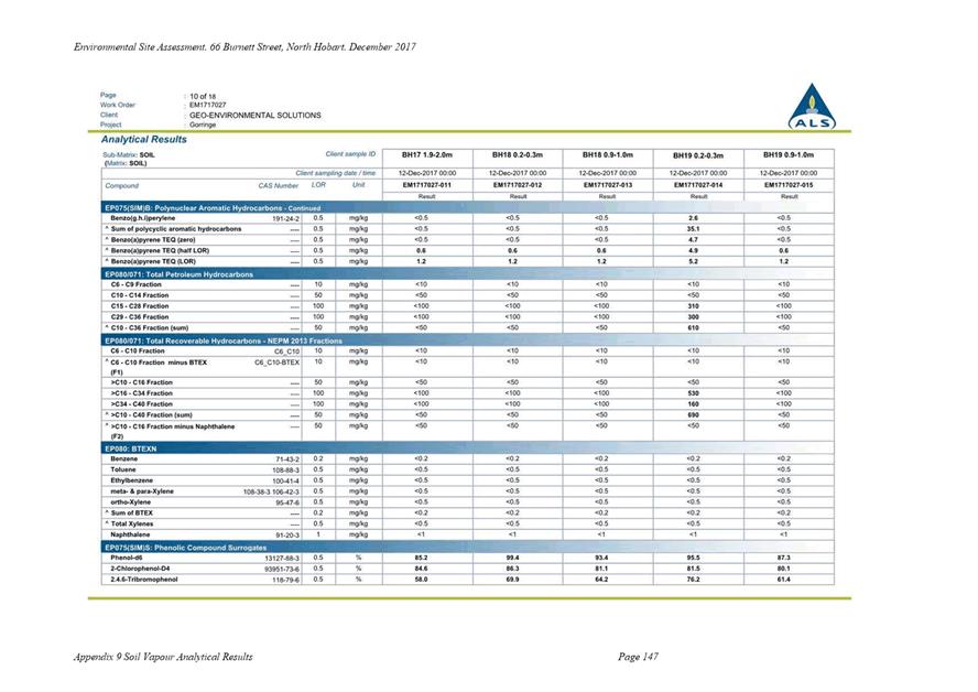
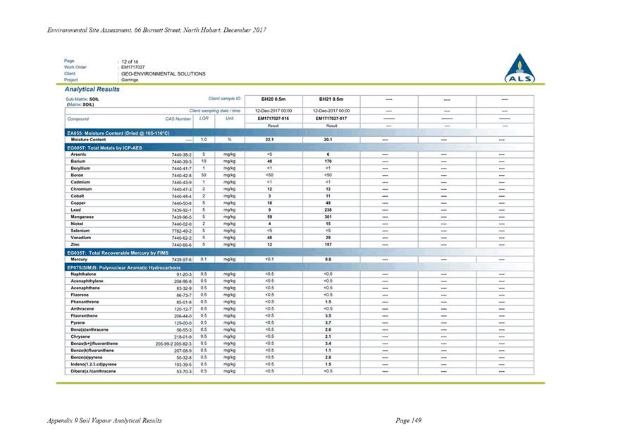
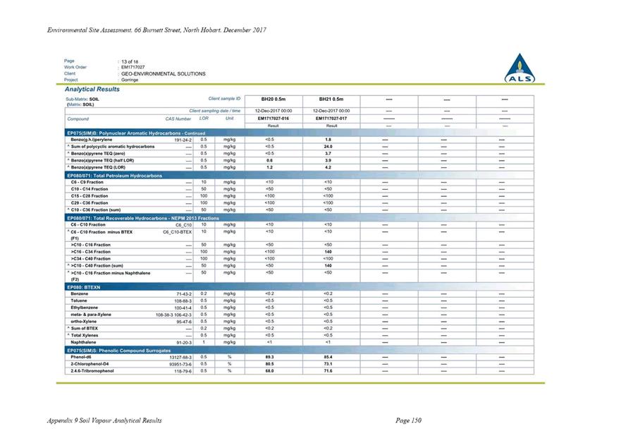
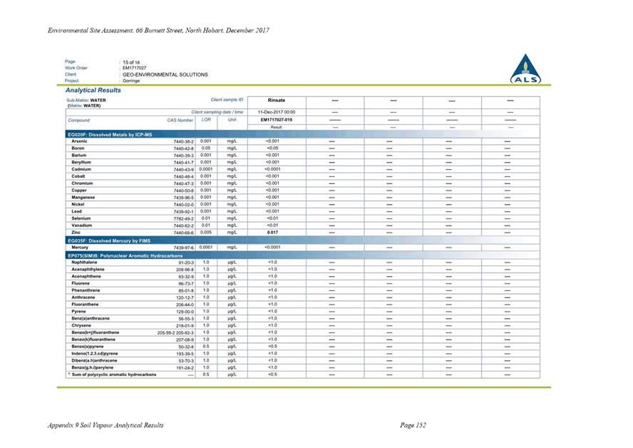
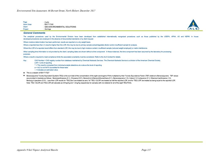
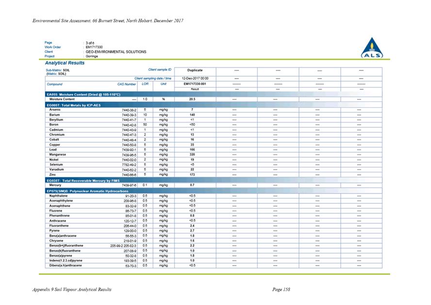
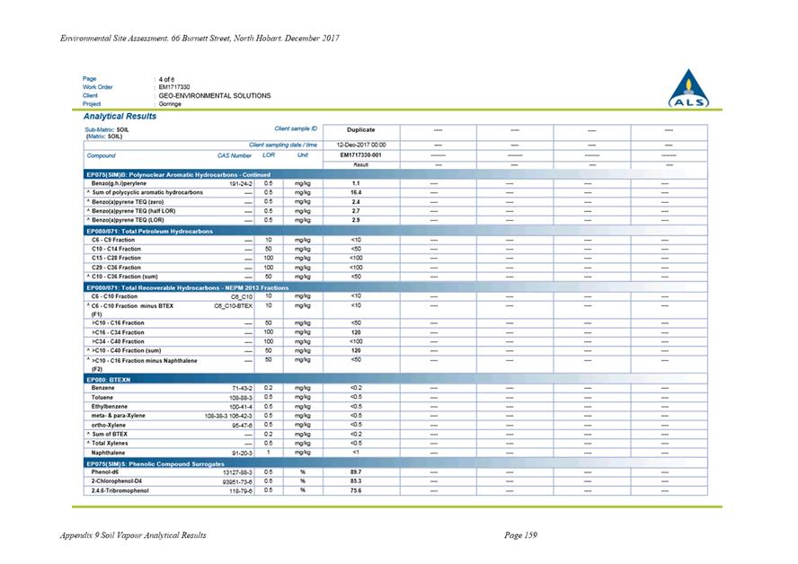
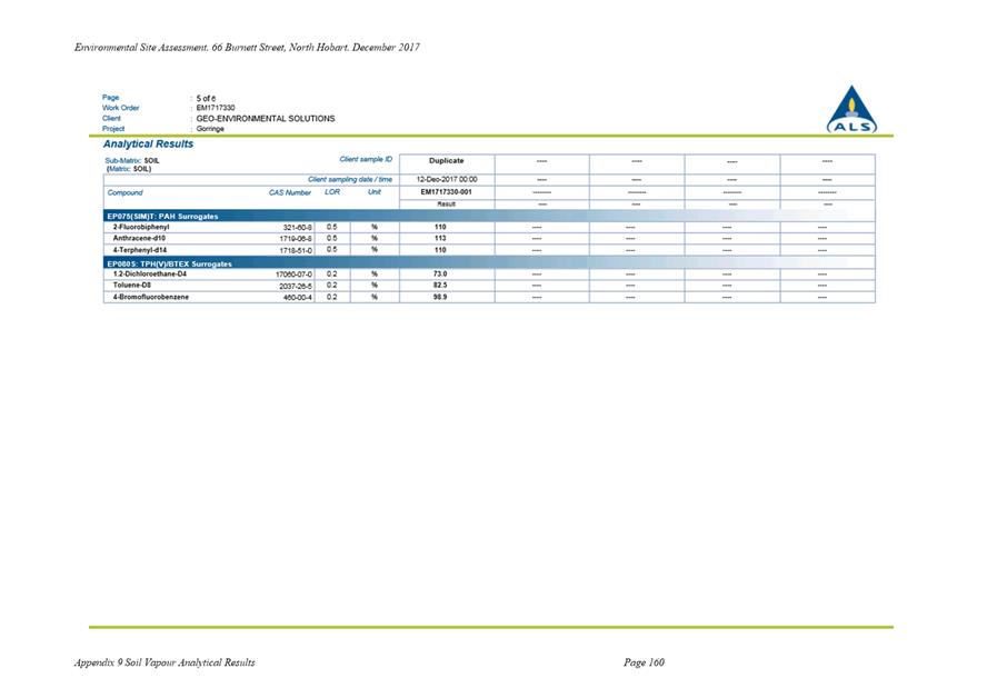
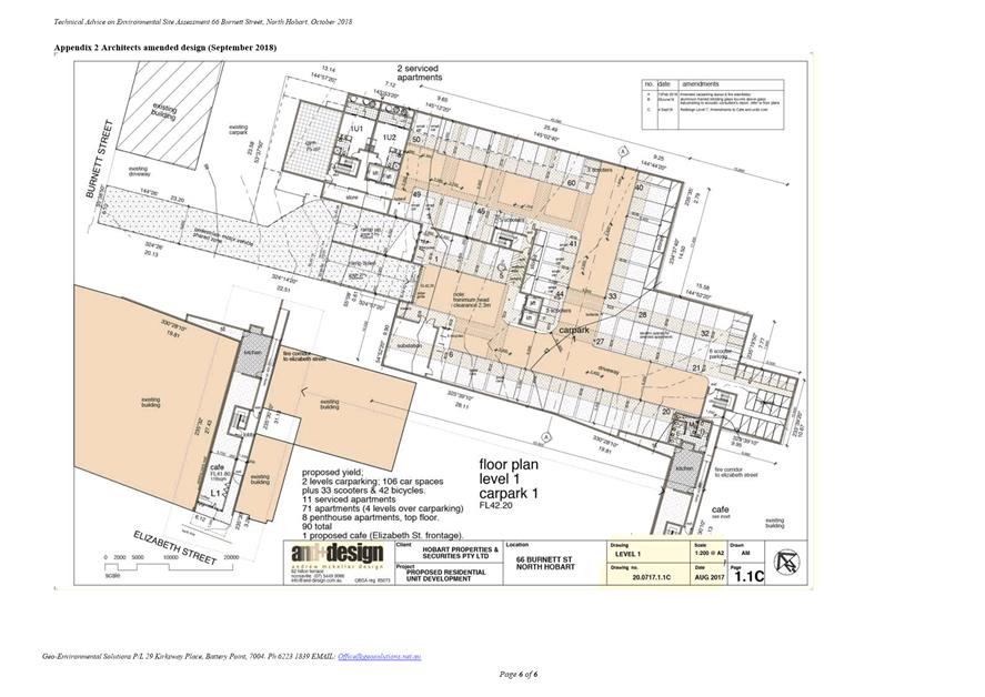
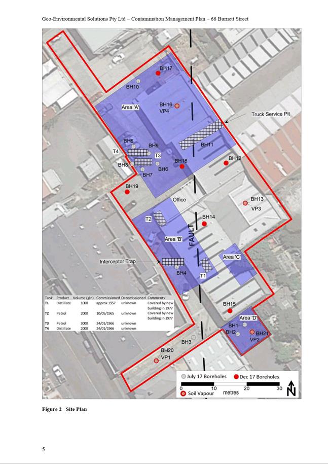
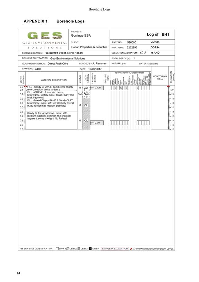
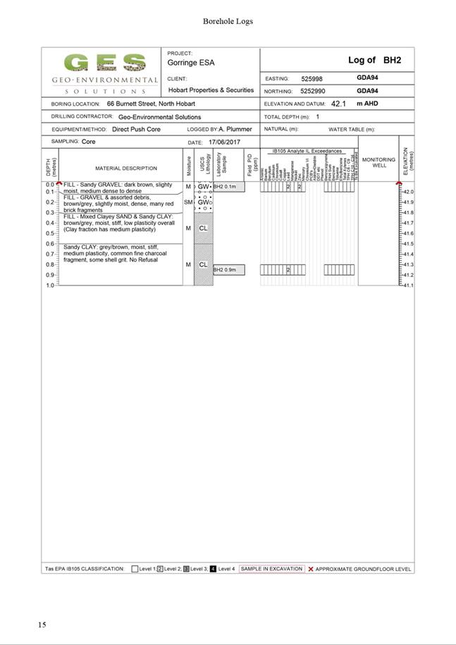
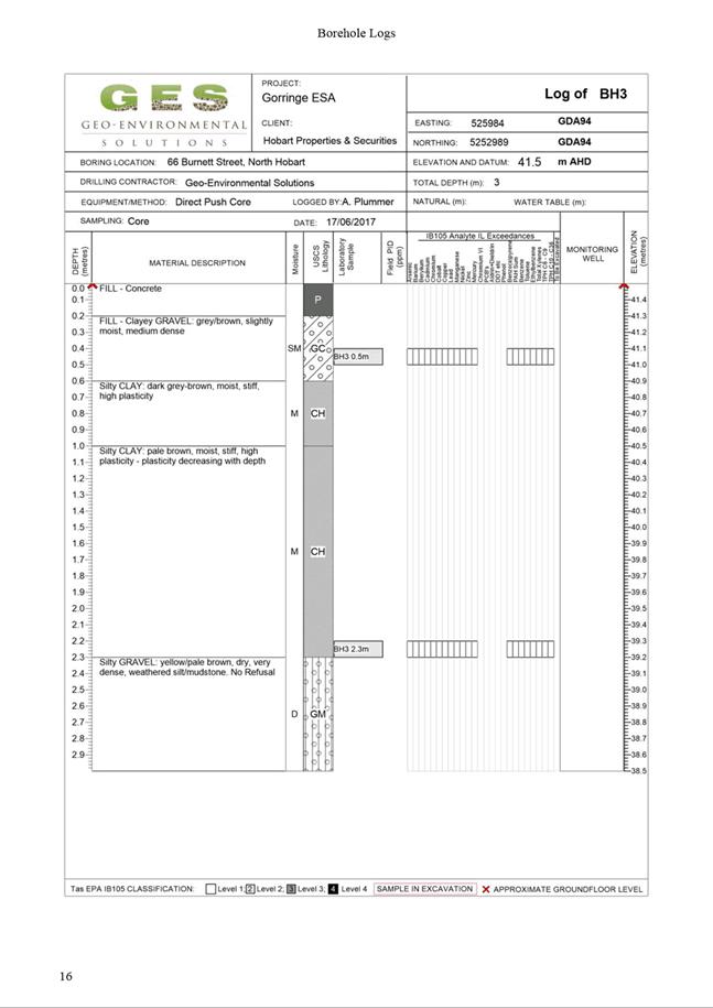
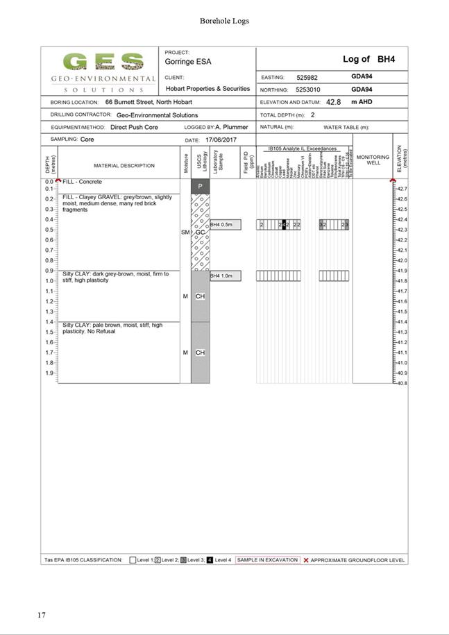
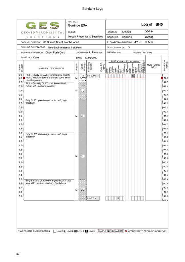
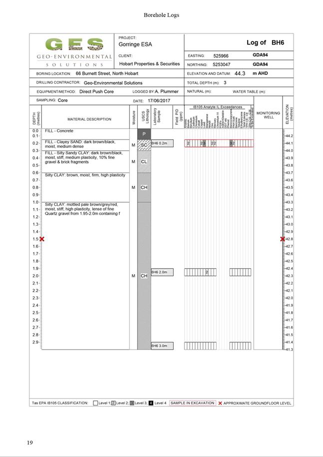
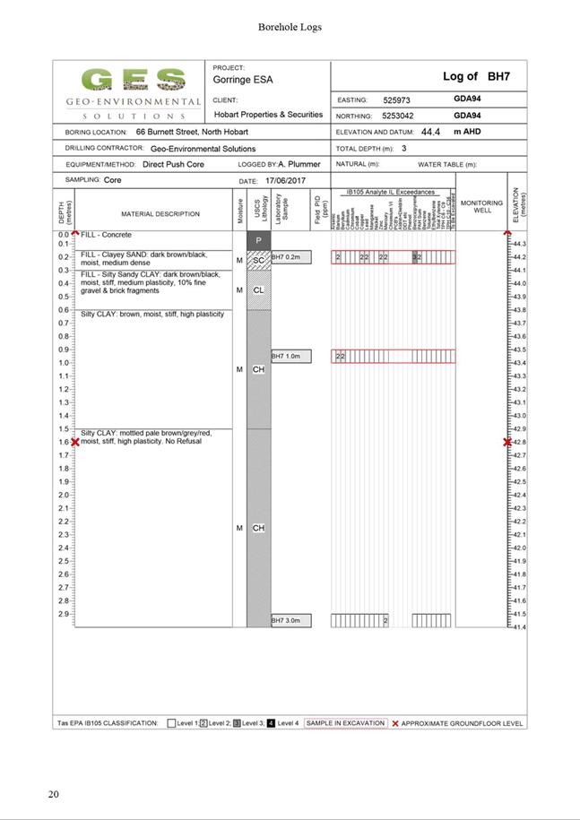
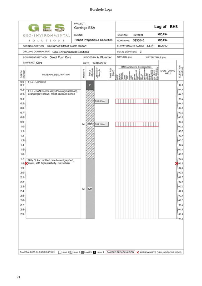
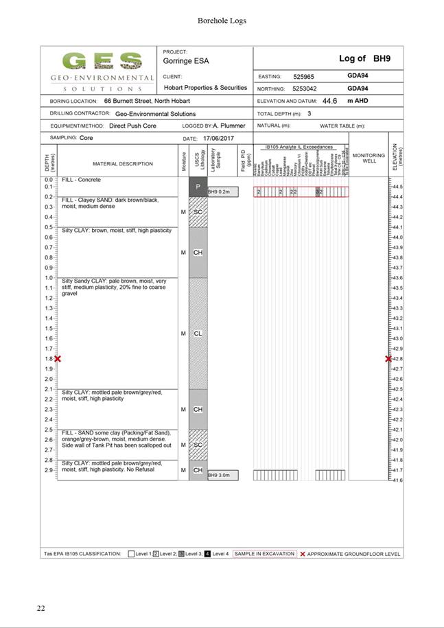
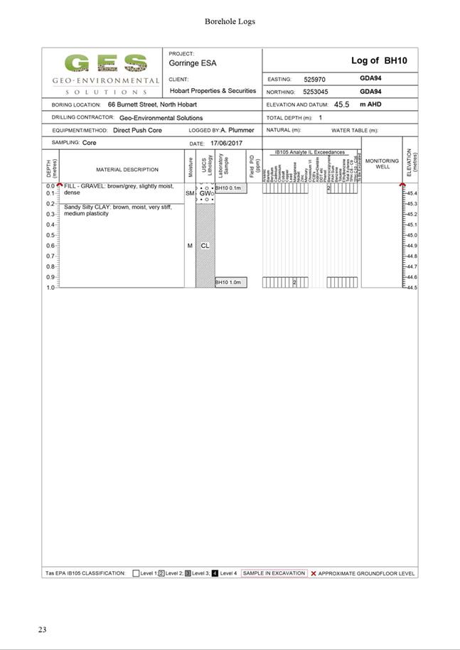
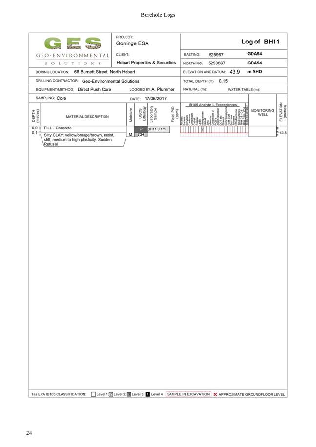
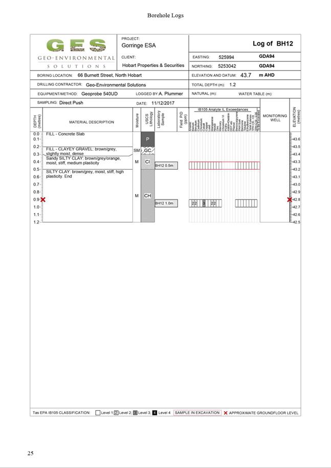
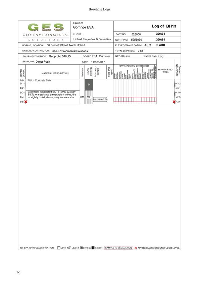
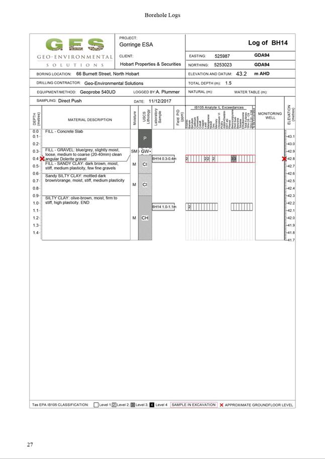
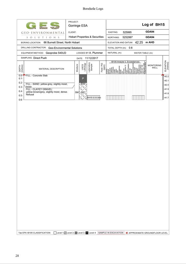
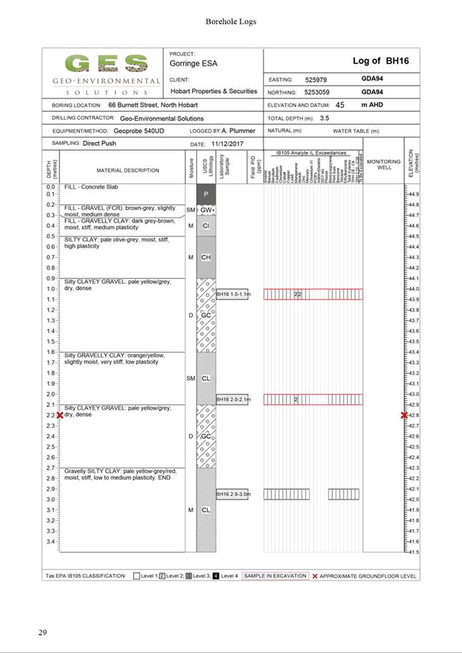
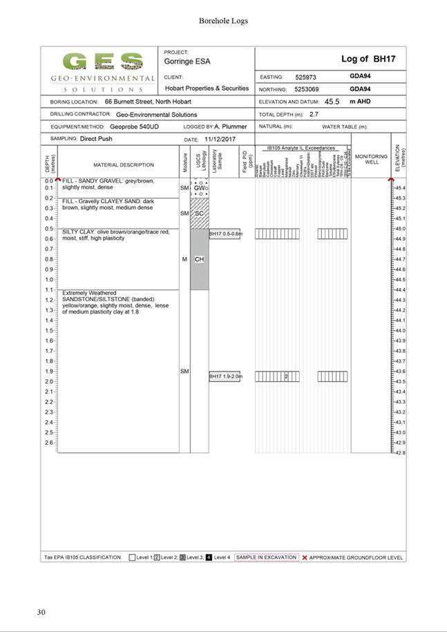
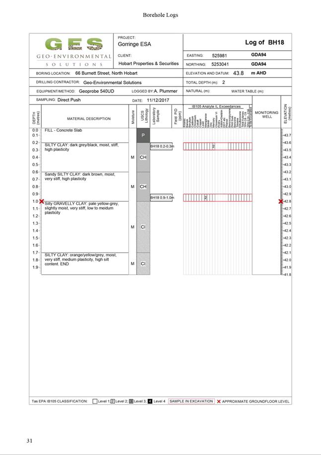
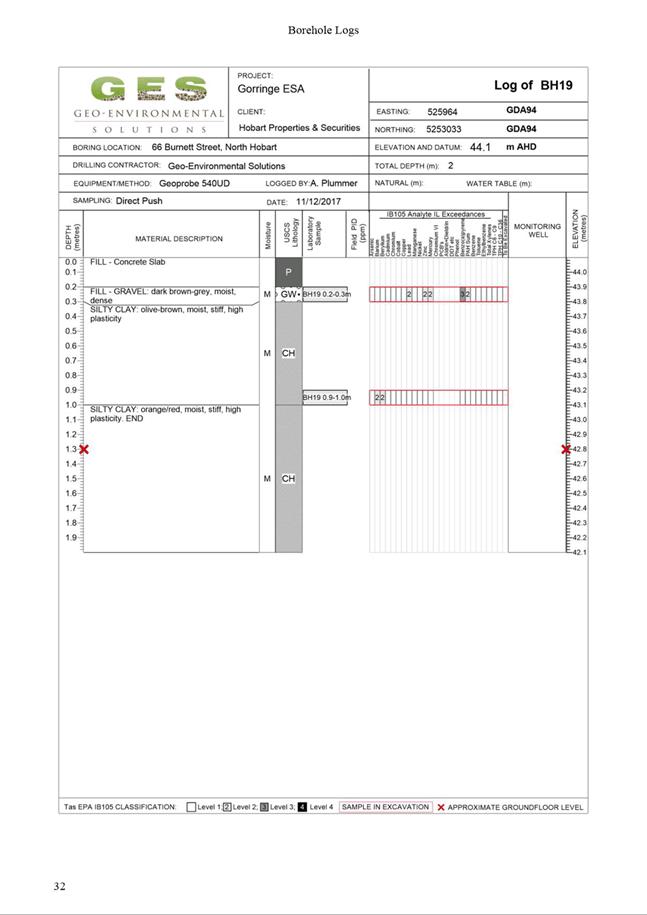
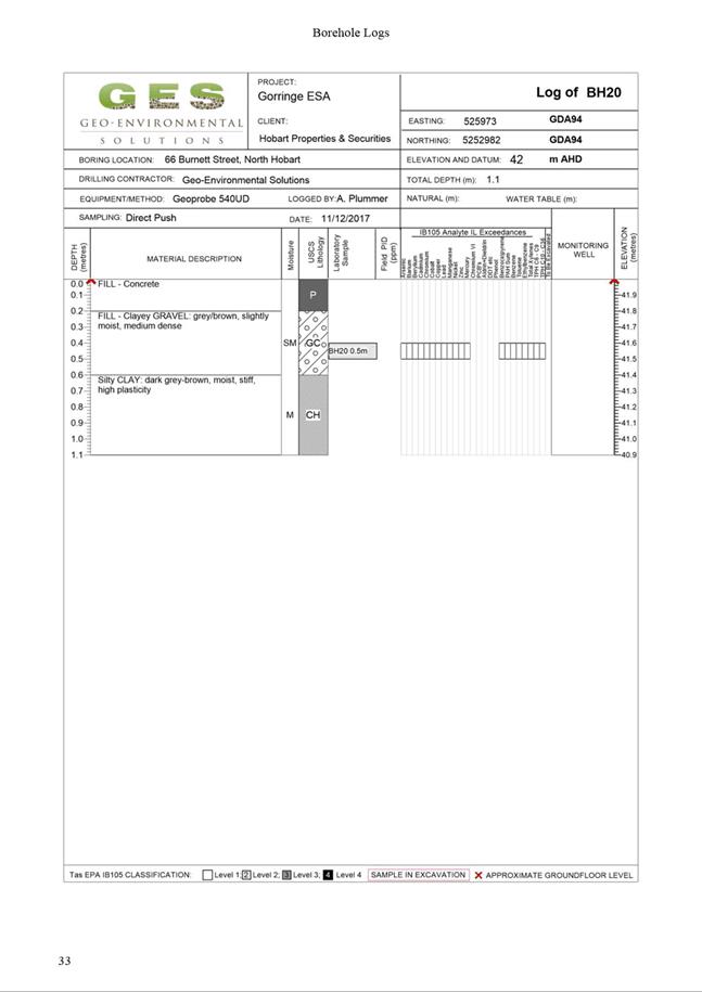
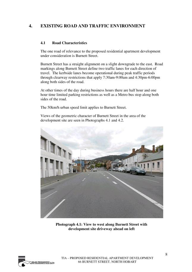
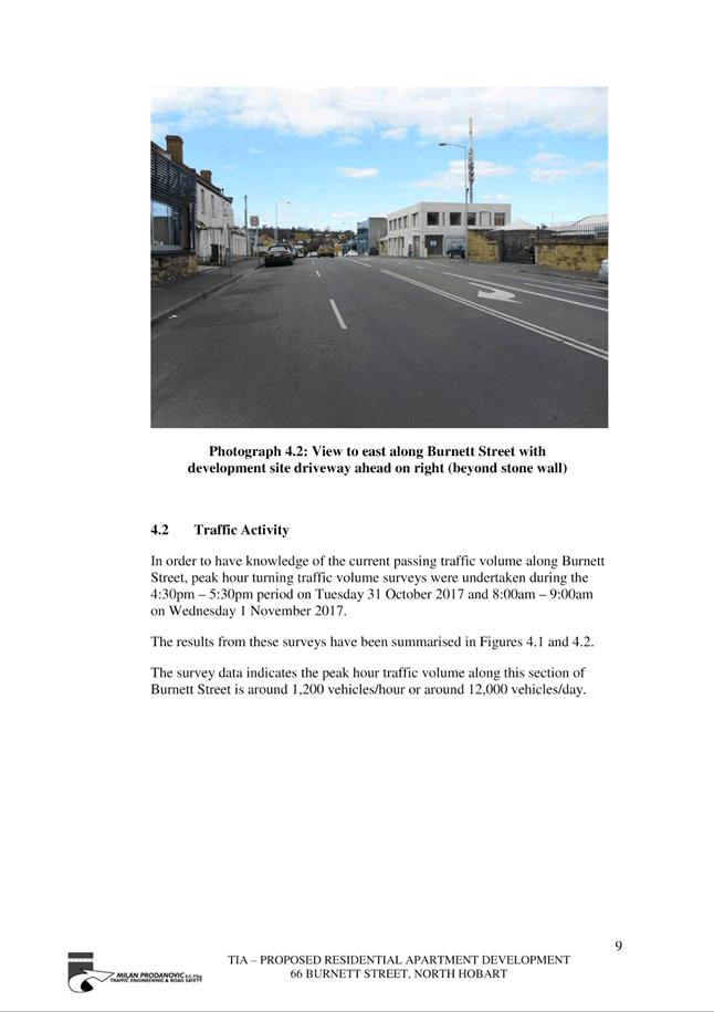
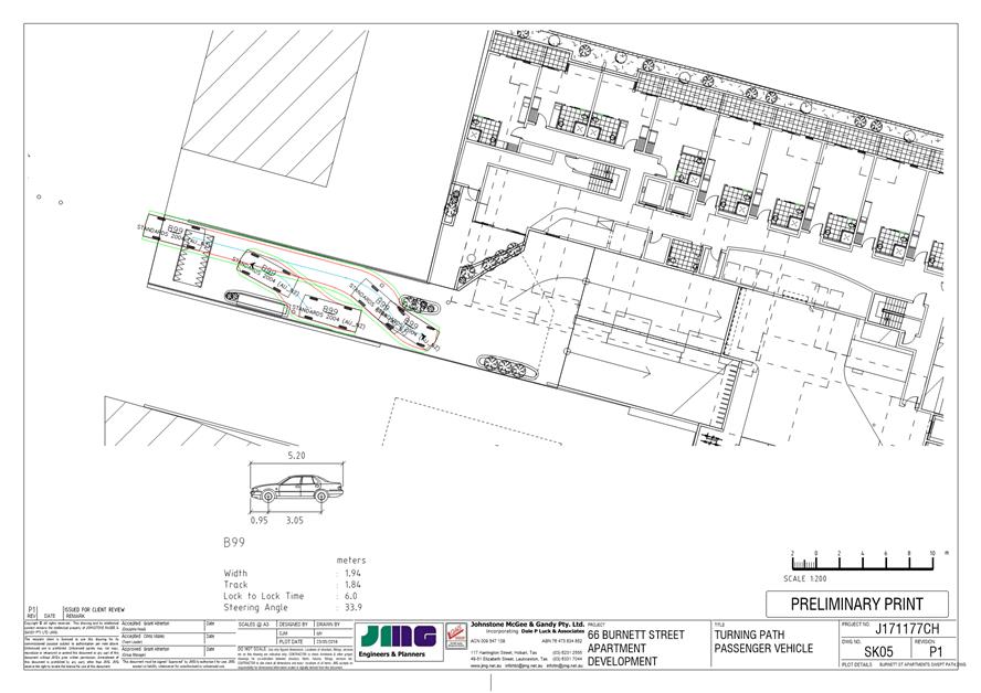
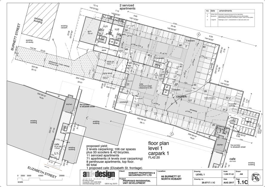
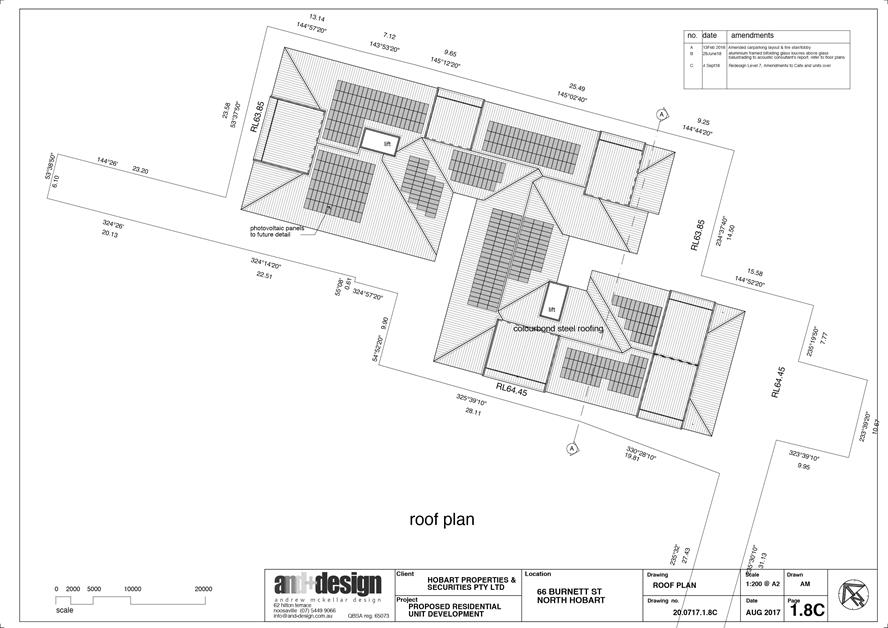
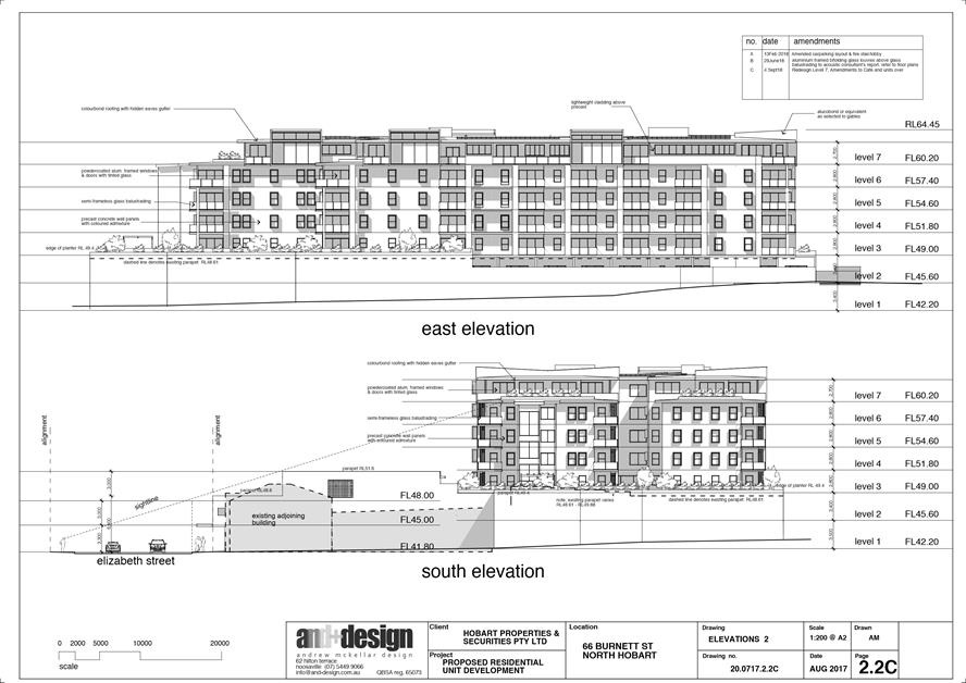
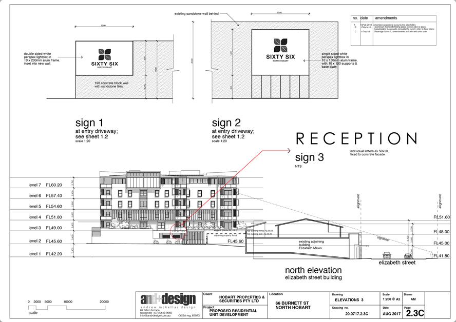
2.2.3 66 Burnett Street, North Hobart Adjacent Road Reserve - Demolition and New Building for 68 Multiple Dwellings, 22 Visitor Accommodation Units, Food Services, and Signage
Address: 66 Burnett Street, North Hobart Adjacent Road Reserve
Proposal: Demolition and New Building for 68 Multiple Dwellings, 22 Visitor Accommodation Units, Food Services, and Signage
Expiry Date: 21 November 2018
Extension of Time: Not applicable
Author: Adam Smee
|
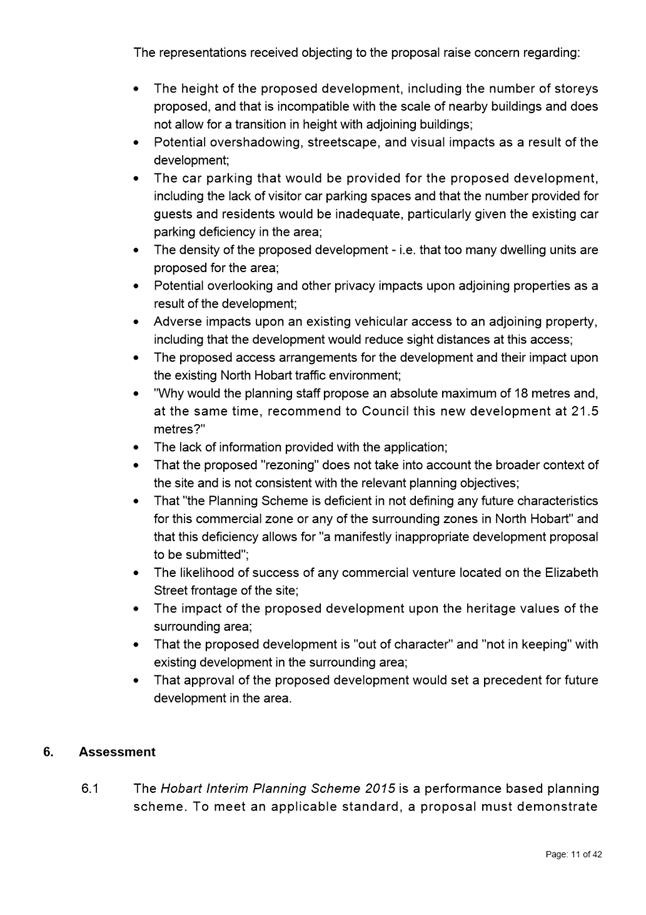
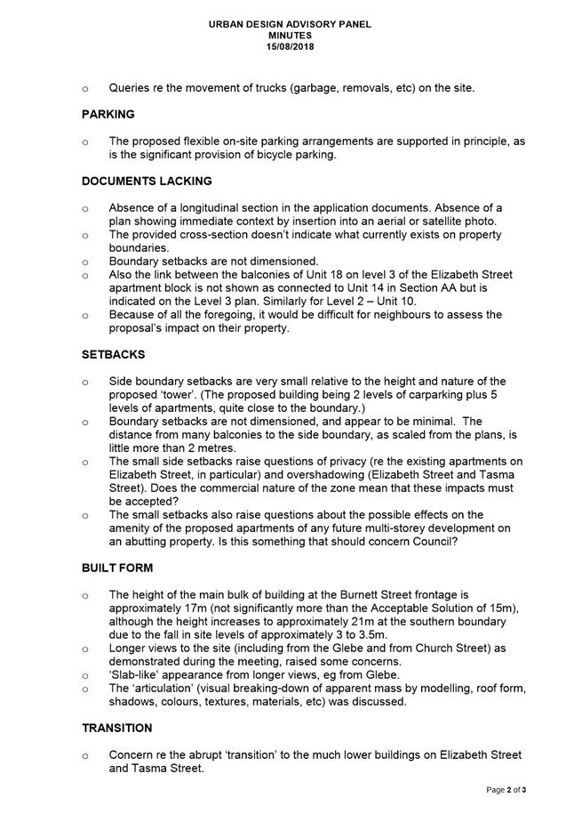
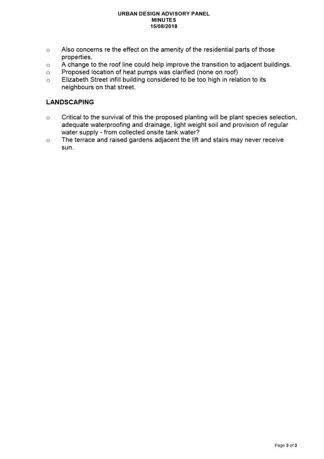
REcommendation That: Pursuant to the Hobart Interim Planning Scheme 2015, the Council refuse the application for demolition and new building for multiple dwellings, visitor accommodation and food services at 66 Burnett Street, North Hobart for the following reasons:
1. The proposal does not meet the acceptable solution or the performance criterion with respect to clause 23.4.1 A1 or P1 of the Hobart Interim Planning Scheme 2015 because:
a) the building
height of the proposed development would not be compatible with the scale of nearby buildings; and, b) the building height of the proposed development would not allow for a transition in height between adjoining buildings.
|
Attachment a: PLN-17-1066
- 66 BURNETT STREET NORTH HOBART TAS 7000 - Planning Committee or Delegated
Report ⇩ ![]()
Attachment
b: PLN-17-1066
- 66 BURNETT STREET NORTH HOBART TAS 7000 - CPC Agenda Documents ⇩ ![]()
Attachment
c: PLN-17-1066
- 66 BURNETT STREET NORTH HOBART TAS 7000 - Referral Officer Report - Cultural
Heritage Officer ⇩ ![]()
Attachment
d: PLN-17-1066
- 66 BURNETT STREET NORTH HOBART TAS 7000 - UDAP Minutes - 15 August 2018 ⇩ ![]()
Attachment
e: PLN-17-1066
- 66 BURNETT STREET NORTH HOBART TAS 7000 - Referral Officer Report -
Environmental Development Planner ⇩ ![]()
Attachment
f: PLN-17-1066
- 66 BURNETT STREET NORTH HOBART TAS 7000 - UDAP Minutes - 23 October 2018 ⇩ ![]()
|
Item No. 2.2.3 |
Agenda (Open Portion) Special City Planning Committee Meeting - 13/11/2018 |
Page 295 ATTACHMENT a |


|
Agenda (Open Portion) Special City Planning Committee Meeting - 13/11/2018 |
Page 337 ATTACHMENT b |


|
Item No. 2.2.3 |
Agenda (Open Portion) Special City Planning Committee Meeting - 13/11/2018 |
Page 351 ATTACHMENT b |


|
Item No. 2.2.3 |
Agenda (Open Portion) Special City Planning Committee Meeting - 13/11/2018 |
Page 472 ATTACHMENT b |
|
Item No. 2.2.3 |
Agenda (Open Portion) Special City Planning Committee Meeting - 13/11/2018 |
Page 473 ATTACHMENT b |


|
Item No. 2.2.3 |
Agenda (Open Portion) Special City Planning Committee Meeting - 13/11/2018 |
Page 513 ATTACHMENT b |
|
Item No. 2.2.3 |
Agenda (Open Portion) Special City Planning Committee Meeting - 13/11/2018 |
Page 514 ATTACHMENT b |


|
Item No. 2.2.3 |
Agenda (Open Portion) Special City Planning Committee Meeting - 13/11/2018 |
Page 551 ATTACHMENT b |


|
Item No. 2.2.3 |
Agenda (Open Portion) Special City Planning Committee Meeting - 13/11/2018 |
Page 588 ATTACHMENT b |
|
Item No. 2.2.3 |
Agenda (Open Portion) Special City Planning Committee Meeting - 13/11/2018 |
Page 609 ATTACHMENT b |


|
Item No. 2.2.3 |
Agenda (Open Portion) Special City Planning Committee Meeting - 13/11/2018 |
Page 634 ATTACHMENT b |


|
Item No. 2.2.3 |
Agenda (Open Portion) Special City Planning Committee Meeting - 13/11/2018 |
Page 645 ATTACHMENT b |
|
Item No. 2.2.3 |
Agenda (Open Portion) Special City Planning Committee Meeting - 13/11/2018 |
Page 648 ATTACHMENT b |


|
Item No. 2.2.3 |
Agenda (Open Portion) Special City Planning Committee Meeting - 13/11/2018 |
Page 698 ATTACHMENT b |
|
Item No. 2.2.3 |
Agenda (Open Portion) Special City Planning Committee Meeting - 13/11/2018 |
Page 701 ATTACHMENT b |
|
Item No. 2.2.3 |
Agenda (Open Portion) Special City Planning Committee Meeting - 13/11/2018 |
Page 702 ATTACHMENT b |
|
Item No. 2.2.3 |
Agenda (Open Portion) Special City Planning Committee Meeting - 13/11/2018 |
Page 703 ATTACHMENT b |
|
Item No. 2.2.3 |
Agenda (Open Portion) Special City Planning Committee Meeting - 13/11/2018 |
Page 704 ATTACHMENT b |
|
Item No. 2.2.3 |
Agenda (Open Portion) Special City Planning Committee Meeting - 13/11/2018 |
Page 705 ATTACHMENT b |


|
Item No. 2.2.3 |
Agenda (Open Portion) Special City Planning Committee Meeting - 13/11/2018 |
Page 739 ATTACHMENT b |


|
Item No. 2.2.3 |
Agenda (Open Portion) Special City Planning Committee Meeting - 13/11/2018 |
Page 758 ATTACHMENT b |
|
Item No. 2.2.3 |
Agenda (Open Portion) Special City Planning Committee Meeting - 13/11/2018 |
Page 764 ATTACHMENT c |
|
Agenda (Open Portion) Special City Planning Committee Meeting - 13/11/2018 |
Page 767 ATTACHMENT d |
|
Agenda (Open Portion) Special City Planning Committee Meeting - 13/11/2018 |
Page 770 ATTACHMENT e |
|
Agenda (Open Portion) Special City Planning Committee Meeting - 13/11/2018 |
Page 774 ATTACHMENT f |

|
Agenda (Open Portion) Special City Planning Committee Meeting |
Page 776 |
|
|
|
13/11/2018 |
|
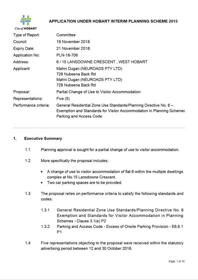
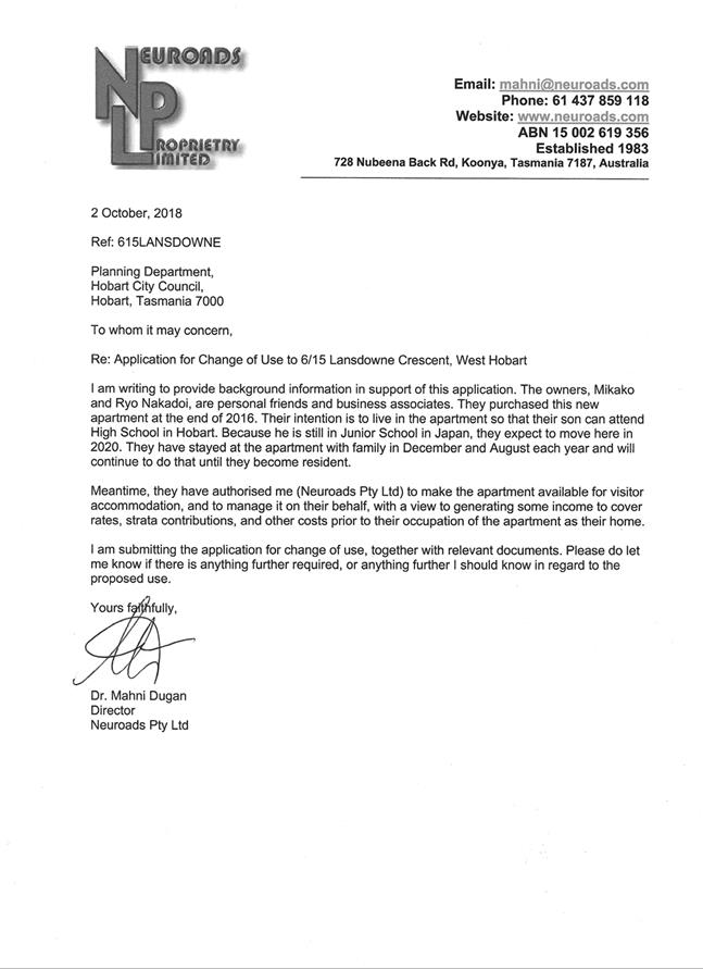
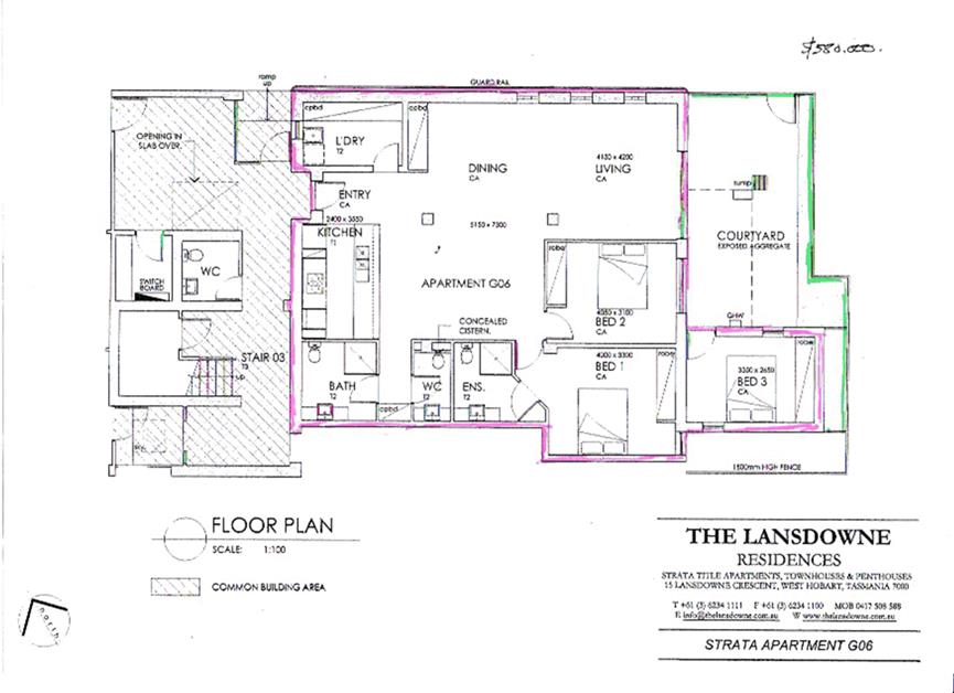
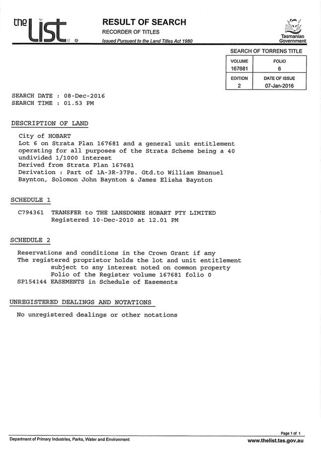
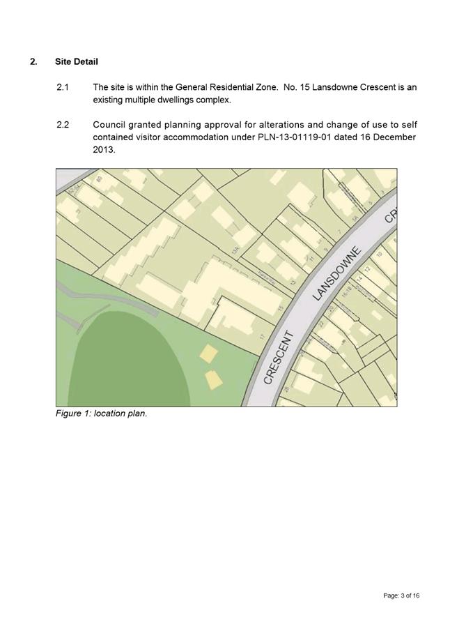
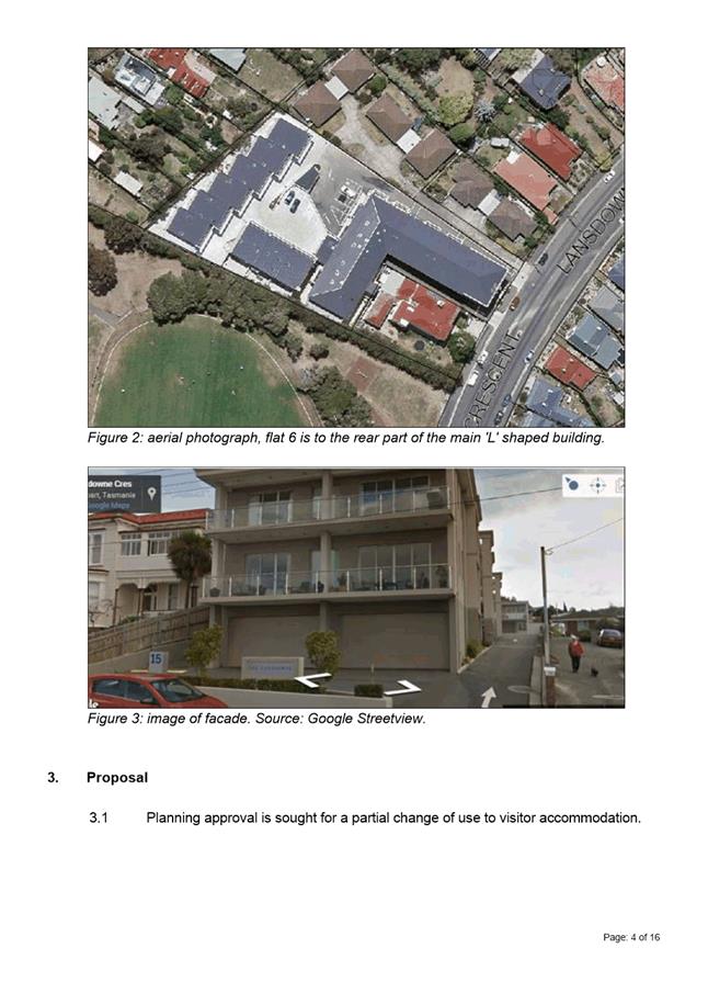
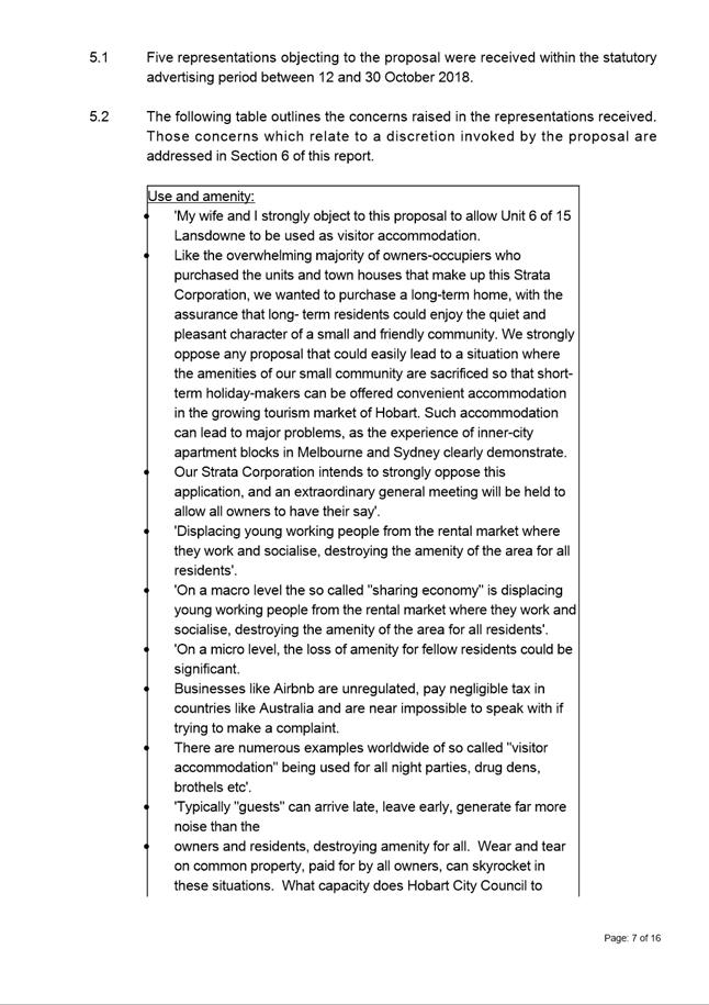
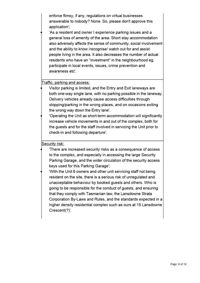
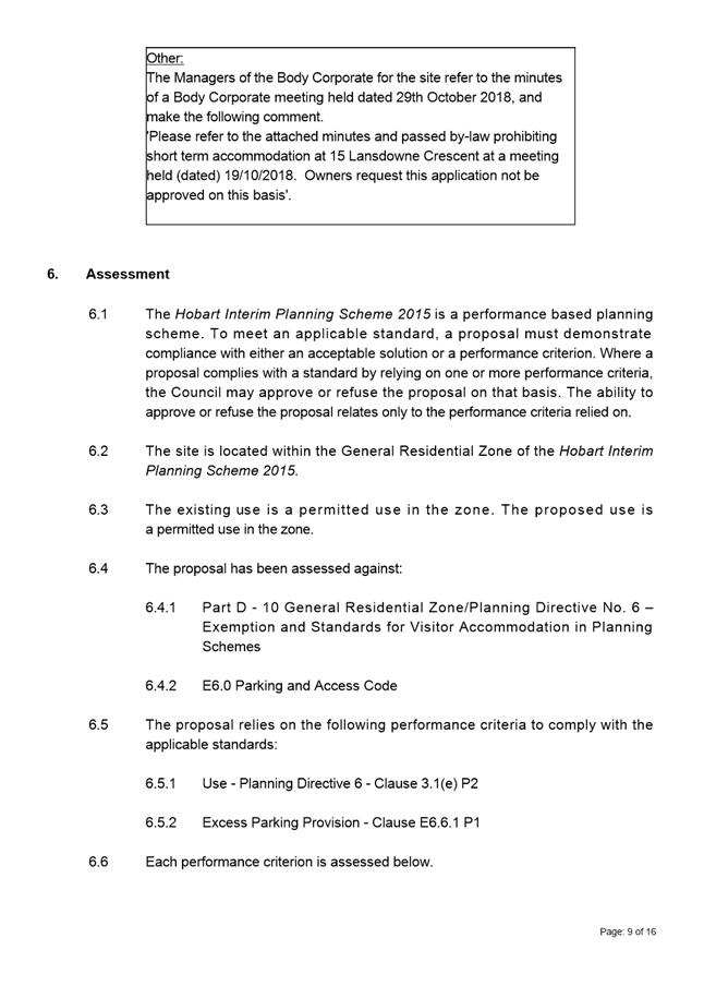
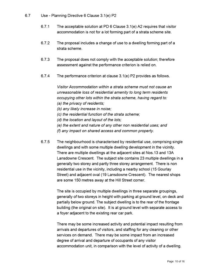
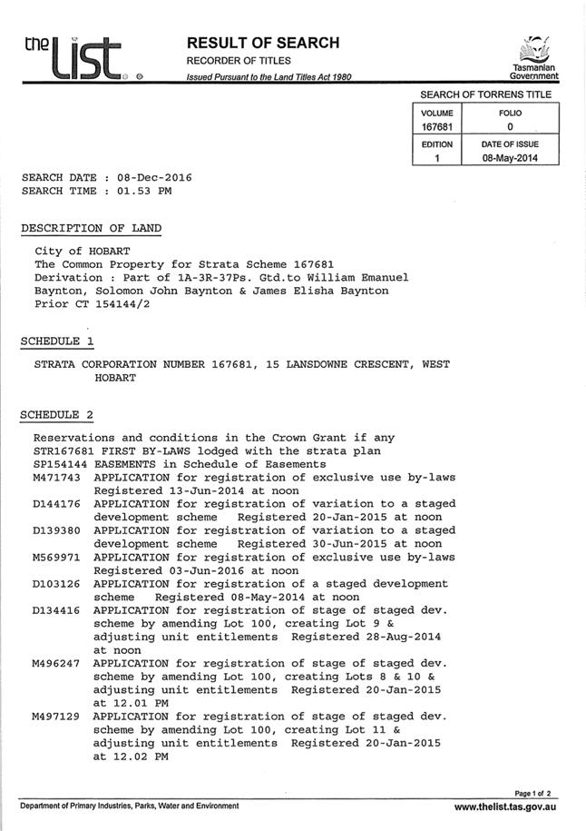
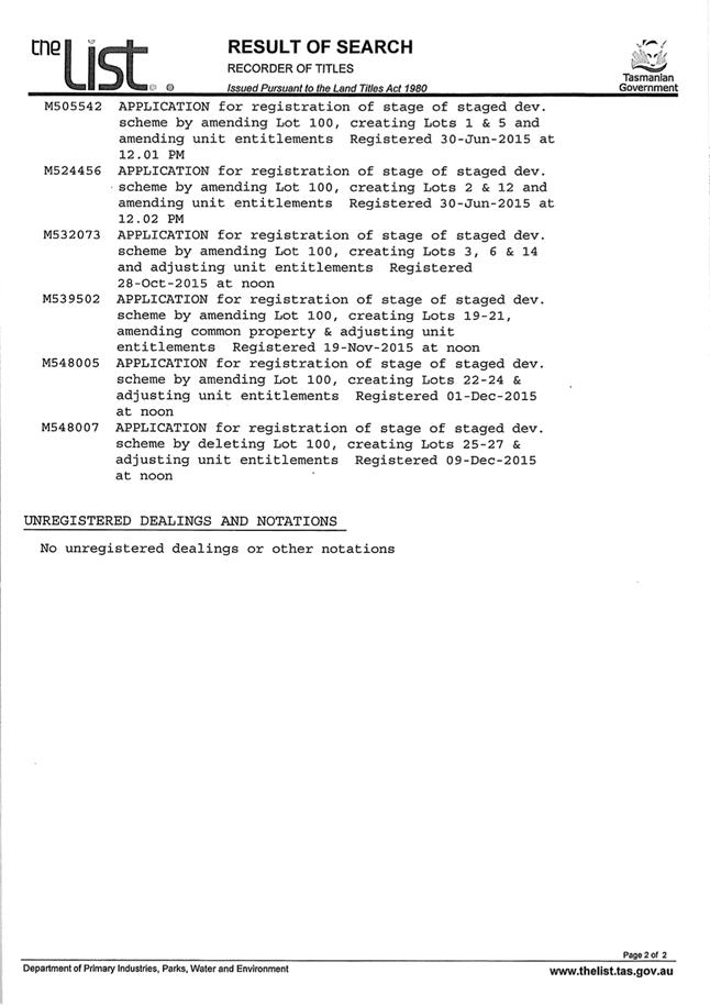
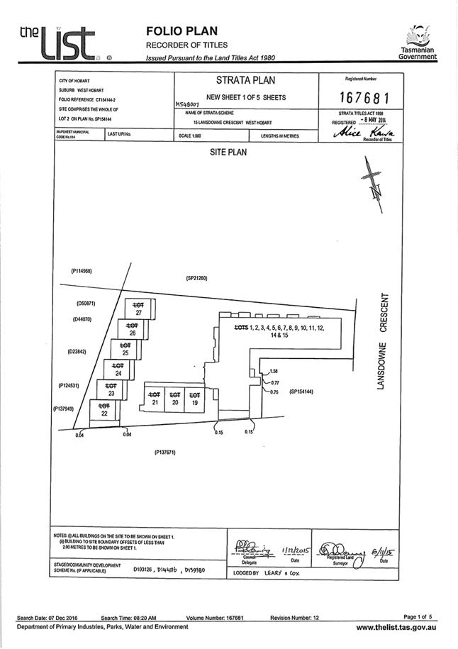
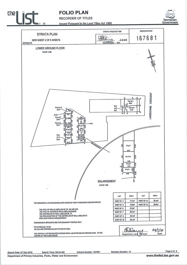
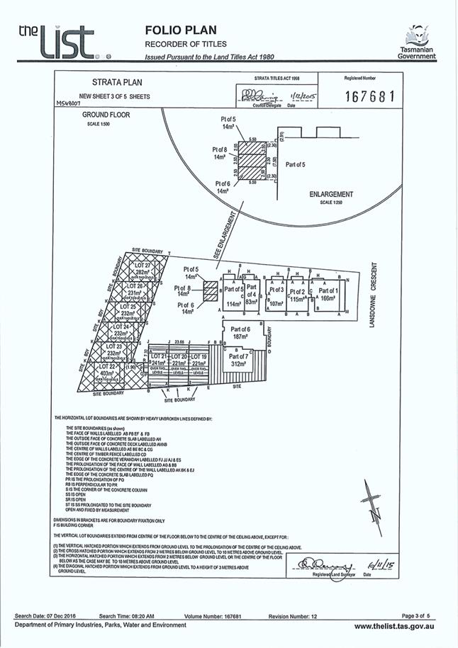
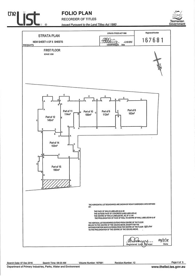
2.2.4 6 / 15 Lansdowne Crescent, West Hobart - Partial Change of Use to Visitor Accommodation
Address: 6 / 15 Lansdowne Crescent, West Hobart
Proposal: Partial Change of Use to Visitor Accommodation
Expiry Date: 21 November 2018
Extension of Time: Not applicable
Author: Richard Bacon
|
REcommendation That: Pursuant to the Hobart Interim Planning Scheme 2015, the Council approve the application for a partial change of use to visitor accommodation at 6/15 Lansdowne Crescent West Hobart TAS 7000 for the reasons outlined in the officer’s report and a permit containing the following conditions be issued:
GEN
The use and/or development must be substantially in accordance with the documents and drawings that comprise PLN18706 6/15 LANSDOWNE CRESCENT WEST HOBART TAS 7000 Final Planning Documents except where modified below.
Reason for condition
To clarify the scope of the permit.
ADVICE
The following advice is provided to you to assist in the implementation of the planning permit that has been issued subject to the conditions above. The advice is not exhaustive and you must inform yourself of any other legislation, bylaws, regulations, codes or standards that will apply to your development under which you may need to obtain an approval. Visit the Council's website for further information.
Prior to any commencement of work on the site or commencement of use the following additional permits/approval may be required from the Hobart City Council.
VISITOR ACCOMMODATION
More information on visitor accommodation, including when building approval is required, can be found here.
In all cases, check with your insurance company that you have adequate cover.
If you are in a bushfire prone area there may be a need to create/review the Bushfire Management Hazard Plan for your property.
|
Attachment a: PLN-18-706
- 6/15 LANSDOWNE CRESCENT WEST HOBART TAS 7000 - Planning Committee or Delegated
Report ⇩ ![]()
Attachment
b: PLN-18-706
- 15 LANSDOWNE CRESCENT WEST HOBART TAS 7000 - CPC Agenda Documents ⇩ ![]()
|
Item No. 2.2.4 |
Agenda (Open Portion) Special City Planning Committee Meeting - 13/11/2018 |
Page 778 ATTACHMENT a |


|
Agenda (Open Portion) Special City Planning Committee Meeting - 13/11/2018 |
Page 794 ATTACHMENT b |
|
Item No. 2.2.4 |
Agenda (Open Portion) Special City Planning Committee Meeting - 13/11/2018 |
Page 795 ATTACHMENT b |
|
Item No. 2.2.4 |
Agenda (Open Portion) Special City Planning Committee Meeting - 13/11/2018 |
Page 796 ATTACHMENT b |
|
Item No. 2.2.5 |
Agenda (Open Portion) Special City Planning Committee Meeting |
Page 806 |
|
|
13/11/2018 |
|
2.2.5 3 Raymont Terrace Mount Stuart - Alterations
Address: 3 Raymont Terrace, Mount Stuart
Proposal: Alterations
Expiry Date: 30 November 2018
Extension of Time: Not applicable
Author: Richard Bacon
|
REcommendation That: Pursuant to the Hobart Interim Planning Scheme 2015, the Council approve the application for alterations at 3 Raymont Terrace Mount Stuart for the reasons outlined in the officer’s report and a permit containing the following conditions be issued:
GEN
The use and/or development must be substantially in accordance with the documents and drawings that comprise PLN18227 3 Raymont Terrace Mount Stuart TAS 7000 Final Planning Documents except where modified below.
Reason for condition
To clarify the scope of the permit.
ADVICE
The following advice is provided to you to assist in the implementation of the planning permit that has been issued subject to the conditions above. The advice is not exhaustive and you must inform yourself of any other legislation, bylaws, regulations, codes or standards that will apply to your development under which you may need to obtain an approval. Visit the Council's website for further information.
Prior to any commencement of work on the site or commencement of use the following additional permits/approval may be required from the Hobart City Council.
BUILDING PERMIT
You may need building approval in accordance with the Building Act 2016. Click here for more information.
This is a Discretionary Planning Permit issued in accordance with section 57 of the Land Use Planning and Approvals Act 1993.
|
Attachment a: PLN-18-227
- 3 RAYMONT TERRACE MOUNT STUART TAS 7000 - Planning Committee or Delegated
Report ⇩ ![]()
Attachment
b: PLN-18-227
- 3 RAYMONT TERRACE MOUNT STUART TAS 7000 - CPC Agenda Documents ⇩ ![]()
|
Item No. 2.2.5 |
Agenda (Open Portion) Special City Planning Committee Meeting - 13/11/2018 |
Page 808 ATTACHMENT a |
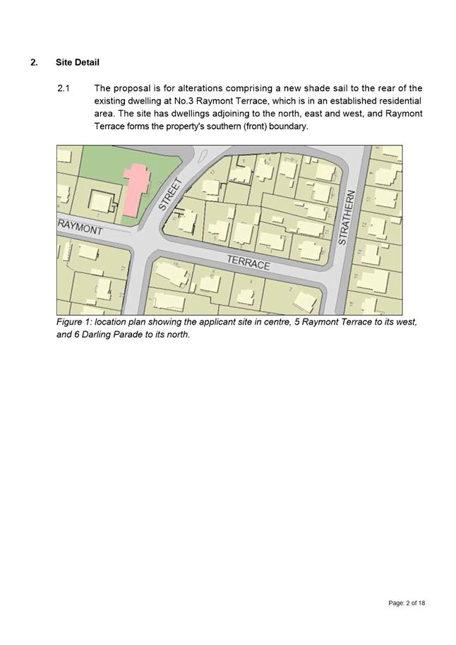
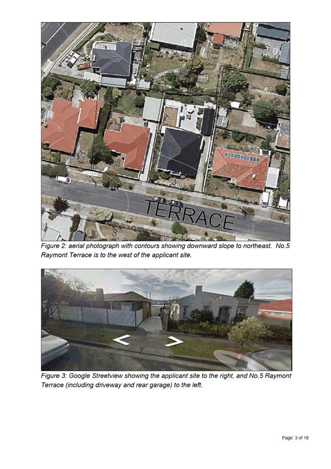
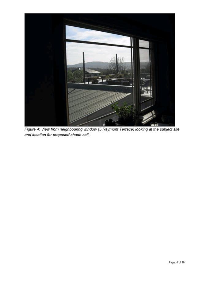
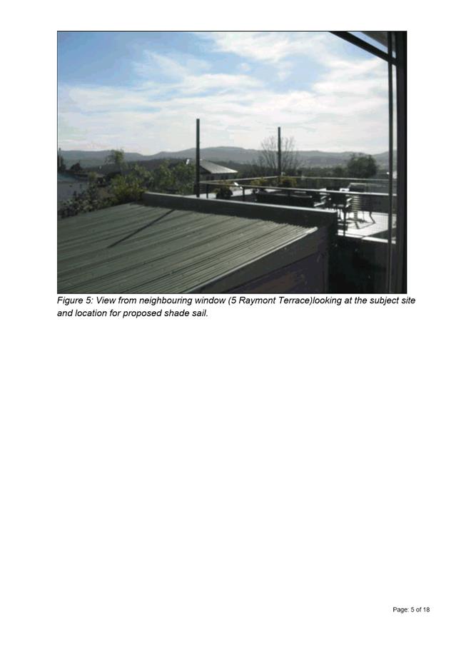
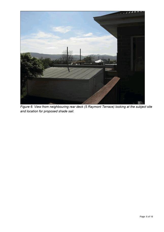
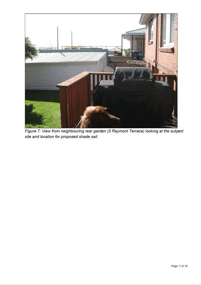
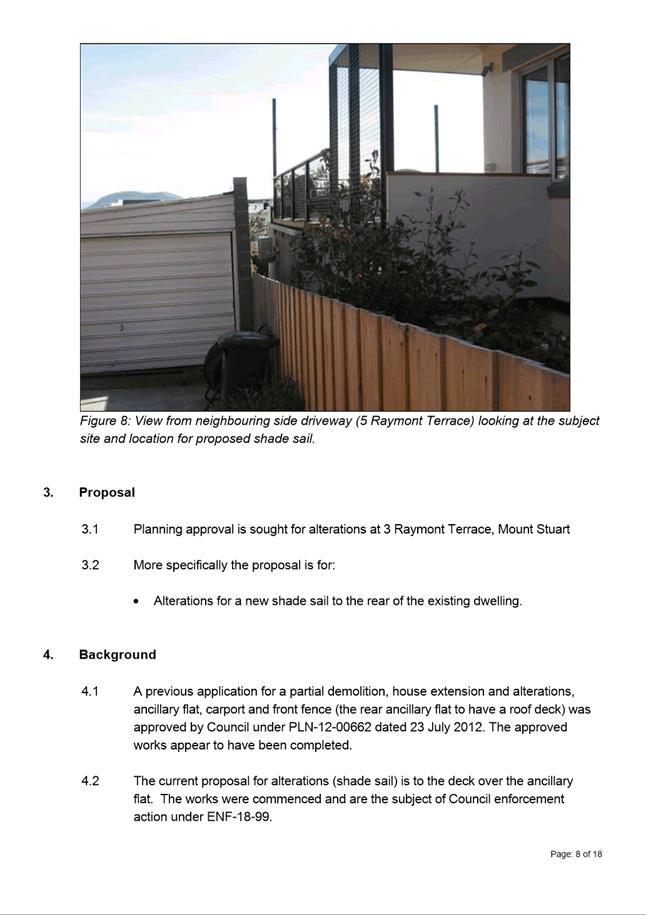

|
Agenda (Open Portion) Special City Planning Committee Meeting - 13/11/2018 |
Page 826 ATTACHMENT b |
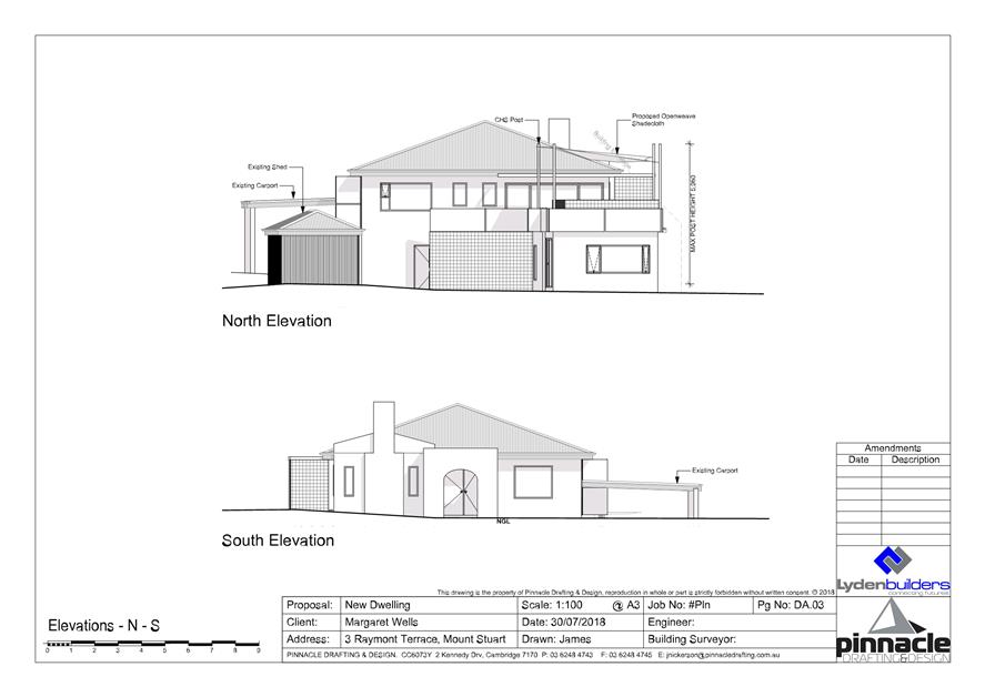
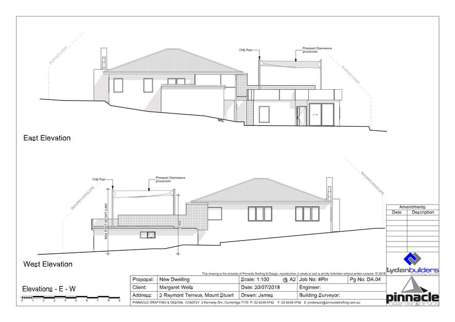
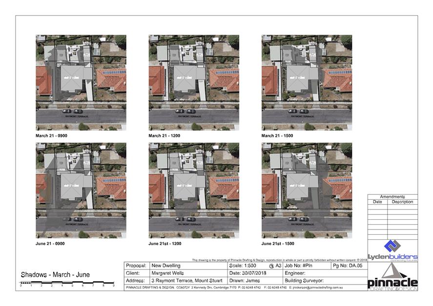
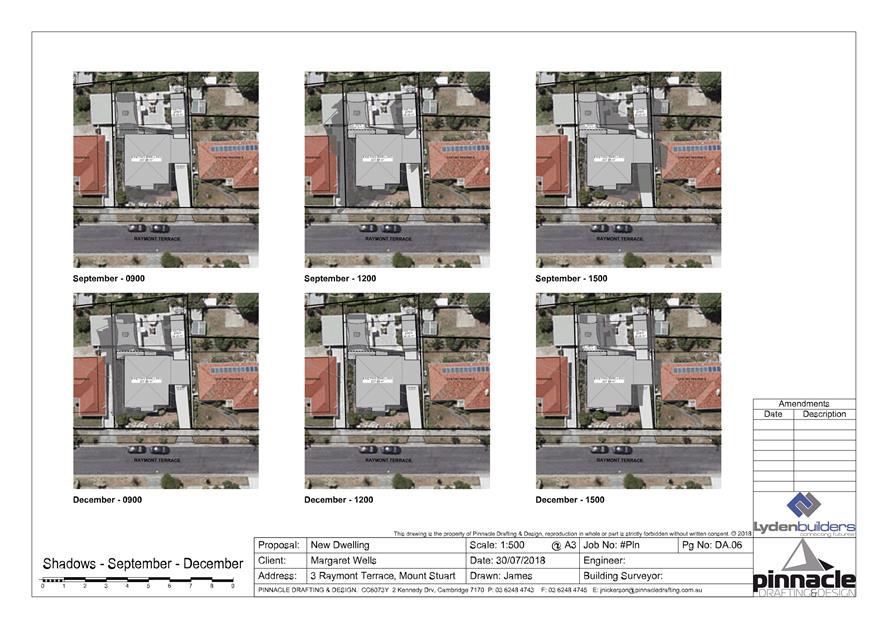
|
Item No. 2.2.5 |
Agenda (Open Portion) Special City Planning Committee Meeting - 13/11/2018 |
Page 832 ATTACHMENT b |
|
Item No. 2.2.5 |
Agenda (Open Portion) Special City Planning Committee Meeting - 13/11/2018 |
Page 833 ATTACHMENT b |

|
Item No. 2.2.5 |
Agenda (Open Portion) Special City Planning Committee Meeting - 13/11/2018 |
Page 836 ATTACHMENT b |
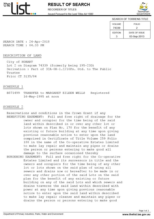
|
Item No. 2.2.6 |
Agenda (Open Portion) Special City Planning Committee Meeting |
Page 839 |
|
|
13/11/2018 |
|
2.2.6 29 Pottery Road, Lenah Valley - Partial Demolition and Two Multiple Dwellings (One Existing, One New)
Address: 29 Pottery Road, Lenah Valley
Proposal: Partial Demolition and Two Multiple Dwellings (One Existing, One New)
Expiry Date: 20 November 2018
Extension of Time: Not applicable
Author: Liz Wilson
|
REcommendation That: Pursuant to the Hobart Interim Planning Scheme 2015, the Council approve the application for partial demolition and two multiple dwellings (one existing, one new) at 29 Pottery Road LENAH VALLEY for the reasons outlined in the officer’s report and a permit containing the following conditions be issued:
GEN
The use and/or development must be substantially in accordance with the documents and drawings that comprise PLN18142 29 POTTERY ROAD LENAH VALLEY TAS 7008 Final Planning Documents except where modified below.
Reason for condition
To clarify the scope of the permit.
TW
The use and/or development must comply with the requirements of TasWater as detailed in the form Submission to Planning Authority Notice, Reference No. TWDA 2018/00380HCC dated 23 March 2018 as attached to the permit.
Reason for condition
To clarify the scope of the permit.
PLN 1
Screening to a height of 1.7m above floor level, with no more than 25% uniform transparency must be installed and maintained along the northern edge of the upper level deck prior to first occupation.
Reason for condition
To provide reasonable opportunity for privacy for the neighbouring property.
PLN 2
The bedroom window on the upper floor of the southern elevation must have a sill height of at least 1.7m above the upper floor finished floor level or be glazed entirely of translucent glass.
Reason for condition
To provide reasonable opportunity for privacy of the neighbouring property.
ENG sw4
If a new stormwater connection to Council infrastructure (kerb & gutter in Pottery Road) is required, it must be constructed and any existing connections to be abandoned sealed by the Council at the owner’s expense, prior to the new use/ first occupation.
Detailed engineering drawings must be submitted and approved, prior to commencement of work. The drawings must include:
1. The location of the proposed connection; and
2. The size of the connection appropriate to satisfy the needs of the development (note that if a larger impervious area is going to be drained, a larger connection may be required).
All work required by this condition must be undertaken in accordance with the approved detailed engineering drawings.
Advice:
· The applicant is advised to submit detailed design drawings via a Council City Infrastructure Division application for a new stormwater connection. If detailed design to satisfy this condition is submitted via the planning condition endorsement process there may be fees associated with the assessment, and once approved the applicant will still need to submit an application for a new stormwater connection with Council City Infrastructure Division.
· Where building / plumbing approval is also required, it is recommended that documentation to satisfy this condition is submitted well before submitting documentation for building/plumbing approval. Failure to address planning condition requirements prior to submitting for building/plumbing approval may result in unexpected delays.
Reason for condition
To ensure the site is drained adequately.
ENG sw6
All stormwater runoff from the proposed development (including hardstand runoff) must be discharged either to the Council’s stormwater infrastructure or to a Councilapproved disposal system prior to new use/ first occupation. All costs associated with works required by this condition are to be met by the owner.
Design drawings and calculations of the proposed stormwater drainage and disposal systems and connections to the Council's stormwater infrastructure must be submitted and approved prior to the issuing of any approval under the Building Act 2016 or the commencement of works on site (whichever occurs first). The drawings and calculations must:
1. Be prepared or certified by an engineer.
2. Include long section(s)/levels and grades to the point of discharge, as required.
3. All stormwater runoff which can reach the kerb & gutter connection by gravity (either freedraining or charged systems) must be allowed to do so, this includes roof areas and some paved areas close to the road (a grated trench across the driveway not too far from the footpath could drain a large part of the driveway towards the road i.e. avoid draining the entire driveway into a soakage trench).
4. Design must clearly distinguish between surface areas which will drain to road and any areas which will drain to a soakage trench.
5. The design of the proposed stormwater soakage trench must be based on an actual site investigation and excavation to determine the depth to bedrock (the proposed 900mm depth of trench may not be achievable if soil is shallow) as well as the permeability of the soil onsite. The design must clearly state that it is based on a site investigation.
All work required by this condition must be undertaken in accordance with the approved drawings and calculations.
Advice:
· The applicant is advised to submit detailed design drawings and calculations as part of their Plumbing Permit Application. If detailed design to satisfy this condition is submitted via the planning condition endorsement process there may be fees associated with the assessment, and once approved the applicant will still need to obtain a plumbing permit for the works.
Reason for condition
To ensure that stormwater from the site will be discharged to a suitable Council approved outlet.
ENG 2a
Prior to first occupation or commencement of use (whichever occurs first), vehicular barriers compliant with the Australian Standard AS/NZS1170.1:2002 must be installed to prevent vehicles running off the edge of an access driveway or parking area where the drop from the edge of the trafficable area to a lower level is 600mm or greater, and wheel stops (kerb) must be installed for drops between 150mm and 600mm. Barriers must not limit the width of the driveway access or parking and turning areas approved under the permit.
Advice:
· The Council does not consider a slope greater than 1 in 4 to constitute a lower level as described in AS/NZS 2890.1:2004 Section 2.4.5.3. Slopes greater than 1 in 4 will require a vehicular barrier or wheel stop.
· Designers are advised to consult the National Construction Code 2016 to determine if pedestrian handrails or safety barriers compliant with the NCC2016 are also required in the parking module this area may be considered as a path of access to a building.
Reason for condition
To ensure the safety of users of the access driveway and parking module and compliance with the standard.
ENG 3c
The access driveway, parking and turning areas must be designed and constructed in accordance with Australian Standard AS/NZS2890.1:2004 (including the requirement for vehicle safety barriers where required).
Prior to the first occupation / new use (or the approval of any strata subdivision), documentation by a suitably qualified engineer certifying that the driveway, parking and turning areas have been built in accordance with the approved design drawings must be lodged with Council. If not built entirely as per the approved drawings, an engineer must certify that the asbuilt driveway, parking and turning areas comply with AS2890.
Advice:
· It is advised that designers consider the detailed design of the access and parking areas prior to finalising the Finished Floor Level (FFL) of the parking spaces (especially if located within a garage incorporated into the dwelling), as failure to do so may result in difficulty complying with this condition.
· Certification may be submitted to Council as part of the Building Act 2016 approval process or via condition endorsement (see general advice on how to obtain condition endorsement).
Reason for condition
To ensure the safety of users of the access and parking areas, and compliance with the relevant Australian Standard.
ENG 4
The access driveway and parking areas approved by this permit must be constructed to a sealed standard (spray seal, asphalt, concrete, pavers or equivalent Council approved) and surface drained to the Council's stormwater infrastructure or Council approved disposal system prior to the first occupation / new use.
Reason for condition
To ensure the safety of users of the access driveway and parking areas, and that it does not detract from the amenity of users, adjoining occupiers or the environment by preventing dust, mud and sediment transport.
ENG 11
Prior to the first occupation / new use, the existing driveway crossover to the Pottery Road highway reservation must be widened on the uphill or southern side to line up with the proposed wider (about 5.5m) driveway. The crossover must be designed and constructed in general accordance with:
1. LGAT Standard Drawing Urban TSDR09v1 – Urban Roads Driveways and TSD R14v1 Type KC vehicular crossing.
2. LGAT Standard Drawing Footpath Urban Roads Footpaths TSDR11 v1.
3. Or a Council City Infrastructure Division approved alternate design.
Advice:
· Local Government Association (LGAT) Tasmanian Standard Drawings (TSD) can be viewed electronically via the LGAT Website.
· Please contact Council City Infrastructure Division to discuss approval of any alternate designs.
· You are likely to require a Permit to Open Up and Temporarily Occupy a Highway (for work within the highway reservation). Click here for more information.
Reason for condition
In the interests of vehicle user safety and the amenity of the development.
ENG 1
The cost of repair of any damage to the Council's infrastructure resulting from the implementation of this permit, must be met by the owners within 30 days of the completion of the development or as otherwise determined by the Council.
A photographic record of the Council's infrastructure adjacent to the subject site must be provided to the Council prior to any commencement of works.
A photographic record of the Council’s infrastructure (e.g. existing property service connection points, roads, buildings, stormwater, footpaths, driveway crossovers and nature strips, including if any, preexisting damage) will be relied upon to establish the extent of damage caused to the Council’s infrastructure during construction. In the event that the owner/developer fails to provide to the Council a photographic record of the Council’s infrastructure, then any damage to the Council's infrastructure found on completion of works will be deemed to be the responsibility of the owner.
Reason for condition
To ensure that any of the Council's infrastructure and/or siterelated service connections affected by the proposal will be altered and/or reinstated at the owner’s full cost.
ENV 1
Sediment and erosion control measures sufficient to prevent sediment from leaving the site must be installed prior to any disturbance of the site, and maintained until all areas of disturbance have been stabilized or revegetated.
Advice: For further guidance in preparing a Soil and Water Management Plan – in accordance with Fact sheet 3 Derwent Estuary Program click here.
Reason for condition
To avoid the sedimentation of roads, drains, natural watercourses, Council land that could be caused by erosion and runoff from the development, and to comply with relevant State legislation.
OPS 1
The title boundary shared between the Council’ neighbouring land and the applicant’s property must be clearly marked by the owner on the ground before any works commence. No works are approved in the reserve.
Reason for condition
To protect the values of the Council’s neighbouring Lenah Valley public reserve.
ADVICE
The following advice is provided to you to assist in the implementation of the planning permit that has been issued subject to the conditions above. The advice is not exhaustive and you must inform yourself of any other legislation, bylaws, regulations, codes or standards that will apply to your development under which you may need to obtain an approval. Visit the Council's website for further information.
Prior to any commencement of work on the site or commencement of use the following additional permits/approval may be required from the Hobart City Council.
CONDITION ENDORSEMENT ENGINEERING
All engineering drawings required to be submitted and approved by this planning permit must be submitted to the City of Hobart as a CEP (Condition Endorsement) via the City’s Online Service Development Portal. When lodging a CEP, please reference the PLN number of the associated Planning Application. Each CEP must also include an estimation of the cost of works shown on the submitted engineering drawings. Once that estimation has been confirmed by the City’s Engineer, the following fees are payable for each CEP submitted and must be paid prior to the City of Hobart commencing assessment of the engineering drawings in each CEP:
Value of Building Works Approved by Planning Permit Fee:
Up to $20,000: $150 per application.
Over $20,000: 2% of the value of the works as assessed by the City's Engineer per assessment.
These fees are additional to building and plumbing fees charged under the Building and Plumbing Regulations.
Once the CEP is lodged via the Online Service Development Portal, if the value of building works approved by your planning permit is over $20,000, please contact the City’s Development Engineer on 6238 2715 to confirm the estimation of the cost of works shown on the submitted engineering drawings has been accepted.
Once confirmed, pleased call one of the City’s Customer Service Officers on 6238 2190 to make payment, quoting the reference number (ie. CEP number) of the Condition Endorsement you have lodged. Once payment is made, your engineering drawings will be assessed.
BUILDING PERMIT
You may need building approval in accordance with the Building Act 2016. Click here for more information.
This is a Discretionary Planning Permit issued in accordance with section 57 of the Land Use Planning and Approvals Act 1993.
PLUMBING PERMIT
You may need plumbing approval in accordance with the Building Act 2016, Building Regulations 2016 and the National Construction Code. Click here for more information.
OCCUPATION OF THE PUBLIC HIGHWAY
You may require a permit for the occupation of the public highway for construction or special event (e.g. placement of skip bin, crane, scissor lift etc). Click here for more information.
You may require a Permit to Open Up and Temporarily Occupy a Highway (for work in the road reserve by a private contractor). Click here for more information.
NEW SERVICE CONNECTION
Please contact the Hobart City Council's City Infrastructure Division to initiate the application process for a new stormwater service connection.
COUNCIL RESERVES
This permit does not authorise any works on the adjoining Council land. Any act that causes, or is likely to cause damage to Council’s land may be in breach of the Council’s Parks, Recreation and Natural Areas Bylaw and penalties may apply. The by law is available here.
WEED CONTROL
Effective measures are detailed in the Tasmanian Washdown Guidelines for Weed and Disease Control: Machinery, Vehicles and Equipment (Edition 1, 2004). The guidelines can be obtained from the Department of Primary Industries, Parks, Water and Environment website.
WASTE DISPOSAL
It is recommended that the developer liaise with the Council’s Cleansing and Solid Waste Unit regarding reducing, reusing and recycling materials associated with demolition on the site to minimise solid waste being directed to landfill.
Further information regarding waste disposal can also be found on the Council’s website.
FEES AND CHARGES
Click here for information on the Council's fees and charges.
DIAL BEFORE YOU DIG
Click here for dial before you dig information. P
|
Attachment a: PLN-18-142
- 29 POTTERY ROAD LENAH VALLEY TAS 7008 - Planning Committee or Delegated
Report ⇩ ![]()
Attachment
b: PLN-18-142
- 29 POTTERY ROAD LENAH VALLEY TAS 7008 - CPC Agenda Documents ⇩ ![]()
|
Item No. 2.2.6 |
Agenda (Open Portion) Special City Planning Committee Meeting - 13/11/2018 |
Page 850 ATTACHMENT a |
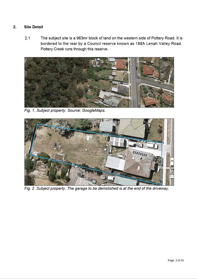
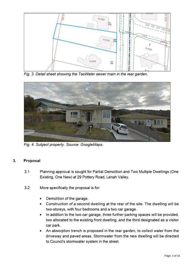
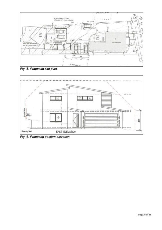
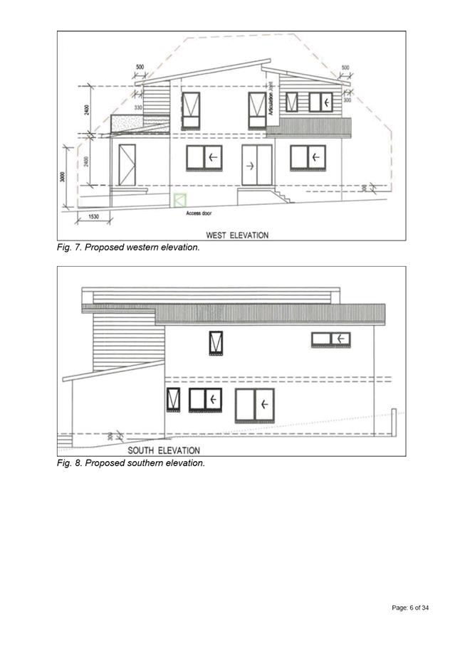
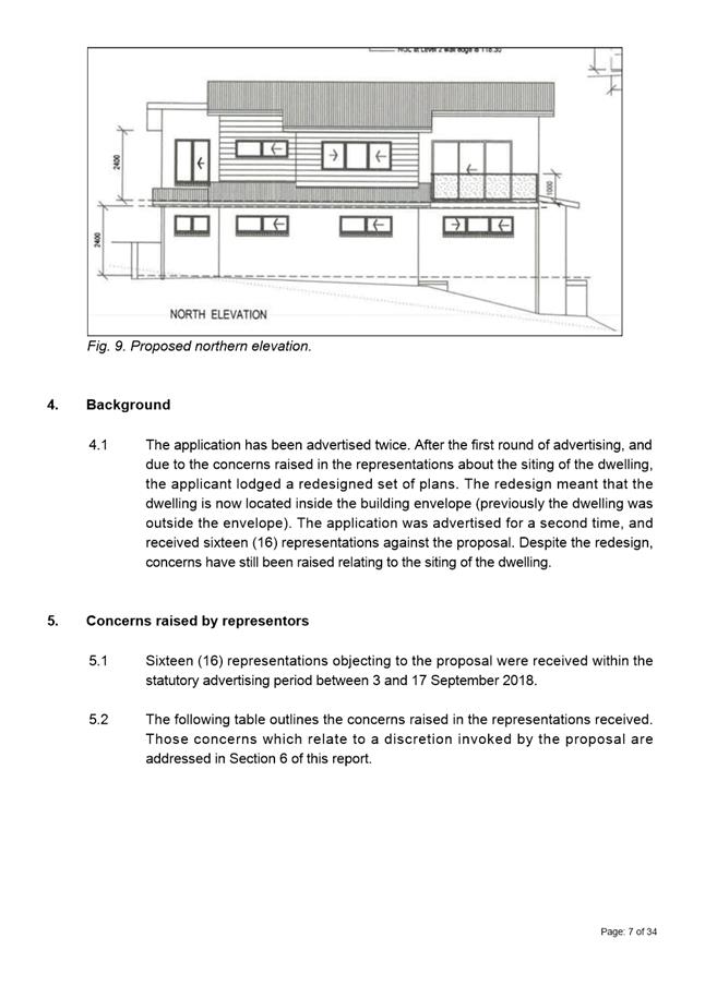
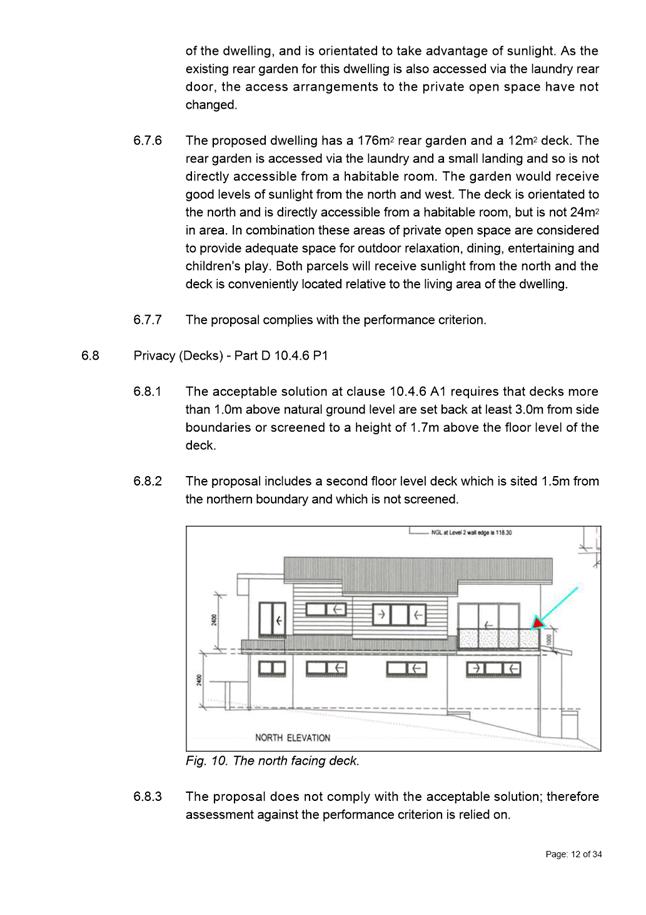
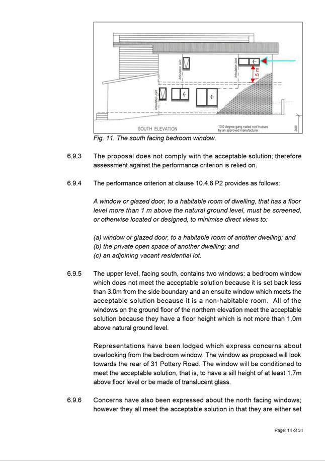


|
Agenda (Open Portion) Special City Planning Committee Meeting - 13/11/2018 |
Page 884 ATTACHMENT b |
|
Item No. 2.2.6 |
Agenda (Open Portion) Special City Planning Committee Meeting - 13/11/2018 |
Page 886 ATTACHMENT b |
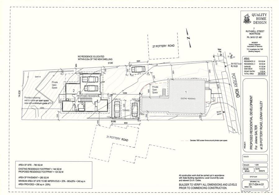
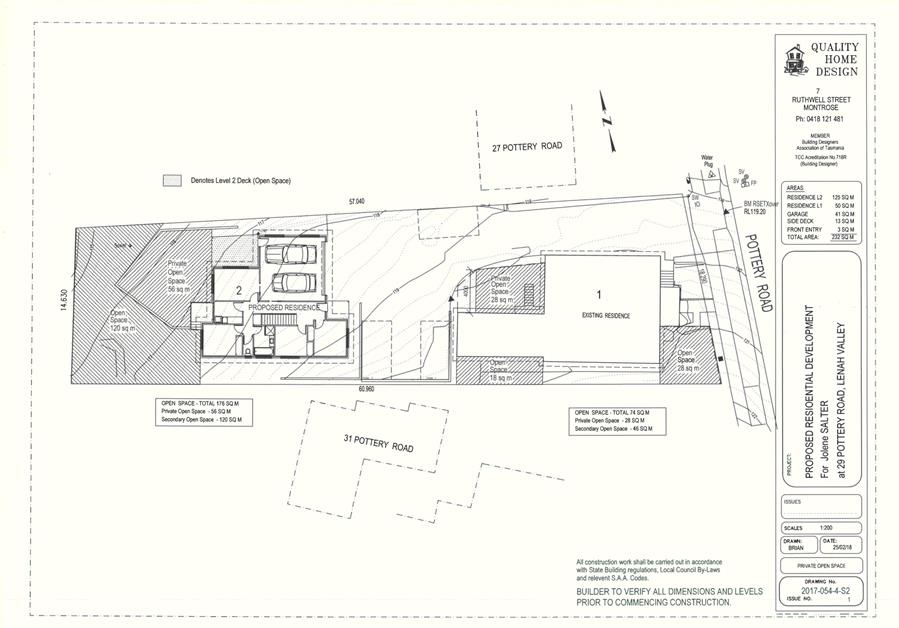
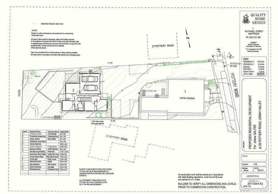
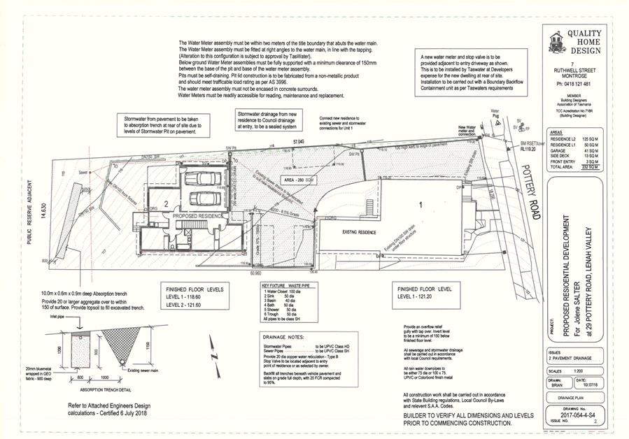
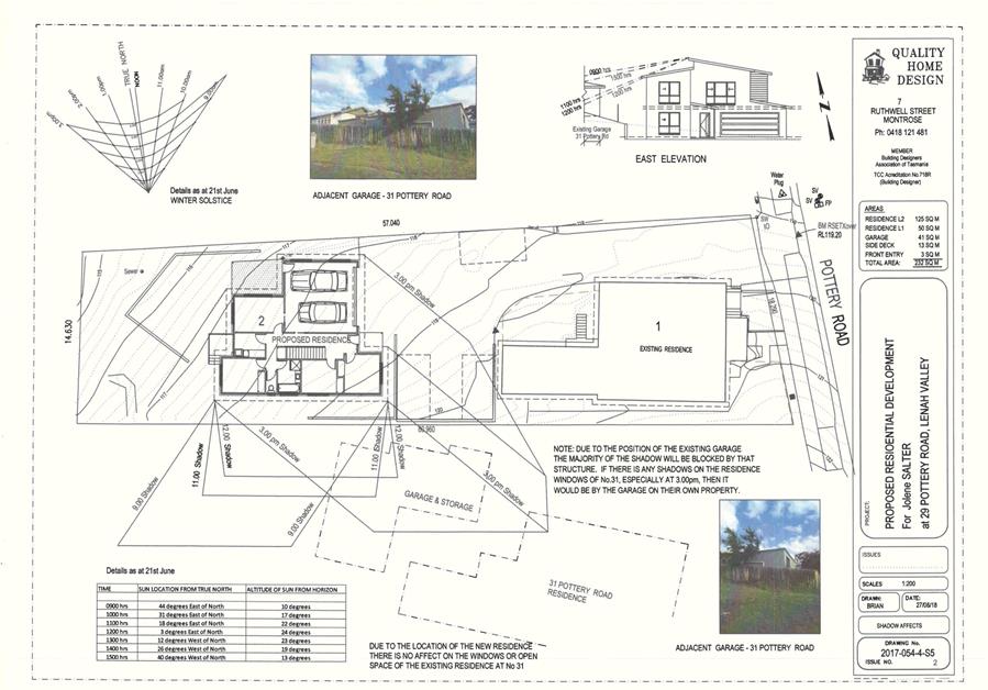
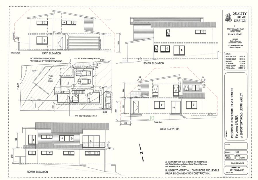
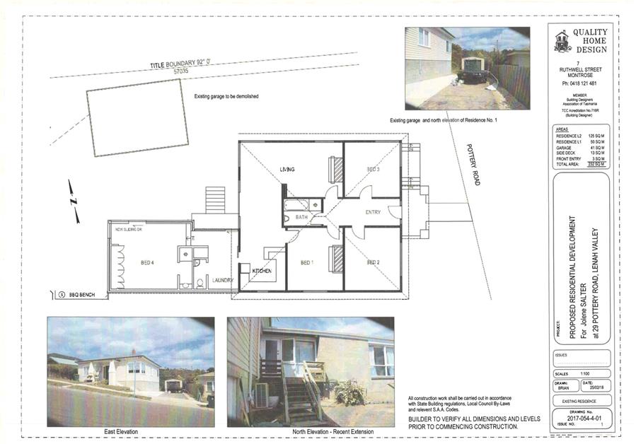
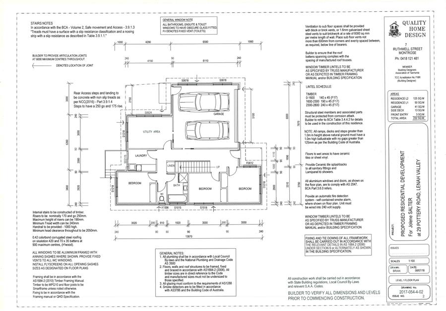
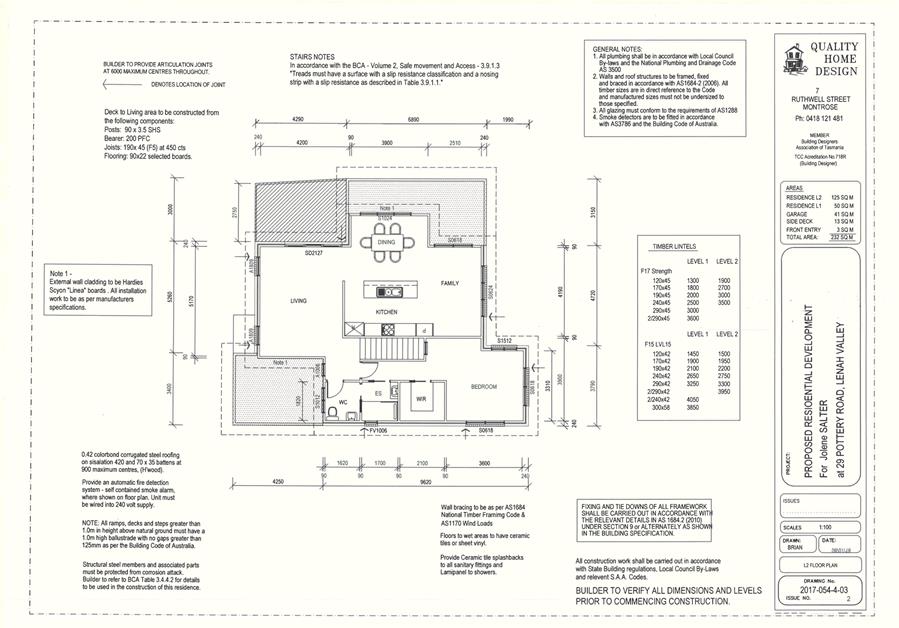
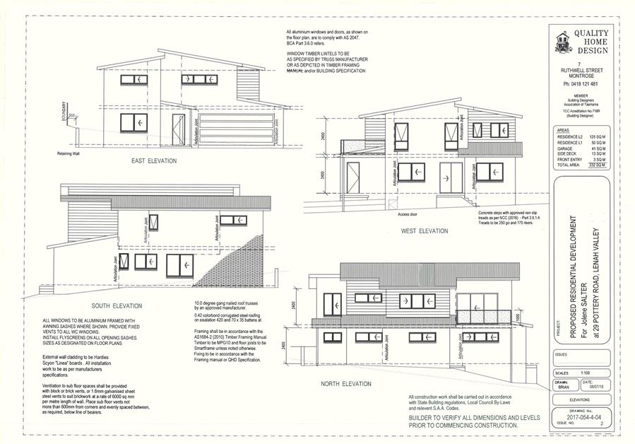
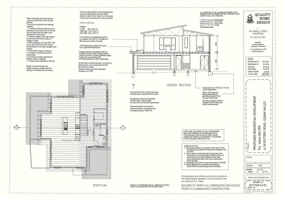
|
Item No. 2.2.6 |
Agenda (Open Portion) Special City Planning Committee Meeting - 13/11/2018 |
Page 899 ATTACHMENT b |
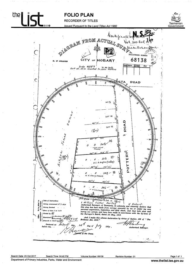
|
Item No. 2.2.6 |
Agenda (Open Portion) Special City Planning Committee Meeting - 13/11/2018 |
Page 901 ATTACHMENT b |
|
Item No. 2.2.6 |
Agenda (Open Portion) Special City Planning Committee Meeting - 13/11/2018 |
Page 902 ATTACHMENT b |
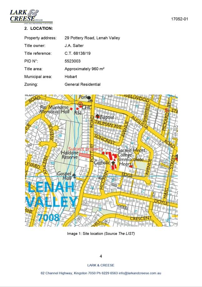
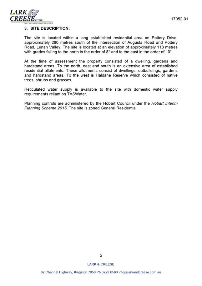
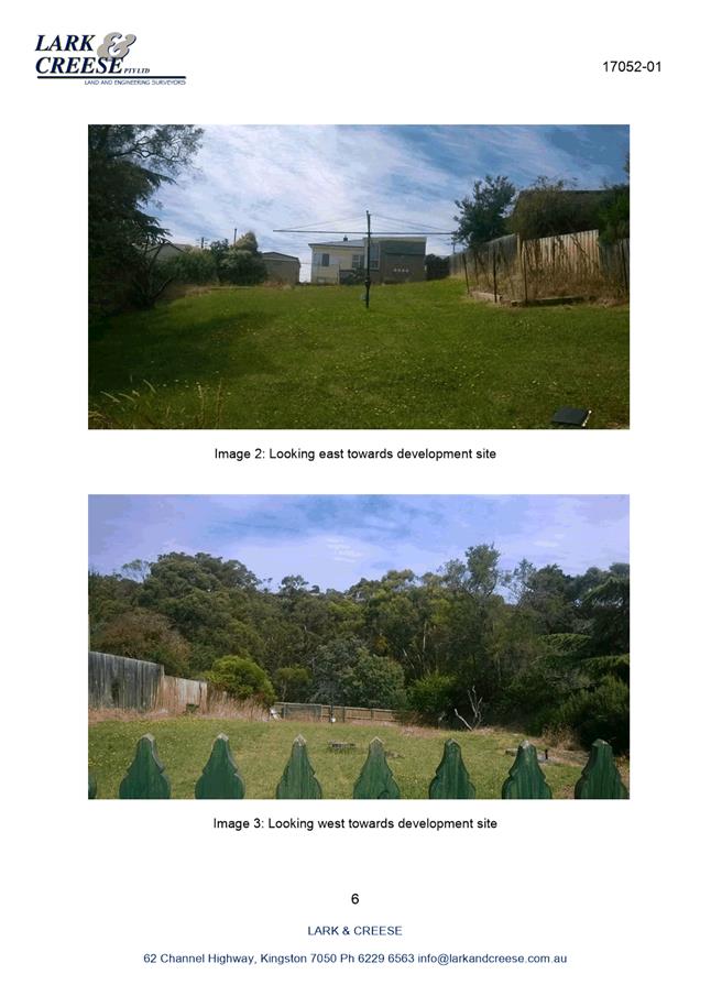
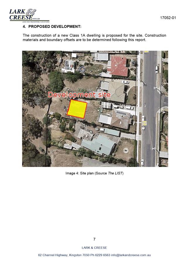
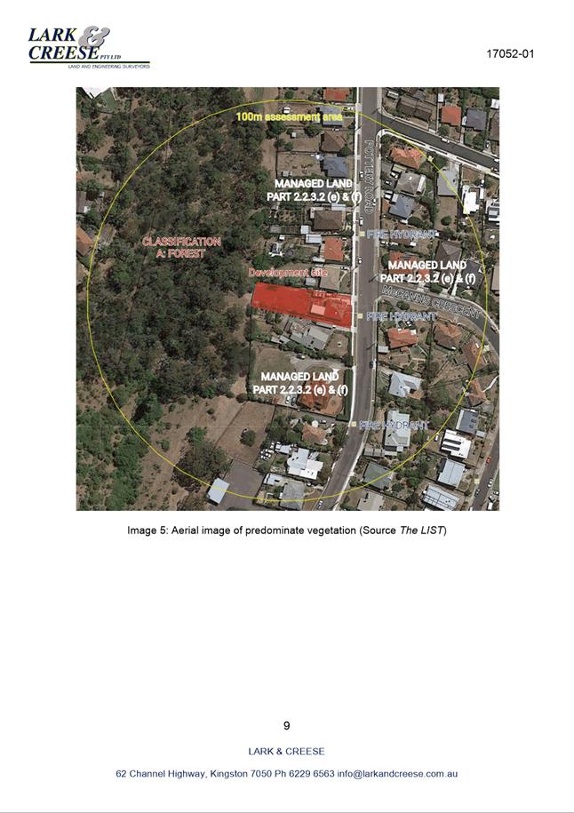
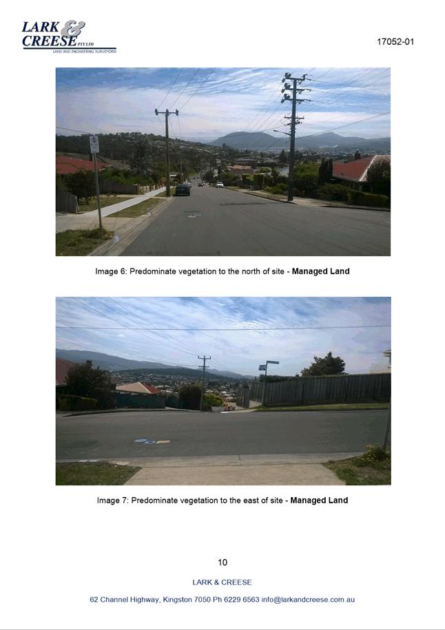
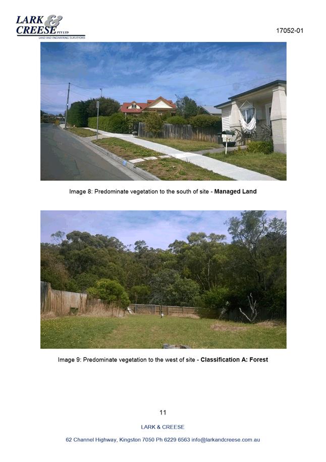
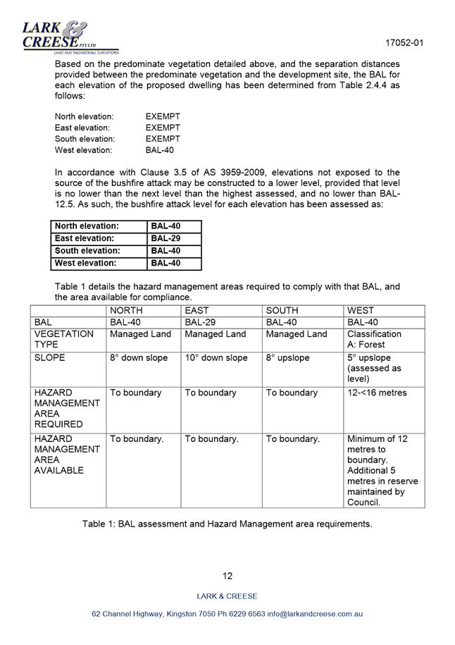
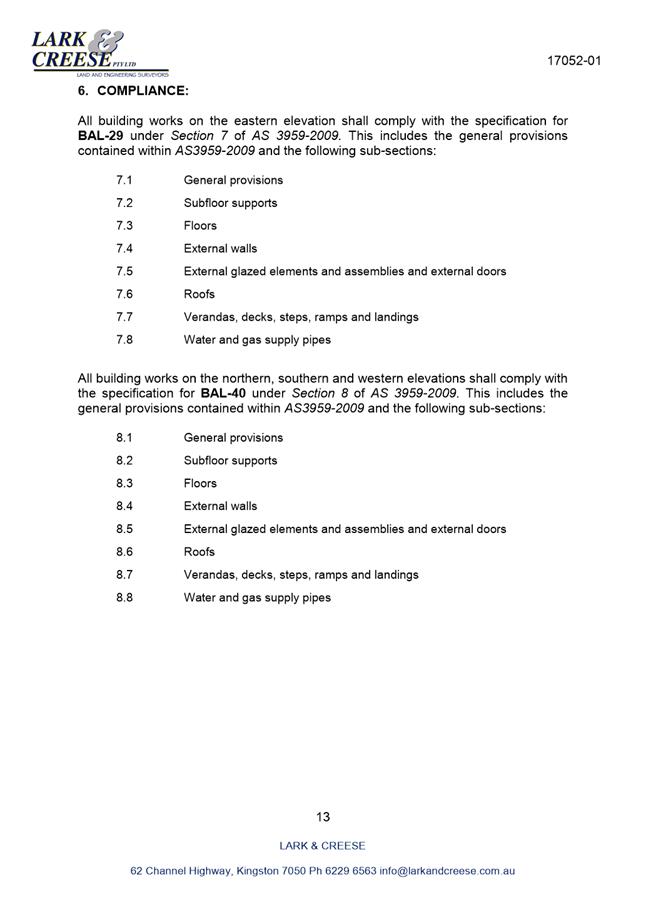
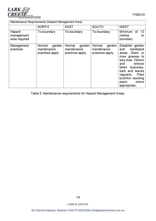
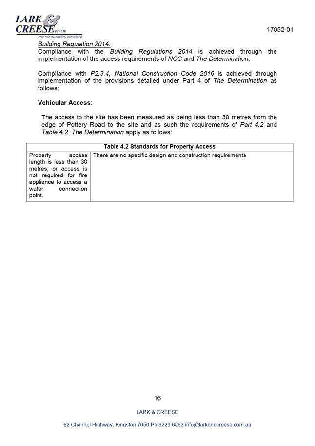
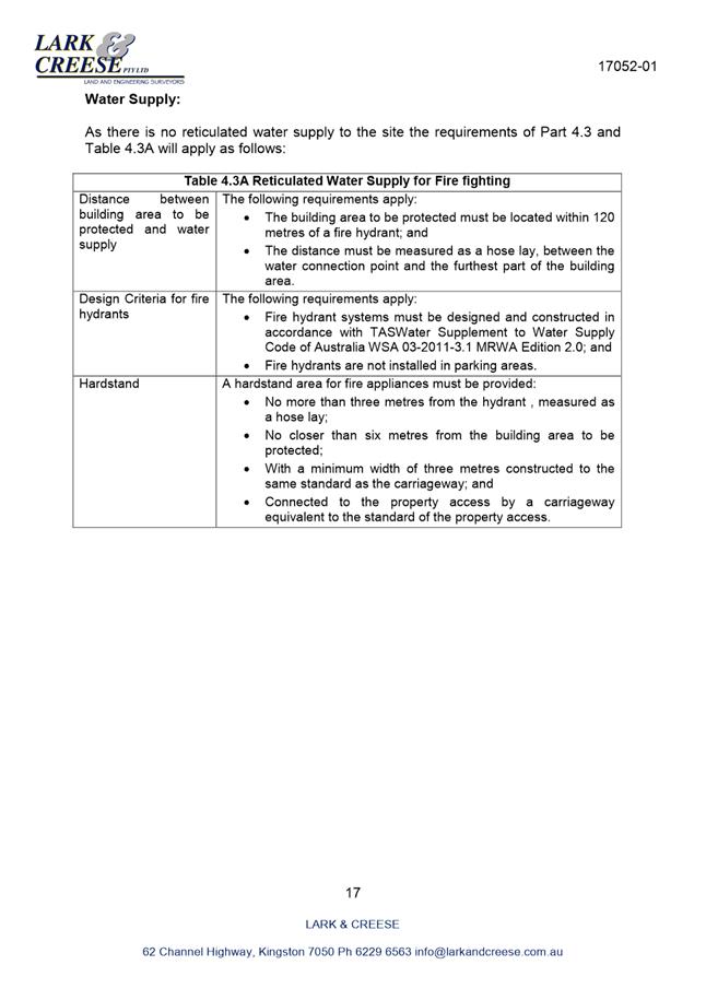
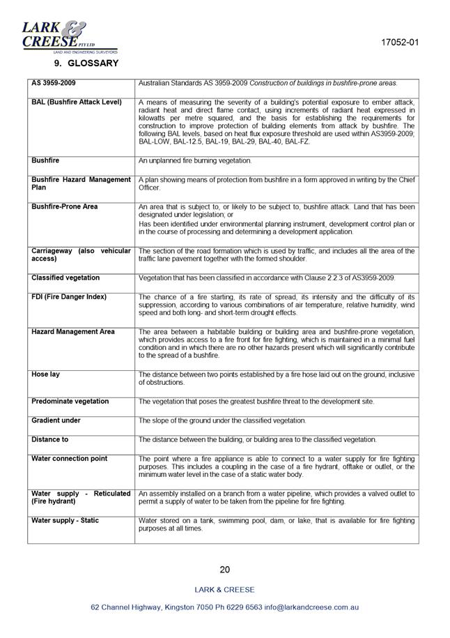
|
Item No. 2.2.6 |
Agenda (Open Portion) Special City Planning Committee Meeting - 13/11/2018 |
Page 922 ATTACHMENT b |
|
Item No. 2.2.6 |
Agenda (Open Portion) Special City Planning Committee Meeting - 13/11/2018 |
Page 923 ATTACHMENT b |
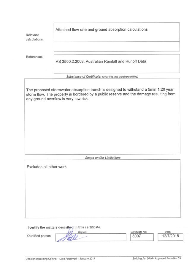
|
Item No. 2.2.7 |
Agenda (Open Portion) Special City Planning Committee Meeting |
Page 926 |
|
|
13/11/2018 |
|
2.2.7 241 New Town Road, New Town - Partial Demolition and Two Multiple Dwellings (One Existing, One New)
Address: 241 New Town Road, New Town
Proposal: Partial Demolition and Two Multiple Dwellings (One Existing, One New)
Expiry Date: 26 November 2018
Extension of Time: Not applicable
Author: Deanne Lang
|
REcommendation That: Pursuant to the Hobart Interim Planning Scheme 2015, the Council refuse the application for partial demolition and two multiple dwellings (one existing, one new) at 241 New Town Road, New Town for the following reasons:
1. The proposal does not meet the acceptable solution or the performance criterion with respect to clause E13.8.2 P1 of the Hobart Interim Planning Scheme 2015 because the design and siting will result in detriment to the historic cultural significance of the Heritage Precinct New Town 1.
|
Attachment a: PLN-18-465
- 241 NEW TOWN ROAD NEW TOWN TAS 7008 - Planning Committee or Delegated Report ⇩ ![]()
Attachment
b: PLN-18-465
- 241 NEW TOWN ROAD NEW TOWN TAS 7008 - CPC Agenda Documents ⇩ ![]()
Attachment
c: PLN-18-465
- 241 NEW TOWN ROAD NEW TOWN TAS 7008 - Planning Referral Officer Cultural
Heritage Report ⇩ ![]()
Attachment
d: PLN-18-465
- 241 NEW TOWN ROAD NEW TOWN TAS 7008 - Planning Referral Officer Development
Engineering Report ⇩ ![]()
Attachment
e: PLN-18-465
- 241 NEW TOWN ROAD NEW TOWN TAS 7008 - CPC Supporting Documents (TasWater) ⇩ ![]()
|
Item No. 2.2.7 |
Agenda (Open Portion) Special City Planning Committee Meeting - 13/11/2018 |
Page 927 ATTACHMENT a |
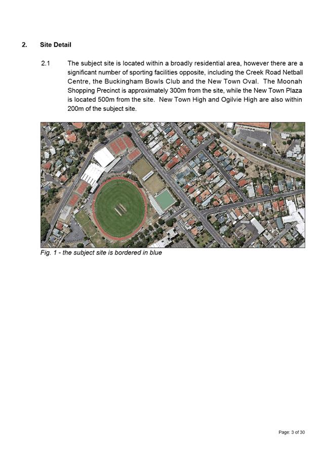
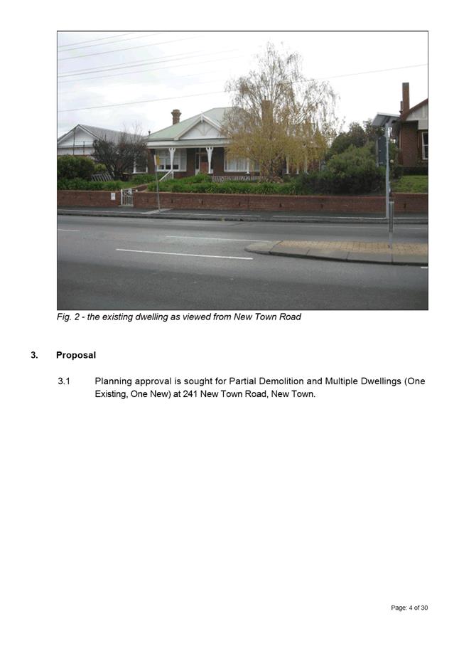
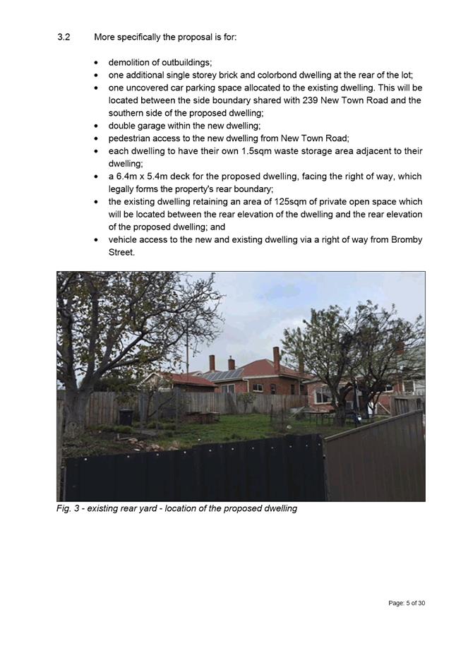
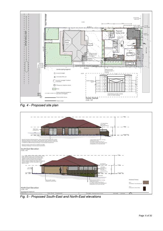
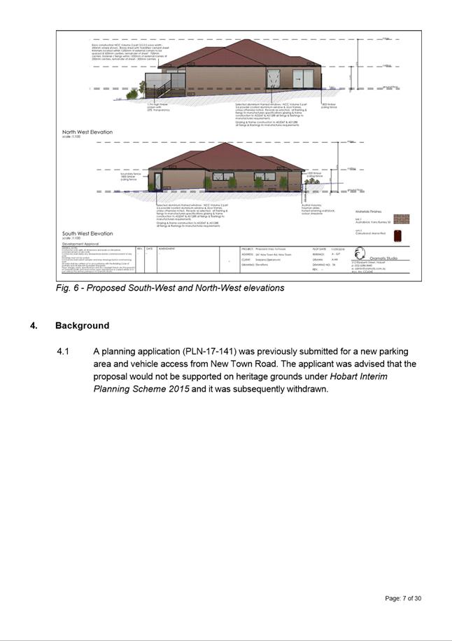
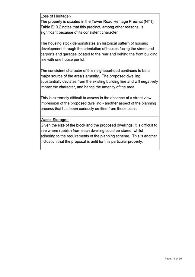
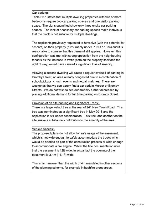
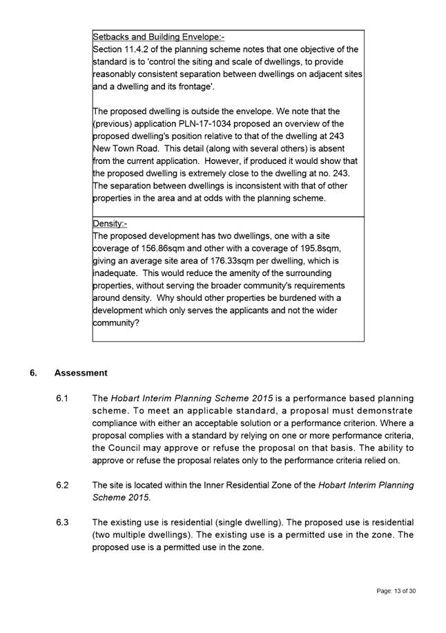
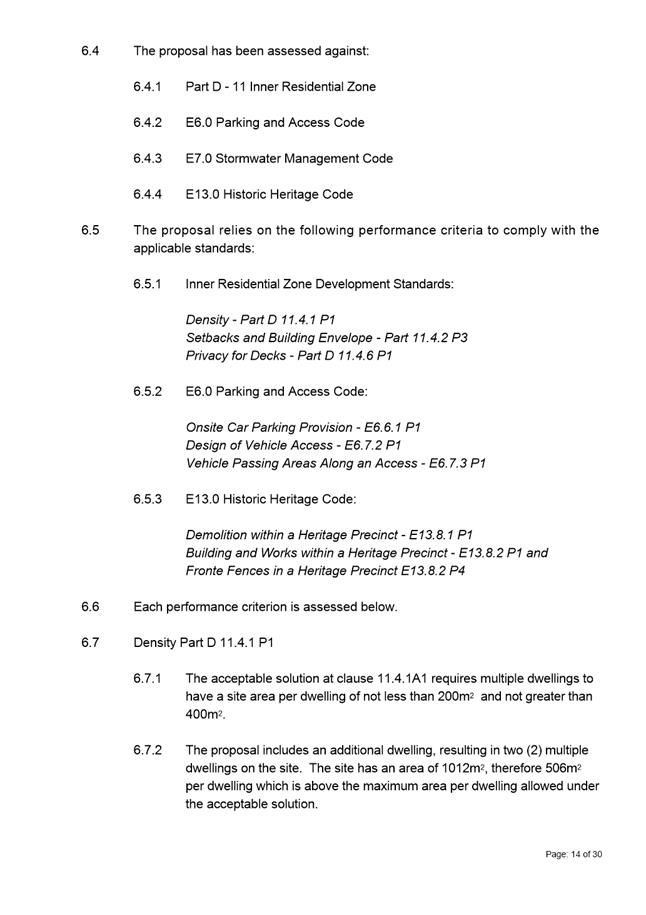
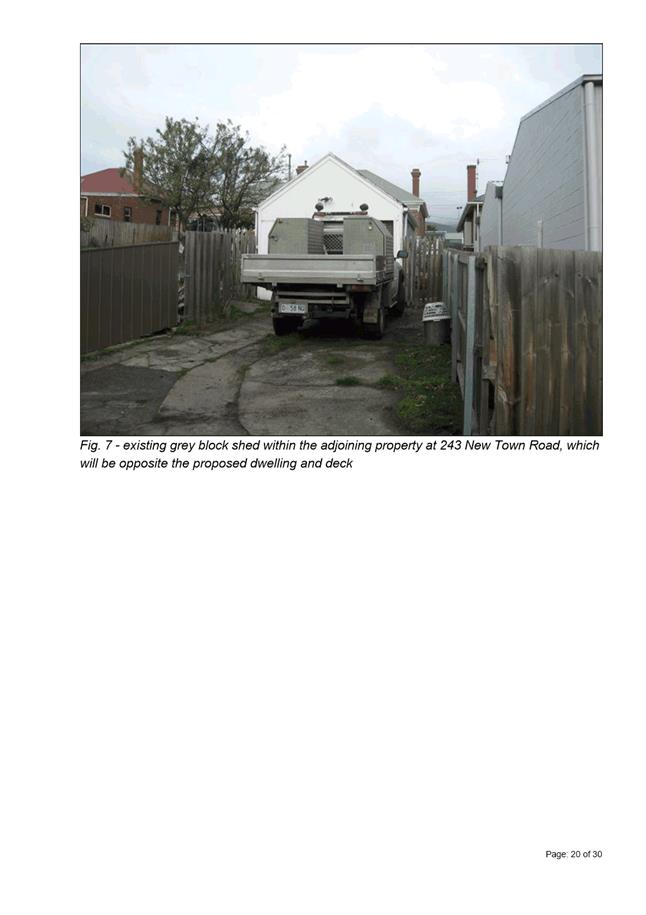
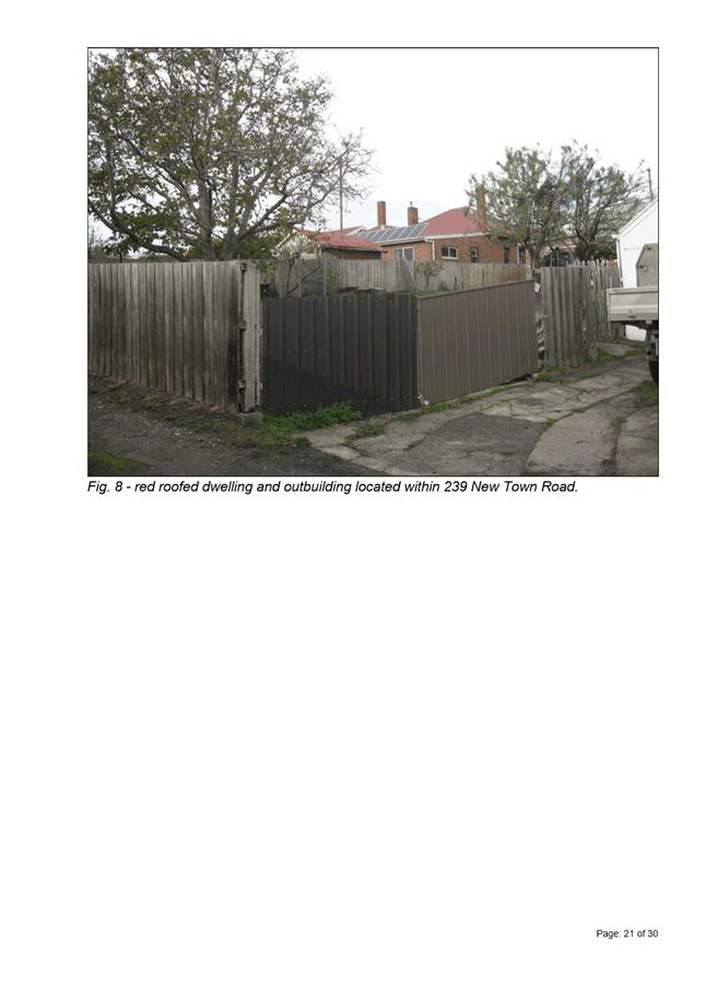
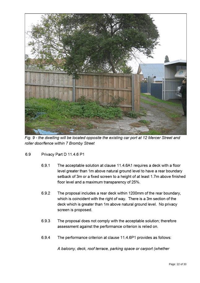
|
Agenda (Open Portion) Special City Planning Committee Meeting - 13/11/2018 |
Page 957 ATTACHMENT b |
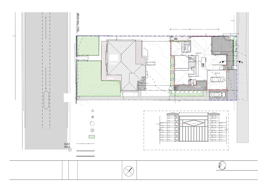
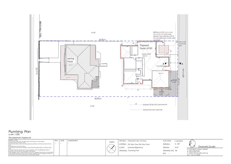
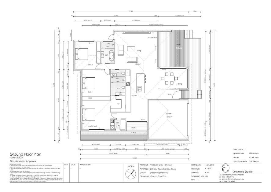
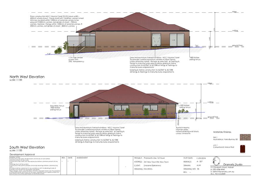
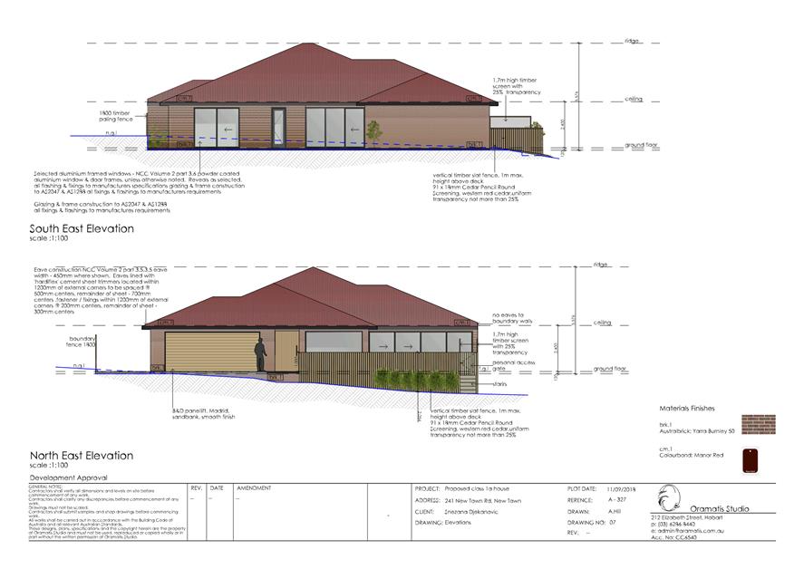
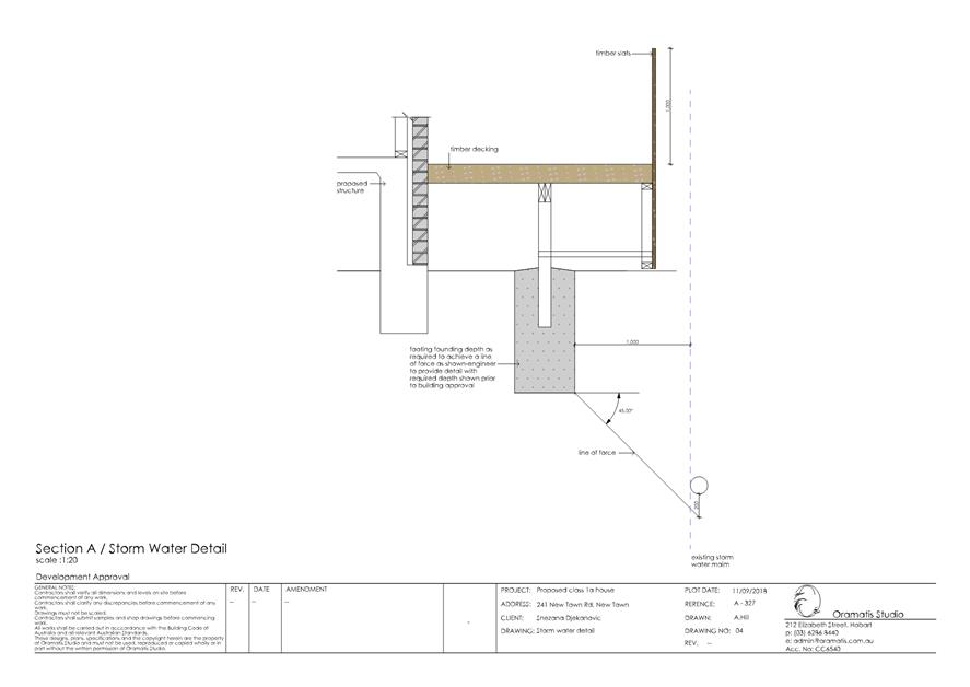
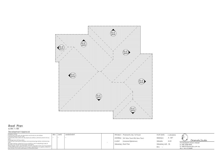
|
Item No. 2.2.7 |
Agenda (Open Portion) Special City Planning Committee Meeting - 13/11/2018 |
Page 966 ATTACHMENT b |
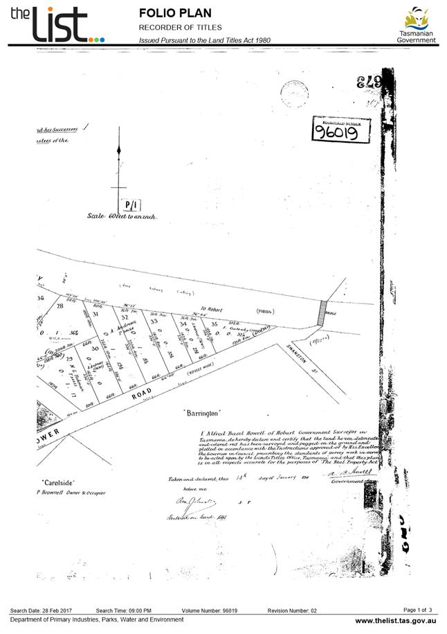
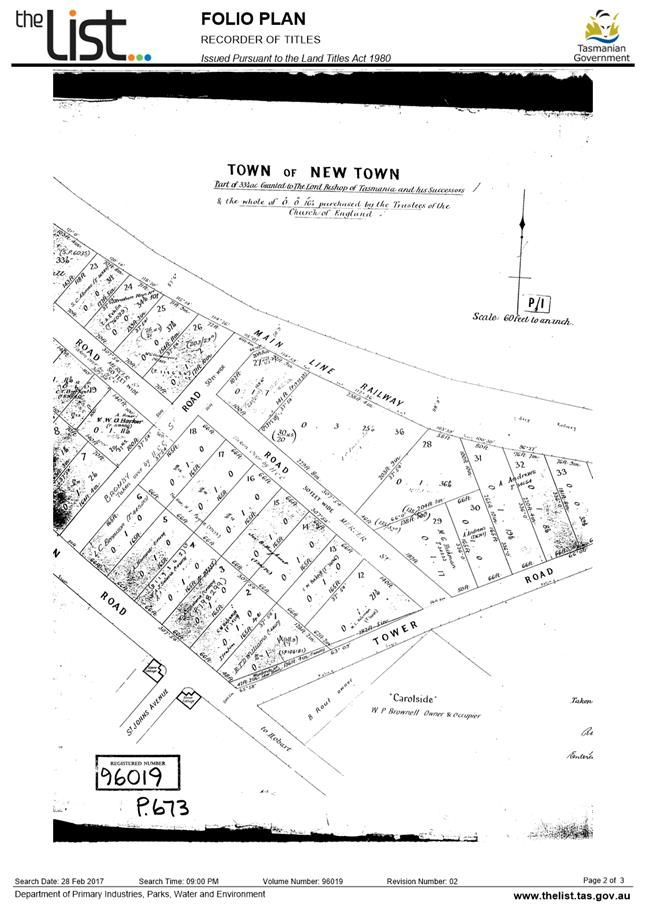
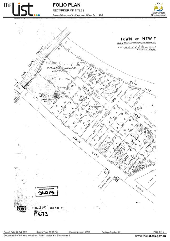
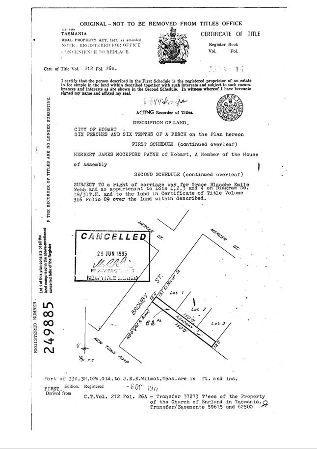
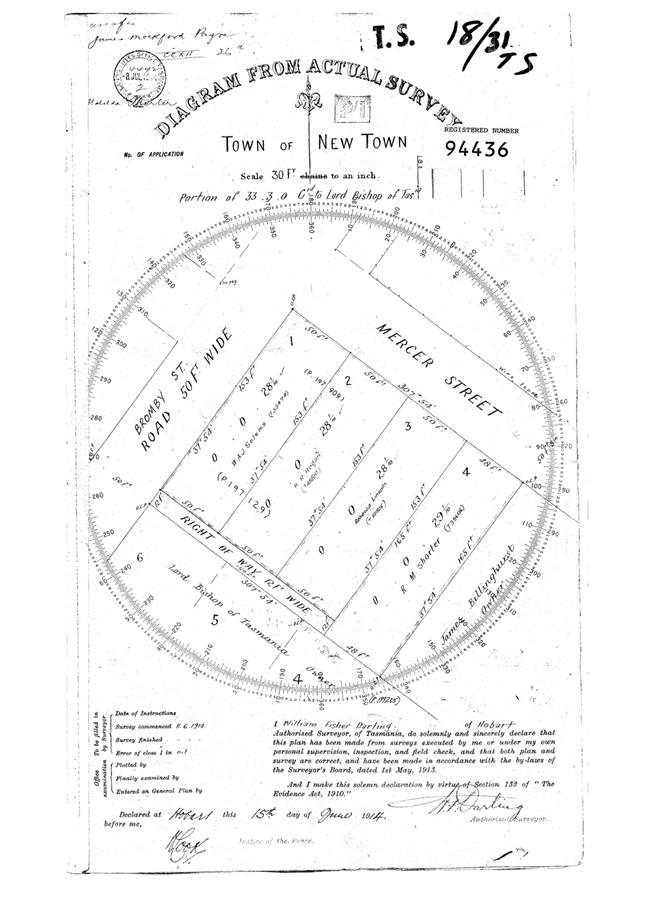
|
Item No. 2.2.7 |
Agenda (Open Portion) Special City Planning Committee Meeting - 13/11/2018 |
Page 973 ATTACHMENT c |
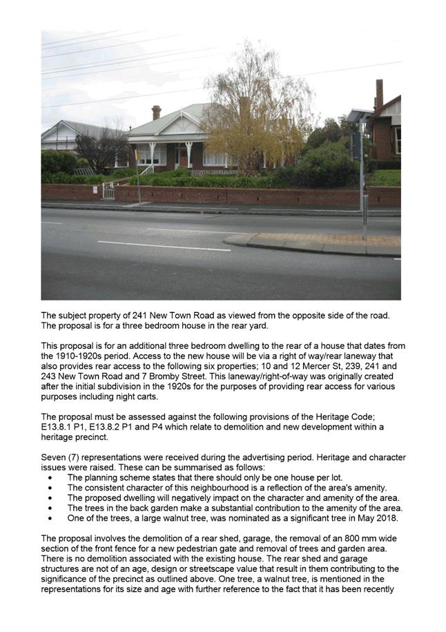
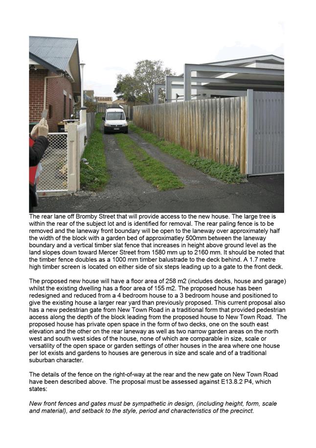
|
Agenda (Open Portion) Special City Planning Committee Meeting - 13/11/2018 |
Page 978 ATTACHMENT d |
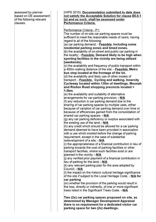
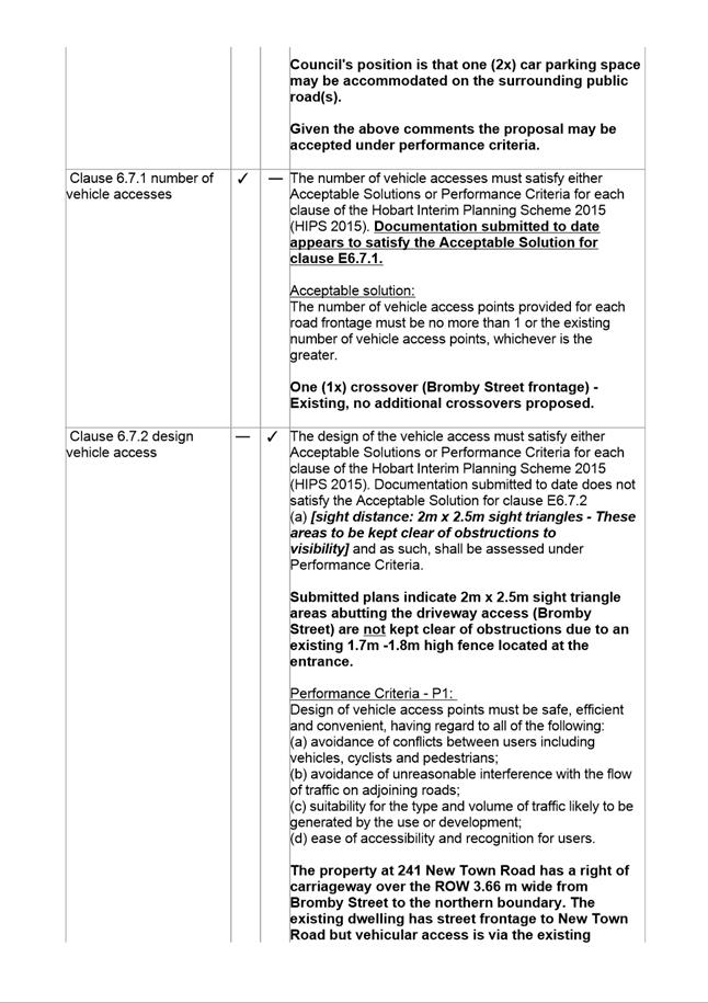
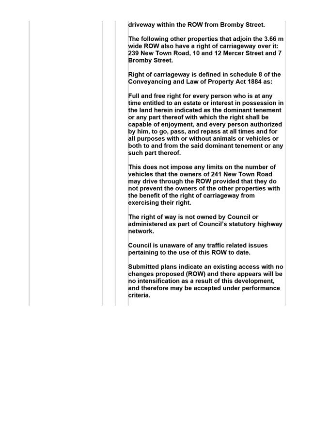
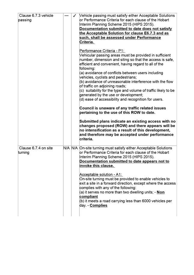
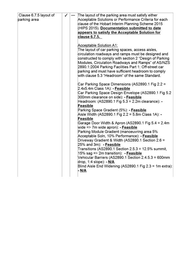
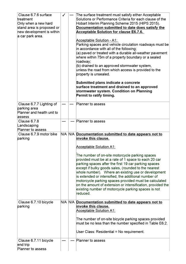
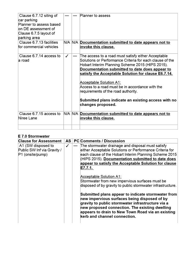
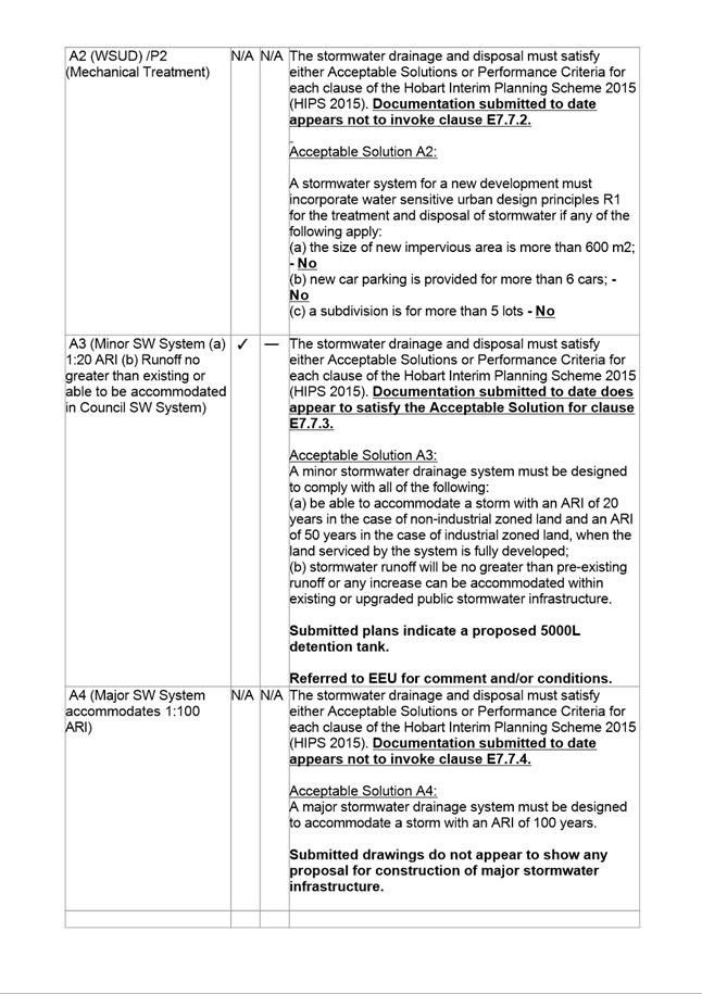
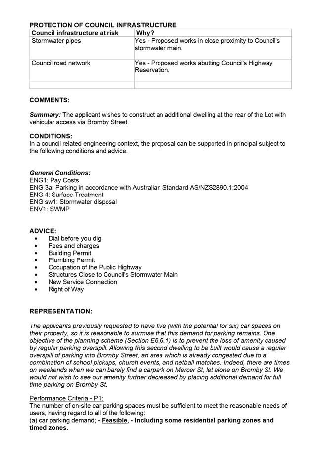
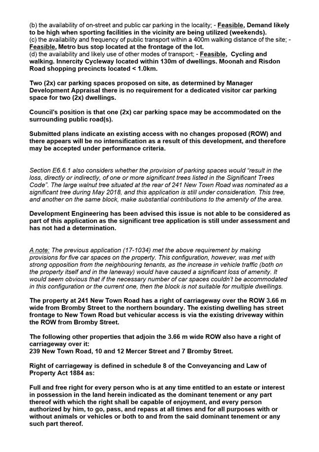

|
Agenda (Open Portion) Special City Planning Committee Meeting - 13/11/2018 |
Page 990 ATTACHMENT e |
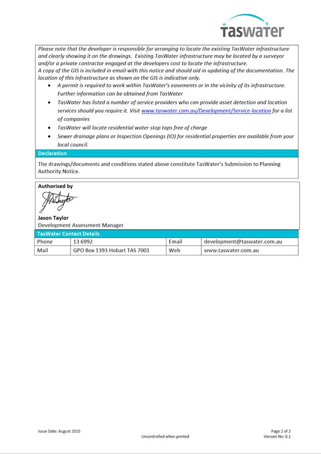
|
Agenda (Open Portion) Special City Planning Committee Meeting |
Page 992 |
|
|
|
13/11/2018 |
|
3. Reports
3.1 Macquarie Point Development Corporation Amendment Bill 2018 - Site Development Plan
Report of the Manager Planning Policy and Heritage and the Director City Planning of 8 November 2018 and attachment.
Delegation: Council
|
Item No. 3.1 |
Agenda (Open Portion) Special City Planning Committee Meeting |
Page 993 |
|
|
13/11/2018 |
|
REPORT TITLE: Macquarie Point Development Corporation Amendment Bill 2018 - Site Development Plan
REPORT PROVIDED BY: Manager Planning Policy and Heritage
Director City Planning
1. Report Purpose and Community Benefit
1.1. The purpose of this report is to inform Council of the Macquarie Point Development Corporation Bill 2018 (Attachment A) which has recently been introduced into Parliament and associated amendments to the Macquarie Point Site Development Plan (SDP) in the Sullivans Cove Planning Scheme 1997 (SCPS).
1.2. The community will benefit from appropriate legislation which provides for sustainable economic development and is consistent with the objectives of the Land Use Planning and Approvals Act 1993.
2. Report Summary
2.1. This report informs the Council of the Macquarie Point Development Corporation Bill 2018 (Attachment A) which has recently been introduced into Parliament and associated amendments to the Macquarie Point SDP in the SCPS.
2.2. In response to an invitation from the State Government, in December 2016, Mona put forward its vision for the Macquarie Point site focusing on the development of an arts and cultural precinct and a nationally significant Truth and Reconciliation Art Park.
2.3. The State Government subsequently directed the MPDC to reset the vision for the Macquarie Point site and prepare a new plan for development based on the Mona vision. This has been the catalyst for the Macquarie Point Development Corporation Amendment Bill 2018 and the proposed amendments to the SDP in the SCPS.
2.4. It is proposed at this stage that Council note the Macquarie Point Development Corporation Amendment Bill 2018 and the proposed amendments to the SDP in the SCPS.
2.5. The Bill was introduced into Parliament on 16 October 2018. Following concerns expressed about the adequacy of the consultation process and the extent of Ministerial powers proposed in the Bill, the State Government has indicated that it will review aspects of the Bill before proceeding.
2.6. The Minister for State Growth will brief Aldermen prior to the Special City Planning Committee meeting on 13 November 2018 in relation to the Bill and proposed modifications to it.
2.7. A further report will be provided to Council when the Bill has been revised and the SDP has been finalised for consultation.
|
That the information contained in the report of the Manager Planning Policy and Heritage and the Director City Planning titled Macquarie Point Development Corporation Amendment Bill 2018 – Site Development Plan of 8 November 2018 be received and noted. |
4. Background
4.1. In 2012 the State Government established the Macquarie Point Development Corporation (MPDC) and gave it responsibility for the remediation and redevelopment of most of the land within Activity Area 3 under the SCPS.
4.2. Under the Macquarie Point Development Corporation Act 2012 the MPDC is required to plan, facilitate and manage the redevelopment of the site.
4.3. At its meeting of 12 October 2015, the Council initiated amendments to the SCPS which inserted the Macquarie Point SDP, along with other associated amendments to the planning scheme document in order to facilitate implementation of the Macquarie Point Strategic Framework and Masterplan 2015-2030.
4.4. Following a public exhibition and lengthy hearing process the Tasmanian Planning Commission gave final approval to a modified version of the amendments in November 2016.
4.5. In response to an invitation from the State Government, in December 2016, Mona put forward its vision for the Macquarie Point site focusing on the development of an arts and cultural precinct and a nationally significant Truth and Reconciliation Art Park.
4.6. In response to public feedback and recognising that Macquarie Point presents a once in a generation opportunity for Hobart and Tasmania, the State Government directed the MPDC to reset the vision for the Macquarie Point site and prepare a new plan for development based on the Mona vision. This has been the catalyst for the Macquarie Point Development Corporation Amendment Bill 2018 and the proposed amendments to the SDP in the SCPS.
5. Proposal and Implementation
5.1. It is proposed at this stage that Council note the Macquarie Point Development Corporation Amendment Bill 2018 and the proposed amendments to the SDP in the SCPS.
5.2. The Bill was introduced into Parliament on 16 October 2018. Following concerns expressed about the adequacy of the consultation process and the extent of Ministerial powers proposed in the Bill, the State Government has indicated that it will review aspects of the Bill before proceeding.
5.3. The Minister for State Growth will brief Aldermen prior to the Special City Planning Committee meeting on 13 November 2018 in relation to the Bill and proposed modifications to it.
5.4. A further report will be provided to Council when the Bill has been revised and the SDP has been finalised for consultation.
Macquarie Point Development Corporation Amendment Bill 2018
5.5. The State Government has advised that the Bill provides a framework to accelerate investment in, and development of, the Macquarie Point site to reflect a shift in focus from remediation to redevelopment.
5.6. The stated purpose of the Bill tabled in Parliament on 16 October 2018 is to:
5.6.1. Update the existing Macquarie Point Development Corporation Act 2012 including to reflect the transition in the Macquarie Point Development Corporation’s focus from remediation to redevelopment; and
5.6.2. Provide a planning framework for the site that will support development and accelerated investment.
5.7. Amendments to the Principal Act include to:
5.7.1. Expand the Corporation’s principal objectives and functions to:
5.7.1.1. Encourage pedestrian and bicycle traffic;
5.7.1.2. Allow for public transport and transit corridors;
5.7.1.3. Provide for public open spaces; and
5.7.1.4. To plan, facilitate and manage temporary and longer-term uses of the site; and
5.7.2. Give the Minister the ability to provide the Board with a statement of expectations.
5.8. The Bill as currently tabled also allows for the Minister to amend the planning arrangements that guide development at the Macquarie Point site.
5.9. To begin the amendment process, the Corporation’s Board will submit a request to the Minister for State Growth seeking an amendment to the relevant planning scheme. Prior to this request, the Board must notify the owners and/or occupiers of adjoining land that it intends to seek an amendment.
5.10. The proposed amendment must:
5.10.1. Further the objectives set out in Schedule 1 of the Land Use Planning and Approvals Act 1993;
5.10.2. Be consistent with any applicable State Policy within the meaning of the State Policies and Projects Act 1993; and
5.10.3. Be consistent, as far as practicable, with the Southern Regional Land Use Strategy.
5.11. Before making a planning amendment, the Minister is to consult with the Minister for Planning, the Corporation, the relevant planning authority, relevant statutory authorities and any agencies the Minister considers to have an interest.
5.12. Following this consultation, the Minister may either approve or resolve not to progress the proposed planning amendment.
5.13. If the Minister approves the proposed amendment, the Tasmanian Planning Commission will update the relevant planning scheme and publish the statement outlining how the amendments meet the intent of the Planning framework. The Minister will then give notice of the amendment in the Gazette and newspaper, and notify the relevant planning authority.
5.14. After an amendment using this process comes into effect, the Minister may make further amendments for a period of up to 12 months. After that time, no further amendments can be made under this Bill. All future planning amendments must take place under the normal planning process.
5.15. The Government has advised that this provides the Minister with the ability to revise the planning arrangements to support appropriate development at the site, as well as to support the timely implementation of arrangements to provide for the realisation of the Hobart City Deal incorporating the Antarctic and Science Precinct.
5.16. As outlined in 5.2 above concerns have been expressed about the adequacy of the consultation process and the extent of Ministerial powers proposed in the current Bill. Accordingly the State Government has indicated that it will review aspects of the Bill before proceeding which the Minister may outline in his briefing to Aldermen.
Planning Scheme Amendments - Site Development Plan
5.17. The proposed Planning Scheme amendments are required to implement the reconfigured layout and uses of the reset masterplan. They comprise a series of updates to the figures and provisions of the Macquarie Point SDP under Clause 32 of Part F as well as some minor consequential changes to the references in the parking policy objectives for Activity Area 3 under Schedule 5 of the Planning Scheme.
5.18. The proposed amendments include some changes to; the Desired Future Character Statements (32.3), height and siting plan (Figure 32.3), development standards (32.7.3 to 32.7.7) and general considerations (32.4) to implement the height, siting and design concepts from the reset masterplan.
5.19. The MPDC has consulted with Council officers in relation to a preliminary draft of the proposed amendments to the SDP and a number of comments were provided. The MPDC is in the process of revising the proposed SDP amendments in response to these comments. The final draft of the SDP amendments will be the subject of a further report to Council when it is released for consultation.
6. Strategic Planning and Policy Considerations
6.1. The proposed SDP amendments, when finalised, will be considered in relation to the strategic objectives of the Capital City Strategic Plan 2015-2025 particularly in relation to Goal 2 Urban Management - 2.3 "City and regional planning ensures quality design, meets community needs...."
7. Financial Implications
7.1. Funding Source and Impact on Current Year Operating Result
7.1.1. None.
7.2. Impact on Future Years’ Financial Result
7.2.1. None.
7.3. Asset Related Implications
7.3.1. None.
8. Legal, Risk and Legislative Considerations
8.1. The Macquarie Point Development Bill 2018, if passed by Parliament, will affect the process by which amendments to the Macquarie Point Site Development Plan in the Sullivans Cove Planning Scheme 1997 are made for a limited period.
9. Delegation
9.1. This matter is delegated to the Council.
As signatory to this report, I certify that, pursuant to Section 55(1) of the Local Government Act 1993, I hold no interest, as referred to in Section 49 of the Local Government Act 1993, in matters contained in this report.
|
James McIlhenny Manager Planning Policy and Heritage |
Neil Noye Director City Planning |
Date: 8 November 2018
File Reference: F18/127219; 17/167
Attachment a: Macquarie
Point Development Corporation Amendment Bill 2018 ⇩ ![]()
|
Item No. 3.1 |
Agenda (Open Portion) Special City Planning Committee Meeting - 13/11/2018 |
Page 999 ATTACHMENT a |